Wichita, Kansas
Weather Forecast Office
Overview
|
Storms rapidly developed over western Oklahoma and central Kansas during the afternoon hours of May 18th. The most severe storms across Kansas developed along a warm front which was situated generally near I-70. A few of these storms produced brief tornado touchdowns and damaging winds. The most severe damage occurred just west of Salina from a tornado warned storm. |
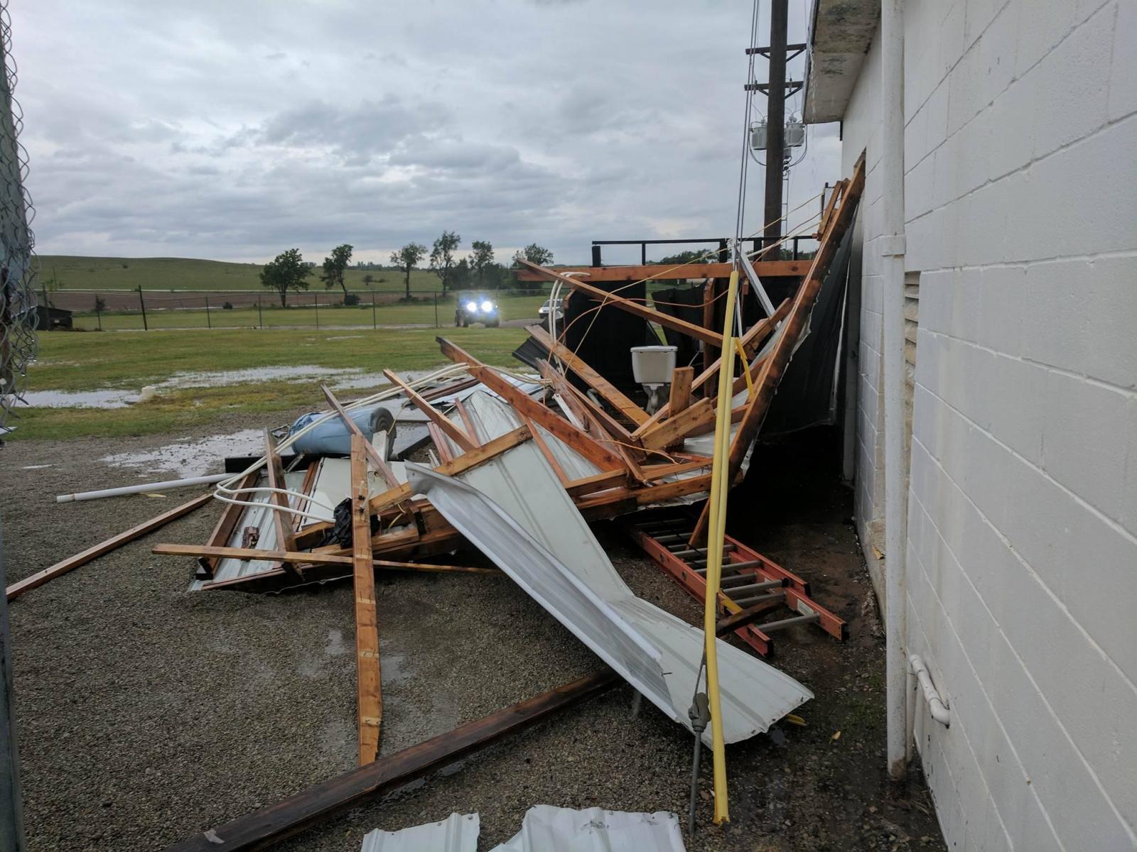 Damage at the Salina Speedway, west of Salina Airport. Picture by Dusty Wiegert |
Photos & Video:
Header
 |
|
 |
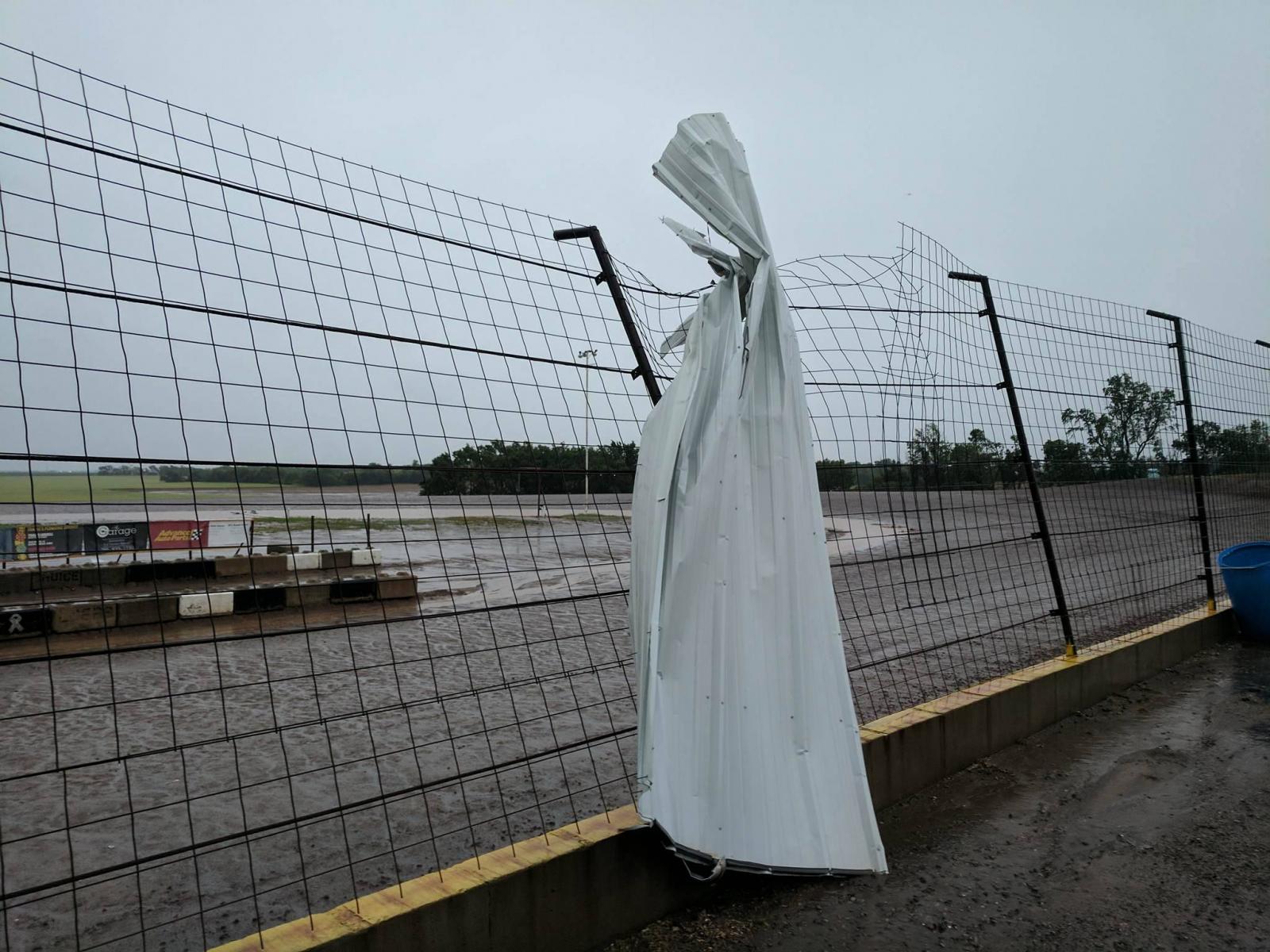 |
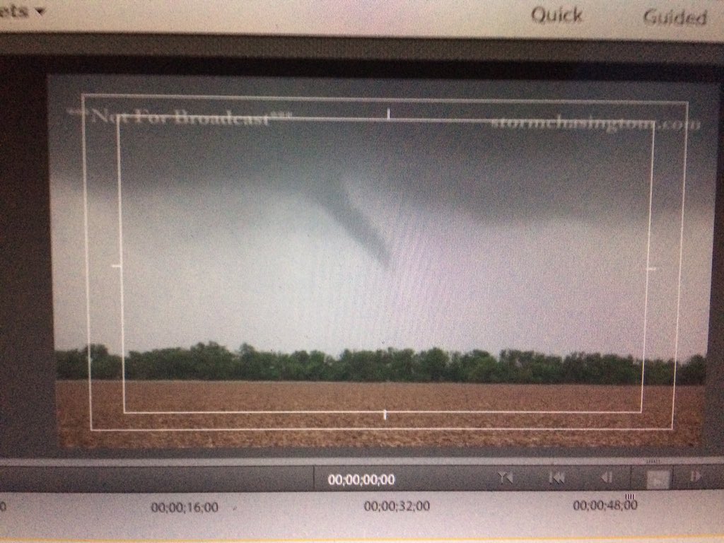
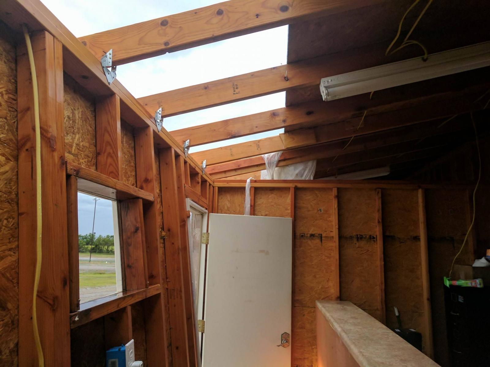
| Picture of funnel/possible tornado 5 miles east of Genesseo. Picture by Brandy Ivey | Damage at the Salina Speedway from tornado warned storm. | Damage at the Salina Speedway from tornado warned storm. |
 |
 |
 |
 |
||
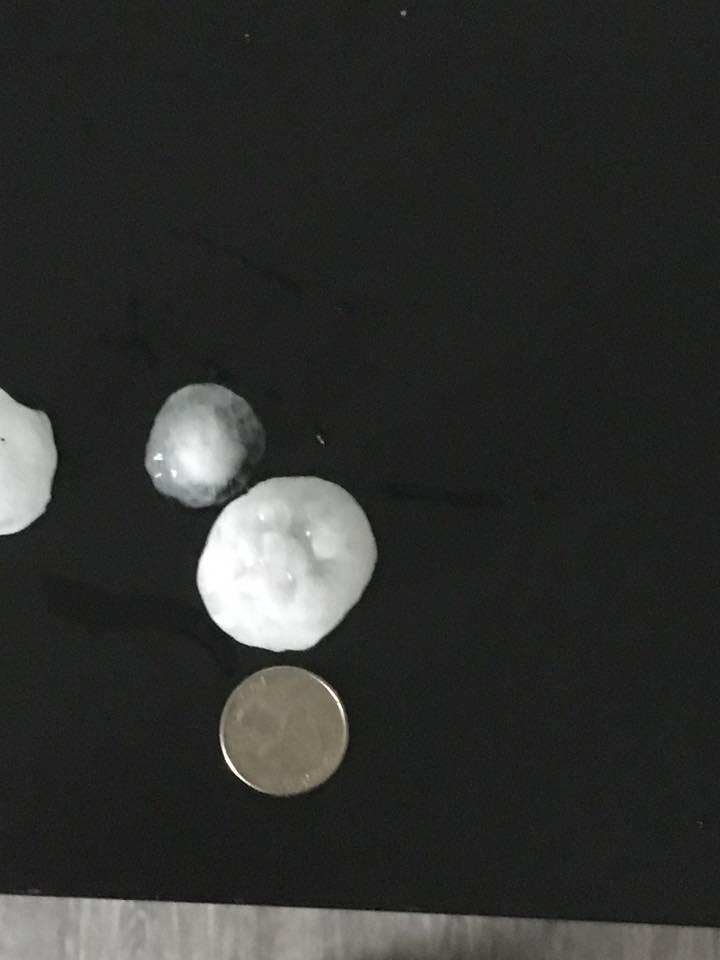
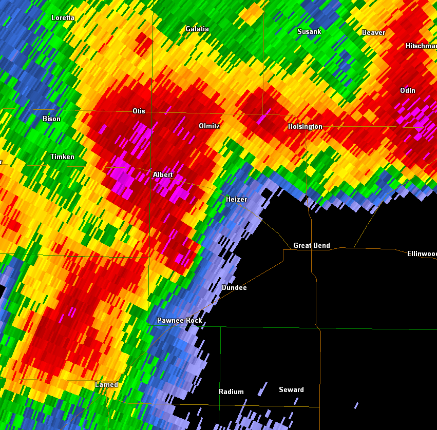
| Large hail in Great Bend. Picture by Jory Hutsler | Radar image of a tornado producing storm entering the west side of Barton County |
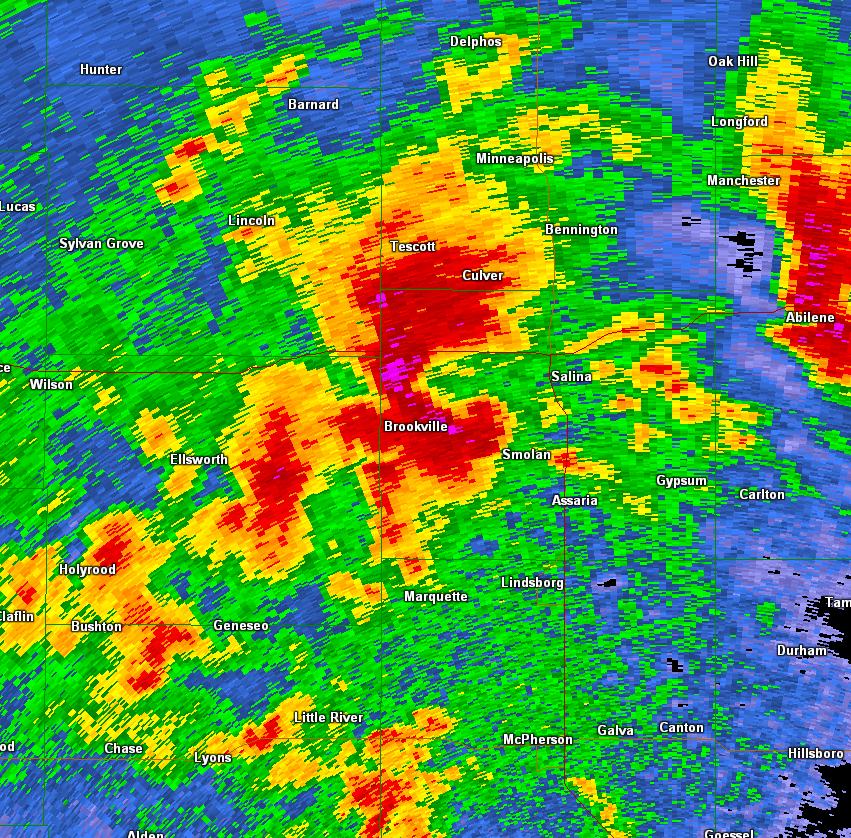
Radar image of tornado warned storm west of Salina
|
Radar animation from May 18th | ||
|
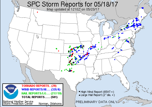
Severe weather reports on May 18th |
|||||
 |
Media use of NWS Web News Stories is encouraged! Please acknowledge the NWS as the source of any news information accessed from this site. |
|
Hazards
Briefing pages
Local weather story
Submit a storm report
Storm Prediction Center
Enhanced Hazardous Weather Outlook
Current Conditions
Local Radar
National Radar
Satellite
Hourly weather(text)
Precip Analysis
Snowfall analysis
This day in weather history
7 Day Lightning Archive
Forecasts
Forecast Discussion
Weather Story
Fire Weather
Activity Planner
Aviation Weather
Soaring Forecast
Hurricane Center
Graphical Forecasts
Regional Weather Summary
Probabilistic Snow
Probabilistic QPF
Wet Bulb Globe temp
Climate
Local Climate Page
Daily/Monthly data(F6)
Daily Records
Climate Normals
Local drought page
Latest Climate Report(ICT)
Latest Climate Report(SLN)
Latest Climate Report(CNU)
CoCoRaHS
7 Day Lightning Archive
US Dept of Commerce
National Oceanic and Atmospheric Administration
National Weather Service
Wichita, Kansas
2142 S. Tyler Road
Wichita, KS 67209-3016
316-942-3102
Comments? Questions? Please Contact Us.