Overview
|
Storms developed over far northwest Kansas during the late afternoon hours of Sunday April 28th. These storms tracked east as the evening hours approached, making it into central Kansas by around 10 pm. Hail up to the size of baseballs were reported with the stronger storms along with damaging winds. Strong winds over southern Chase county derailed 21 train cars south of Matfield Green. In addition, several power poles were blown down north of Eureka. |
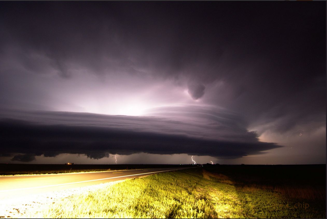
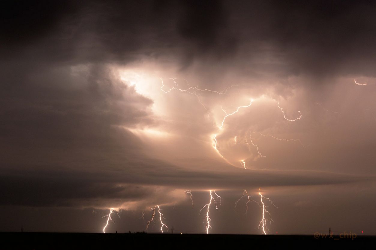 Picture taken by Chip Redmond near Larned, KS (@wx_chip) |
Photos & Video
 |
 |
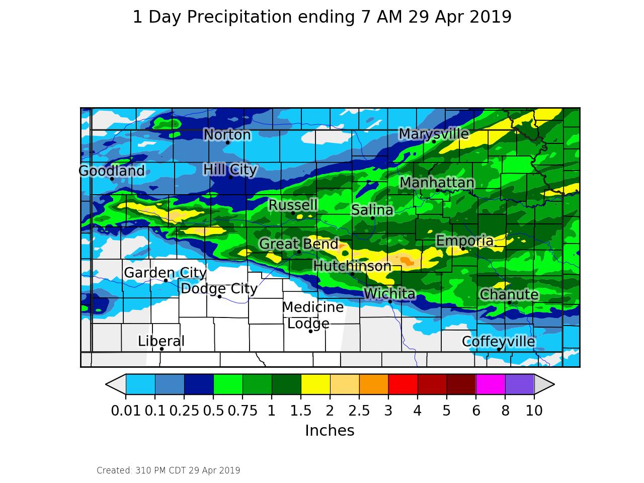 |
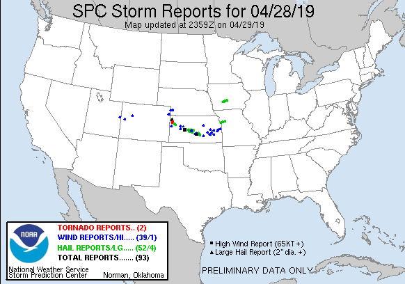
| Picture taken by Chip Redmond near Larned, KS | Severe weather reports | Rainfall amounts from this event |
|
|
|
|
|
|
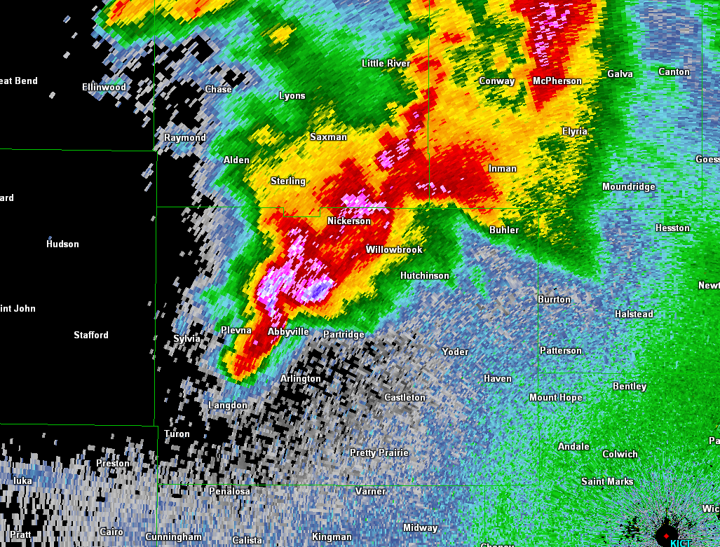
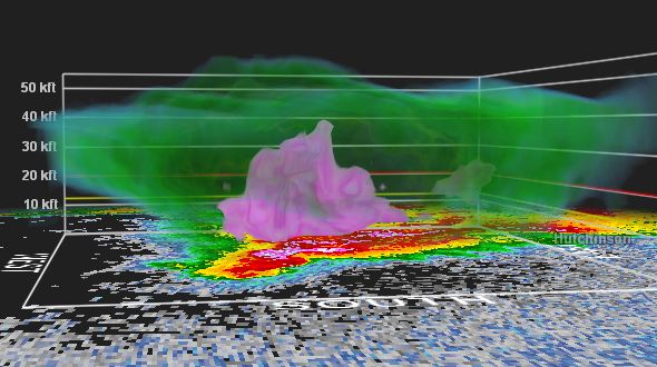
Radar
 |
 |
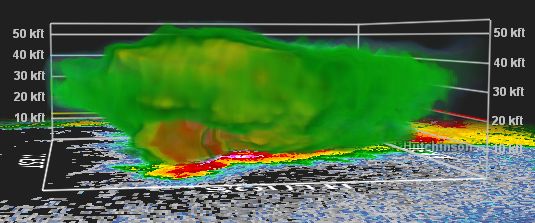 |
| Radar image of the storm that produced baseball size hail in Reno county | 3-D radar image showing the 60+ dbz core reaching over 30,000 ft | Another 3-D image of the storm showing it's top around 50,000ft |
 |
Media use of NWS Web News Stories is encouraged! Please acknowledge the NWS as the source of any news information accessed from this site. |
|

