Overview
Intense upper level low pressure system allowed unseasonably moist airmass to lift north across the southern and central Plains. Widespread heavy rainfall north of a warm front started Monday afternoon May 20th and ramped up Monday night into Tuesday morning. Extremely high rainfall rates caused widespread flash flooding and river flooding.
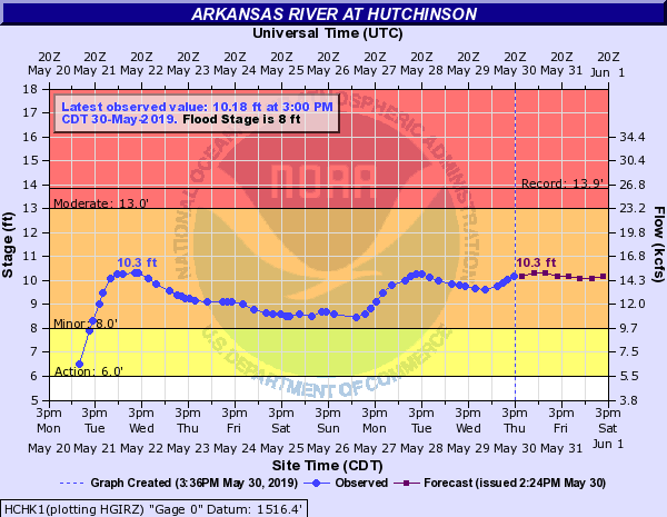
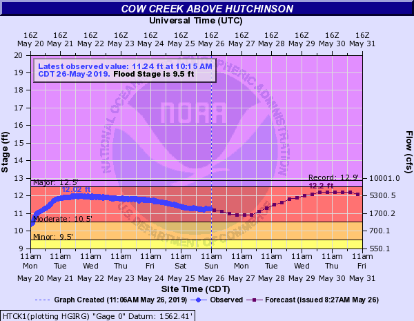
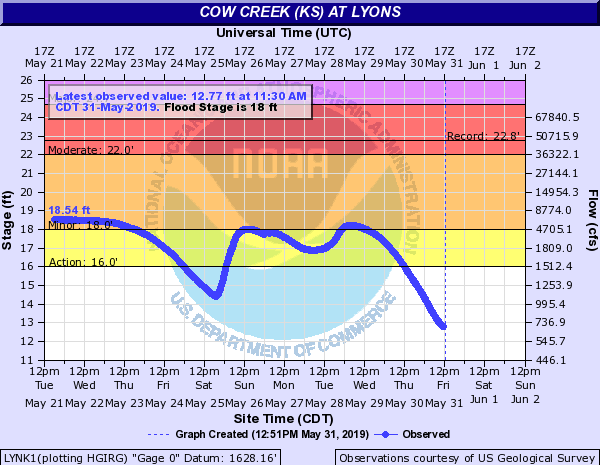
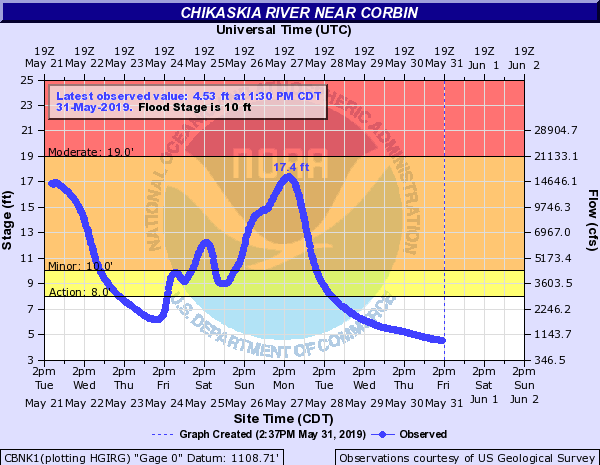
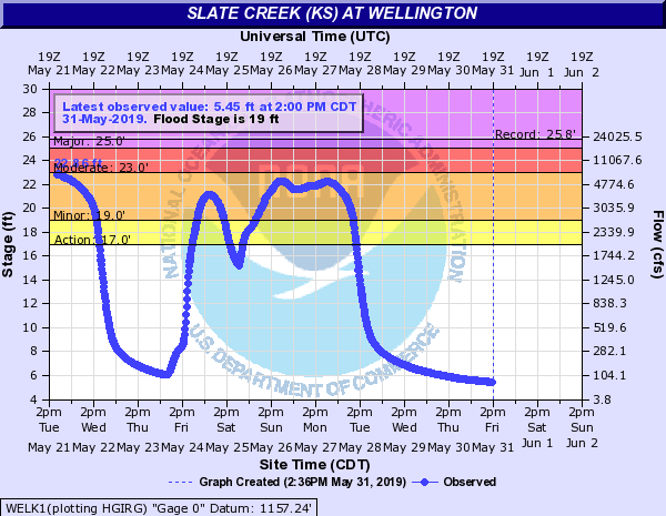
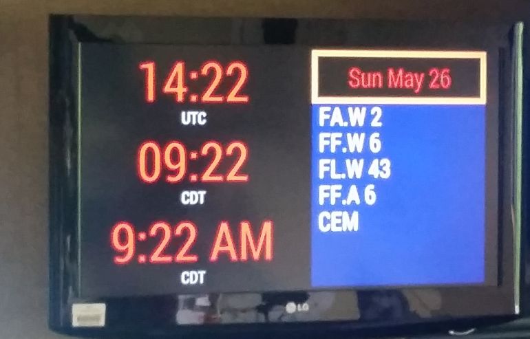
Bouts of heavy rain and flooding continued for the next several days causing all of the rivers across central and south central Kansas to be in flood at some point. At one point, the NWS in Wichita had a river flood warning for 43 river points! Some rivers reached levels not seen in over a decade or even longer. Major flood category was reached along the Neosho, Arkansas, Vergigris and Walnut rivers with numerous other rivers reaching moderate flood stage.
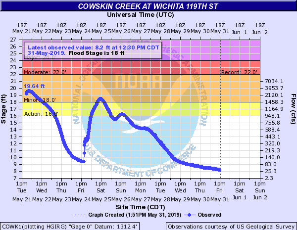
Flash flooding became a more widespread concern on the evening of May 24th. This is when flash flood emergencies were issued for the Wichita area along with Greenwood county, including Eureka. Numerous cars were overtaken by water with evacuations needed in Eureka. Sections of several highways were closed through this event due to both river flooding and flash flooding, most of these in southeast Kansas. These included, Highway 99 north of Eureka, Highway 400 west of Neodesha, Highway 54 east of Eureka and Highway 39 east of Chanute. Evacuations were done below the Fall River dam during the early morning hours on May 25th and around 50 homes were evacuated in Independence due to rises on the Verdigris River. This page is still being updated with information.
Hydrographs
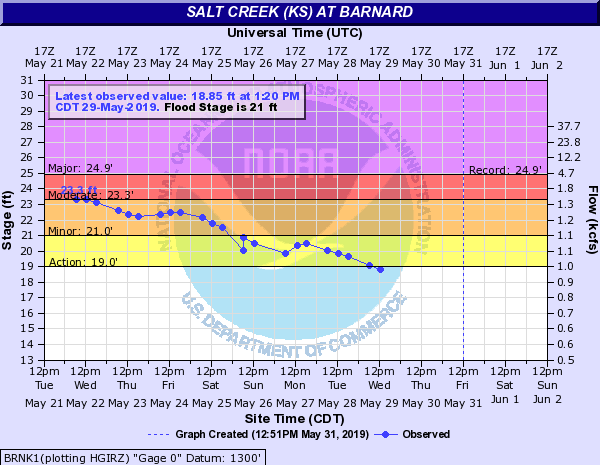
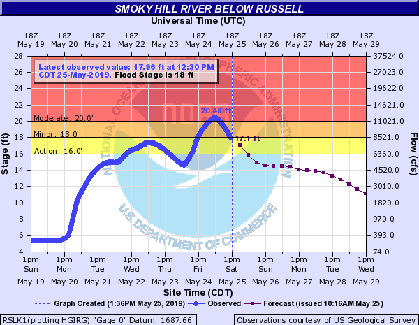
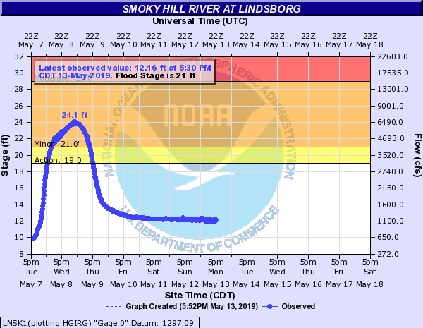
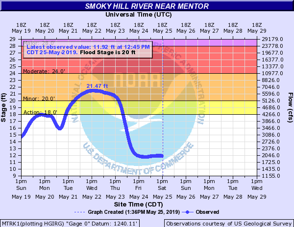
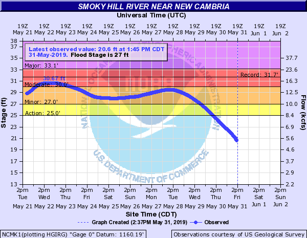
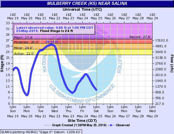
Smoky Hill River, Salt Creek & Mulberry Creek
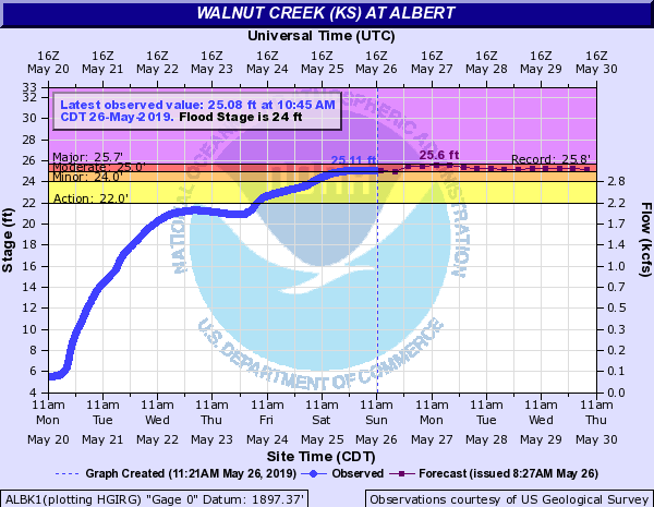
Walnut Creek reached a level that hasn't been seen since the floods of 1993
 |
 |
 |
 |
 |
 |
Little Arkansas
.png) |
.png) |
.png) |
Arkansas River, Walnut Creek & Cowskin Creek
The river level at Great Bend reached a height that hasn't been seen since 1973
.png) |
 |
.png) |
.png) |
.png) |
.png) |
.png) |
 |
 |
Cow Creek
 |
 |
Chikaskia River
 |
Slate Creek
 |
Whitewater River
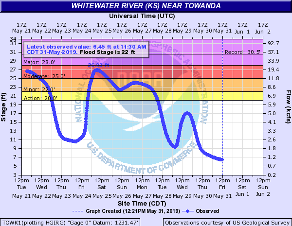 |
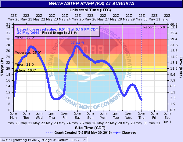 |
Walnut River
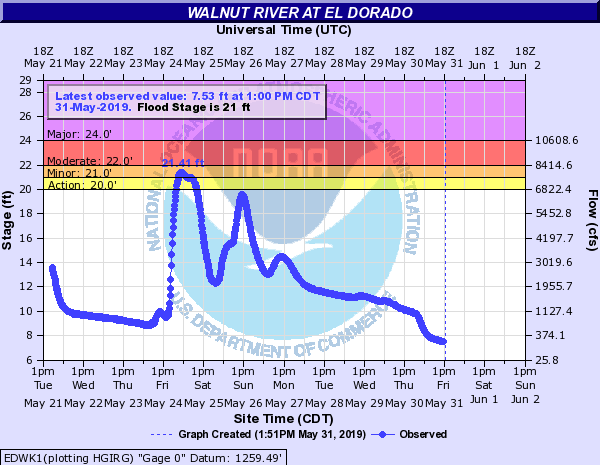 |
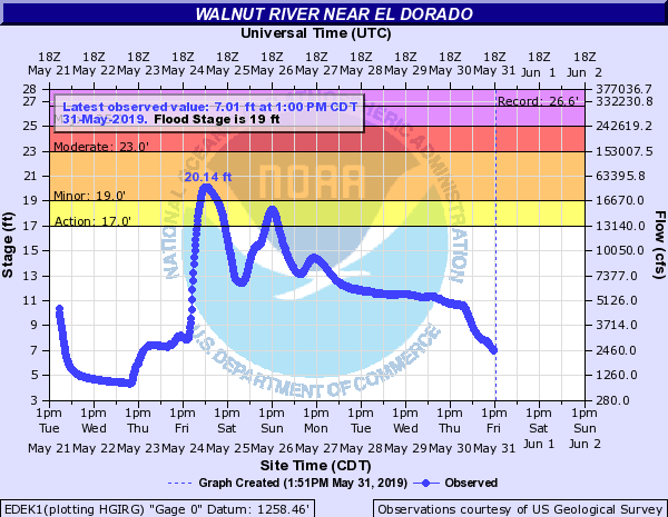 |
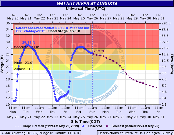 |
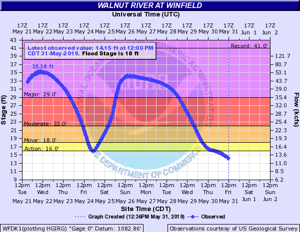 |
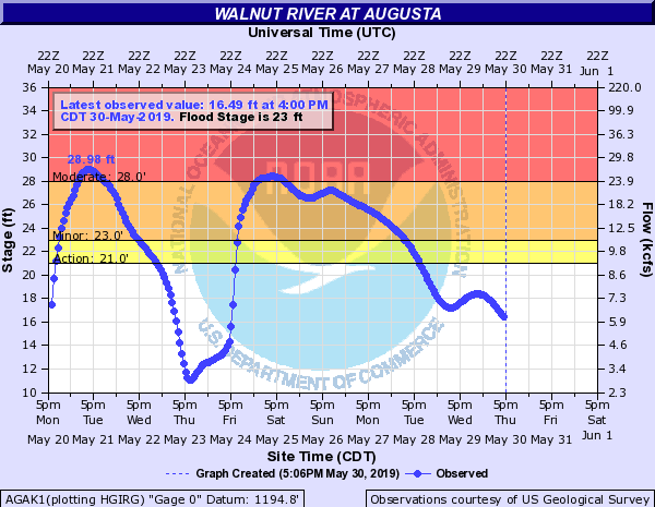 |
Ninnescah
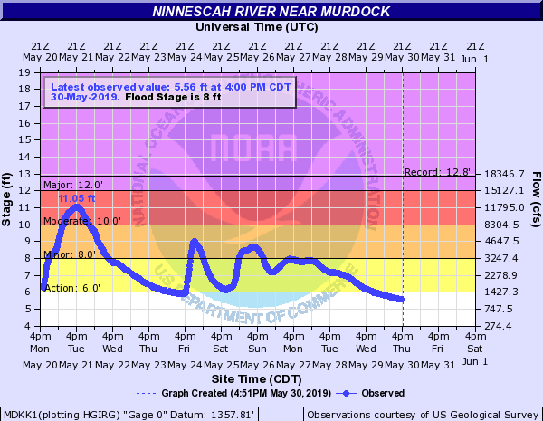 |
 |
 |
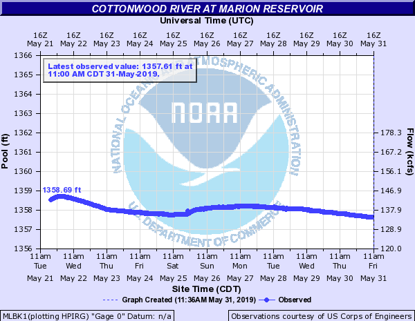
Cottonwood River
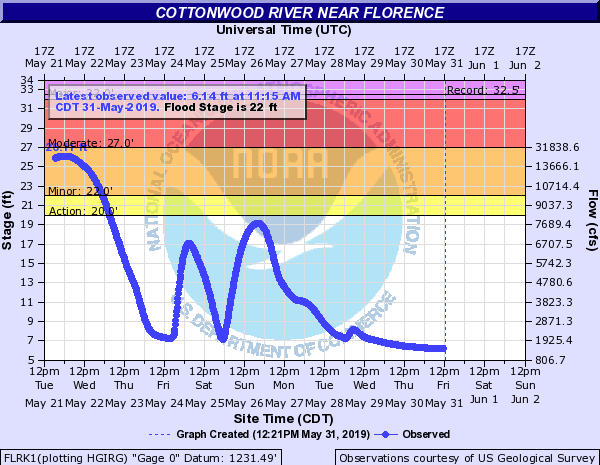 |
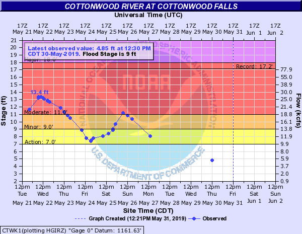 |
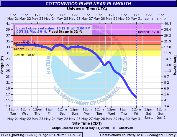 |
Fall River
.png) |
Verdigris
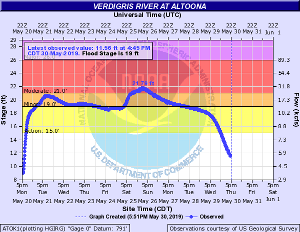 |
.png) |
.png) |
Neosho River
.png) |
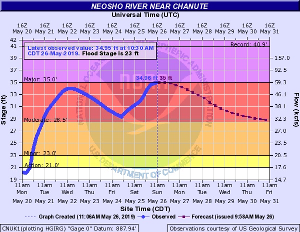 |
.png) |
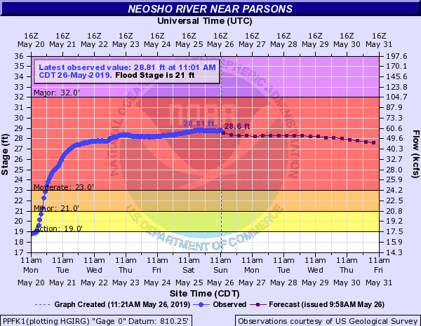 |
.png) |
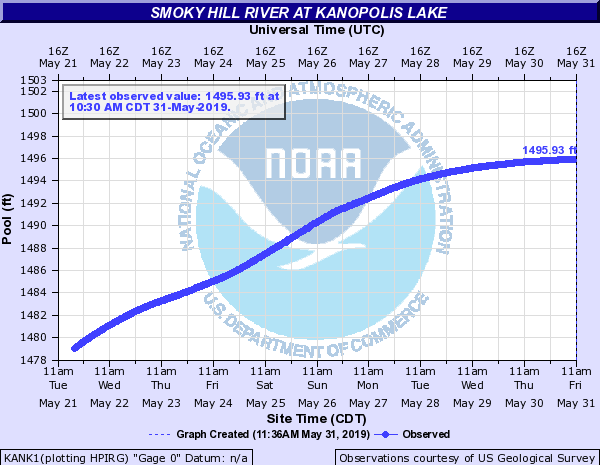
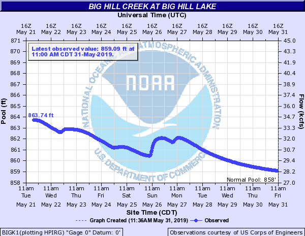
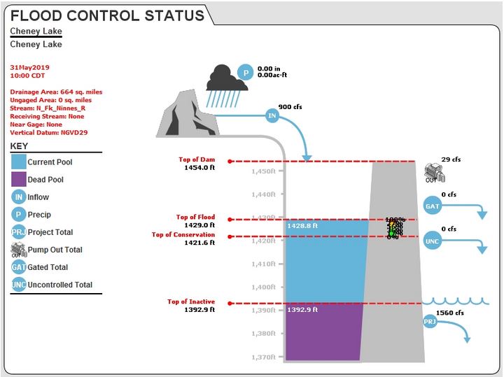
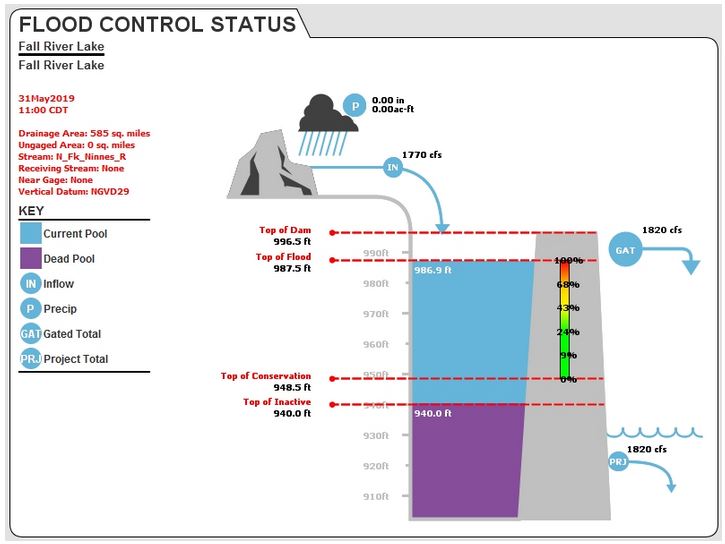
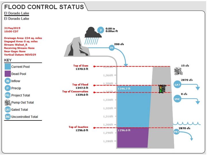
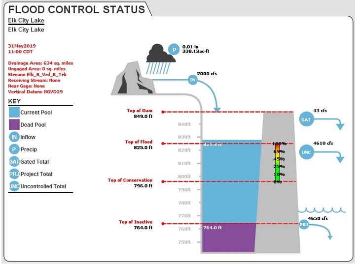
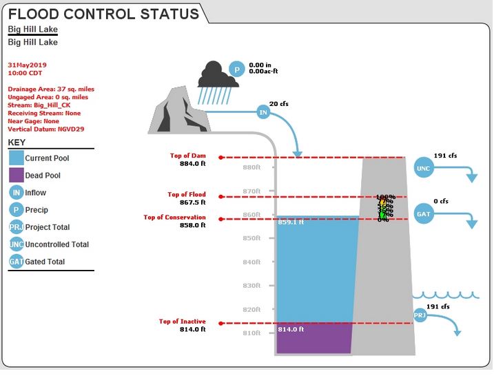
Lakes and Reservoirs
.png) |
.png) |
.png) |
 |
.png) |
.png) |
 |
 |
|
 |
 |
 |
 |
 |
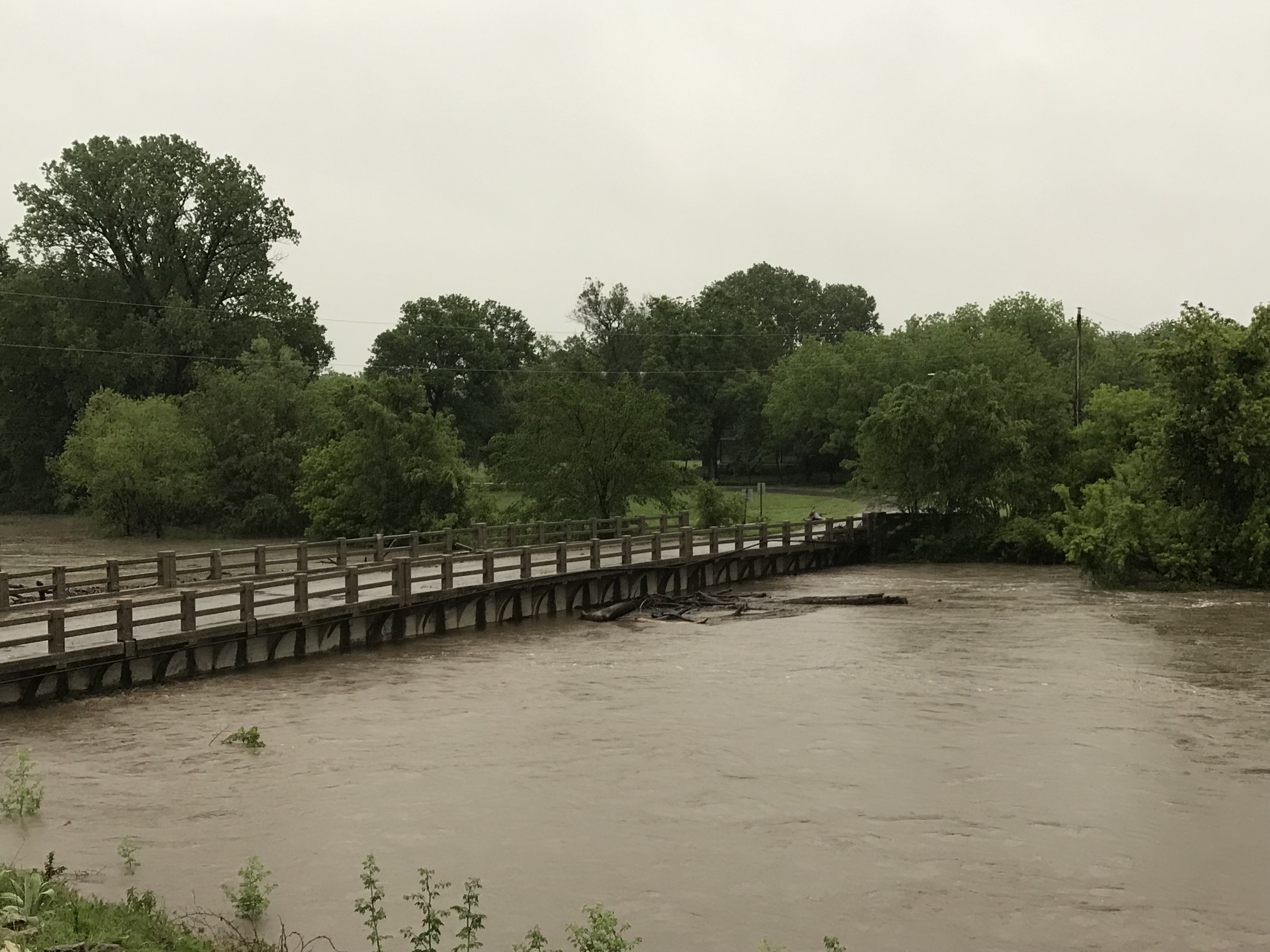
Photos & Video
|
 |
|
| 7 Day rainfall ending on May 27th | Florence, KS Bridge Courtesy Randy Frank |
Three hour rise on the west branch of the Walnut River (Charlene Miller) |
|
|
|
|
|
|
|
|
|
|
|
|
|
|
|
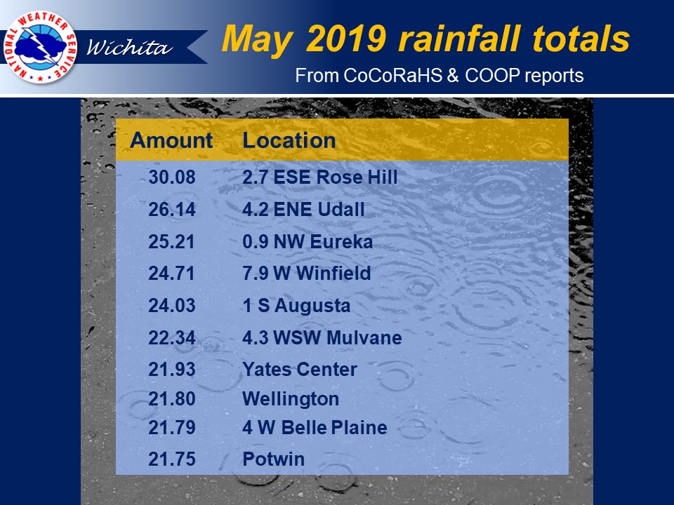
Rainfall info
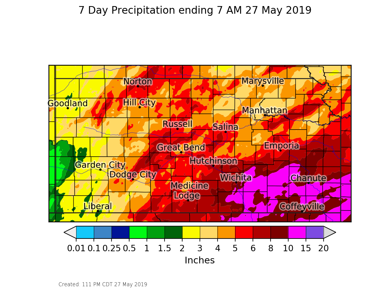
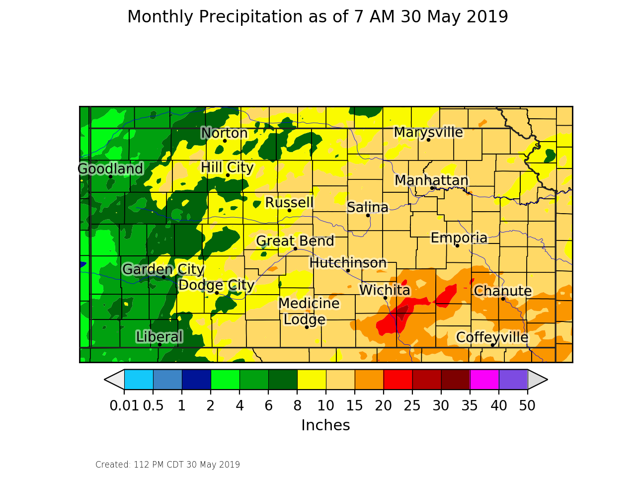
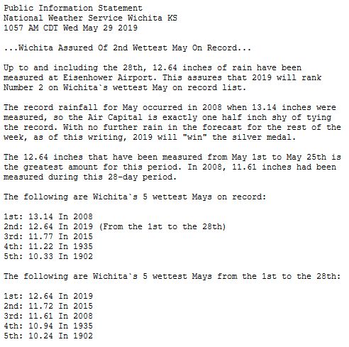
Widespread 8 to 12 inches of rainfall fell in a 7 day period ending around May 27th. In addition, may areas across southern and eastern Kansas have picked-up between 15 and 25 inches for the month of May. May 2019 will go down as the 2nd wettest may on record for Wichita with a rainfall total of 12.64 inches. The wettest May on record of Wichita is 13.14 from back in 2008.
|
7 day rainfall ending on May 27th |
May 2019 rainfall totals |
 |
Rainfall stats for Wichita |
Additional Information
 |
 |
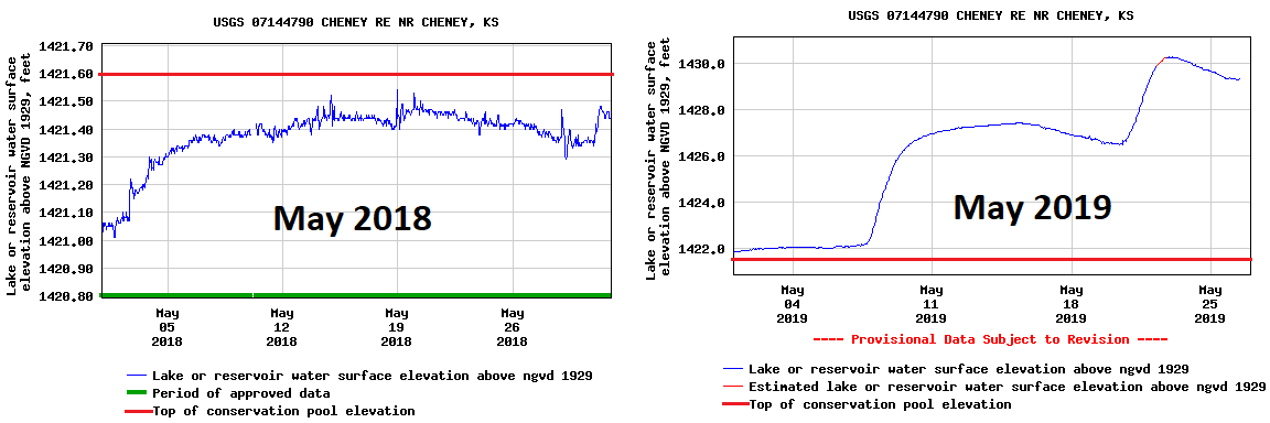 |
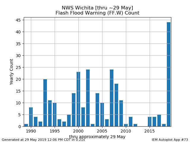
| NWS Wichita heads up display for May 26th showing 43 river flood warning, 6 flash flood warnings, 2 areal flood warnings, flood watches and a civil emergency message | Year by year breakdown of flash flood warnings through May 29th issued by NWS Wichita | Comparing lake levels at Cheney Lake from 2018 to 2019 |
.jpg) |
.jpg) |
 |
Media use of NWS Web News Stories is encouraged! Please acknowledge the NWS as the source of any news information accessed from this site. |
|