Overview
|
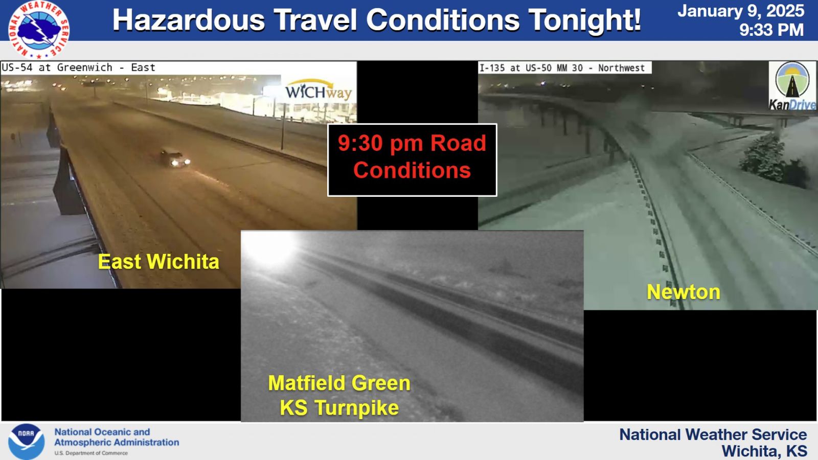
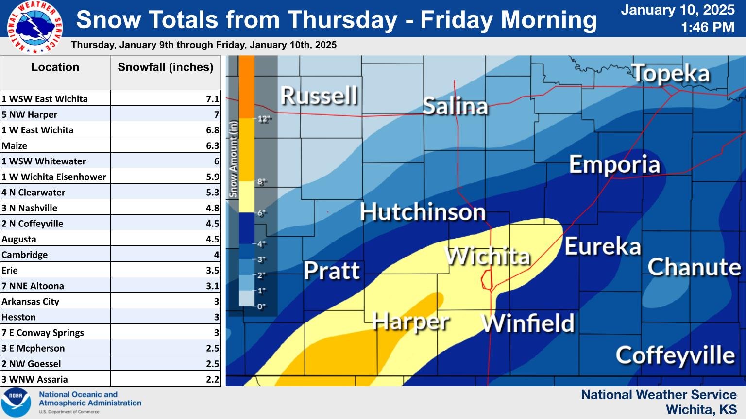
For the second time in 6 days, a winter storm affected much of central and eastern Kansas. Unlike the earlier event, this time the winter precipitation fell as all snow and didn't include any high winds. Snow started a couple hours prior to the evening commute on Thursday January 9th and continued through the evening hours. This time the highest snow totals were across south central Kansas where 4 to 7 inches was common. Numerous accidents occurred with this storm and most schools across south central and southeast Kansas cancelled school for the next day. |
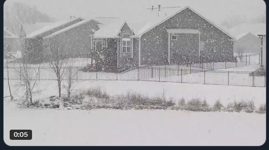 Image by Bryce Kintigh |
Photos & Video
 |
 |
 |
| Picture of road conditions Thursday evening | A look at snow amounts from this storm | Radar animation from the evening of January 9th |
|
|
|
|
|
|
|
|
|
Storm Reports
Preliminary Local Storm Report...Summary
National Weather Service Wichita KS
110 PM CST Fri Jan 10 2025

..TIME...   ...EVENT...      ...CITY LOCATION...     ...LAT.LON...
..DATE...   ....MAG....      ..COUNTY LOCATION..ST.. ...SOURCE....
            ..REMARKS..

0944 AM     Snow             7 E Conway Springs      37.37N 97.53W
01/10/2025  M3.0 Inch        Sumner             KS   Public

            24 hour total.

0931 AM     Snow             5 NW Harper             37.34N 98.09W
01/10/2025  M7.0 Inch        Harper             KS   Trained Spotter

            24 hour total.

0820 AM     Snow             1 WSW East Wichita      37.68N 97.27W
01/10/2025  M7.1 Inch        Sedgwick           KS   Broadcast Media

            24 hour total.

0818 AM     Snow             1 WSW Whitewater        37.96N 97.17W
01/10/2025  M6.0 Inch        Harvey             KS   NWS Employee

            24 hour total.

0814 AM     Snow             3 N Nashville           37.48N 98.43W
01/10/2025  M4.8 Inch        Kingman            KS   Trained Spotter

            24 hour total.

0727 AM     Snow             Hesston                 38.14N 97.43W
01/10/2025  M3.0 Inch        Harvey             KS   Emergency Mngr


0725 AM     Snow             1 W East Wichita        37.69N 97.28W
01/10/2025  M6.8 Inch        Sedgwick           KS   Trained Spotter


0630 AM     Snow             Augusta                 37.70N 96.97W
01/10/2025  M4.5 Inch        Butler             KS   CO-OP Observer

            Storm-total.

0619 AM     Snow             Arkansas City           37.07N 97.04W
01/10/2025  M3.0 Inch        Cowley             KS   Emergency Mngr

            Storm-total.

0605 AM     Snow             2 NW Goessel            38.27N 97.37W
01/10/2025  M2.5 Inch        McPherson          KS   CO-OP Observer

            Storm-total.

0604 AM     Snow             Cambridge               37.32N 96.67W
01/10/2025  M4.0 Inch        Cowley             KS   CO-OP Observer

            Storm-total.

0600 AM     Snow             4 N Clearwater          37.56N 97.52W
01/10/2025  M5.3 Inch        Sedgwick           KS   Cocorahs

            Storm-total.

0600 AM     Snow             2 N Coffeyville         37.07N 95.63W
01/10/2025  M4.5 Inch        Montgomery         KS   CO-OP Observer

            24-hour total. Still snowing lightly.

0600 AM     Snow             Erie                    37.57N 95.25W
01/10/2025  M3.5 Inch        Neosho             KS   Cocorahs

            24-hour total. Still lightly snowing.

0600 AM     Snow             7 NNE Altoona           37.62N 95.60W
01/10/2025  M3.1 Inch        Wilson             KS   Cocorahs

            24-hour total. Still snowing lightly.

0600 AM     Snow             4 WNW Little River      38.42N 98.09W
01/10/2025  M2.5 Inch        Rice               KS   Cocorahs

            Storm-total.

0600 AM     Snow             3 E Mcpherson           38.38N 97.61W
01/10/2025  M2.5 Inch        McPherson          KS   CO-OP Observer

            Storm-total.

0553 AM     Snow             Maize                   37.77N 97.46W
01/10/2025  M6.3 Inch        Sedgwick           KS   Broadcast Media

            Storm-total. Courtesy KWCH TV.

0517 AM     Snow             1 W Wichita Eisenhower  37.65N 97.44W
01/10/2025  M5.9 Inch        Sedgwick           KS   Official NWS Obs

            Storm-total at the National Weather Service.
            Snow has stopped.

0500 AM     Snow             4 NNW Wichita Eisenhowe 37.71N 97.47W
01/10/2025  M6.3 Inch        Sedgwick           KS   Cocorahs

            Storm-total.
 |
Media use of NWS Web News Stories is encouraged! Please acknowledge the NWS as the source of any news information accessed from this site. |
|

