Wichita, Kansas
Weather Forecast Office
Overview
|
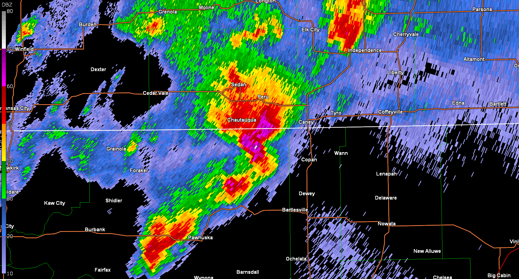
Severe storms erupted during the afternoon hours of April 1st across Oklahoma with a couple of the stronger storms moving into far southern and southeast Kansas. One of the more intense supercells tracked across the town of Caney producing hail up to tennis ball size along with 70 mph winds. This same supercell affected a few additional communities as it tracked across far southeast Kansas. |
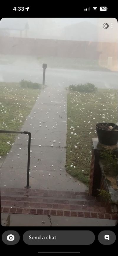
 Large hail in Caney Kansas. Picture courtesy of Emergency Manager. |
Photos & Video
 |
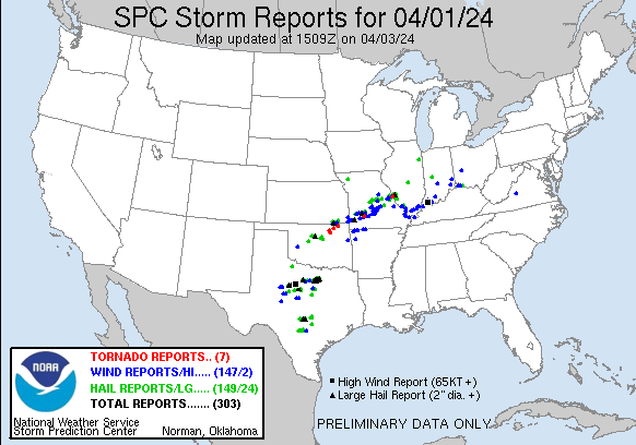 |
| Radar animation showing the supercell tracking across Southeast Kansas | Map of storm reports from this event |
 |
 |
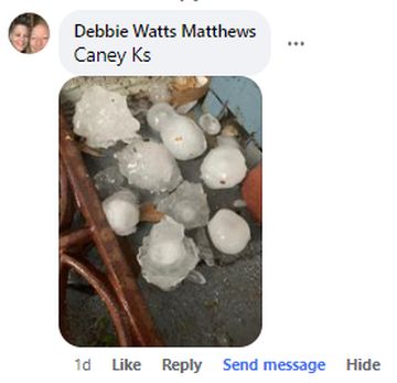 |
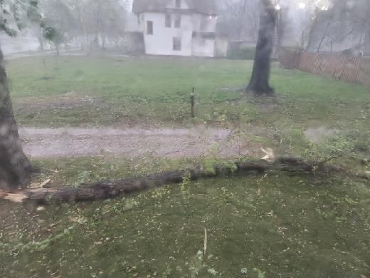
| Tree damage on Coffeyville, courtesy of Emergency Management | Large hail in Caney. | Caption (source) |
|
|
|
||
 |
||||
 |
Media use of NWS Web News Stories is encouraged! Please acknowledge the NWS as the source of any news information accessed from this site. |
|
Hazards
Briefing pages
Local weather story
Submit a storm report
Storm Prediction Center
Enhanced Hazardous Weather Outlook
Hazardous Weather Outlook Text
Current Conditions
Local Radar
National Radar
Satellite
Hourly weather(text)
Precip Analysis
Snowfall analysis
This day in weather history
7 Day Lightning Archive
Forecasts
Forecast Discussion
Weather Story
Fire Weather
Activity Planner
Aviation Weather
Soaring Forecast
Hurricane Center
Graphical Forecasts
Regional Weather Summary
Probabilistic Snow
Probabilistic QPF
Wet Bulb Globe temp
Climate
Local Climate Page
Daily/Monthly data(F6)
Daily Records
Climate Normals
Local drought page
Latest Climate Report(ICT)
Latest Climate Report(SLN)
Latest Climate Report(CNU)
CoCoRaHS
7 Day Lightning Archive
US Dept of Commerce
National Oceanic and Atmospheric Administration
National Weather Service
Wichita, Kansas
2142 S. Tyler Road
Wichita, KS 67209-3016
316-942-3102
Comments? Questions? Please Contact Us.

