Overview
|
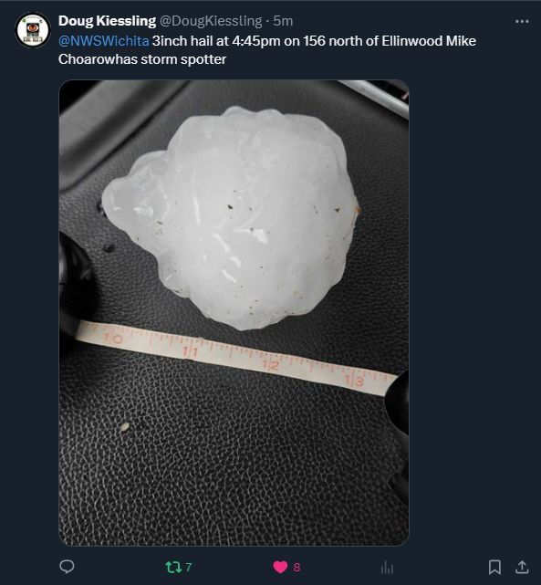
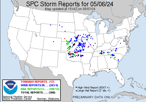
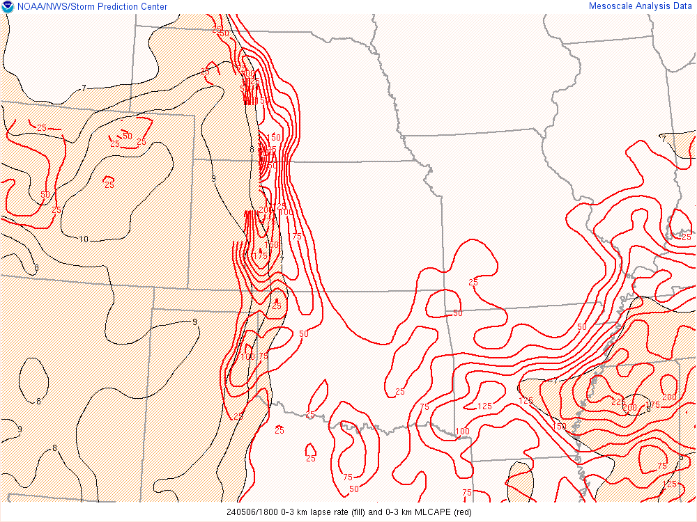
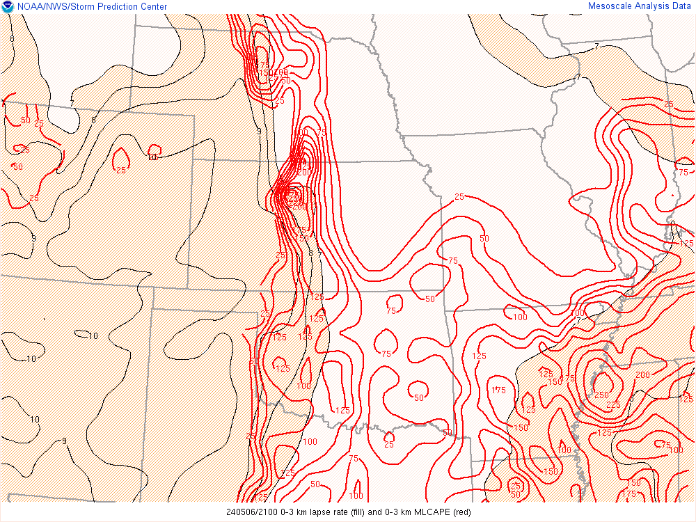
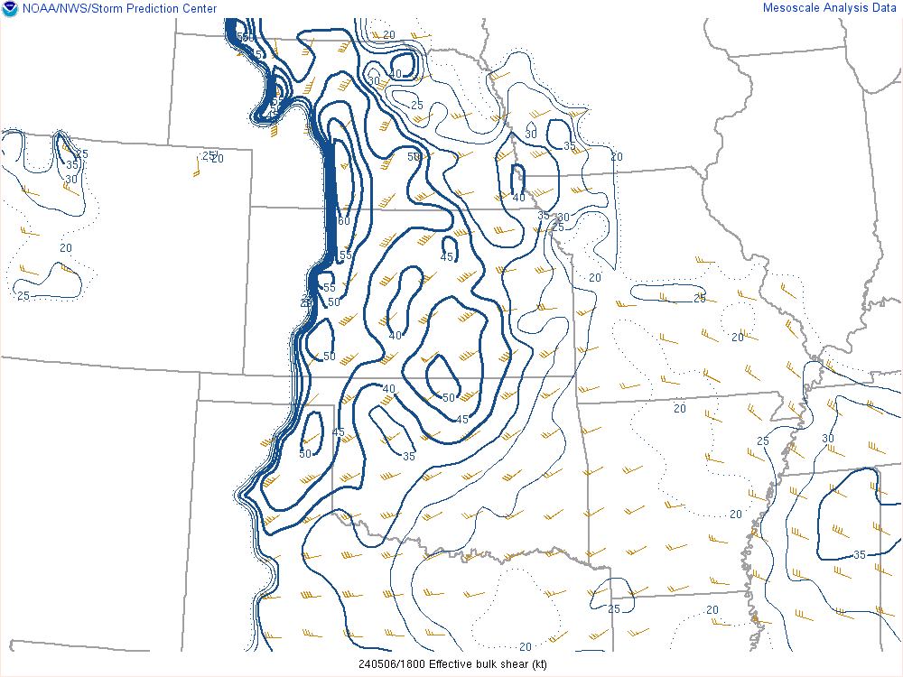
A dryline and Pacific cold front moved into the region on Monday May 6th and with abundant moisture and instability already in place, storms erupted by the early afternoon hours across west-central Kansas. As storms tracked across Central Kansas they produced hail up to slightly larger than baseballs! Storms became more numerous over southeast Kansas after sunset with wind and heavy rain becoming the main threats. The majority of the tornadoes on this day took place down in Oklahoma where an EF-4 struck the town of Barnsdall Oklahoma. |
 |
Photos & Video
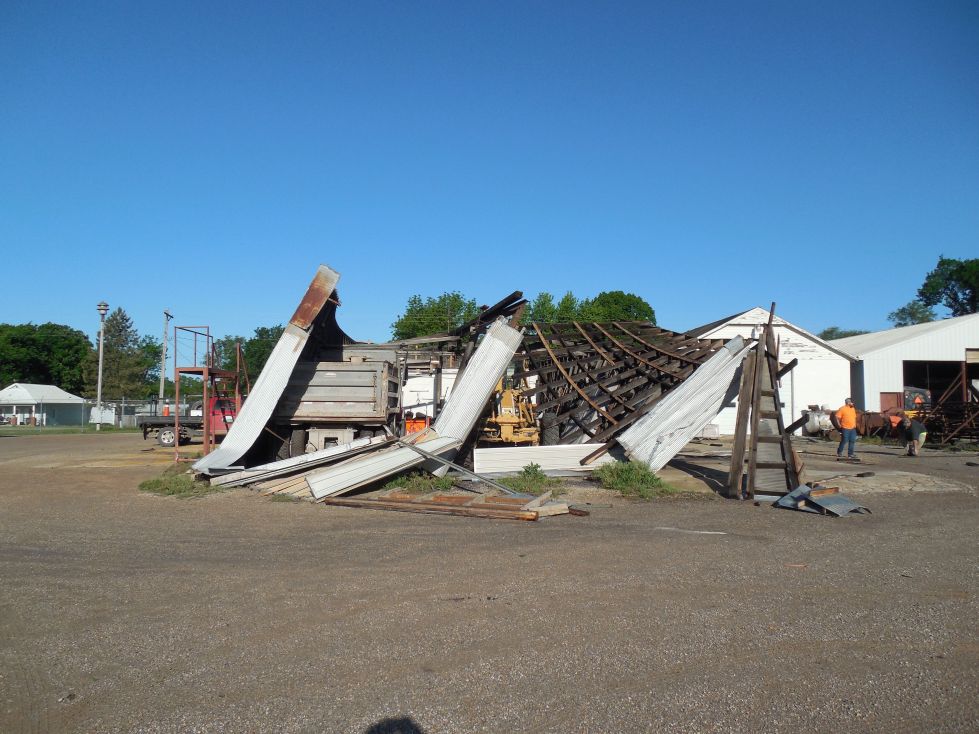
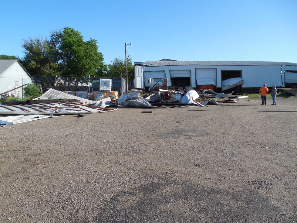
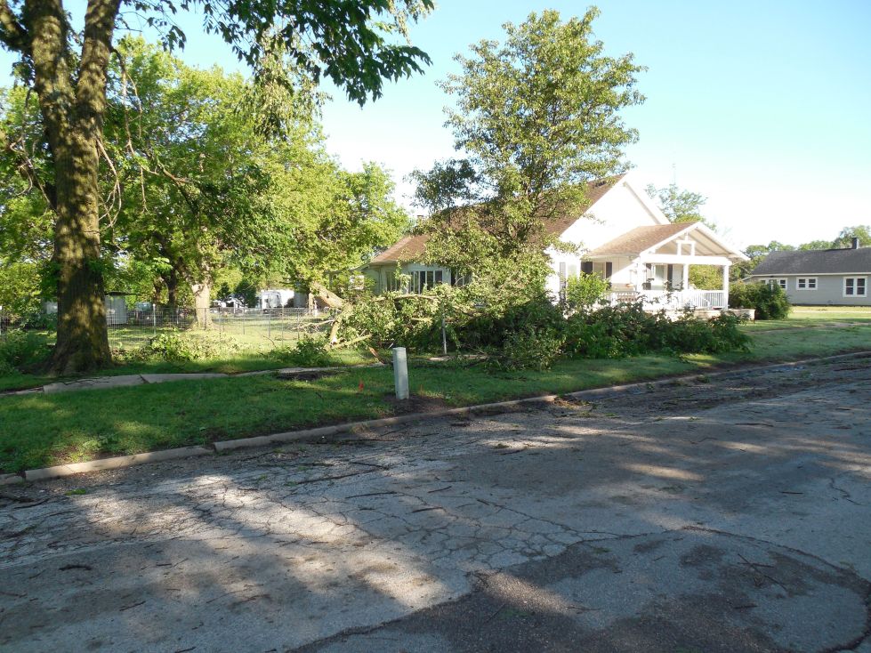
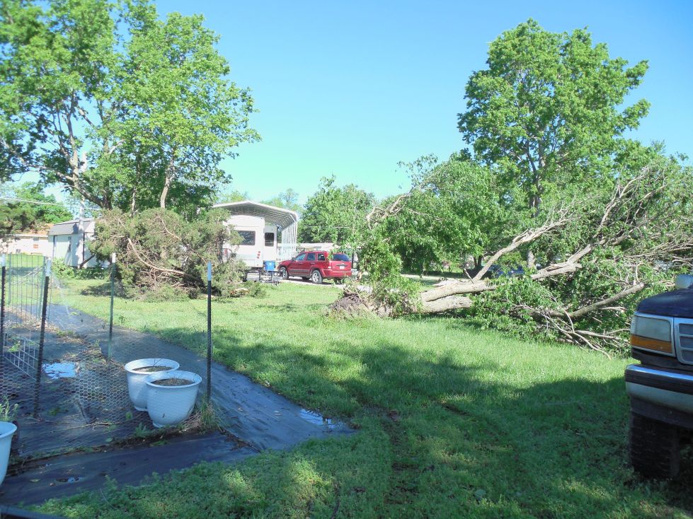
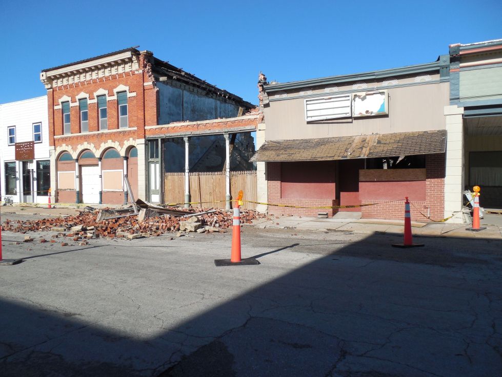
The following pictures are of straight-line wind damage near Burden
 |
 |
 |
 |
 |
|
|
|
|
|
here |
Radar
 |
Storm Reports
  Preliminary Local Storm Report...Summary
National Weather Service Wichita KS
1258 AM CDT Tue May 7 2024

..TIME...   ...EVENT...      ...CITY LOCATION...     ...LAT.LON...
..DATE...   ....MAG....      ..COUNTY LOCATION..ST.. ...SOURCE....
            ..REMARKS..

0400 PM     Tstm Wnd Gst     5 S Hoisington          38.45N 98.78W
05/06/2024  M54 MPH          Barton             KS   Mesonet

            Measured by the Kansas State mesonet
            station.

0412 PM     Hail             Pawnee Rock             38.27N 98.98W
05/06/2024  E1.00 Inch       Barton             KS   911 Call Center

            Nickel to quarter sized hail in Pawnee Rock.

0422 PM     Hail             Great Bend              38.36N 98.81W
05/06/2024  E0.88 Inch       Barton             KS   Law Enforcement


0436 PM     Hail             3 SW Holyrood           38.56N 98.44W
05/06/2024  M1.00 Inch       Ellsworth          KS   Trained Spotter

            Just east of main hail core. One inch hail.

0440 PM     Hail             4 SSW Claflin           38.47N 98.57W
05/06/2024  M3.00 Inch       Barton             KS   Public

            Delayed report, via image on social media
            (X).

0444 PM     Hail             Claflin                 38.53N 98.54W
05/06/2024  M0.88 Inch       Barton             KS   911 Call Center


0450 PM     Hail             Claflin                 38.52N 98.53W
05/06/2024  M2.00 Inch       Barton             KS   Public

            Picture messaged to NWS.

0450 PM     Hail             8 N Ellsworth           38.85N 98.23W
05/06/2024  M0.25 Inch       Ellsworth          KS   Emergency Mngr


0451 PM     Hail             Claflin                 38.52N 98.54W
05/06/2024  M2.50 Inch       Barton             KS   Law Enforcement

            Corrects time on previous hail report from
            Claflin.

0454 PM     Hail             Claflin                 38.52N 98.54W
05/06/2024  E1.00 Inch       Barton             KS   911 Call Center


0544 PM     Hail             3 ESE Sterling          38.19N 98.15W
05/06/2024  E0.70 Inch       Rice               KS   Emergency Mngr


0607 PM     Hail             Nickerson               38.15N 98.09W
05/06/2024  E1.00 Inch       Reno               KS   Trained Spotter


0618 PM     Hail             7 N Inman               38.33N 97.77W
05/06/2024  E0.88 Inch       McPherson          KS   Trained Spotter


0619 PM     Tstm Wnd Gst     1 S Mcpherson           38.36N 97.66W
05/06/2024  M52 MPH          McPherson          KS   Mesonet

            Kansas State mesonet station.

0619 PM     Tstm Wnd Gst     2 SSE Lindsborg         38.55N 97.67W
05/06/2024  M50 MPH          McPherson          KS   Trained Spotter


0622 PM     Tstm Wnd Dmg     3 NE Mcpherson          38.40N 97.61W
05/06/2024                   McPherson          KS   Public

            Power pole snapped. Time estimated via
            radar.

0624 PM     Tstm Wnd Gst     2 NNW Lindsborg         38.61N 97.69W
05/06/2024  M57 MPH          McPherson          KS   Trained Spotter

            Relayed by Saline County EM.

0624 PM     Hail             2 NNW Lindsborg         38.61N 97.69W
05/06/2024  E0.70 Inch       McPherson          KS   Trained Spotter

            Relayed by Saline County EM.

0823 PM     Tstm Wnd Dmg     2 E Burden              37.31N 96.72W
05/06/2024                   Cowley             KS   Emergency Mngr

            Power line down on roadway along US-160.

0855 PM     Tornado          7 W Elgin               37.00N 96.41W
05/06/2024                   Chautauqua         KS   Public

            Possible tornado crossed the state line near
            Hewins. Report passed on from media.

0856 PM     Tstm Wnd Gst     Severy                  37.62N 96.23W
05/06/2024  M68 MPH          Greenwood          KS   Mesonet


0907 PM     Flood            1 W Severy              37.62N 96.25W
05/06/2024                   Greenwood          KS   Fire Dept/Rescue

            Reports of flooding on K99 just sough of US
            400.

0914 PM     Hail             Salina                  38.82N 97.62W
05/06/2024  E0.75 Inch       Saline             KS   Emergency Mngr


0922 PM     Tstm Wnd Gst     Fall River              37.61N 96.03W
05/06/2024  E70 MPH          Greenwood          KS   Fire Dept/Rescue


0926 PM     Tstm Wnd Gst     Elk City                37.29N 95.91W
05/06/2024  E70 MPH          Montgomery         KS   Emergency Mngr


0930 PM     Flood            Howard                  37.47N 96.26W
05/06/2024                   Elk                KS   Emergency Mngr

            Street flooding reported in Howard.

0936 PM     Flood            2 N Severy              37.65N 96.23W
05/06/2024                   Greenwood          KS   Emergency Mngr

            Water over Highway 99 north of Severy.

0955 PM     Tstm Wnd Gst     3 S Elk City            37.24N 95.90W
05/06/2024  E70 MPH          Montgomery         KS   Fire Dept/Rescue

            Corrects previous tstm wnd gst report from 3
            S Elk City.

1033 PM     Tstm Wnd Dmg     4 S Angola              37.05N 95.47W
05/06/2024                   Labette            KS   Emergency Mngr

            Corrects previous tstm wnd dmg report from 4
            S Angola. Barn had the roof blown off.

1044 PM     Tstm Wnd Gst     Edna                    37.06N 95.36W
05/06/2024  E60 MPH          Labette            KS   Broadcast Media


1100 PM     Tstm Wnd Dmg     Chetopa                 37.04N 95.09W
05/06/2024                   Labette            KS   Emergency Mngr

            Tree fell on a house with injuries reported
            by Emergency Management.
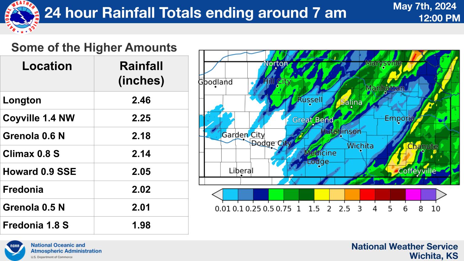
Rain Reports
Environment
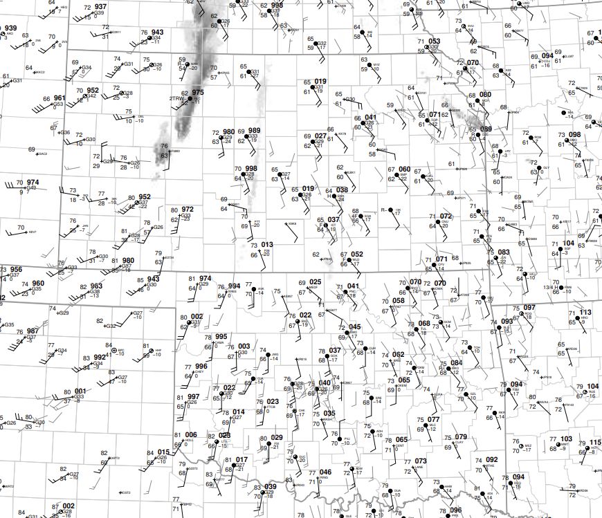 |
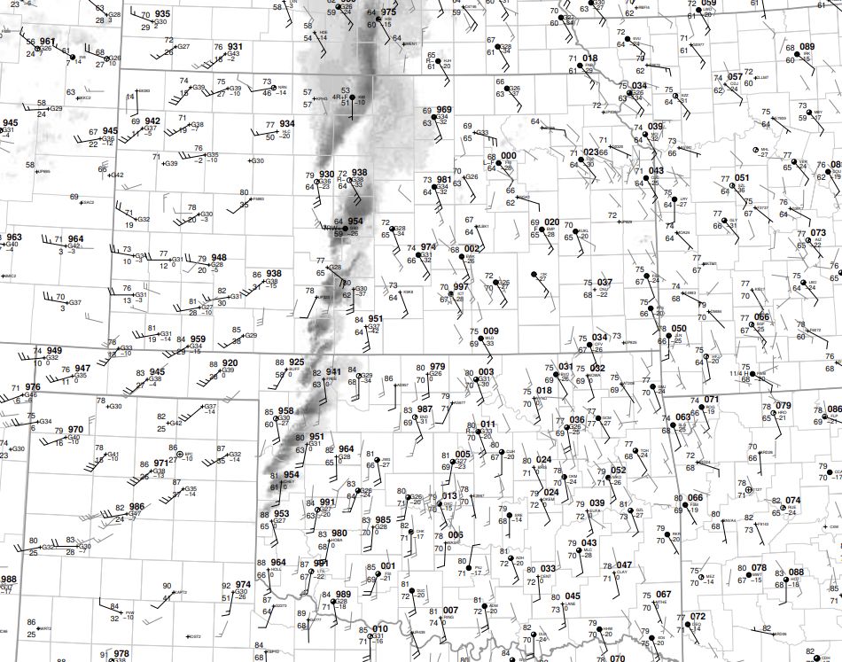 |
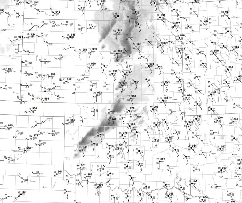 |
| 18z SFC map | 21z sfc map | 00z sfc map |
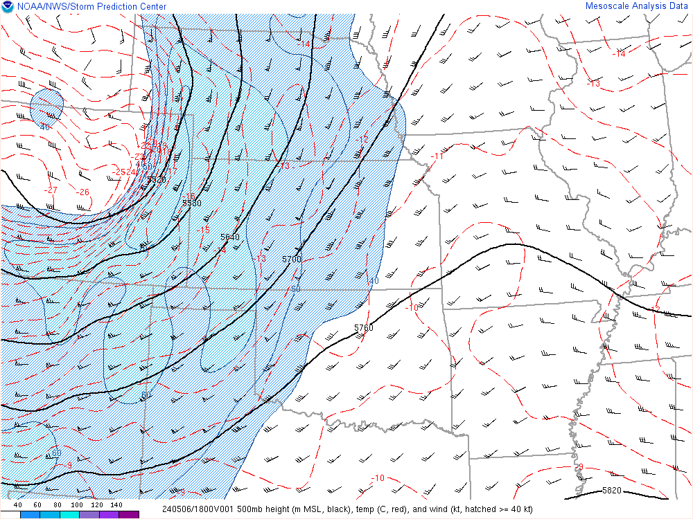 |
 |
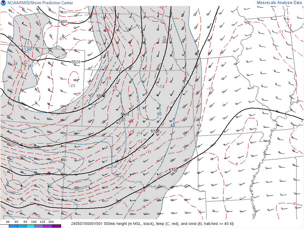 |
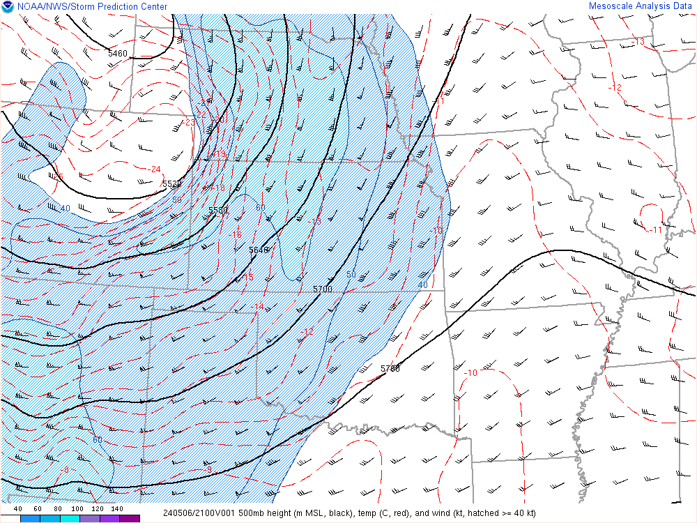
| 18z 500mb | 21z 500mb | 00z 500mb |
 |
 |
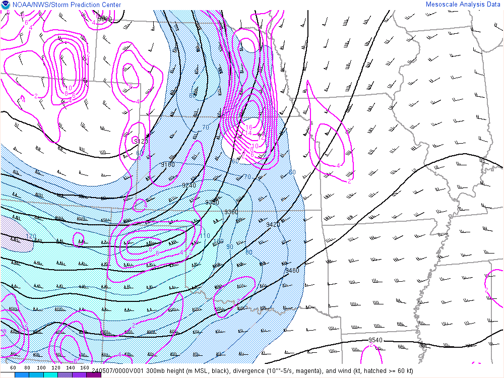 |
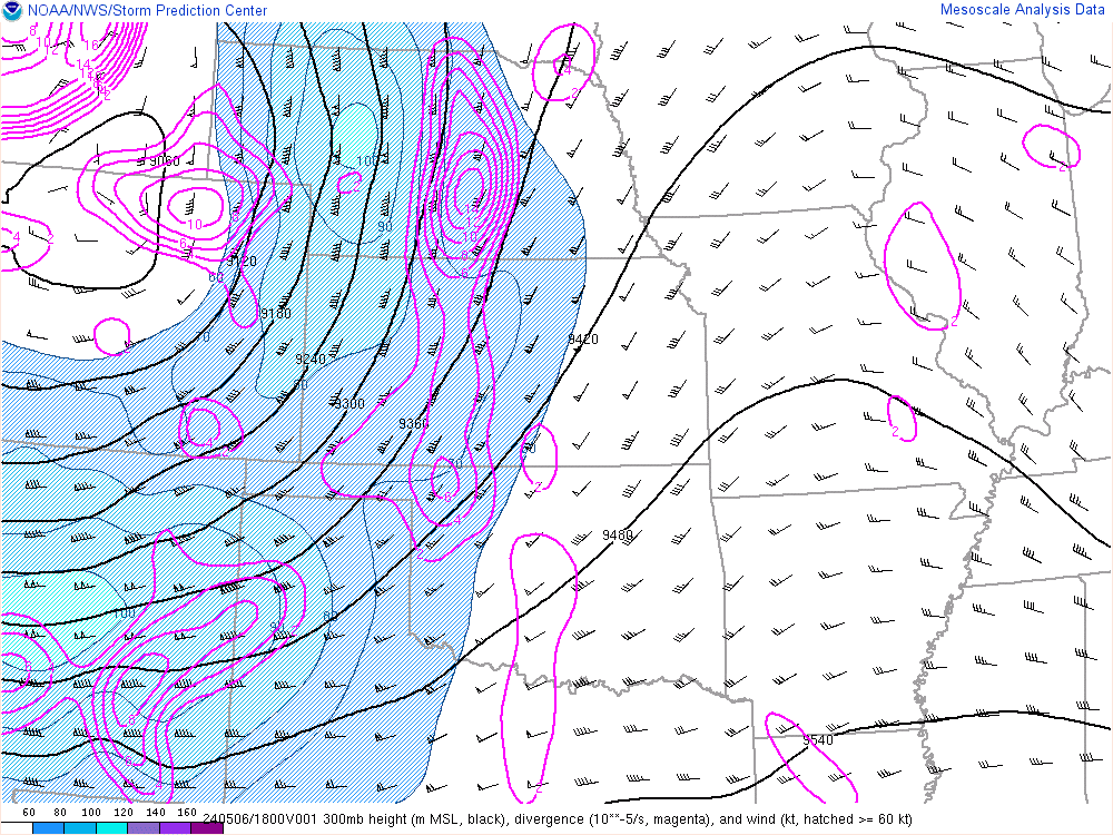
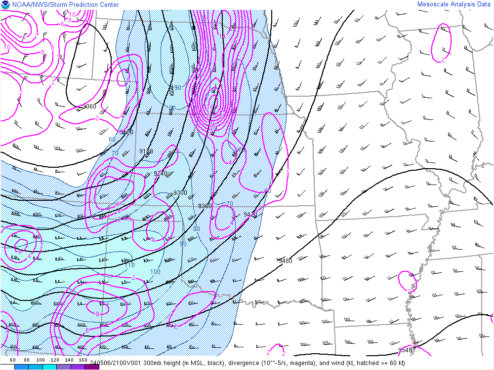
| 18z 300mb | 21z 300mb | 00z 300mb |
 |
 |
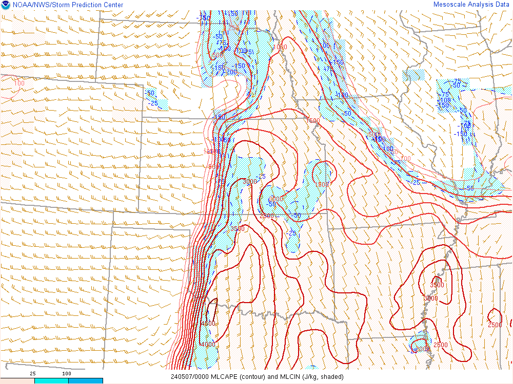 |
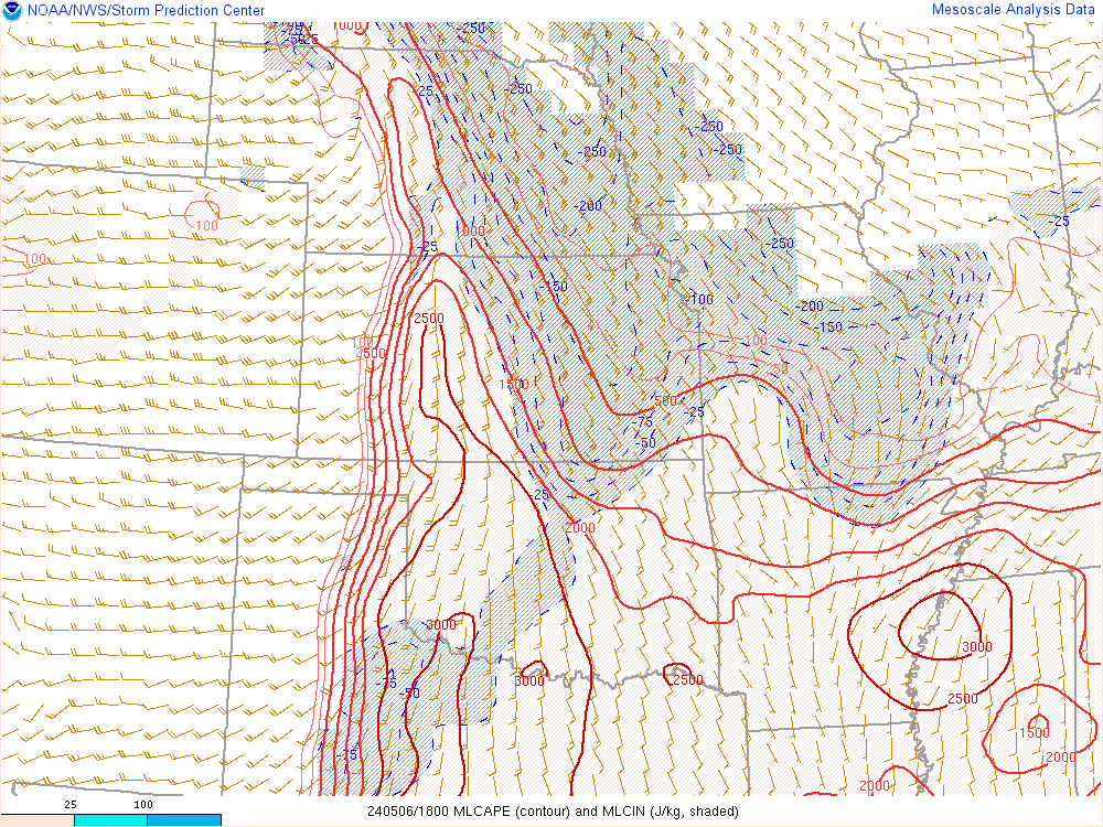
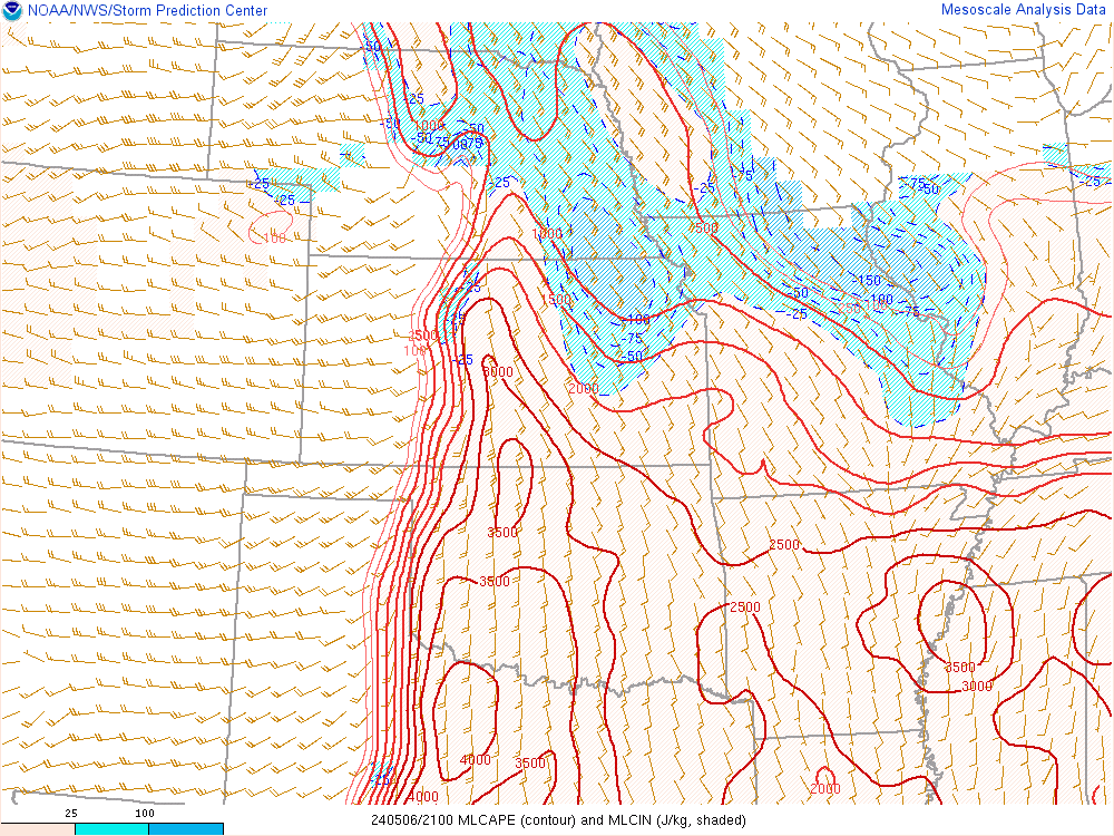
| 18z ML CAPE | 21z ML CAPE | 00z ML CAPE |
 |
 |
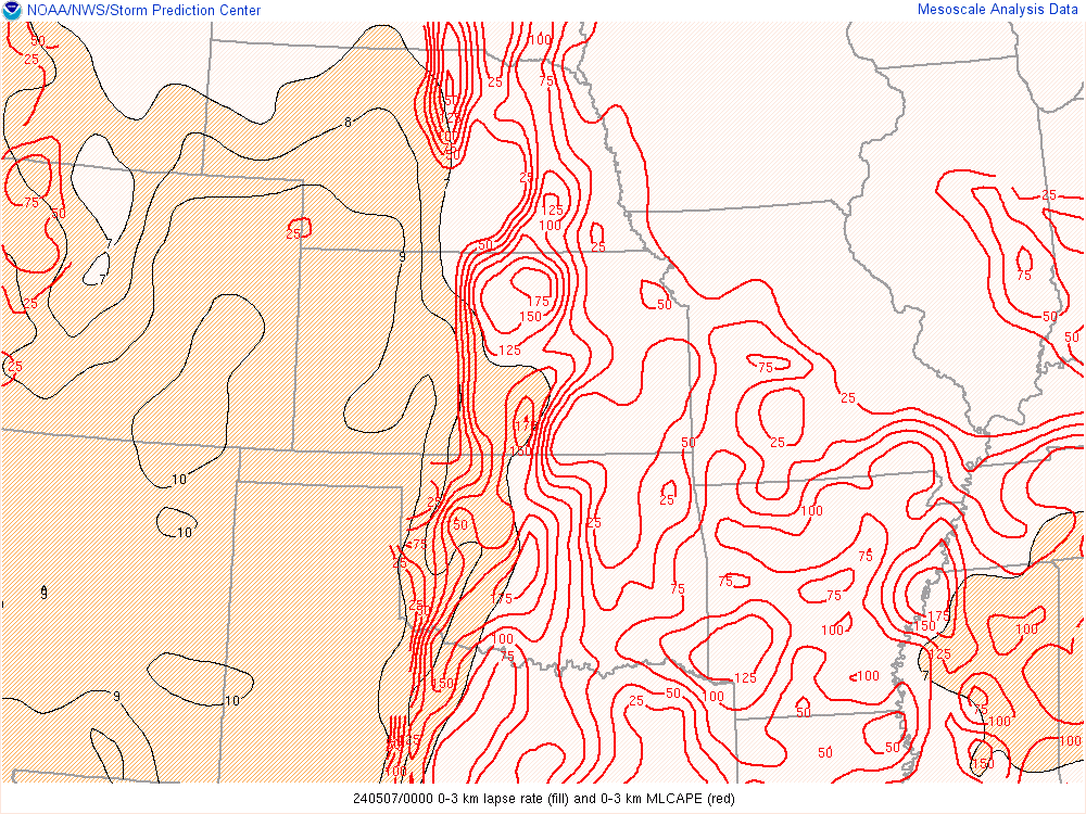 |
| 18z 0-3km CAPE | 21z 0-3km CAPE | 00z 0-3km CAPE |
 |
 |
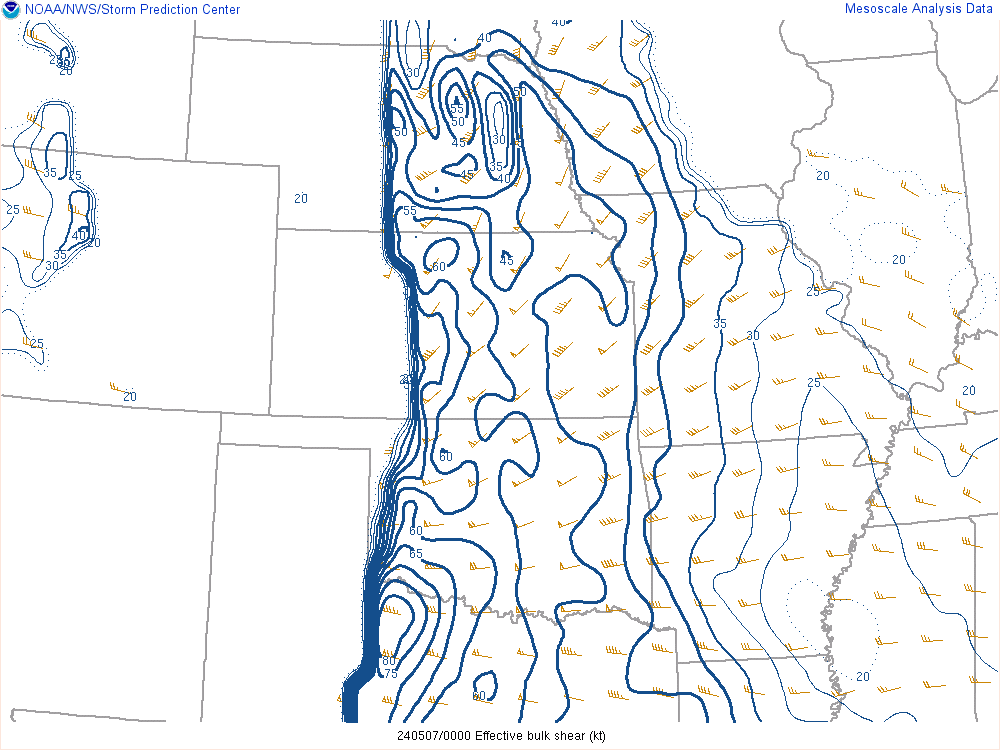 |
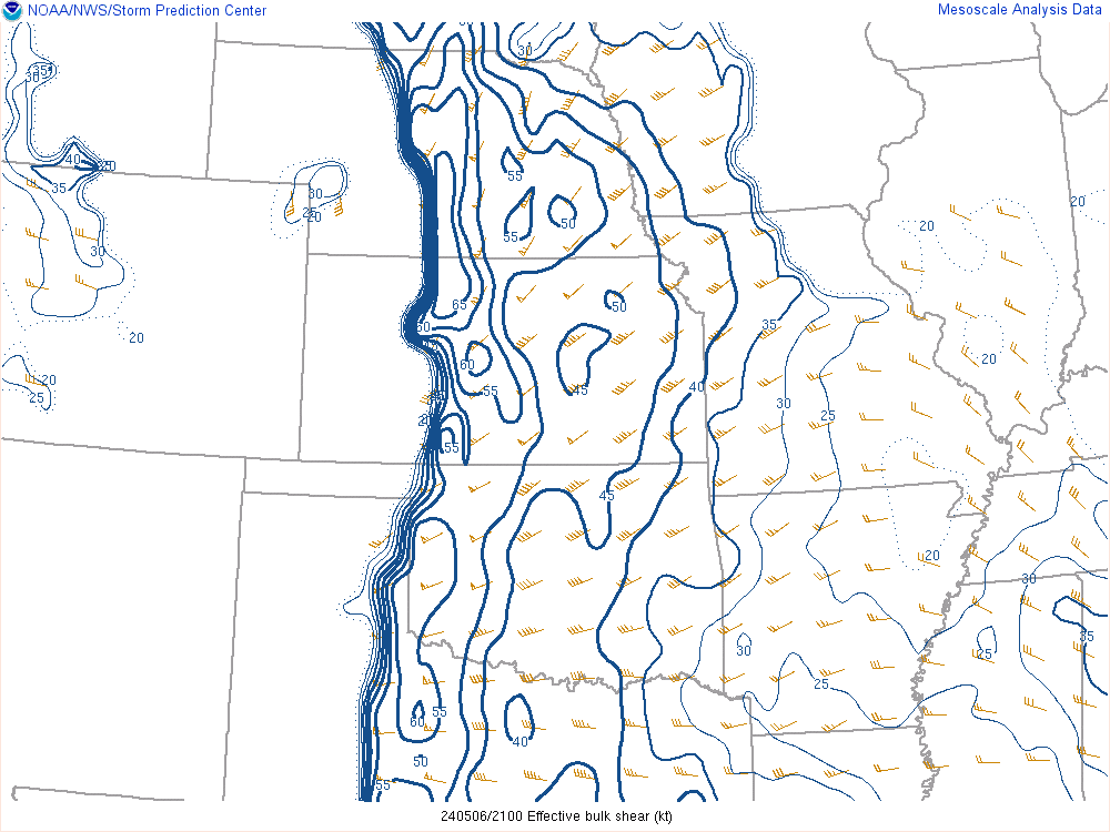
| 18z Effective bulk shear | 21z Effective bulk shear | 00z Effective bulk shear |
 |
 |
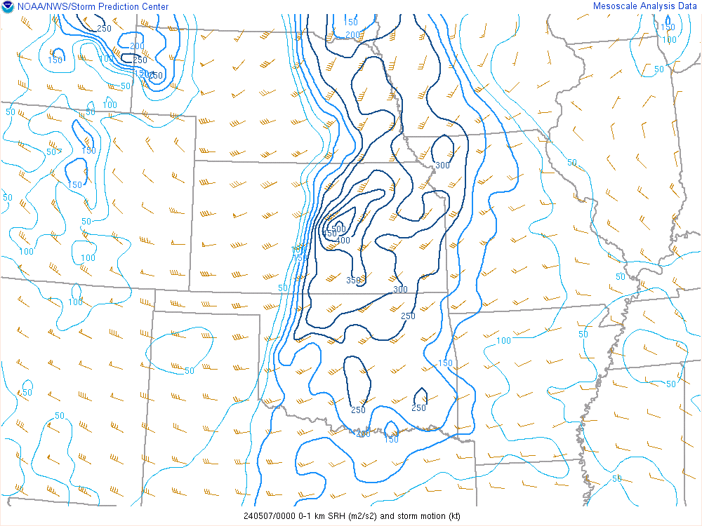 |
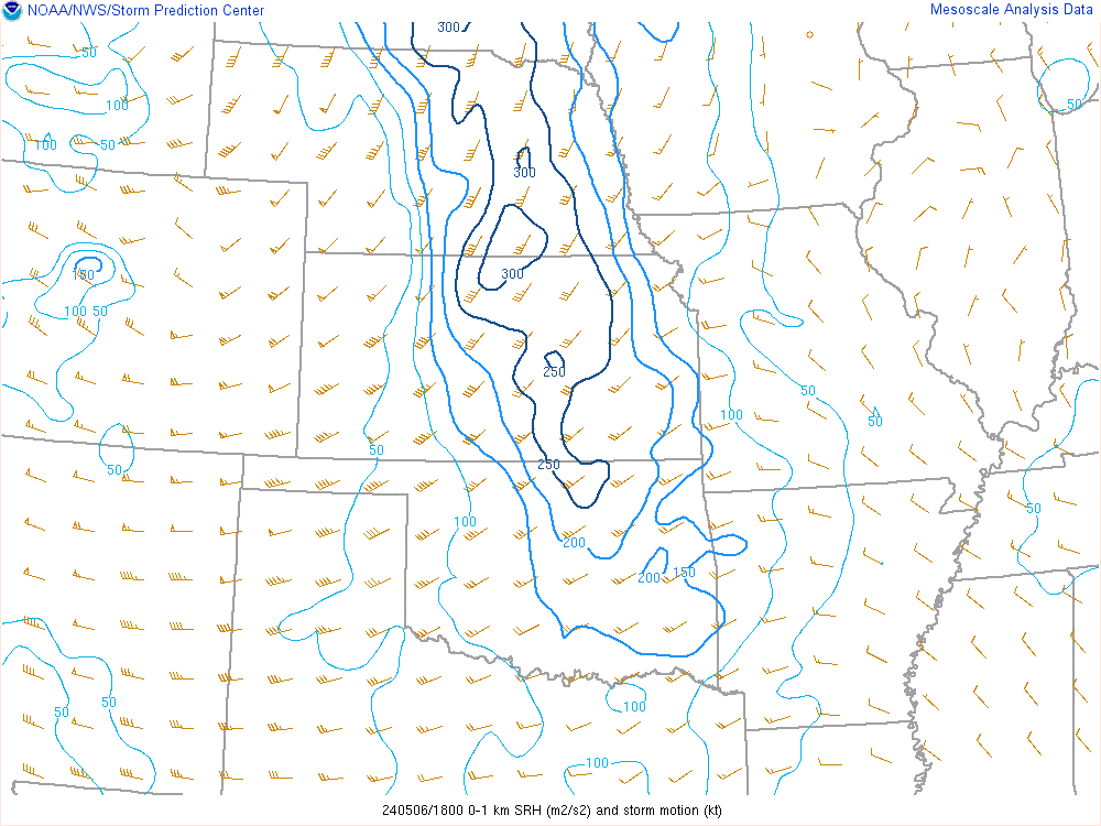
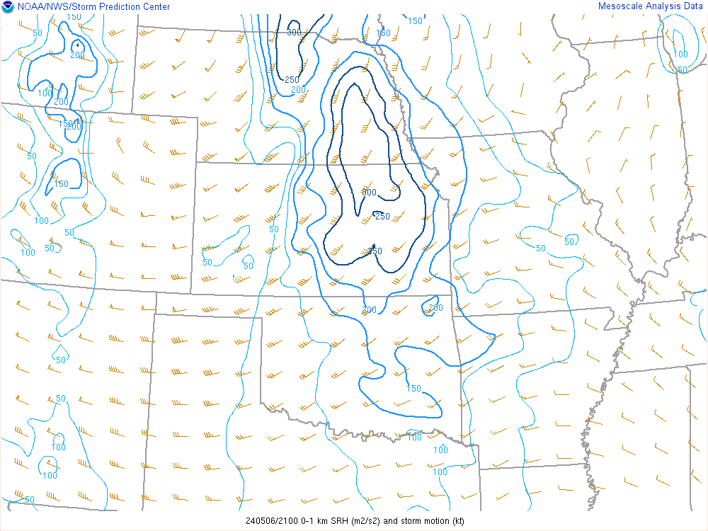
| 18z 0-1km SRH | 21z 0-1km SRH | 00z 0-1km SRH |
 |
 |
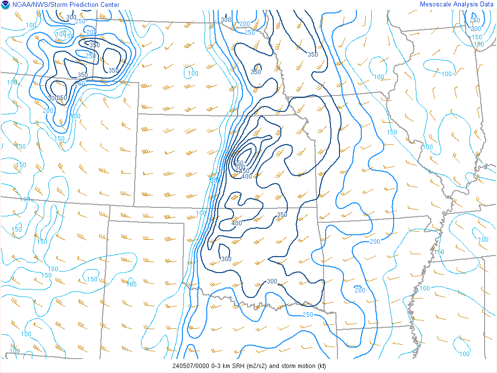 |
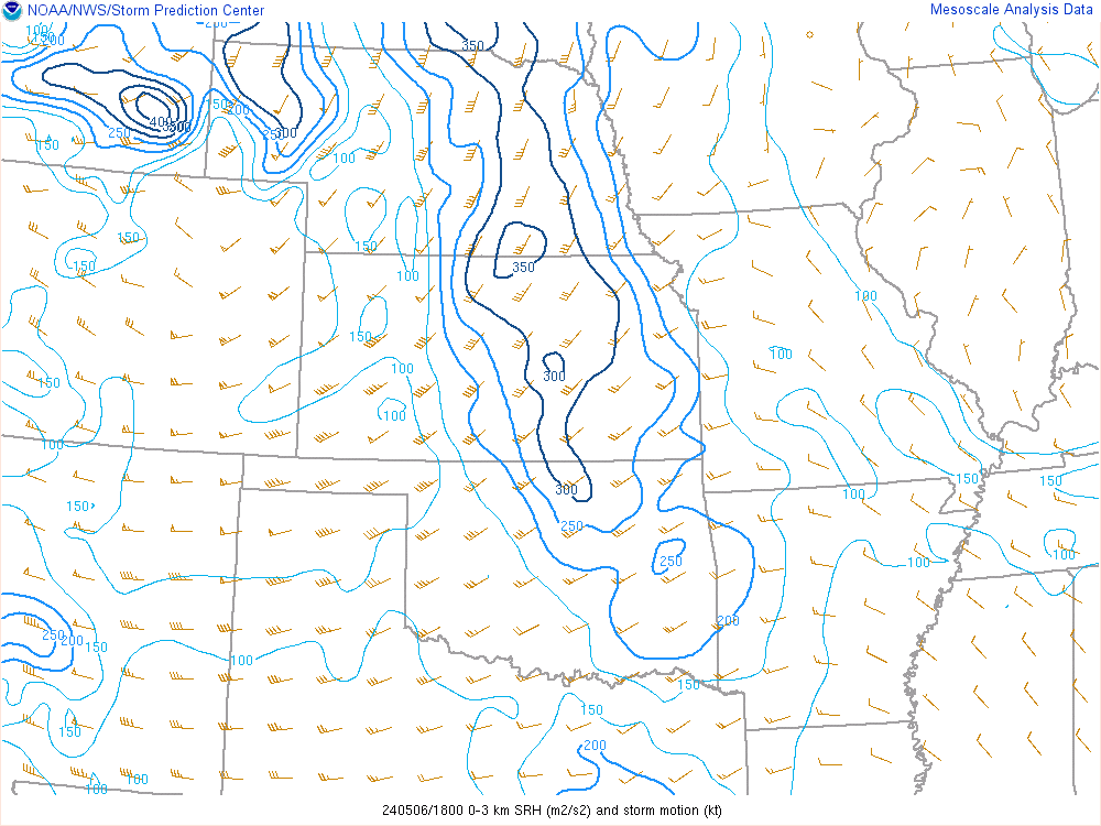
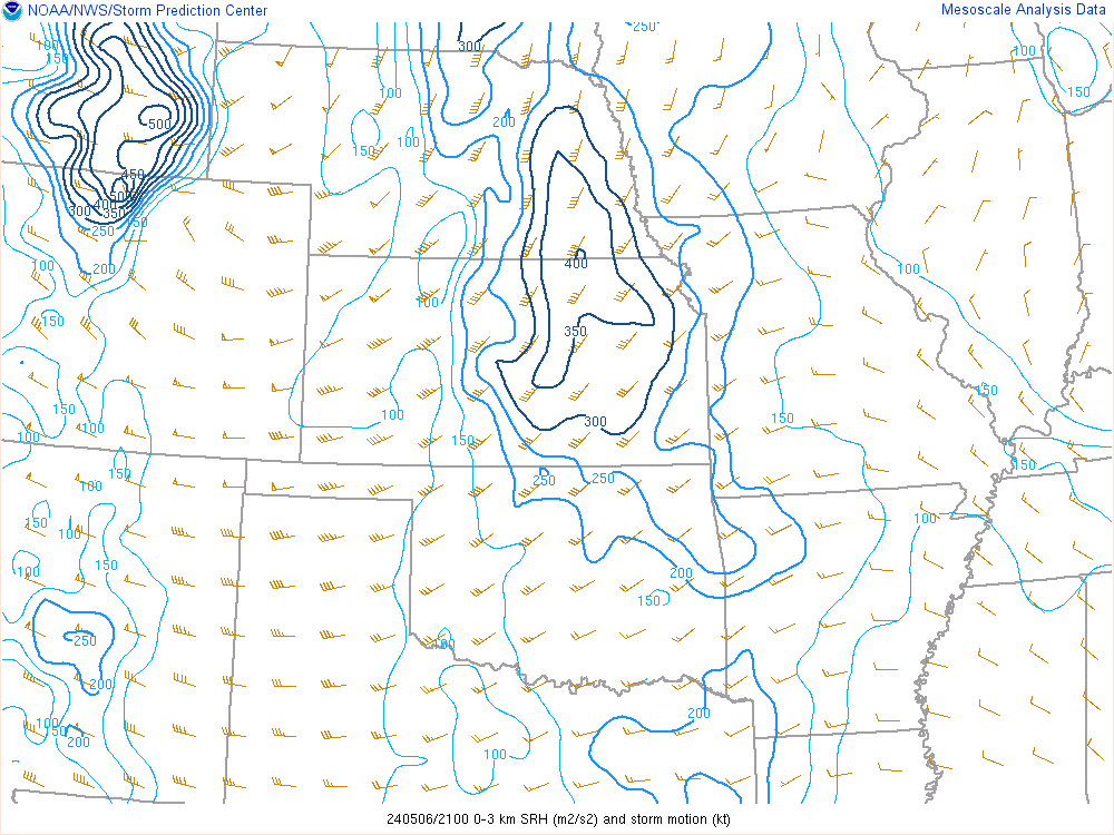
| 18z 0-3km SRH | 21z 0-3km SRH | 00z 0-3km SRH |
 |
 |
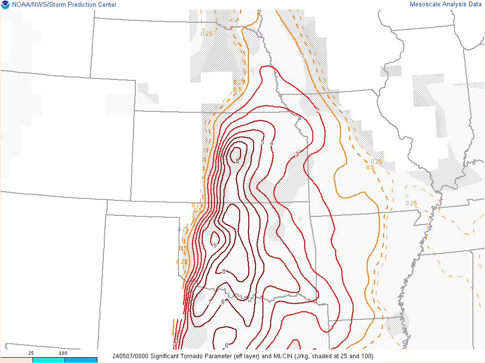 |
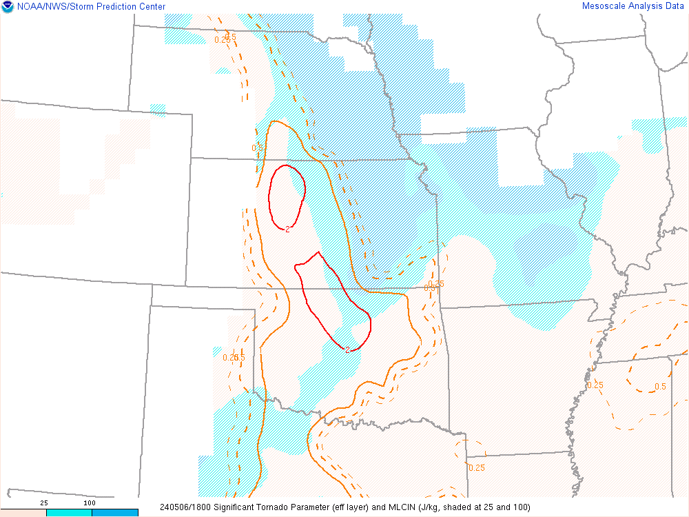
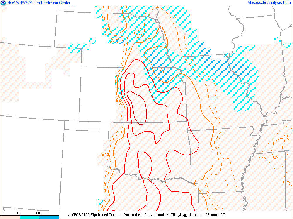
| 18z STP | 21z STP | 00z STP |
 |
Media use of NWS Web News Stories is encouraged! Please acknowledge the NWS as the source of any news information accessed from this site. |
|

