Overview
|
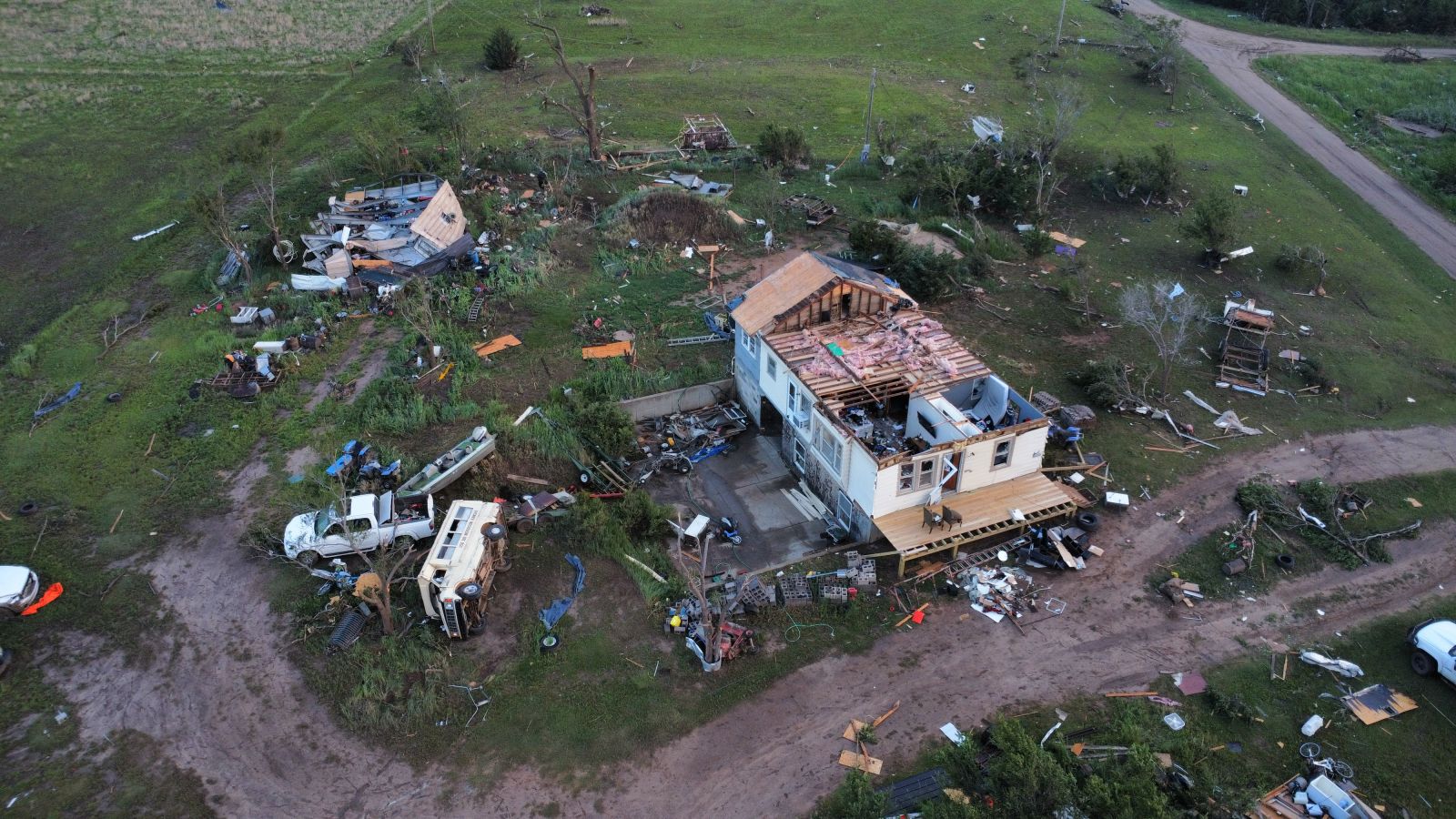
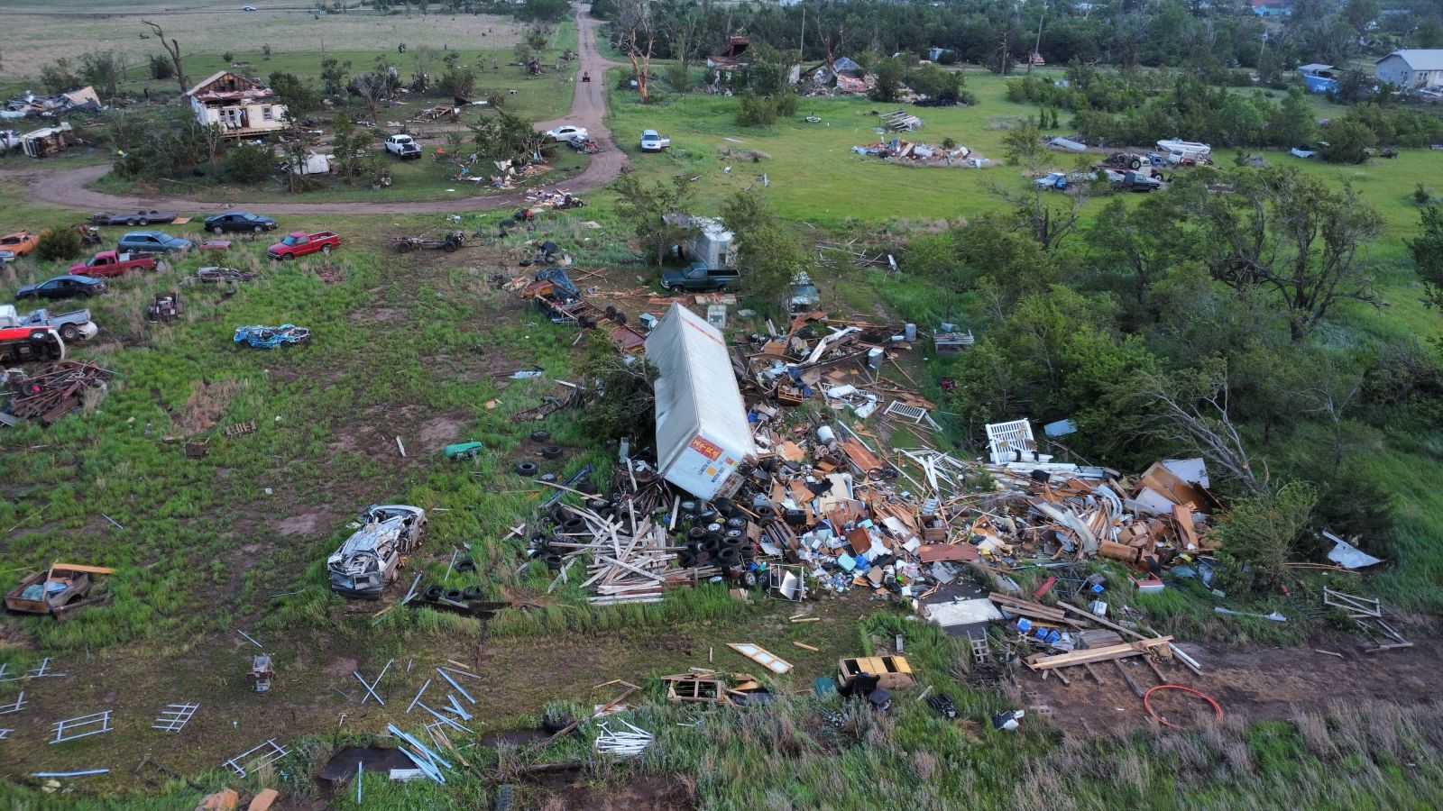
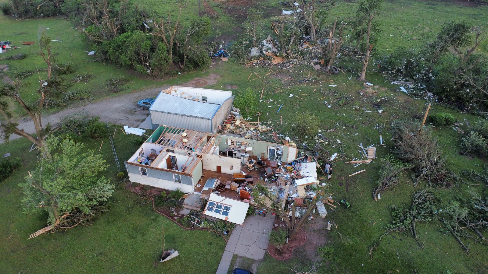
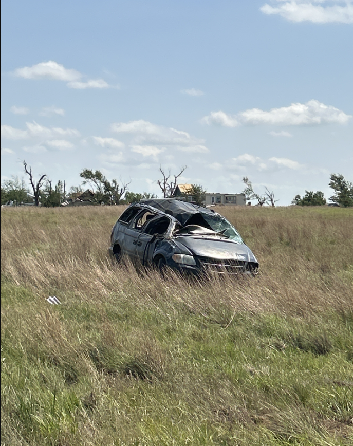
A lone supercell thunderstorm tracked across southwest Kansas and eventually moved into Reno County. This storm produced a long track wedge tornado that was on the ground for over 30 miles. It destroyed 3 homes near Plevna along with widespread tree and power line damage. This tornado was given an EF-3 rating with the most significant damage just southwest of Plevna. Fortunately there were no injuries or fatalities with this destructive tornado. |
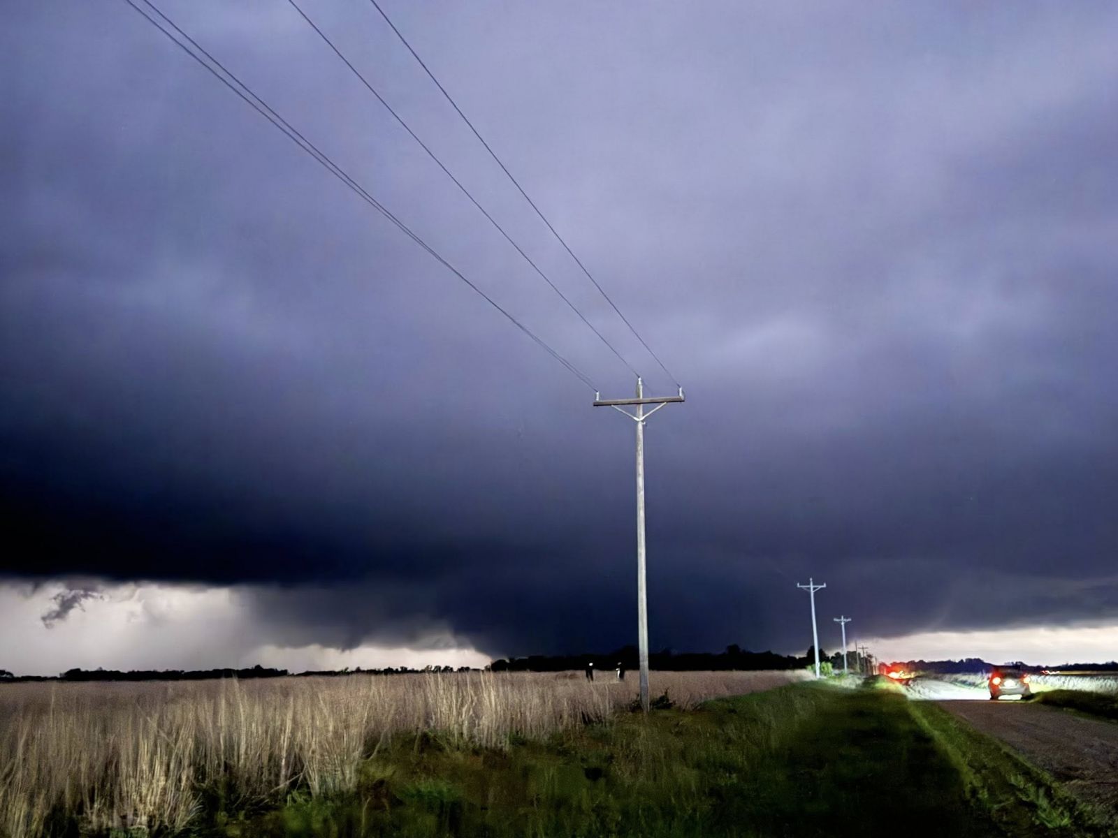 Picture by Bryan Baerg |
Tornadoes:
|
NOTE: times shown below are local to your device's time zone. |

The Enhanced Fujita (EF) Scale classifies tornadoes into the following categories:
| EF0 Weak 65-85 mph |
EF1 Moderate 86-110 mph |
EF2 Significant 111-135 mph |
EF3 Severe 136-165 mph |
EF4 Extreme 166-200 mph |
EF5 Catastrophic 200+ mph |
 |
|||||
| Tornadoes that fail to impact any ratable structures on the EF-Scale are rated EF-Unknown (EF-U) | |||||
Photos
 |
 |
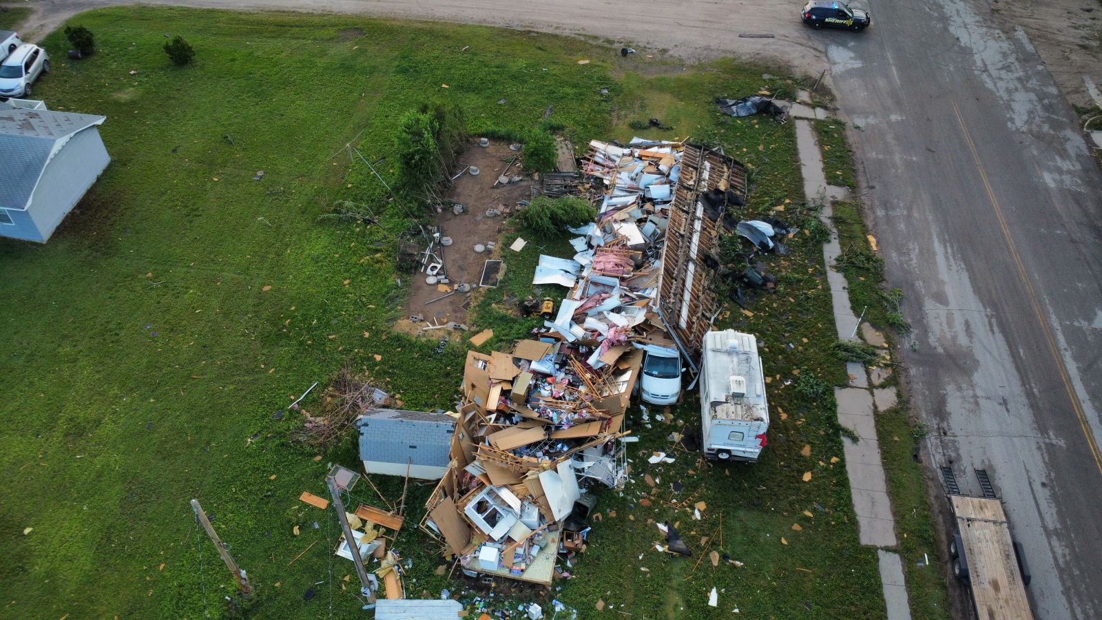 |
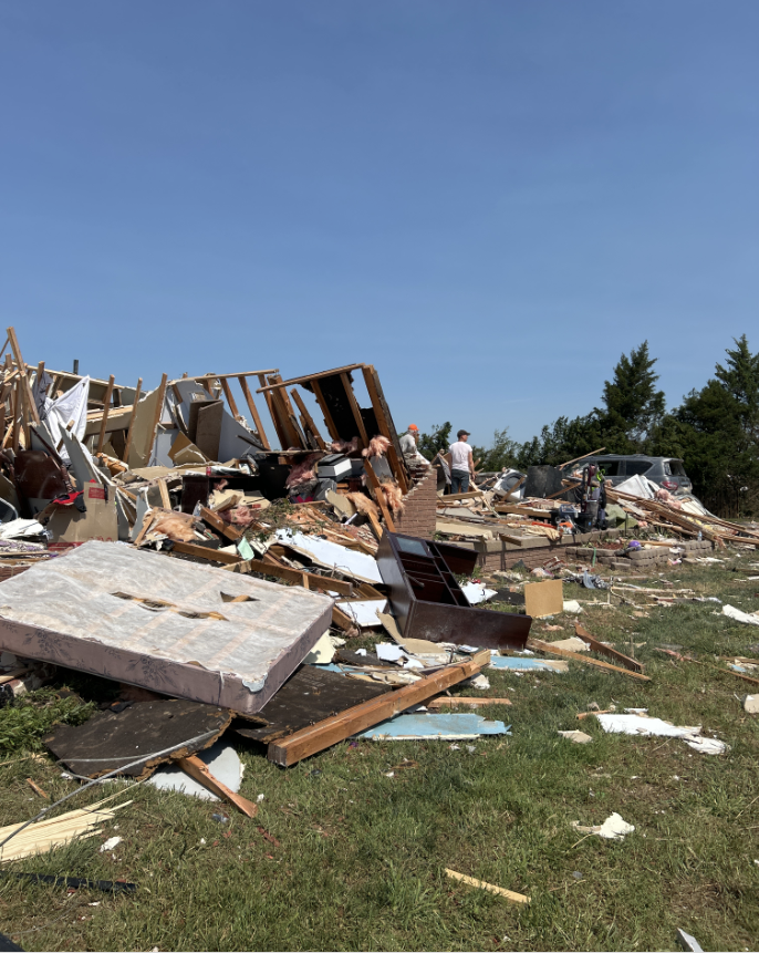
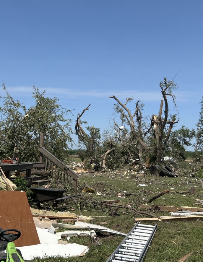
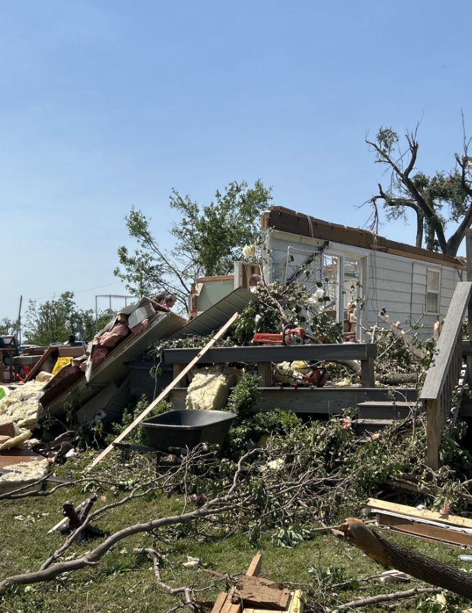
| Tornado damage in western Reno County near Plevna (Courtesy Brad Ketcham) | Tornado damage in western Reno County near Plevna (Courtesy Brad Ketcham) | Tornado damage in western Reno County near Plevna (Courtesy Brad Ketcham) |
 |
 |
 |
| Tornado damage in western Reno County near Plevna (Courtesy Brad Ketcham) | Tornado damage in western Reno County near Plevna (NWS ICT) | Tornado damage in western Reno County near Plevna (NWS ICT) |
|
 |
 |
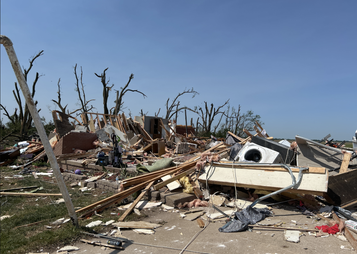
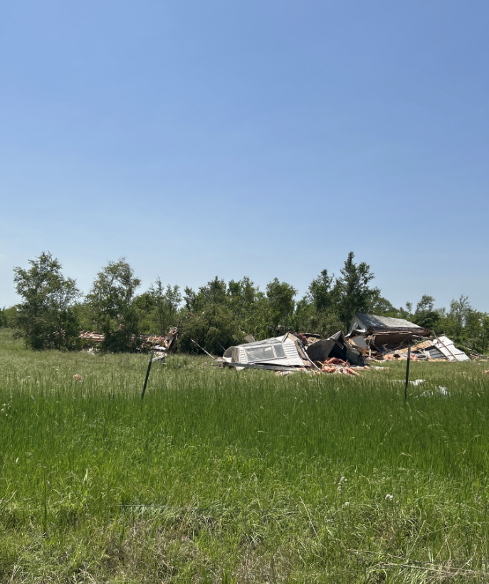
| Tornado damage in western Reno County 3 NNE of Plevna (NWS ICT) | Tornado damage in western Reno County 3 NNE of Plevna (NWS ICT) | Tornado damage in Plevna, KS (NWS ICT) |
 |
 |
 |
 |
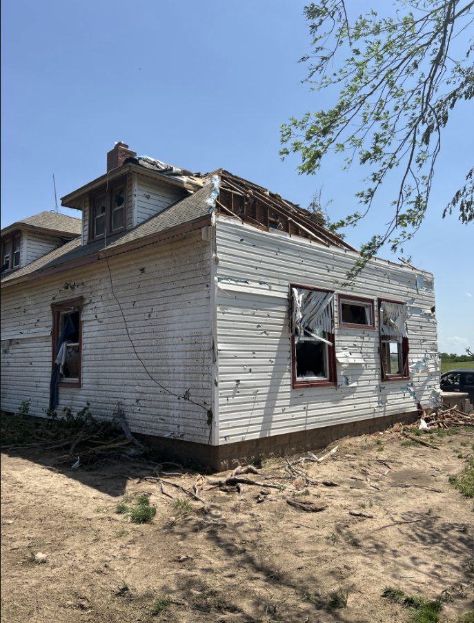
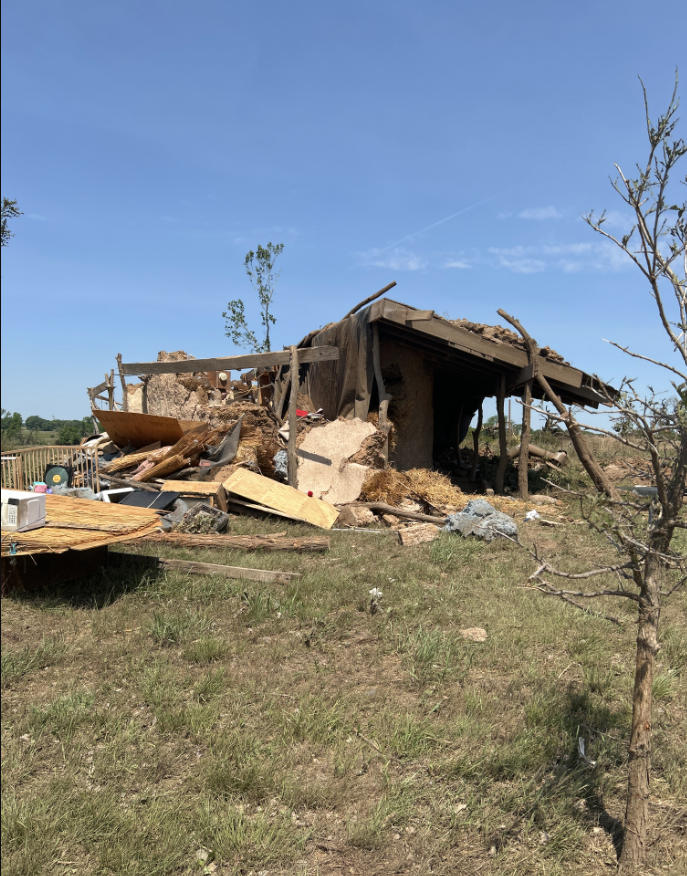
| Tornado damage in Plevna, KS (NWS ICT) | Tornado damage in Plevna, KS (NWS ICT) | Tornado damage SW of Plevna, KS (NWS ICT) | Tornado damage SW of Plevna, KS (NWS ICT) |
Radar
 |
 |
| Reflectivity and SRM data | Reflectivity and CC data |
Storm Reports
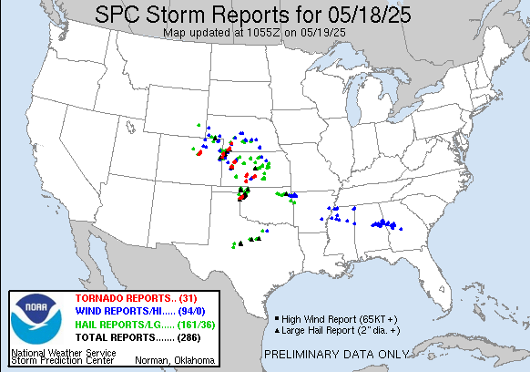
Preliminary Local Storm Report...Summary
National Weather Service Wichita KS
538 AM CDT Mon May 19 2025

..TIME...   ...EVENT...      ...CITY LOCATION...     ...LAT.LON...
..DATE...   ....MAG....      ..COUNTY LOCATION..ST.. ...SOURCE....
            ..REMARKS..

0259 PM     Hail             2 E Garden Plain        37.66N 97.64W
05/18/2025  M1.25 Inch       Sedgwick           KS   Trained Spotter


0315 PM     Hail             Colwich                 37.78N 97.54W
05/18/2025  E1.50 Inch       Sedgwick           KS   Fire Dept/Rescue


0324 PM     Hail             Wichita Eisenhower Airp 37.65N 97.44W
05/18/2025  M1.25 Inch       Sedgwick           KS   NWS Employee

            Half dollar size hail at NWS office.

0325 PM     Hail             1 NNE Wichita Eisenhowe 37.68N 97.43W
05/18/2025  E1.75 Inch       Sedgwick           KS   Storm Chaser

            Near Kellogg and Ridge.

0328 PM     Hail             3 WNW Downtown Wichita  37.70N 97.39W
05/18/2025  E1.75 Inch       Sedgwick           KS   NWS Employee

            Near 9th and Zoo Boulevard.

0329 PM     Hail             3 WNW Downtown Wichita  37.71N 97.39W
05/18/2025  E1.75 Inch       Sedgwick           KS   Broadcast Media

            Near 13th and West, courtesy of KAKE TV.

0426 PM     Hail             1 NW Hesston            38.15N 97.44W
05/18/2025  M1.50 Inch       Harvey             KS   Trained Spotter


0515 PM     Hail             Bushton                 38.51N 98.40W
05/18/2025  M1.00 Inch       Rice               KS   Public


0519 PM     Hail             Holyrood                38.59N 98.41W
05/18/2025  E2.00 Inch       Ellsworth          KS   Storm Chaser


0538 PM     Hail             1 W Geneseo             38.52N 98.17W
05/18/2025  M1.50 Inch       Rice               KS   Trained Spotter


0539 PM     Hail             Geneseo                 38.52N 98.16W
05/18/2025  E1.75 Inch       Rice               KS   Trained Spotter


0550 PM     Hail             5 N Sylvan Grove        39.09N 98.41W
05/18/2025  M1.25 Inch       Lincoln            KS   Trained Spotter


0557 PM     Hail             8 WNW Marquette         38.60N 97.98W
05/18/2025  M1.25 Inch       Ellsworth          KS   Public


0601 PM     Hail             3 WNW Marquette         38.57N 97.88W
05/18/2025  E1.00 Inch       McPherson          KS   Public

            mping report.

0622 PM     Hail             6 WNW Lost Springs      38.60N 97.06W
05/18/2025  E1.00 Inch       Marion             KS   Public


0643 PM     Hail             1 E Salina              38.82N 97.60W
05/18/2025  E1.00 Inch       Saline             KS   Public

            Received via mPING.

0645 PM     Hail             3 N Salina              38.86N 97.61W
05/18/2025  E1.75 Inch       Saline             KS   Emergency Mngr

            Time and location estimated from radar.

0651 PM     Hail             2 S Salina              38.78N 97.62W
05/18/2025  E1.50 Inch       Saline             KS   Public


0838 PM     Funnel Cloud     3 ENE Pawnee Rock       38.29N 98.93W
05/18/2025                   Barton             KS   Trained Spotter

            Looking north, trained spotter reported
            small funnel appearing occasionally, but no
            tornado on ground.

1142 PM     Tornado          4 N Turon               37.87N 98.44W
05/18/2025                   Reno               KS   NWS Employee

            Off duty NWS Employee reports a very large
            tornado. Radar also shows a very large
            debris signature.

1150 PM     Tornado          5 SW Plevna             37.92N 98.37W
05/18/2025                   Reno               KS   Emergency Mngr

            Home destroyed and power lines down.
Environment
Insert synoptic summary.
 |
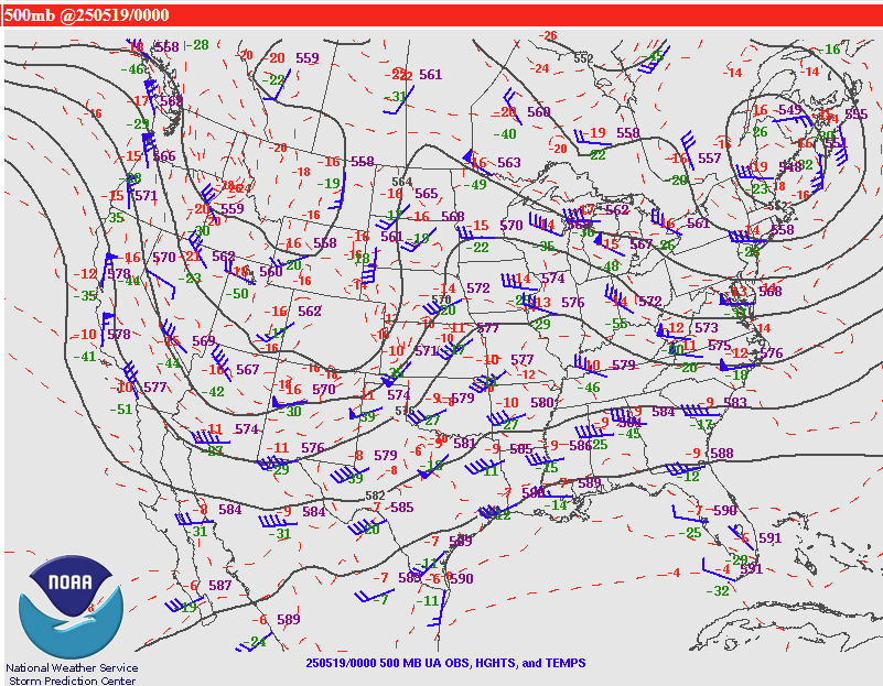 |
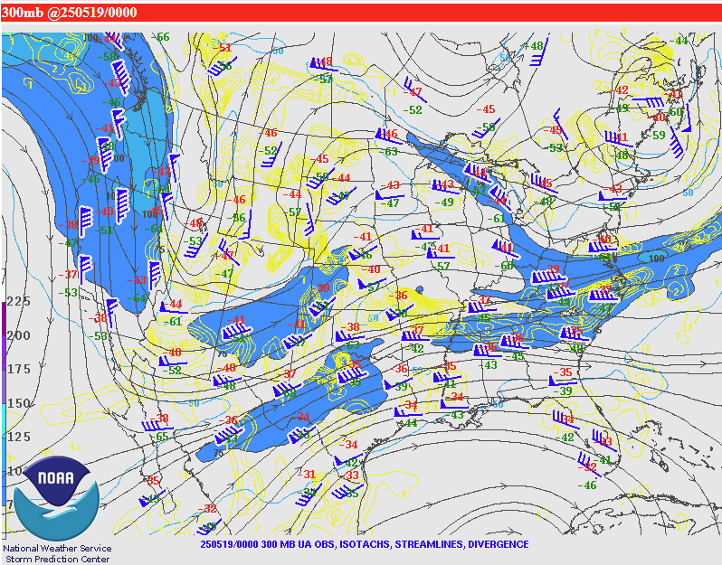 |
| 850 mb at 00Z on 5/19/2025 | 500 mb at 00Z on 5/19/2025 | 300 mb at 00Z on 5/19/2025 |
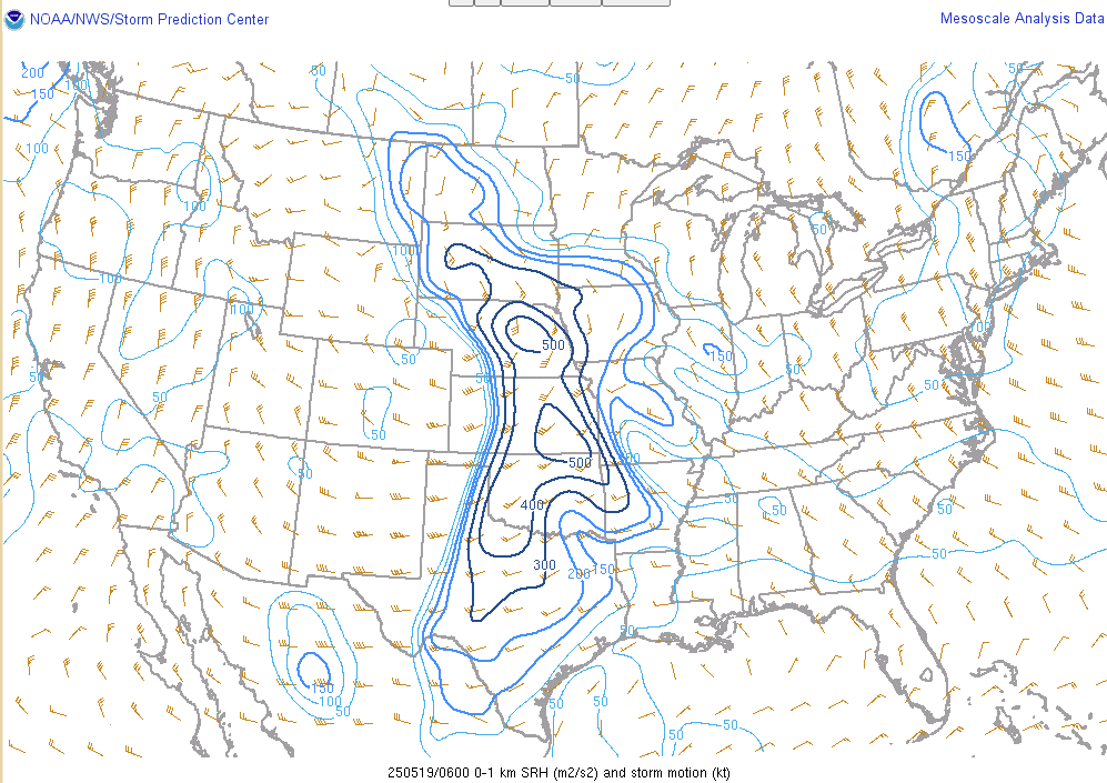
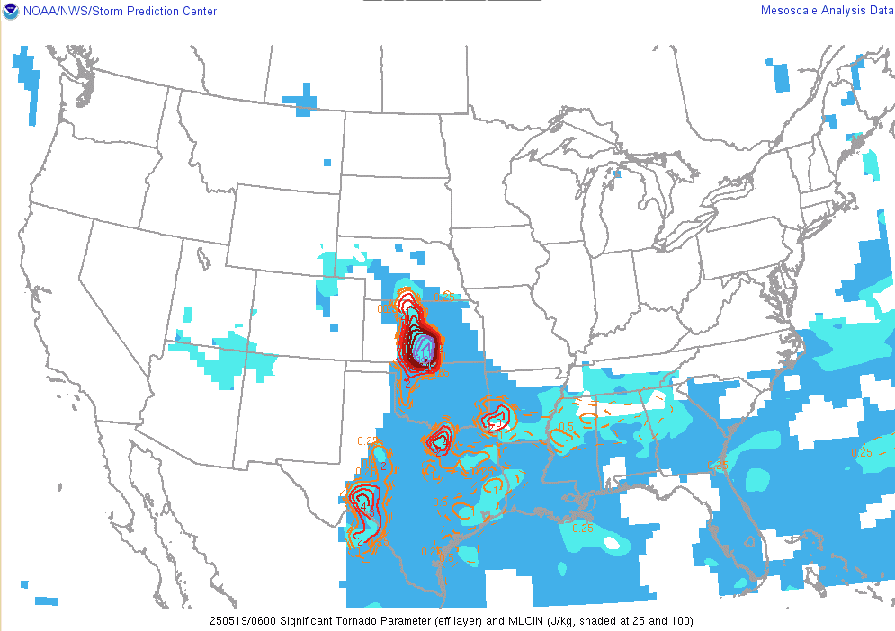
Near-storm environment summary.
 |
 |
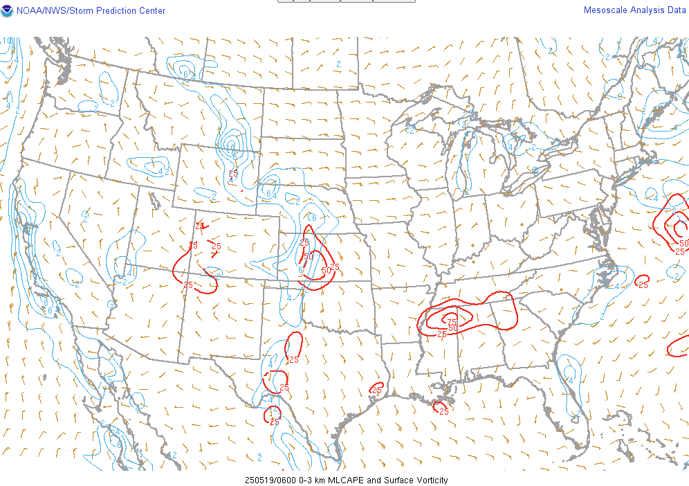 |
| 0-1km SRH at 06Z 5/19/25 | Significant Tornado Parameter at 06Z 5/19/25 | 0-3km CAPE and Surface Vorticity at 06Z 5/19/25 |
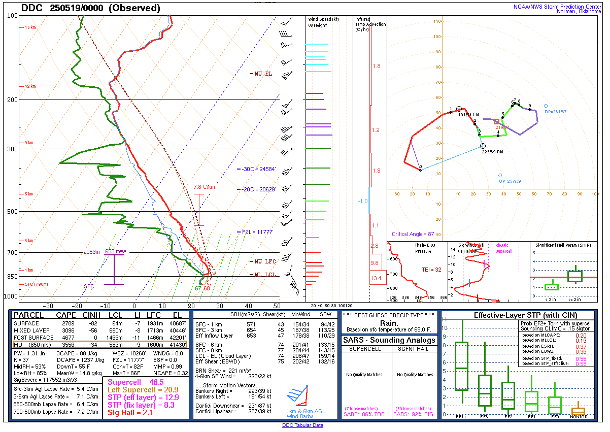
Additional environmental data.
 |
||
| KDDC 00Z Sounding 5/19/25 |
 |
Media use of NWS Web News Stories is encouraged! Please acknowledge the NWS as the source of any news information accessed from this site. |
|


