|
FOR IMMEDIATE PRESS RELEASE
National Weather Service
2142 S. Tyler Rd 67209
Wichita KS
Contact: John Ogren
(316) 945-3687 May 4, 1999
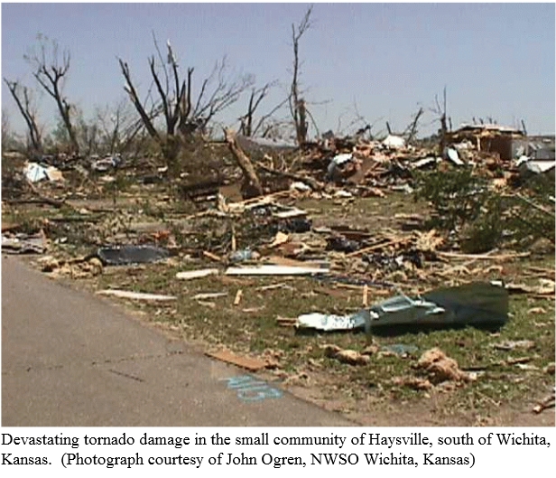
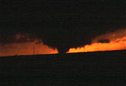
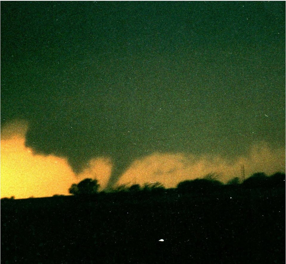
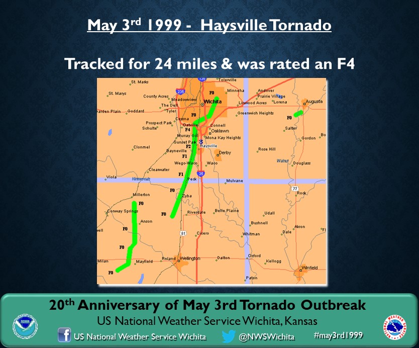
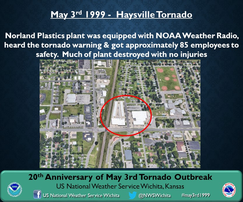
NWS Rates the Wichita/Haysville Tornado F4
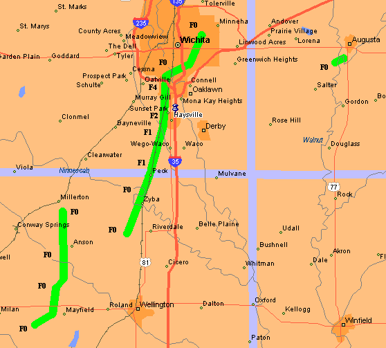
The National Weather Service Damage assessment team has completed an aerial storm damage assessment of the Wichita/Haysville tornado. The path was about 24 miles long beginning west of Riverdale and traveled northeast to just
south of Haysville and then went nearly straight north along Seneca to I-235. From there the damage weakened significantly as the tornado went northeast to about Linwood Park. Tree damage was also observed as far
north as the College Hill area where numerous trees were uprooted but structural damage was minimal.
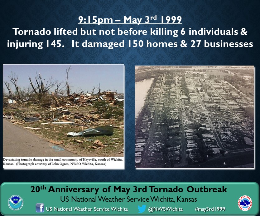
This tornado caused F4 type damage in the Haysville and southern Wichita areas. The definition of an F4 on the Fujita scale is one that has winds estimated 207-260 mph. Well constructed houses are leveled; structures with weak foundations are blown some distance; cars are thrown and large missiles are generated.
|
The following is a time line of those event that occurred at the National Weather Service prior to the tornado.
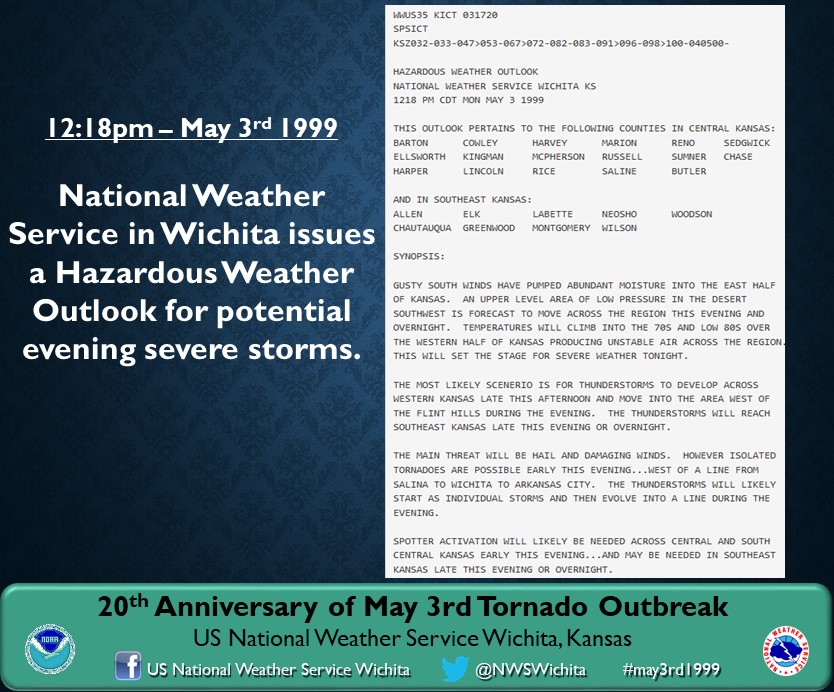
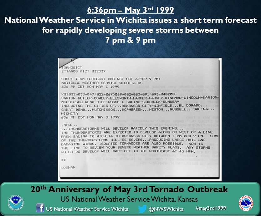
5/3/99 1218 PM Hazardous Weather Outlook issued stressing the threat of hail, wind and tornadoes.
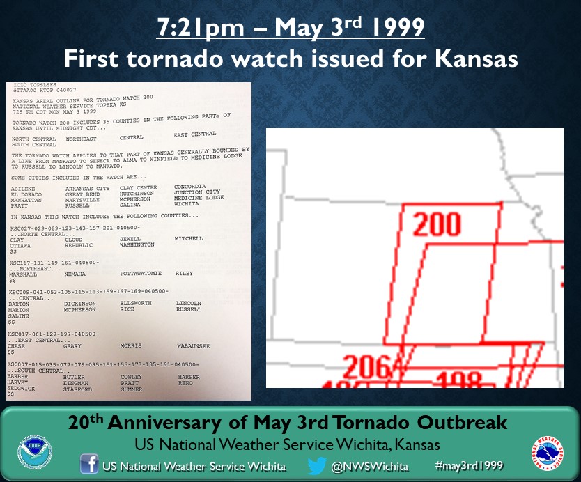
5/3/99 721 PM Tornado Watch #200 was issued for 35 Kansas Counties including South Central Kansas.
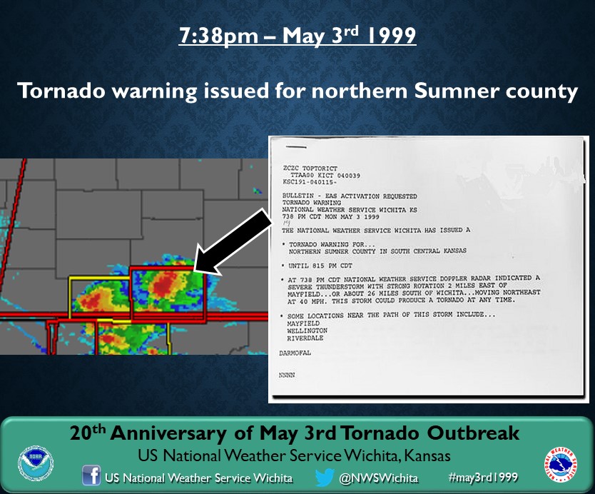
5/3/99 738 PM Tornado Warning issued for Northern Sumner County
5/3/99 744 PM Trained spotter reports a tornado near Mayfield in Sumner County
5/3/99 749 PM Severe Thunderstorm Warning was issued for Sedgwick County, specifically mentioning the threat of tornadoes as a possibility.
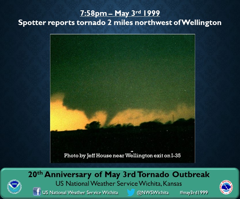
5/3/99 758 PM Trained spotter reports a tornado 2 NW of Wellington
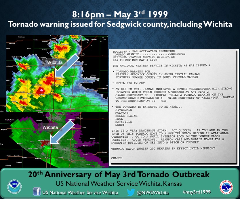
5/3/99 816 PM Tornado Warning was issued for Southeast Sedgwick and re-issued Northern Sumner County.
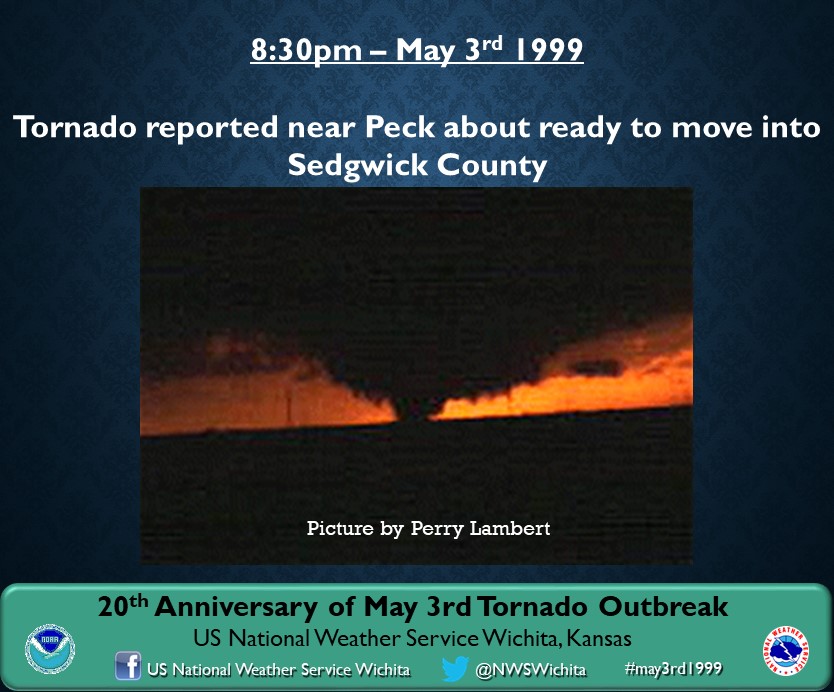
5/3/99 830 PM Trained spotters report a tornado near Peck along the Sedgwick/Sumner County line
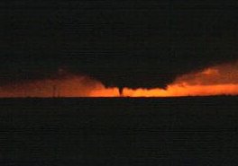
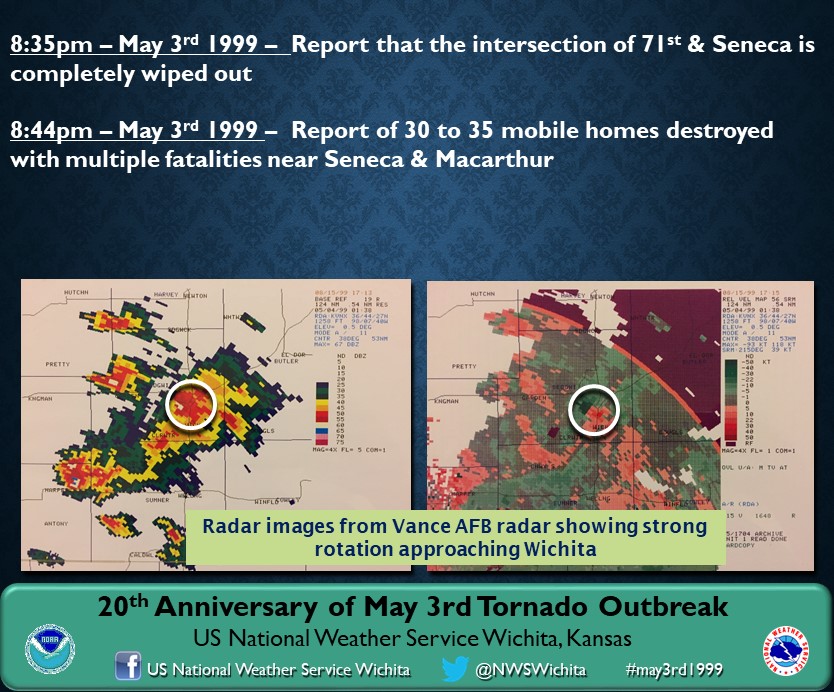
5/3/99 843 PM National Weather Service radar shows the tornado entering the southern part of Wichita.
5/3/99 848 PM First reports of significant damage are received around Seneca and MacArthur.
5/3/99 920 PM Tornado Warning expires.
|


 Follow us on YouTube