Overview
|
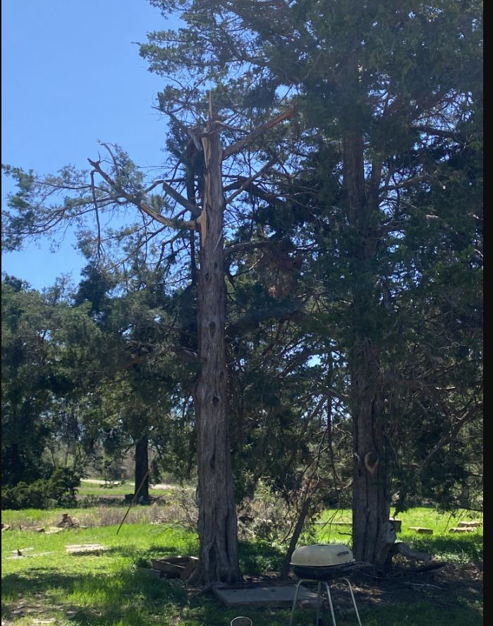
A powerful upper level low pressure system moved out across the Plains during the evening of April 15th and the early morning hours of Tuesday April 16th. Storms developed ahead of an advancing cold front across Oklahoma into the Flint Hills of Kansas after midnight. Around 4 am one of the storms started to show low level rotation as it moved into southern Greenwood county and shortly after produced an EF-1 tornado southeast and east of Eureka.
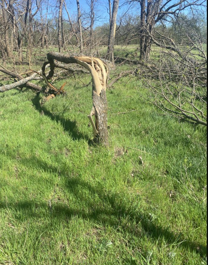
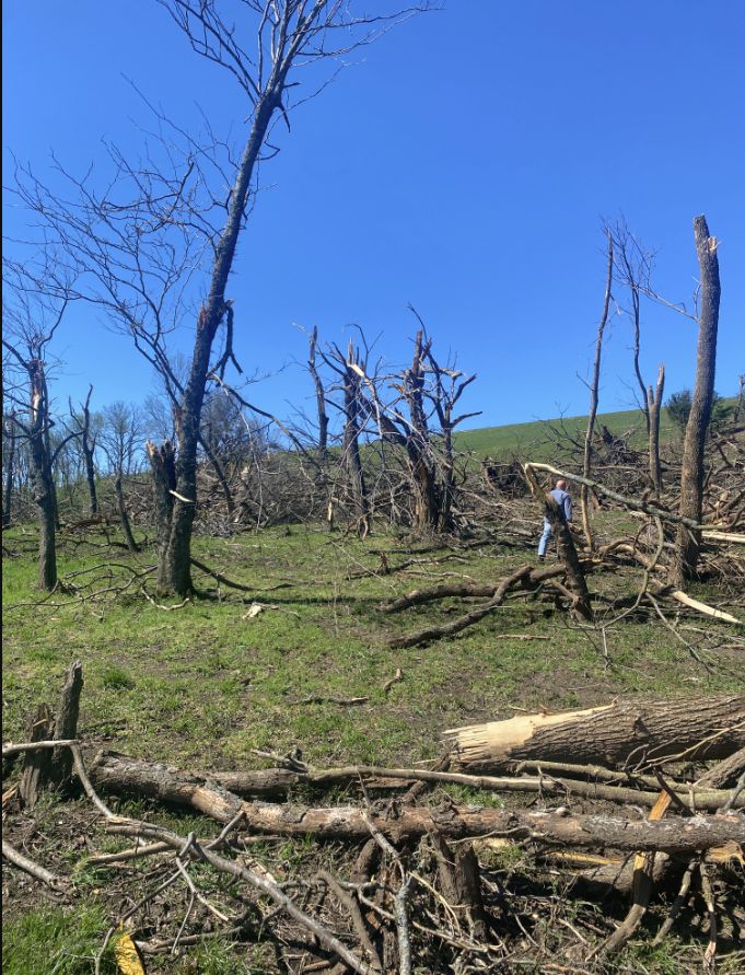
A few hours later, a line storms along the cold front moved into the Flint Hills with a brief but strong tornado occurring south of Virgil. This tornado was rated an EF-2 with damage including steel purlins being bent along with a large outbuilding ripped from its foundation. Luckily there were no injuries of fatalities with these tornadoes. |
 |
Tornadoes:
|
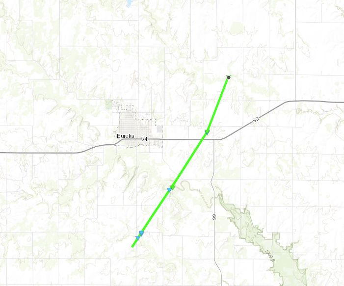
East-Southeast of Eureka
Track Map
|
|||||||||||||||||||
|
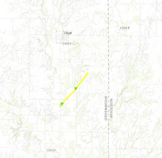
South of Virgil
Track Map
|
||||||||||||||||||||
The Enhanced Fujita (EF) Scale classifies tornadoes into the following categories:
| EF0 Weak 65-85 mph |
EF1 Moderate 86-110 mph |
EF2 Significant 111-135 mph |
EF3 Severe 136-165 mph |
EF4 Extreme 166-200 mph |
EF5 Catastrophic 200+ mph |
 |
|||||
Radar
 |
 |
 |
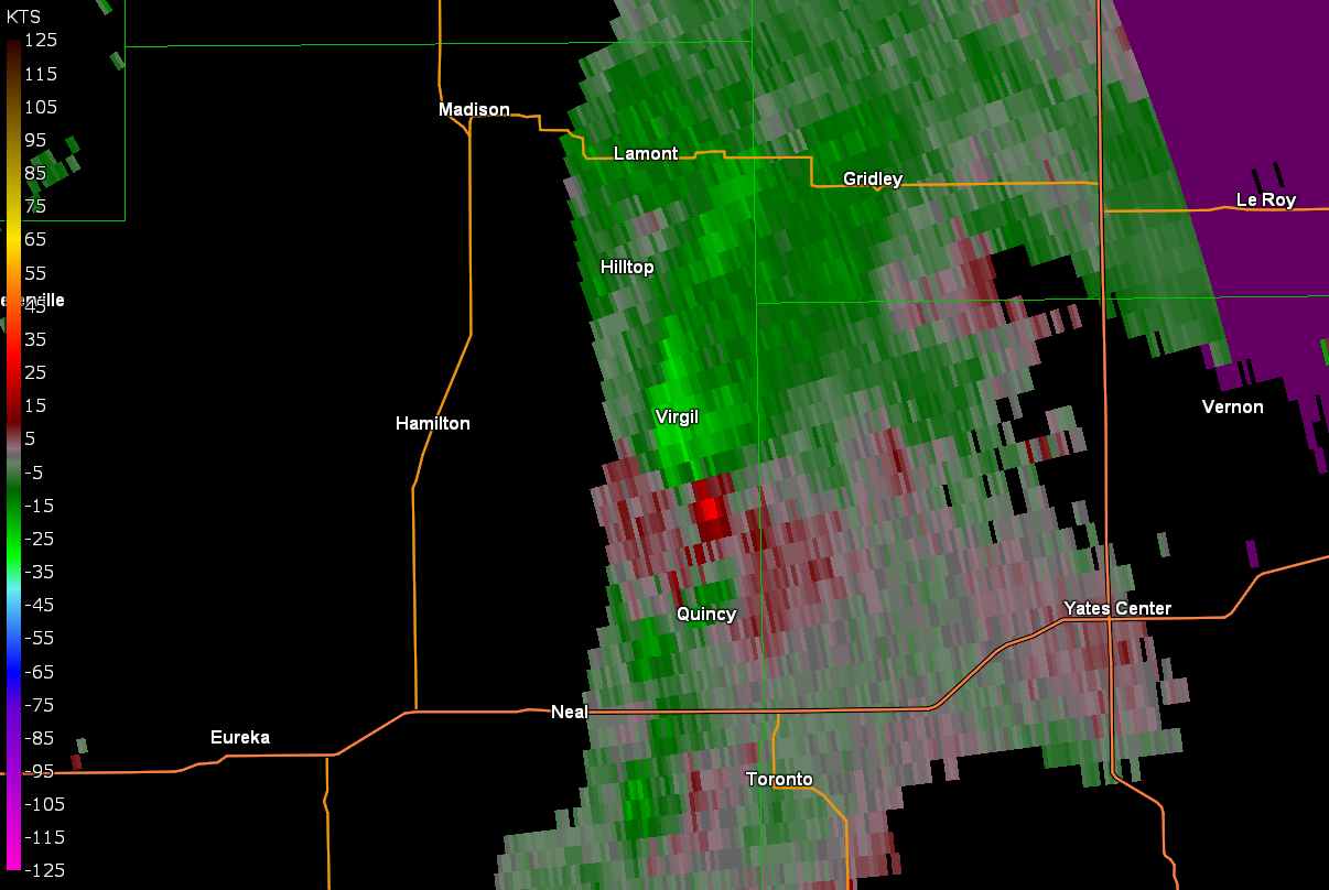 |
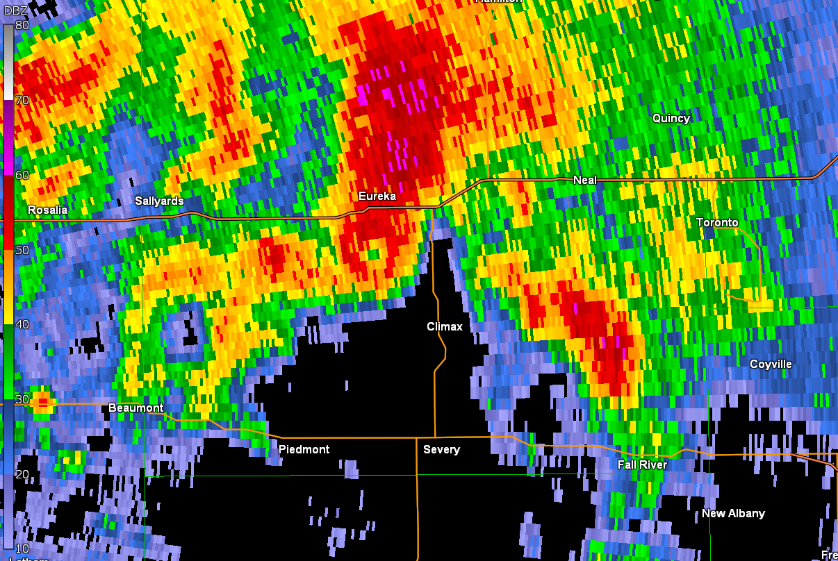
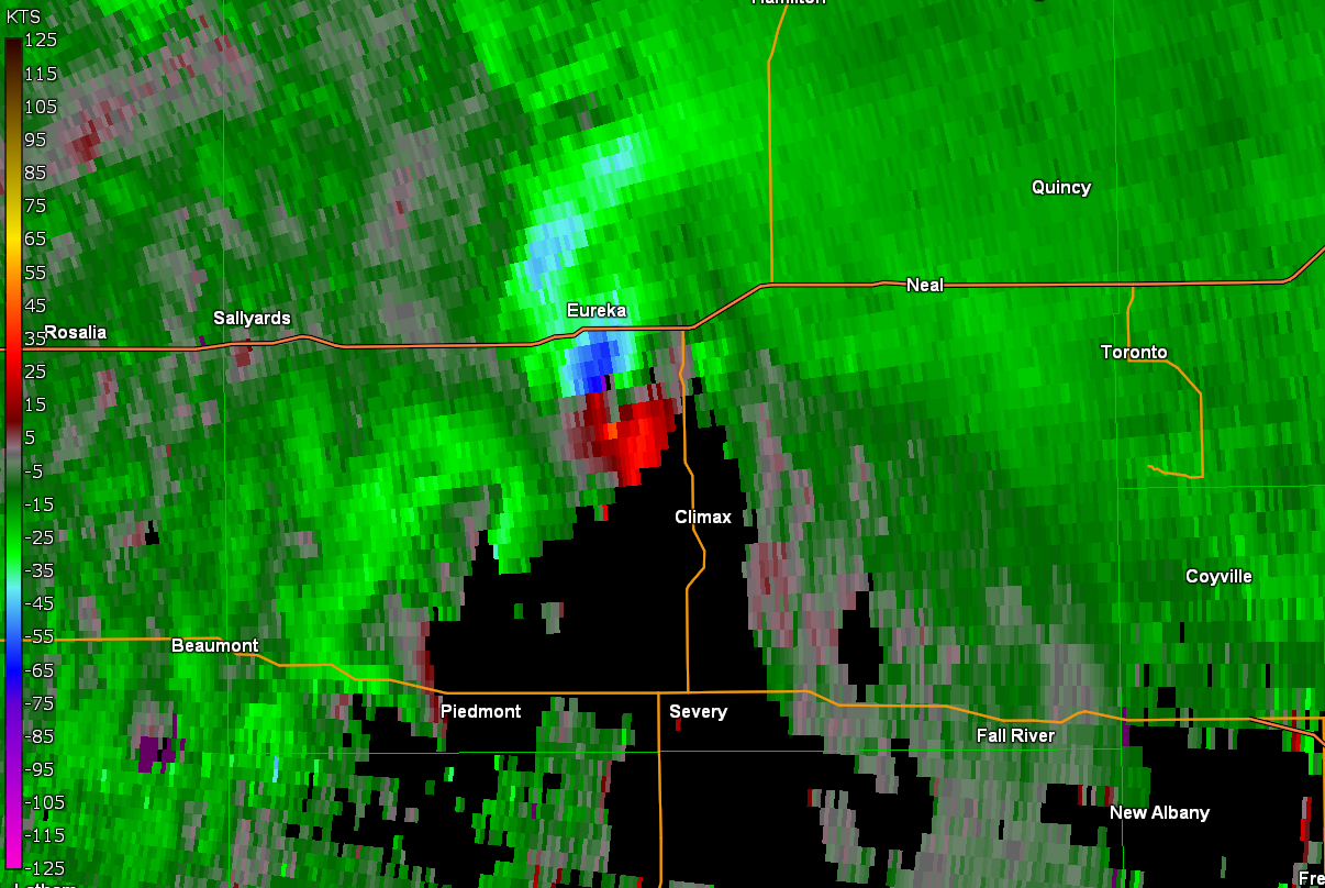
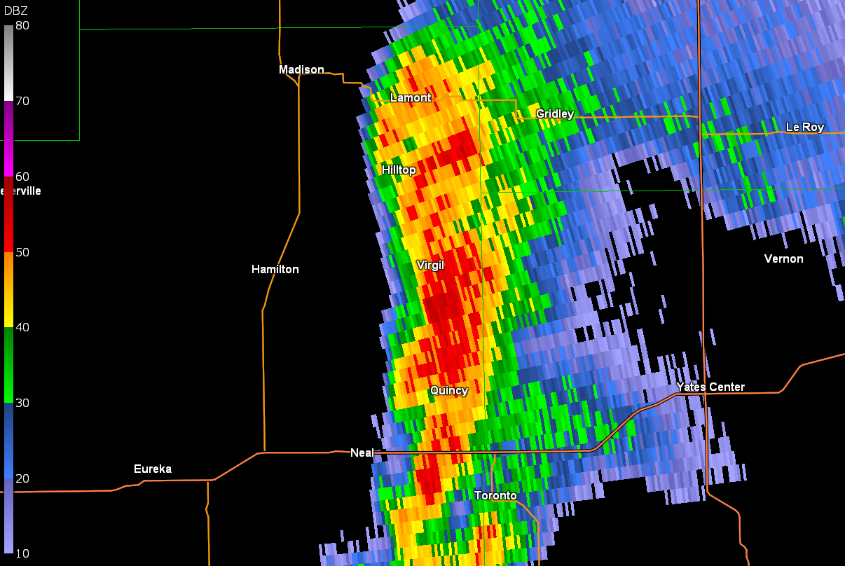
| Reflectivity of supercell that produced the tornado south of Eureka | Storm relative velocity of supercell that produced the tornado south of Eureka | Reflectivity of the storm that produced the EF-2 tornado south of Virgil | Storm relative velocity of the storm that produced the EF-2 tornado south of Virgil |
|
Animation of reflectivity from the supercell that produced the EF-1 tornado |
Storm relative velocity animation from the storm that produced the EF-1 tornado east and southeast of Eureka |
Environment
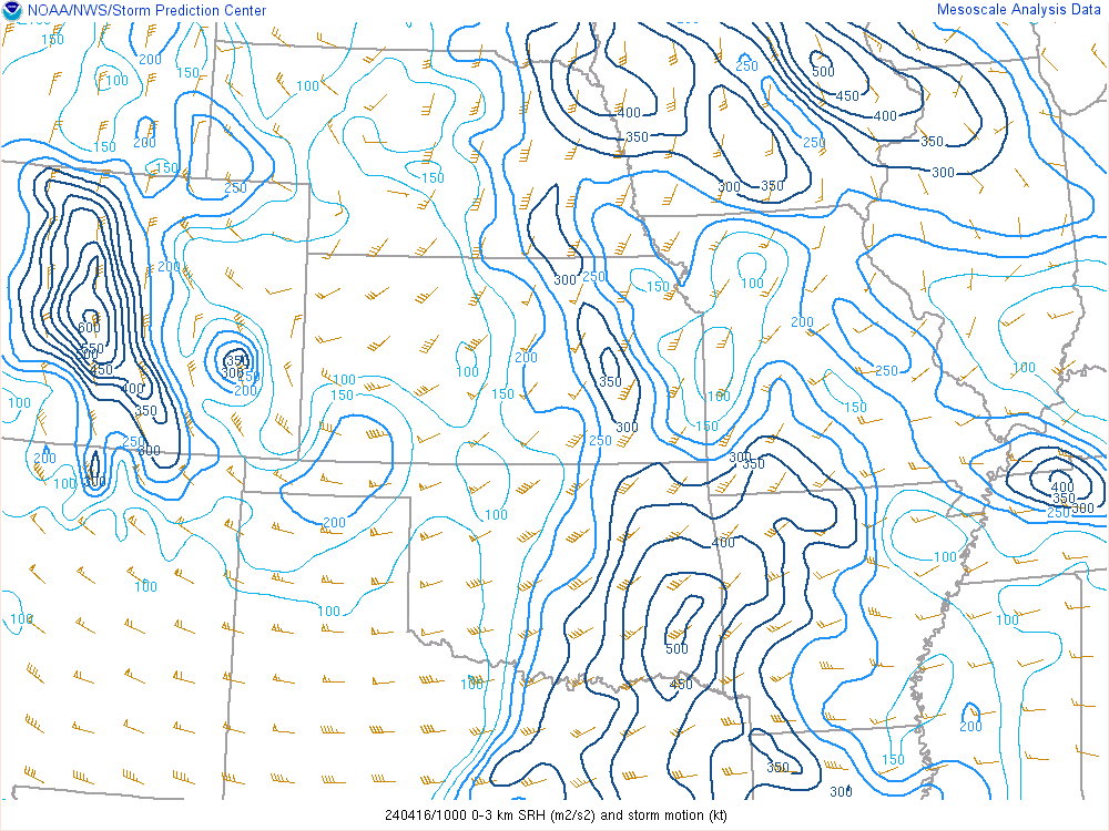
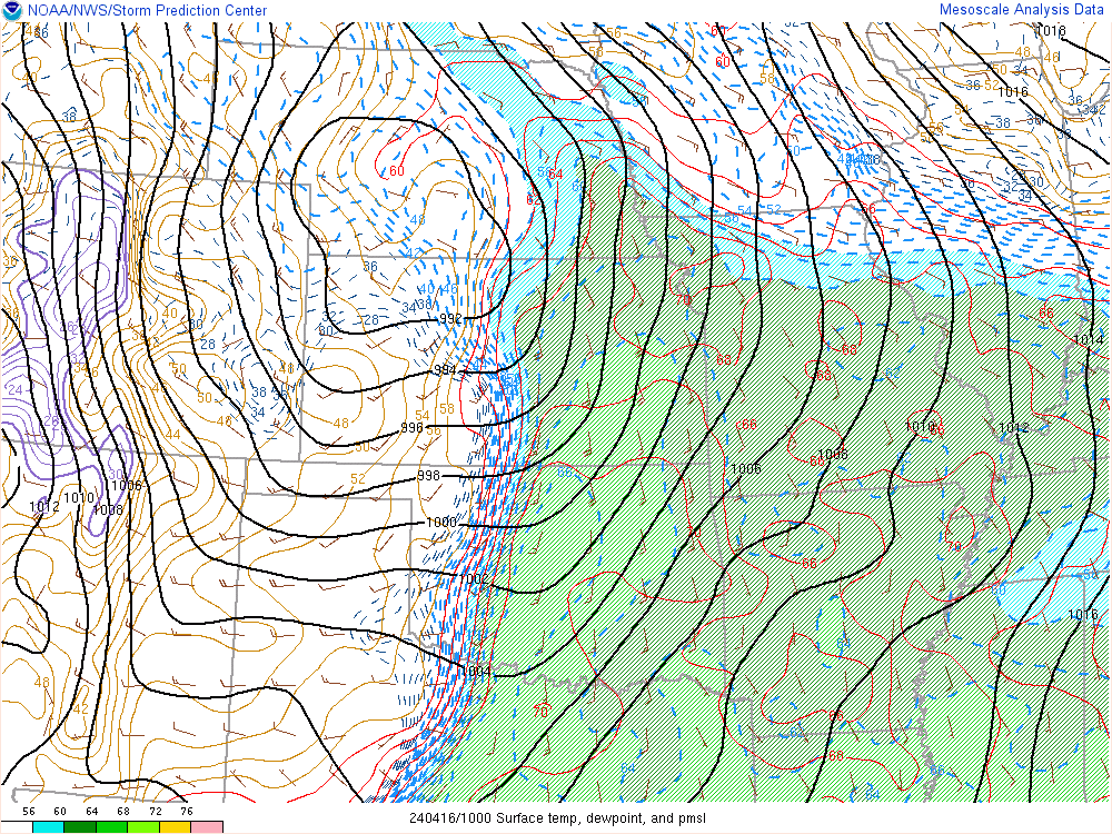
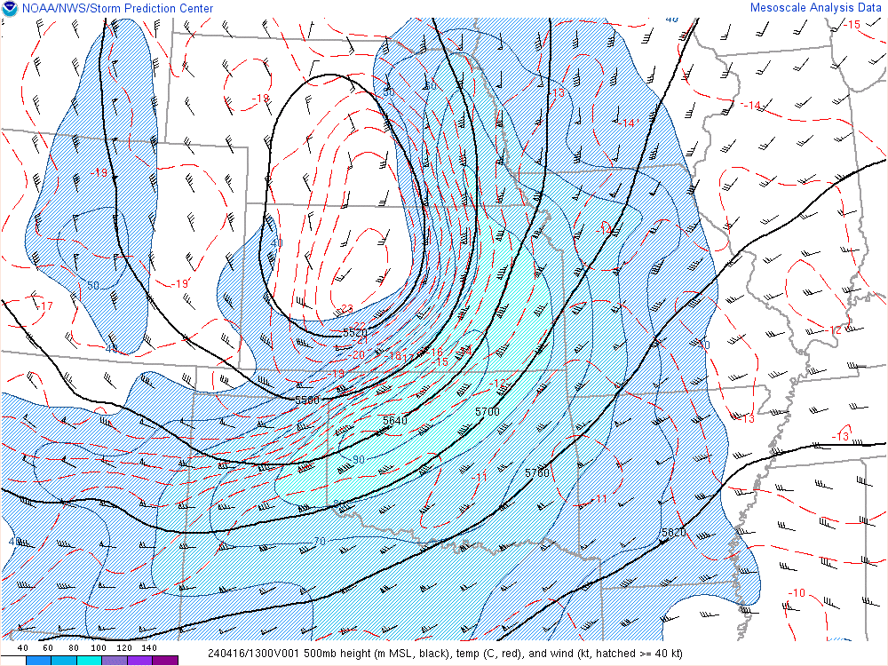
Late on the night of April 15th, a powerful trough ejected into the plains with a sharp dryline located across western Kansas. While robust theta-e advection and stout low level shear kept the boundary layer from decoupling after sunset, strong capping from a stout EML prevented initial storm development along the dryline. A Pacific front merged with the dryline helping to trigger a line of storms across western Kansas, but storms moved northeast into north-central Kansas and south-central Nebraska and produced a couple a brief tornadoes as well as damaging winds across those areas.
Meanwhile, strong mid-level moisture transport was triggering numerous showers and some thunderstorms across northern Oklahoma and southern Kansas during the early morning hours of the 16th. The cap across these areas was fairly strong, and storms were likely rooted in the mid-levels as they quickly moved northeast. However, the Pacific front was rapidly moving eastward, and the associated strong mid-level cooling as well as synoptic lift was helping to remove environmental CIN as a result of the EML. Also, the boundary layer never decoupled in the warm sector due to factors mentioned previously. This uncapped environment with stout low-level shear moved eastward into south-central/southeast Kansas around 3-4 AM the morning of April 16th where many elevated storms resided. The strongest of these storms was able to become surface based across the Flint Hills and began to show signs of quick organization as a supercell on doppler radar. This supercell took full advantage of its environment, and an EF-1 tornado traveled quickly northeast across central Greenwood County narrowly missing the towns of Eureka and Hamilton.
Later on that morning, the Pacific front entered southeast Kansas, and while instability and low-level shear were not as impressive as 3 hours prior, a skinny, shallow line of storms was able to take advantage of decent low-level CAPE and surface vorticity along the boundary to produce a 2nd brief tornado south of Virgil; this tornado was rated EF-2.
It should be noted that this environment is exceptionally rare during this time of day, especially the fact that the warm sector was uncapped and that the boundary layer was not decoupled. This helped to support storms that are normally seen during the afternoon hours.
 |
 |
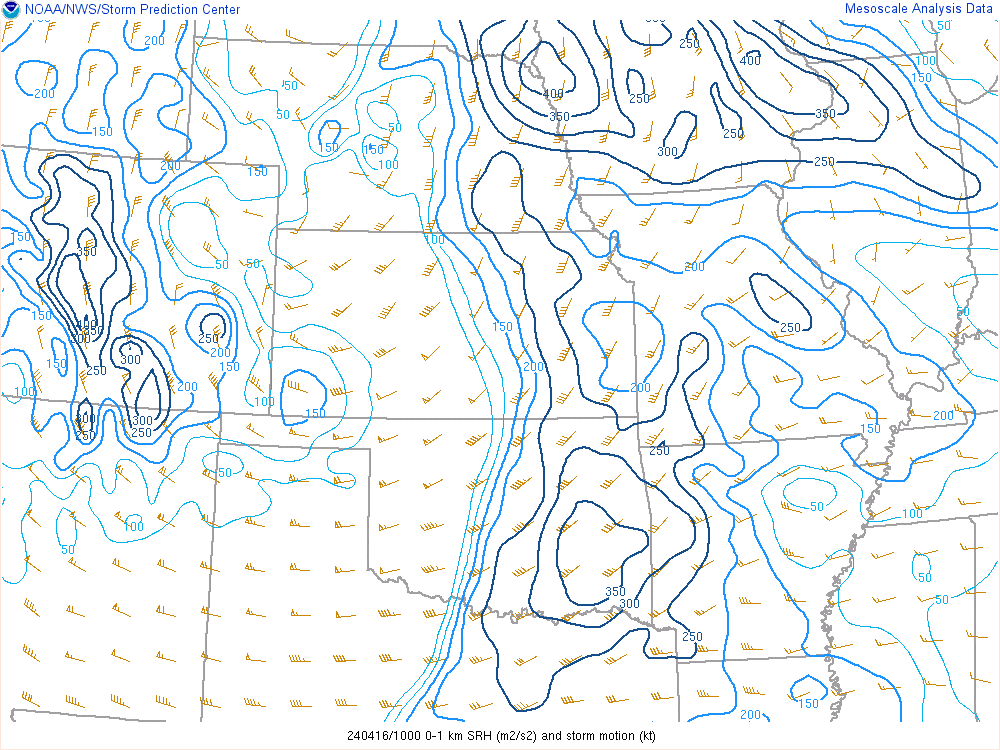 |
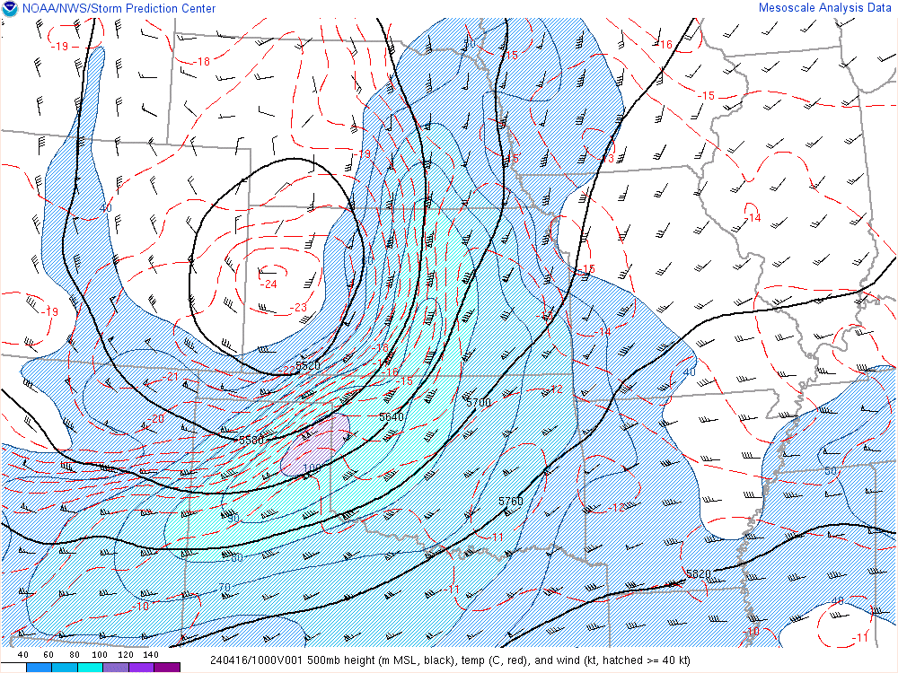
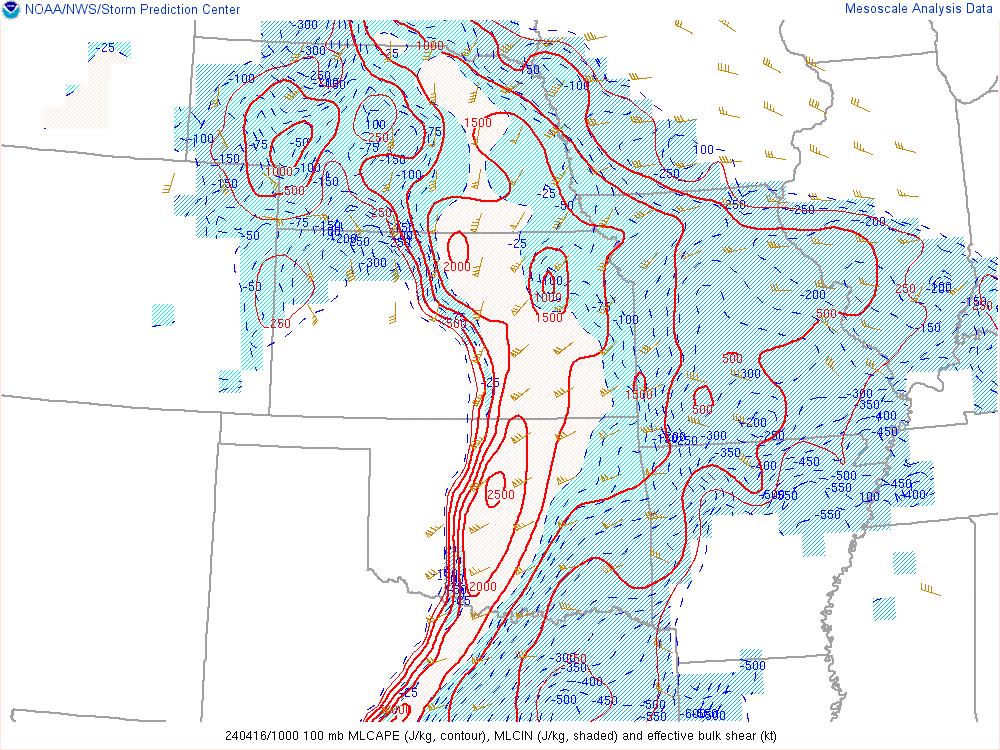
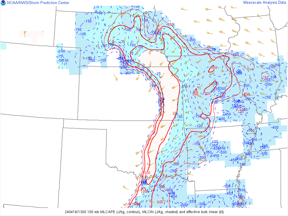
| April 16 - 5 AM: 500 mb winds and heights. | April 16 - 5 AM: Mixed-Layer CAPE, Mixed-Layer CIN, and Effective Bulk Shear | April 16 - 5 AM: 0-1km SRH |
 |
 |
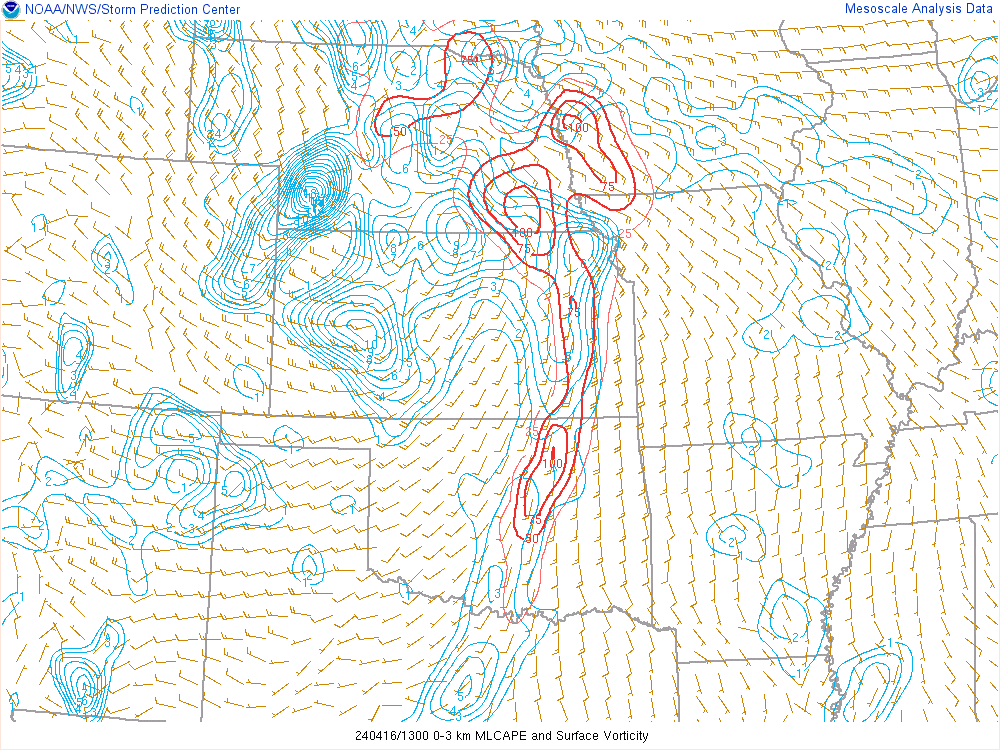 |
| April 16 - 5 AM: 0-3km SRH | April 16 - 5 AM: Surface Temperature, Surface Dewpoint, and Surface Pressure | April 16 - 8 AM: 0-3km CAPE and Surface Vorticity |
 |
 |
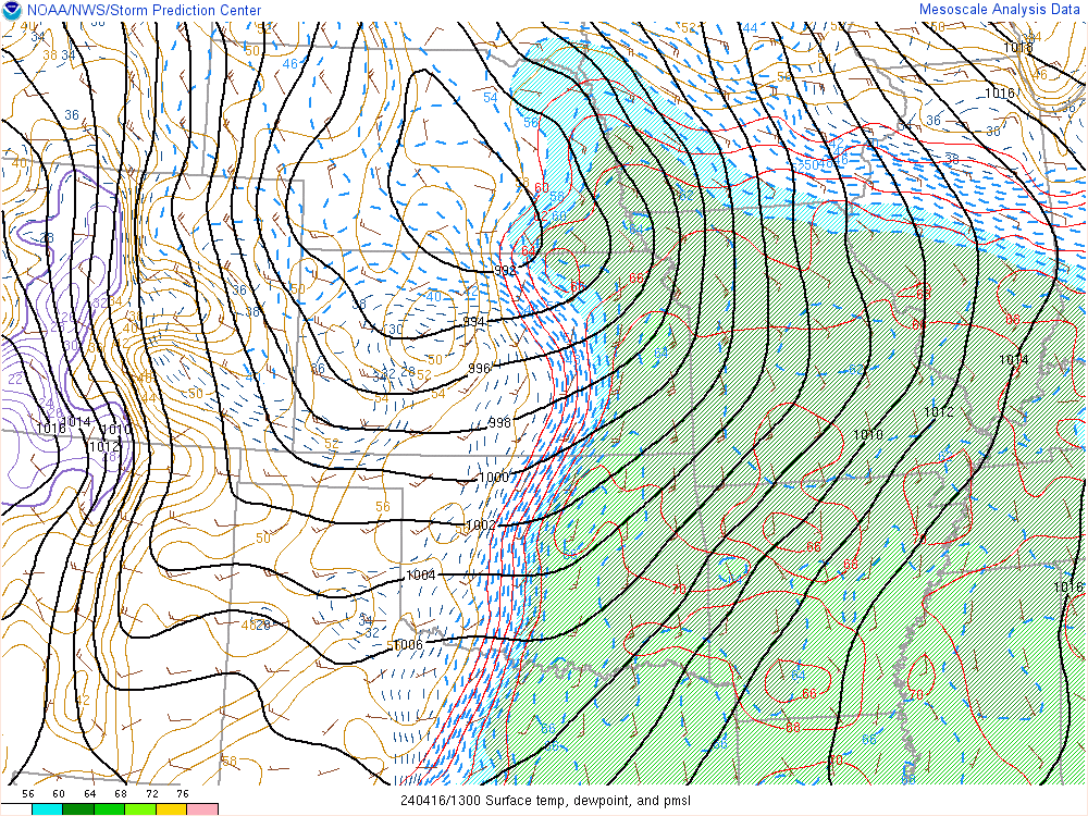 |
| April 16 - 8 AM: 500 mb winds and heights | April 16 - 8 AM: Mixed-Layer CAPE, Mixed-Layer CIN, and Effective Bulk Shear | April 16 - 8 AM: Surface Temperature, Surface Dewpoint, and Surface Pressure |
 |
Media use of NWS Web News Stories is encouraged! Please acknowledge the NWS as the source of any news information accessed from this site. |
|


.jpg)