Use your mouse scroll wheel or the
 /
/  buttons to zoom in and out of the map.
About This Map:
This is an interactive mapping of the tornadoes that occurred across Illinois in 2016. Mouse over each icon to view more information on that tornado, which will appear in the box to the right. A season summary and table of these tornadoes is provided below. Detailed KMZ files for many of the tracks can be downloaded by clicking on the appropriate icon in the table below. To download the full year map shown above, click the download button below.

Please note: Track lines and contours are often interpolated and may not encompass the full extent of the damage. Surveying procedures vary between NWS offices. Downloadable tracks may not be available for weak tornadoes that were not surveyed.
Format credit for this page: National Weather Service, Des Moines, IA
| # | Date | Time - Local (CDT/CST) |
Counties | Start Location | EF Rating |
Path Length |
Deaths/ Injuries |
View Map |
KMZ File |
|---|---|---|---|---|---|---|---|---|---|
| 1 | 3/15/16 | 6:26 pm - 7:00 pm | McDonough, Warren, Fulton | Good Hope | EF2 | 16.0 mi. | 0/0 | 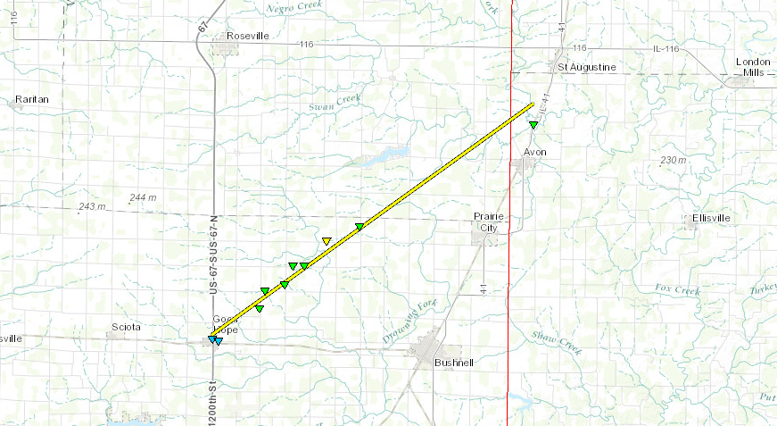 |
 |
| 2 | 3/15/16 | 7:25 pm - 7:35 pm | Rock Island | 3 SE Hampton | EF2 | 4.8 mi. | 0/10 | .PNG) |
|
| 3 | 3/15/16 | 7:42 pm - 7:57 pm | Peoria | 2.0 NW Trivoli | EF2 | 7.1 mi. | 0/0 | 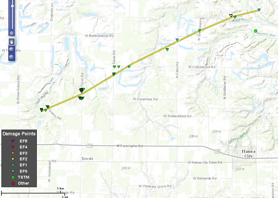 |
|
| 4 | 3/15/16 | 7:44 pm - 7:50 pm | Sangamon | 2.4 W Curran | EF1 | 3.5 mi. | 0/0 |  |
|
| 5 | 3/15/16 | 8:05 pm - 8:14 pm | Peoria | 4.1 NW Downtown Peoria | EF0 | 3.8 mi. | 0/0 | 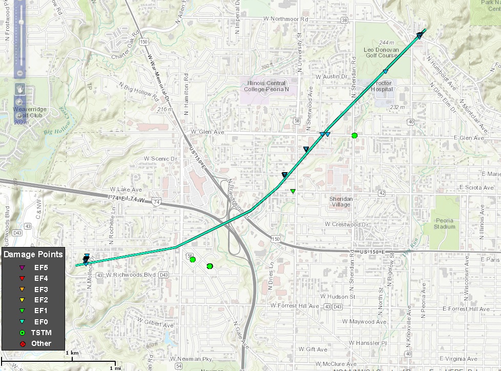 |
|
| 6 | 3/15/16 | 8:33 pm - 8:38 pm | Whiteside | 3.8 N Deer Grove | EF0 | 1.8 mi. | 0/0 | 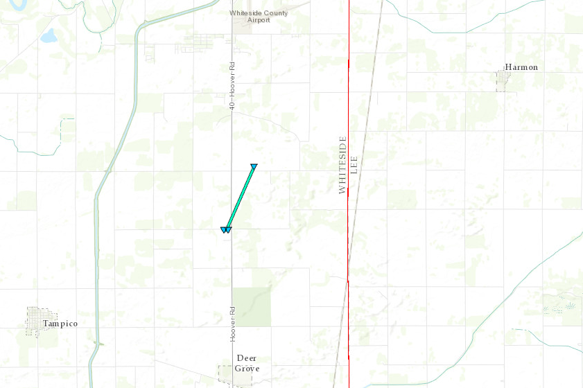 |
|
| 7 | 4/27/16 | 6:23 pm - 6:35 pm | Montgomery | Raymond | EF0 | 5.0 mi. | 0/0 |  |
|
| 8 | 4/27/16 | 6:58 pm | Effingham | 3.2 SSW Altamont | EF0 | 0.1 mi. | 0/0 | 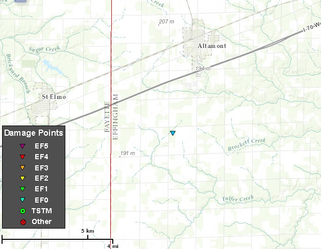 |
|
| 9 | 4/27/16 | 7:47 pm | Richland | 1.7 N Olney | EF0 | 0.1 mi. | 0/0 | 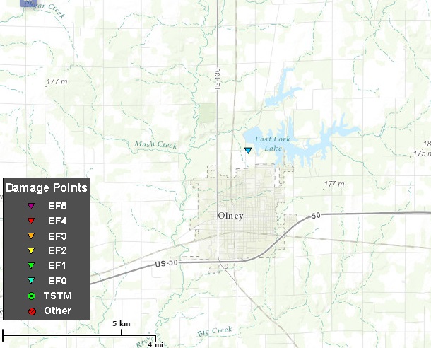 |
|
| 10 | 5/9/16 | 5:15 pm - 5:17 pm | McDonough | 1.7 SE Bushnell | EF0 | 0.1 mi. | 0/0 | 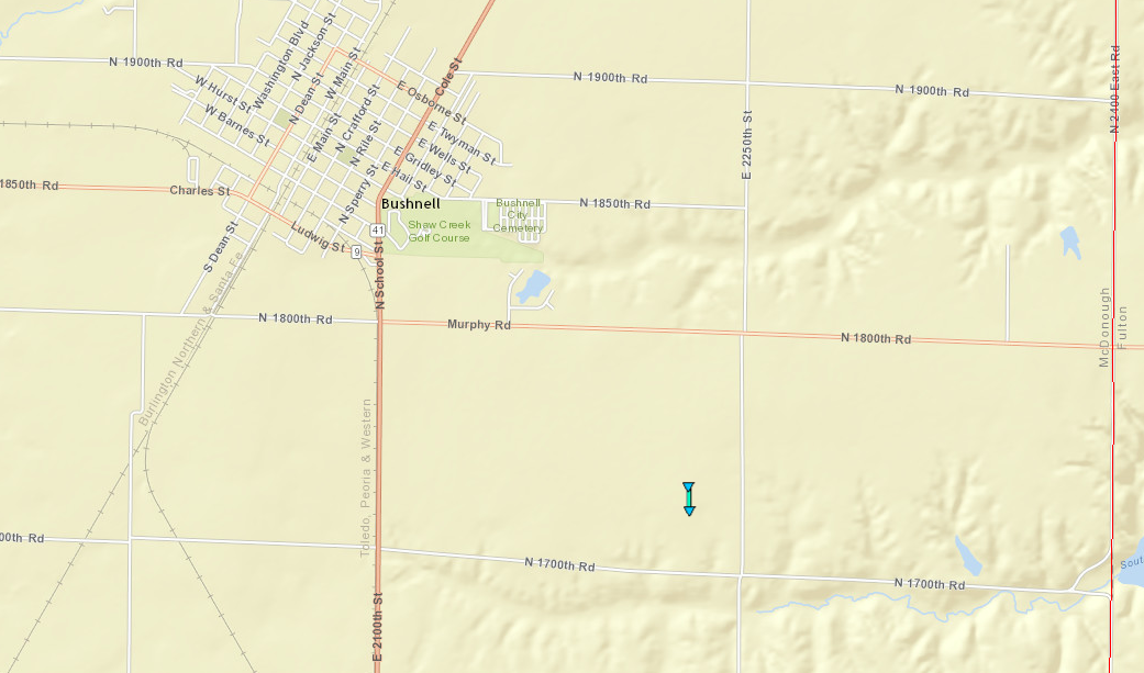 |
|
| 11 | 5/9/16 | 5:43 pm | Warren | 0.8 SSE Greenbush | EF0 | 0.1 mi. | 0/0 | 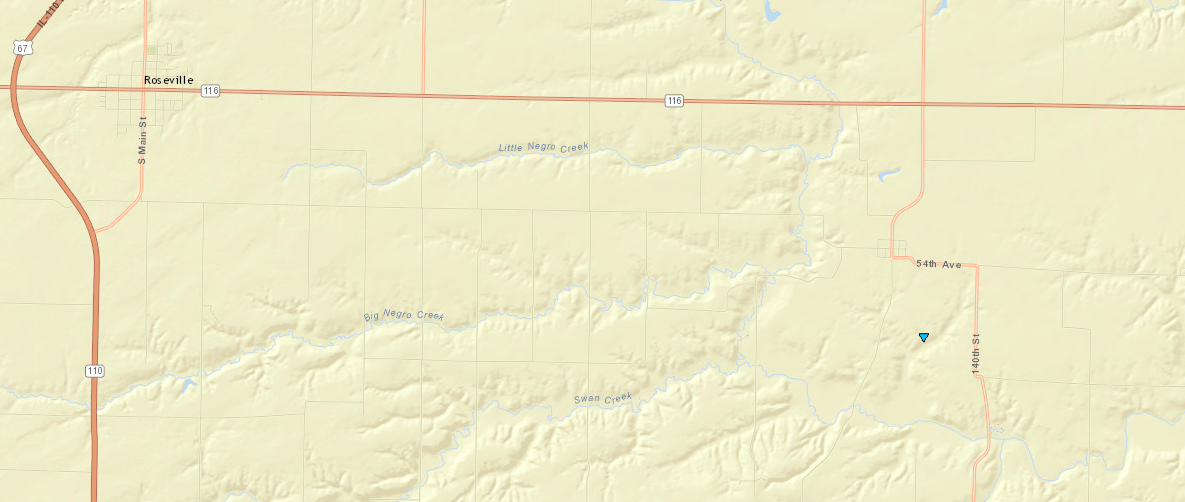 |
|
| 12 | 5/10/16 | 5:36 pm | Pope | 3.2 NW Dixon Springs | EF0 | 0.1 mi. | 0/0 |  |
|
| 13 | 5/10/16 | 5:56 pm | Hardin | 9.2 NW Cave-in-Rock | EF0 | 0.1 mi. | 0/0 | 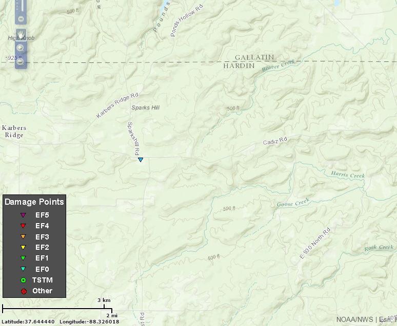 |
|
| 14 | 5/11/16 | 6:34 pm | Franklin | 1 ENE Cleburne | EF0 | 0.1 mi. | 0/0 |  |
|
| 15 | 6/13/16 | 5:30 pm - 5:33 pm | St. Clair | 3.4 SSW Belleville | EF0 | 0.4 mi. | 0/0 |  |
|
| 16 | 6/14/16 | 7:15 pm - 7:16 pm | Stark | 3.0 WSW Bradford | EF0 | 0.1 mi. | 0/0 |  |
|
| 17 | 6/22/16 | 7:19 pm - 7:35 pm | Lee | 1.1 NW West Brooklyn | EF1 | 4.1 mi. | 0/0 | 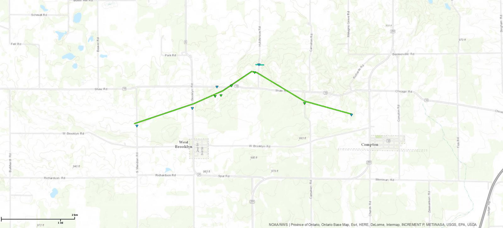 |
|
| 18 | 6/22/16 | 7:31 pm - 7:32 pm | Lee | 1.7 NE West Brooklyn | EF0 | 0.1 mi. | 0/0 | 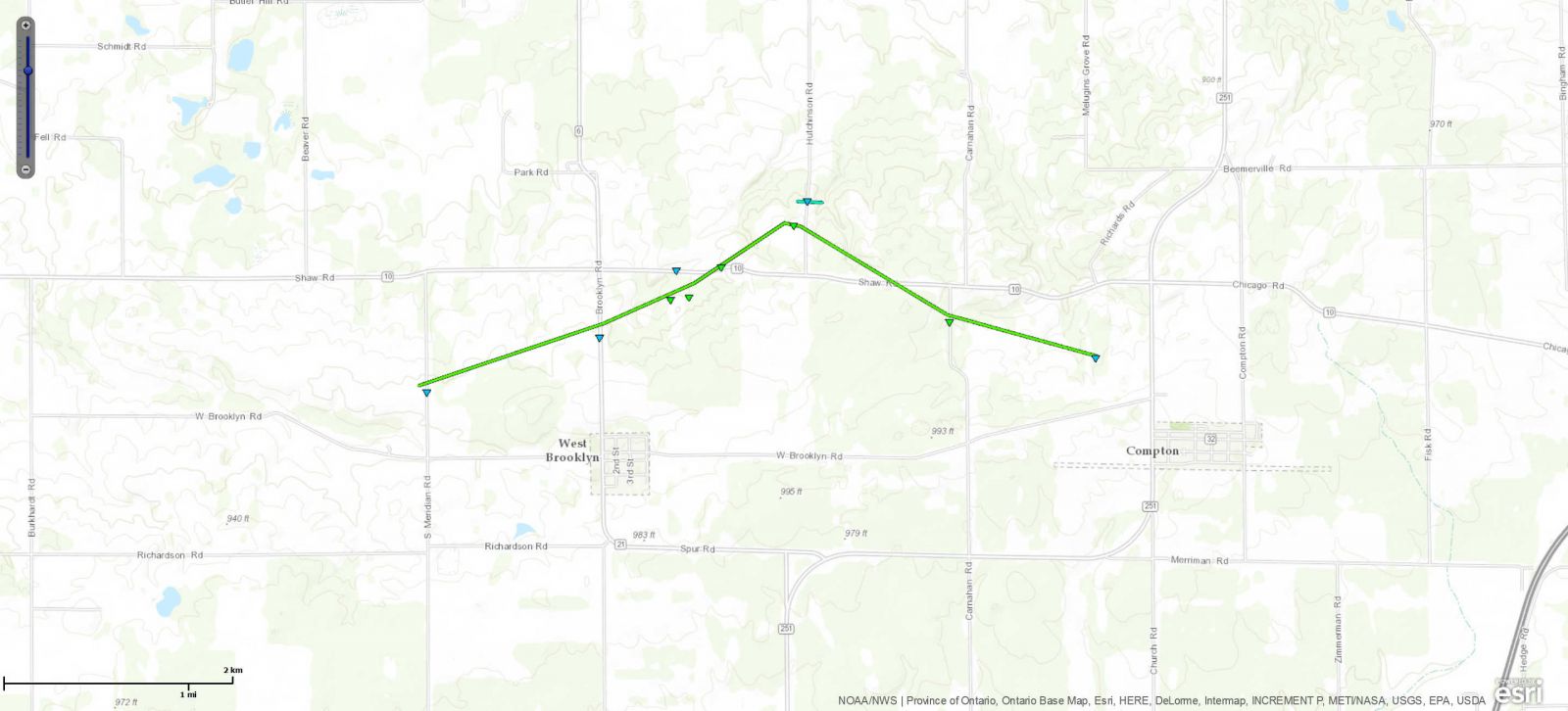 |
|
| 19 | 6/22/16 | 7:40 pm - 7:43 pm | Bureau | 5.1 WSW La Moille | EF0 | 0.5 mi. | 0/0 | 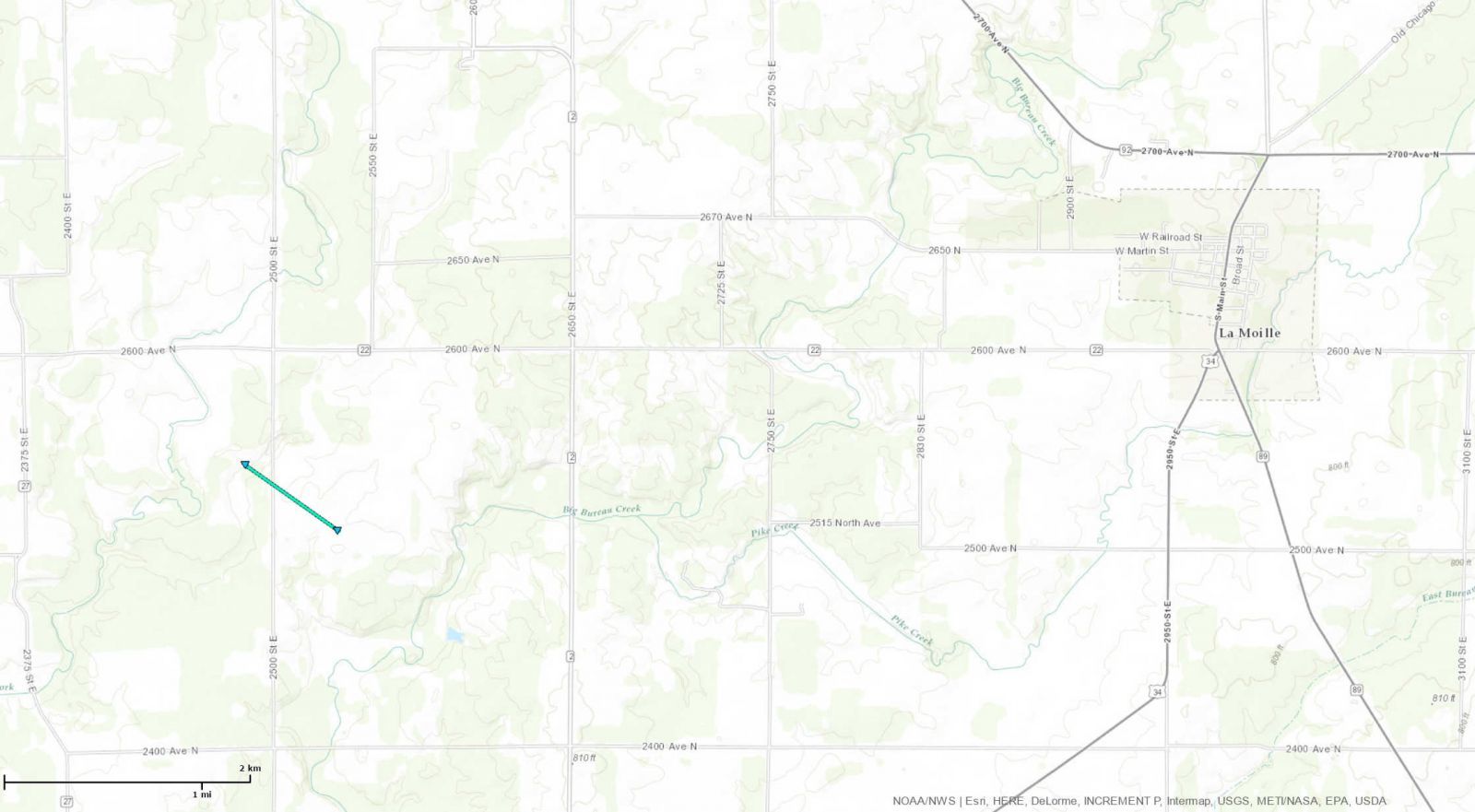 |
|
| 20 | 6/22/16 | 7:59 pm - 8:09 pm | La Salle | 0.7 NE Earlville | EF1 | 4.3 mi. | 0/0 | 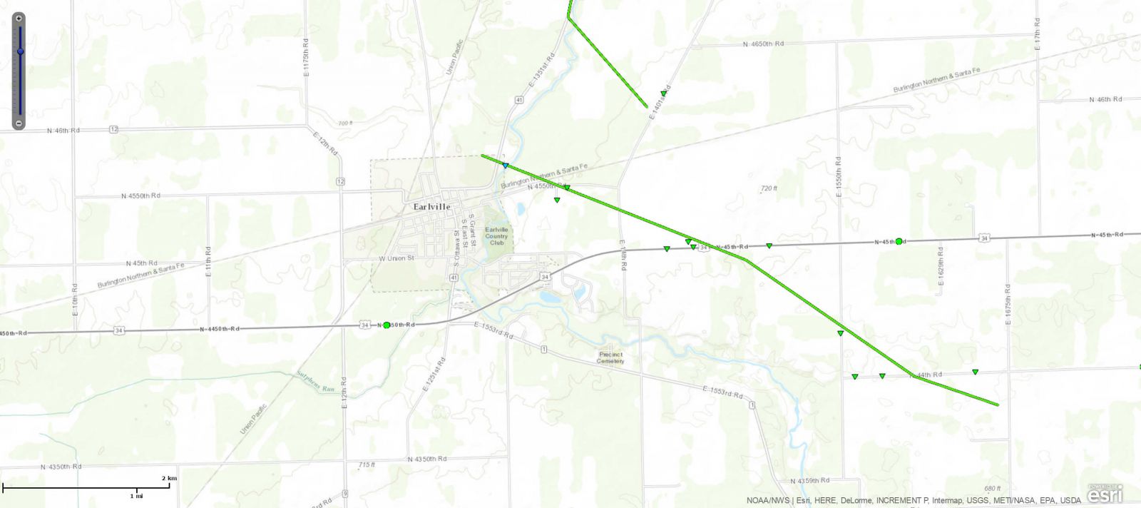 |
|
| 21 | 6/22/16 | 7:59 pm - 8:00 pm | La Salle | 2.8 NE Earlville | EF0 | 0.3 mi. | 0/0 | 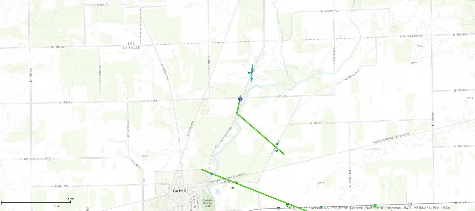 |
|
| 22 | 6/22/16 | 8:02 pm - 8:07 pm | La Salle | 2.1 NE Earlville | EF1 | 1.4 mi. | 0/0 | 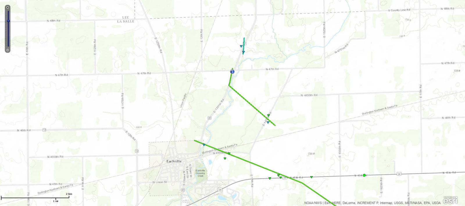 |
|
| 23 | 6/22/16 | 8:04 pm - 8:05 pm | Bureau | 3.3 N Manlius | EF0 | 0.3 mi. | 0/0 |  |
|
| 24 | 6/22/16 | 8:11 pm - 8:12 pm | La Salle | Troy Grove | EF1 | 0.5 mi. | 0/0 | 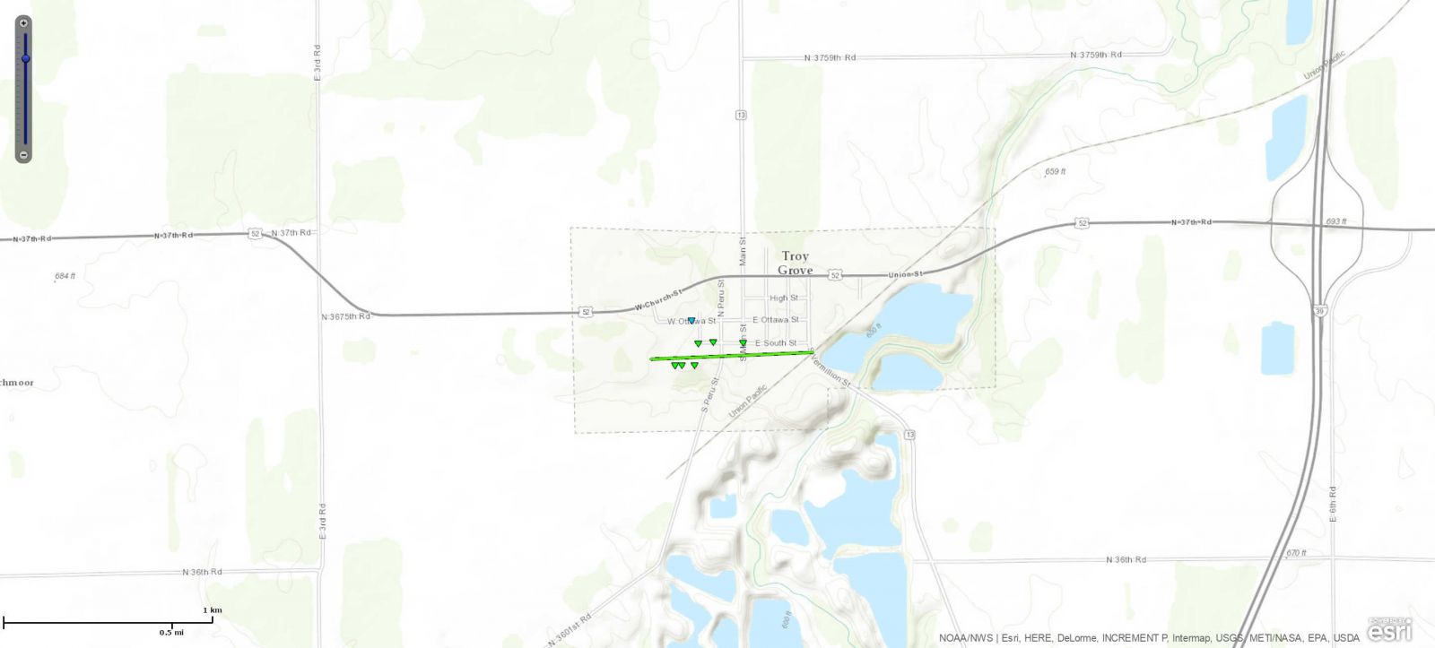 |
|
| 25 | 6/22/16 | 8:22 pm - 8:27 pm | La Salle | 5.0 NW Sheridan | EF1 | 1.7 mi. | 0/0 | 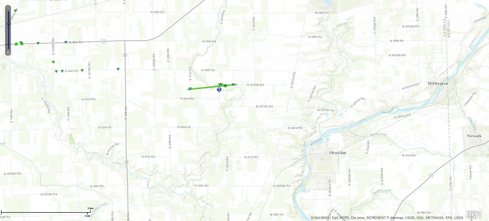 |
|
| 26 | 6/22/16 | 8:32 pm - 8:33 pm | La Salle | 5.5 NW Ottawa | EF1 | 0.5 mi. | 0/0 | 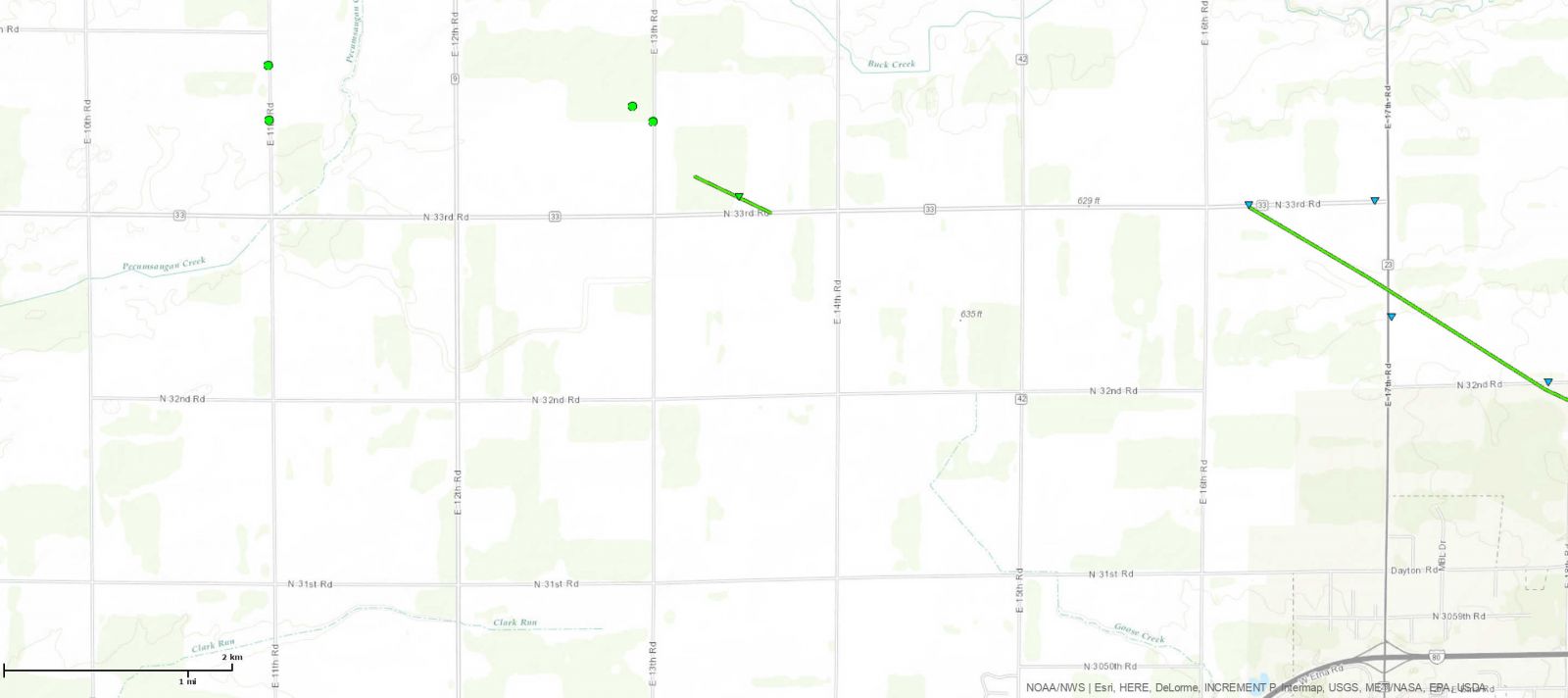 |
|
| 27 | 6/22/16 | 8:33 pm - 8:37 pm | Bureau | 0.7 S Malden | EF0 | 0.5 mi. | 0/0 | 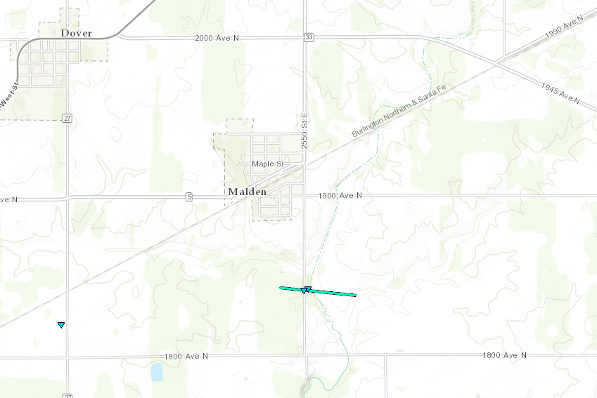 |
|
| 28 | 6/22/16 | 8:39 pm - 8:53 pm | La Salle | 6.6 N Ottawa | EF1 | 6.7 mi. | 0/0 | 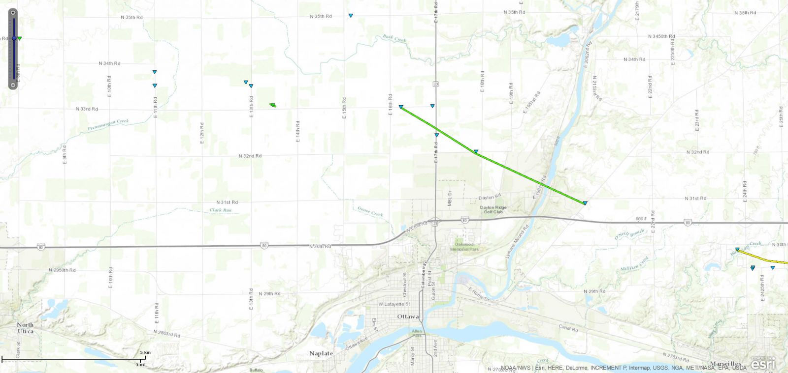 |
|
| 29 | 6/22/16 | 8:53 pm - 9:15 pm | La Salle, Grundy | 2.5 N Marseilles | EF2 | 8.1 mi. | 0/0 | 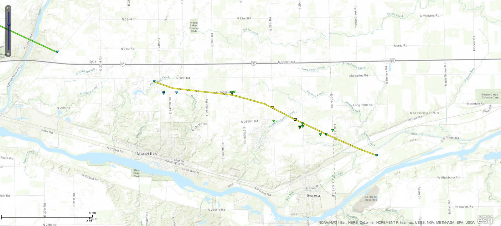 |
|
| 30 | 6/22/16 | 9:29 pm - 9:36 pm | Grundy | 3.1 NE Mazon | EF0 | 1.0 mi. | 0/0 | 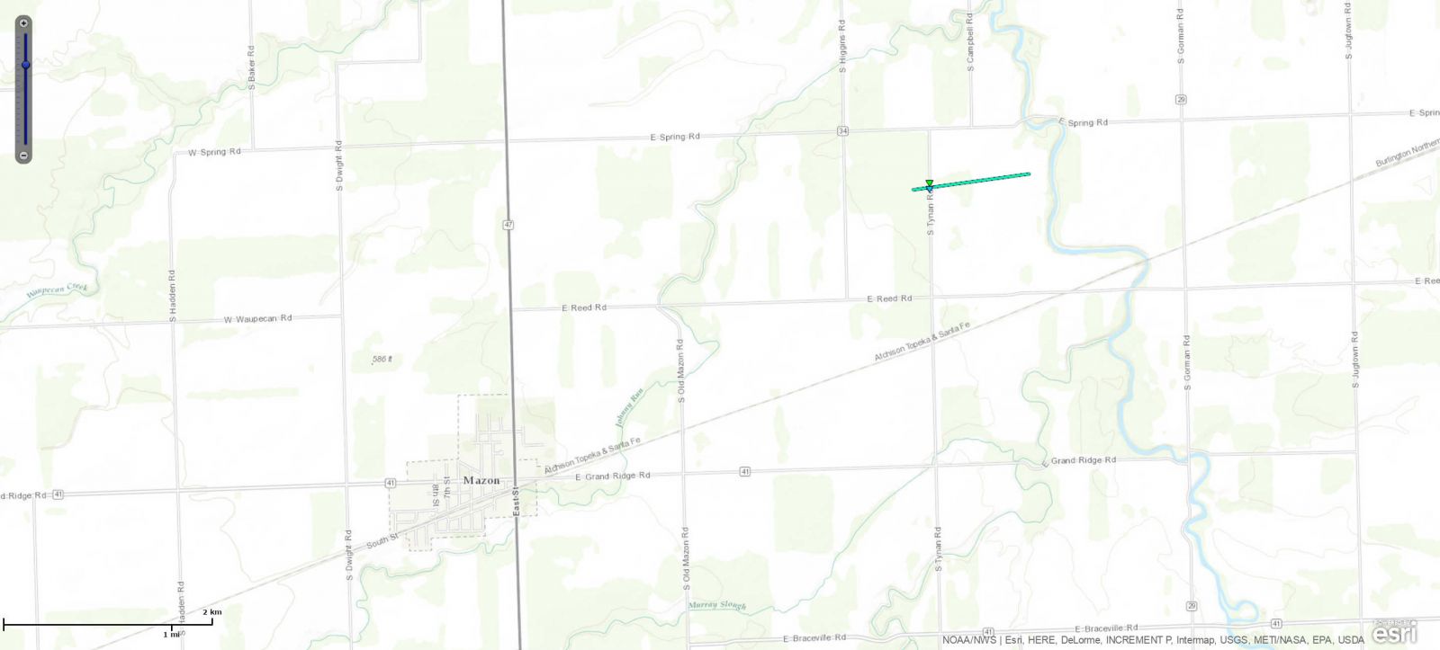 |
|
| 31 | 6/22/16 | 10:06 pm - 10:24 pm | Livingston | 8.0 NW Pontiac | EF2 | 11.1 mi. | 0/4 | 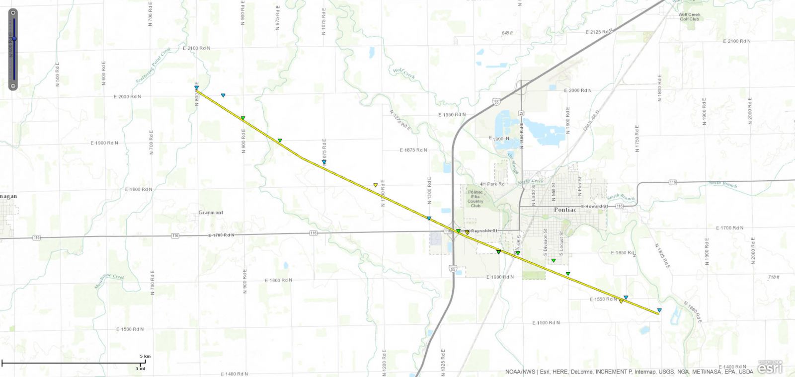 |
|
| 32 | 6/22/16 | 10:12 pm - 10:15 pm | Iroquois | 2.0 WSW Clifton | EF1 | 1.7 mi. | 0/0 | 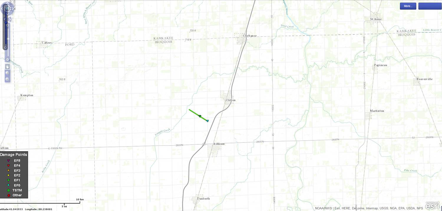 |
|
| 33 | 6/22/16 | 10:49 pm - 10:50 pm | Livingston | 1.0 N Chatsworth | EF0 | 0.1 mi. | 0/0 | 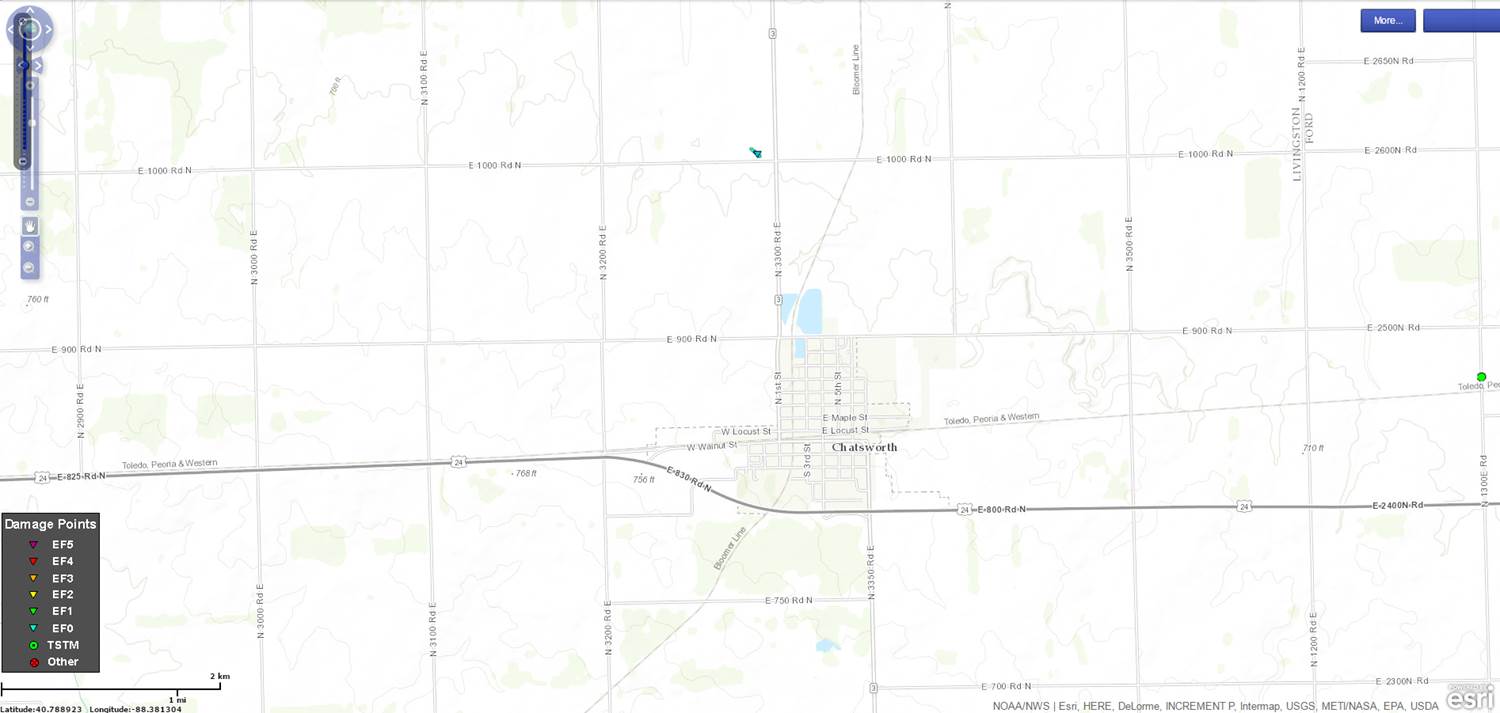 |
|
| 34 | 6/22/16 | 11:37 pm - 11:41 pm | Iroquois | 1.6 N Cissna Park | EF1 | 3.1 mi. | 0/0 | 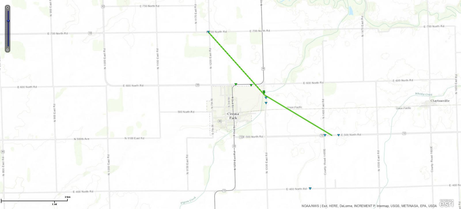 |
|
| 35 | 7/6/16 | 1:39 pm - 1:45 pm | Massac | Metropolis | EF1 | 2.9 mi. | 0/2 | 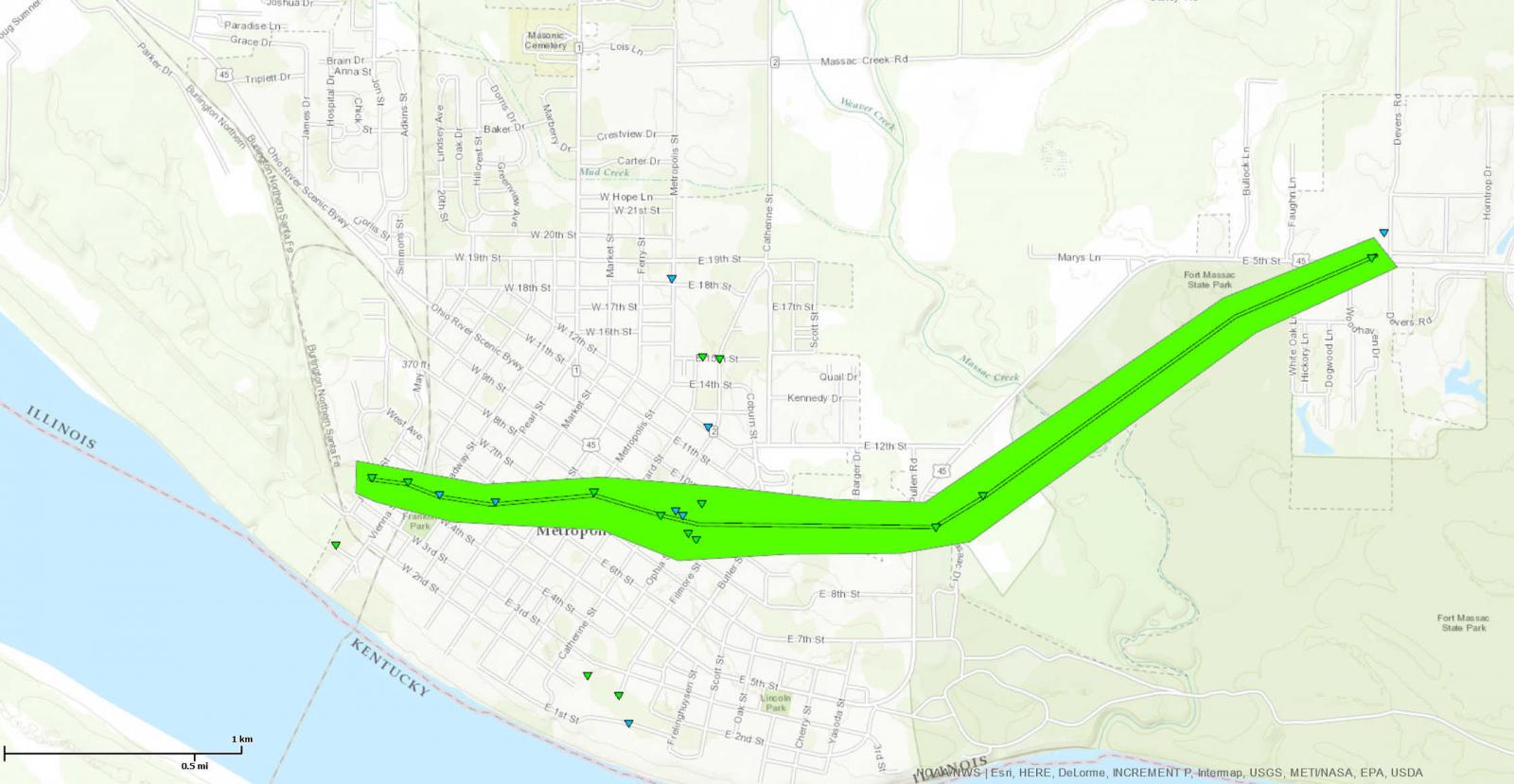 |
|
| 36 | 7/17/16 | 8:18 pm - 8:19 pm | Putnam | 3.7 SSE Hennepin | EF0 | 0.1 mi. | 0/0 |  |
|
| 37 | 7/17/16 | 8:23 pm - 8:24 pm | Putnam | 0.5 SSE Florid | EF0 | 0.1 mi. | 0/0 |  |
|
| 38 | 7/17/16 | 9:41 pm - 9:48 pm | Kankakee | 0.7 E Cabery | EF1 | 2.2 mi. | 0/0 |  |
|
| 39 | 8/9/16 | 3:48 pm - 3:58 pm | Cook | 2.0 ESE Cicero | EF0 | N/A | 0/0 | N/A | N/A |
| 40 | 9/9/16 | 6:31 pm - 6:50 pm | Champaign | 3.6 S Sidney | EF2 | 6.3 mi. | 0/0 |  |
|
| 41 | 9/9/16 | 6:34 pm - 6:43 pm | Vermilion | 3.5 S Bismarck | EF1 | 1.7 mi. | 0/0 | 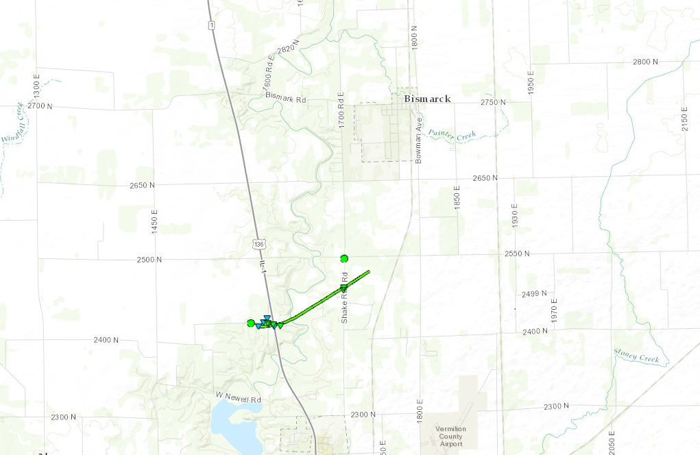 |
|
| 42 | 9/9/16 | 6:44 pm - 6:45 pm | Clark | 1.4 S Casey | EF0 | 0.1 mi. | 0/0 | 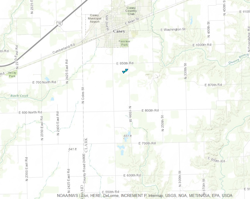 |
|
| 43 | 9/9/16 | 7:13 pm - 7:14 pm | Vermilion | 2.0 SW Catlin | EF0 | 0.1 mi. | 0/0 | 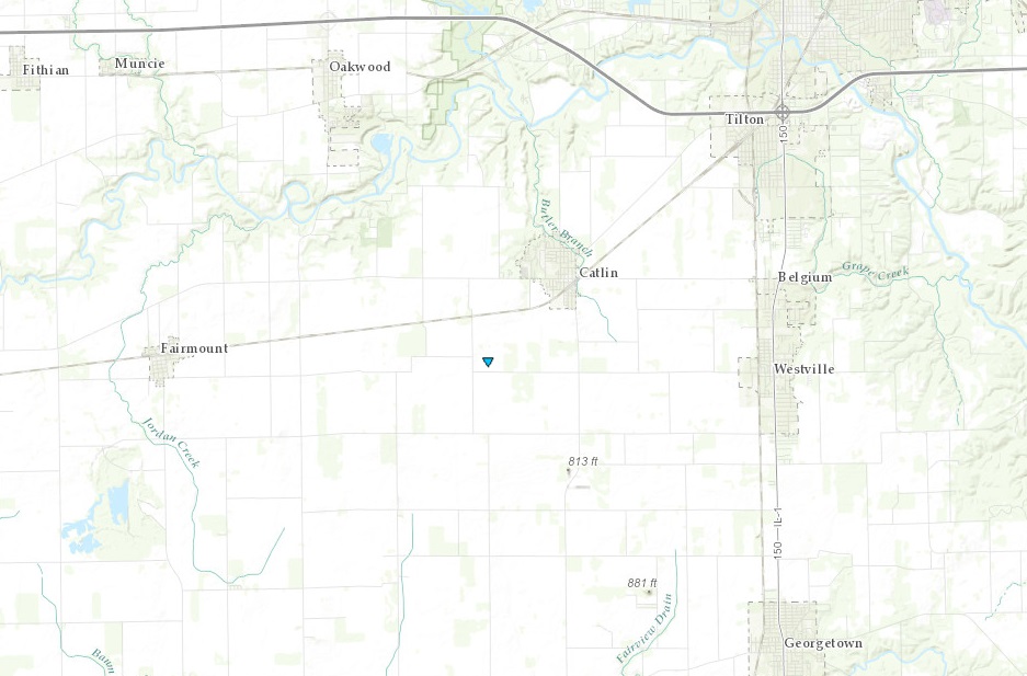 |
|
| 44 | 10/6/16 | 10:36 pm - 11:00 pm | Scott IA, Rock Island IL | Davenport IA | EF1 | 20.0 mi. | 0/0 |  |
|
| 45 | 10/6/16 | 10:41 pm - 10:46 pm | Rock Island | 2.0 S Coal Valley | EF0 | 4.9 mi. | 0/0 | 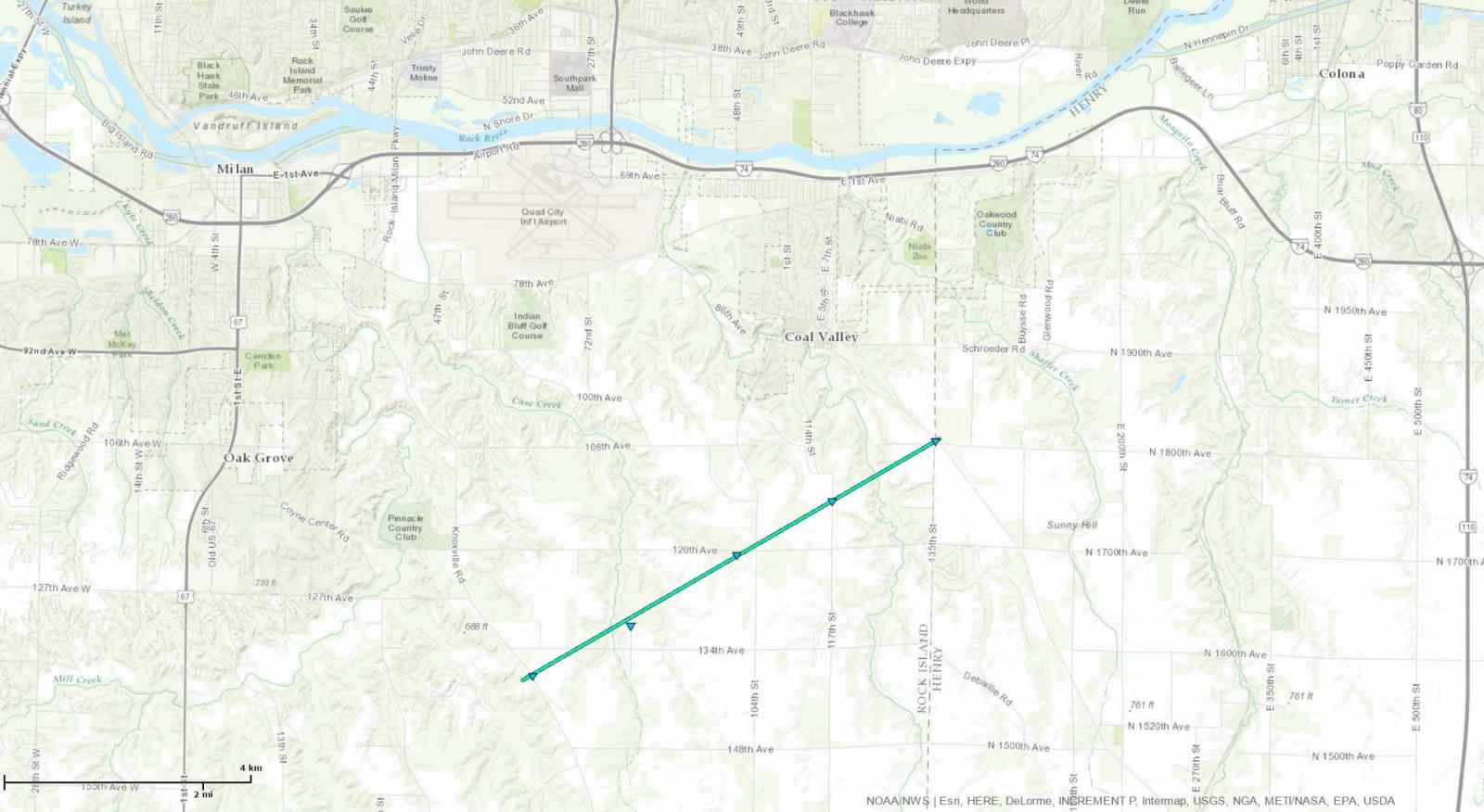 |
|
* Red entries indicate that the tornado is still under review

