Scattered thunderstorms with severe gusts, hail and a tornado risk are possible near a cold front from the Ohio Valley to the Mid-Atlantic tonight. Tropical Storm Bertha is expected to bring tropical storm conditions to portions of the Gulf Coast from the panhandle of Florida into Louisiana through Wednesday. Read More >
Overview
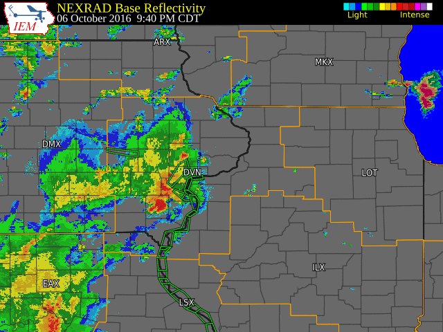
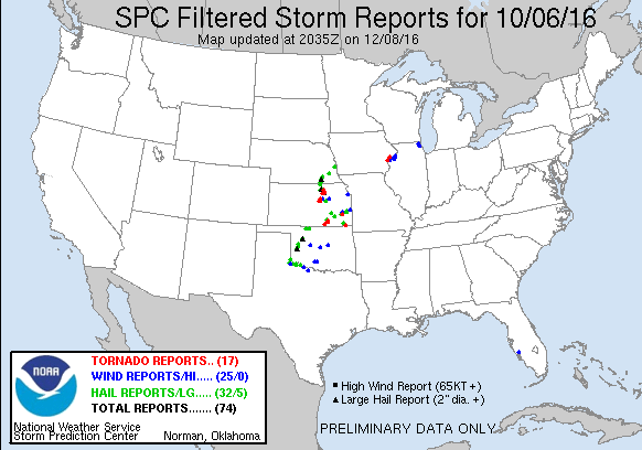
| A complex of severe thunderstorms developed in eastern Iowa during the evening of October 6, 2016 ahead of a cold front. The storms intensified as they moved into far east-central Iowa and northwestern Illinois bringing heavy rain, frequent lightning, strong winds, and several tornadoes. Damage was reported in Muscatine, Scott, and Rock Island Counties. | |
Surface Map / Radar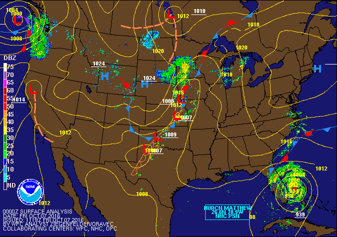 |
Tornado Track Paths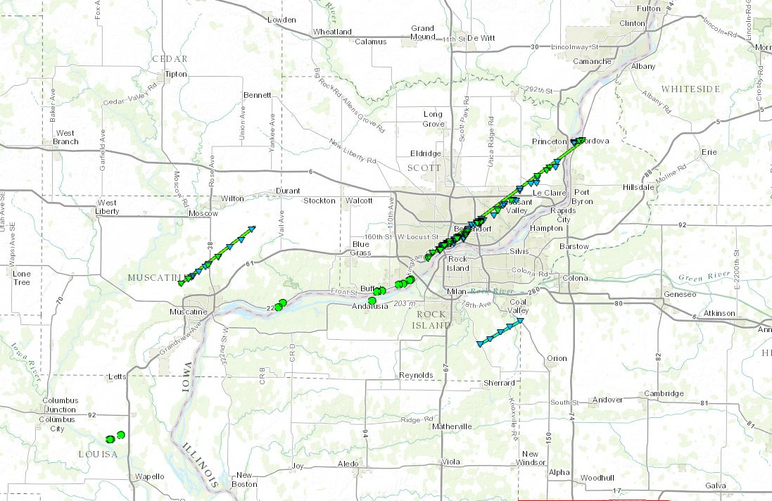 |
Tornadoes:
|
Tornado #1 - 4 Miles NW Muscatine, IA
Track Map 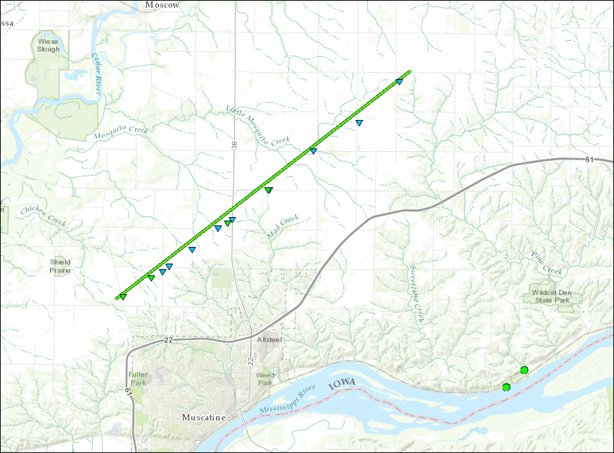 
|
||||||||||||||||
|
Tornado #2 - 2 Miles S Coal Valley, IL
Track Map 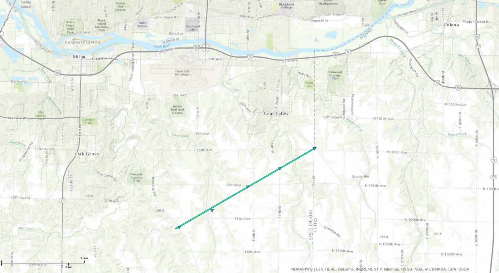
|
||||||||||||||||
|
Tornado #3 - Davenport-Bettendorf-Princeton, IA & Cordova, IL
Track Map 
|
||||||||||||||||
The Enhanced Fujita (EF) Scale classifies tornadoes into the following categories:
| EF0 Weak 65-85 mph |
EF1 Moderate 86-110 mph |
EF2 Significant 111-135 mph |
EF3 Severe 136-165 mph |
EF4 Extreme 166-200 mph |
EF5 Catastrophic 200+ mph |
 |
|||||
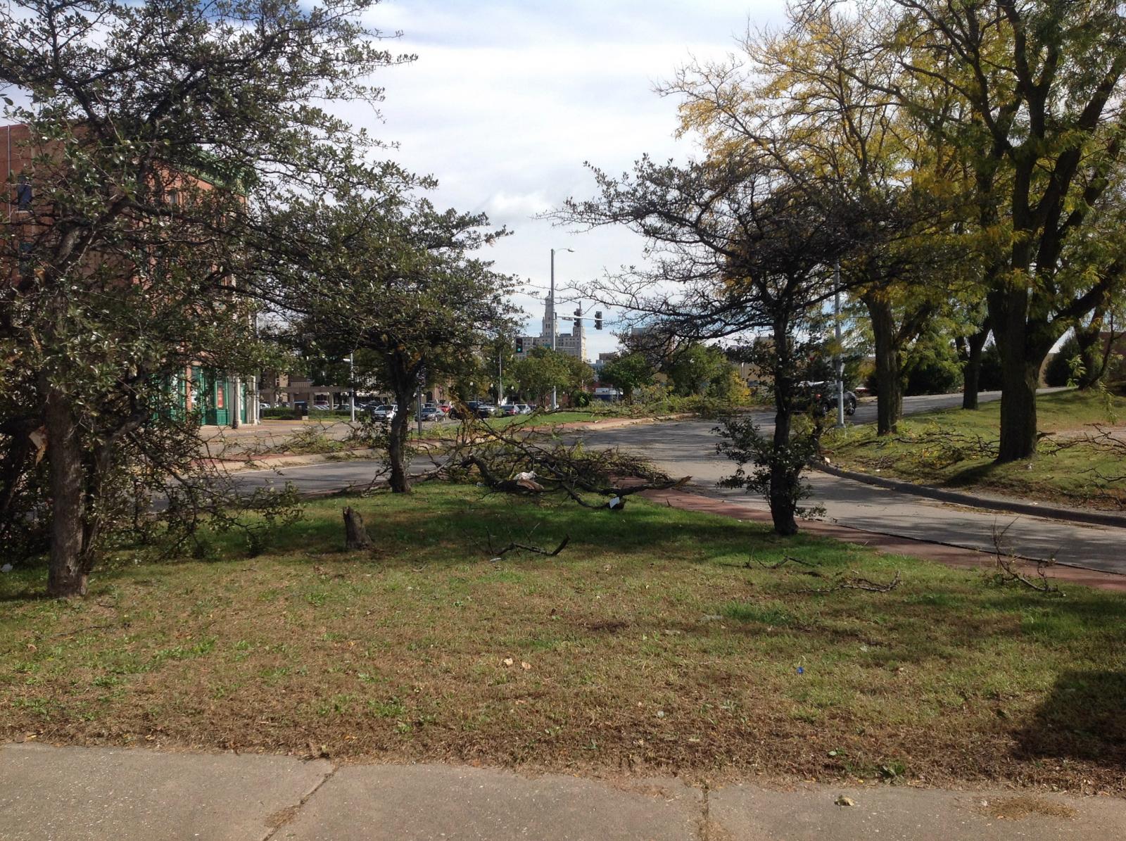
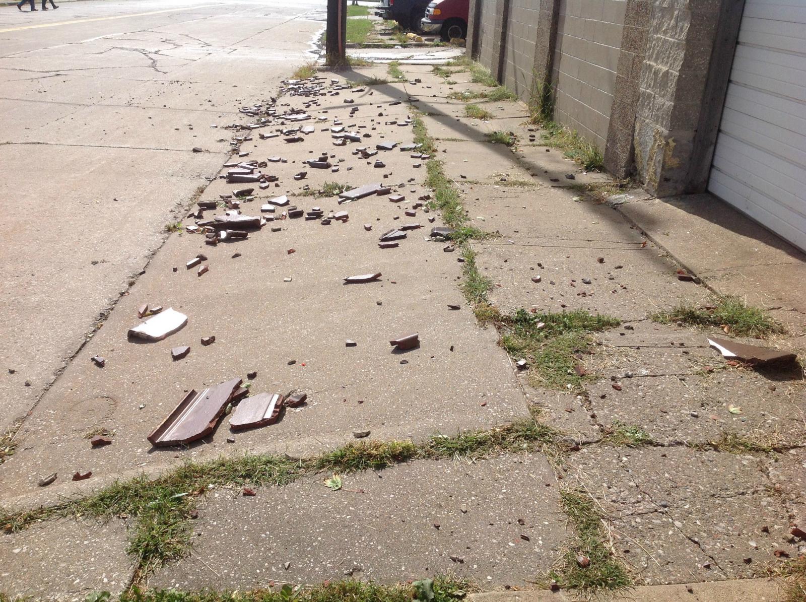
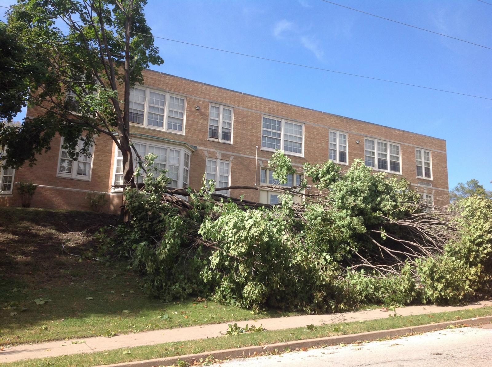
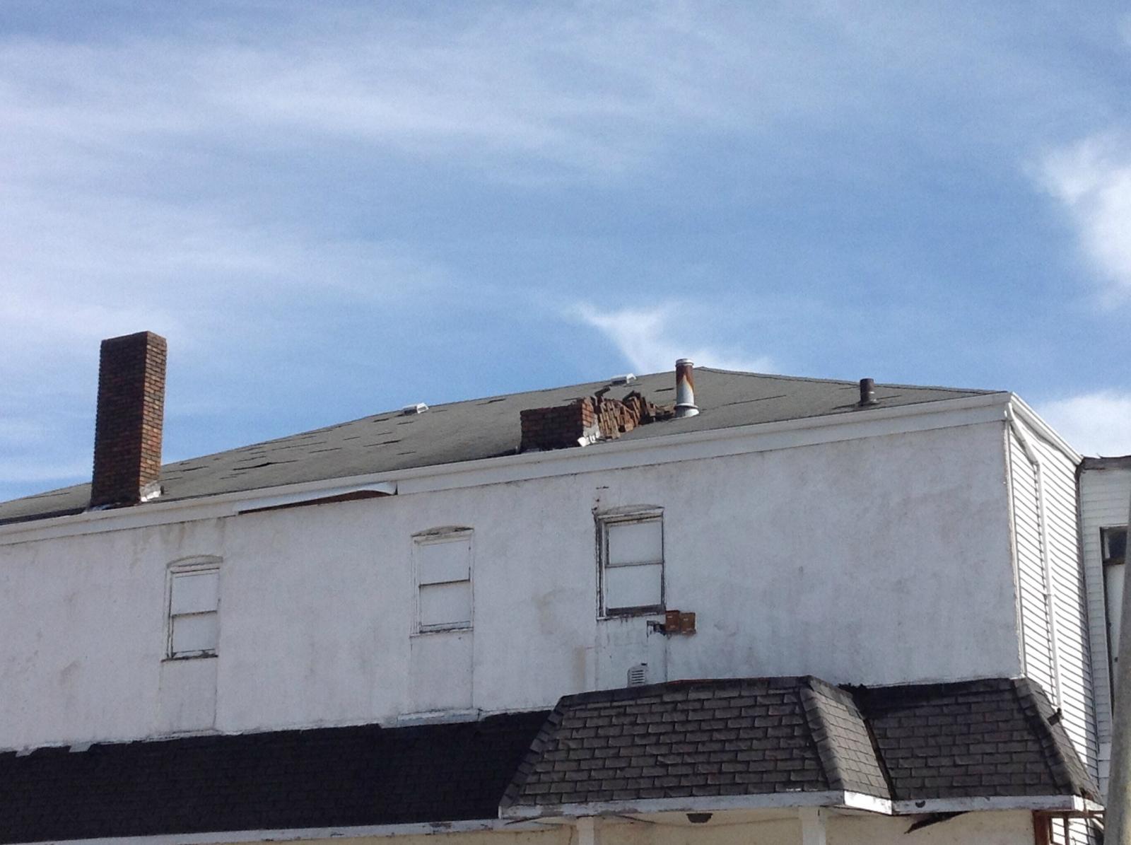
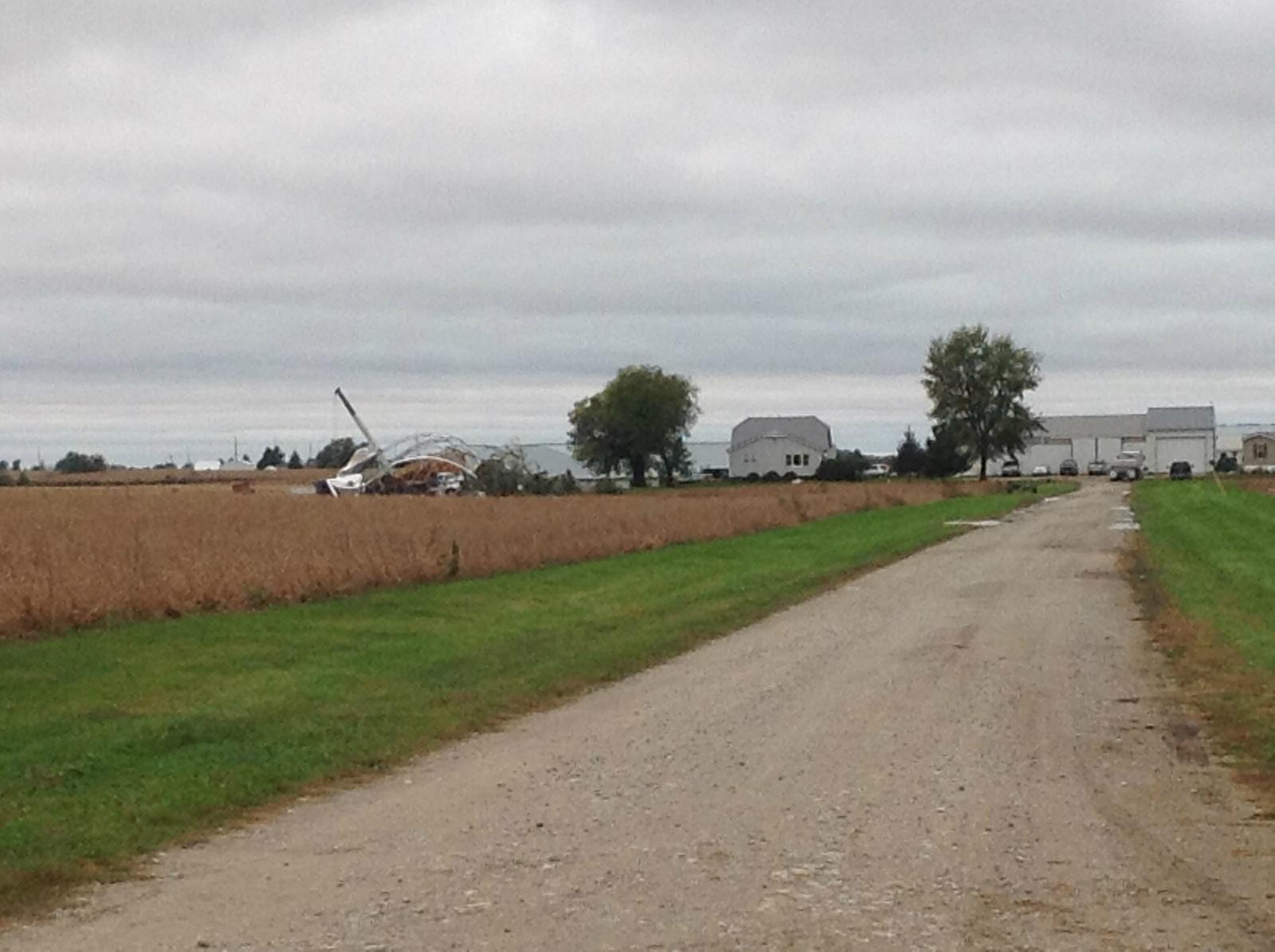
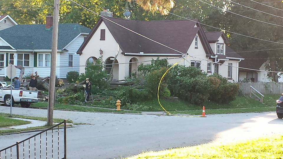
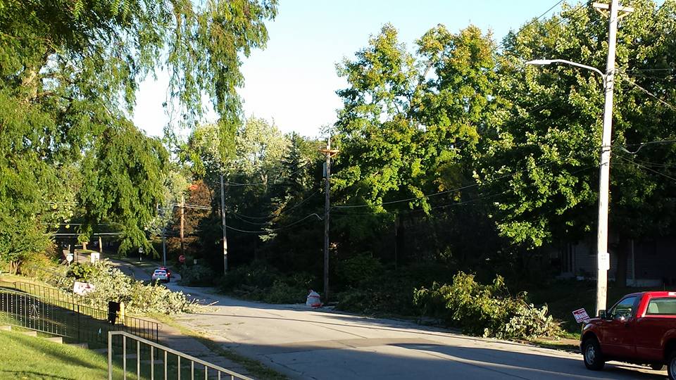
Photos & Video:
 |
 |
 |
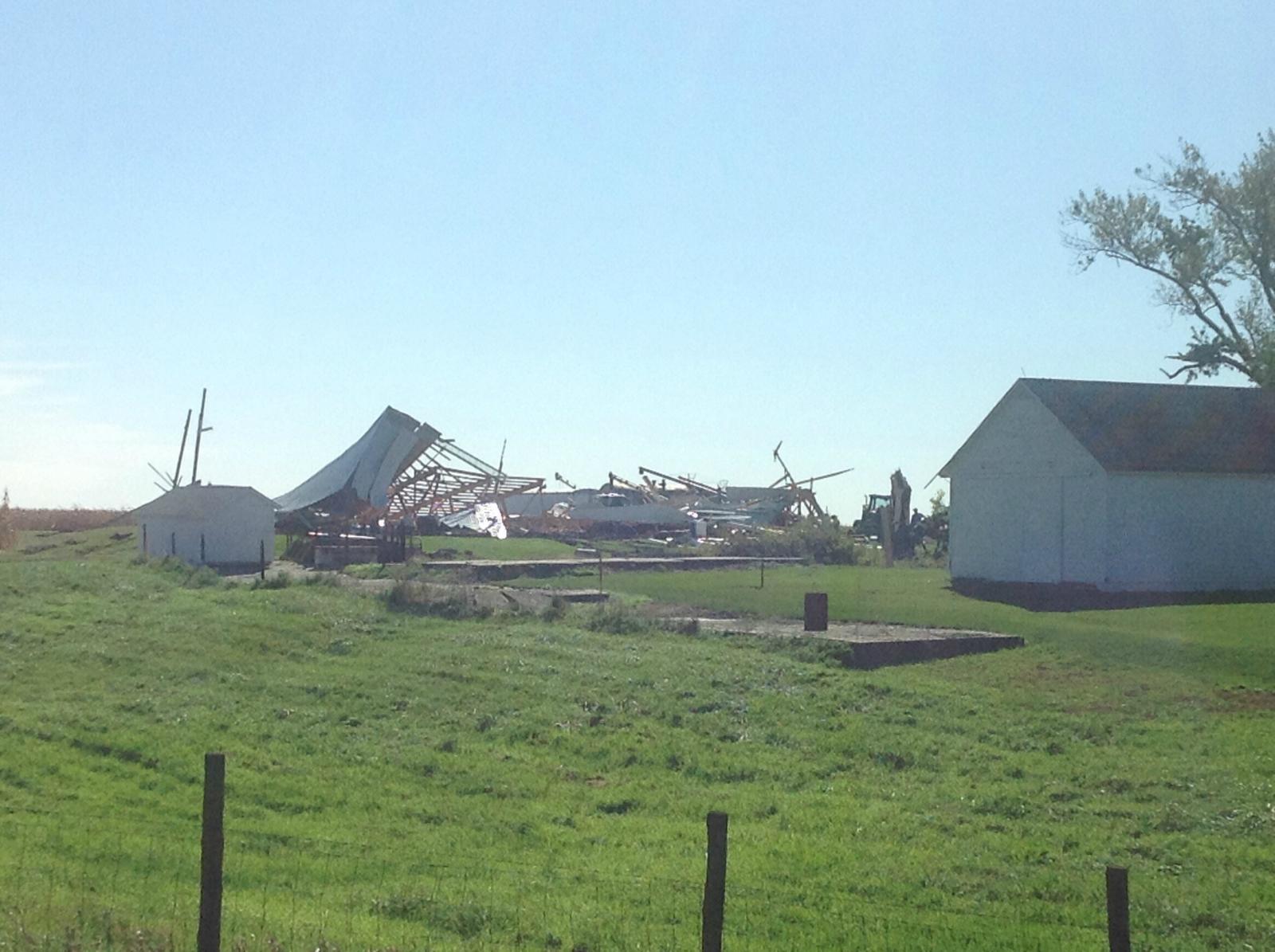 |
| NWS Official Survey (source) |
NWS Official Survey (source) |
NWS Official Survey (source) |
NWS Official Survey (source) |
 |
 |
 |
 |
| NWS Official Survey (source) |
NWS Official Survey (source) |
NWS Official Survey (source) |
NWS Official Survey (source) |
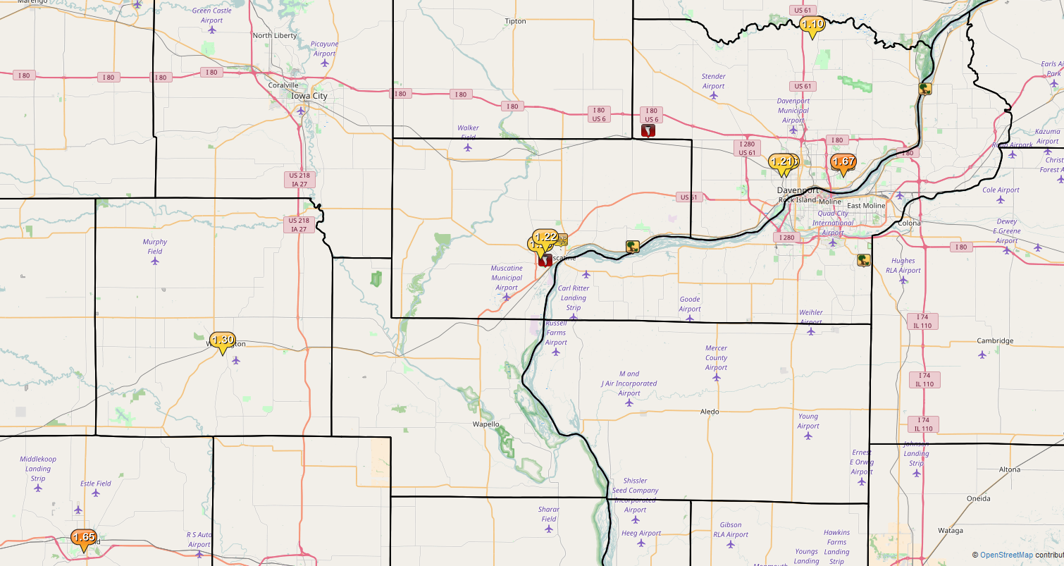
Storm Reports
| INTERACTIVE MAP | SPC REPORTS |
 |
 |
PRELIMINARY LOCAL STORM REPORT...SUMMARY
NATIONAL WEATHER SERVICE QUAD CITIES IA IL
505 PM CDT FRI OCT 07 2016

..TIME...   ...EVENT...      ...CITY LOCATION...     ...LAT.LON...
..DATE...   ....MAG....      ..COUNTY LOCATION..ST.. ...SOURCE....
            ..REMARKS..

1013 PM     TSTM WND GST     3 NE MUSCATINE          41.45N 91.04W
10/06/2016  E60.00 MPH       MUSCATINE          IA   TRAINED SPOTTER

1015 PM     TSTM WND DMG     NW FAIRPORT             41.44N 90.90W
10/06/2016                   MUSCATINE          IA   TRAINED SPOTTER

            TREE DOWN ACROSS RAILROAD TRACKS IN HWY 22, HAS ALSO
            BROUGHT DOWN POWER LINES WITH IT.

1015 PM     TSTM WND DMG     NW FAIRPORT             41.44N 90.90W
10/06/2016                   MUSCATINE          IA   TRAINED SPOTTER

            BUILDING DAMAGE AND MULTIPLE TREES DOWN ON WATER STREET
            IN FAIRPORT.

1019 PM     TORNADO          MUSCATINE               41.42N 91.07W
10/06/2016                   MUSCATINE          IA   TRAINED SPOTTER

            TRAINED SPOTTER REPORTED POSSIBLE TORNADO ON EAST SIDE OF
            MUSCATINE NEAR F-70 AND HIGHWAY 61.

1027 PM     TORNADO          2 N STOCKTON            41.61N 90.87W
10/06/2016                   SCOTT              IA   TRAINED SPOTTER

            TRAINED SPOTTER REPORTED TORNADO LIFTED AROUND 1027 PM.
            TORNADO WAS ON THE GROUND FOR ABOUT 12 TO 15 MINUTES.

1032 PM     TSTM WND DMG     DAVENPORT               41.56N 90.60W
10/06/2016                   SCOTT              IA   NWS EMPLOYEE

            NEAR INTERSECTION OF ELM AND JERSEY RIDGE, REPORT OF
            SEVERAL BRANCHES DOWN. POSSIBLE TORNADO.

1039 PM     TSTM WND DMG     DAVENPORT               41.56N 90.60W
10/06/2016                   SCOTT              IA   LAW ENFORCEMENT

            PARTIAL ROOF OFF HOME ON W 3RD STREET, POSSIBLE TORNADO
            DAMAGE. ESTIMATED TIME BASED OFF RADAR.

1040 PM     TSTM WND DMG     BETTENDORF              41.56N 90.48W
10/06/2016                   SCOTT              IA   PUBLIC

            TREE DOWN ON CAR ON SOUTH HAMPTON DRIVE IN BETTENDORF.
            REPORT RELAYED FROM SOCIAL MEDIA.

1040 PM     TSTM WND DMG     2 W BETTENDORF          41.56N 90.50W
10/06/2016                   SCOTT              IA   TRAINED SPOTTER

            WIDESPREAD TREE DAMAGE WITH 2 TO 3 FOOT DIAMETER LIMBS
            DOWN AND SOME TREES SNAPPED OFF. ALSO AT LEAST 3 REPORTS
            OF HOLES IN ROOFS DUE TO TREES AND DAMAGE TO SHINGLES AND
            SIDING. DAMAGE PATH ROUGHLY FROM SPRUCE HILLS DRIVE
            THROUGH TANGLEFOOT LANE AND GREENBIER DRIVE, ENDING AT
            CROW CREEK RD IN AN APPARANT NORTHEASTERLY DAMAGE PATH.

1042 PM     TSTM WND DMG     1 W BETTENDORF          41.56N 90.49W
10/06/2016                   SCOTT              IA   TRAINED SPOTTER

            TIME ESTIMATED - 2 INCH DIAMETER LIMBS DOWN

1044 PM     TSTM WND DMG     2 S COAL VALLEY         41.42N 90.45W
10/06/2016                   ROCK ISLAND        IL   TRAINED SPOTTER

            SPOTTER REPORTED TREE DAMAGE AND DAMAGE TO A SHED AT
            ARROWHEAD RANCH.

1059 PM     TSTM WND DMG     1 SSW CORDOVA           41.67N 90.33W
10/06/2016                   ROCK ISLAND        IL   TRAINED SPOTTER

            TIME ESTIMATED- 3 TO 4 MATURE ELMS AND OAKS BLOWN DOWN IN
            CORDOVA

0600 AM     HEAVY RAIN       2 NNW MUSCATINE         41.44N 91.08W
10/07/2016  M1.23 INCH       MUSCATINE          IA   TRAINED SPOTTER

0606 AM     HEAVY RAIN       1 W WASHINGTON          41.30N 91.70W
10/07/2016  M1.30 INCH       WASHINGTON         IA   TRAINED SPOTTER

0700 AM     HEAVY RAIN       DAVENPORT               41.56N 90.60W
10/07/2016  M1.36 INCH       SCOTT              IA   CO-OP OBSERVER

0710 AM     HEAVY RAIN       2 N MUSCATINE           41.45N 91.07W
10/07/2016  M1.22 INCH       MUSCATINE          IA   CO-OP OBSERVER

0712 AM     HEAVY RAIN       1 NW DAVENPORT          41.56N 90.61W
10/07/2016  M1.21 INCH       SCOTT              IA   TRAINED SPOTTER

0715 AM     HEAVY RAIN       4 S DEWITT              41.76N 90.55W
10/07/2016  M1.10 INCH       SCOTT              IA   CO-OP OBSERVER

0800 AM     HEAVY RAIN       1 W BETTENDORF          41.56N 90.49W
10/07/2016  M1.67 INCH       SCOTT              IA   TRAINED SPOTTER

            24 HOUR RAIN TOTAL. 0.55 SINCE MIDNIGHT.

0800 AM     HEAVY RAIN       FAIRFIELD               41.01N 91.97W
10/07/2016  M1.65 INCH       JEFFERSON          IA   CO-OP OBSERVER
|
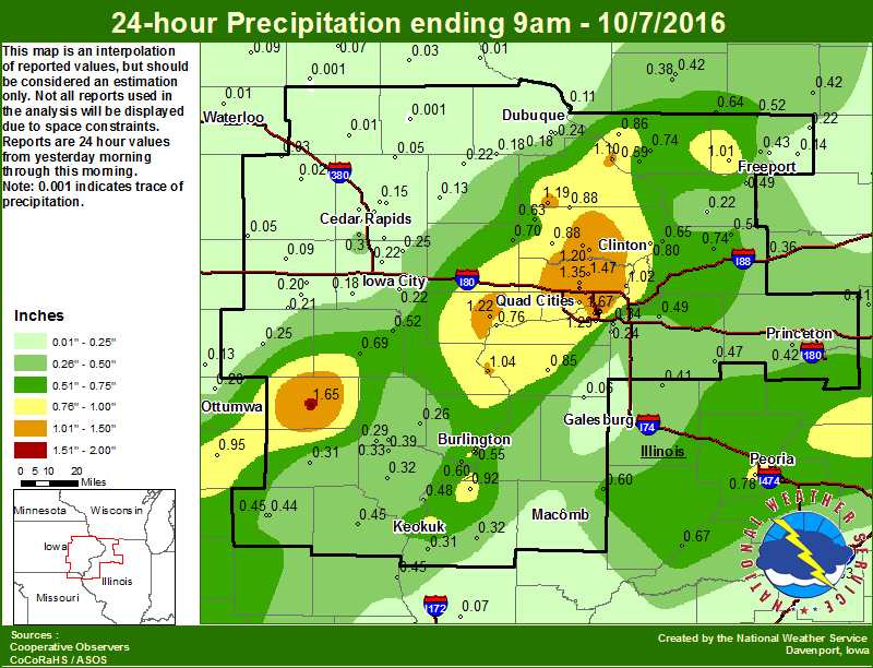
Rainfall Amounts
 |
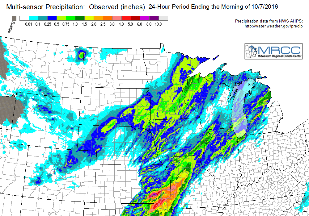 |
| Local Rainfall Map | Regional Rainfall Map |
|
|
|
|
|
|
Environment
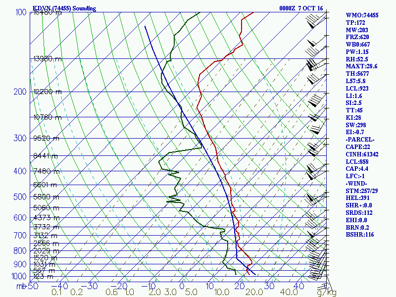 |
| 00Z 10/07/2016 SOUNDING |
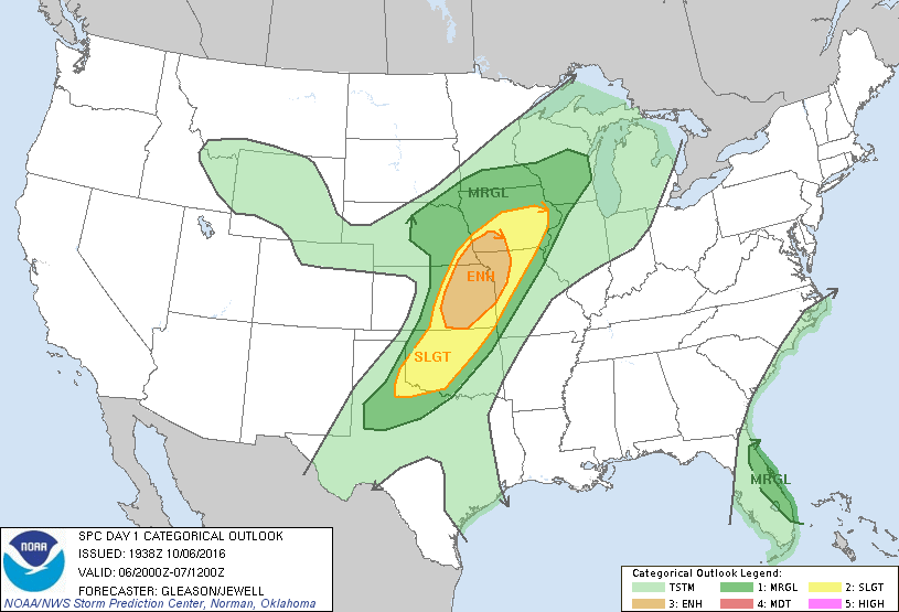
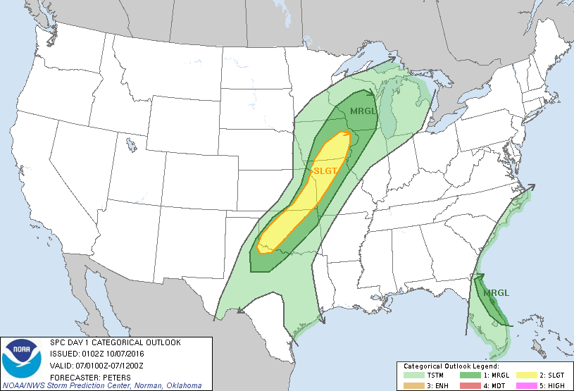
SPC OUTLOOKS
 |
 |
 |
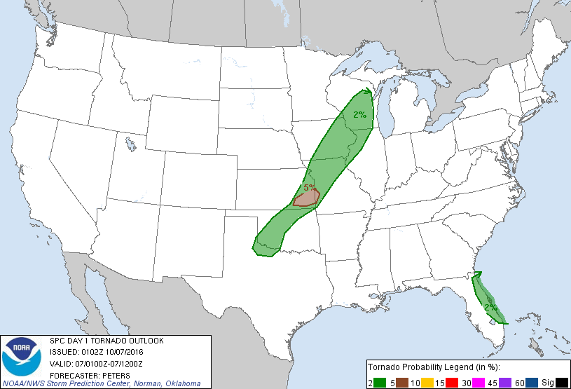 |
| DAY 1 OUTLOOK 20Z | DAY 1 TOR OUTLOOK 20Z | DAY1 OUTLOOK 01Z | DAY 1 TOR OUTLOOK 01Z |
 |
Media use of NWS Web News Stories is encouraged! Please acknowledge the NWS as the source of any news information accessed from this site. |