Overview
|
A couple of rounds of thunderstorms, some of which were severe, moved across central Indiana from the afternoon of the 17th to the early morning hours of the 18th. The severe storms produced damaging winds, which caused an injury at a campground as well as damage to a marina. |
Storm Reports
Preliminary Local Storm Report
National Weather Service Indianapolis IN
..TIME... ...EVENT... ...CITY LOCATION... ...LAT.LON...
..DATE... ....MAG.... ..COUNTY LOCATION..ST.. ...SOURCE....
..REMARKS..
0255 PM Tstm Wnd Dmg 3 SE Spring Lake 39.74N 85.81W
08/16/2025 Hancock IN Public
Picture of a tree snapped about 5 feet off
the ground. Time estimated from radar.
0447 PM Tstm Wnd Dmg 4 ESE Covington 40.13N 87.33W
08/16/2025 Fountain IN Trained Spotter
Thunderstorm winds downed power poles on
West Public Service Road and blew metal
roofing into fields on both sides of US
Highway 136 1/8 to 1/4 mile west of
Interstate 74 overpass. Time estimated from
radar.
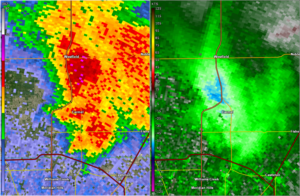
0935 PM Tstm Wnd Dmg 3 NW Westfield 40.07N 86.17W
08/16/2025 Hamilton IN Public
Home siding damage in Osborne Trails
subdivision at 193rd and Spring Mill Roads.
0935 PM Tstm Wnd Gst 1 NNW Westfield 40.06N 86.14W
08/16/2025 M59 MPH Hamilton IN Mesonet
0951 PM Tstm Wnd Dmg 2 NE Carmel 39.99N 86.09W
08/16/2025 Hamilton IN Public
Numerous trees down in a defined area of
Westfield and Carmel along with two reports
of trees on houses.
1000 PM Tstm Wnd Gst 2 N Castleton 39.93N 86.05W
08/16/2025 M62 MPH Hamilton IN AWOS
AWOS station KUMP 1 N Castleton.
1005 PM Tstm Wnd Dmg Chesterfield 40.11N 85.59W
08/16/2025 Madison IN Emergency Mngr
A few trees and power pole snapped. Time
estimated from radar.
1015 PM Tstm Wnd Gst 1 WNW Chesterfield 40.12N 85.62W
08/16/2025 M56 MPH Madison IN AWOS
AWOS station KAID Anderson Municipal Apt.
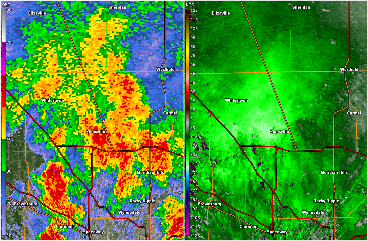
1022 PM Tstm Wnd Dmg 3 SSE Zionsville 39.91N 86.25W
08/16/2025 Marion IN Public
Several trees downed.
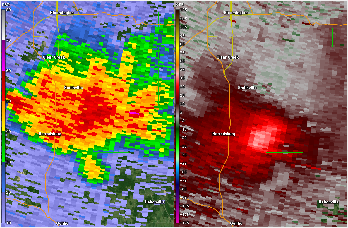
1217 AM Tstm Wnd Dmg 2 SSW Monroe Reservoir 39.03N 86.45W
08/17/2025 Monroe IN Newspaper
*** 1 INJ ***
One camper at Hardin Ridge campsite was
injured when a tree fell on her tent.
Numerous trees downed nearby.
1219 AM Tstm Wnd Dmg 1 E Fairfax State Recre 39.02N 86.48W
08/17/2025 Monroe IN Newspaper
Several areas of storm damage near the
Fourwinds marina with trees down and damage
to docks and walkways. There was some damage
to boats on the lake as well.
1234 AM Tstm Wnd Dmg 3 ENE Oolitic 38.91N 86.47W
08/17/2025 Lawrence IN Public
Multiple trees downed.
&&
$$
Radar
Selected images from the event. A loop is available.
 |
 |
 |
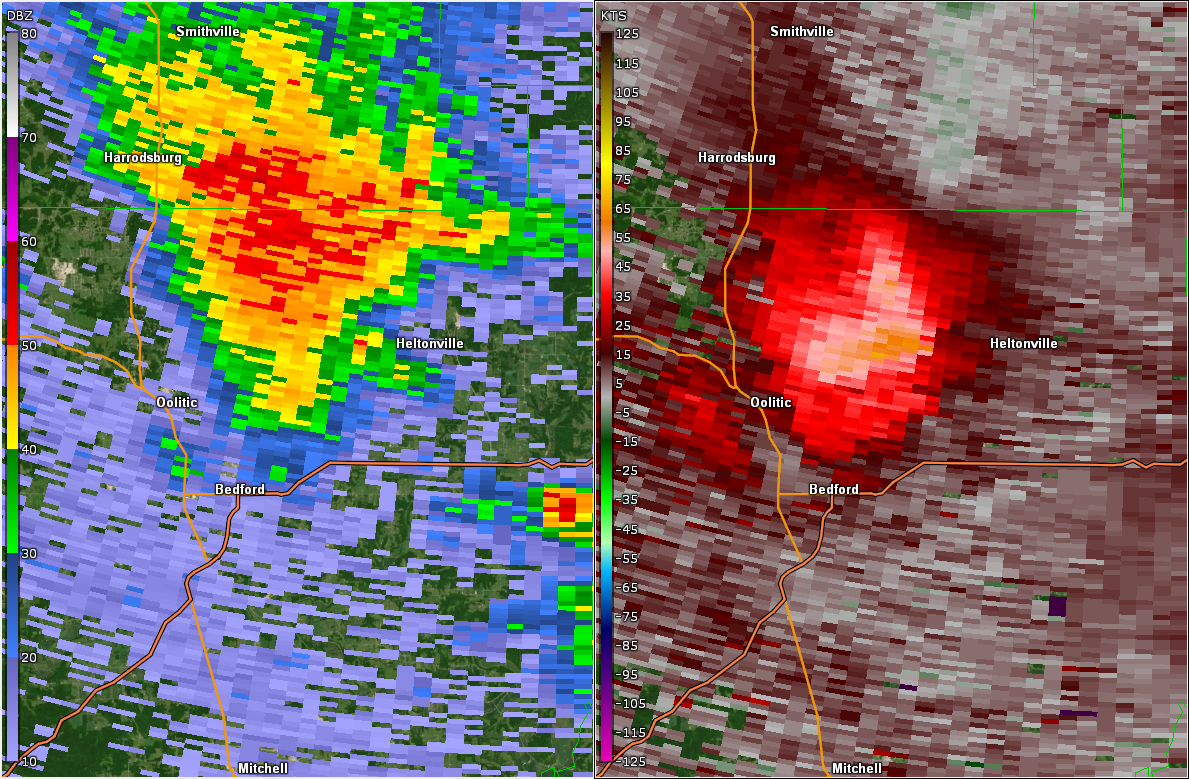 |
| Radar/Velocity image at 9:45 PM EDT. Velocity showed over 60kt inbound. | Radar/Velocity Image at 10:20 PM EDT | Radar/Velocity Image at 12:22 AM EDT | Radar/Velocity Image at 12:32 AM EDT Radar showed near 60kt outbound. |
Environment
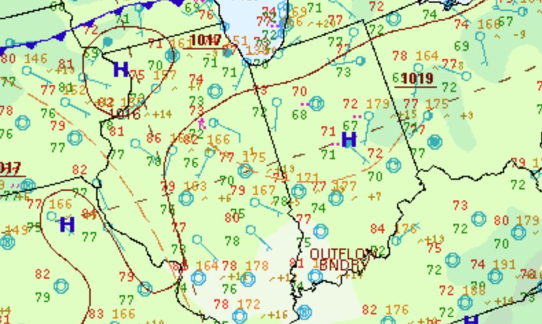
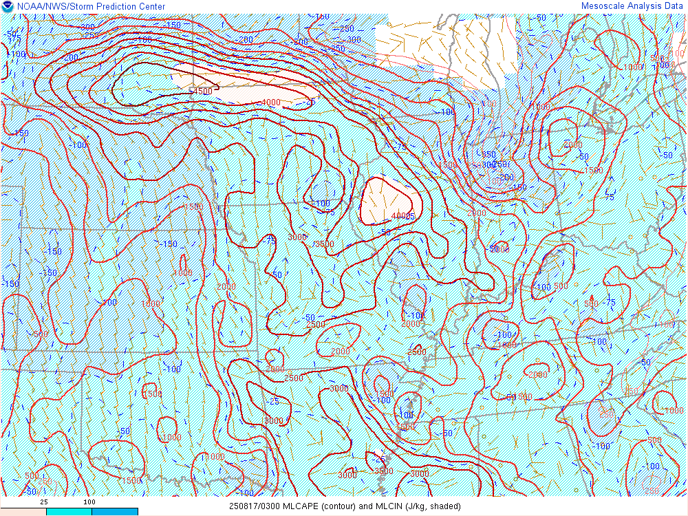
Thunderstorms developed strong outflow which allowed them to move south into unstable air.
 |
 |
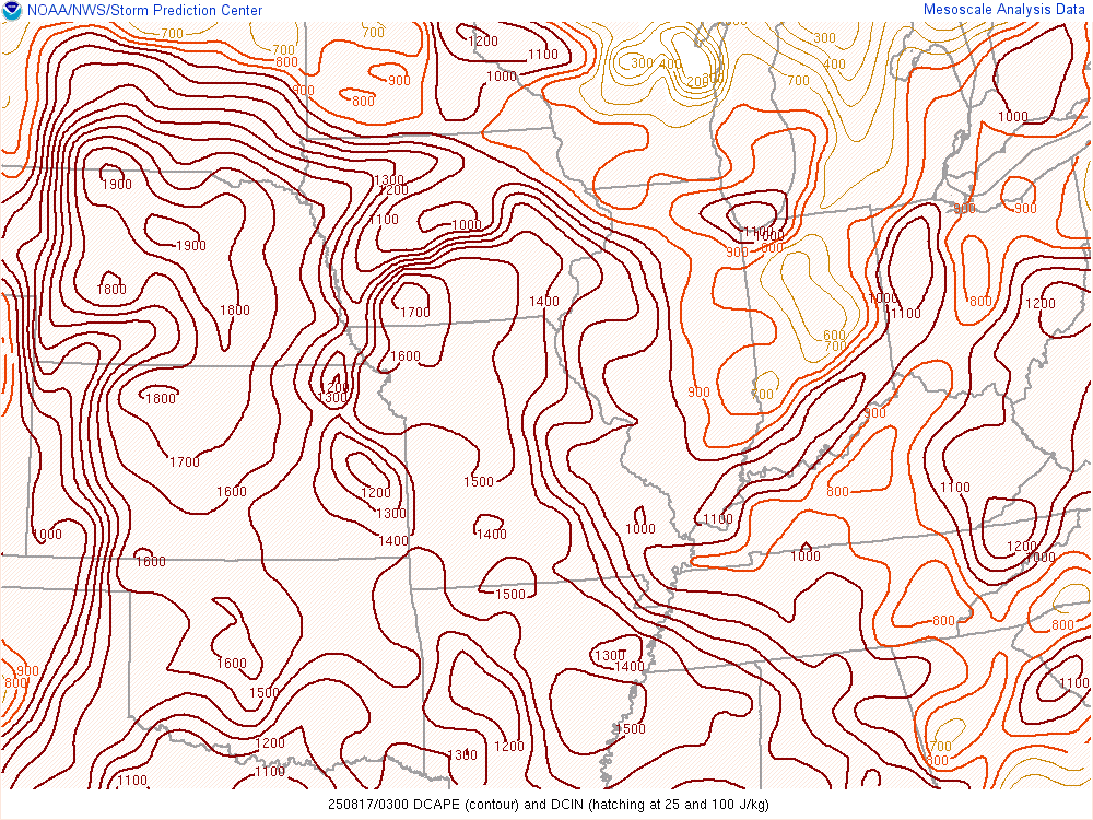 |
| Figure 1: Zoomed Surface Map at 11 PM EDT | Figure 2: Mixed Layer CAPE at 11 PM EDT | Figure 3: Downdraft CAPE at 11 PM EDT |
 |
Media use of NWS Web News Stories is encouraged! Please acknowledge the NWS as the source of any news information accessed from this site. |
|

