Indianapolis, IN
Weather Forecast Office
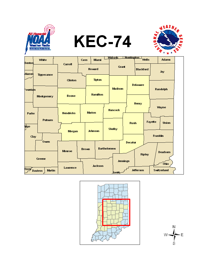
KEC-74 is a 1000 Watt transmitter broadcasting at a frequency of 162.550 MHz. Follow this link to see a detailed map of the area covered by the signal. Below is a map of counties served by the transmitter. Click to enlarge.
KEC-74 serves the following counties in central Indiana:
 |
|
Miscellaneous links:
Hazards
Hazardous Weather Outlook
Drought Information
NOAA All Hazards Radio
Graphical Hazards Outlook
Spotter Information
Outdoor Event Watcher
Local forecasts
Local Area
Aviation
Computer Model Forecasts
Fire Weather
Graphical
Precipitation
Air Quality
Text River Forecasts
Area Forecast Discussion
Central Indiana Weather Brief

US Dept of Commerce
National Oceanic and Atmospheric Administration
National Weather Service
Indianapolis, IN
6900 West Hanna Avenue
Indianapolis, IN 46241-9526
317-856-0664
Comments? Questions? Please Contact Us.


 Follow us on X
 Follow us on Facebook
 Follow us on YouTube
 IND RSS Feed