Indianapolis, IN
Weather Forecast Office
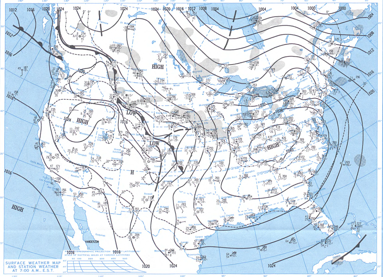
A couple of weather systems brought snow to central Indiana I the period of January 16-18, 1994. This left a layer of snow across central Indiana, with a snow depth at Indianapolis of 8 inches on the 17th, settling to 6 inches by the 19th. Behind these systems came a large area of arctic high pressure. The fresh snow, the arctic air, and relatively light winds allowed temperatures to reach all time record cold levels by the morning of the 19th. Below is a surface map valid the morning of January 19 (click to enlarge). The upper air maps are available at the bottom of this page.
 |
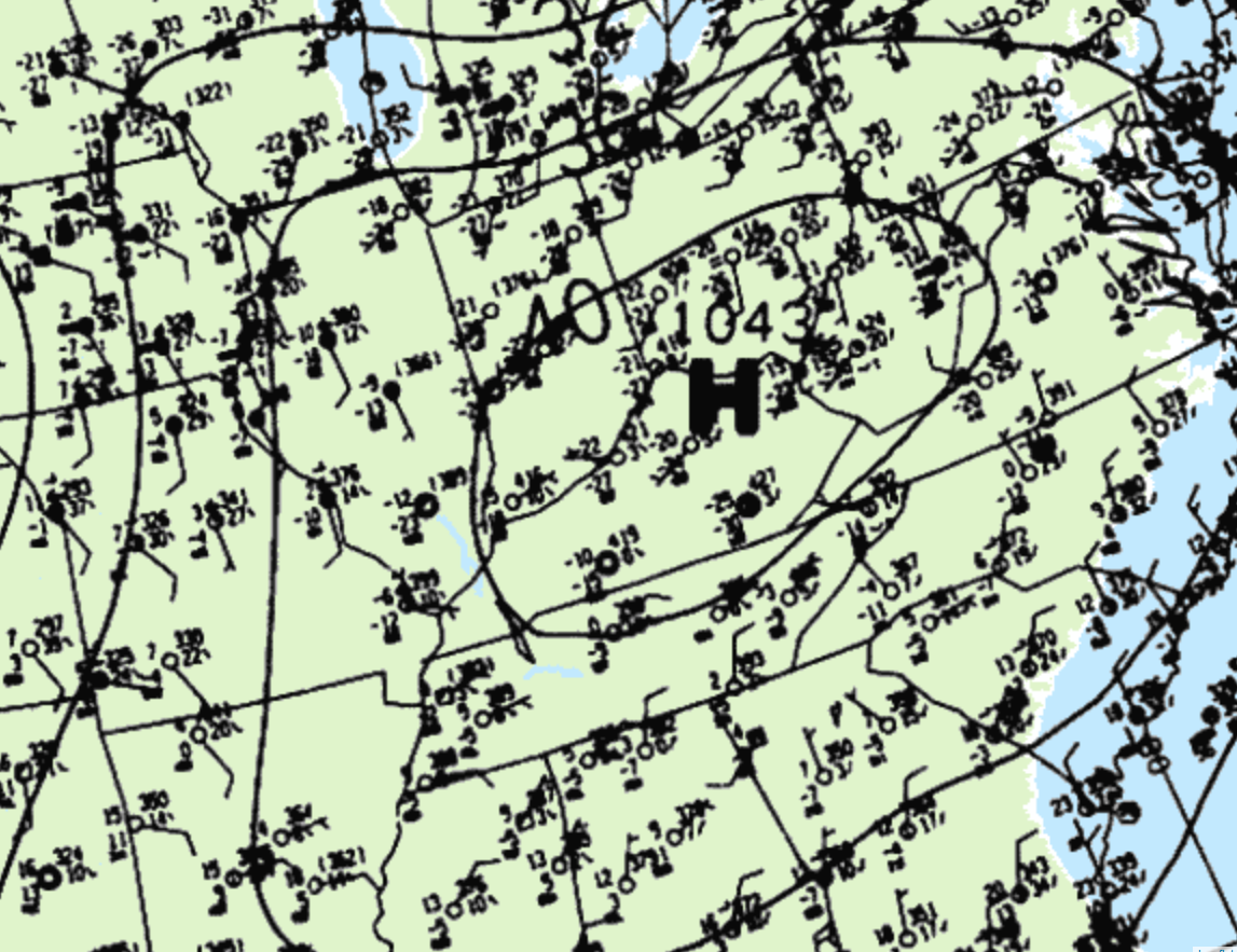 |
| Surface map at 7:00 AM Jan 19, 1994. Courtesy of NOAA Daily Weather Maps publication. | Zoomed in view of the surface map, courtesy of the Weather Prediction Center. |
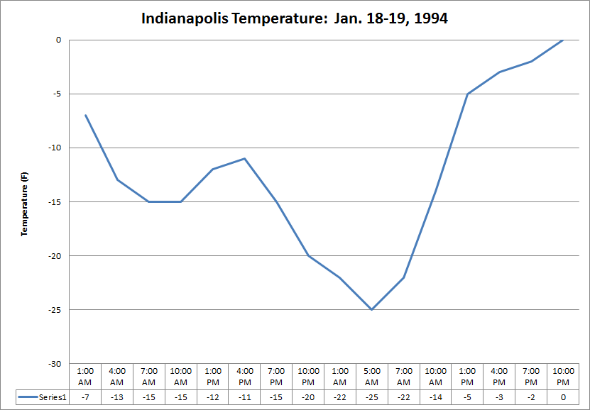
Indianapolis set its all time record low of -27 degrees (F) on January 19. Below is a graph of temperatures during the 18th and 19th at the Indianapolis International Airport.
Map of Average Min Temperature on January 19 (courtesy of Midwest Climate Center). Click the image for a larger version.
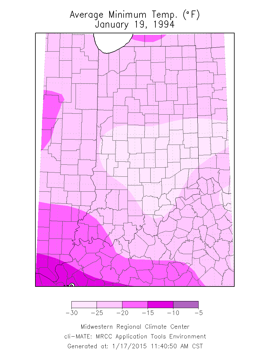
The all time record low temperature for the state of Indiana was recorded on January 19, -36 (F) at New Whiteland.
Below is the upper air reanalysis for the evening of January 18. Click to enlarge.
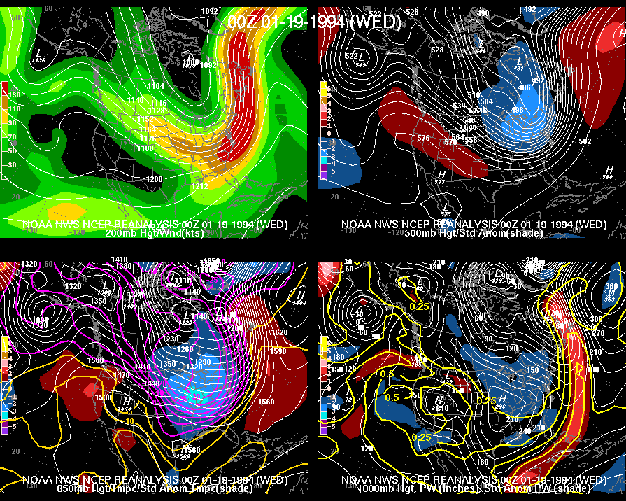
Upper air maps. Click to enlarge.
Hazards
Graphical Hazards Outlook
Spotter Information
Outdoor Event Watcher
Hazardous Weather Outlook
Drought Information
NOAA All Hazards Radio
Local forecasts
Local Area
Aviation
Computer Model Forecasts
Fire Weather
Graphical
Precipitation
Air Quality
Text River Forecasts
Area Forecast Discussion
Central Indiana Weather Brief
US Dept of Commerce
National Oceanic and Atmospheric Administration
National Weather Service
Indianapolis, IN
6900 West Hanna Avenue
Indianapolis, IN 46241-9526
317-856-0664
Comments? Questions? Please Contact Us.

