Indianapolis, IN
Weather Forecast Office
Overview
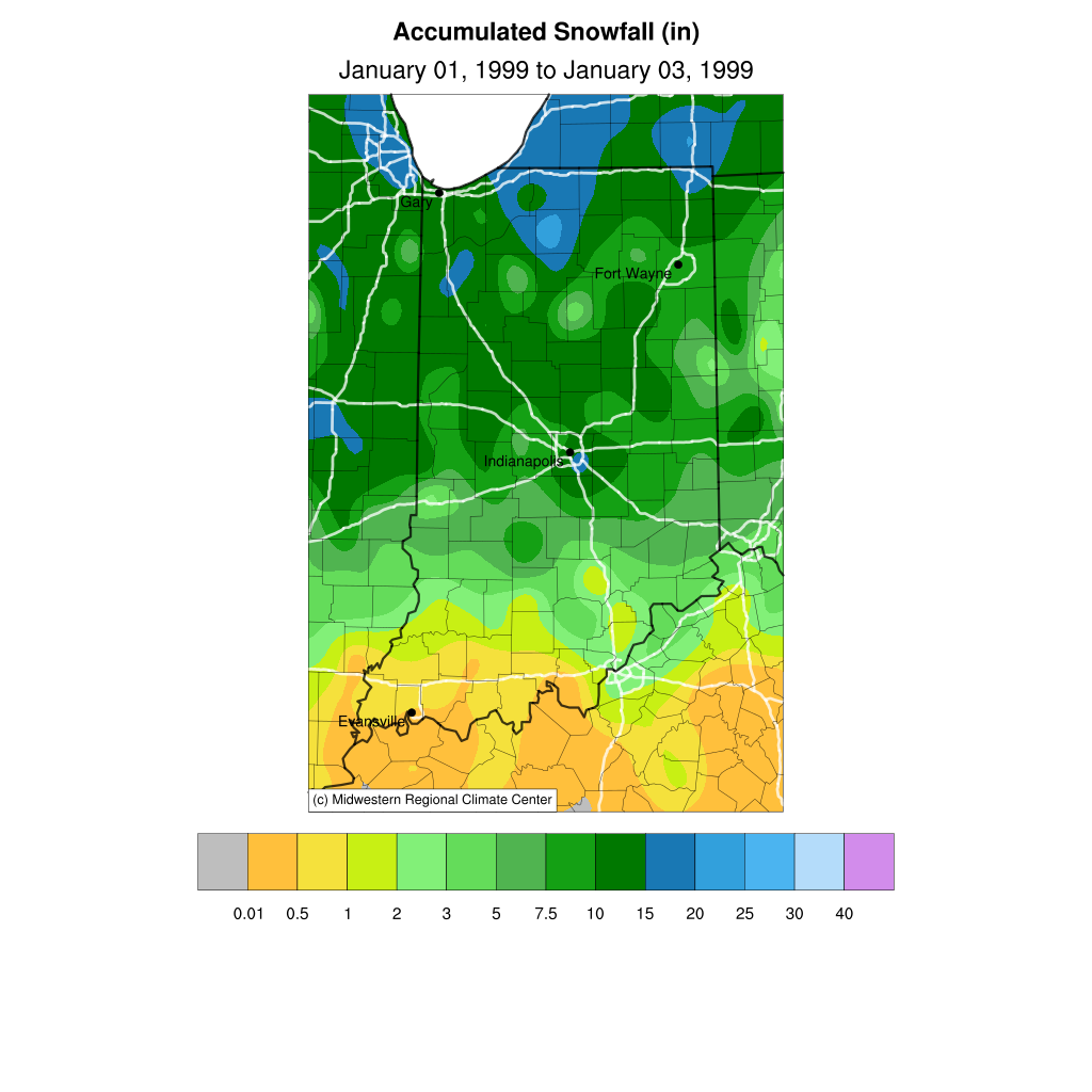
A strong low pressure system brought heavy snow as well as sleet and freezing rain to central Indiana from January 1 to January 3, 1999. Some areas received over 10 inches of snow. After the snow fell, a 4 hour period of sleet followed by 4 to 6 hours of freezing rain fell. The freezing rain caused significant additional icing of the snow cover. Temperatures falling into the single digits on the third of January and below zero on the fourth created a solid layer of ice and snow. This resulted in an extremely hard accumulation to remove by plows. For example, a large number of plow blades were broken in Vigo County.Snow/Ice
The highest snowfall amounts were across northern sections of central Indiana. The map below is courtesy of the Midwest Regional Climate Center. Click the image for a larger version.
Environment
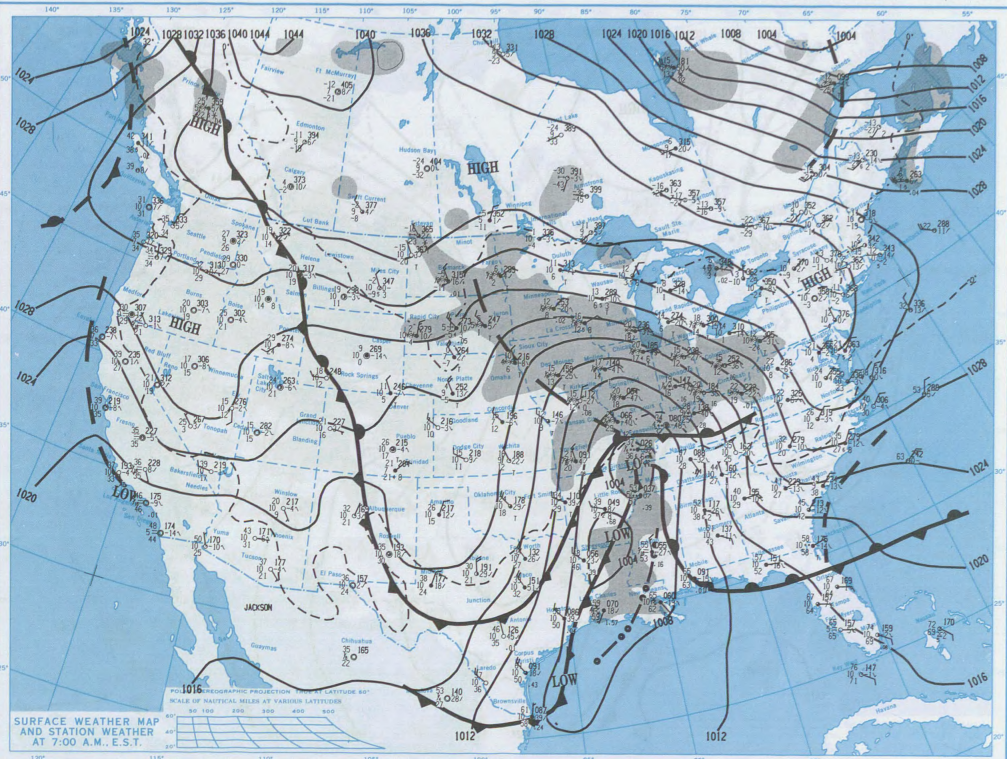
An upper level trough created a strong surface low, which then produced the winter precipitation across central Indiana. The surface low had plentiful moisture from the Gulf of America to work with.
The image below is a surface map for the morning of January 2, 1999. The image comes from the Daily Weather Maps publication. Click the image for a larger version.
 |
Media use of NWS Web News Stories is encouraged! Please acknowledge the NWS as the source of any news information accessed from this site. |
|
Hazards
NOAA All Hazards Radio
Graphical Hazards Outlook
Spotter Information
Outdoor Event Watcher
Hazardous Weather Outlook
Drought Information
Local forecasts
Local Area
Aviation
Computer Model Forecasts
Fire Weather
Graphical
Precipitation
Air Quality
Text River Forecasts
Area Forecast Discussion
Central Indiana Weather Brief
US Dept of Commerce
National Oceanic and Atmospheric Administration
National Weather Service
Indianapolis, IN
6900 West Hanna Avenue
Indianapolis, IN 46241-9526
317-856-0664
Comments? Questions? Please Contact Us.

