2025's weather included multiple tornadoes as well as a return to an active winter. Here are the top events of the year, in chronological order. All past events can be found on our events page. A summary of all Indiana tornadoes can be found in this statement.
Radar/Storm Relative Velocity image of a tornado in Parke County
A potent low pressure system generated a line of strong to severe thunderstorms that moved across central Indiana. Storms ahead of the line also become severe. Widespread wind damage along with a few tornadoes occurred. Tens of thousands of people were without power. (more info)
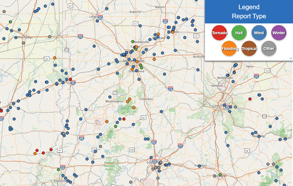
Map of Storm Reports
A strong low pressure system generated a line of strong to severe thunderstorms that started in Illinois and moved across central Indiana. Multiple severe storms were embedded within the line and some of these produced tornadoes. In addition to the tornadoes widespread wind damage occurred with gusts over 80+ mph reported. (more info)
A meandering surface front with waves of low pressure along it generated periods of heavy rain across central Indiana from April 2 to April 5. Rain totals in a 96-hour period reached over 7 inches in some areas, with weekly totals over 8 inches. The heavy rain falling in short time periods caused flash flooding. Extensive river flooding followed, with some areas seeing the highest river levels since 2008.
The Big Blue River at Shelbyville had its highest crest since 1913. (more info)
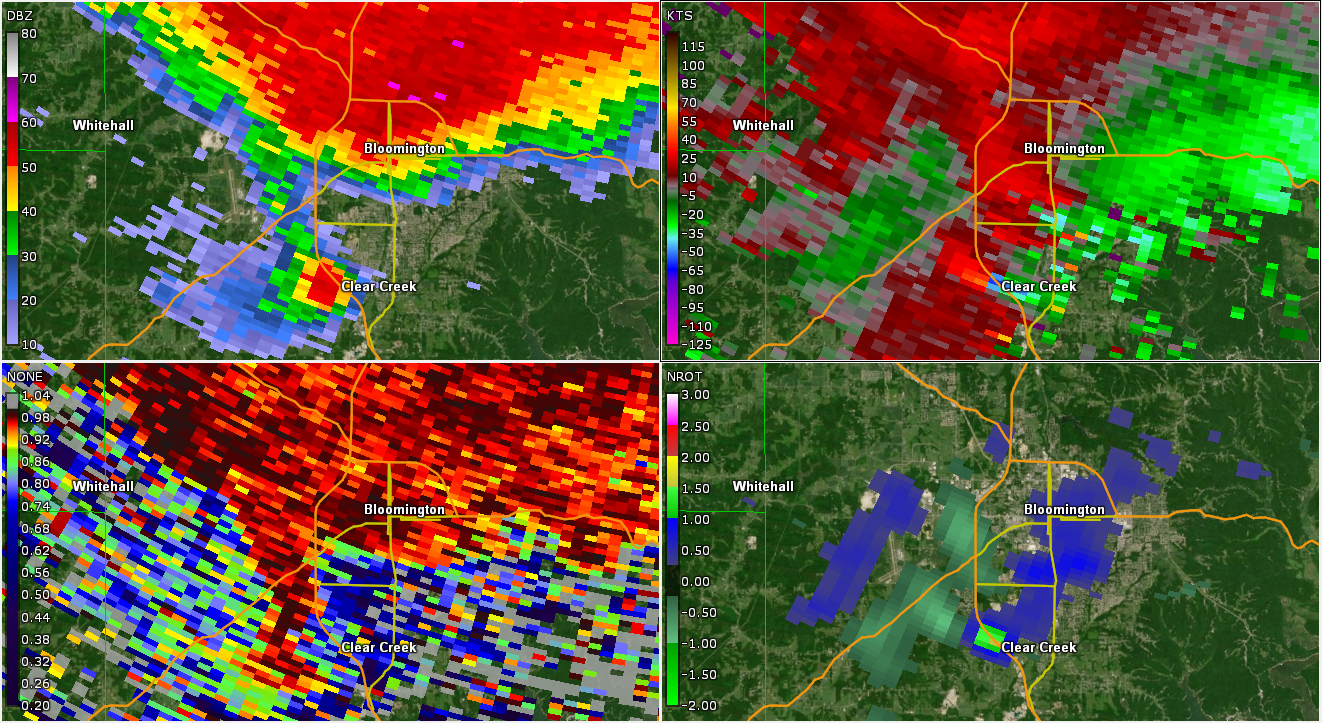
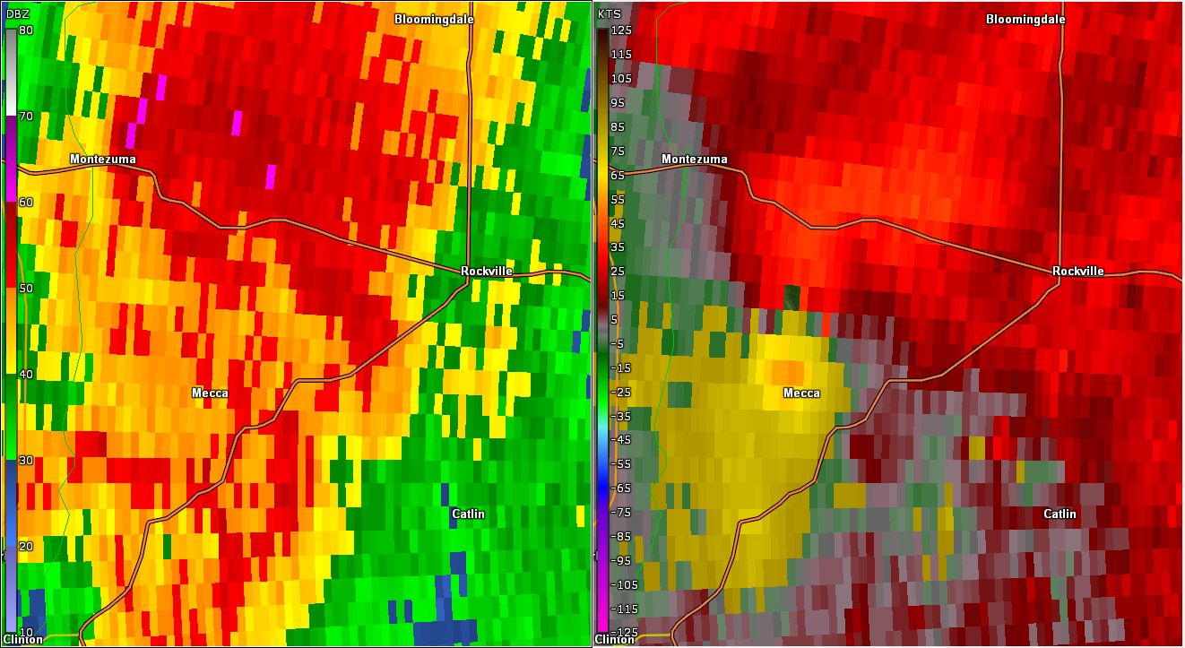
Different Radar Products for a Tornadic Storm Near Bloomington
Numerous strong to severe thunderstorms developed in the late afternoon of May 16 and moved across central Indiana into the evening. Multiple tornadoes, hail up to around 4 inches in diameter, and widespread wind damage occurred. Winds gusted over 80 mph in some areas. (more info)
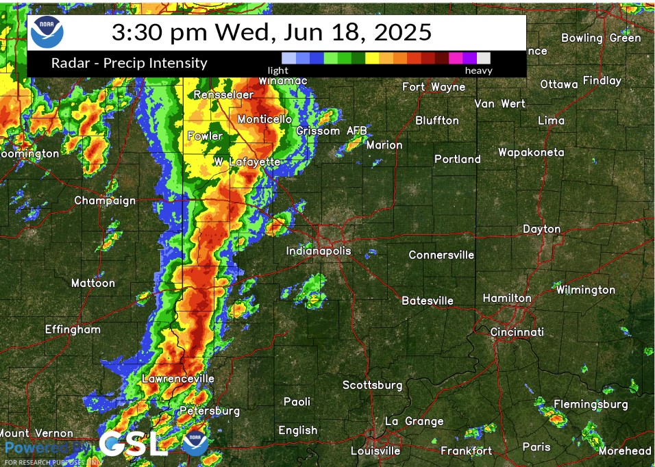
Radar Image from the Event
A line of strong to severe thunderstorms moved through central Indiana during the afternoon of June 18. The storms produced widespread wind damage, including downed trees and utility lines. Many power outages were reported.
Two brief tornadoes caused damage west and northwest of Lafayette. (more info)
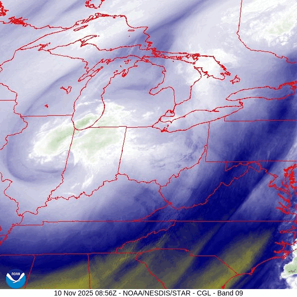
Water Vapor Satellite Loop
A system along with influence from Lake Michigan brought snow up to a few inches in central Indiana, with much higher totals closer to Lake Michigan. 1.3 inches of snow fell at Indianapolis on November 10, setting a daily record. The city had not recorded so much snow that early in the season since 2.4 inches fell on October 30, 1993. (The total snowfall at Indy was 1.8 inches for November 9-10). (more info)
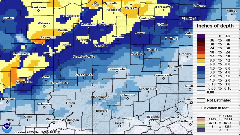
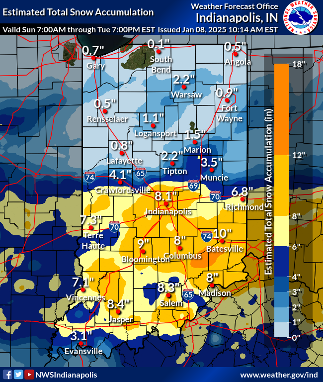
Snowfall Map
A system brought snow to central Indiana, with amounts ranging from less than an inch south to around 8 inches in the northwest. A dry layer in the atmosphere limited snowfall amounts in the I-70 corridor. The 1.7 inches of snowfall at Indianapolis for November 29 set a new record for the date and was only the fifth October or November day to measure 1.7 inches or greater at Indy since 1998. (more info)

Snowfall Map
Two different clipper systems moved through central Indiana followed by a surge of cold air between December 11-15, 2025. This brought multiple rounds of snow to the area as well as record cold temperatures. A record Low Maximum temperature of 7°F was set at Indianapolis on 12/14 (old record was 9°F in 1963), making it only the city's second December day held to 7°F or lower since 2004. (more info)

