Overview
|
A strong low pressure system brought wind gusts over 60 mph to central Indiana on March 13. Some trucks were blown off the road, numerous power outages occurred, and some tree and structural damage were reported. |
Highest Wind Speeds
Public Information Statement
National Weather Service Indianapolis IN
948 PM EDT Fri Mar 13 2026

...CENTRAL INDIANA PEAK WIND GUST REPORTS ON MARCH 13, 2026...

COUNTY      Location               Speed    Time/Date    Source

DELAWARE    Muncie 3 N            67 MPH   208 PM 3/13   ASOS
MARION      Indianapolis Intl AP  62 MPH   149 PM 3/13   ASOS
HOWARD      Kokomo 5 NE           61 MPH   230 PM 3/13   AWOS
MARION      Monument Circle 1 NW  61 MPH   140 PM 3/13   Local Govt
SHELBY      Shelbyville 4 NNW     58 MPH  1226 PM 3/13   ASOS
DELWARE     Mount Pleasant 1 SW   58 MPH   235 PM 3/13   Mesonet
TIPPECANOE  Purdue Univ 2 SW      58 MPH  1154 AM 3/13   ASOS
-------------------------------------------------------------------
BOONE       Whitestown 1.8 SE     56 MPH   140 PM 3/13   Mesonet
MORGAN      Martinsville          56 MPH   156 PM 3/13   Public
SHELBY      New Palestine 2 SSE   56 MPH   245 PM 3/13   Mesonet
CLINTON     Frankfort 3 WSW       55 MPH  1215 PM 3/13   AWOS
BOONE       Zionsville 6 NNE      54 MPH  1235 PM 3/13   AWOS
DELAWARE    Cowan 2 NNW           54 MPH   215 PM 3/13   Mesonet
HANCOCK     Mount Comfort 1 NNE   54 MPH   127 PM 3/13   AWOS
MARION      Eagle Creek Airpark   54 MPH   103 PM 3/13   ASOS
PARKE       Bellmore 2 NNE        54 MPH  1252 PM 3/13   Mesonet
CARROLL     Camden 2 ENE          53 MPH  1154 AM 3/13   Public
HENDRICKS   Danville 2 ESE        53 MPH   107 PM 3/13   AWOS
PUTNAM      Greencastle           53 MPH  1255 PM 3/13   Spotter
RANDOLPH    Farmland 5 NNW        53 MPH   250 PM 3/13   Mesonet
JOHNSON     Greenwood 1 NE        52 MPH   135 PM 3/13   AWOS
MONTGOMERY  Crawfordsville 5 S    52 MPH  1215 PM 3/13   AWOS
HANCOCK     Greenfield 3 WNW      51 MPH   200 PM 3/13   Mesonet
HAMILTON    Castleton 1 N         49 MPH  1052 AM 3/13   AWOS
MONROE      Bloomington 5 WSW     48 MPH  1156 AM 3/13   ASOS
RANDOLPH    Lynn 4 WNW            48 MPH   255 PM 3/13   Mesonet
VIGO        Terre Haute 5 ESE     48 MPH  1123 AM 3/13   ASOS
MARION      Grandview             47 MPH   200 PM 3/13   Mesonet
TIPTON      Kempton 4 ENE         47 MPH  1235 PM 3/13   Mesonet
HAMILTON    Sheridan Airport      46 MPH   125 PM 3/13   Mesonet
HOWARD      Dunlap Family Farm    46 MPH  1150 AM 3/13   Mesonet
SHELBY      Edinburgh 3 E         46 MPH   945 AM 3/13   Mesonet
TPPECANOE   Lafayette 8 S         46 MPH   635 AM 3/13   Mesonet
CLINTON     Antioch 2 S           45 MPH  1215 PM 3/13   Mesonet
HENRY       New Castle 3 SW       45 MPH  1230 PM 3/13   Mesonet
MARION      Homecroft 3 N         45 MPH  1230 PM 3/13   Mesonet
PARKE       Nyesville 1 NE        45 MPH  1228 PM 3/13   Mesonet
-------------------------------------------------------------------
GREENE      Shawnee Field         44 MPH   915 AM 3/13   Mesonet
TIPPECANOE  Martell Forest        44 MPH   225 PM 3/13   Mesonet
TIPTON      Tipton 1 NW           44 MPH   200 PM 3/13   Mesonet
VERMILLION  Fairview Park         44 MPH   100 PM 3/13   Mesonet
WARREN      Pine Village 3 ESE    44 MPH  1145 AM 3/13   Mesonet
HAMILTON    Noblesville 4 SE      43 MPH   130 PM 3/13   Public
MADISON     Summitville 4 WNW     43 MPH   225 PM 3/13   Mesonet
OWEN        Stinesville 3 W       43 MPH   546 AM 3/13   Public
RUSH        Rushville 1 NW        43 MPH   200 PM 3/13   Mesonet
MORGAN      Monrovia 2 NE         42 MPH  1203 PM 3/13   Mesonet
DELAWARE    Yorktown 3 NNE        41 MPH   315 PM 3/13   Mesonet
HENDRICKS   Brownsburg 4 NNE      41 MPH   100 PM 3/13   Mesonet
HENRY       Knightstown 3 WNW     41 MPH   300 PM 3/13   Mesonet
HOWARD      Judson 3 W            41 MPH   848 AM 3/13   Mesonet
LAWRENCE    Bedford 2 ESE         41 MPH  1050 AM 3/13   AWOS
MADISON     Pendleton 2 SSE       41 MPH   215 PM 3/13   Mesonet
DELAWARE    Gaston 2 NNE          40 MPH   215 PM 3/13   Mesonet
HANCOCK     Greenfield 5 ENE      40 MPH   225 PM 3/13   Mesonet
PUTNAM      Heritage Dam          40 MPH   205 PM 3/13   Mesonet


Observations are collected from a variety of sources with varying
equipment and exposures. We thank all volunteer weather observers
for their dedication. Not all data listed are considered official.
Storm Reports
Preliminary Local Storm Report...Summary
National Weather Service Indianapolis IN
848 PM EDT Fri Mar 13 2026

..TIME...   ...EVENT...      ...CITY LOCATION...     ...LAT.LON...
..DATE...   ....MAG....      ..COUNTY LOCATION..ST.. ...SOURCE....
            ..REMARKS..

1154 AM     Non-Tstm Wnd Gst 2 E Camden              40.62N 86.51W
03/13/2026  M53 MPH          Carroll            IN   Public

            Carroll Schools lost power before 11:20 AM
            and school was dismissed early.

1154 AM     Non-Tstm Wnd Gst 2 SW Purdue University  40.41N 86.94W
03/13/2026  M58 MPH          Tippecanoe         IN   ASOS

            Corrects previous non-tstm wnd gst report
            from 2 SW Purdue University.

1226 PM     Non-Tstm Wnd Gst 3 ESE Fairland          39.58N 85.81W
03/13/2026  M58 MPH          Shelby             IN   ASOS


1255 PM     Non-Tstm Wnd Gst 1 NNW Greencastle       39.66N 86.85W
03/13/2026  M53 MPH          Putnam             IN   Trained Spotter


0100 PM     Non-Tstm Wnd Dmg 1 SE Noblesville        40.04N 86.02W
03/13/2026                   Hamilton           IN   Public

            Time is very roughly estimated. Large amount
            of branches down, patio furniture and
            outdoor things blown about.

0103 PM     Non-Tstm Wnd Gst 1 SSE Eagle Creek Reser 39.83N 86.30W
03/13/2026  M54 MPH          Marion             IN   ASOS


0110 PM     Non-Tstm Wnd Dmg 1 SE Rocky Ripple       39.84N 86.16W
03/13/2026                   Marion             IN   Emergency Mngr

            Time is approximate. A large tree was blown
            down onto a house at 5007 Boulevard Place in
            Indianapolis that penetrated the second
            level.

0140 PM     Non-Tstm Wnd Gst 1 NW Indianapolis       39.79N 86.16W
03/13/2026  M61 MPH          Marion             IN   Local Official


0149 PM     Non-Tstm Wnd Gst Indianapolis Int'l Airp 39.72N 86.30W
03/13/2026  M62 MPH          Marion             IN   ASOS


0153 PM     Non-Tstm Wnd Dmg 3 NE Eagle Creek Reserv 39.88N 86.28W
03/13/2026                   Marion             IN   Public

            Sections of privacy fence were blown down
            along a parking lot at Fox 59 and CBS 4
            studios. Time reflects time report was
            received.

0156 PM     Non-Tstm Wnd Gst Martinsville            39.43N 86.42W
03/13/2026  M56 MPH          Morgan             IN   Public

            Delayed report due to Internet outage. Small
            tree branches were blown down.

0203 PM     Non-Tstm Wnd Dmg 4 NE Elwood             40.33N 85.79W
03/13/2026                   Madison            IN   Emergency Mngr

            Approximate location. Time shown is time the
            report was received. Gradient winds blew
            over a semi on SR 37 North of Elwood. EMA
            units are enroute and nearby SR 13 will be
            shut down.

0208 PM     Non-Tstm Wnd Gst 2 SW Royerton           40.24N 85.40W
03/13/2026  M67 MPH          Delaware           IN   ASOS


0209 PM     Non-Tstm Wnd Dmg 2 SE Goldsmith          40.27N 86.13W
03/13/2026                   Tipton             IN   Public

            Time shown is time the report was received.
            Semi blown over.

0213 PM     Non-Tstm Wnd Dmg Muncie                  40.20N 85.39W
03/13/2026                   Delaware           IN   Emergency Mngr

            Time shown is time the report was received.
            Location does not reflect the actual
            location but rather represents the county as
            a whole Multiple reports of downed trees and
            lines throughout Delaware County blocking
            roadways. 2 reports of semi rollovers on
            I-69 I-69 236MM NB I-69 250MM SB.

0216 PM     Non-Tstm Wnd Dmg 2 ENE Columbus          39.22N 85.89W
03/13/2026                   Bartholomew        IN   Emergency Mngr

            Time shown is time the report was received.
            Wires hanging down between 25th Street and
            50 N.

0216 PM     Non-Tstm Wnd Dmg 6 ENE Gnaw Bone         39.21N 86.05W
03/13/2026                   Bartholomew        IN   Public

            Time shown is the time the report was
            received. Four or five calls received from
            the Columbus area, including one from this
            general area...Baker Hollow neighborhood.

0223 PM     Non-Tstm Wnd Dmg 2 E Camden              40.62N 86.51W
03/13/2026                   Carroll            IN   Trained Spotter

            Tree branch 3.5 inches in diameter blown
            down from a healthy oak tree.

0230 PM     Non-Tstm Wnd Gst 5 NE Kokomo             40.53N 86.06W
03/13/2026  M61 MPH          Howard             IN   AWOS


0233 PM     Non-Tstm Wnd Dmg 1 ESE Woodlawn Heights  40.11N 85.68W
03/13/2026                   Madison            IN   Trained Spotter

            Time is the time the report was received.
            Minor brick facade damage to a building in
            downtown Anderson.

0240 PM     Non-Tstm Wnd Dmg 1 NE Ball State Univers 40.20N 85.40W
03/13/2026                   Delaware           IN   Public

            Roof shingles blown off and damaged on
            apartment building and homes.

0250 PM     Non-Tstm Wnd Dmg 5 NE Elwood             40.33N 85.79W
03/13/2026                   Madison            IN   Emergency Mngr

            Time shown reflects the time the report was
            received. Overturned semi on State Road 37
            and 1550 North.

0309 PM     Non-Tstm Wnd Dmg 2 S Muncie              40.17N 85.38W
03/13/2026                   Delaware           IN   Public

            Corrects previous non-tstm wnd dmg report
            from 2 S Muncie. Approximate location that
            was simply described as south side of
            Muncie. Time is time the report was
            received. Roof damage to business.
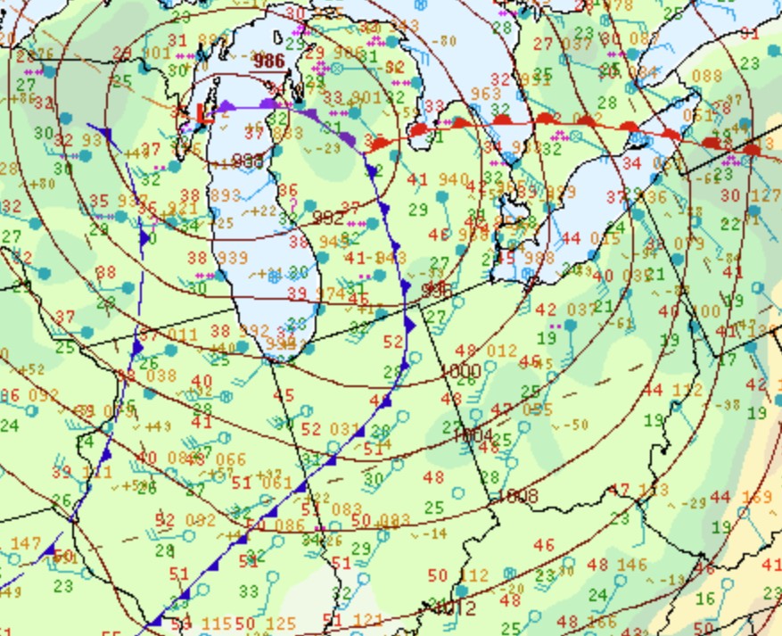
Environment
Insert synoptic summary.
 |
 |
 |
| Figure 1: Surface Map at 11:00 AM EDT | Figure 2: 2 Hour Surface Pressure Change at Noon EDT | Figure 3: 925mb Plot at Noon EDT |
 |
 |
| Figure 4: 850mb Plot at Noon EDT | Figure 5: 500mb Plot at Noon EDT |
 |
Media use of NWS Web News Stories is encouraged! Please acknowledge the NWS as the source of any news information accessed from this site. |
|

