Indianapolis, IN
Weather Forecast Office
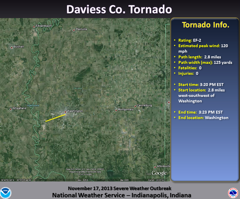
Damage Path (Click to enlarge):
Tornado Information:
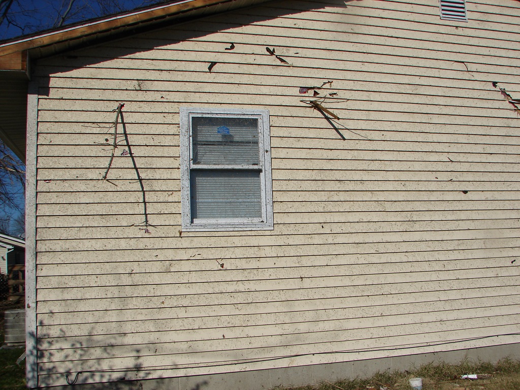
RATING: EF-2 ESTIMATED PEAK WIND: 120 MPH PATH LENGTH /STATUTE/: 2.8 MILES PATH WIDTH /MAXIMUM/: 125 YARDS FATALITIES: 0 INJURIES: 0 START DATE: NOVEMBER 17 2013 START TIME: 320 PM EST START LOCATION: 2.8 MILES WSW OF WASHINGTON START LAT/LON: 38.6420/-87.2224 END DATE: NOVEMBER 17 2013 END TIME: 323 PM EST END LOCATION: WASHINGTON END LAT/LON: 38.6546/-87.1730 THE TORNADO MOVED INTO THE SOUTHWEST SIDE OF WASHINGTON...WITH PROPERTY DAMAGE IN THE CITY OF WASHINGTON. AN ENTIRE HOME WAS KNOCKED OFF OF ITS FOUNDATION NEAR THE INTERSECTION OF FOURTH AND SYCAMORE STREETS. |
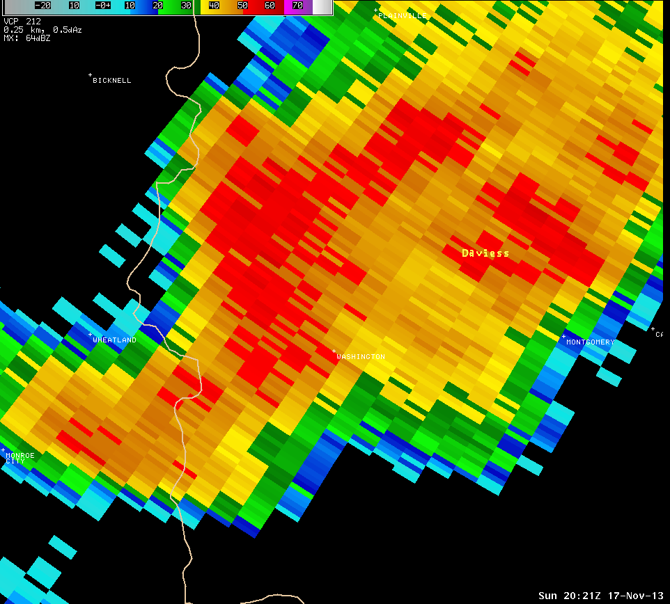
Radar Imagery: (Click to enlarge)
 |
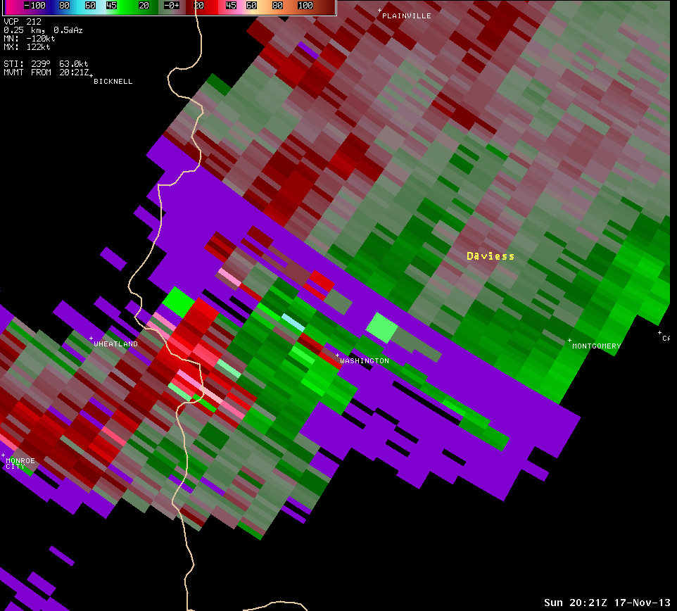 |
| Radar image at 3:21 PM EST centered on Daviess County. | Storm Relative Motion image from 3:21 PM for the same area. Radar is off to the northeast of this location. Green indicates winds toward the radar while reds indicate winds away from the radar. Purple indicates unavailable motion (range folding). At this distance from the radar, the radar is looking at mainly the mid levels of the storm. |
Damage Pictures: (click to enlarge)
 |
 |
|
|
|
||
Hazards
Outdoor Event Watcher
Hazardous Weather Outlook
Drought Information
NOAA All Hazards Radio
Graphical Hazards Outlook
Spotter Information
Local forecasts
Local Area
Aviation
Computer Model Forecasts
Fire Weather
Graphical
Precipitation
Air Quality
Text River Forecasts
Area Forecast Discussion
Central Indiana Weather Brief
US Dept of Commerce
National Oceanic and Atmospheric Administration
National Weather Service
Indianapolis, IN
6900 West Hanna Avenue
Indianapolis, IN 46241-9526
317-856-0664
Comments? Questions? Please Contact Us.


