Overview
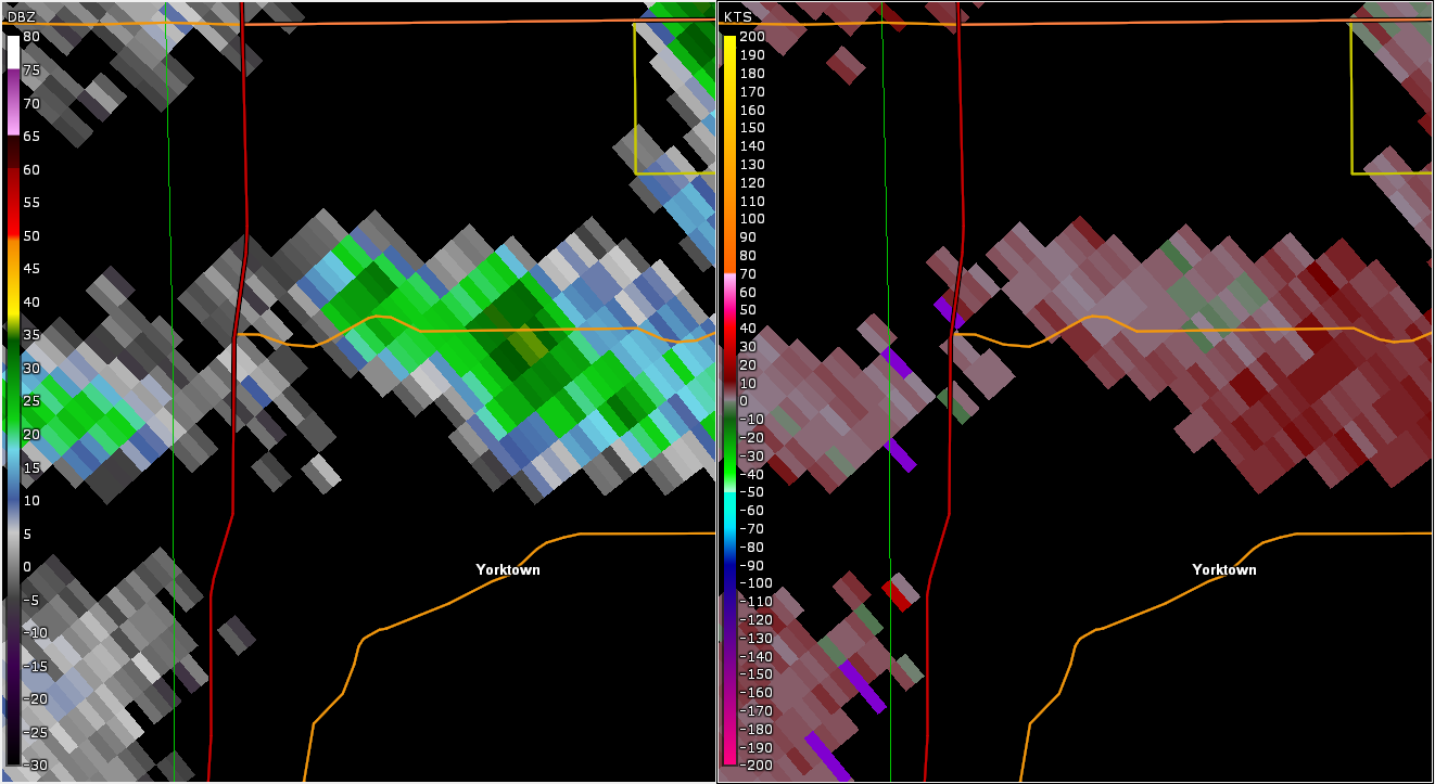
A landspout tornado developed from a shower across Delaware County. The tornado damaged one building near Yorktown.Tornadoes
|
Landspout Tornado - Near Yorktown
Track Map 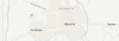 
|
||||||||||||||||
|
||||||||||||||||
The Enhanced Fujita (EF) Scale classifies tornadoes into the following categories:
| EF0 Weak 65-85 mph |
EF1 Moderate 86-110 mph |
EF2 Significant 111-135 mph |
EF3 Severe 136-165 mph |
EF4 Extreme 166-200 mph |
EF5 Catastrophic 200+ mph |
 |
|||||
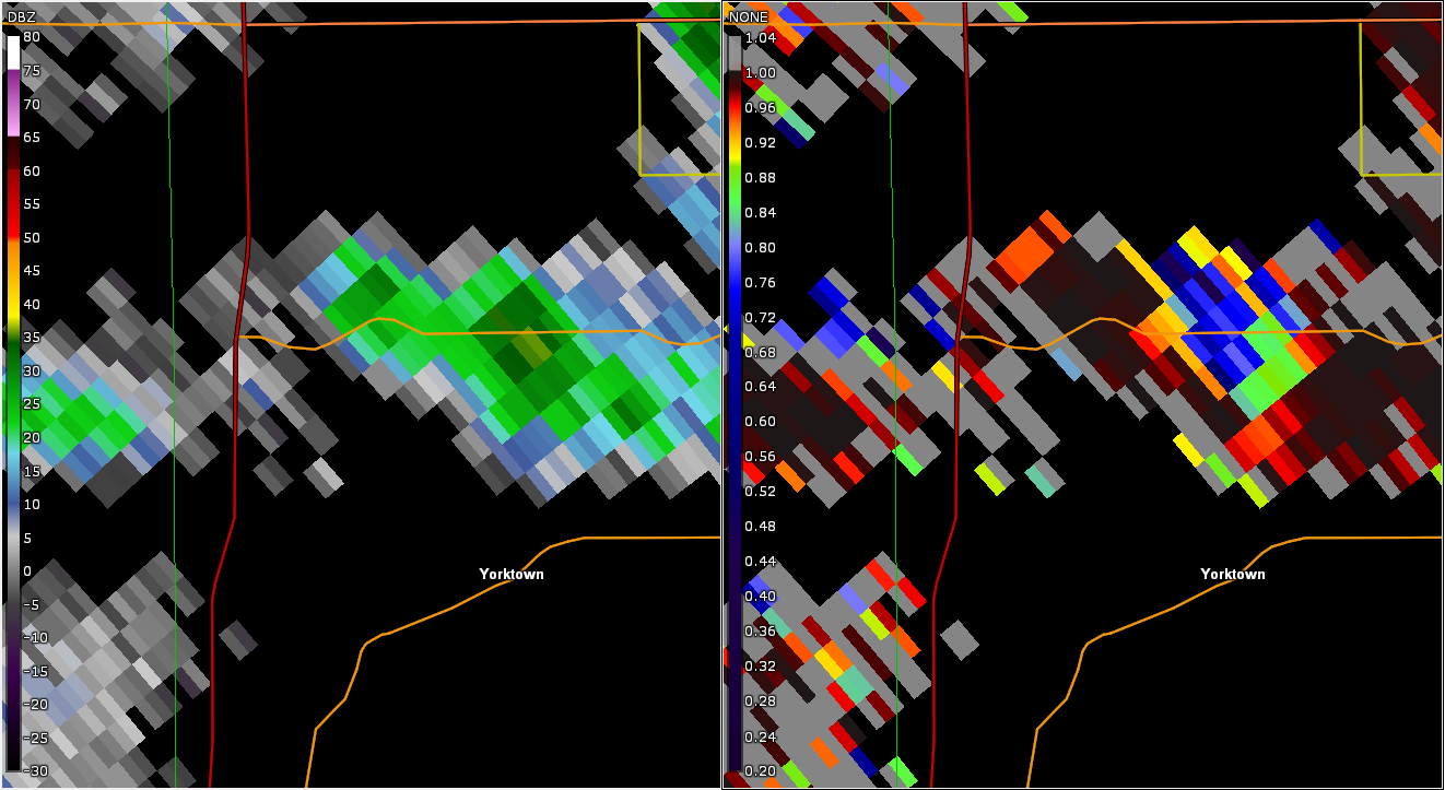
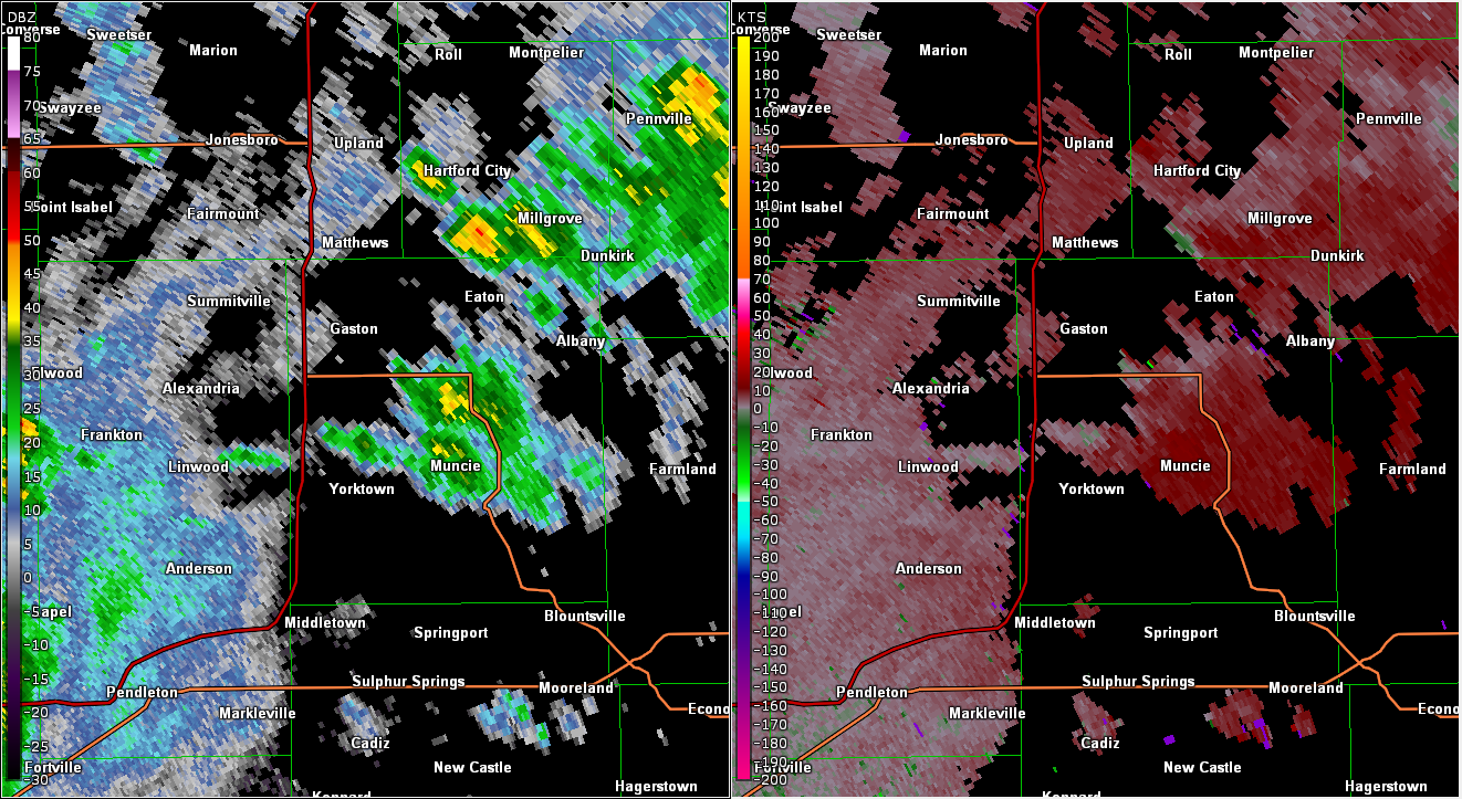
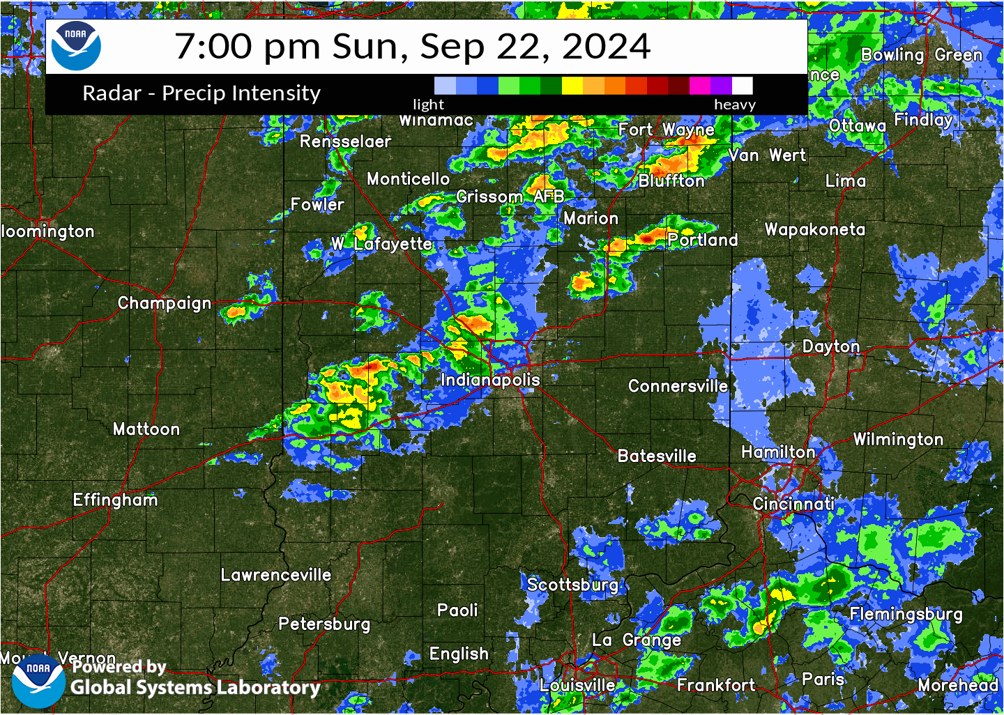
Radar
Loop of Radar Including Time of Tornado
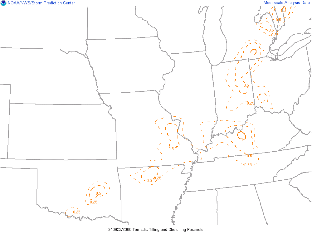
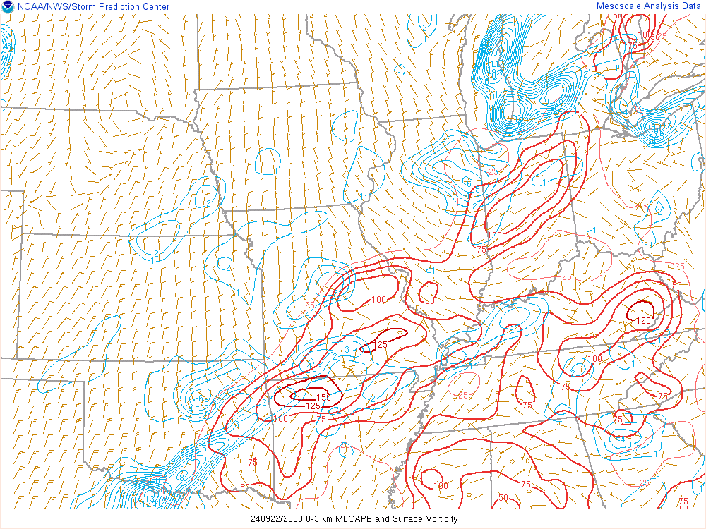
Environment
 |
 |
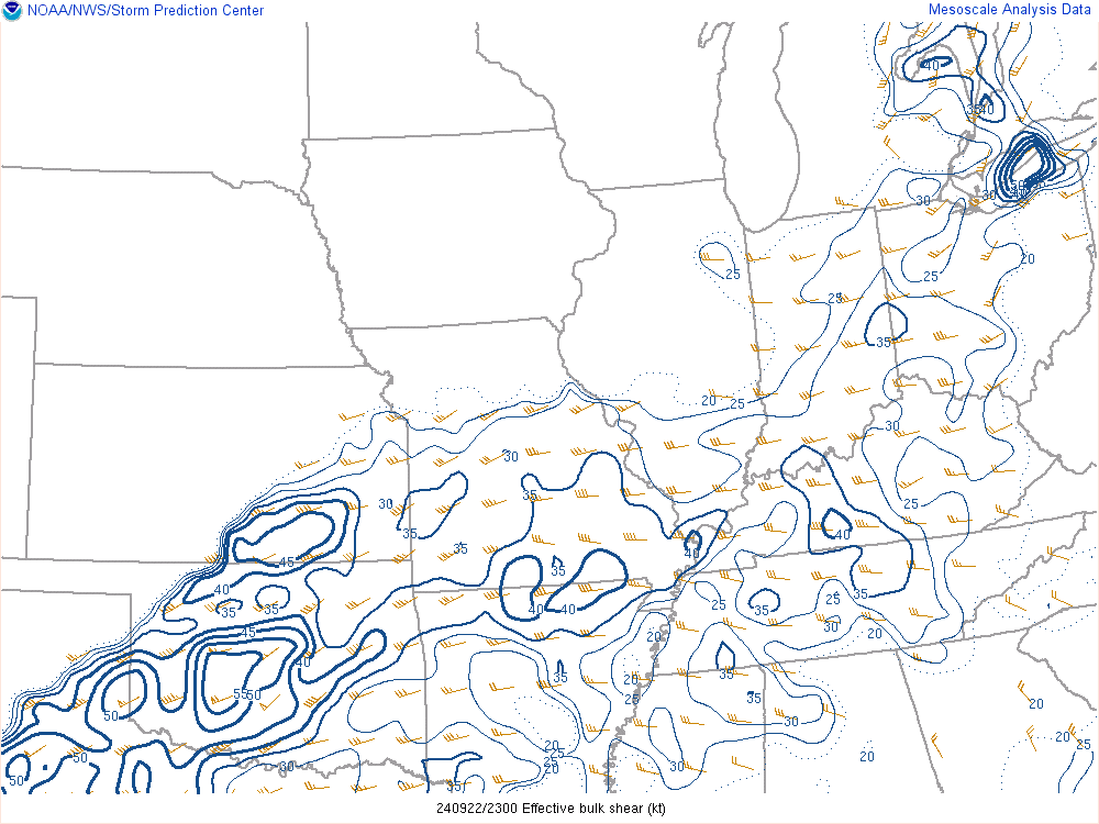 |
| Figure 1: Tornadic Tilting & Stretching Parameter at 7 PM EDT | Figure 2: 0-3km ML CAPE & Surface Vorticity at 7 PM EDT | Figure 3: Effective Shear at 7 PM EDT |
 |
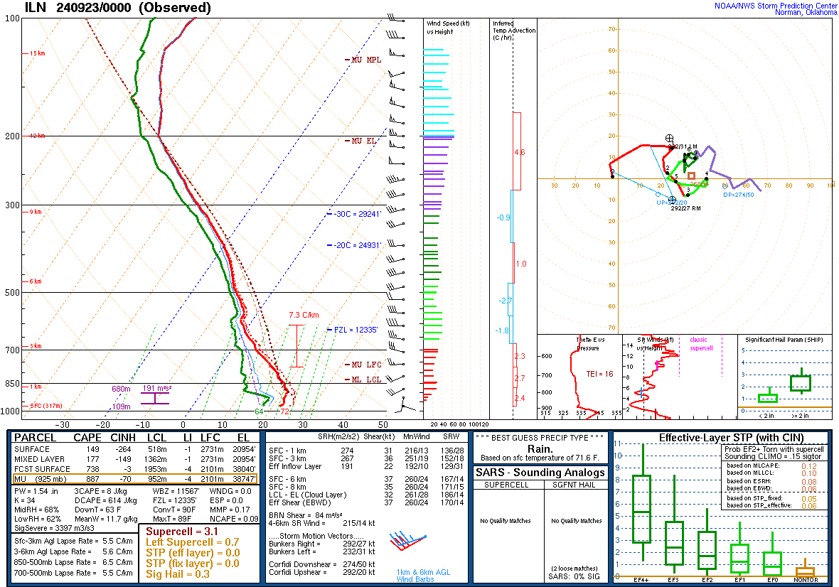 |
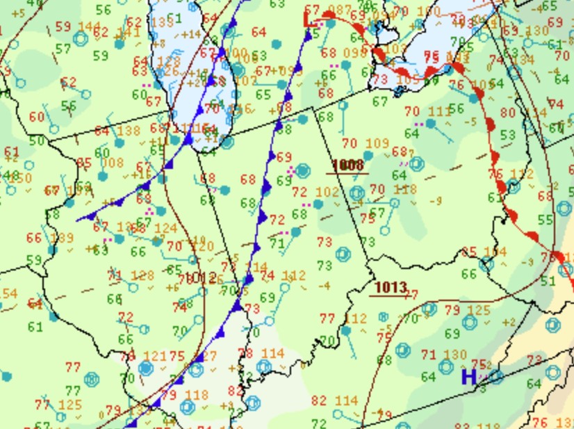
| Figure 4: Zoomed in Surface Map at 8 PM EDT | Figure 5: Wilmington, OH Sounding at 8 PM EDT |
 |
Media use of NWS Web News Stories is encouraged! Please acknowledge the NWS as the source of any news information accessed from this site. |
|