Overview
|
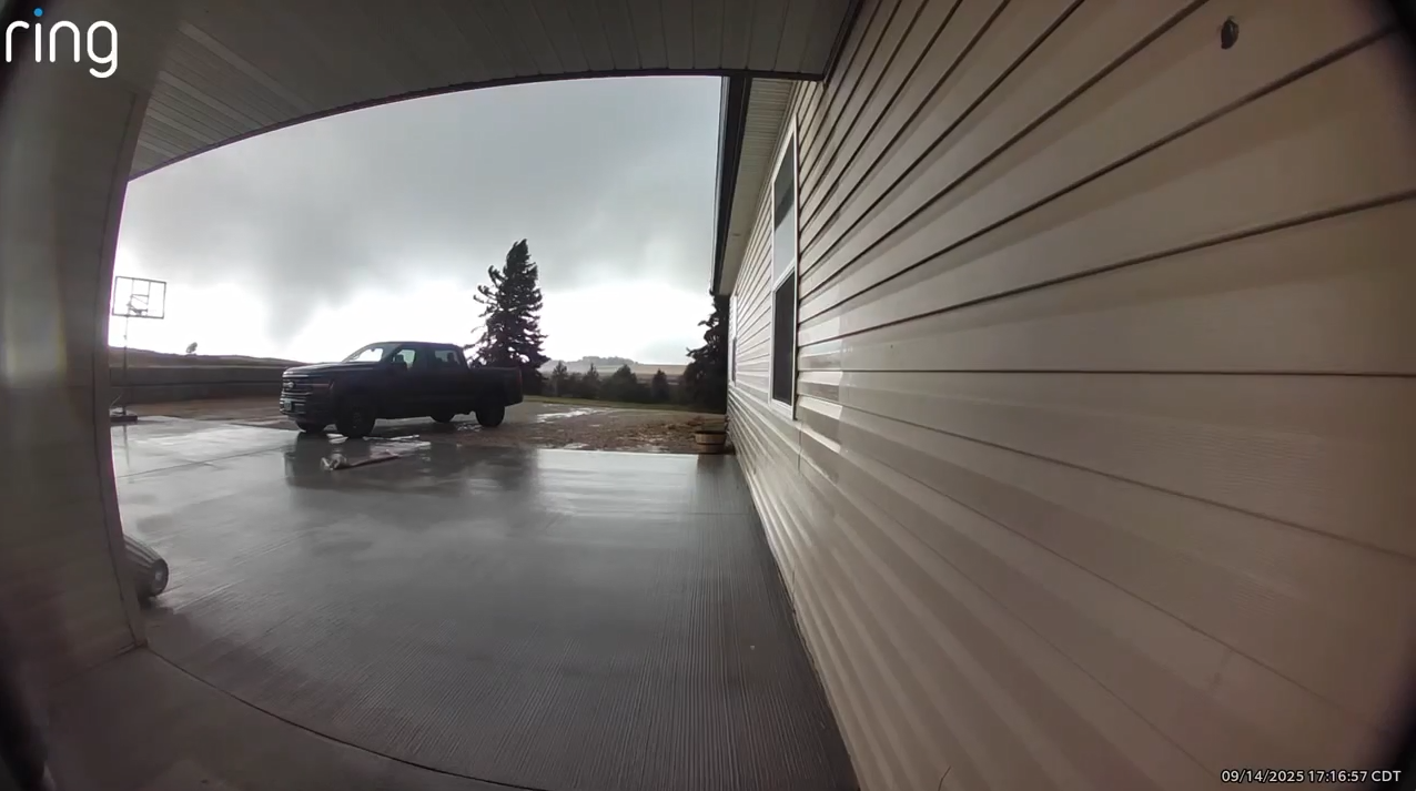
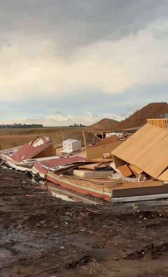
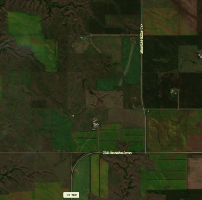
Numerous tornadoes occurred across central North Dakota on Sunday, September 14th, 2025. During the afternoon on Sunday, a low pressure center moved north from South Dakota to North Dakota, and a Tornado Watch was issued just after 1 PM CDT. Low topped-supercells formed near a warm front that was lifting north, and the low pressure meant that there was a lot of spin near the surface. This spin, combined with low cloud bases caused by a high amount of moisture in the lower atmosphere, helped produce numerous tornadoes. Not only was this unusual because of the time of year, but the tornadoes moved south to north, which is not a typical thunderstorm track in North Dakota. As of September 23rd, 20 individual tornadoes from the event on September 14th had been identified across central North Dakota. Additional tracks may be added in the future as more reports and high-resolution satellite imagery are processed. A storm survey team went out on Monday September 15th to investigate reports of damage. EF-2 tornado damage was discovered by Denhoff, with a large outbuilding completely destroyed south of Denhoff. There was also a trailer home rolled, with a path of assorted tree and other damage, leading to a total path length of about 18 miles from this multivortex tornado. The second area of EF-2 tornado damage was about 13 miles west of Linton, where a barn was destroyed near Beaver Bay. The other main area that was surveyed was west and north of the city of Mercer. Along the damage path, a pole barn was partially destroyed, and a mobile home on wheels was destroyed, with a tornado rating of EF-1. Lastly, EF1 damage was reported near Menoken with damage to trees and the roof of a farm outbuilding. There are numerous tornadoes that are currently rated as EF-Unknown, as there have not been any damage reports from those areas. Flooding was also a concern with this storm system, as a few rounds of heavy rain in a short amount of time led to localized flooding. There were multiple road closures in the city of Bismarck, with estimated rain amounts of 3 to 4 inches that fell in 2 to 3 hours. All tornado ratings are preliminary and subject to change. This event also pushed North Dakota's total number of 2025 tornadoes to 80. If verified, this would be the most tornadoes in a calendar year, pasing the old record of 61 set in 1999. Additionally, there were 25 Tornado Warnings issued in the month of September, which is by far the most on record for the state of North Dakota. 20 tornadoes occurring in a single day is the close to the current single-day record of 24, set on June 11, 1976. |
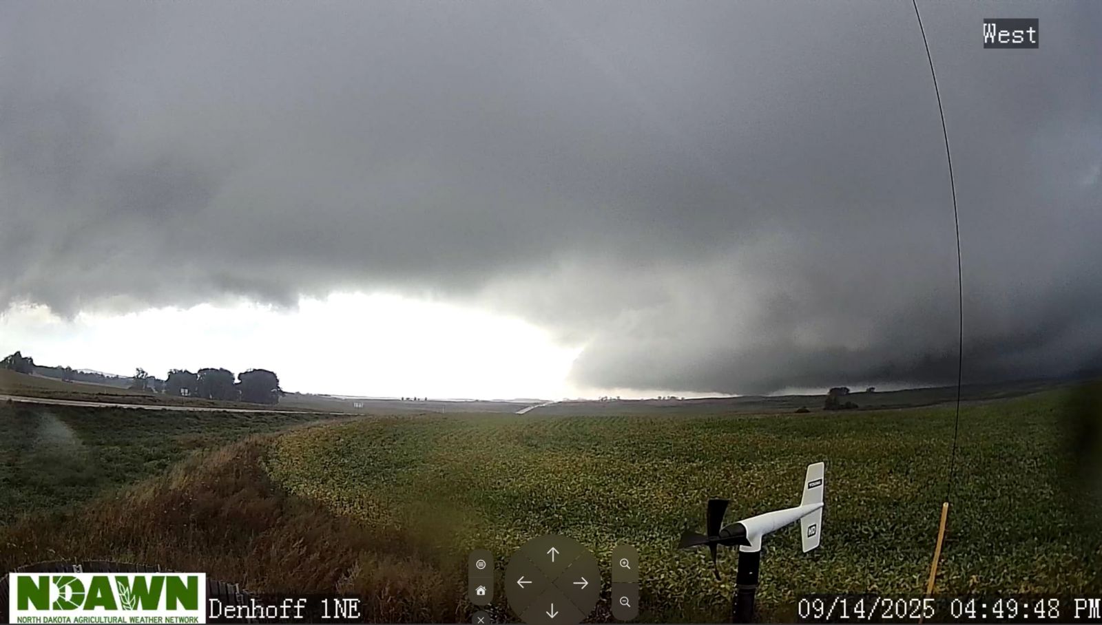 Photo from the Denhoff NDAWN station shows a tornado on the ground at 4:49 PM CDT. |
Tornadoes
Select a tornado from the table to zoom into the track and view more information. The default table view is limited to 8 tracks, but can be scrolled by a mouse wheel or dynamically expanded. Additionally, the table can fill the entire window by clicking the small circular expanding arrow icon at the very top right of the table and returned to its original size by clicking the button again. The side information panel that opens over the map can be closed using the "X" on the upper right corner of the pop-up. Zoom into the map and click damage points to see detailed information and pictures from the surveys.
|
NOTE: times shown below are local to your device's time zone. |

The Enhanced Fujita (EF) Scale classifies tornadoes into the following categories:
| EF0 Weak 65-85 mph |
EF1 Moderate 86-110 mph |
EF2 Significant 111-135 mph |
EF3 Severe 136-165 mph |
EF4 Extreme 166-200 mph |
EF5 Catastrophic 200+ mph |
 |
|||||
| Tornadoes that fail to impact any ratable damage indicators on the EF-Scale are rated EF-Unknown (EF-U) | |||||
Photos & Video
.png) |
 |
 |
 |
| Single-wide mobile home that was rolled from a tornado, located about 1 mile southwest of Denhoff, ND (NWS Bismarck Storm Survey) |
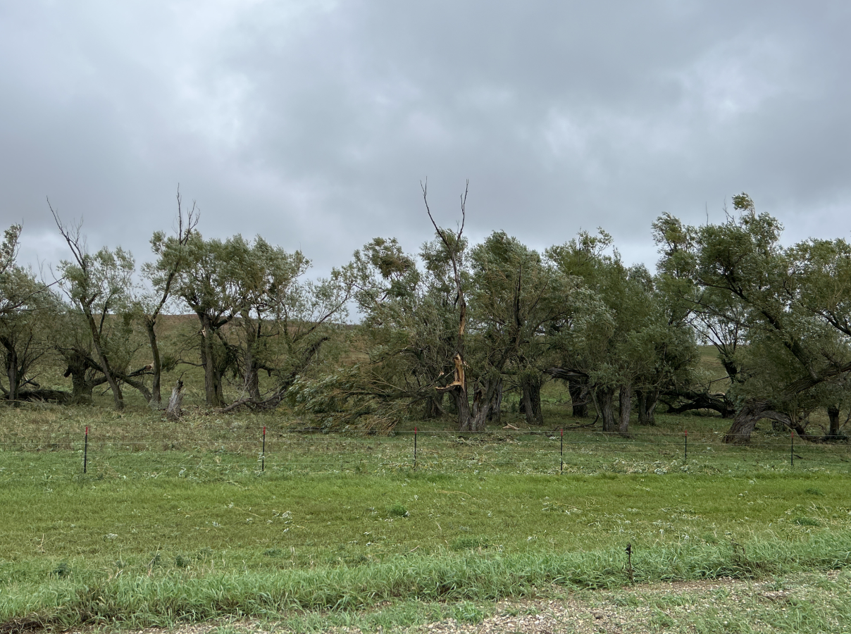
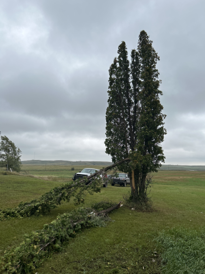
Tree damage form a tornado 3.5 miles northwest of Denhoff, ND (NWS Bismarck Storm Survey) |
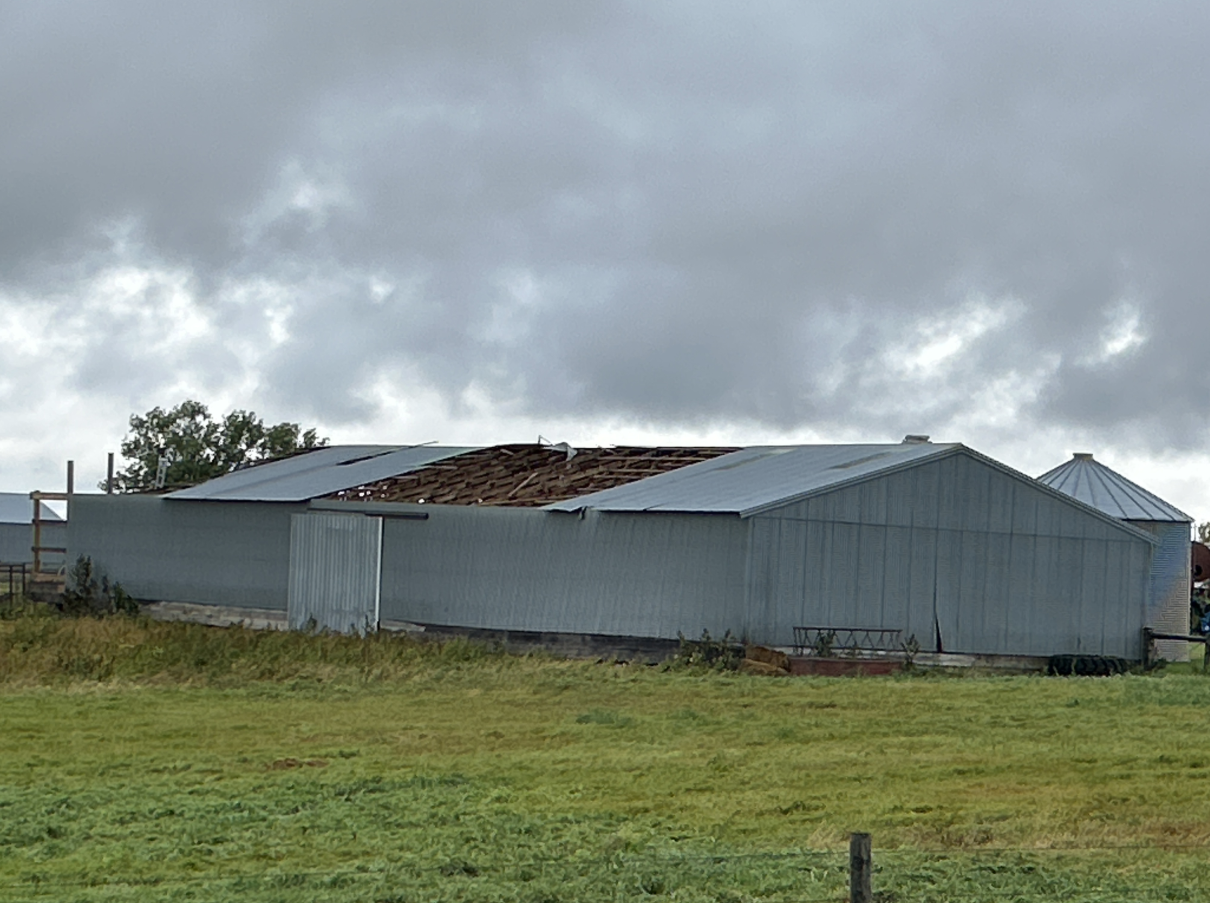
Roof damage caused by a tornado 4 miles northwest of Denhoff, ND (NWS Bismarck Storm Survey) |
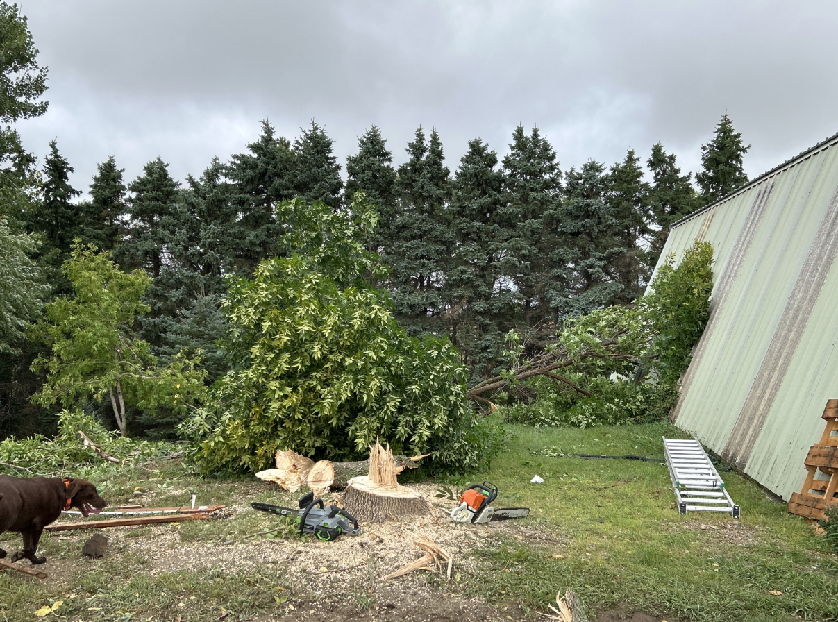
Tornado damage approximately 5 miles north-northwest of Denhoff, ND (NWS Bismarck Storm Survey) |
 |
 |
 |
 |
| Tree damage from a tornado about 1 mile southwest of Denhoff, ND (NWS Bismarck Storm Survey) |
Video footage of a tornado 6 miles north of Mercer, ND (Courtesy of Caitlin Wacker) |
Damage from a tornado 6 miles north of Mercer, ND (Courtesy of Caitlin Wacker) |
High resolution satellite imagery shows a tornado track abut 13 miles west of Linton, ND (Modified Copernicus Sentinel data 2025 processed in Copernicus Browser) |
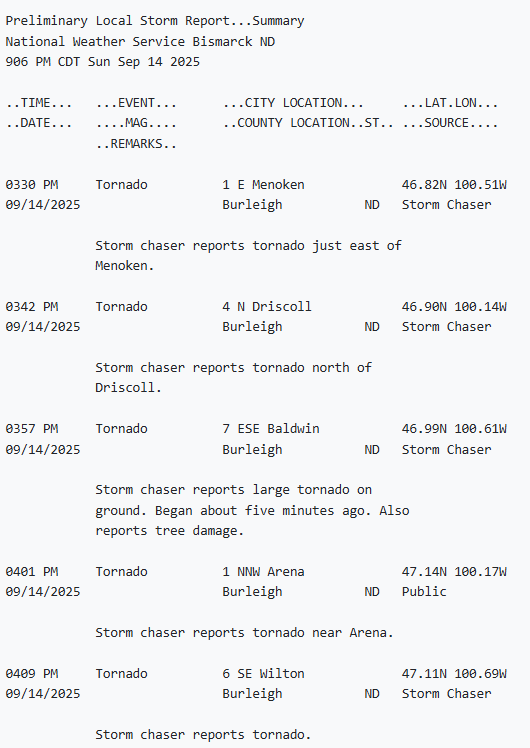
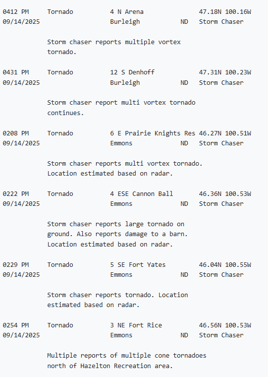
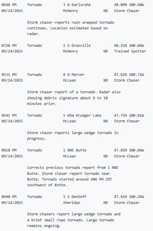
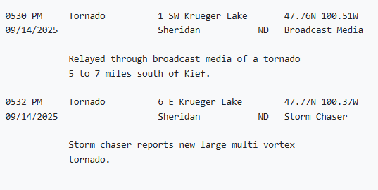
Storm Reports
Environment
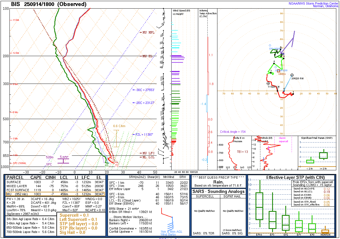
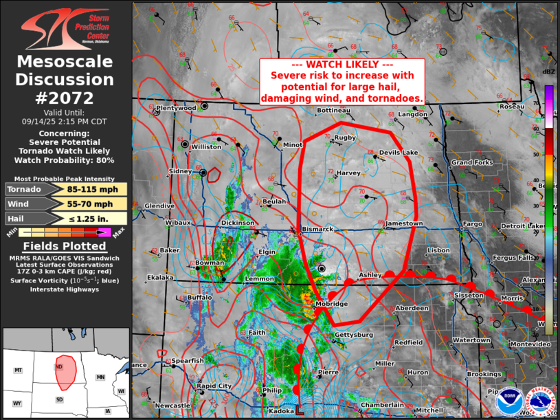
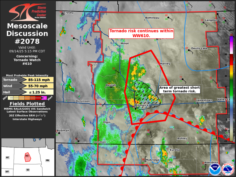
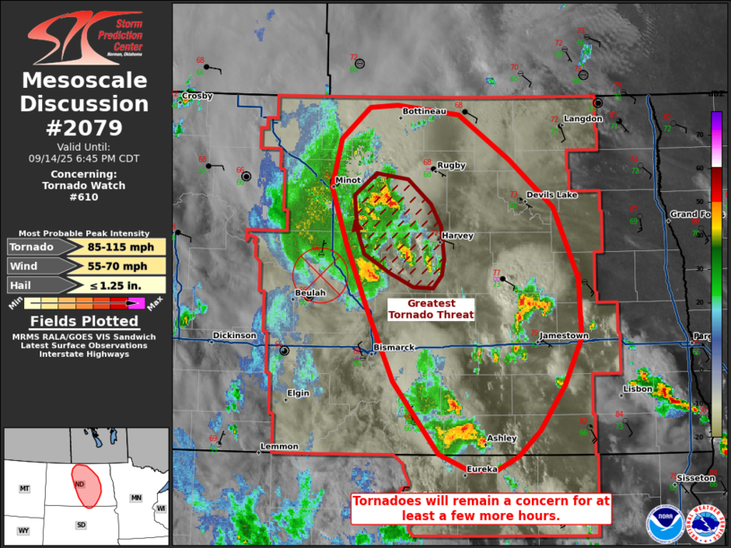
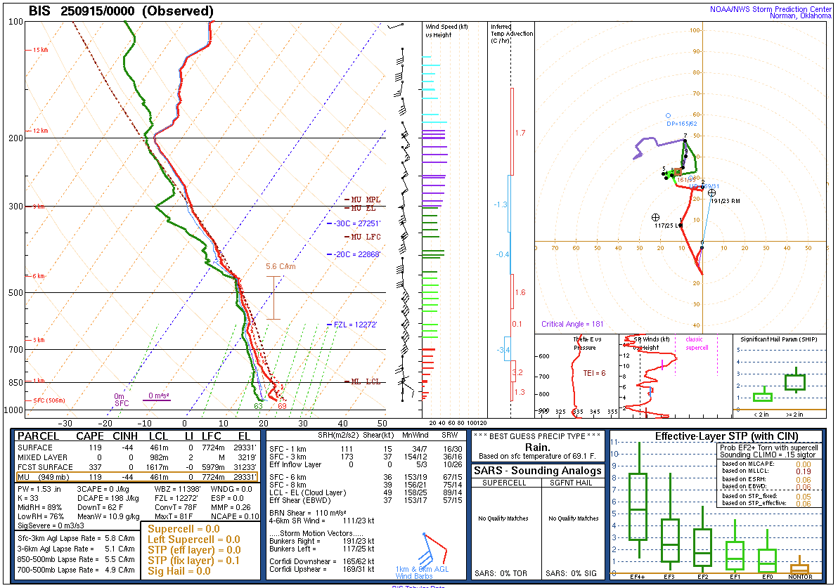
A compact and relatively fast-moving area of low pressure and associated warm front moved northward across central North Dakota and resulted in the tornado outbreak on September 14th, 2025. The small area of low pressure initially became defined the night before in western Nebraska, then moved northward across the central Dakotas during the daytime on Sunday, September 14th. As the system approached the North and South Dakota border just after noon, daytime heating and high dewpoints that were in the middle and upper 60s F resulted in the development of thunderstorms. The thunderstorms that developed close to the low pressure system and near the warm front extending to its east formed in an environment that contained very large low-level wind shear and “spin” in the atmosphere. This raised concern among local meteorologists and forecasters at the Storm Prediction Center, which resulted in the issuance of several “Mesoscale Discussions” and also a Tornado Watch for central and parts of eastern North Dakota during the afternoon and evening.
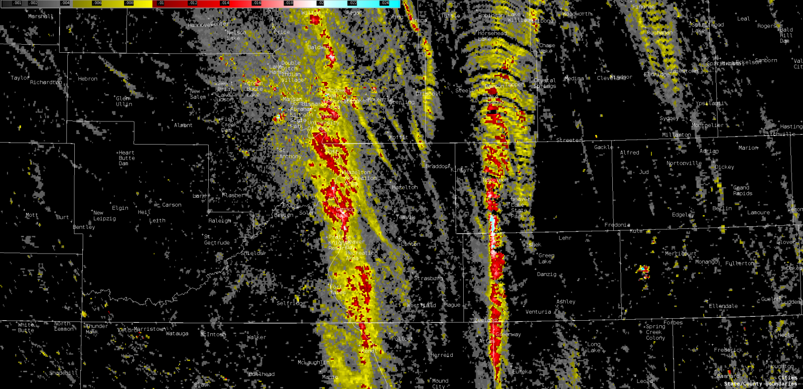
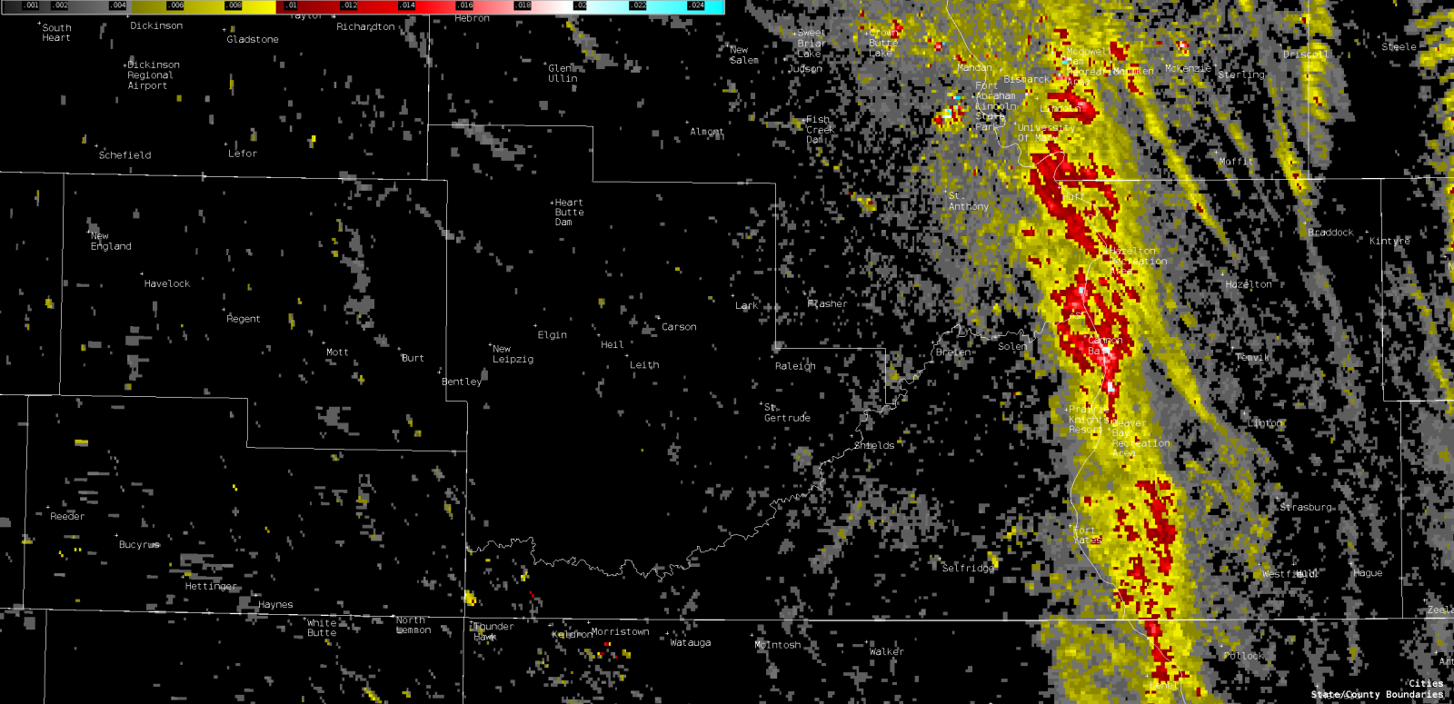
The updrafts associated with the thunderstorms took advantage of the strong low-level wind shear and atmospheric “spin” near the low pressure system and warm front, became supercells, and began to produce tornadoes. The supercells moved northward around 30 mph, closely matching the speed of the low pressure system and warm front, which meant that they remained in a very favorable environment to produce tornadoes throughout their life cycle even as the whole weather system moved northward. While the wind shear was strong, and even though dewpoints were high, the middle and upper parts of the atmosphere were relatively warm and moist, as well, which resulted in only weak to moderate instability in this case. The weather balloon soundings from Bismarck at 1 PM and 7 PM CDT confirmed the weak instability. As a result, the supercells in this case were “low-topped”, with the tops of the storms only reaching up to around 15,000 feet above the ground. This contrasts with typical summertime supercell thunderstorms in the Northern Plains, which often reach up to 50,000 feet above the ground. These lower thunderstorm tops also contributed to the lack of lightning, hail, and strong wind reports during this event. Despite their low-topped nature, the storms rotated strongly since almost their entire updraft region was within the strong low-level shear environment. As a result, their low-level rotation tracks were very apparent in radar-derived algorithms. While not all of the low-level rotation was directly associated with tornadoes, the tracks gave meteorologists an idea of the relative strength of rotation and the potential for the supercells to produce tornadoes, as they did on numerous occasions the afternoon of September 14th.
 |
 |
 |
| Figure 1: 1 PM Upper Air Sounding from Bismarck | Figure 2: Mesoscale Discussion issued by the Storm Prediction Center at 12:43 PM | Figure 3: Mesoscale Discussion issued by the Storm Prediction Center at 3:49 PM |
 |
 |
 |
| Figure 4: Mesoscale Discussion issued by the Storm Prediction Center at 5:11 PM | Figure 5: 7 PM Upper Air Sounding from Bismarck | Figure 6: Mesoscale Discussion issued by the Storm Prediction Center at 7:00 PM |
 |
 |
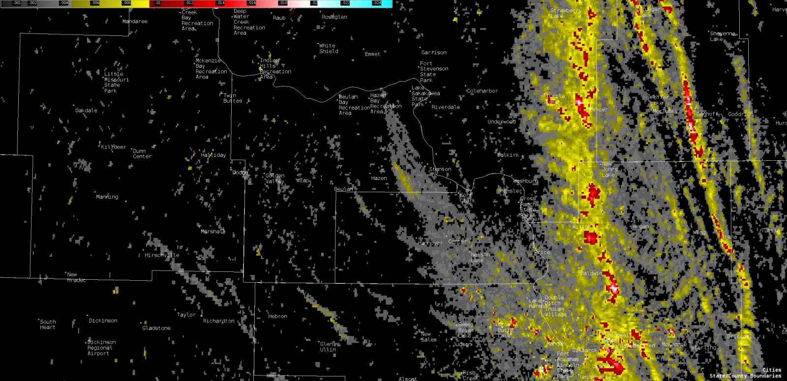 |
| Figure 7: Low-level rotation tracks across south-central North Dakota | Figure 8: Low-level rotation tracks across south-central North Dakota | Figure 9: Low-level rotation tracks across central North Dakota |
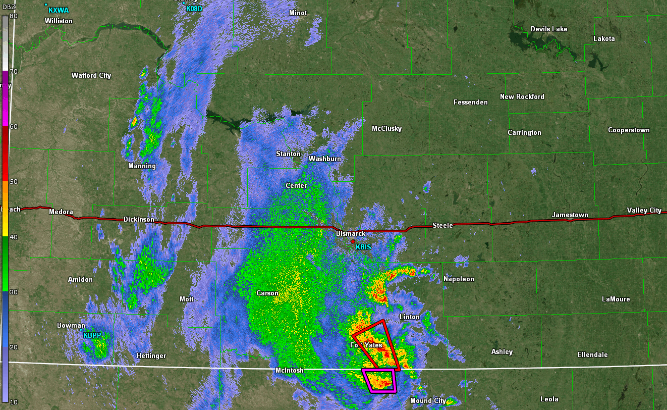
Radar
 |
 |
 |
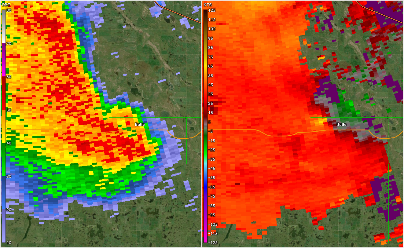 |
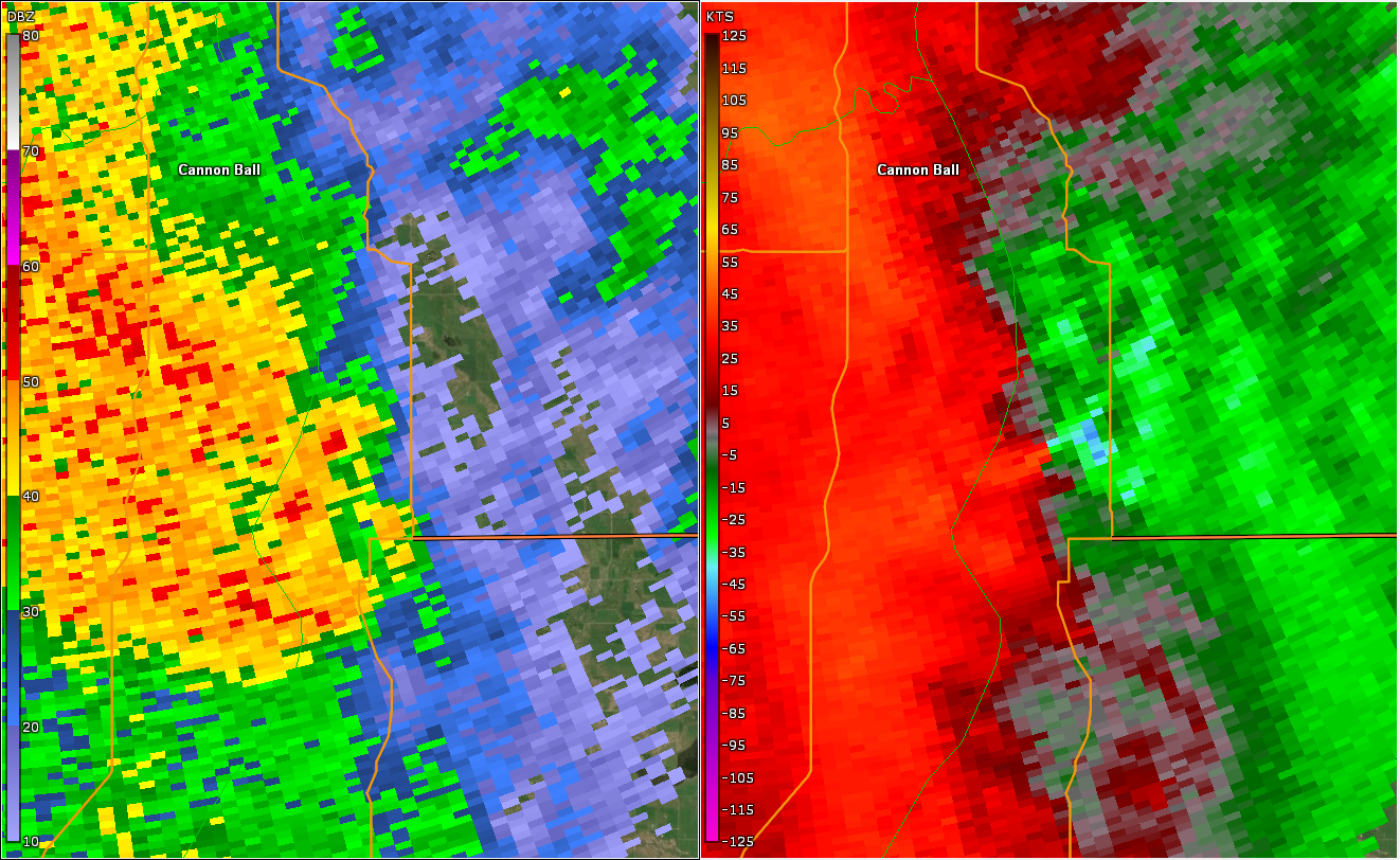
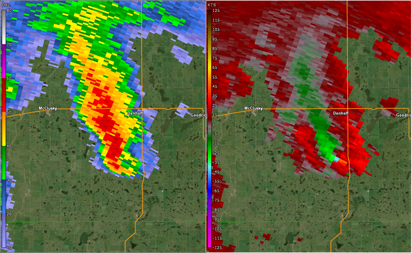
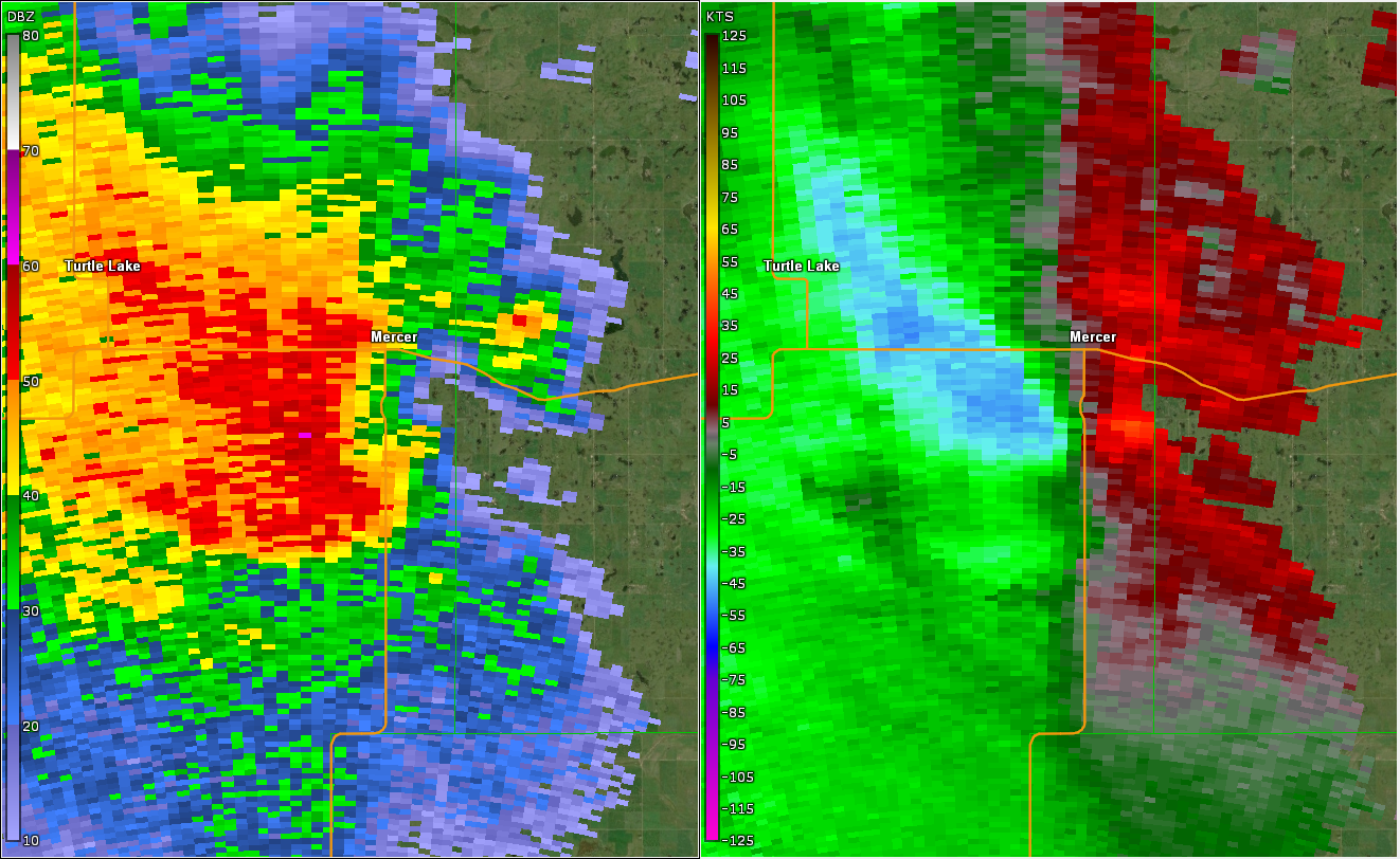
| KBIS Radar Reflectivity and Storm Relative Velocity at 2:16 PM | KBIS Radar Reflectivity and Storm Relative Velocity at 4:38 PM | KBIS Radar Reflectivity and Storm Relative Velocity at 4:58 PM | KBIS Radar Reflectivity and Storm Relative Velocity at 6:10 PM |
 |
Media use of NWS Web News Stories is encouraged! Please acknowledge the NWS as the source of any news information accessed from this site. |
|

