Public Information Statement
National Weather Service Charleston WV
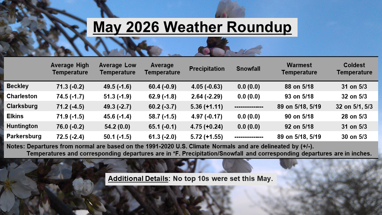
..............A COOL MAY WITH VARYING PRECIPITATION DEPARTURES...............
Compared to historical records and the 1991-2020 U.S. Climate Normals, it was
a cool May across the NWS Charleston forecast area, with mean temperatures
ranging from slightly below normal up to nearly 4 degrees below normal in
some locations. Precipitation totals for the month of May varied significantly
across the forecast area, ranging anywhere from approximately 2 to 9 inches.
This resulted in varying departures, with some locations close to 3 inches
below normal, while others ended up over 3 inches above normal. For instance,
only 2.51 inches of precipitation was observed at the Charleston Weather
Forecast Office, which was 2.68 inches below normal. On the other end of the
spectrum, 8.03 inches was observed at the Cooperative Observer station in
Warnock, Kentucky, which was 2.85 inches above normal.
No Top 10s were set at any of the official NWS Charleston climate locations
this May in terms of mean temperature or precipitation.