The remnants of Isaias will bring widespread, but mainly beneficial rain through Sunday to the area. Rainfall totals will generally be between 0.75-2.00", but heavier bands of rain could result in locally higher amounts and the potential for isolated flooding. In addition, gusty winds up to 50 mph are expected in the higher terrain through Sunday morning. Please keep updated on the forecast. Read More >

|
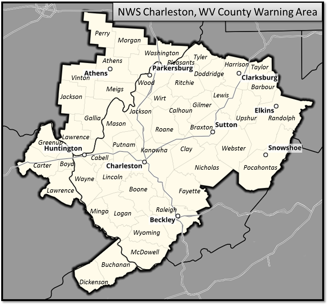
The following summaries cover "significant" or widespread hazardous weather events the have occurred in the NWS Charleston, WV Forecast and Warning Area.
|
Scroll down the page for year, or go directly:
|
2026
2025
2024
2023
2022
2021
2020
2019
2018
2016
2015
2014
2013
2012
2010
2006
2005
2004
Historic
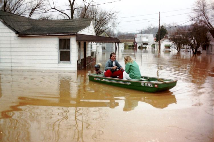 |
Remembering the Flood of March 1997 Copious amounts of rain fell on central Kentucky, southern Ohio, southern Indiana and into West Virginia as the calendar turned from February to March back in 1997. As thunderstorms and large areas of heavy rain repeatedly moved over the same areas, impressive rainfall totals were recorded, with rainfall records being broken in some areas. The deluge resulted in record flooding along smaller streams and some of the worst flooding along the Ohio River since at least 1964, and in some places since the Great Flood of 1937. Several tributaries of the Ohio River set all-time record river crests that still stand today. |
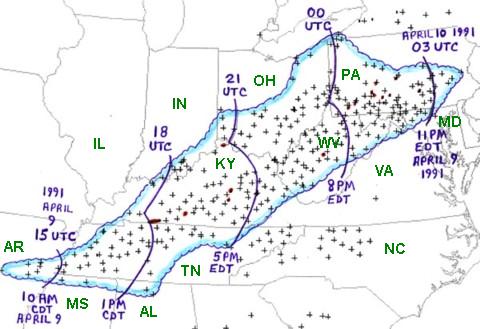 |
The West Virginia Derecho of April 9, 1991 Many West Virginians and Ohioans easily recall the Derecho of 2012, however, the Derecho of 1991 was comparable in wind speeds and resulting damage. The southwest to northeast moving squall line caused 2 deaths, 86 injuries and over 8,000 insurance claims due to damage to homes and businesses in West Virginia alone. |
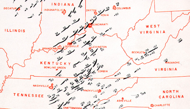 |
April 3-4 1974 Super Outbreak The 1974 Super Outbreak occurred on April 3-4, 1974 and is the second largest outbreak on record. This outbreak still holds the record for the most F5 tornadoes to occur on a single day (7 total). A total of 148 tornadoes occurred within 24 hours on April 3-4, touching down in 13 states and killing more than 300 people and injuring over 6,000 people. The hardest hit areas were in the Midwest, particularly in Ohio, Indiana, Kentucky, and Tennessee. These states alone had approximately 200 fatalities, most of which occurred on April 3rd from 2 pm to 10 pm. The Appalachian region was not immune to the tornadic outbreak either. Several tornadoes occurred during the early morning hours of April 4th, resulting in significant damage in portions of southern West Virginia and southwest Virginia. This more or less debunked the long-standing myth that tornadoes do not occur in the mountains. |
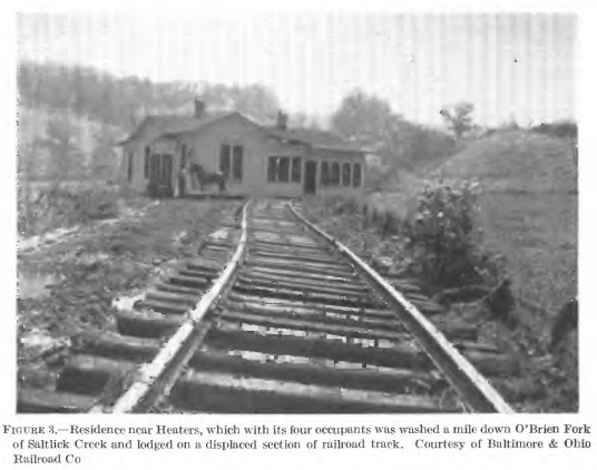 |
The Little Kanawha Flash Floods of 1943 On August 4-5, 1943, one of the deadliest floods in West Virginia history occurred in the Little Kanawha River Basin. Many small streams in Braxton, Calhoun, Gilmer, Ritchie, and Wirt Counties reached stages much higher than previously known as a result of estimated rainfall that amounted to as much as 15 inches in 2 hours. Twenty-three lives were lost as a result of the flood. Although there was considerable flooding of residential property in the communities along the Little Kanawha River, all loss of life occurred along relatively small tributaries. There, in the small valleys, the water rose with great rapidity during the early morning hours of August 5th, carrying away many homes. |
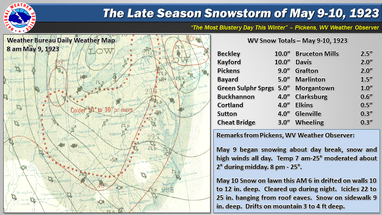 |
Looking Back at the Late Season Snowstorm of May 9-10, 1923 The latest snow on record for many locations occurred on May 9-10, 1923 when up to 10" of snow blanketed parts of West Virginia. |



 Radar
Radar Current Weather
 Rivers & Lakes
 Satellite
 Forecast Maps
 Hour by Hour Forecast
 Tropical Weather
 Graphical Hazards
 Weather Hazard Briefing
 Forecaster's Discussion
 Text Bulletins
 Climate Plots
 Aviation Weather
 Fire Weather
 Drought
 Submit Storm Report
 Weather Spotters
 NOAA Weather Radio
 Follow us on X
 Follow us on Facebook
 RLX RSS Feed