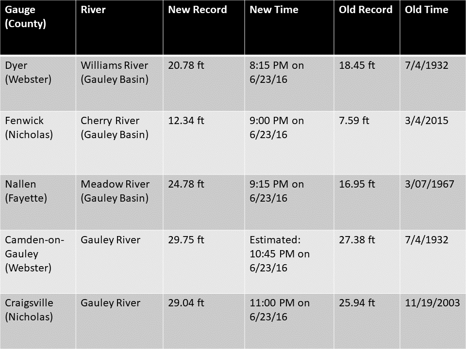
Event Summary
|
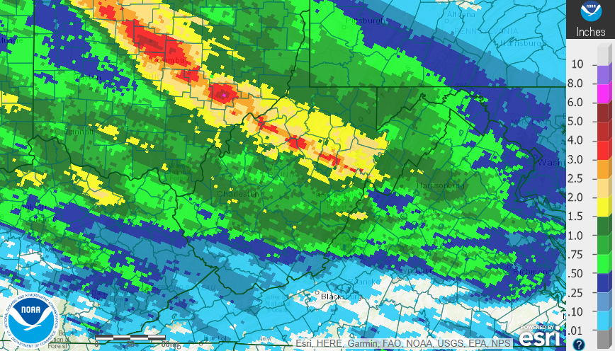
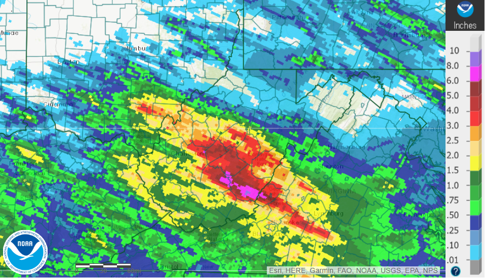
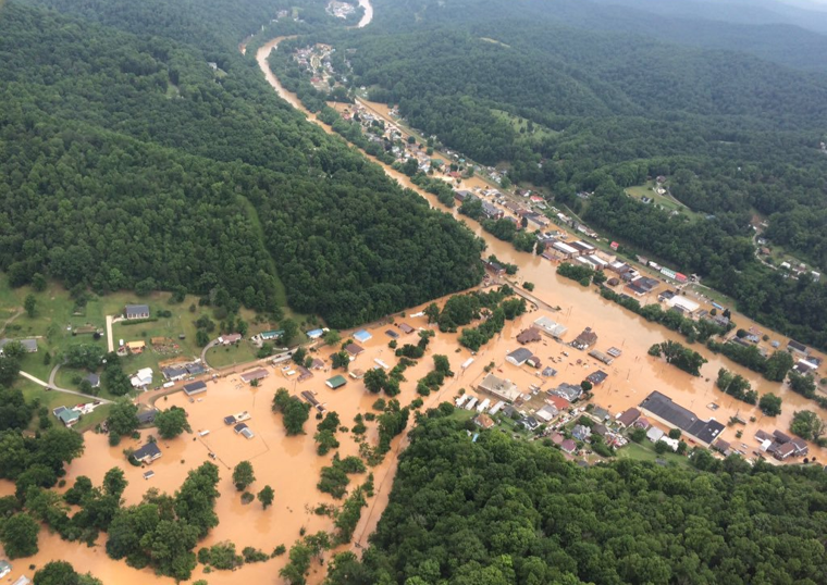
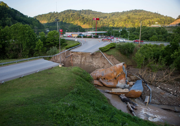
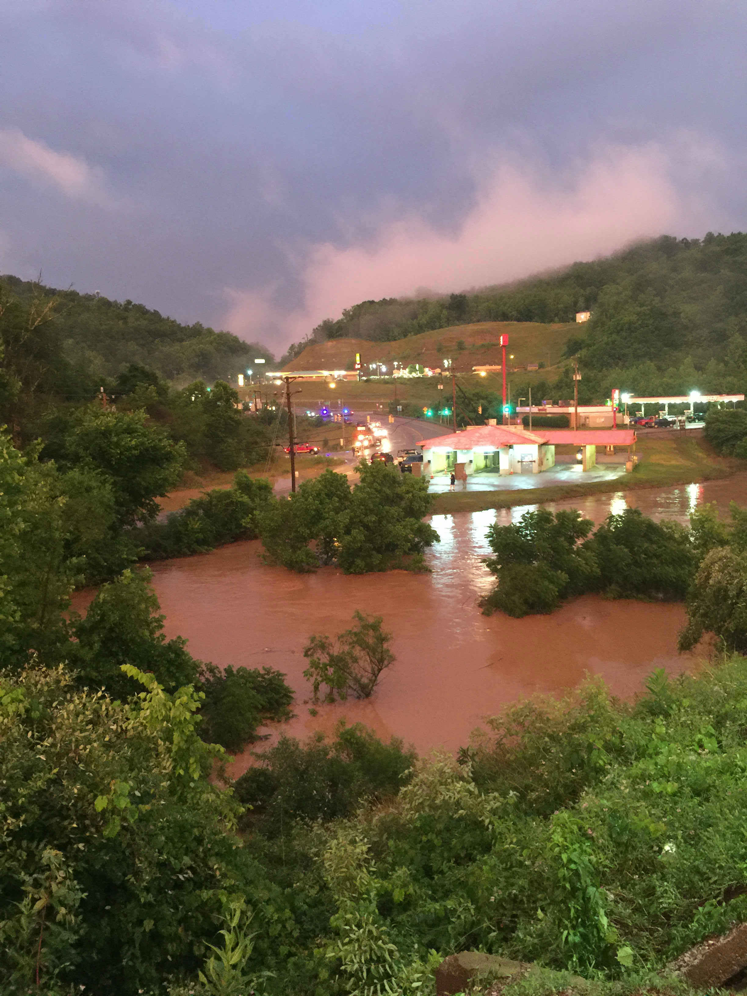
On June 23rd, 2016, several rounds of thunderstorms brought intense rainfall to most of the state of West Virginia. The most intense precipitation occurred over the Central/Southeastern portions of the state, with observed 24-hour precipitation totals reaching over 7" in some areas (Runa, WV - southwest Nicholas County). Approximately 25 miles northeast, the Gauley River near Craigsville (Nicholas County) reached a crest of 29.04' (USGS), setting a new record crest at that location and shattering the old record by over three feet. Sadly, flash flooding across the state resulted in 23 fatalities, including 6 in Kanawha County, as well as 1 in both Jackson and Ohio counties in West Virginia. These rounds of thunderstorms were caused by a stationary front over the Ohio Valley Region. This allowed for continuous moisture transport and prolonged storm development over a small area for an extended period of time. Excessive rainfall over the harsh terrain caused extreme lowland flooding and various rivers to rise to flood stages. River basin flooding can cause flooding downstream from areas that receive higher rainfall totals, as well as prolonged flooding effects in river basins that receive large amounts of precipitation. In addition, numerous reports of tree damage were received in association with the thunderstorms throughout the day, along with a few hail reports. One tornado (EF-1) was confirmed in Jackson County (WV) at approximately 5 AM on June 23rd. A State of Emergency was declared in 44 of 55 West Virginia counties, and 12 counties received a Presidential Disaster Declaration. An estimated half a million people were initially without power, and thousands of buildings all across the state were either damaged or destroyed, leaving many displaced (FEMA). The damage total was an estimated $1.2 billion (CPI-Adjusted; NOAA). Please click on the tabs below for more detailed information about this event. Please note that most images/loops can be expanded by clicking on them. |
Image Source: Advanced Hydrologic Prediction Service
Image Source: Advanced Hydrologic Prediction Service
|
 |
 |
 |
 |
|
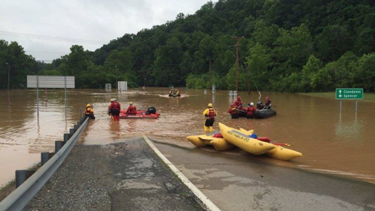
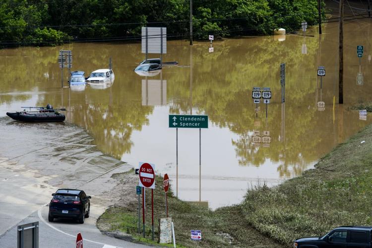
Flooding in Clendenin, WV (Photo Courtesy of WOWK-TV) |
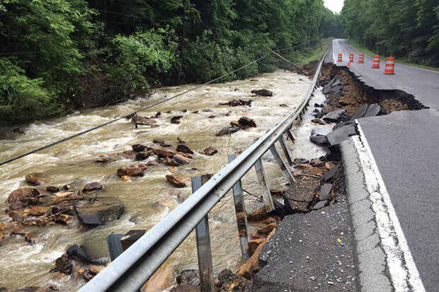
Bridge Collapse in Elkview, WV (Photo Courtesy of The New York Times) |
Flooded Road Near I-79 Exit (Photo Courtesy of West Virginia Department of Highways) |
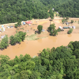
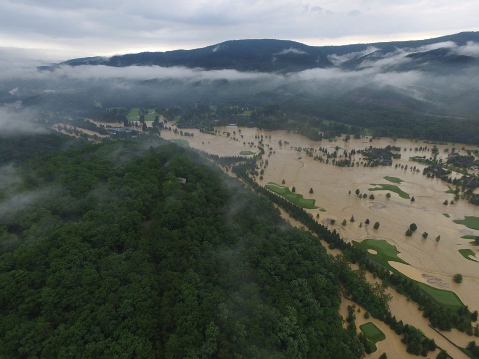
Severe River Flooding in WV (Photo Courtesy of West Virginia Division of Homeland Security and Emergency Management) |
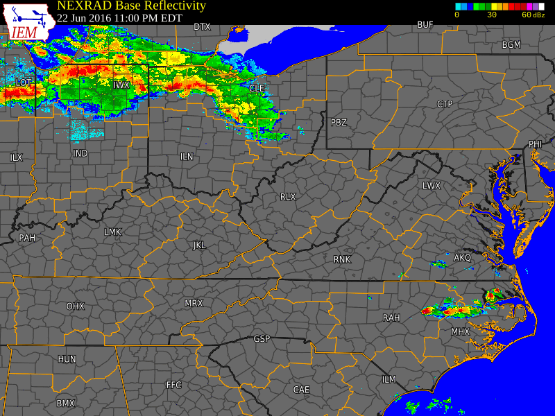
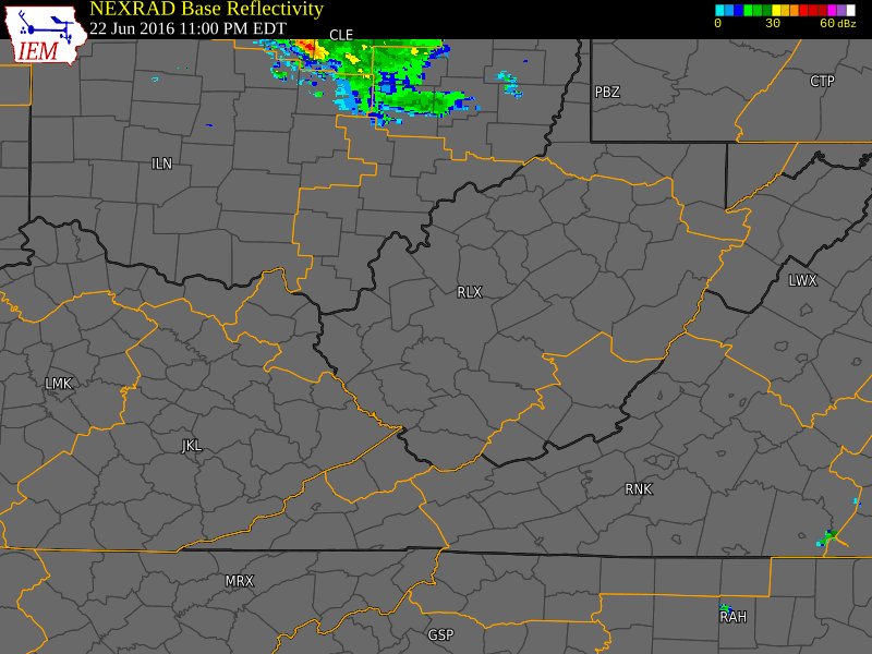
June 22-23 Time Synchronized Local/Regional Radar Loops
 |
 |
|
June 22-23 Regional Radar Loop Radar loop courtesy of Iowa Environmental Mesonet (IEM) |
June 22-23 Local Radar Loop (w/ Warnings Overlaid) Radar loop courtesy of Iowa Environmental Mesonet (IEM) |
June 22-23 Satellite Loops
.gif) |
.gif) |
|
June 23rd Visible Loop Satellite loop courtesy of University Corporation for Atmospheric Research (UCAR) |
June 22-24 Infrared Satellite Loop Satellite loop courtesy of University Corporation for Atmospheric Research (UCAR) |
Overview
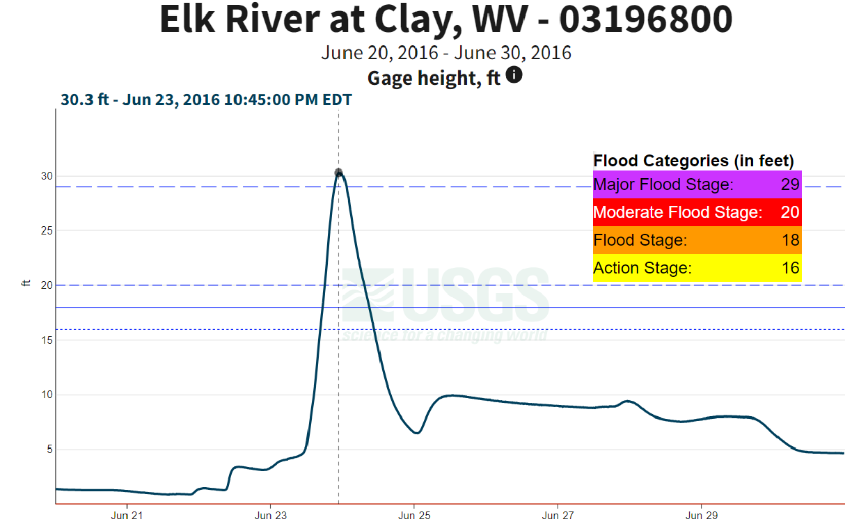
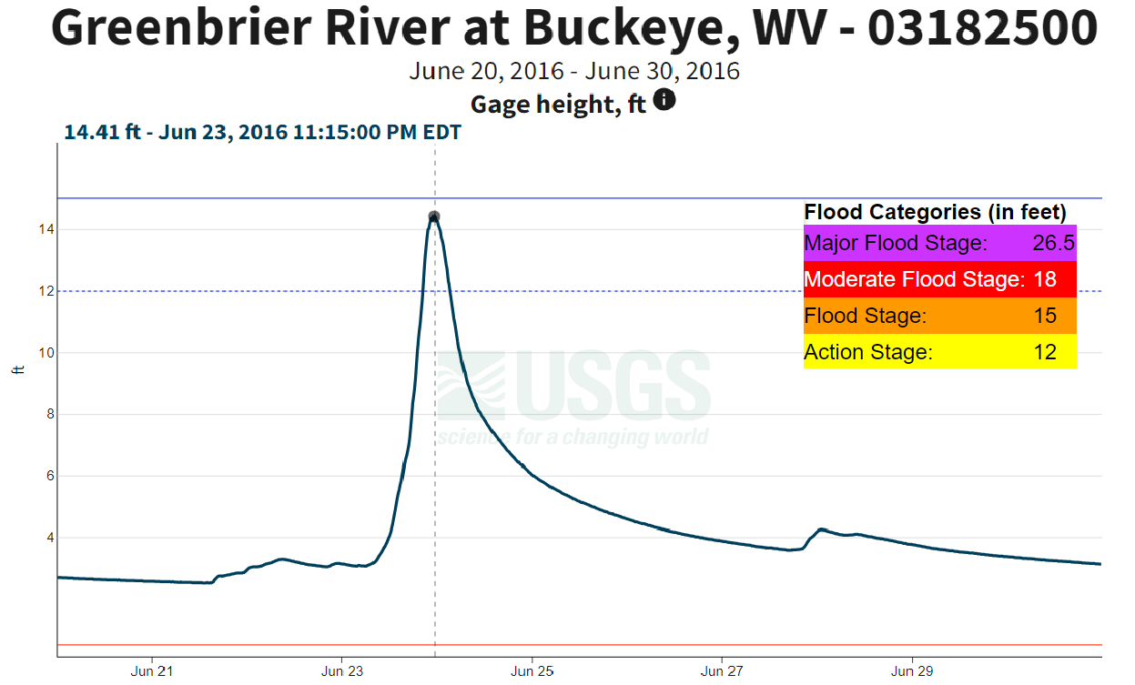
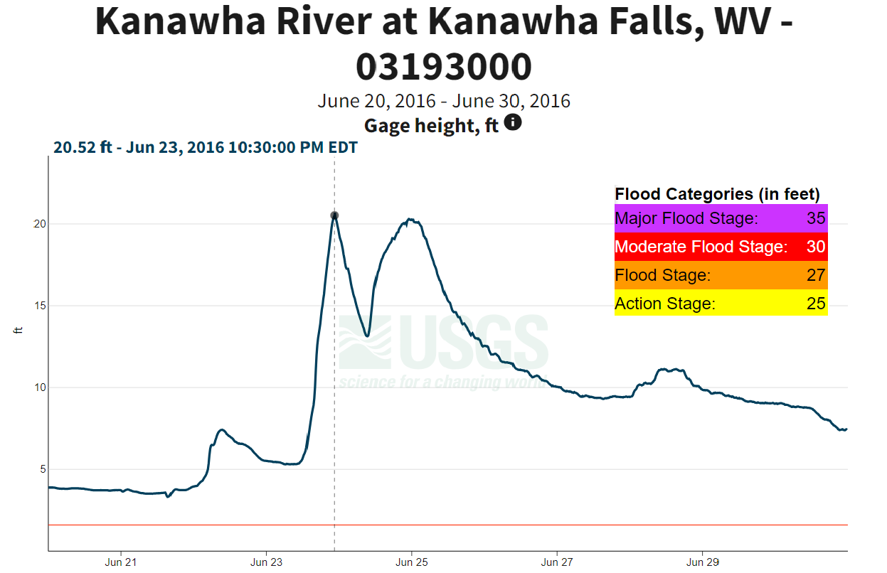
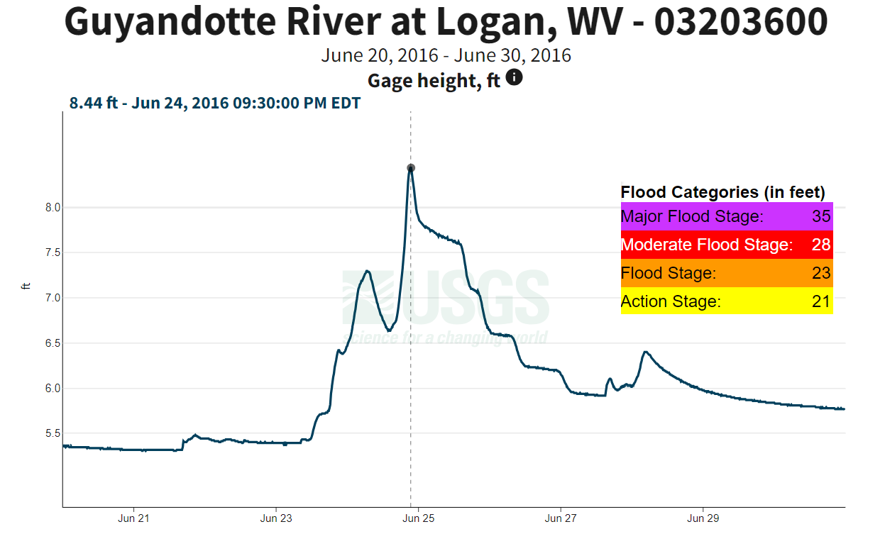
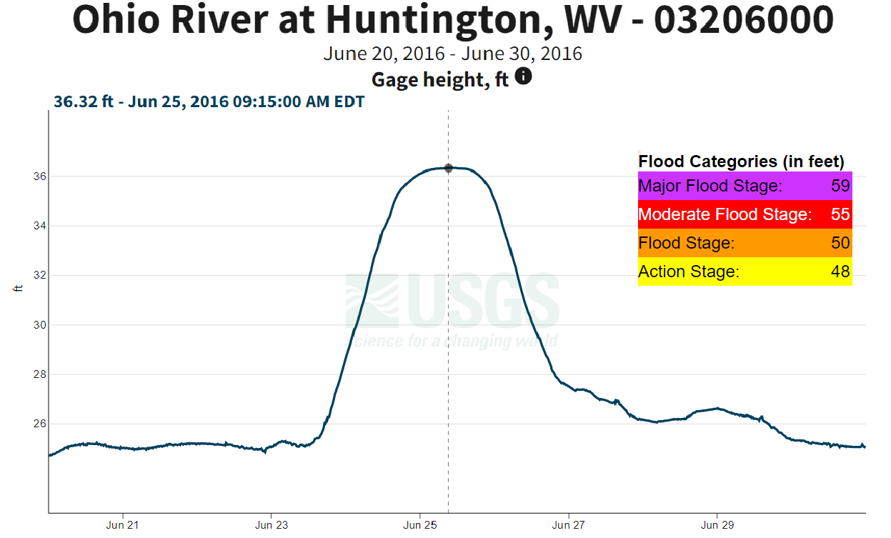
Hydrographs are a time series line graph of water level at a specific location. All of the hydrographs below show the crest of their respective rivers from June 20th to June 30th. Four gauges reached major flooding stage, two along the Elk River, one on the Gauley River, and one on the Williams River. Three sites set record crests as a result of the event: Gauley River near Craigsville, Williams River at Dyer, and Birch River at Herold (although it only reached its moderate flood stage). The New River at Thurmond reached its minor flood stage, and the Greenbrier River at Buckeye reached its action stage. Although the other rivers did not reach flood stages, significant rises were observed all across the state. Prior to the peak crest, a much smaller crest was observed on the Gauley, New, and Kanawha Rivers. This smaller crest occurred from the initial flash flooding event, followed by excessive runoff into the main stem rivers, resulting in the peak crest approximately 24 hours later. Incredibly, the Elk River rose over 28 feet from this event at both Clay and Queen Shoals. All hydrographs are courtesy of the United States Geological Survey (USGS).
.png) |
 |
.png) |
|
*Major Flood Stage Reached* Rise of ~28 ft. |
*Major Flood Stage Reached* Rise of ~28 ft. |
*Major Flood Stage Reached* ** Record Crest of 29.04 ft.** |
.png) |
.png) |
.png) |
|
*Major Flood Stage Reached* ** Record Crest of 20.78 ft.** |
*Moderate Flood Stage Reached* ** Record Crest of 18.03 ft.** |
*Minor Flood Stage Reached* Rise of ~14 ft. |
 |
.png) |
 |
|
*Action Stage Reached* Rise of ~11 ft. |
Rise of ~17 ft. No Flood Stages Reached |
Rise of ~15 ft. No Flood Stages Reached |
 |
 |
.png) |
.png) |
|
Rise of ~3 ft. No Flood Stages Reached |
Rise of ~ 11ft. No Flood Stages Reached |
Rise of ~ 3ft. No Flood Stages Reached |
Rise of ~18 ft. ** No Flood Stages Available for this Location ** |
 |
 |
 |
|
Floodwaters Over Road Near Clendenin Photo Courtesy of Charleston Gazette-Mail |
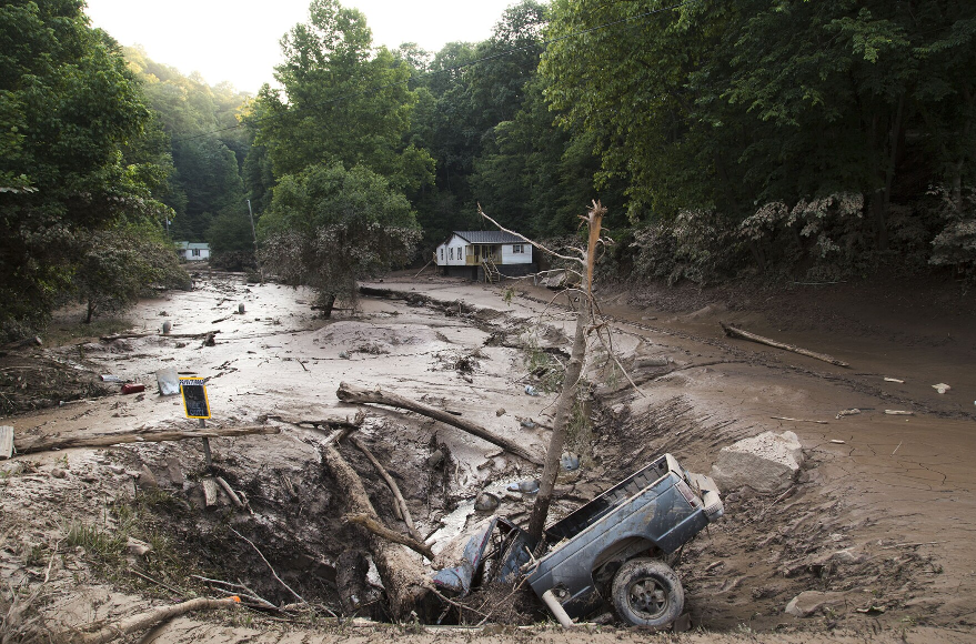
Road Damage Near Hilton Village, WV Photo Courtesy of Rebecca Lindsey |
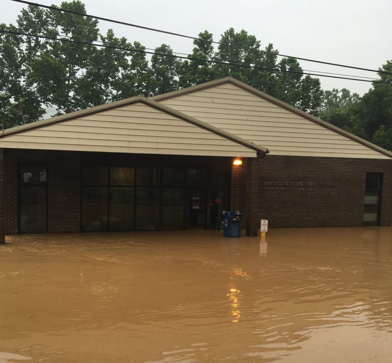
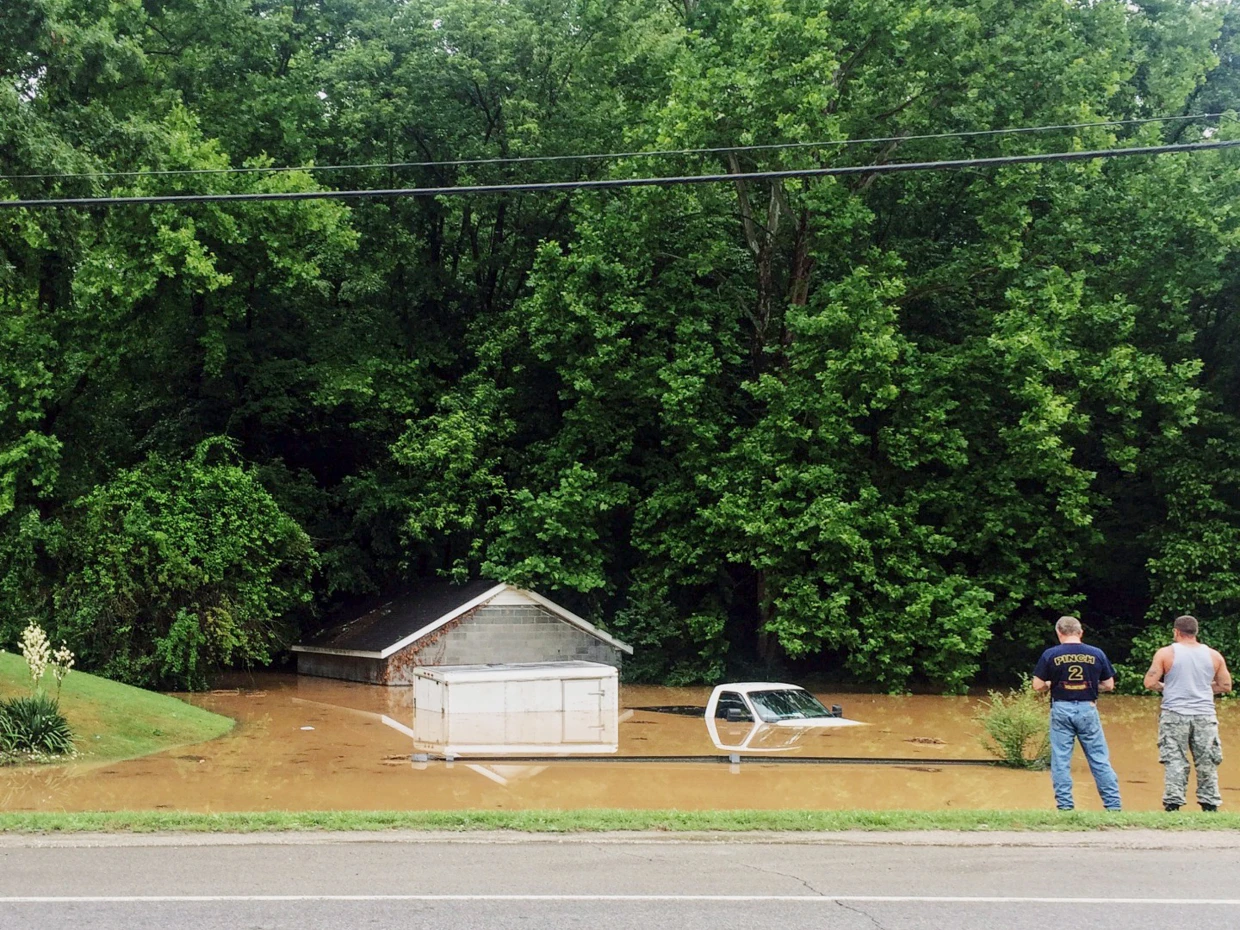
Flooding at Elkview, WV Post Office Photo Courtesy of Craig Baldwin Via WV MetroNews |
 |
 |
 |
|
Flooding in Elkview, WV Photo Courtesy of WOWK-TV |
Flood Damage Near Clendenin, WV Photo Courtesy of West Virginia Public Broadcasting |
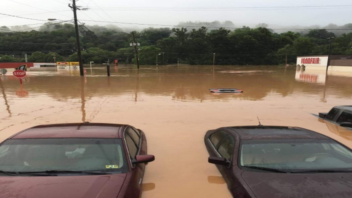
Parking Lot Flooded in Clendenin, WV Photo Courtesy of Nathan Takitch Via WSAZ News |
 |
 |
 |
|
High Water in Elkview, WV Photo Courtesy of Caleb Smith Via NBC News |
Kayaking Through Elkview, WV Streets Photo Courtesy of Caleb Smith Via NBC News |
Significant Flooding at The Greenbier Photo Courtesy of Greenbrier Emergency Management |
Record Crests Set June 23, 2016
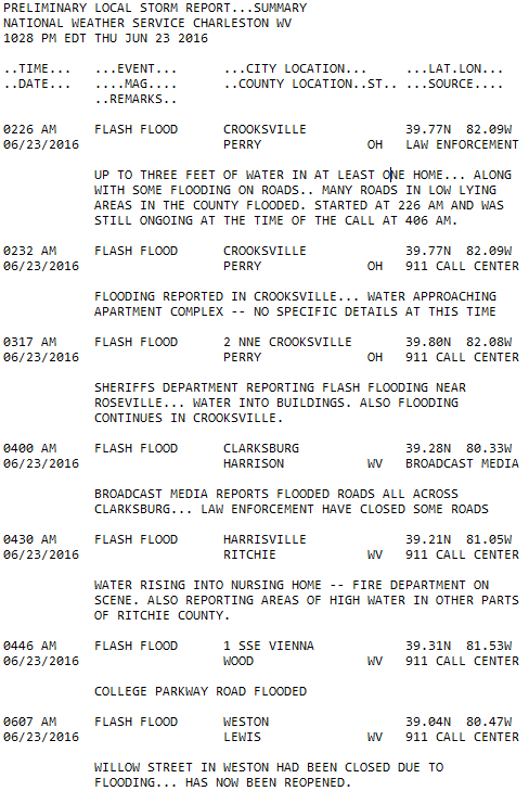
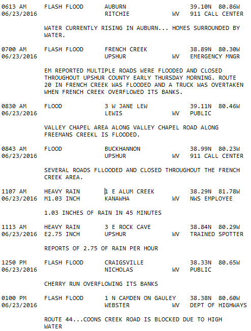
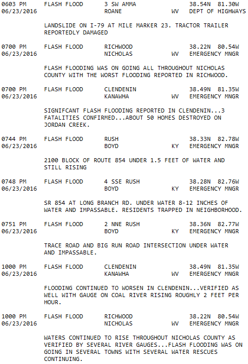
Local Storm Reports

Map Courtesy of ESRI
Rainfall Reports From Across The Forecast Area
.png)
.png)
.png)
.png)
June 22-23 Environmental Breakdown
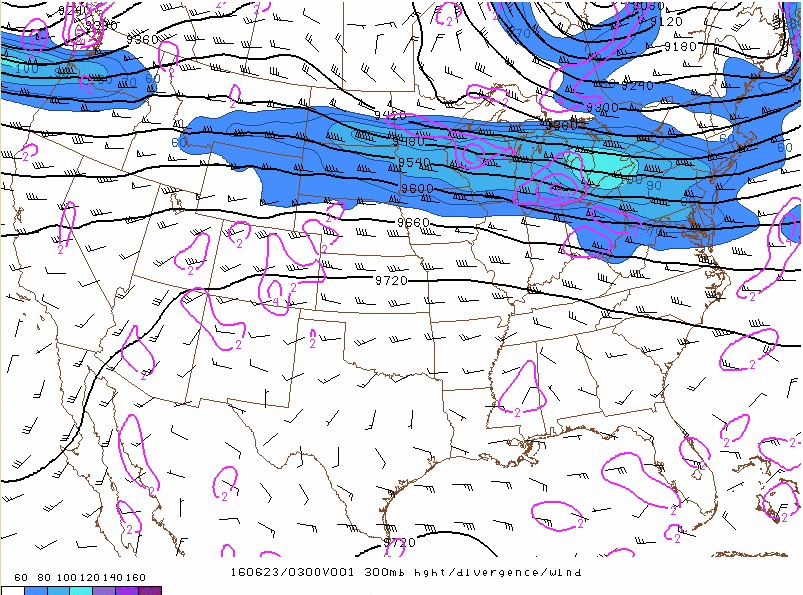
300 millibar analysis shows an upper level low pressure center over Quebec. It remains mostly stationary over the course of the 23rd, providing the strong jet stream over the Great Lakes Region. West Virginia lies just outside of the flow, resulting in shortwave troughs and diffluent flow to cause upper level divergence over the area throughout the day.
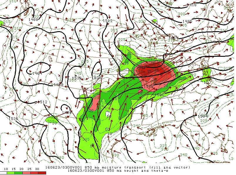
The 850 millibar moisture transport is a measure of the horizontal movement of moisture. Values shaded in pink/red colors are receiving an abundance of moisture from the low level jet stream. As seen by the direction of the wind barbs, the moisture is originating from the Gulf of America. However, there is a large buildup of the horizontal movement of moisture behind the frontal passage. As the winds shift when the fronts begin to move into the forecast area, the moisture comes with it, further destabilizing the atmosphere and promoting widespread heavy rainfall.
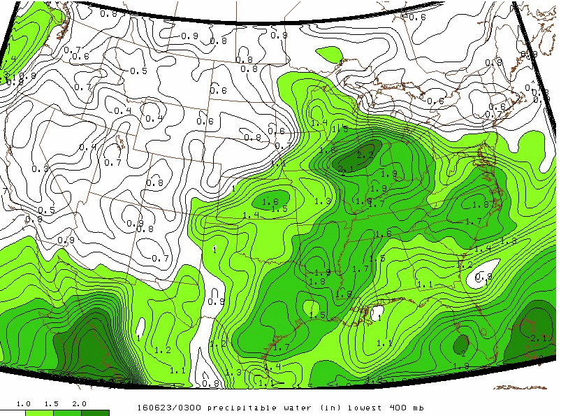
Precipitable Water (PWAT) values are the measure of the depth of liquid water at the surface that would result after precipitating all of the water vapor in a vertical column over a given location. In this loop, that column extends from the surface to 400 millibars above it (~14,000 ft.). During the flooding event, values of 2+ inches of precipitable water is observed over parts of West Virginia, however, the entire region consistently stays over 1.5 inches for an extended period of time throughout the day.
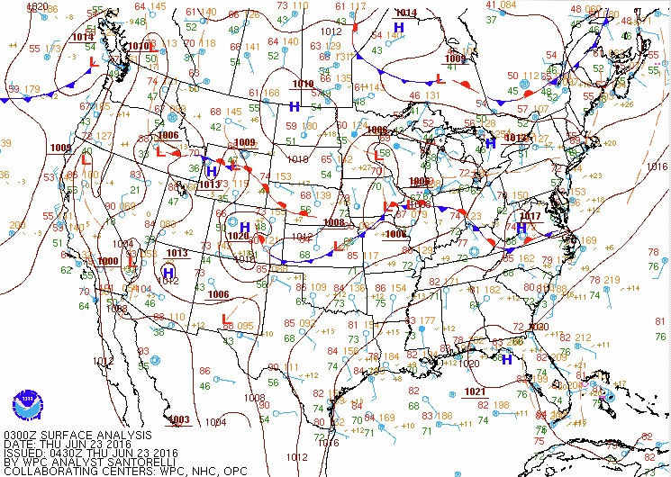
Surface frontal analysis shows a low pressure system propagating eastward through IL, IN, and OH. The pressure center remains just south of the Great Lakes, and the frontal passage continues to produce outflow boundaries that pass through West Virginia throughout the day which enhanced convection and provided rounds of heavy precipitation on the 23rd. At 2 PM, the front transitions to stationary which further prolongs the effects of the frontal passage. The stationary front is finally moved out by a cooler and drier air mass a little after 11 PM on the 24th.
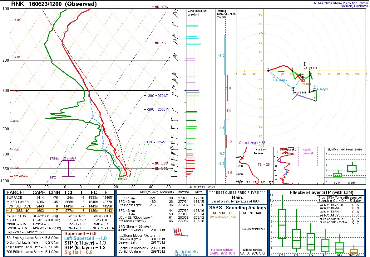
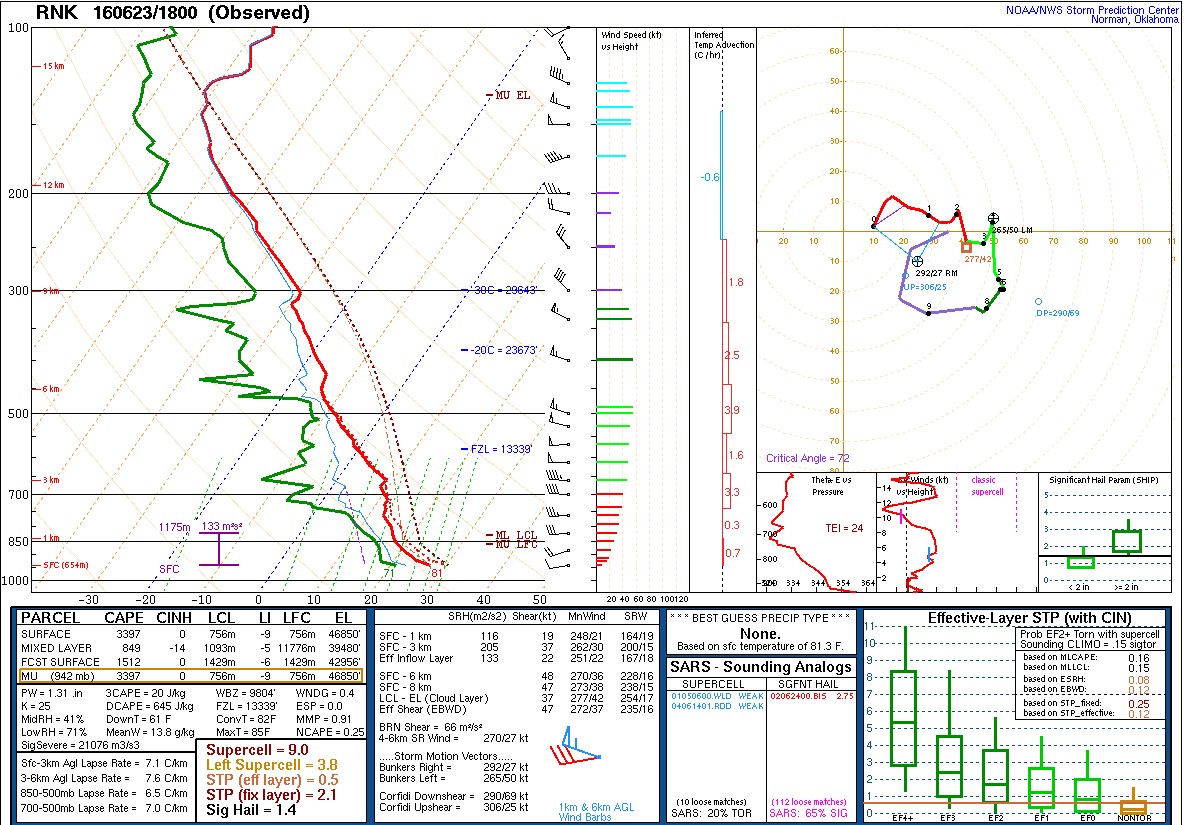
June 23 Soundings (Courtesy of NWS Blacksburg, VA)
 |
 |
|
|
23rd at 1200 UTC (8 AM) |
23rd at 1800 UTC (2 PM) |
24th at 0000 UTC (8 PM) |
Special thanks to Luke Ferguson for creating this webpage during his 2023 Summer Student Volunteership.
 |
Media use of NWS Web News Stories is encouraged! Please acknowledge the NWS as the source of any news information accessed from this site. |
|