| 3 Day (72 Hour) Snow/Sleet Amount Potential
Experimental - Leave feedback
|
|
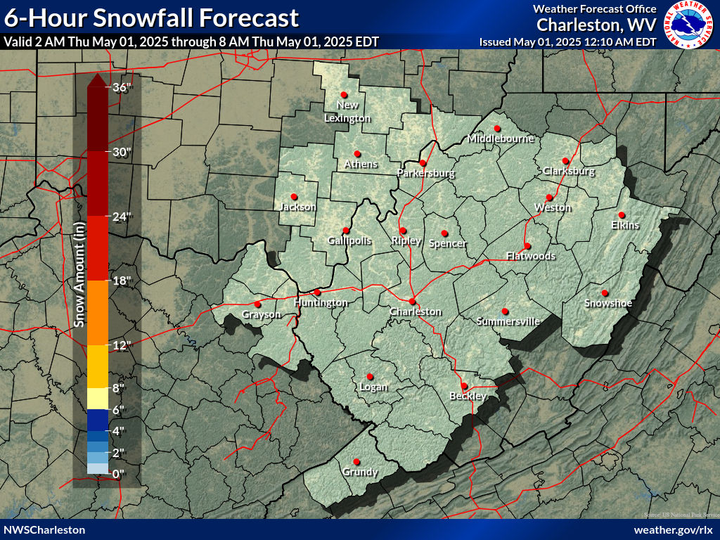
| Expected Snowfall - Official NWS Forecast
The "Point" map is the official NWS snowfall forecast in inches during the time period shown on the graphic. This snowfall amount is determined by NWS forecasters to be the most likely outcome based on evaluation of data from computer models, satellite, radar, and other observations. Note that forecast snow amounts also includes sleet.
The "Range" map is the 25th percentile (lower number) to 75th percentile (higher number) of possible snowfall amounts based on the Weather Prediction Center (WPC) Super Ensemble output during the time period of the graphic. The official NWS snowfall forecast influences this range of values either up or down depending upon how closely they match. |
High End Amount 1 in 10 Chance (10%) of Higher Snowfall What's this? |
| Low End Amount 9 in 10 Chance (90%) of Higher Snowfall What's this? |
|
| Percent Chance That Snow Amounts Will Be Greater Than...
Experimental - Leave feedback
What's this?
|
||||||||||||||||
|
||||||||||||||||
| Snowfall Totals by Location
Experimental - Leave feedback
What's this?
|
|
|
| 3 Day (72 Hour) Snow/Sleet Amount Potential
Experimental - Leave feedback
|
|
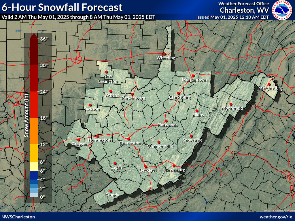
| Expected Snowfall - Official NWS Forecast
The "Point" map is the official NWS snowfall forecast in inches during the time period shown on the graphic. This snowfall amount is determined by NWS forecasters to be the most likely outcome based on evaluation of data from computer models, satellite, radar, and other observations. Note that forecast snow amounts also includes sleet.
The "Range" map is the 25th percentile (lower number) to 75th percentile (higher number) of possible snowfall amounts based on the Weather Prediction Center (WPC) Super Ensemble output during the time period of the graphic. The official NWS snowfall forecast influences this range of values either up or down depending upon how closely they match. |
High End Amount 1 in 10 Chance (10%) of Higher Snowfall What's this? |
| Low End Amount 9 in 10 Chance (90%) of Higher Snowfall What's this? |
|
| Percent Chance That Snow Amounts Will Be Greater Than...
Experimental - Leave feedback
What's this?
|
||||||||||||||||
|
||||||||||||||||
| 3 Day (72 Hour) Ice Accumulation Potential
Experimental - Leave feedback
|
|
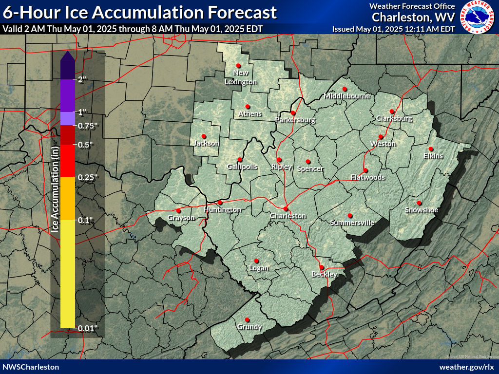
| Expected Ice Accumulation - Official NWS Forecast
The "Point" map is the official NWS ice accumulation forecast in inches during the time period shown on the graphic. This ice accumulation amount is determined by NWS forecasters to be the most likely outcome based on evaluation of data from computer models, satellite, radar, and other observations.
The "Range" map is the 25th percentile (lower number) to 75th percentile (higher number) of possible ice accumulation amounts based on the Weather Prediction Center (WPC) Super Ensemble output during the time period of the graphic. The official NWS ice accumulation forecast influences this range of values either up or down depending upon how closely they match. |
High End Amount 1 in 10 Chance (10%) of Higher Ice Accumulation What's this? |
| Low End Amount 9 in 10 Chance (90%) of Higher Ice Accumulation What's this? |
|
| Percent Chance That Ice Accumulation Will Be Greater Than...
Experimental - Leave feedback
What's this?
|
||||||||||||||||
|
||||||||||||||||
| Ice Accumulation by Location
Experimental - Leave feedback
What's this?
|
|
|
| 3 Day (72 Hour) Ice Accumulation Potential
Experimental - Leave feedback
|
|
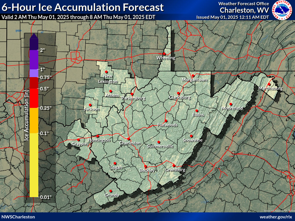
| Expected Ice Accumulation - Official NWS Forecast
The "Point" map is the official NWS ice accumulation forecast in inches during the time period shown on the graphic. This ice accumulation amount is determined by NWS forecasters to be the most likely outcome based on evaluation of data from computer models, satellite, radar, and other observations.
The "Range" map is the 25th percentile (lower number) to 75th percentile (higher number) of possible ice accumulation amounts based on the Weather Prediction Center (WPC) Super Ensemble output during the time period of the graphic. The official NWS ice accumulation forecast influences this range of values either up or down depending upon how closely they match. |
High End Amount 1 in 10 Chance (10%) of Higher Ice Accumulation What's this? |
| Low End Amount 9 in 10 Chance (90%) of Higher Ice Accumulation What's this? |
|
| Percent Chance That Ice Accumulations Will Be Greater Than...
Experimental - Leave feedback
What's this?
|
||||||||||||||||
|
||||||||||||||||
 |
 |
 |
 |
 |
 |
| Precipitation Onset/End Timing | ||
| Onset of Wintry Precipitation | End Timing of Wintry Precipitation | |
|---|---|---|
 |
 |
|
| What's this? | What's this? | |
| Winter Storm Severity Index (WSSI) | Winter Storm Outlook (WSO) |
|---|---|
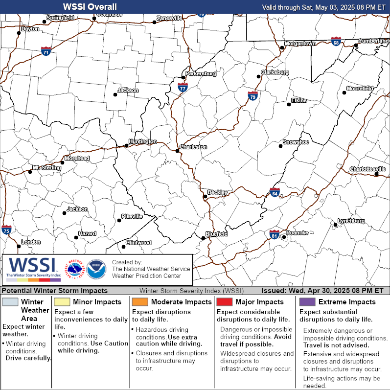 |
 |
| Local Snow Reports | National Snowfall Analysis |
|---|---|
 |
 |
| Days 4-7 Winter Weather Outlook | |
| Day 4 Winter Weather Outlook | Day 5 Winter Weather Outlook |
 |
 |
| Day 6 Winter Weather Outlook | Day 7 Winter Weather Outlook |
 |
 |
| CPC Week-2 Experimental Heavy Snow Risk | |
 |
|
| CPC Temperature & Precipitation Maps | |
|
Days 6-10 |
|
| Temperature | Precipitation |
 |
 |
|
Days 8-14 |
|
| TEMPERATURE | PRECIPITATION |
 |
 |
|
Week 3-4 |
|
|
TEMPERATURE |
PRECIPITATION |
 |
 |
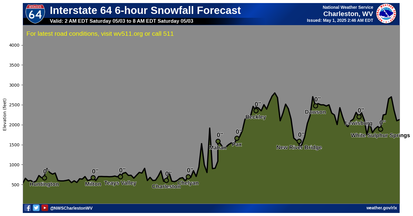
Click on a highway shield below to view a forecast highway profile
 |
 |
 |
 |
 |
|
Interstate 64Huntington to White Sulphur Springs |
Interstate 68Morgantown to Hazelton |
Interstate 77Bluefield to Parkersburg |
Interstate 79Charleston to Morgantown |
Interstate 81Ridgeway to Marlowe |
|
 |
 |
 |
|||
US Route 33Ravenswood to High Knob |
US Route 50Parkersburg to Capon Bridge |
US Route 219Rich Creek to Silver Lake |

This Morning |

This Afternoon |

This Evening |

Tonight |

Tomorrow Morning |

Tomorrow Afternoon |

Tomorrow Evening |
Tomorrow Night |
Hover over or click an image to view the larger version.
NOTE: The white shading along the elevation profile indicates the snow level, not that accumulating snow is necessarily forecast. Check the forecast point to see the forecast snow accumulation.
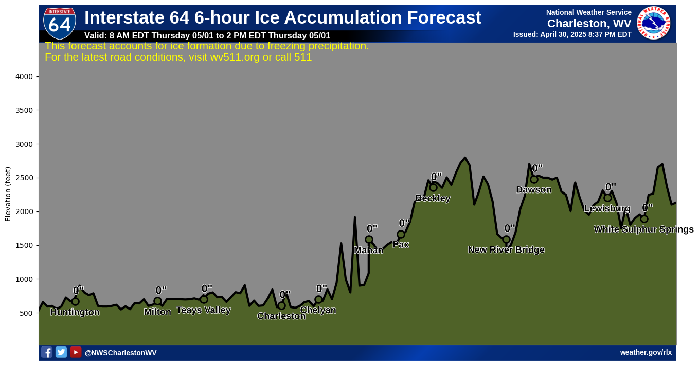
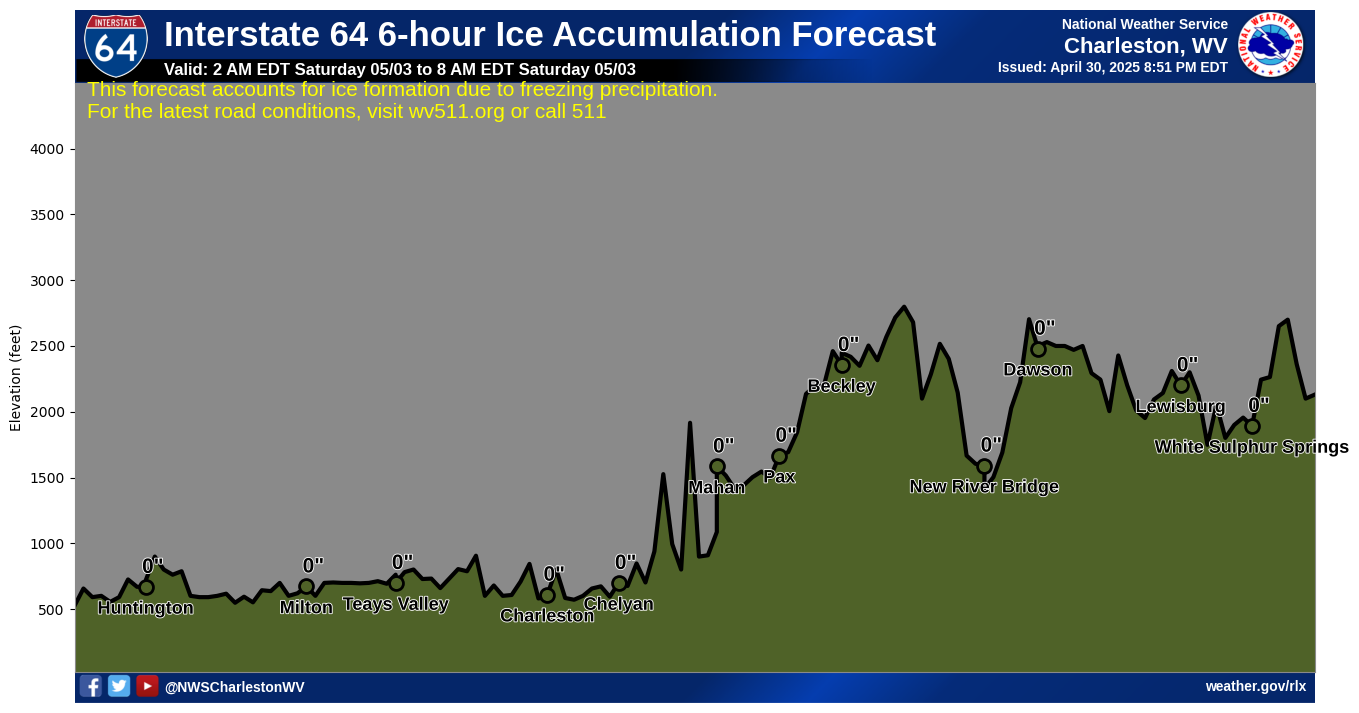
Click on a highway shield below to view a forecast highway profile
|
|
|
|
|
|
Interstate 64Huntington to White Sulphur Springs |
Interstate 68Morgantown to Hazelton |
Interstate 77Bluefield to Parkersburg |
Interstate 79Charleston to Morgantown |
Interstate 81Ridgeway to Marlowe |
|
|
|
|
|||
US Route 33Ravenswood to High Knob |
US Route 50Parkersburg to Capon Bridge |
US Route 219Rich Creek to Silver Lake |
This Morning |

This Afternoon |

This Evening |

Tonight |

Tomorrow Morning |

Tomorrow Afternoon |

Tomorrow Evening |
Tomorrow Night |
Hover over or click an image to view the larger version.
NOTE: The yellow shading along the elevation profile indicates an ice accumulation level, not that accumulating ice is necessarily forecast. Check the forecast point to see the forecast ice accumulation.

