Prior to every flight, pilots should gather all information vital to the nature of the flight. This site is informational in nature and is designed to assist pilots and aircrews for flight planning and weather familiarization. It may be used in conjunction with other preflight information sources needed to satisfy all the requirements of 14 CFR 91.103 and is not to be considered as a sole source of information to meet all preflight action. Pilots can complete their regulatory-compliant preflight briefing by using other automated resources or from Flight Service at www.1800wxbrief.com or by calling 1-800-WX-BRIEF.


.AVIATION /09Z MONDAY THROUGH FRIDAY/...
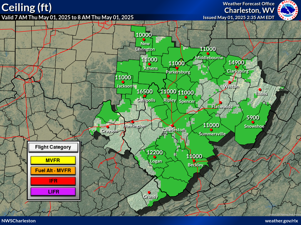
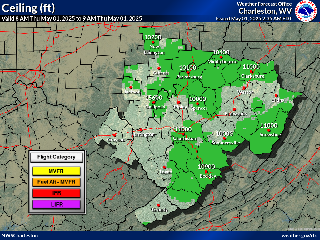
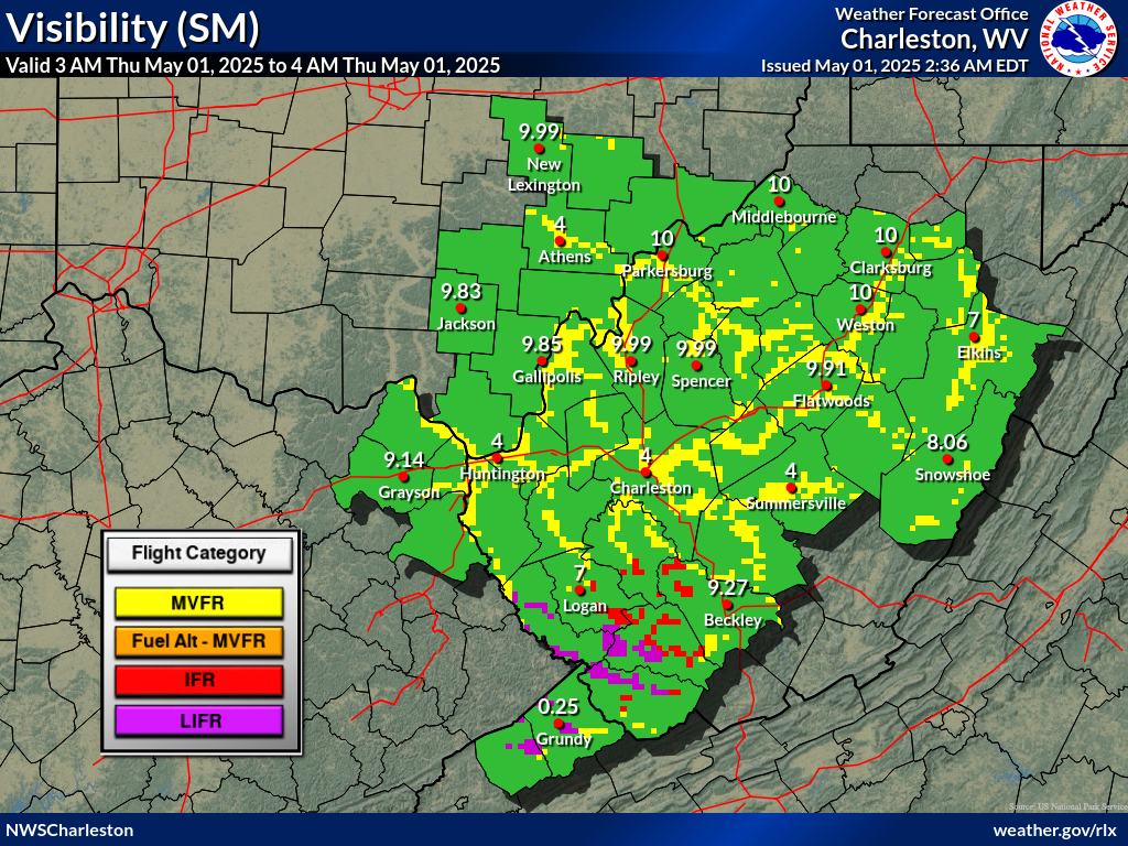
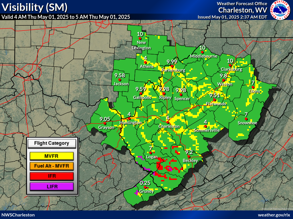
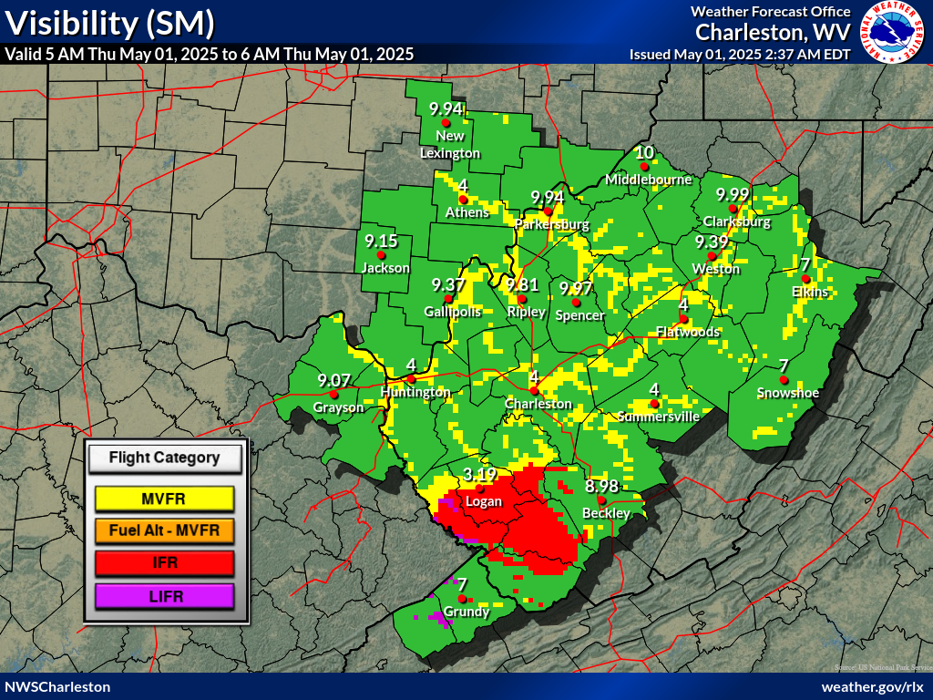
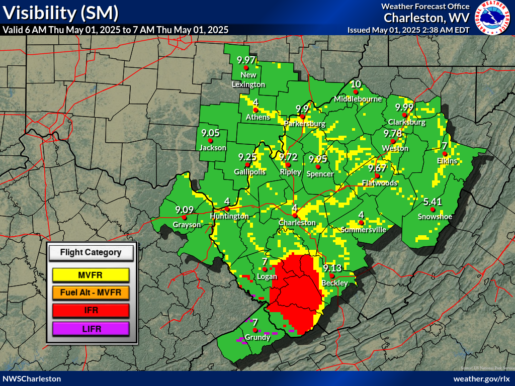
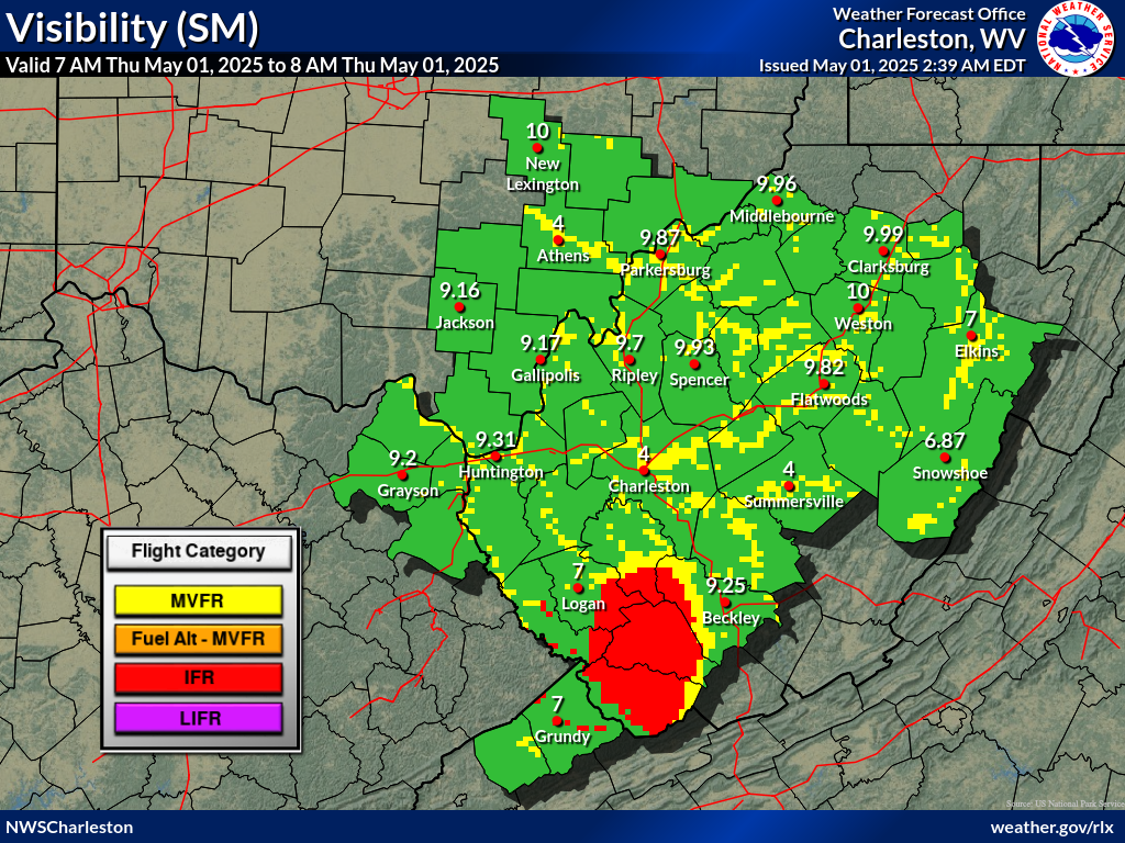
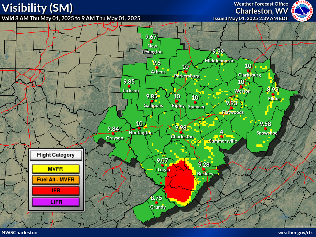
IFR/LIFR conditions associated with valley fog will quickly improve
to VFR shortly after sunrise at all terminals, with the exception
of KBKW, which will remain VFR through the morning. Isolated -SHRA/-
TSRA will develop this afternoon, but confidence in spatiotemporal
coverage still remains too low to warrant inclusion in the TAFs. VFR
and light, easterly winds will prevail for the TAF period otherwise,
with KBKW gusting to 10-15 kt this afternoon. Reductions to VSBYs
are forecast to return during the predawn hours Tuesday as valley
fog develops once again across the region, with LIFR possible.
FORECAST CONFIDENCE AND ALTERNATE SCENARIOS THROUGH 12Z TUESDAY...
FORECAST CONFIDENCE: Low-medium through sunrise, then high.
AVIATION FORECAST CONFIDENCE
| Updated: 552 AM EDT Mon Jul 13 2026 |
| UTC | 10 | 11 | 12 | 13 | 14 | 15 | 16 | 17 | 18 | 19 | 20 | 21 |
| EDT | 06 | 07 | 08 | 09 | 10 | 11 | 12 | 13 | 14 | 15 | 16 | 17 |
| CRW | L | L | L | L | H | H | H | H | H | H | H | H |
| HTS | L | L | L | H | H | H | H | H | H | H | H | H |
| BKW | H | H | H | H | H | H | H | M | H | H | H | H |
| EKN | L | L | H | H | H | H | H | H | H | H | H | H |
| PKB | M | M | L | L | M | H | H | H | H | H | H | H |
| CKB | H | H | H | H | H | H | H | H | H | H | H | H |
| 9 AM | 10 AM | 11 AM | 12 PM | 1 PM | 2 PM | |
 |
 |
 |
 |
 |
 |
 |
| 9 AM | 10 AM | 11 AM | 12 PM | 1 PM | 2 PM | |
 |
 |
 |
 |
 |
 |
|
 Airports with TAFs |
  Airports without TAFs
Additional Local Information |
Regional/National Information |

