
Thunderstorms this afternoon and evening could produce damaging winds and hail, particularly with a line that moves southeast ahead of an advancing cold front. A tornado or two, as well as localized flash flooding, are also possible. There is a Slight to Enhanced Risk for Severe Storms, and a Slight Risk for Flash Flooding. Please keep updated on the forecast and have ways to receive warnings. Read More >
Charleston, WV
Weather Forecast Office
 |
 |
 |
|
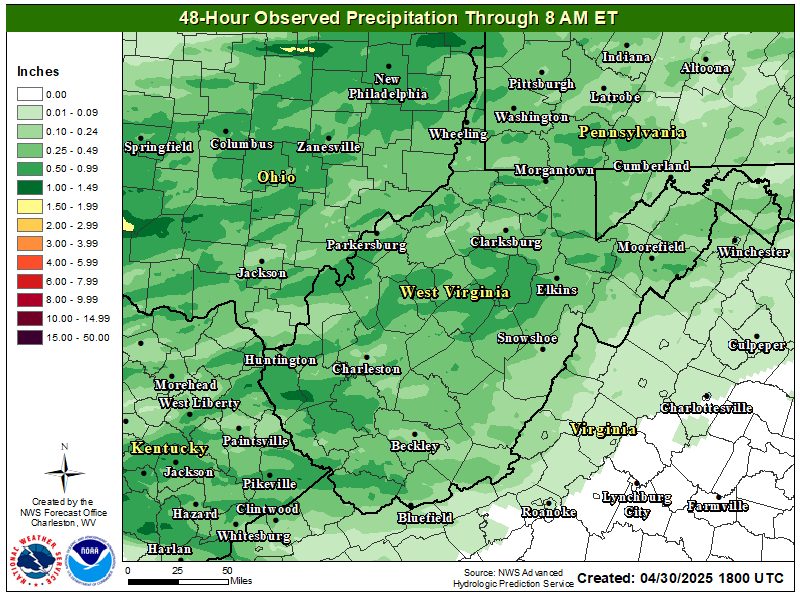
| Recent Rainfall | Future Rainfall | Long Range Outlook |
 |
 |
 |
| More Detailed Rainfall Accumulation Information | More Detailed Rainfall Forecast Information | More Long Range Outlook Information |
Warnings/Hazards
Local Briefing
Report Severe Weather
Winter Storm Severity Index
Hazards Criteria
Heat Risk
Observations
Current Weather Briefing
Observations (List)
Local Radar
Regional Radar
Satellite
Rain Gauge Monitoring
Snowfall Reports
Ice Reports
Local Storm Reports
Public Information Statements
Forecasts
Forecast Discussion
Local Zone Forecast
Graphical Forecasts
Hourly Forecasts
Local Aviation Weather
Local Fire Weather
Winter Weather Forecasts
Probabilistic Rainfall Forecasts
Long Range Outlooks
Rivers and Lakes
River Observations/Forecasts
Ensemble River Guidance
Ensemble Dashboard
River Monitor
Hydrograph Dashboard
River/Lake Summary
US Dept of Commerce
National Oceanic and Atmospheric Administration
National Weather Service
Charleston, WV
1754 Hendrickson Drive
South Charleston, WV 25303
(304) 356-5885
Comments? Questions? Please Contact Us.

