STORM SUMMARY OF HEAVY RAIN EVENT JANUARY 22-23, 2006
by Hunter Coleman
(click on images for full size versions)
A low pressure system and associated cold front affected the Ohio Valley and Central Appalachians on January 22nd and 23rd. A strong upper storm system moved across the southern plains during the day Sunday, January 22nd, while a surface low pressure system slowly lifted northeast through the lower Mississippi Valley, with an inverted trough extending into West Virginia (Fig 1).
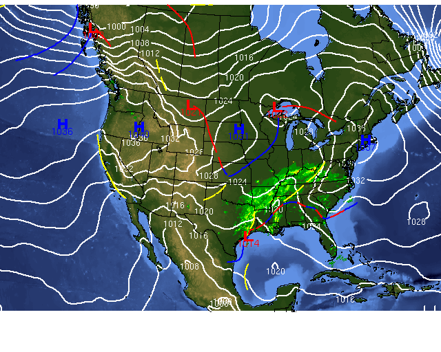
Figure 1 - Surface weather map from Sunday, January 22, 2006.
Strong southerly winds ahead of the storm system allowed abundant moisture to flow northeastward over the Tennessee Valley into eastern Kentucky, Southeast Ohio and western West Virginia.
A band of light to moderate rain overspread the tri-state area after 5 pm EST on Sunday (Fig 2).
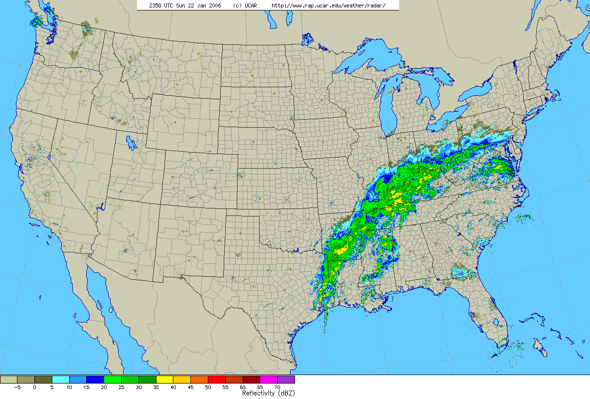
Figure 2- Radar map from 7 PM, Sunday, January 22, 2006.
The rain became moderate to heavy at times, and continued throughout the evening and overnight hours as the low pressure system lifted northeast (Fig 3).
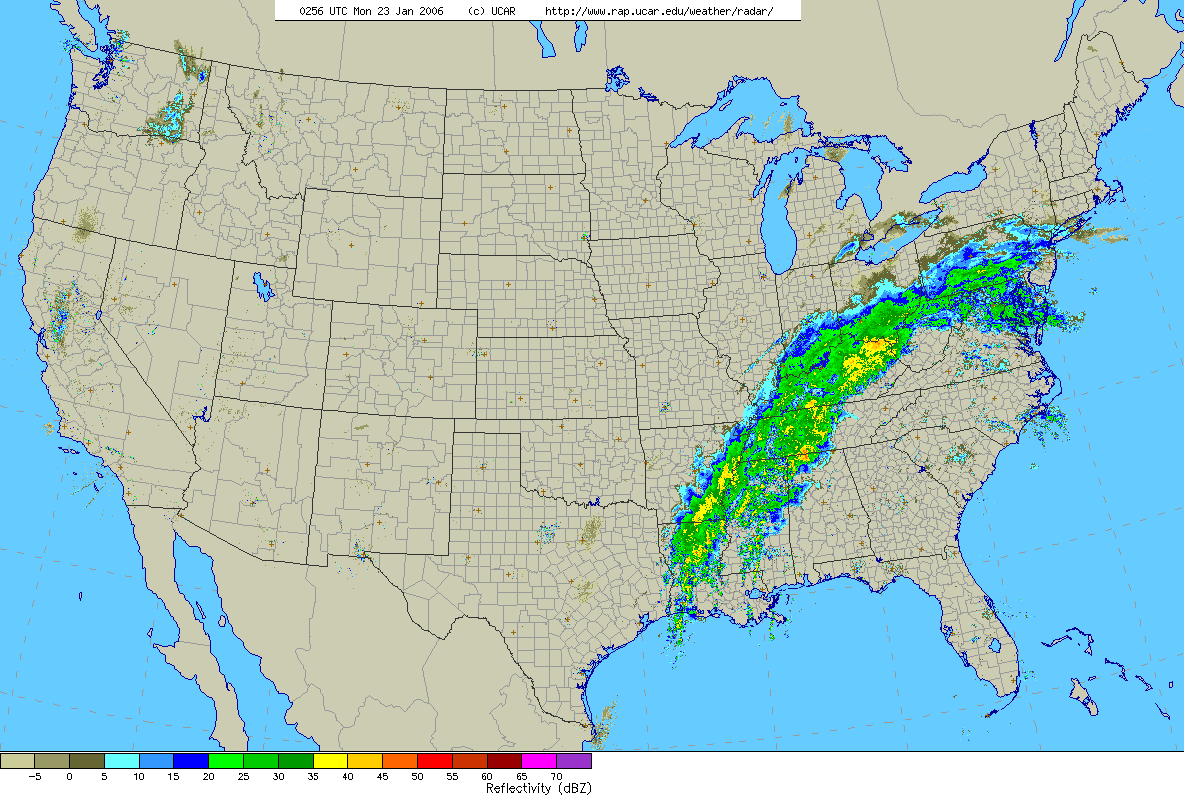
Figure 3- Radar map from 11 PM, Sunday, January 22, 2006.
This band of rain generally remained west of a Charleston, WV to Clarksburg, WV line through early Monday morning (Fig 4), with only scattered showers east of this line.
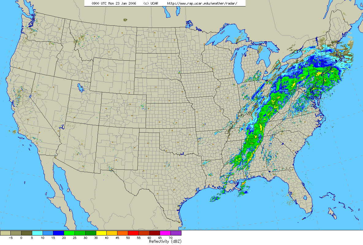
Figure 4- Radar map from 4 AM Monday, January 23, 2006.
As the low pressure system accelerated northeastward, the rain spread further east during the predawn hours on Monday, January 23rd, followed by a cold frontal passage late Monday morning (Fig 5).
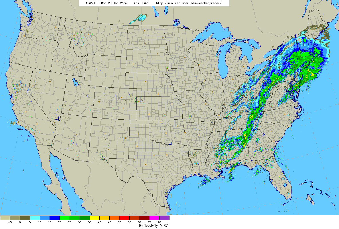
Figure 5-Radar map from 7 AM, Monday, January 23, 2006.
The total rainfall amounts ranged from a quarter inch or less along the Greenbrier Valley to a ribbon of greater than 2.50 inches over northeast Kentucky, nosing into southwest West Virginia (Fig 6).
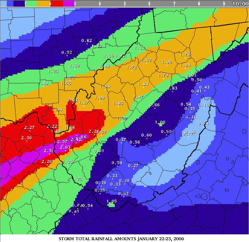
Figure 6- Storm total precipitation map in inches from January 22-23, 2006.

