Event Summary
|
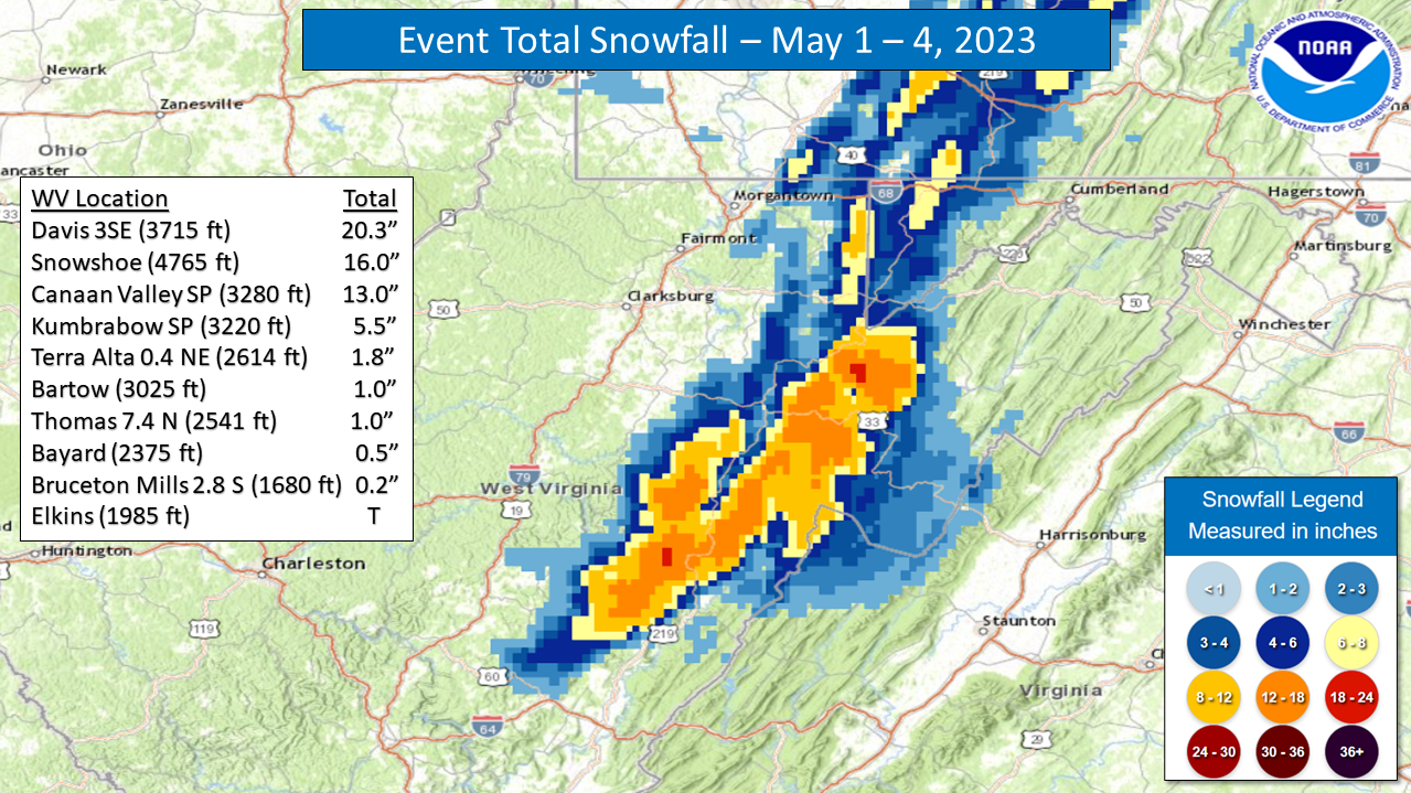
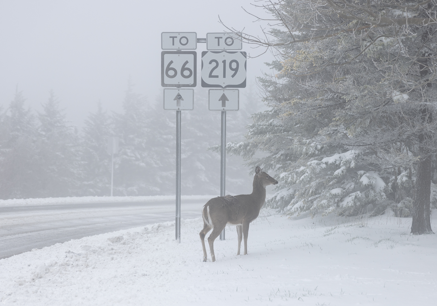
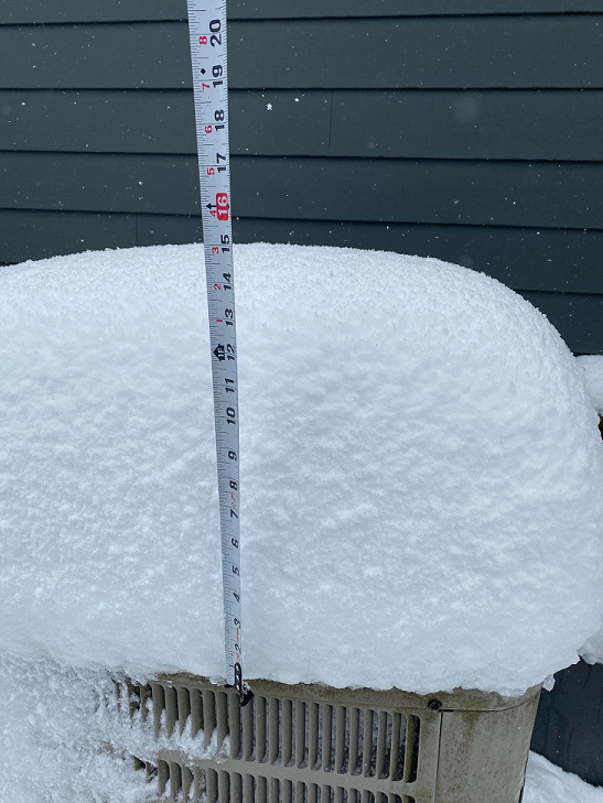
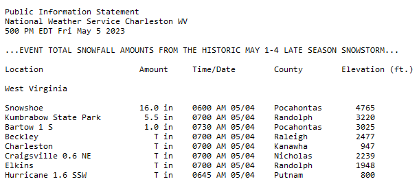
A historic late season snowstorm impacted the higher elevations of the West Virginia mountains on May 1-4, 2023, breaking all-time May snowfall records for our County Warning Area and the state of West Virginia, as a large disturbance stalled/spun north of the region, resulting in an extended high elevation snowfall event. Snowfall amounts up to 16" were reported in portions of Pocahontas and Randolph counties at elevations above 4,000 feet, with amounts steadily decreasing at lower mountain elevations. Most accumulating snowfall occurred at elevations near/above 3,000 feet. The highest snowfall total reported was 20.3" near Davis, WV, which is just outside of the NWS Charleston forecast area. This total shattered the former largest May snowstorm on record for the state of West Virginia by over 8". New state snowfall records for 'Largest 24-Hr May Snow' and 'Snowiest May' were also set by the aforementioned Davis, WV snowfall amount. A new state 'Greatest May Snow Depth' record was also set with this storm by our Cooperative Observer site in Snowshoe, WV. They reported an incredible snow depth of 15" on the morning of May 4th! This was certainly a storm for the West Virginia record books, and one that will not be soon forgotten. Please click on the tabs below for more detailed information about this event. Please note that all images/loops can be expanded by clicking on them. |
|
 |
 |
 |
 |
|
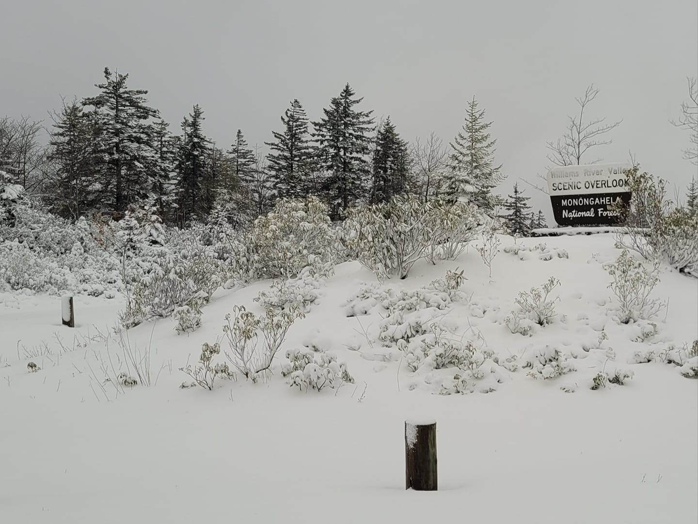
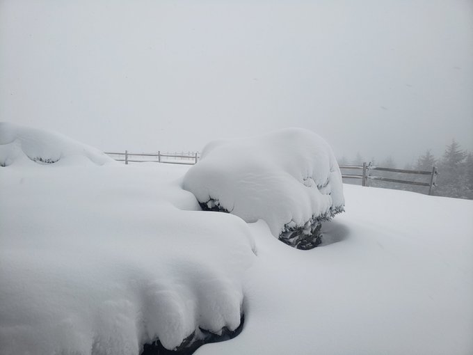
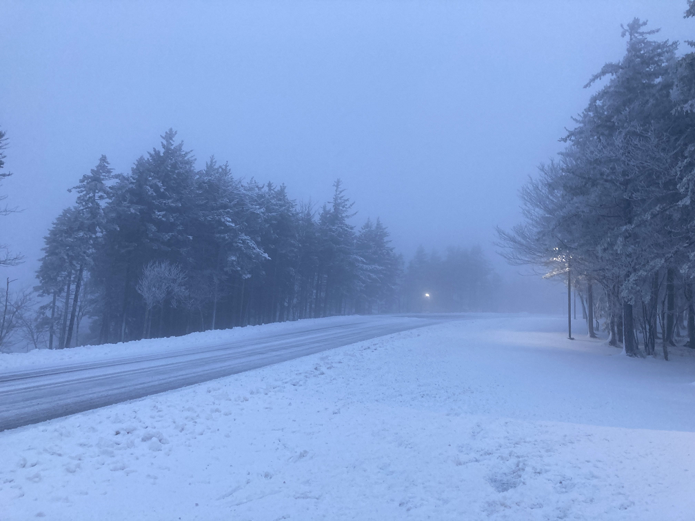
Monongahela N. F. (~4400 ft) (Photo Credit: Christina Roach) |
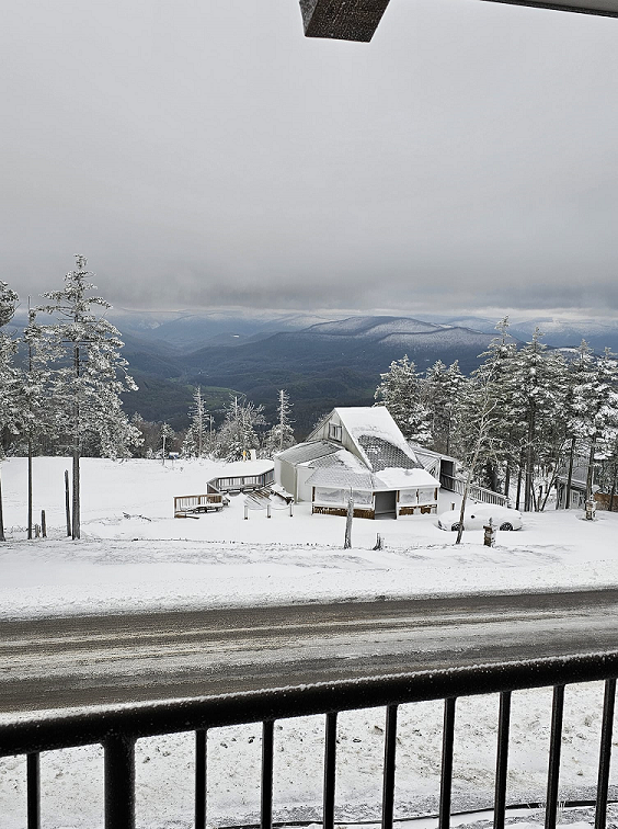
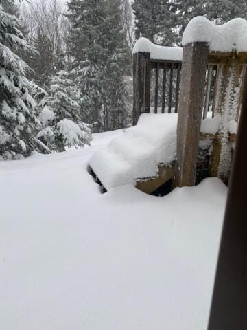
Snowshoe Mountain (~4800 ft) (Photo Credit: Peter Forister) |
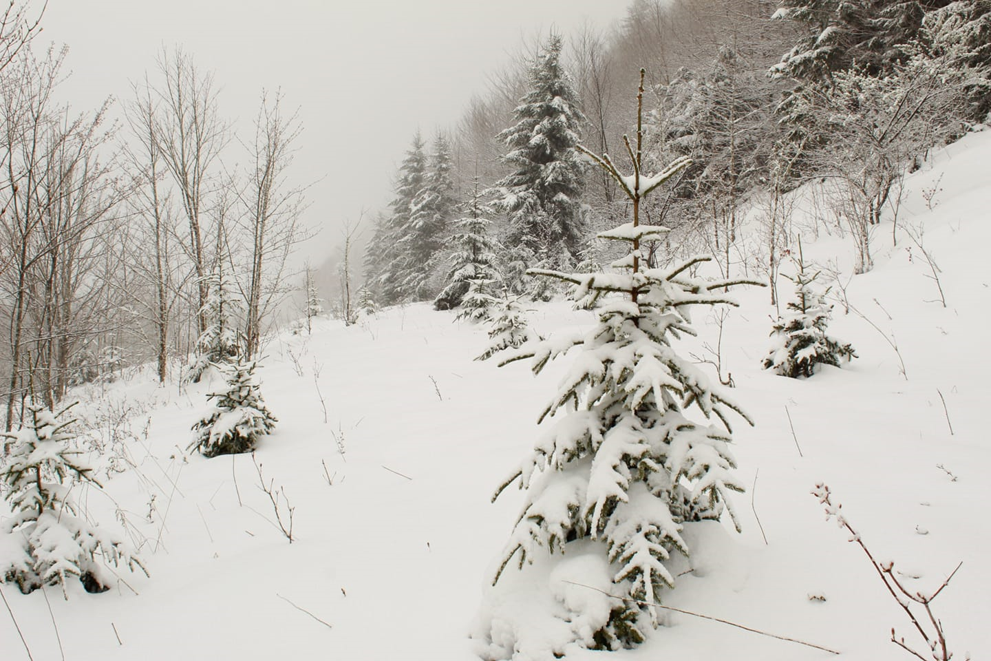
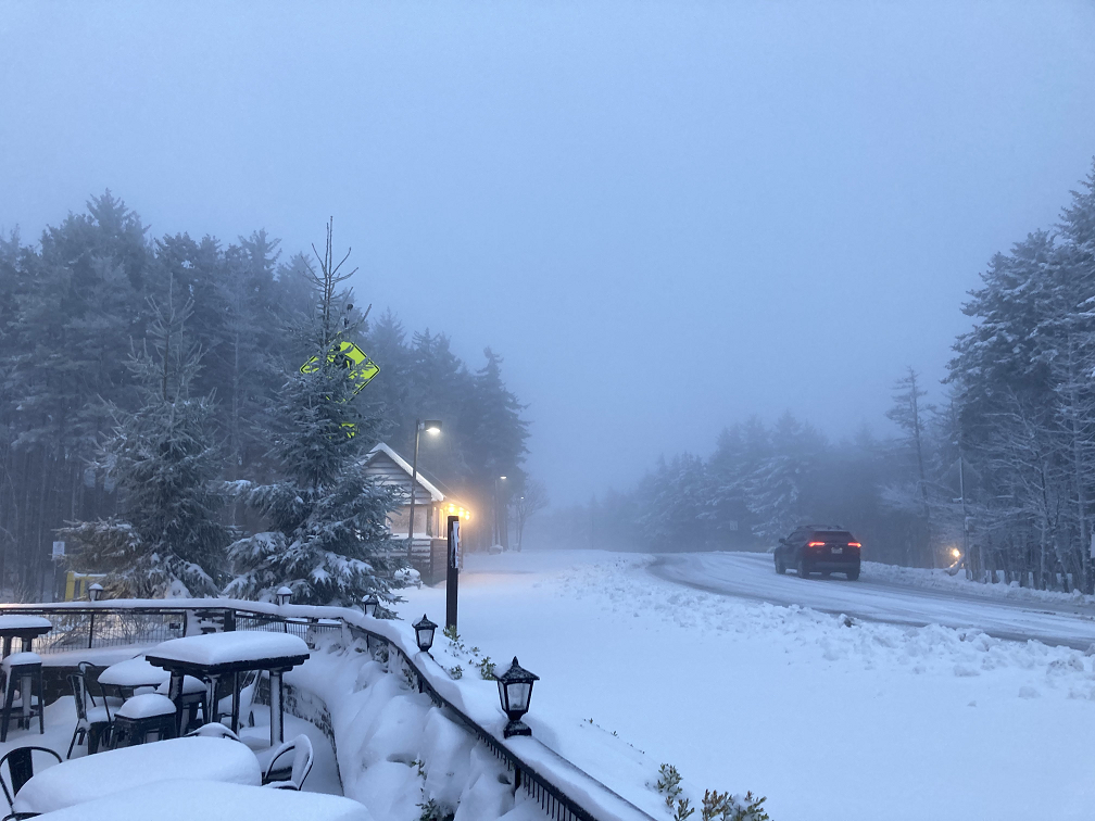
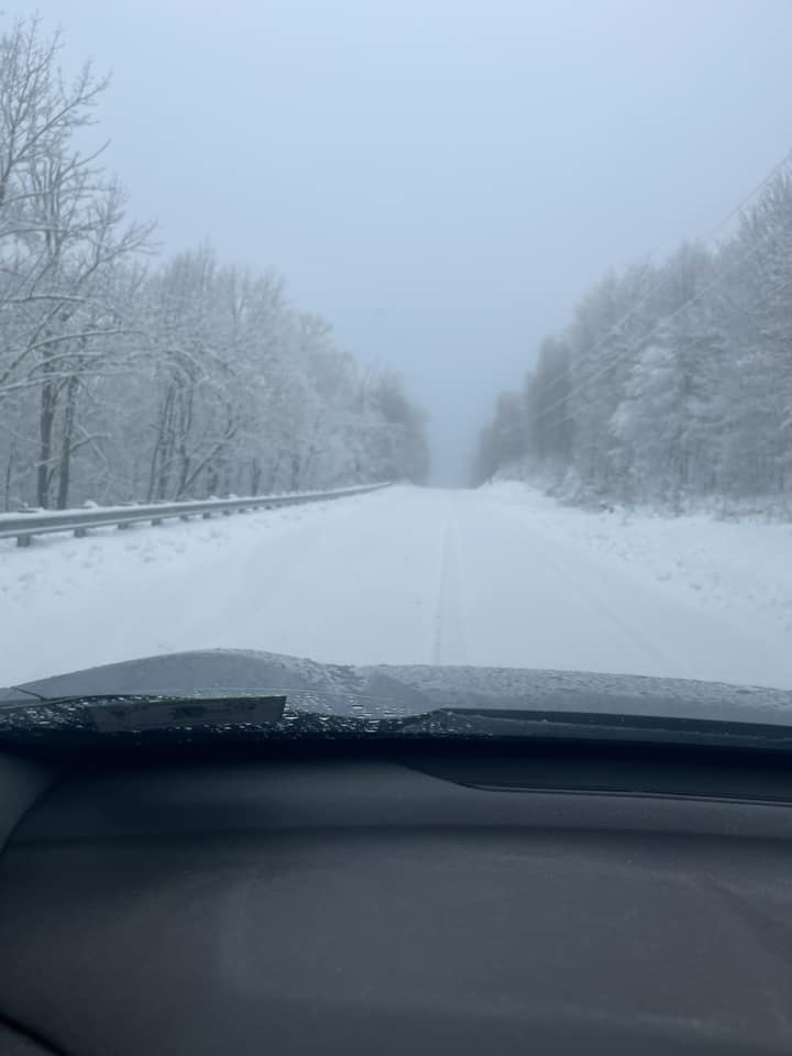
Pocahontas County (~4300 ft) (Photo Credit: Jeremy Cutlip) |
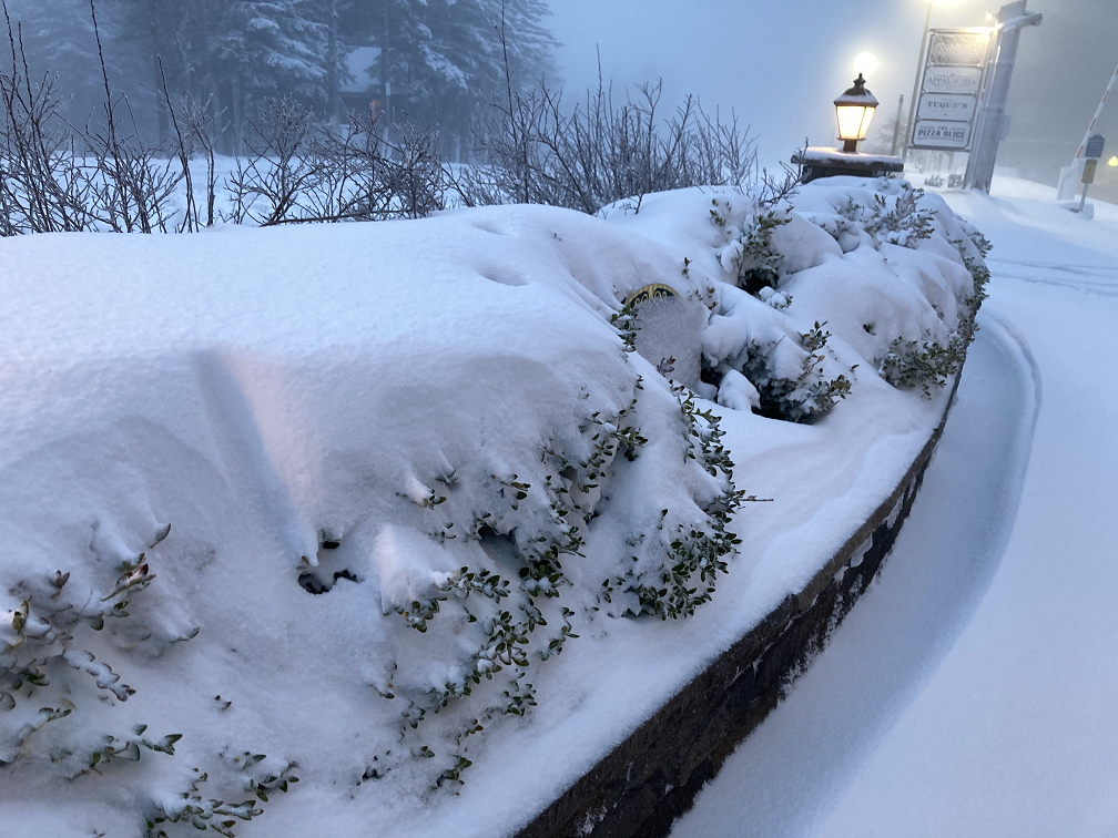
Snowshoe Mountain (~4800 ft) (Photo Credit: Snowshoe Mtn. Resort) |
May 1-4 Time Synchronized Local/Regional Radar Loops
.gif) |
.gif) |
|
May 1-4 Regional Radar Loop Radar loop courtesy of Iowa Environmental Mesonet (IEM) |
May 1-4 Local Radar Loop Radar loop courtesy of Iowa Environmental Mesonet (IEM) |
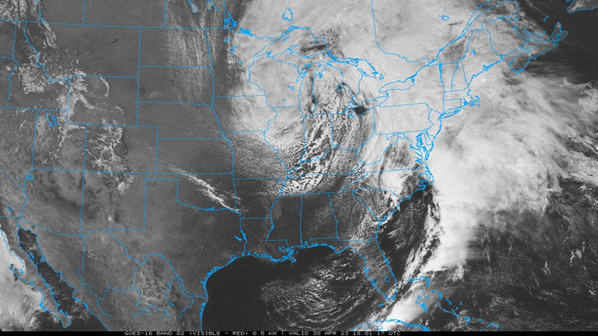
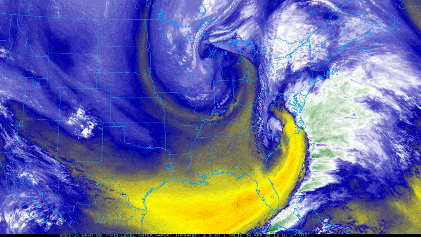
April 30 - May 4 Time Synchronized Satellite Loops
 |
 |
|
April 30 - May 4 Visible Loop (GOES-16) Satellite loop courtesy of NEXLAB- College of Dupage |
April 30 - May 4 Mid-level Water Vapor Loop (GOES-16) Satellite loop courtesy of NEXLAB- College of Dupage |
 |
 |
 |
|
Snowshoe Mountain (Taken May 2nd) (Photo Credit: Peter Forister) |
Snowshoe Mountain (Taken May 2nd) (Photo Credit: Peter Forister) |
Snowshoe Mountain (Taken May 2nd) (Photo Credit: Peter Forister) |
 |
 |
 |
 |
|
Snowshoe Mountain (Photo Credit: Bev Gragg) |
Snowcapped Mts, Bare Valleys (Photo Credit: Jacob Redden) |
Snowshoe Mountain (Photo Credit: Bev Gragg) |
Point Mountain (Photo Credit: Crystal Knight) |
Event Total Snowfall Amounts from the NWS Charleston, WV County Warning Area
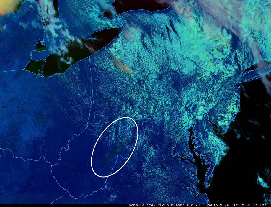
Day Cloud Phase Distinction RGB from GOES-16 at 11:41 AM, May 5th, 2023 highlighting (in shades of green) the snow cover across the higher elevations of the West Virginia mountains, amid a developing cumulus field.
.png)
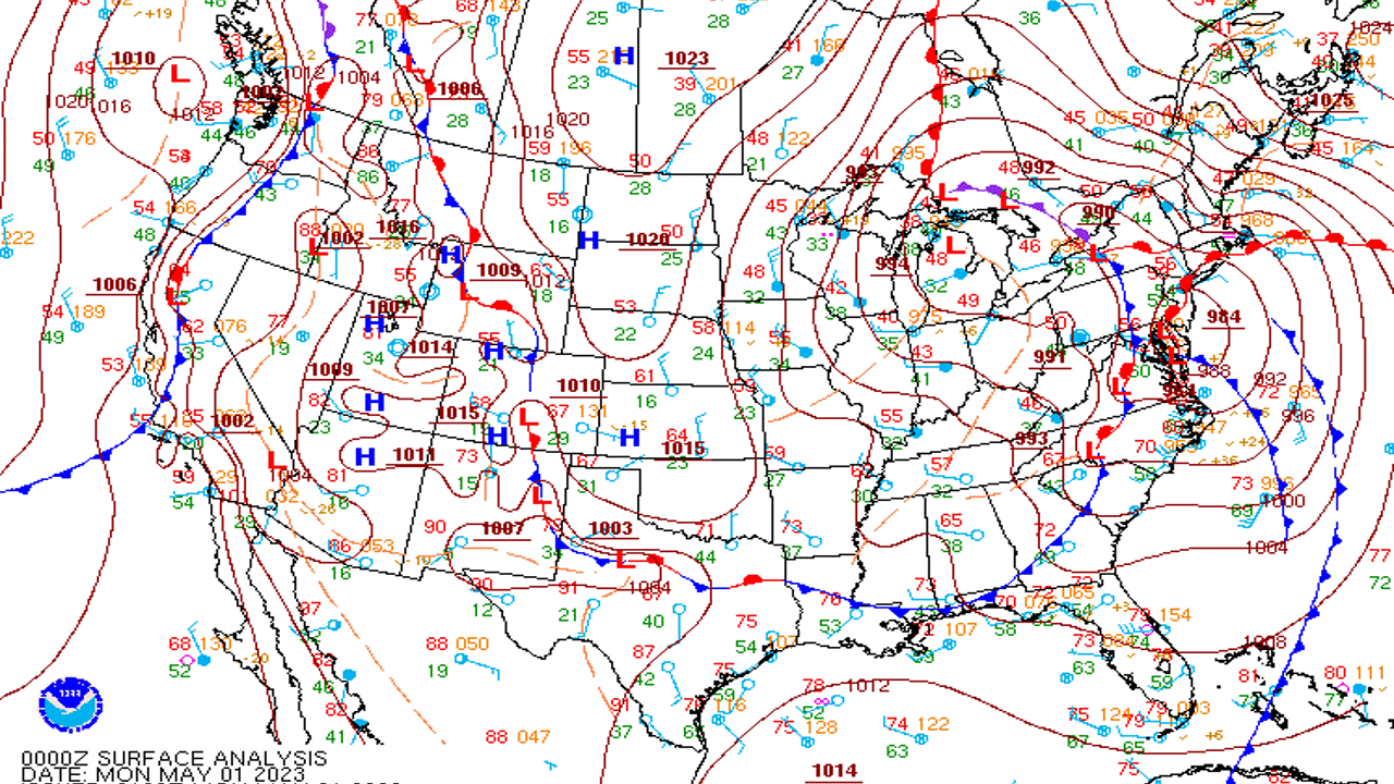
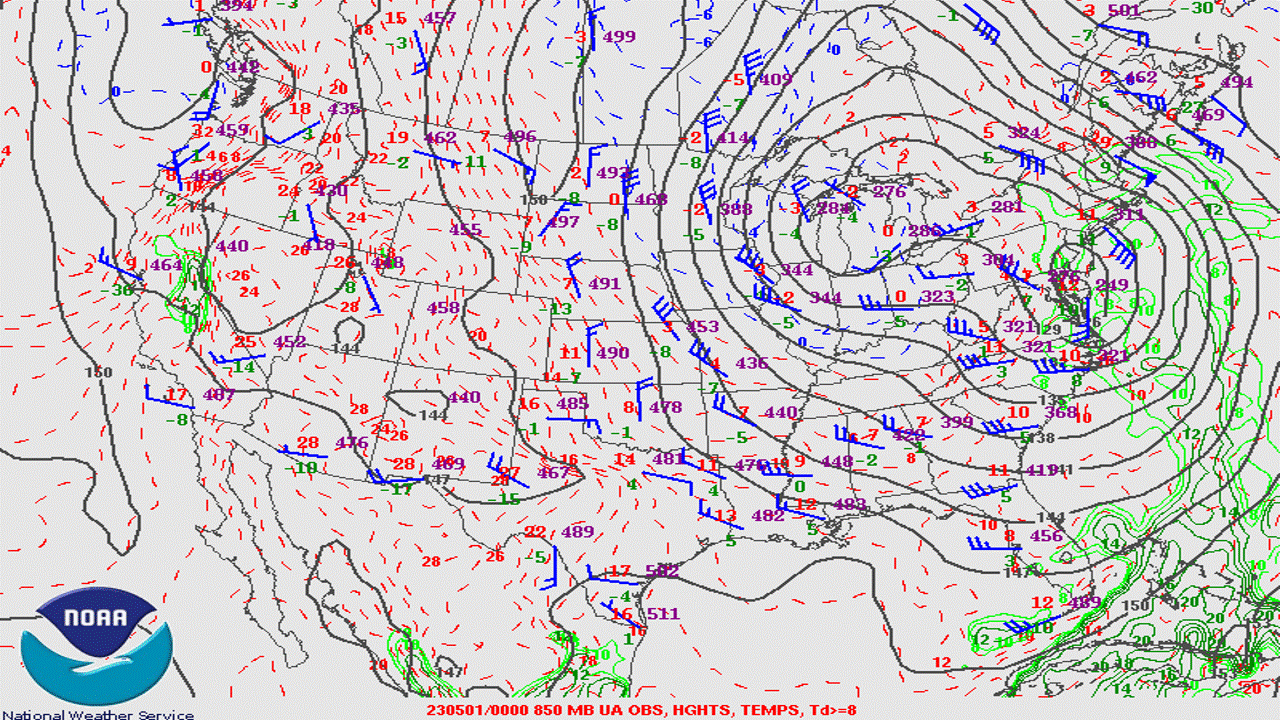
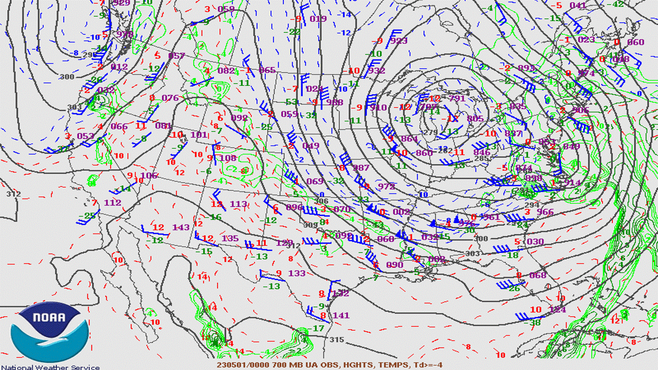
April 30 - May 3 Time Synchronized Surface and Upper Air Maps
A large and near vertically stacked system, positioned across the central/northern Great Lakes throughout the first few days of May, 2023, provided the necessary cold air and moisture for a high elevation snow event across the mountains of West Virginia. Most accumulating snowfall was confined to elevations near/above 3,000 feet, with the high May sun angle melting some, if not all of the overnight accumulations at lower mountain elevations during the daytime hours. Snow accumulations at the high mountain elevations would however withstand the strong May sun angle, as periodic rounds of snowfall continued to add up, courtesy of a three tier-punch of synoptic moisture, lake enhanced moisture, and orographic lift. The following loops below are from 8 PM April 30th until 8 PM May 3rd (at 12-hr intervals).
 |
 |
|
April 30 - May 3 Surface Analysis Loop Loop courtesy of the Storm Prediction Center |
April 30 - May 3 850 mb Analysis Loop Loop courtesy of the Storm Prediction Center |
 |
 |
|
April 30 - May 3 700 mb Analysis Loop Loop courtesy of the Storm Prediction Center |
April 30 - May 3 500 mb Analysis Loop Loop courtesy of the Storm Prediction Center |
 |
Media use of NWS Web News Stories is encouraged! Please acknowledge the NWS as the source of any news information accessed from this site. |
|