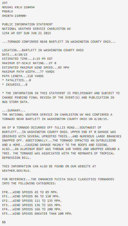
Bartlett (Washington County) EF-0 Tornado
June 20, 2015
|
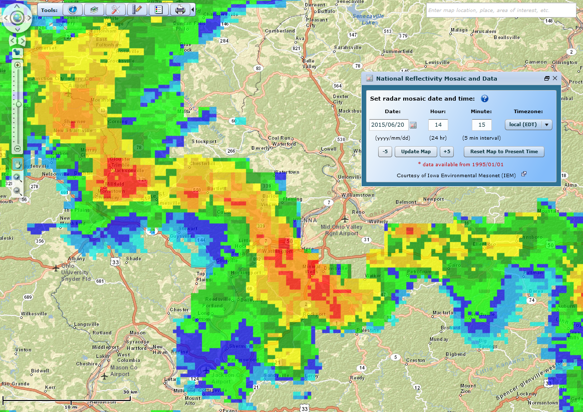
As the remnants of what was Tropical Storm Bill moved east, heavy rain fell through northern Kentucky during the morning hours, reaching near Portsmouth during the mid afternoon hours. Showers were more persistent from northern Vinton County and the Hocking River Valley on north. Lines of thunderstorms formed ahead of the low pressure center during the early afternoon and moved north. One brief tornado was confirmed in Washington County on the mesoscale comma head of one short convective line.
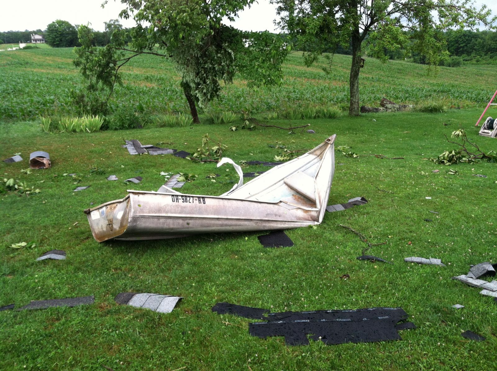
The tornado was rated EF-0 and occurred off of Tullis Road, southwest of Bartlett. The estimated strongest wind gust was around 85 mph. Several trees were uprooted and numerous large branches were snapped. One house and an outbuilding were damaged, mainly to the roof and siding. Also, a small aluminum boat was thrown from the edge of the pond, 140 yards and wrapped around a tree.
Radar Data
 |
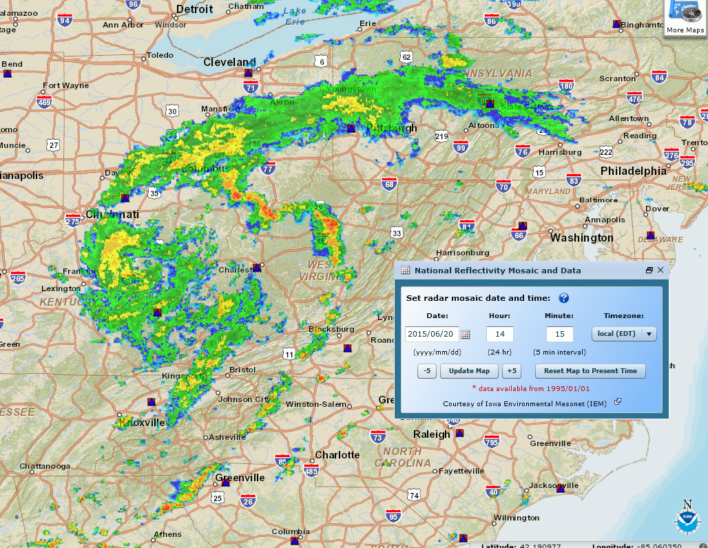 |
| Low level reflectivity image form 6/20 in the area of the tornado. | Wider reflectivity image showing the remnants of Tropical Storm Bill neart he time of the event. |
| Storm Damage Images |
|
|
|
|
|
|
Official NWS Damage Survey Information Statement:


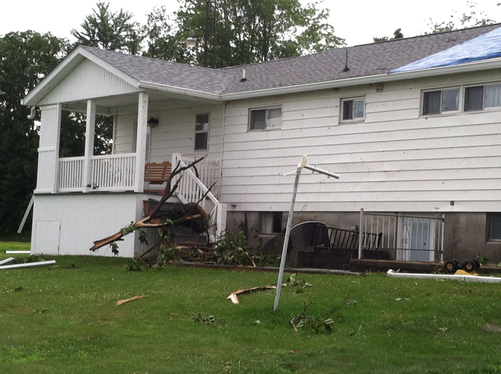 Minor damage to residence.
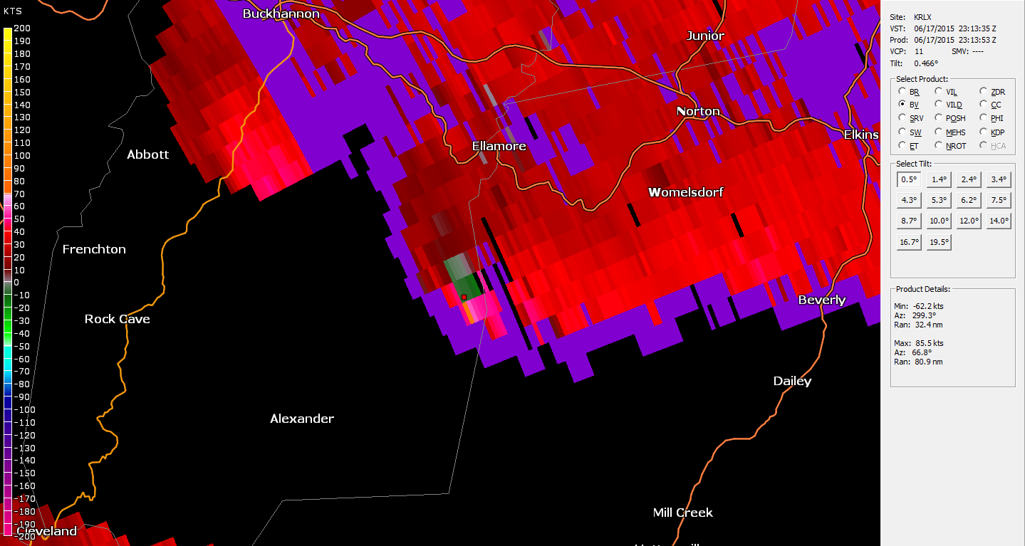