Event Synopsis
|
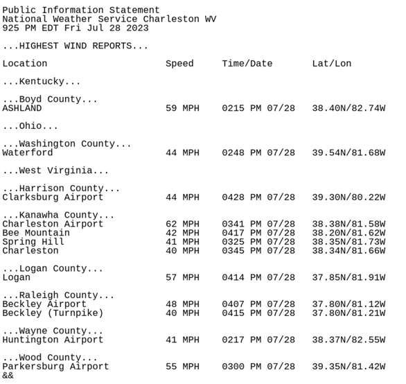
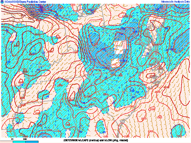
July 28, 2023 was a very hot and active weather day with a line of severe thunderstorms tracking across nearly the entire County Warning Area (CWA) during the afternoon hours. Temperatures reached the upper 80s and lower 90s with dew point temperatures in the lower 70s, making the air feel quite oppressive. This heat and humidity was the fuel that ignited severe thunderstorms across the middle Ohio Valley and central Appalachians during the mid-to-late afternoon hours. Early in the day, a long-lived cluster of thunderstorms tracked from eastern Indiana into Ohio with an increasingly unstable air mass developing ahead of it. MLCAPE values were soaring into the 1500-2000 J/kg range across southeast Ohio by midday. There were no large-scale synoptic features present on this day with surface high pressure over the middle Atlantic region. Because of this, forecast guidance had some difficulty handling the evolution of these storms as they continued to progress and regenerate along the associated outflow with very unstable air downstream. As these thunderstorms reached the NWS Charleston, WV forecast area, many of them turned severe. This resulted in numerous severe wind damage reports across the region, with a total of 17 severe thunderstorm warnings issued across the forecast area during the afternoon hours. Please click on the tabs below for more detailed information about this event. All images and loops can be expanded by clicking on them. |
July 28th Local Radar Loop Radar loop courtesy of Iowa Environmental Mesonet (IEM) |
 |
 |
|
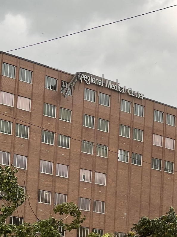
Wind Damage at Logan Regional Medical Center in Logan, WV (Photo Credit: WSAZ-TV) |
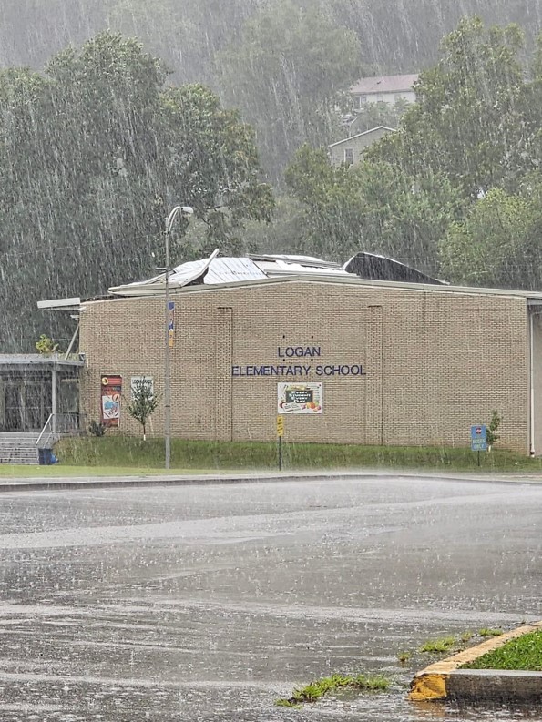
Damaged Roof at Logan Elementary School in Logan, WV (Photo Credit: WSAZ-TV) |
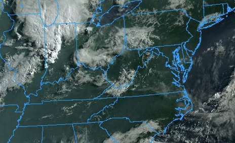
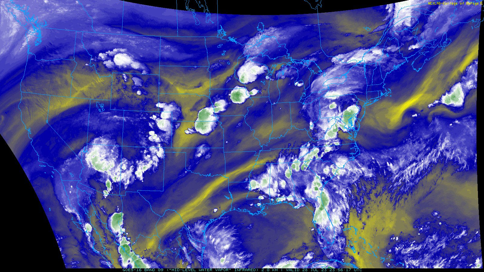
GOES-16 TrueColor and Mid-Level Water Vapor Imagery on July 28th
 |
 |
 |
|
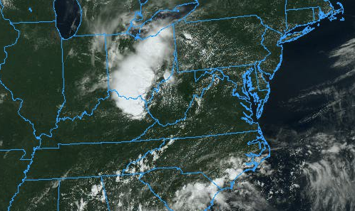
8 AM July 28th: Regional TrueColor Image (GOES-16) Satellite image courtesy of NEXLAB - College of Dupage |
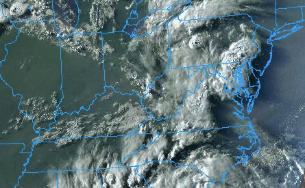
2 PM July 28th: Regional TrueColor Image (GOES-16) Satellite image courtesy of NEXLAB - College of Dupage |
8 PM July 28th: Regional TrueColor Image (GOES-16) Satellite image courtesy of NEXLAB - College of Dupage |
 |
 |
 |
|
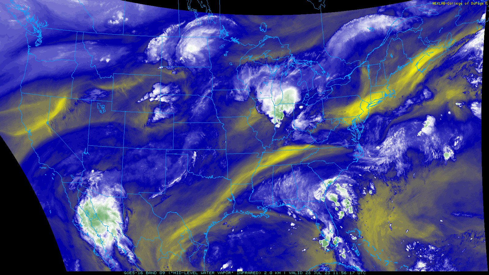
8 AM July 28th: CONUS Mid-level Water Vapor Image (GOES-16) Satellite image courtesy of NEXLAB - College of Dupage |
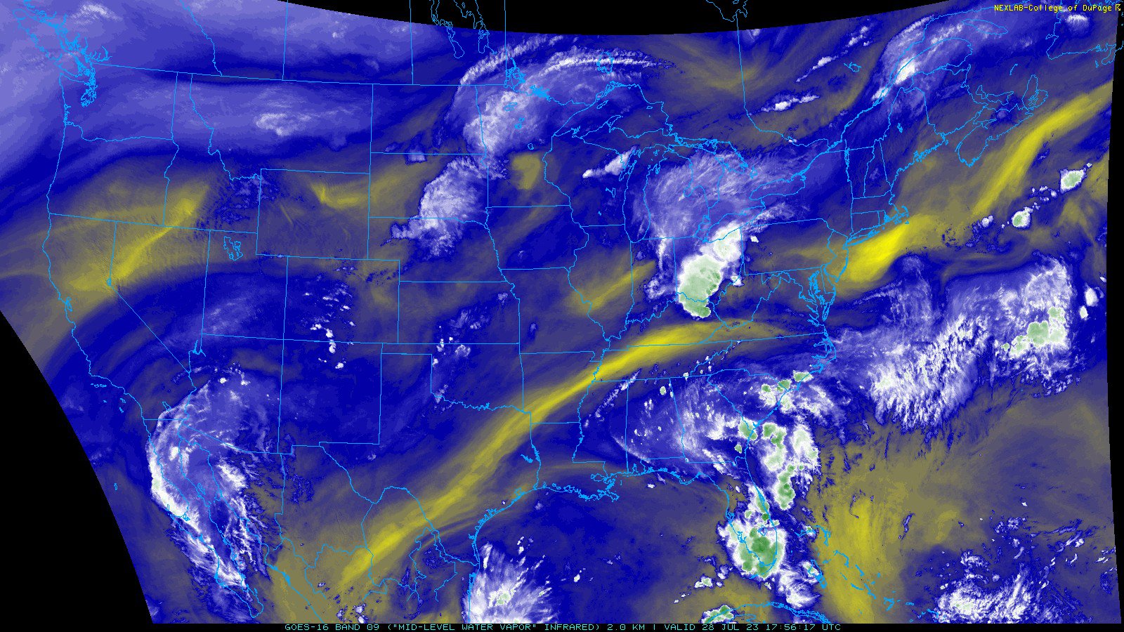
2 PM July 28th: CONUS Mid-level Water Vapor Image (GOES-16) Satellite image courtesy of NEXLAB - College of Dupage |
8 PM July 28th: CONUS Mid-level Water Vapor Image (GOES-16) Satellite image courtesy of NEXLAB - College of Dupage |
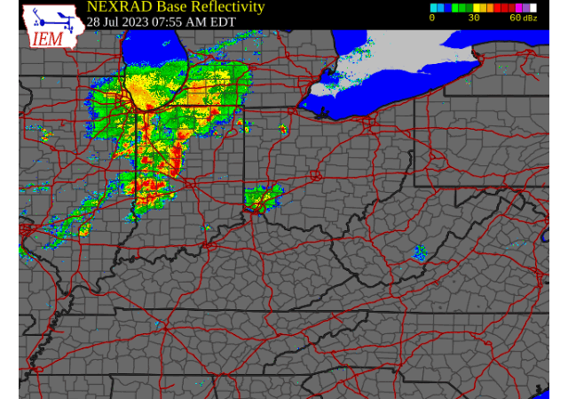
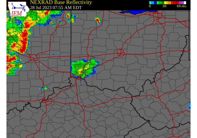
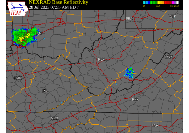
July 28th Time Synchronized Local/Regional Radar Loops
 |
 |
 |
|
Regional Radar Loop Radar loop courtesy of Iowa Environmental Mesonet (IEM) |
Middle Ohio Valley Radar Loop Radar loop courtesy of Iowa Environmental Mesonet (IEM) |
Local Radar Loop (w/ Convective Warnings Overlaid) Radar loop courtesy of Iowa Environmental Mesonet (IEM) |
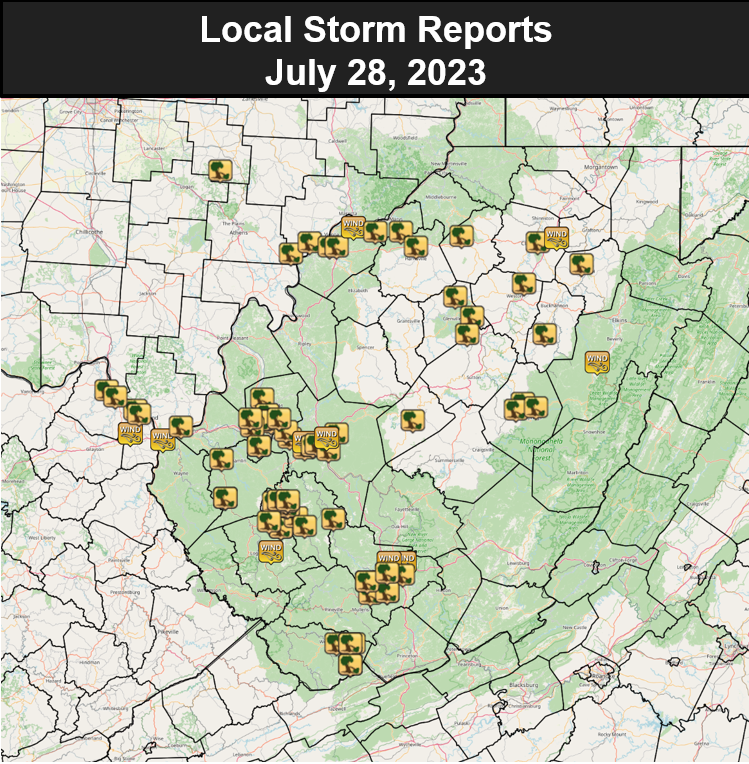
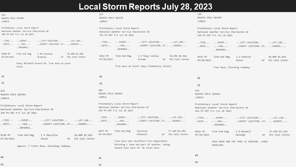
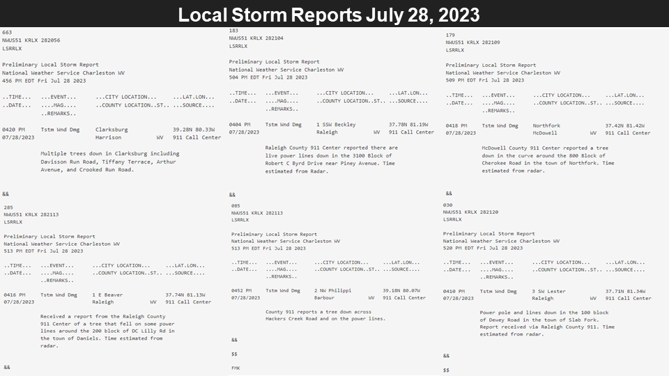
Static Radar Images Overlaid With Damage Reports Across Kanawha/Putnam Counties
.PNG) |
 |
|
0.5 Degree Base Reflectivity from KRLX at 3:14 PM and 3:24 PM. Maximum reflectivity at 3:14 PM was 61 dBZ just south of U.S. Route 60. Maximum reflectivity had propagated just north of U.S. Route 60 at 3:24 PM with a value of 63 dBZ. Radar images courtesy of GR2Analyst |
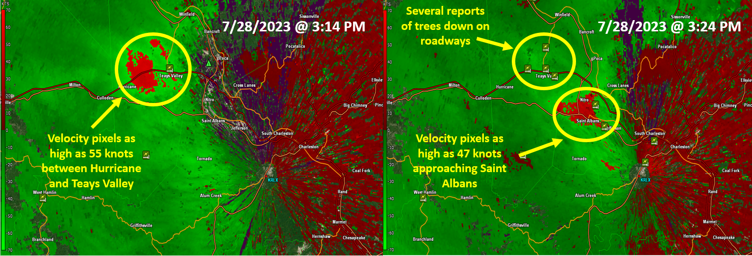
0.5 Degree Base Velocity from KRLX at 3:14 PM and 3:24 PM. Velocity data peaked at 55 knots across portions of Putnam County at 3:14 PM. Shortly after the storm passed southeast, there were numerous reports of downed trees near Hurricane, WV. Radar images courtesy of GR2Analyst |
Surface/500mb/0-6 km Bulk Shear/100mb Mixed-Layer CAPE Charts
 |
 |
 |
|
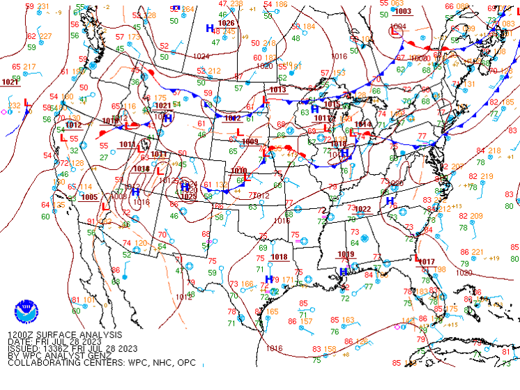
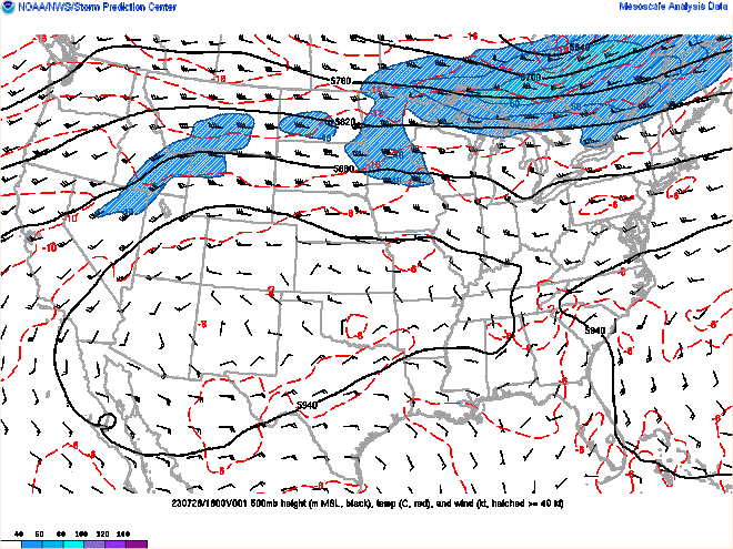
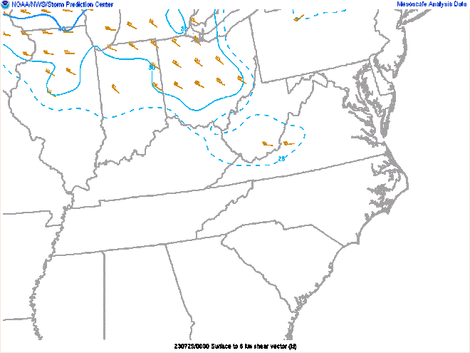
8 AM July 28th Surface Analysis Image courtesy of the Weather Prediction Center |
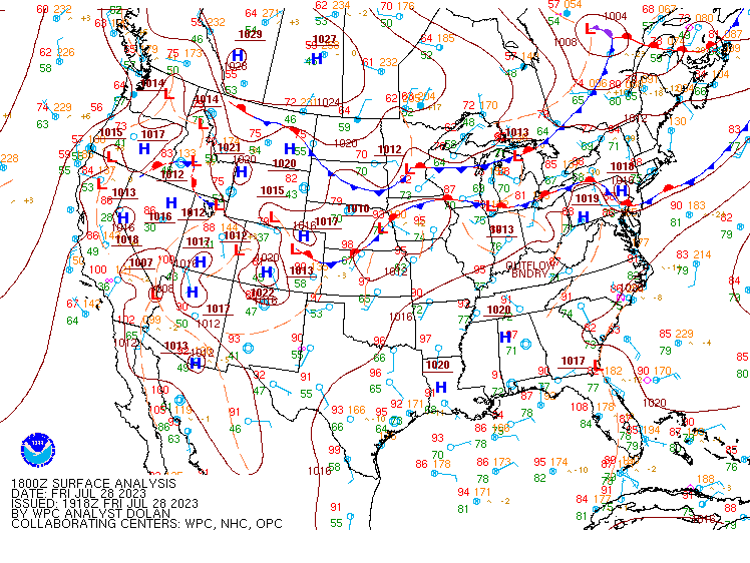
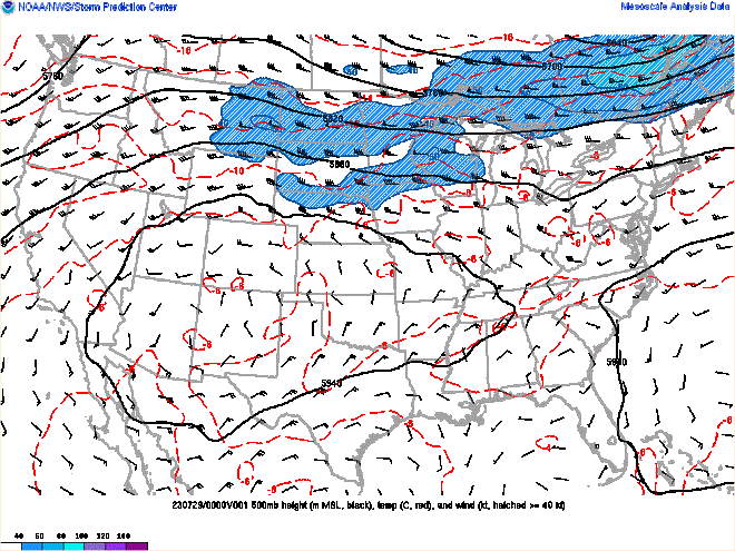
2 PM July 28th Surface Analysis Image courtesy of the Weather Prediction Center |
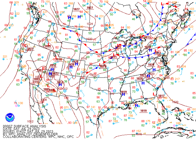
8 PM July 28th Surface Analysis Image courtesy of the Weather Prediction Center |
 |
 |
 |
|
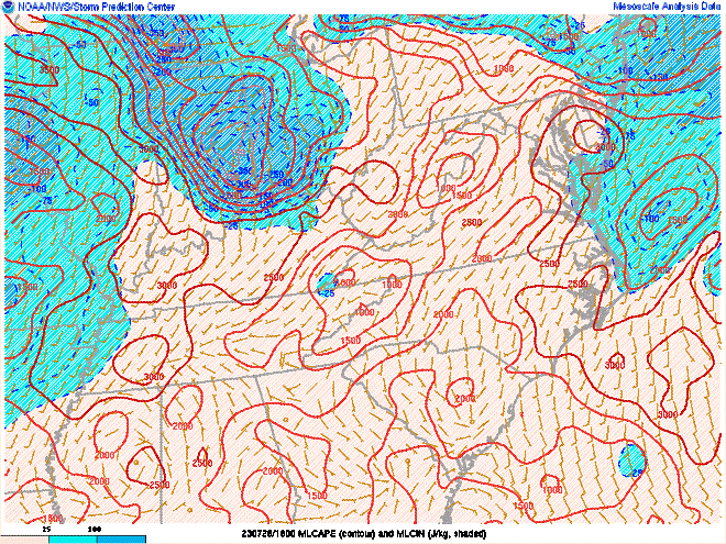
8 AM July 28th 500mb Chart Image courtesy of the Storm Prediction Center |
2 PM July 28th 500mb Chart Image courtesy of the Storm Prediction Center |
8 PM July 28th 500mb Chart Image courtesy of the Storm Prediction Center |
 |
 |
 |
|
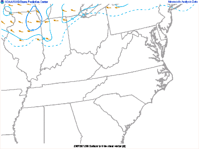
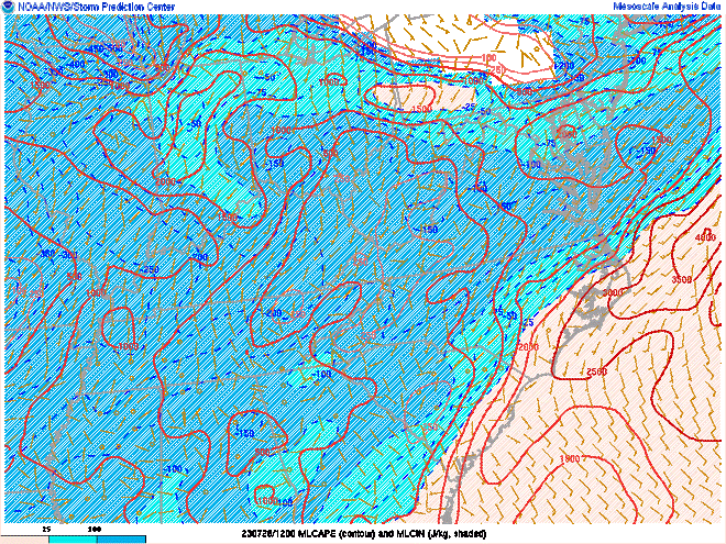
8 AM July 28th 0-6 km Bulk Shear Image courtesy of the Storm Prediction Center |
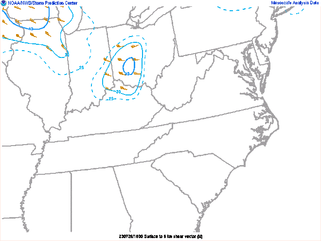
2 PM July 28th 0-6 km Bulk Shear Image courtesy of the Storm Prediction Center |
8 PM July 28th 0-6 km Bulk Shear Image courtesy of the Storm Prediction Center |
 |
 |
 |
|
8 AM July 28th 100mb Mixed-Layer CAPE Image courtesy of the Storm Prediction Center |
2 PM July 28th 100mb Mixed-Layer CAPE Image courtesy of the Storm Prediction Center |
8 PM July 28th 100mb Mixed-Layer CAPE Image courtesy of the Storm Prediction Center |
 |
Media use of NWS Web News Stories is encouraged! Please acknowledge the NWS as the source of any news information accessed from this site. |
|