
The remnants of Isaias will bring widespread, but mainly beneficial rain through Sunday to the area. Rainfall totals will generally be between 0.75-2.00", but heavier bands of rain could result in locally higher amounts and the potential for isolated flooding. In addition, gusty winds up to 50 mph are expected in the higher terrain through Sunday morning. Please keep updated on the forecast. Read More >
Event Synopsis
|
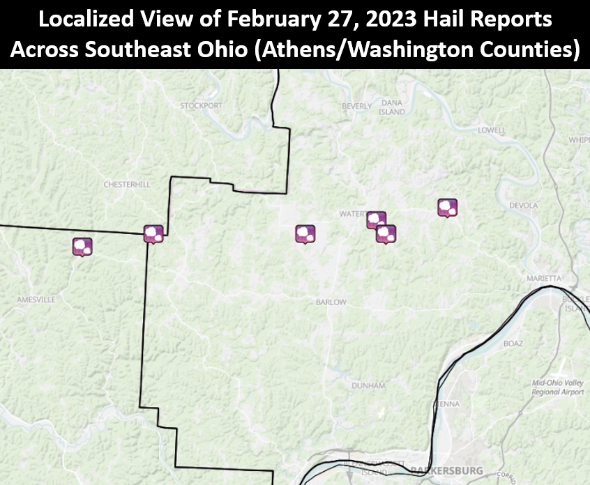
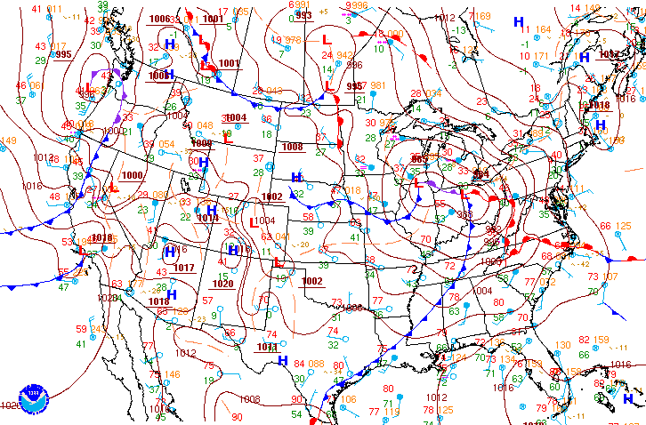
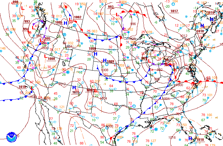
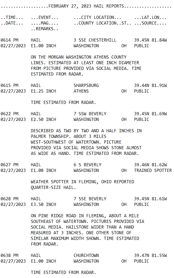
Localized severe weather in the form of very large hail occurred on the evening of February 27, 2023 across portions of the Mid-Ohio Valley. A 'Colorado Low' would quickly progress towards the Great Lakes region throughout the daytime hours of February 27th, with an associated warm front lifting through much of the local area during the late morning hours. Much warmer conditions would overspread a large portion of the NWS Charleston forecast area following the passage of this boundary, all in advance of a rapidly approaching cold front positioned just to the west. With the region positioned in the warm sector, scattered showers and thunderstorms would move across the Mid-Ohio Valley during the late afternoon and evening hours in advance/along the front. Some storms were strong to severe, producing large hail over 2" in some cases, with all hail reports from the evening of February 27th coming from Athens and Washington counties in far southeast Ohio. The largest hail report was estimated at 3.5" and came from near Watertown (Washington County). Please click on the tabs below for more detailed information about this event. Please note that all images/loops can be expanded by clicking on them. |
.gif)
February 27th Regional Radar Loop Radar loop courtesy of Iowa Environmental Mesonet (IEM) |
 |
 |
 |
|
Hail that fell near Watertown, OH (up to 3.5" in diameter) (Photo Credit: Lindsey Webster) |
Oddly shaped hail that fell near Watertown, OH (up to 3.5" in diameter) (Photo Credit: Lindsey Webster) |
Oddly shaped hail that fell near Watertown, OH (up to 3.5" in diameter) (Photo Credit: Lindsey Webster) |
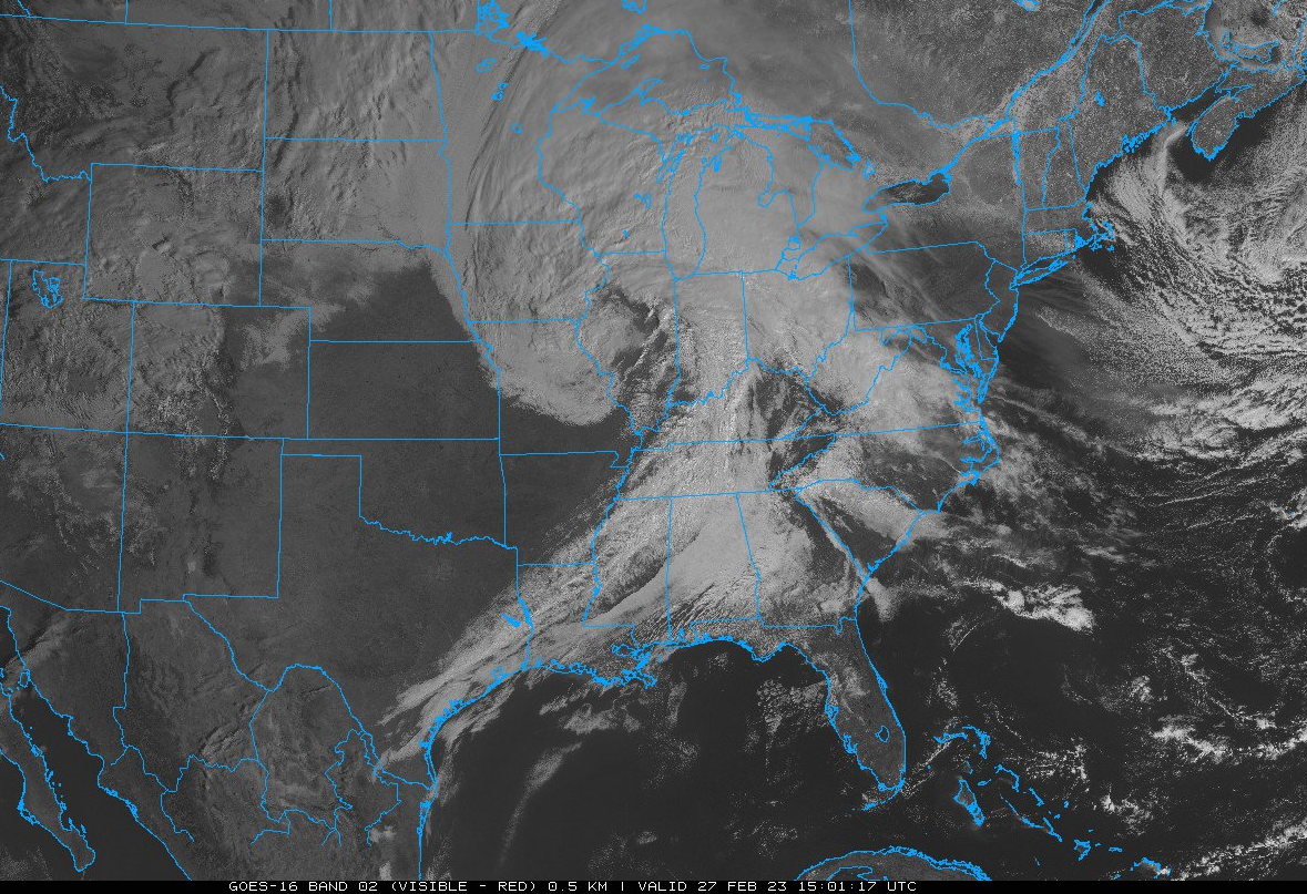
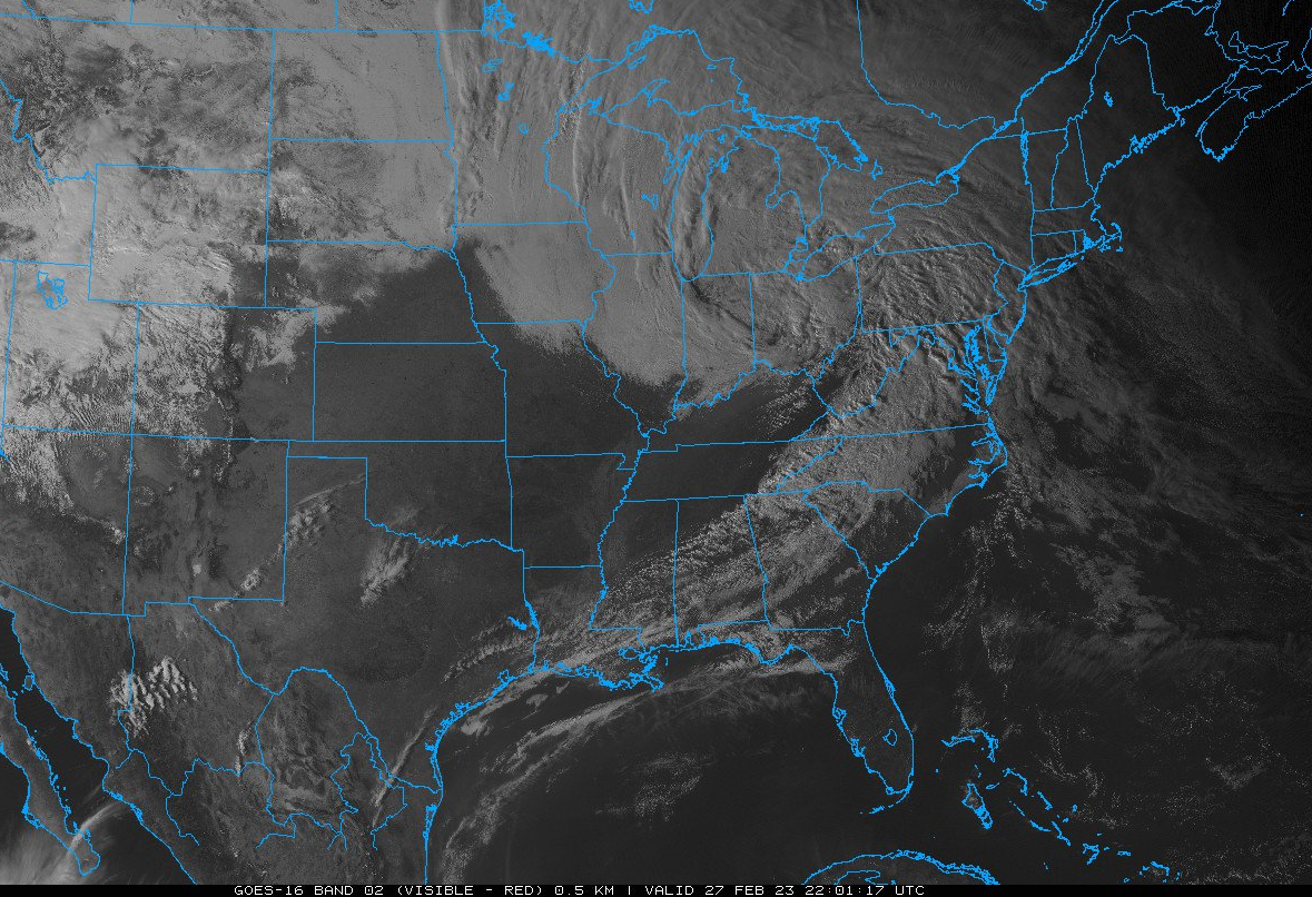
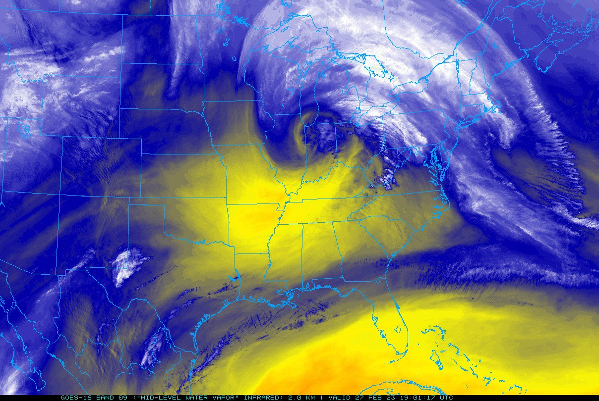
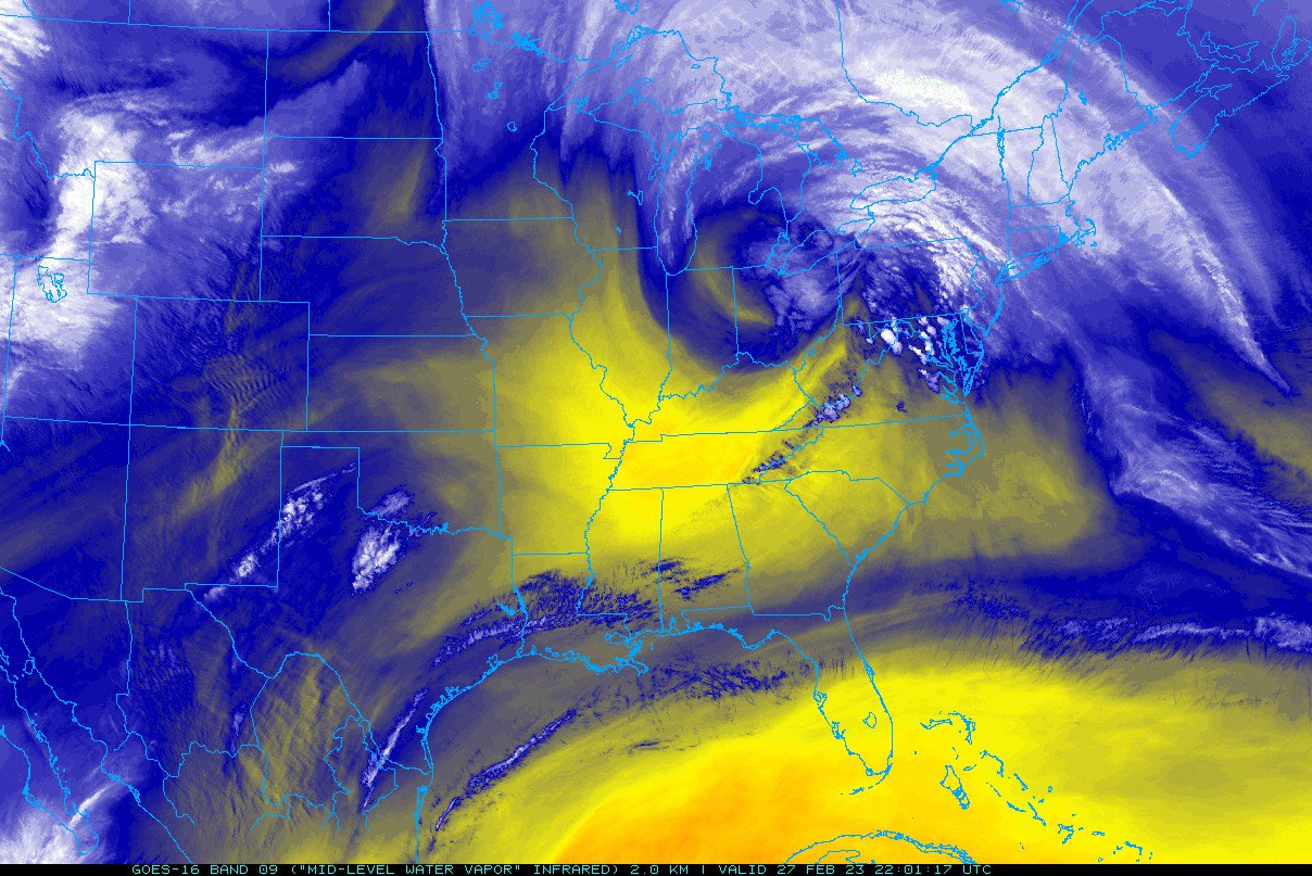
Visible and Mid-Level Water Vapor Images on February 27th Leading Up to the Event
 |
 |
 |
|
10 AM February 27th: Visible Image (GOES-16) Satellite image courtesy of NEXLAB - College of Dupage |
2 PM February 27th: Visible Image (GOES-16) Satellite image courtesy of NEXLAB - College of Dupage |
5 PM February 27th: Visible Image (GOES-16) Satellite image courtesy of NEXLAB - College of Dupage |
 |
 |
 |
|
10 AM February 27th: Mid-level Water Vapor Image (GOES-16) Satellite image courtesy of NEXLAB - College of Dupage |
2 PM February 27th: Mid-level Water Vapor Image (GOES-16) Satellite image courtesy of NEXLAB - College of Dupage |
5 PM February 27th: Mid-level Water Vapor Image (GOES-16) Satellite image courtesy of NEXLAB - College of Dupage |
February 27th Time Synchronized Local/Regional Radar Loops
.gif) |
.gif) |
.gif) |
|
February 27th Regional Radar Loop Radar loop courtesy of Iowa Environmental Mesonet (IEM) |
February 27th Local Radar Loop Radar loop courtesy of Iowa Environmental Mesonet (IEM) |
February 27th Local Radar Loop (w/ Convective Warnings Overlaid) Radar loop courtesy of Iowa Environmental Mesonet (IEM) |
Static Radar Images Time Synchronized With When the Largest Hail Fell
 |
 |
|
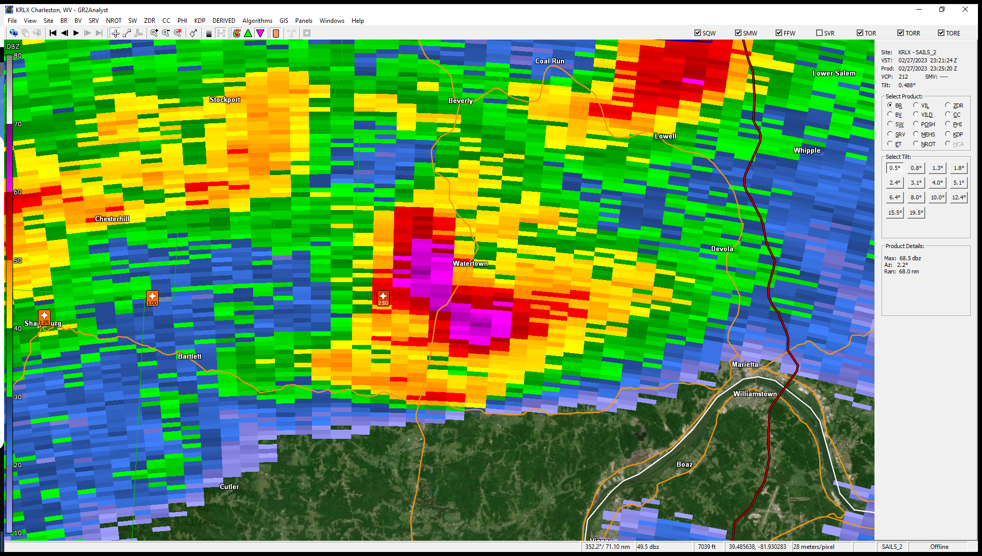
0.5 Degree Base Reflectivity from KRLX at 6:25 PM. Maximum reflectivity in this image is ~ 68 dBZ! Radar image courtesy of GR2Analyst |
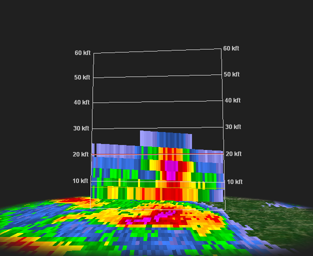
A Cross-Section of the Base Reflectivity Image at 6:25 PM (left). This Cross-Section runs North (Left) to South (Right) and shows > 50 dBZ above 20,000 ft AGL (above ground level). The freezing level at this time was ~ 9,000 ft AGL. Cross-Section image courtesy of GR2Analyst |
Surface/500mb/0-6 km Bulk Shear/100mb Mixed-Layer CAPE Charts
 |
 |
 |
|
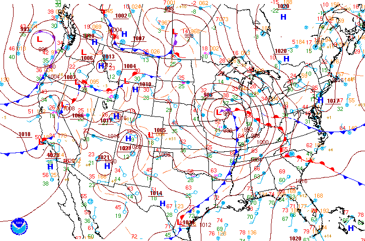
10 AM February 27th Surface Analysis Image courtesy of WPC (Weather Prediction Center) |
4 PM February 27th Surface Analysis Image courtesy of WPC (Weather Prediction Center) |
7 PM February 27th Surface Analysis Image courtesy of WPC (Weather Prediction Center) |
 |
 |
 |
|
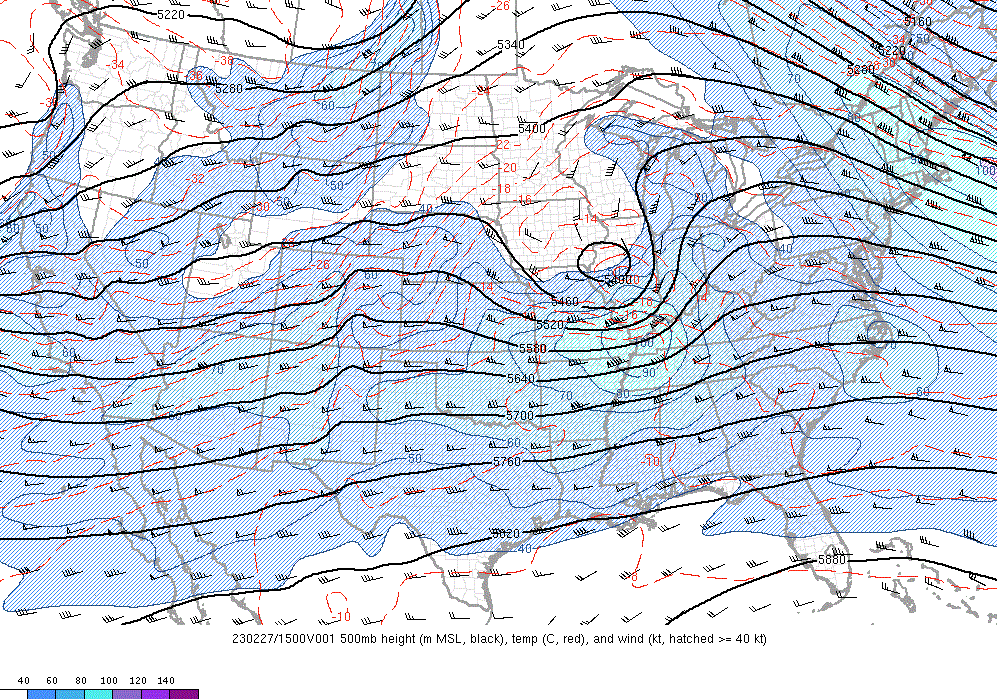
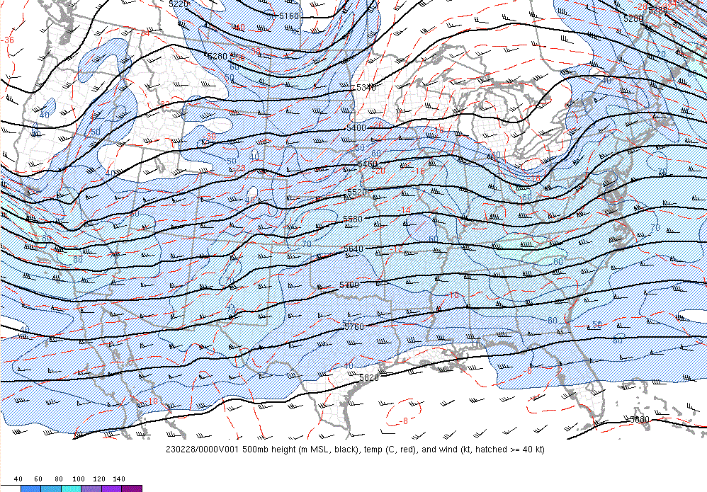
10 AM February 27th 500mb Chart Image courtesy of the Storm Prediction Center |
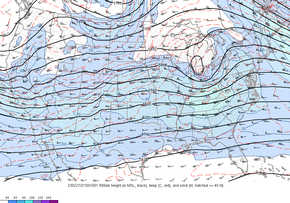
4 PM February 27th 500mb Chart Image courtesy of the Storm Prediction Center |
7 PM February 27th 500mb Chart Image courtesy of the Storm Prediction Center |
 |
 |
 |
|
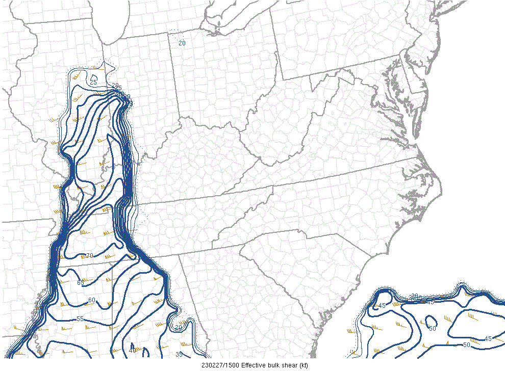
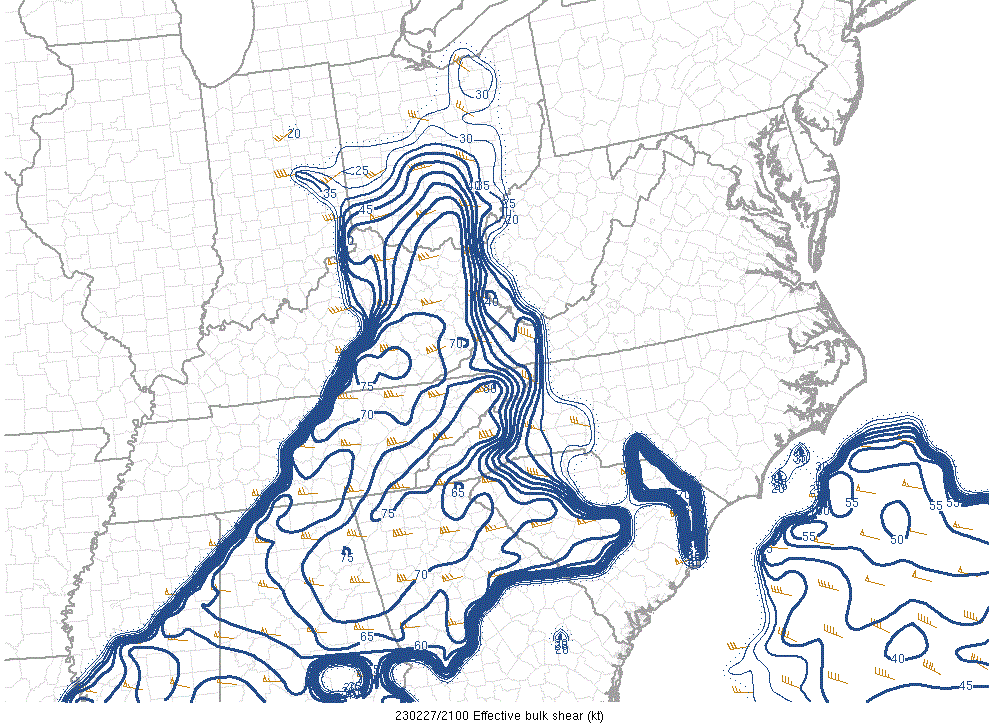
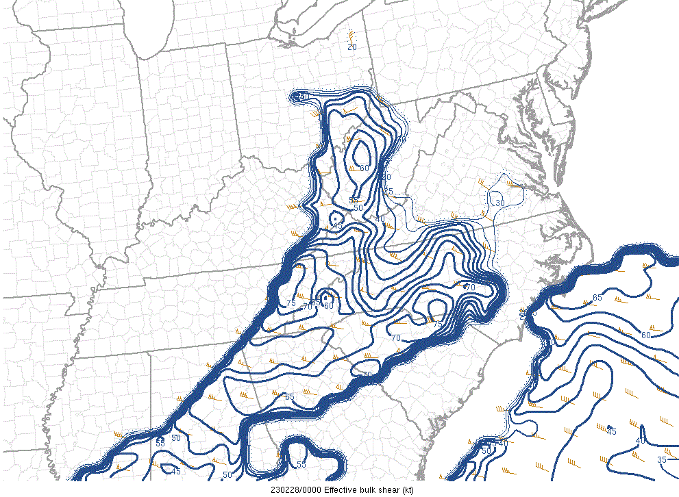
10 AM February 27th 0-6 km Bulk Shear Image courtesy of the Storm Prediction Center |
4 PM February 27th 0-6 km Bulk Shear Image courtesy of the Storm Prediction Center |
7 PM February 27th 0-6 km Bulk Shear Image courtesy of the Storm Prediction Center |
 |
 |
 |
|
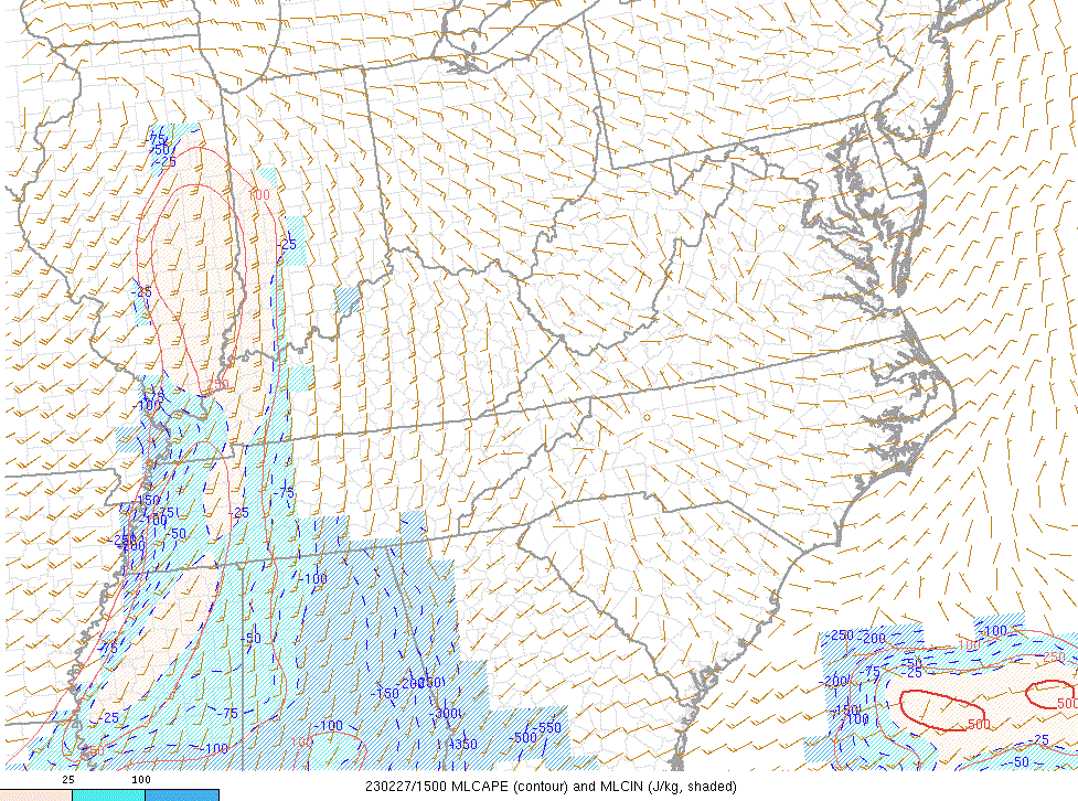
10 AM February 27th 100mb Mixed-Layer CAPE Image courtesy of the Storm Prediction Center |
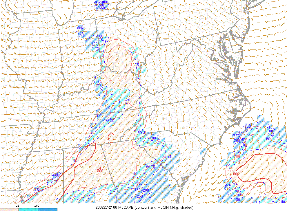
4 PM February 27th 100mb Mixed-Layer CAPE Image courtesy of the Storm Prediction Center |
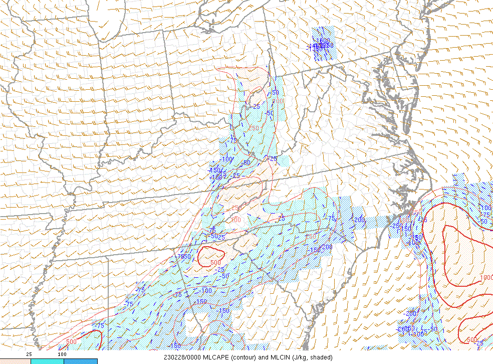
7 PM February 27th 100mb Mixed-Layer CAPE Image courtesy of the Storm Prediction Center |
 |
Media use of NWS Web News Stories is encouraged! Please acknowledge the NWS as the source of any news information accessed from this site. |
|



 Radar
Radar Current Weather
 Rivers & Lakes
 Satellite
 Forecast Maps
 Hour by Hour Forecast
 Tropical Weather
 Graphical Hazards
 Weather Hazard Briefing
 Forecaster's Discussion
 Text Bulletins
 Climate Plots
 Aviation Weather
 Fire Weather
 Drought
 Submit Storm Report
 Weather Spotters
 NOAA Weather Radio
 Follow us on X
 Follow us on Facebook
 RLX RSS Feed