
Thunderstorms this afternoon and evening could produce damaging winds and hail, particularly with a line that moves southeast ahead of an advancing cold front. A tornado or two, as well as localized flash flooding, are also possible. There is a Slight to Enhanced Risk for Severe Storms, and a Slight Risk for Flash Flooding. Please keep updated on the forecast and have ways to receive warnings. Read More >
 |
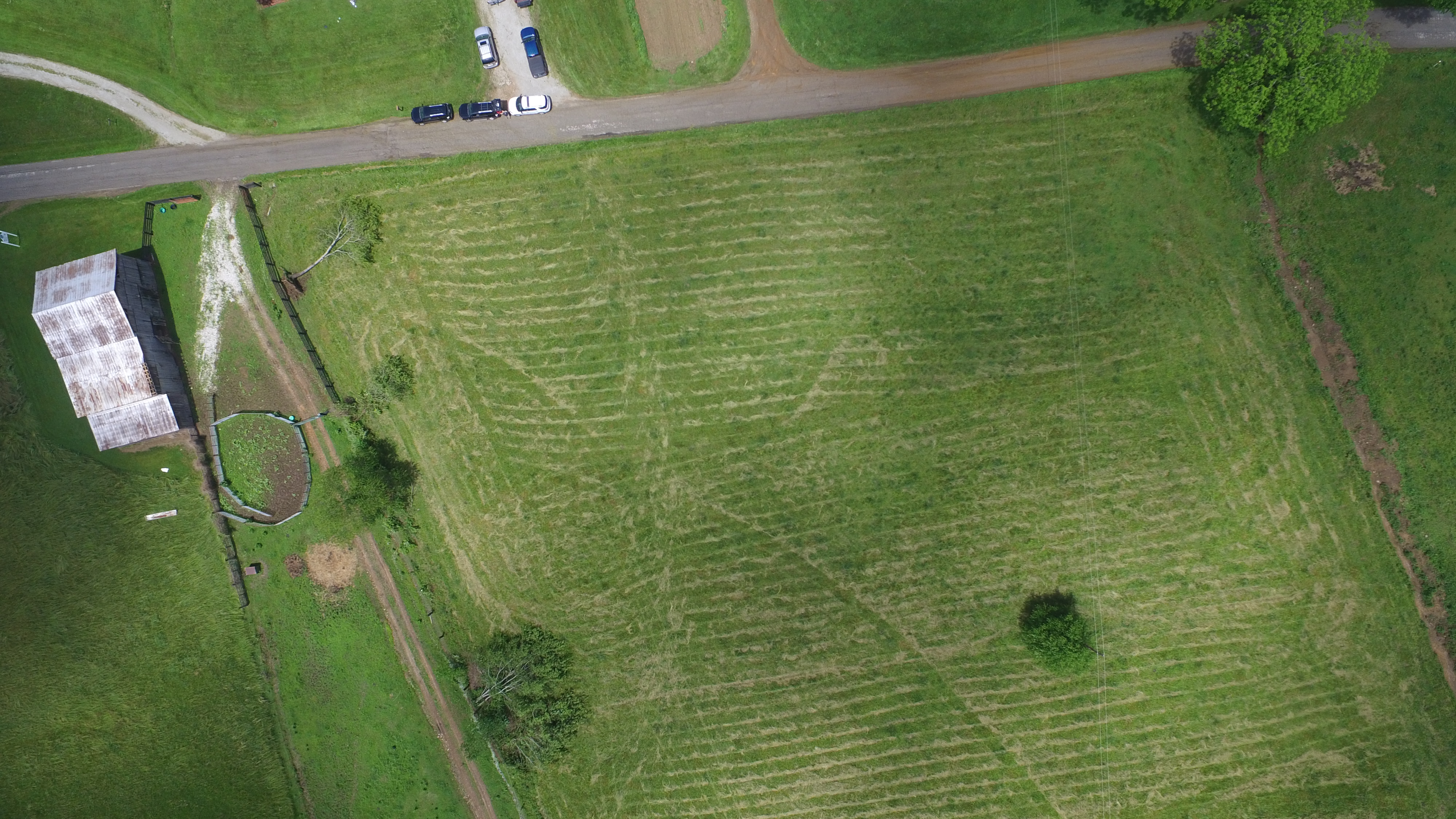 |
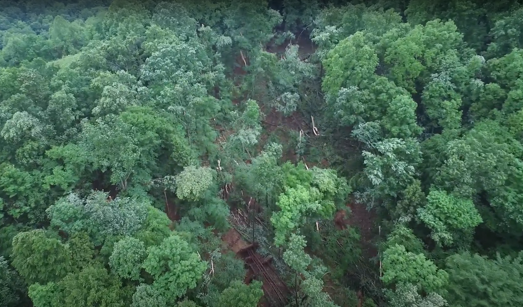
| Initial tree damage on ridge south of Little White Oak Rd | Convergent pattern in mowed hay field as tornado tracked north |
 |
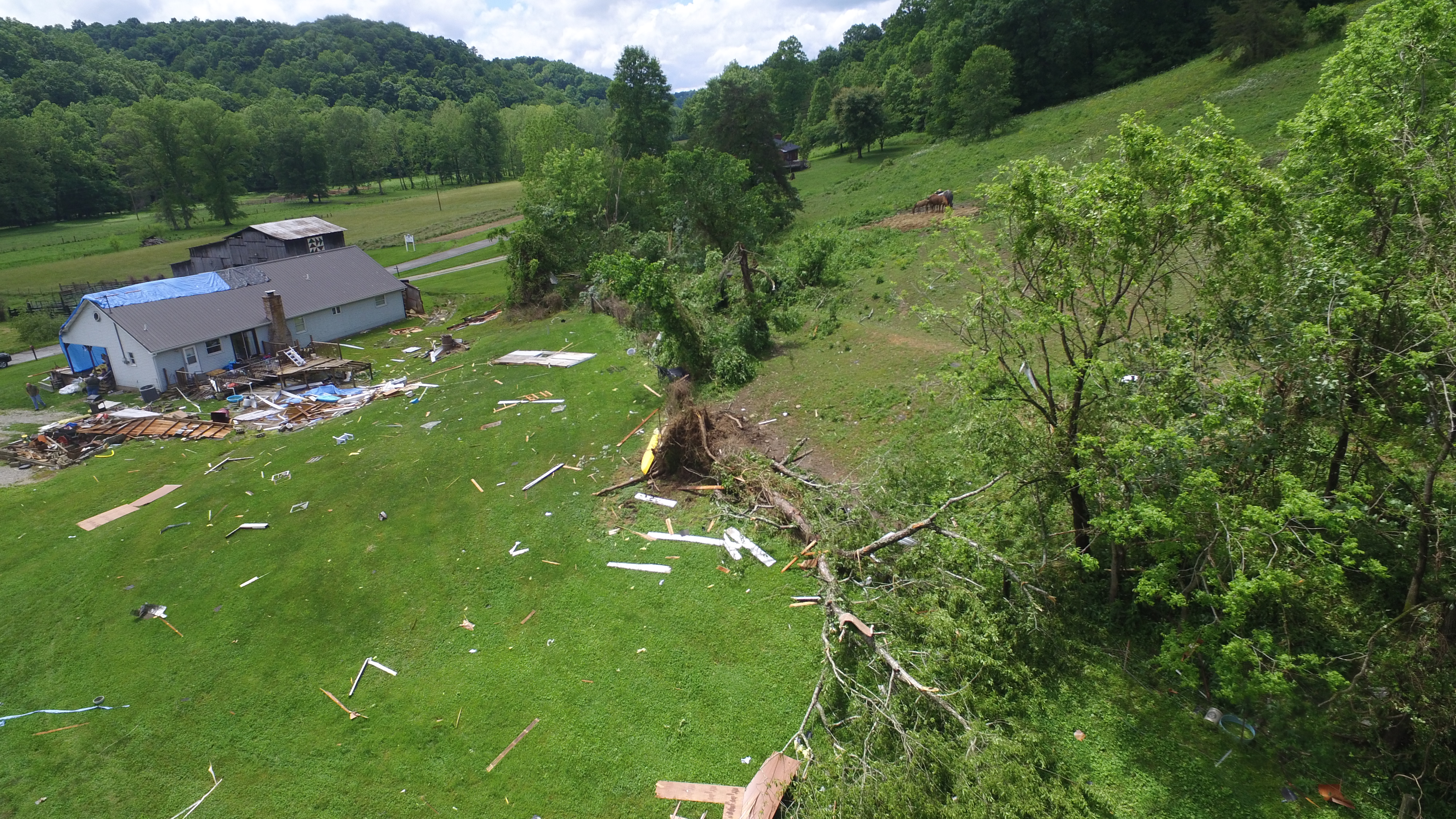 |
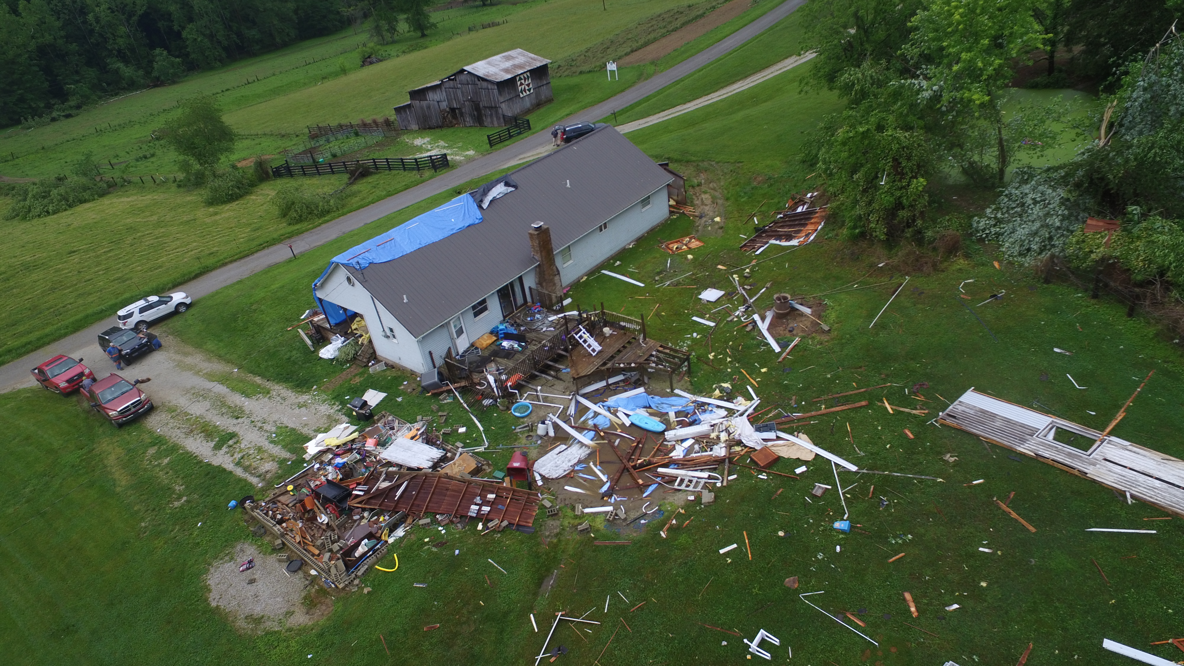
| Home damaged and garage destroyed on Little White Oak Rd | |
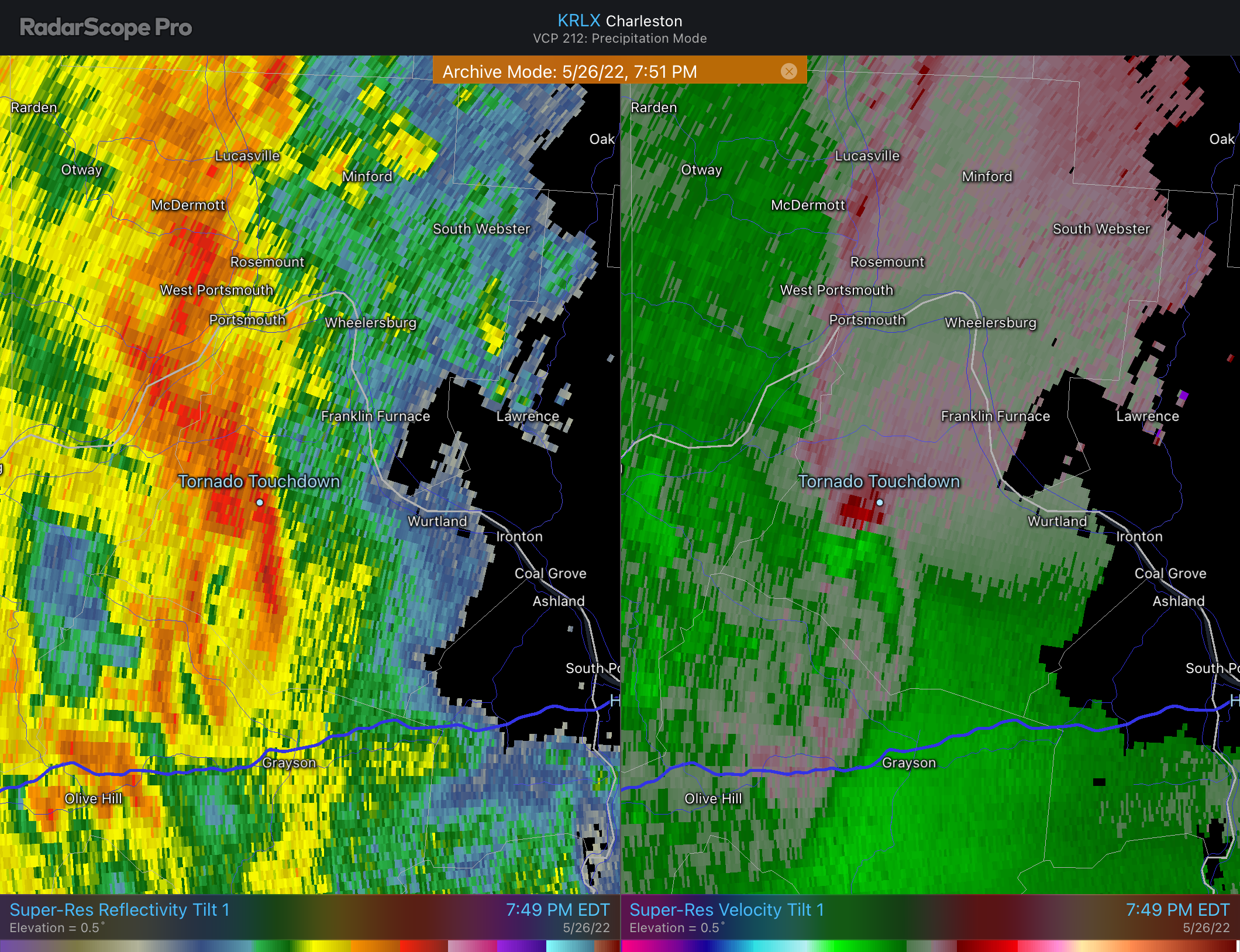
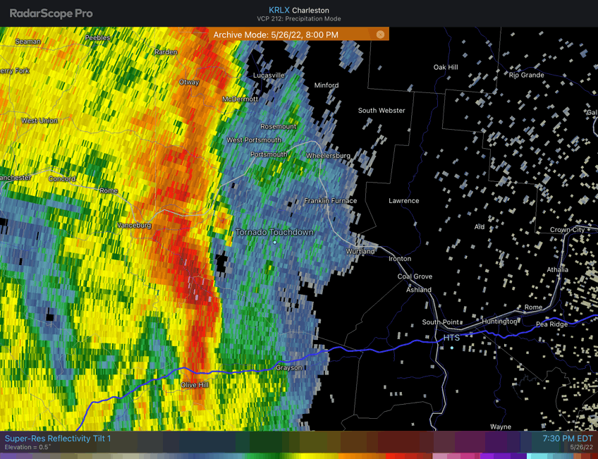
...NWS Damage Survey for 05/26/22 Tornado Event...

...Greenup County EF1 Tornado...

Rating:                 EF1
Estimated Peak Wind:    90 mph
Path Length /statute/:  0.85 miles
Path Width /maximum/:   60.0 yards
Fatalities:             0
Injuries:               0

Start Date:             05/26/2022
Start Time:             07:50 PM EDT
Start Location:         9 WSW Greenup / Greenup County / KY
Start Lat/Lon:          38.5329 / -82.9948

End Date:               05/26/2022
End Time:               07:52 PM EDT
End Location:           8 SW Franklin Furnace / Greenup County / KY
End Lat/Lon:            38.5445 / -82.9913

Survey Summary:
An EF1 tornado touched down on a hillside south of Little White
Oak Road uprooting several trees, then traveled north across a
newly mowed hay field with a convergent pattern evident in the
mowed hay, then impacted a house and garage. The tornado tore off
a large section of the roof of the home and destroyed the adjacent
garage. Residents of the home witnessed the tornado as it was
moving across the hay field toward the house and were able to take
shelter. The tornado caused additional tree damage as it continued
north up a ridge and then onto Cub Run Road.

This is the first documented tornado to have occurred in Greenup
County since May 24, 1998.

Many thanks to Greenup County Emergency Management and the Load
Volunteer Fire Department for their assistance in this survey,
including the use of their drone for aerial photos.

&&

EF Scale: The Enhanced Fujita Scale classifies tornadoes into the
following categories:

EF0...Weak......65 to 85 mph
EF1...Weak......86 to 110 mph
EF2...Strong....111 to 135 mph
EF3...Strong....136 to 165 mph
EF4...Violent...166 to 200 mph
EF5...Violent...>200 mph

NOTE:
The information in this statement is preliminary and subject to
change pending final review of the event and publication in NWS
Storm Data.
 |
|
 |
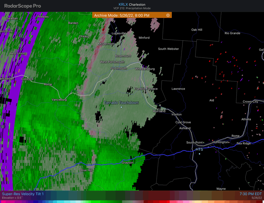 |
| KRLX radar reflectivity and velocity imagery near the time of the tornado touchdown. | |

