 |
|
|||||||||||||||||||||||||||||||||||||||||||||||||||||||||||||||||||||||||||||||||||||||||||||||
|
Event Overview A historic severe weather outbreak occurred on Tuesday, April 2nd, 2024 across the NWS Charleston, WV County Warning Area. This event brought two rounds of convection to the NWS Charleston forecast area, with one round occurring in the late morning, and the second round occurring in the late afternoon and evening. April 2nd set a record number of tornadoes for both the County Warning Area (CWA) and the state of West Virginia for any calendar day! The strength of the first round of storms was beyond expectations and resulted in over 100 wind damage reports and 15 tornadoes, with an additional two tornadoes occurring later in the day. When all was said and done, the April 2nd event resulted in four EF-2 tornadoes in the CWA. Additionally, an Automated Surface Observing System (ASOS) at the Huntington (WV) Tri-State Airport measured a wind gust of 92 mph, setting an all-time record gust for the station. More information about each tornado surveyed can be seen below or found in the Damage Survey Viewer. Historical tornado information, including all recorded tornadoes for each county in the NWS Charleston County Warning Area, can be found in our online Tornado Database. ** Note - Given the length of this review and number of images contained in it, there may be some delay in all of the images populating into the review. Additionally, all images/loops can be expanded by clicking on them ** |
Synopsis of the Historic April 2nd, 2024 Severe Weather Outbreak
Setting the Stage
The bowing line that struck the NWS Charleston CWA on April 2nd was part of a greater tornado outbreak where a low pressure system traversed across the United States from April 1-3. This system first caused damage in the plains, then moved east throughout the night and into the morning of April 2nd, with damage from tornadoes being left behind by the storm as it moved east. The system weakened overnight, but rapidly grew upscale in the early morning, progressing into a Mesoscale Convective System (MCS) as it entered the Ohio Valley.
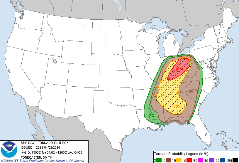
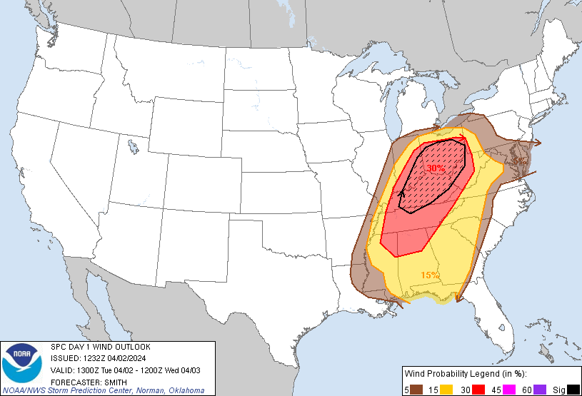
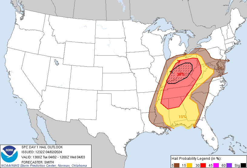
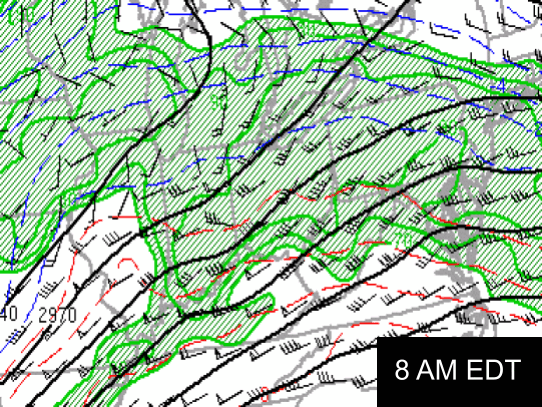
The expectation on the morning of April 2nd was that the Ohio Valley region had favorable conditions present for a continuation of the tornado outbreak. The environment had energy, moisture, and wind dynamics making it capable of all severe hazards, with the main focus for the day initially being on the second round of convection in the afternoon into the evening. The environment led to the Storm Prediction Center issuing a Moderate Risk (Level 4) for the Ohio Valley in their convective outlook at 9 AM EDT. Around an hour after this outlook was released, the convection that initiated on April 1st was entering the NWS Charleston CWA after rapidly growing into a bowing line.
.png) |
 |
 |
 |
|
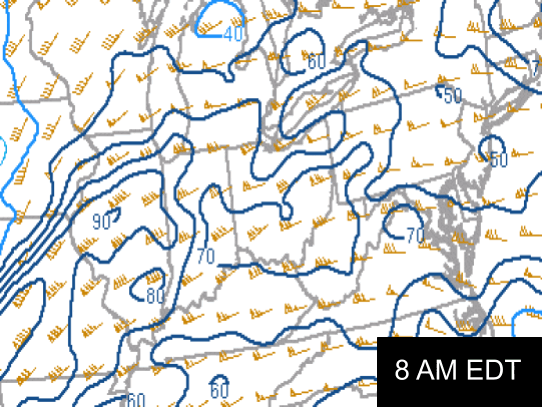
13Z Convective Outlook Image Credit: Storm Prediction Center |
13Z Tornado Outlook Image Credit: Storm Prediction Center |
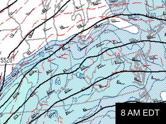
13Z Wind Outlook Image Credit: Storm Prediction Center |
13Z Hail Outlook Image Credit: Storm Prediction Center |
Timeline of Severe Weather Throughout the NWS Charleston Forecast Area
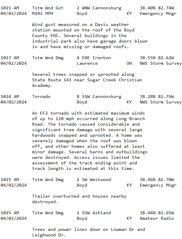
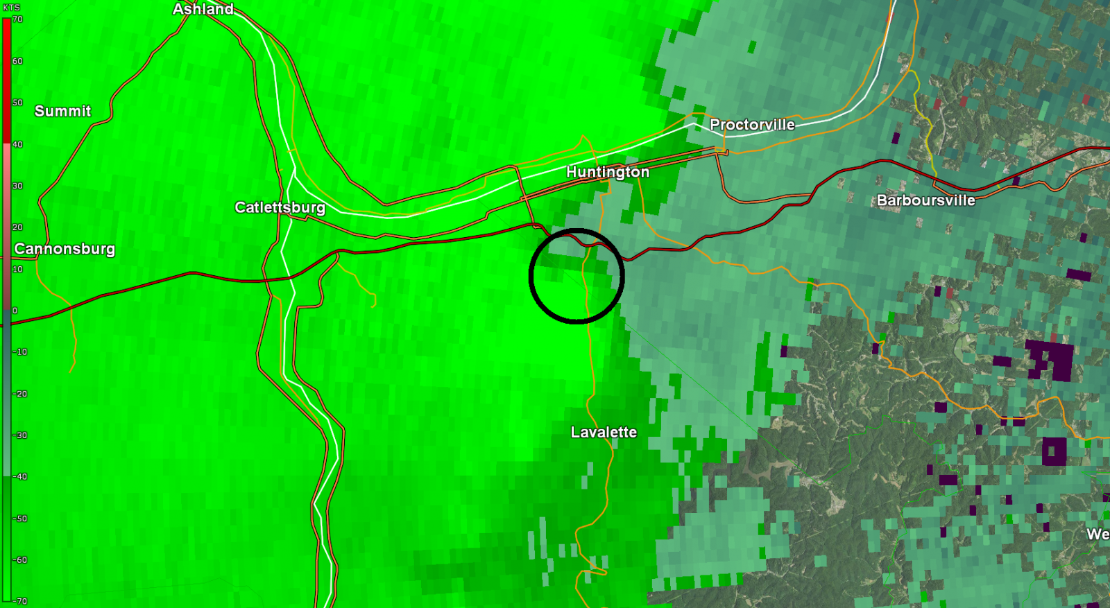
The line entered the NWS Charleston forecast area from the west with the first warning being issued at 9:49 AM EDT, including the cities of Ashland and Greenup in Kentucky. Greenup was the location of the first tornado in the CWA. Shortly after passing through Greenup, the system began to develop multiple areas of rotation in the line. Once the line reached Wayne County (WV), the line rapidly began to develop a bowing feature with high winds being recorded in multiple locations. This is when the highest official wind gust of the event, 92 mph, was recorded in Wayne County by an ASOS at the Huntington (WV) Tri-State Airport. It should be noted, however, that there was a higher "unofficial" wind gust of 102 mph observed slightly further to the west on the Boyd County Emergency Management weather station in Ashland, Kentucky! The bowing part of the line became the focus of the morning with widespread wind damage and 15 tornadoes forming from this feature. Wind damage was not limited to the bowing part of the line, however, with damage also being reported in the northern part of the CWA, although less widespread. The line rapidly advanced eastward, continuing to cause damage before weakening once it had reached Fayette County, with the last tornado of this first round occurring in southeast Kanawha County. Following this, the line continued causing damage while moving eastward, before leaving the CWA and dissipating.
The heat from the day brought an unstable environment in the late afternoon and evening, resulting in severe weather that led to two more tornadoes being recorded, both of which were rated EF2. At 4:08 PM EDT, an intensifying storm led to the issuance of a Severe Thunderstorm Warning for Fayette County. This storm continued to develop as it moved eastward through the county with rotation developing on its south side. The storm produced a strong EF2 tornado along with severe hail and damaging winds. At 8:31 PM EDT, a Severe Thunderstorm Warning was issued in Jackson County (OH), where the atmospheric environment was most favorable. The storm produced an EF2 tornado northwest of the city of Jackson, with this tornado being the northernmost tornado in the CWA on April 2nd. Once the warning in Jackson County expired, no more warnings were issued and activity decreased into the overnight hours.
April 2nd Local Radar Loop (w/ Warnings Overlaid)
.gif)
Radar Loop Courtesy of Iowa Environmental Mesonet (IEM)
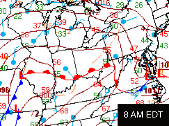
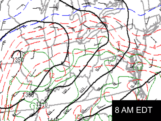
April 2nd Surface and Upper Air Maps
 |
 |
 |
|
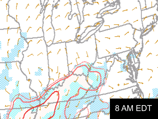
Surface Analysis Loop Image Credit: Weather Prediction Center |
850 mb Analysis Loop Image Credit: Storm Prediction Center |
700 mb Analysis Loop Image Credit: Storm Prediction Center |
 |
 |
|
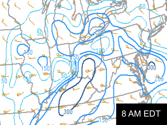
500 mb Analysis Loop Image Credit: Storm Prediction Center |
300 mb Analysis Loop Image Credit: Storm Prediction Center |
April 2nd Severe Weather Parameters
 |
 |
 |
|
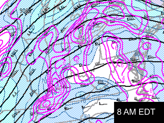
CAPE - 100 mb Mixed-Layer Image Credit: Storm Prediction Center |
Bulk Shear - Sfc-6km Image Credit: Storm Prediction Center |
Storm Relative Helicity - Sfc-1km Image Credit: Storm Prediction Center |
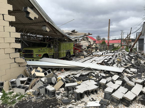
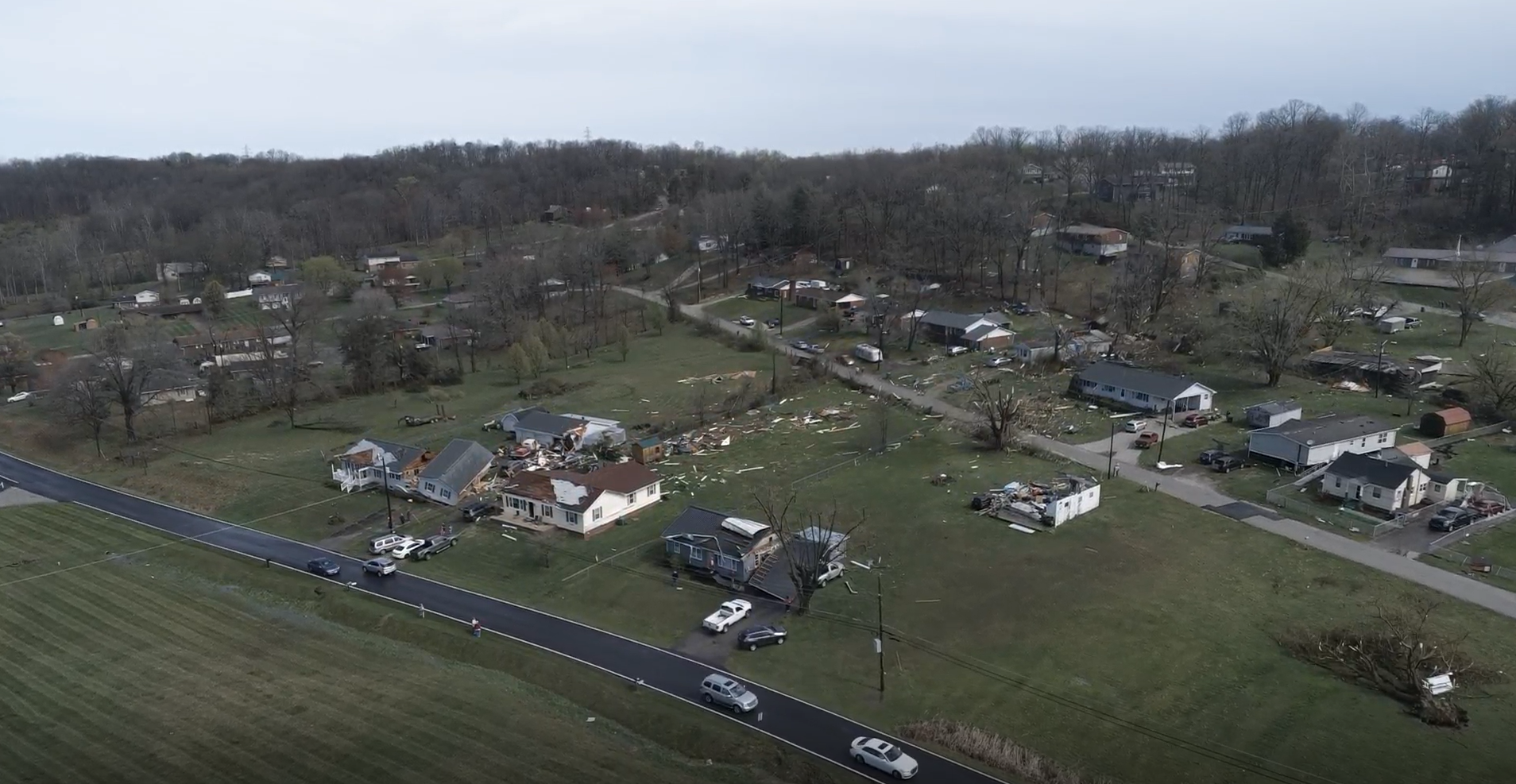
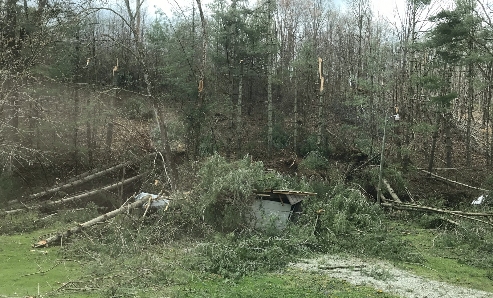
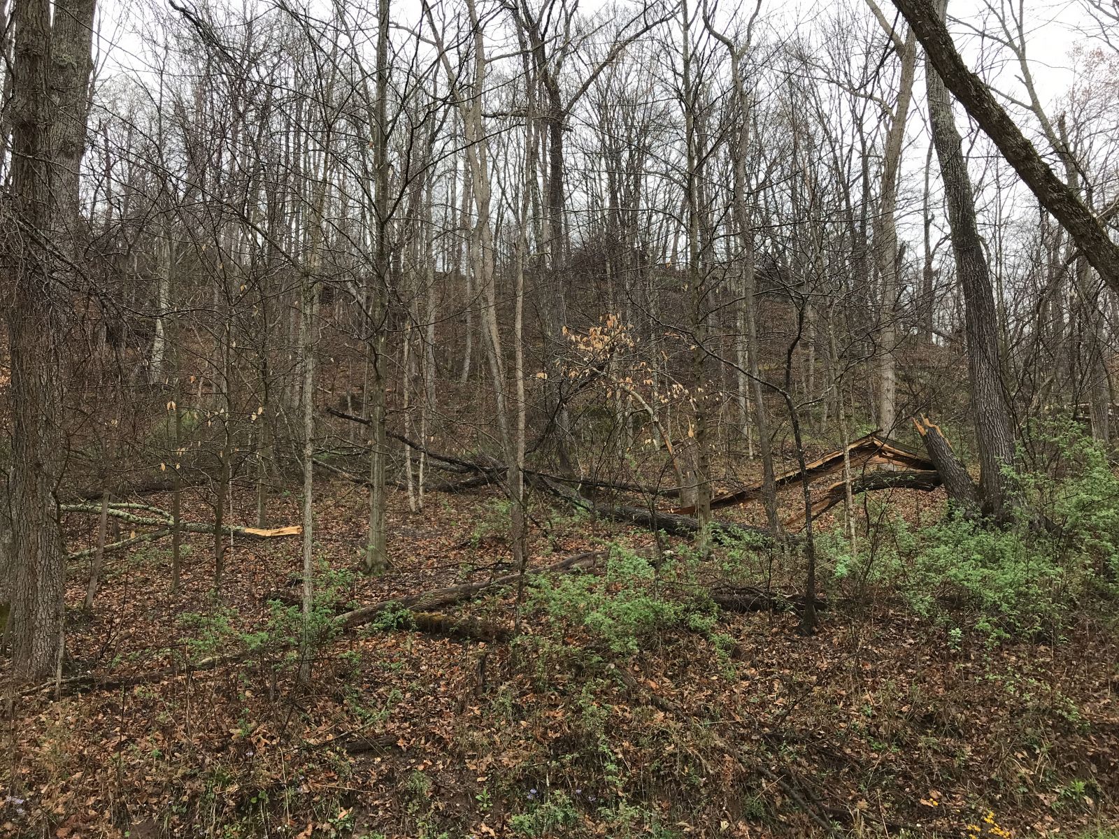
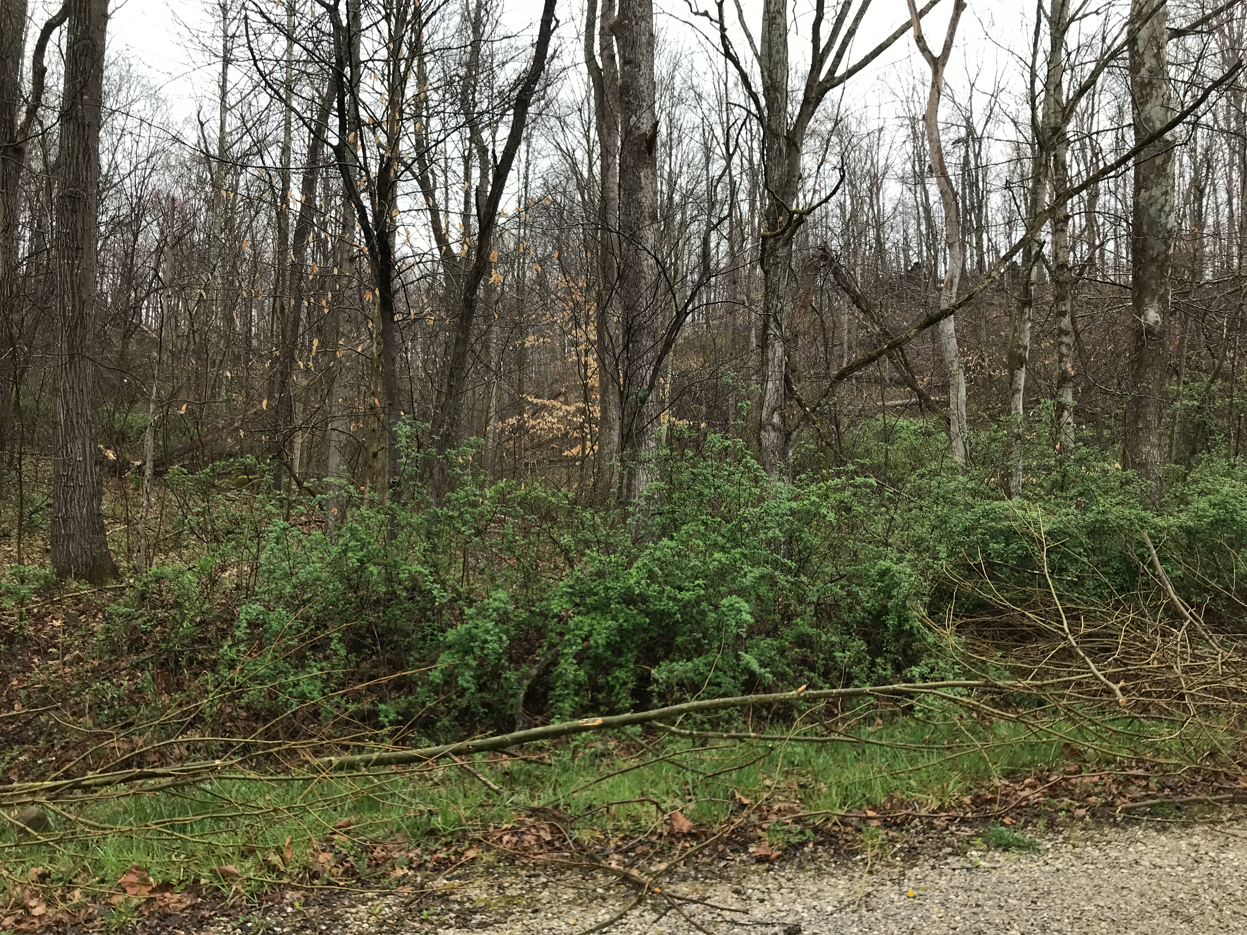
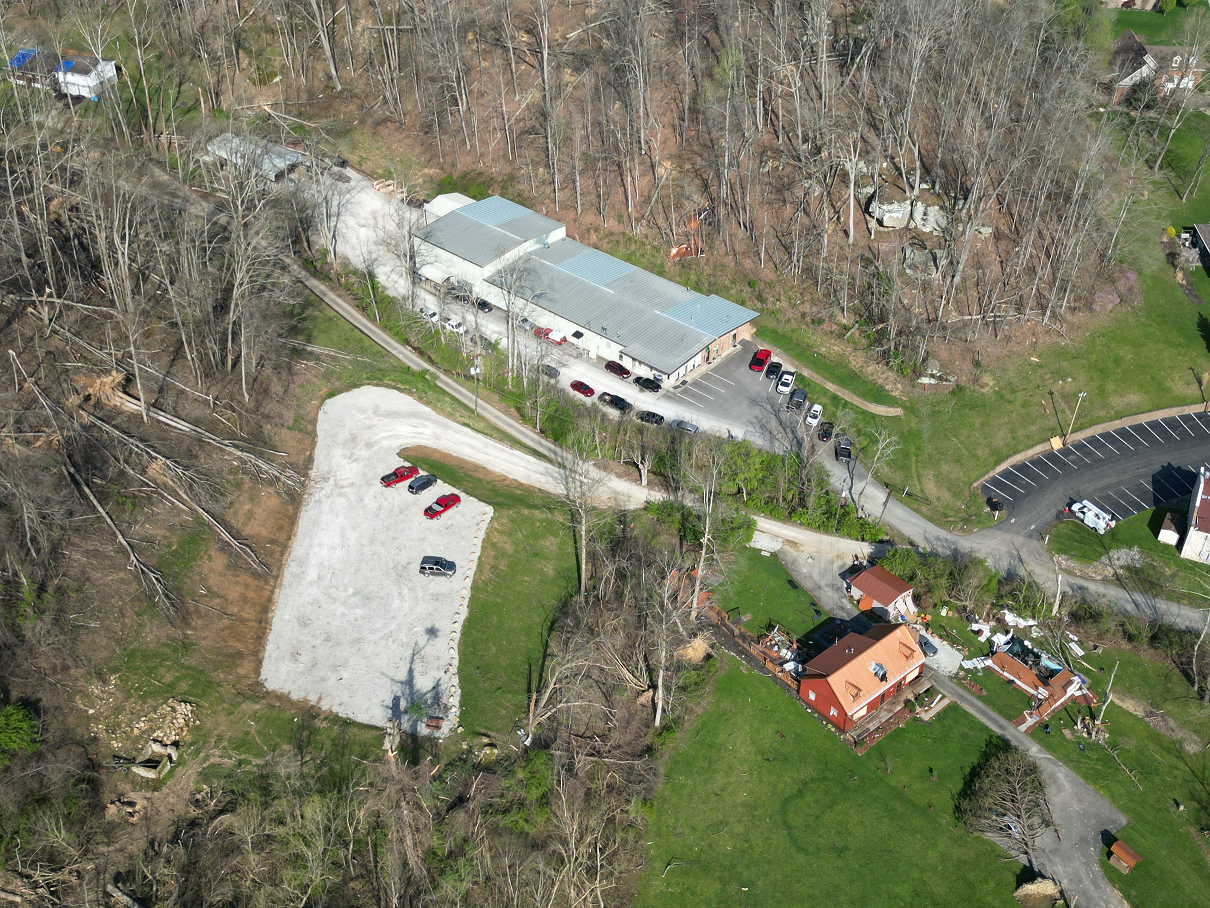
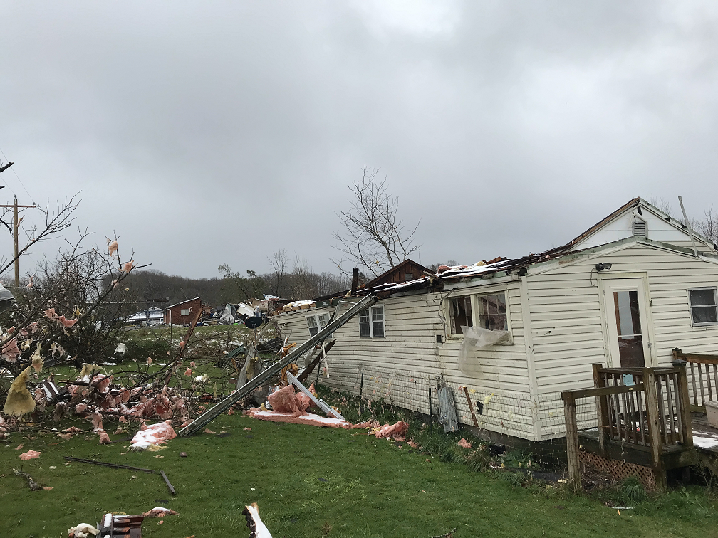
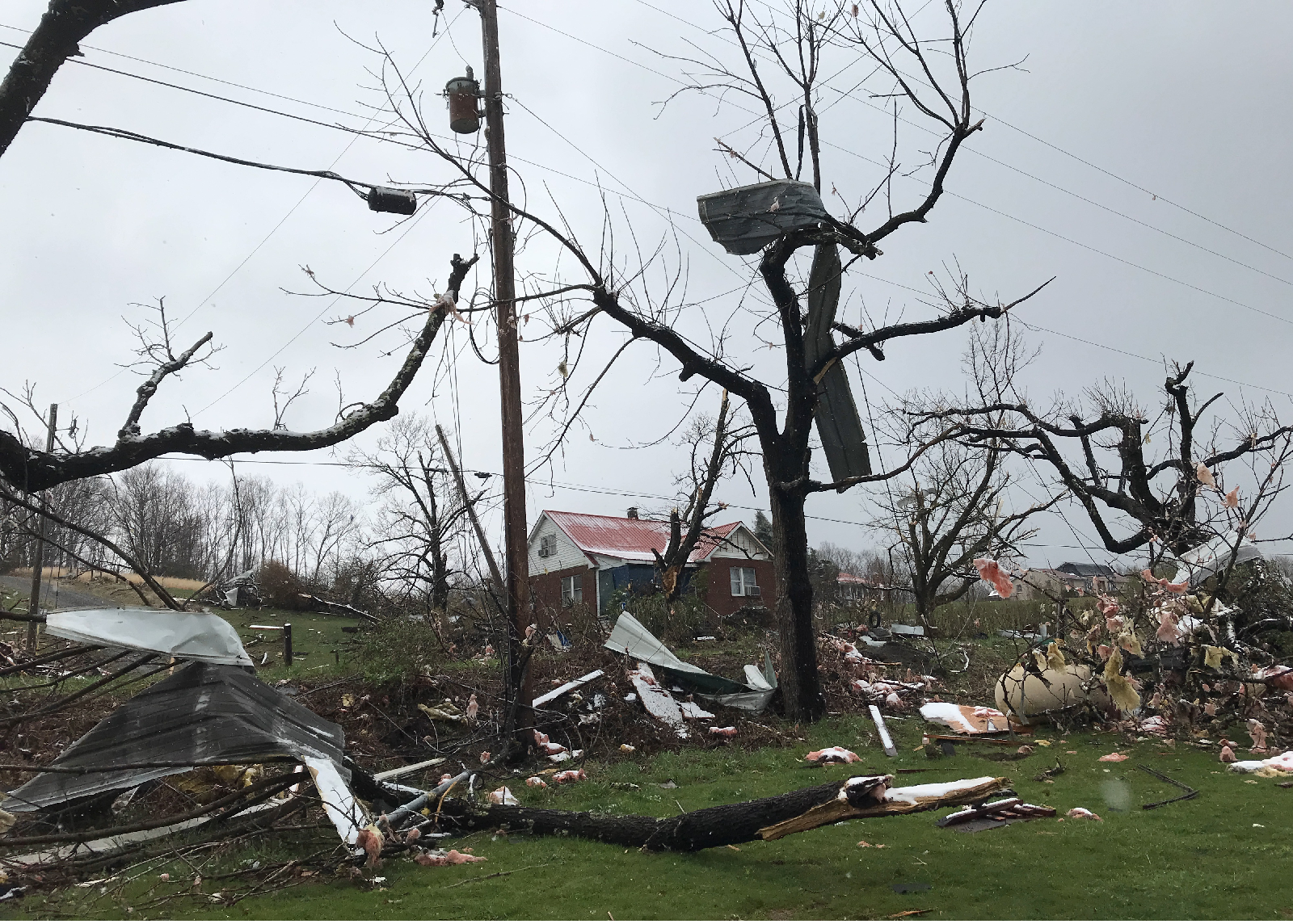
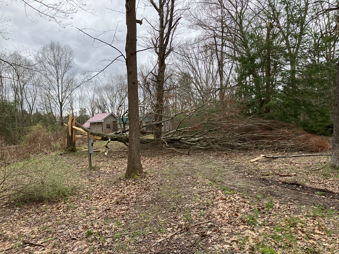
Detailed Information about the April 2nd Tornadoes (Public Information Statements, Track Maps, Radar Imagery, and Damage Images)
|
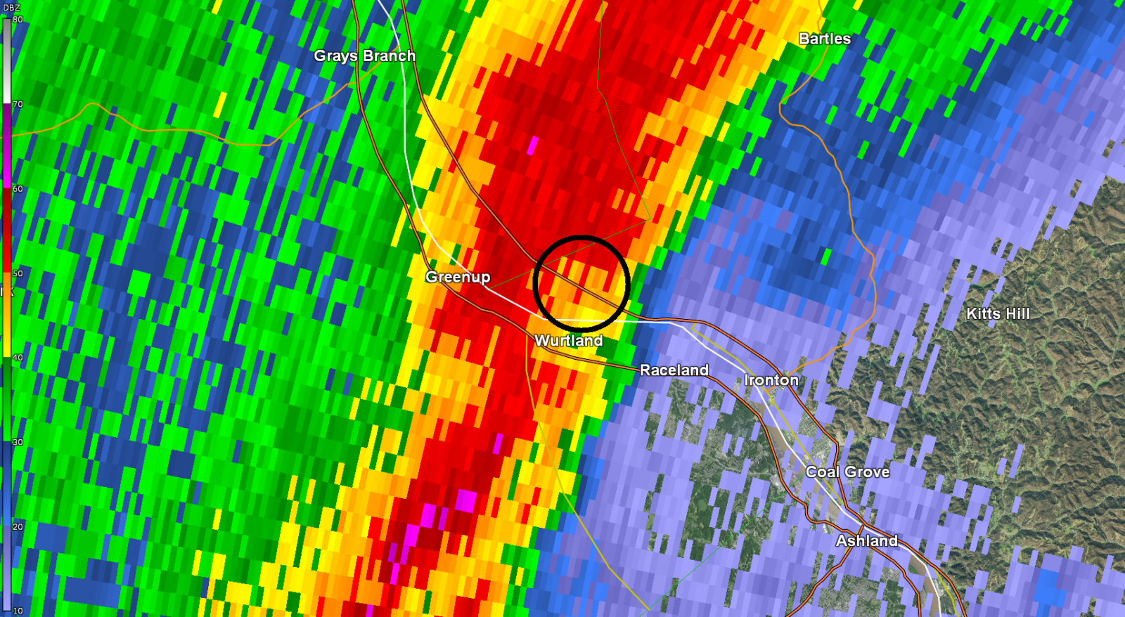
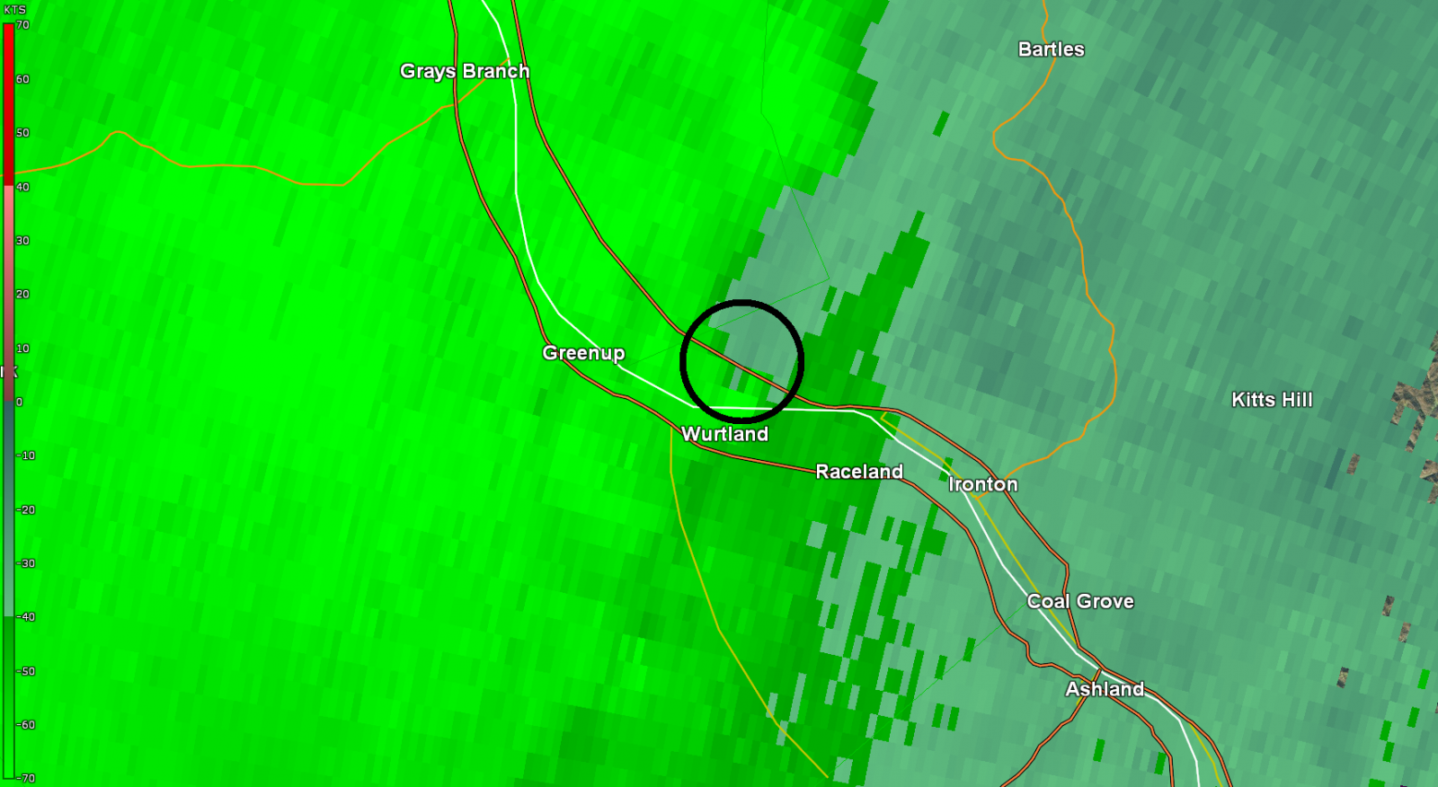
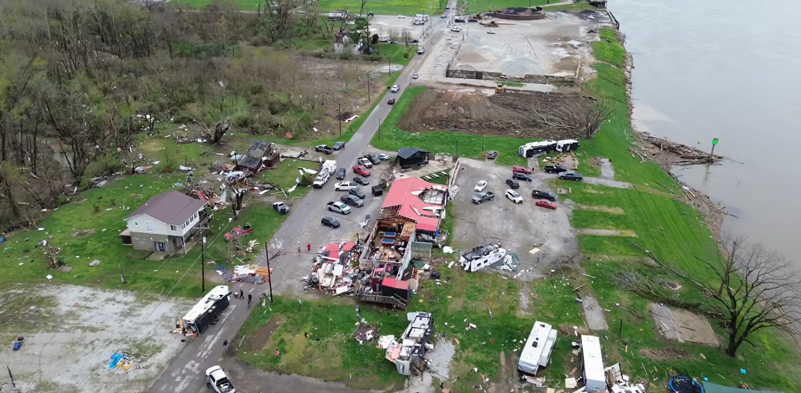
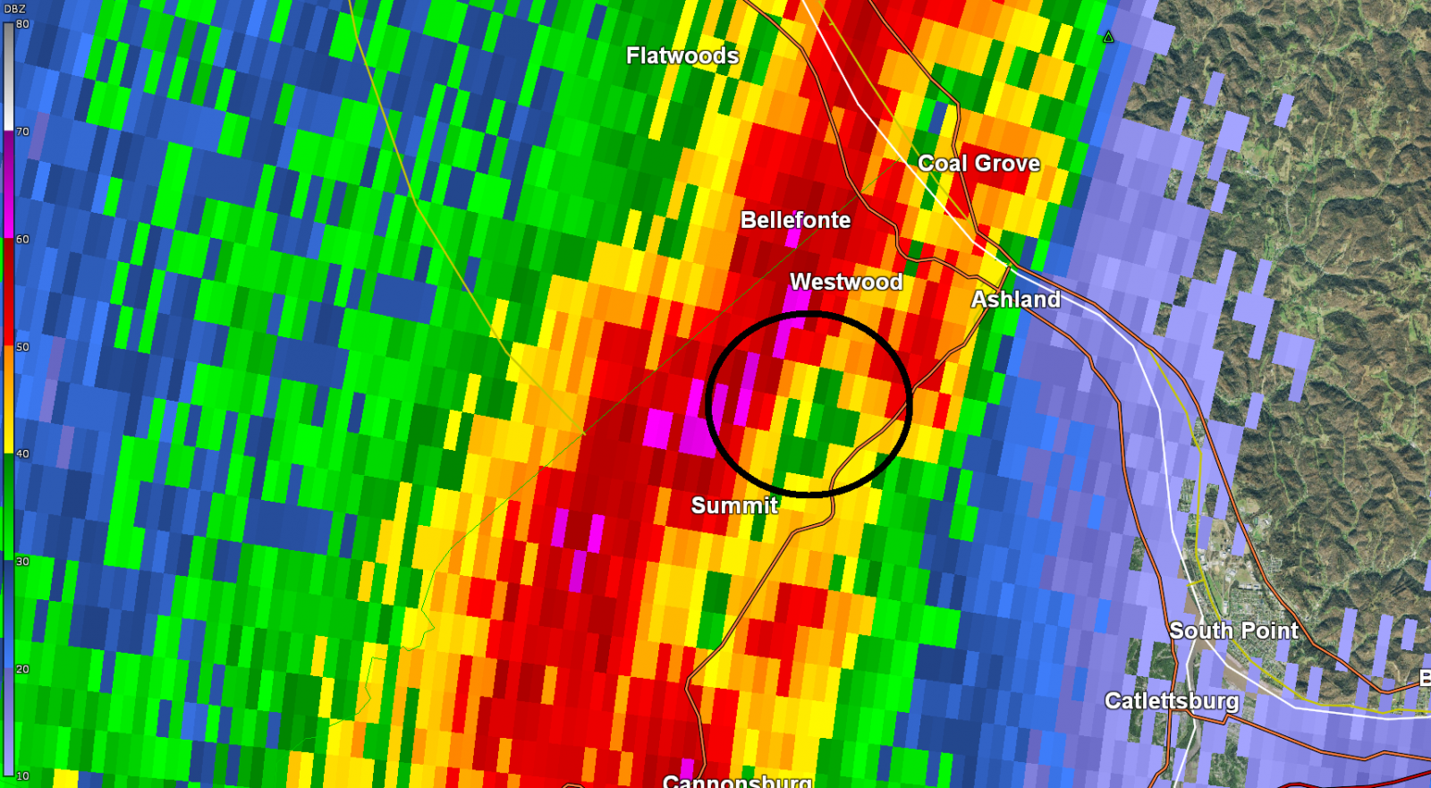
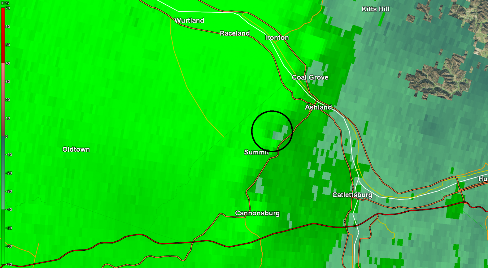
Tornado #1 - Greenup, KY - Ironton, OH
Track Map 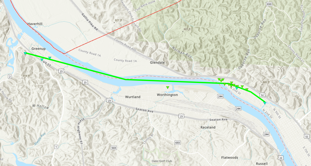 
Radar Imagery: Base Reflectivity / Storm-Relative Velocity (0.5 Degree)
Damage Pictures
|
||||||||||||||||||||||||
|
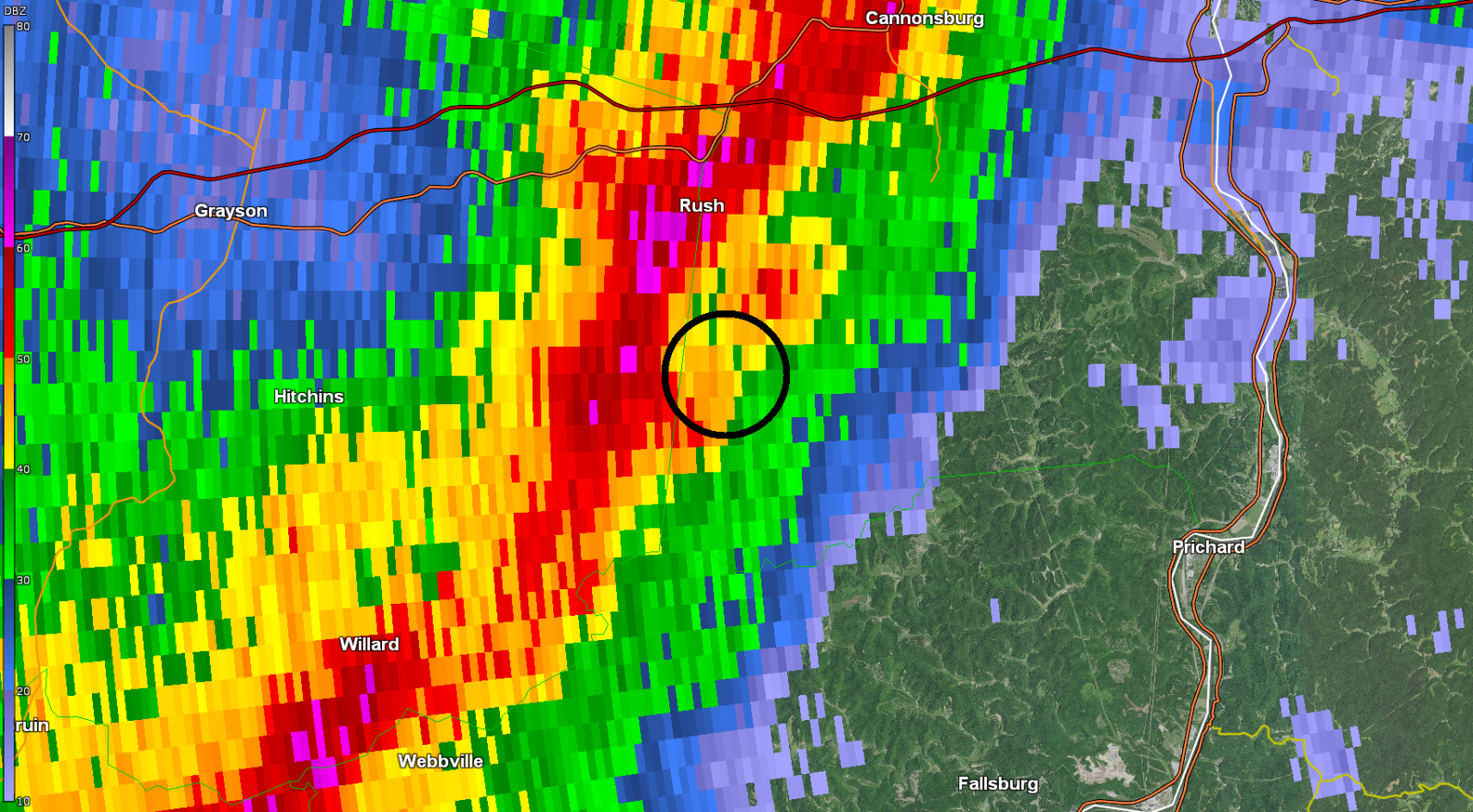
Tornado #2 - Rose Road (KY)
Track Map 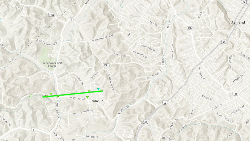
Radar Imagery: Base Reflectivity / Storm-Relative Velocity (0.5 Degree)
Damage Pictures
|
||||||||||||||||||||||||
|
Tornado #3 - Long Branch Road (KY)
Track Map 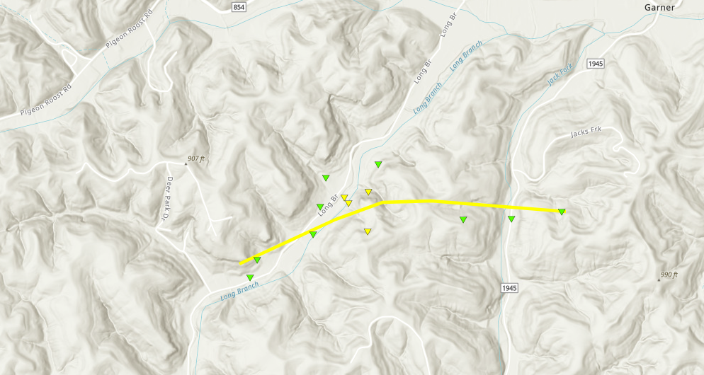
Radar Imagery: Base Reflectivity / Storm-Relative Velocity (0.5 Degree)
Damage Pictures
|
||||||||||||||||||||||||||||
|
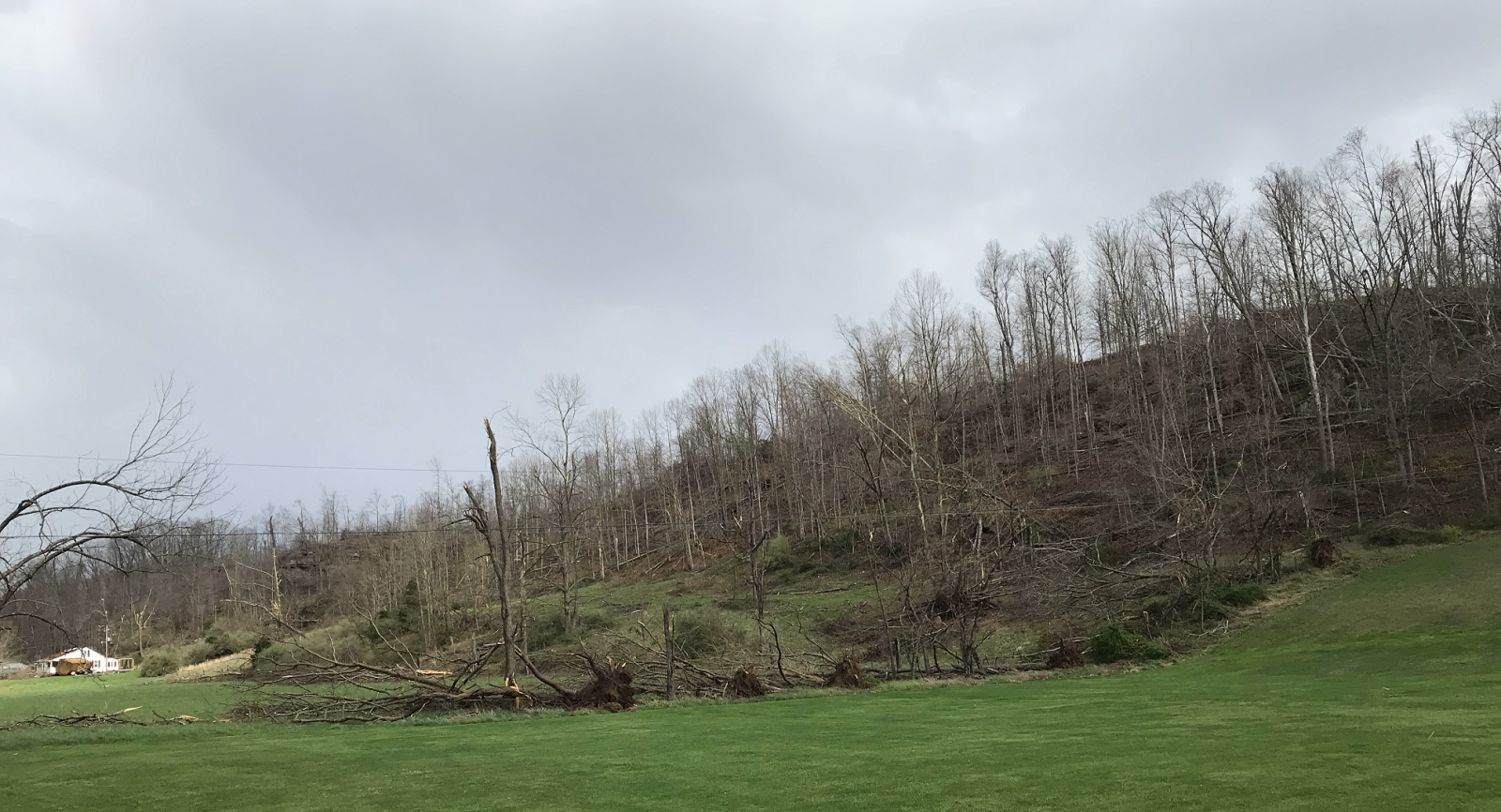
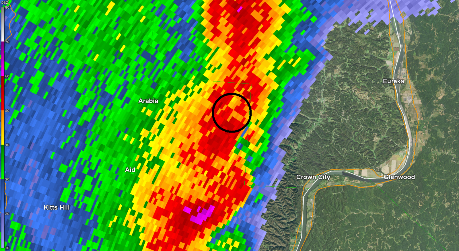
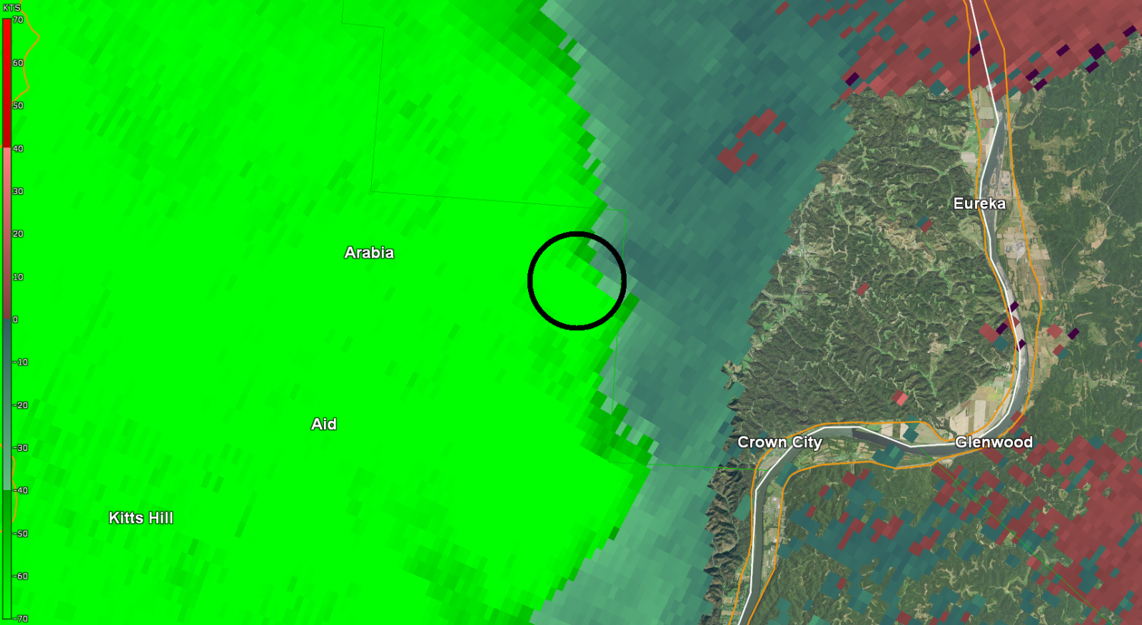
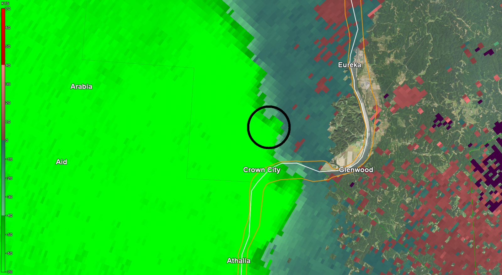
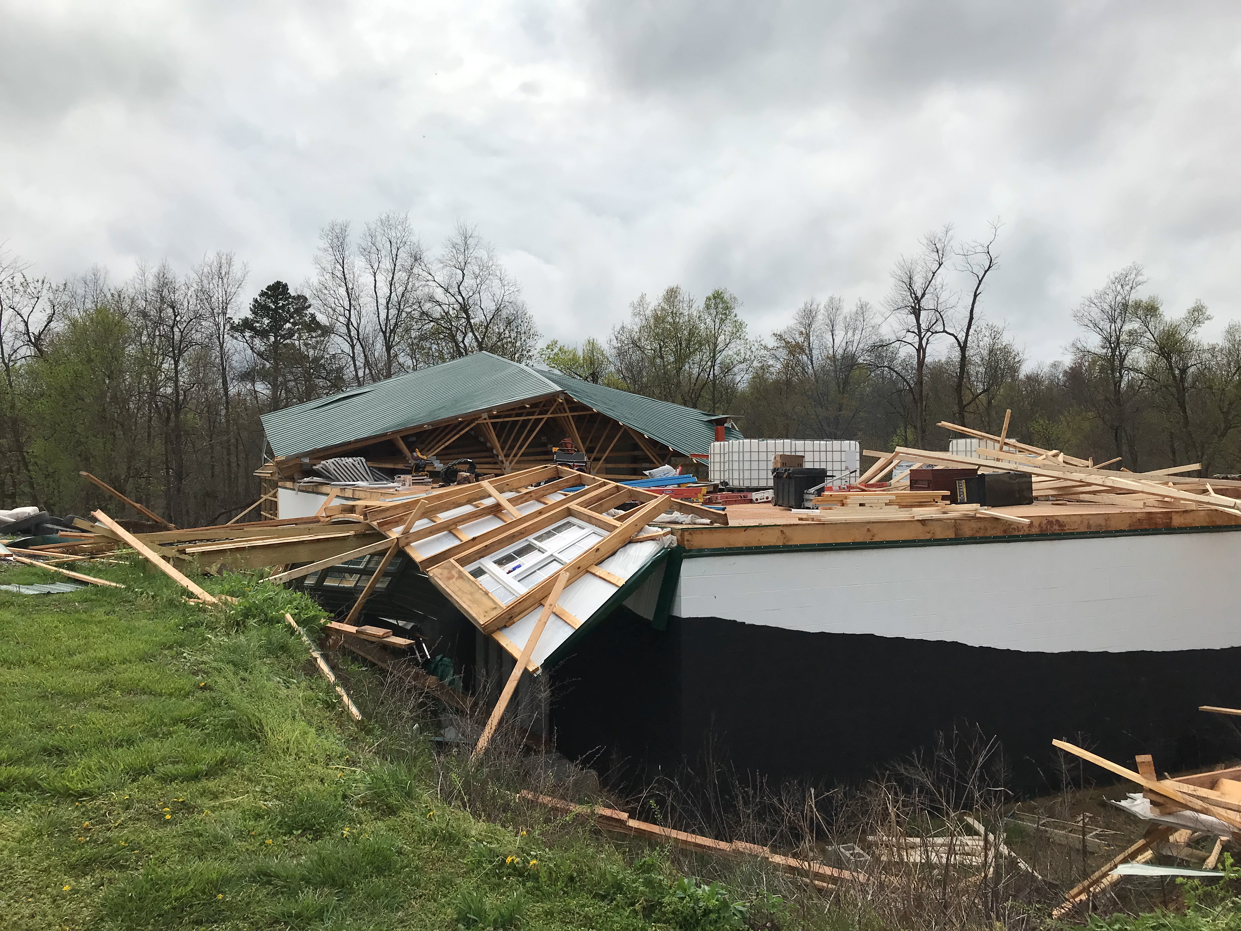
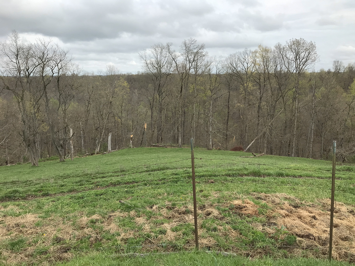
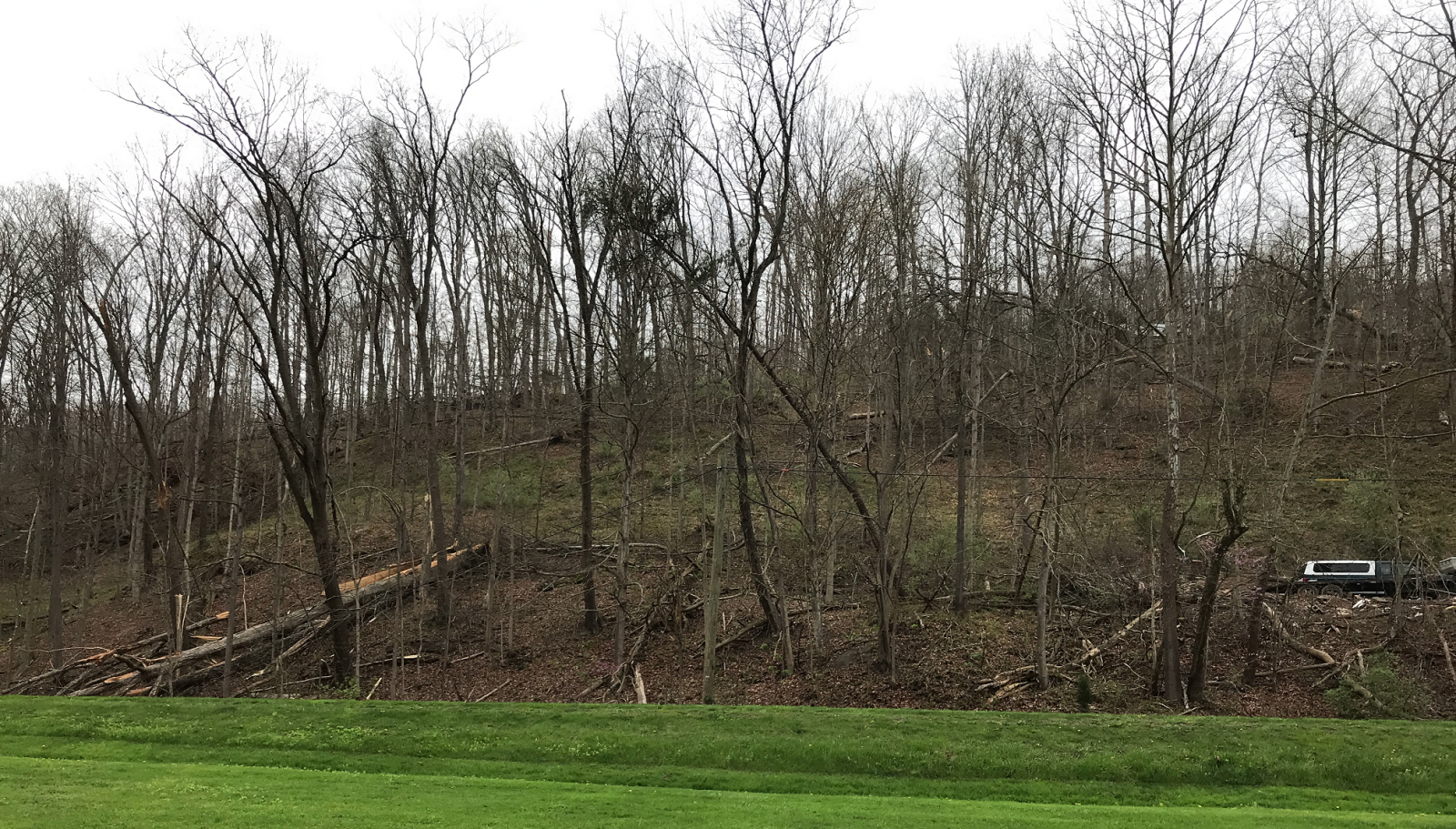
Tornado #4 - Aid (OH)
Track Map 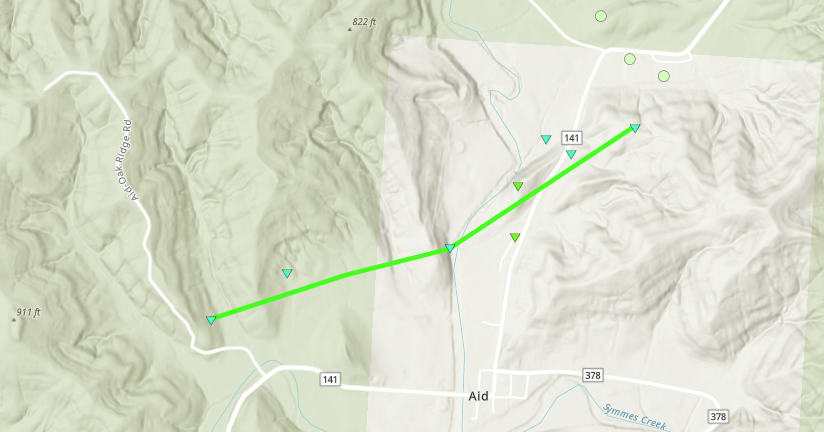
Radar Imagery: Base Reflectivity / Storm-Relative Velocity (0.5 Degree)
Damage Pictures
|
||||||||||||||||||||||||
|
Tornado #5 - Timber Ridge Lake (OH)
Track Map 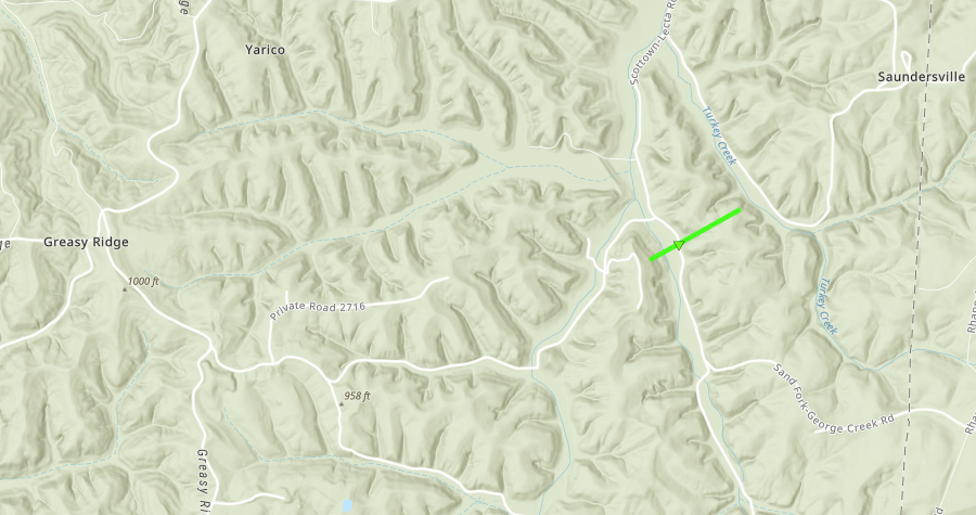
Radar Imagery: Base Reflectivity / Storm-Relative Velocity (0.5 Degree)
Damage Pictures
|
||||||||||||||||||||||||
|
Tornado #6 - 5th Street Road (WV)
Track Map 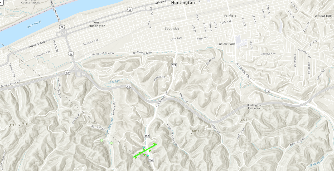
Radar Imagery: Base Reflectivity / Storm-Relative Velocity (0.5 Degree)
Damage Pictures
|
||||||||||||||||||||||||
|
Tornado #7 - North of Pea Ridge (WV)
Track Map 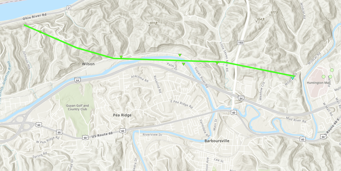
Radar Imagery: Base Reflectivity / Storm-Relative Velocity (0.5 Degree)
Damage Pictures
|
||||||||||||||||||||||||
|
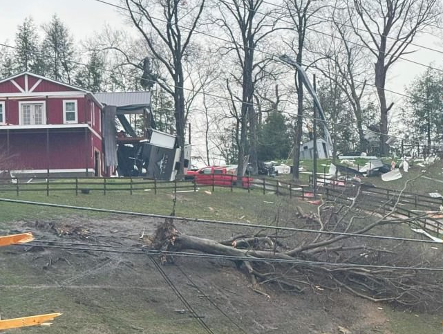
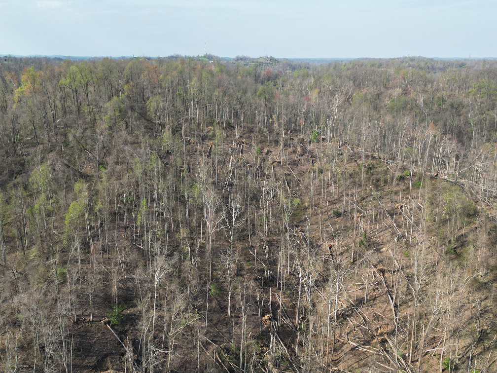
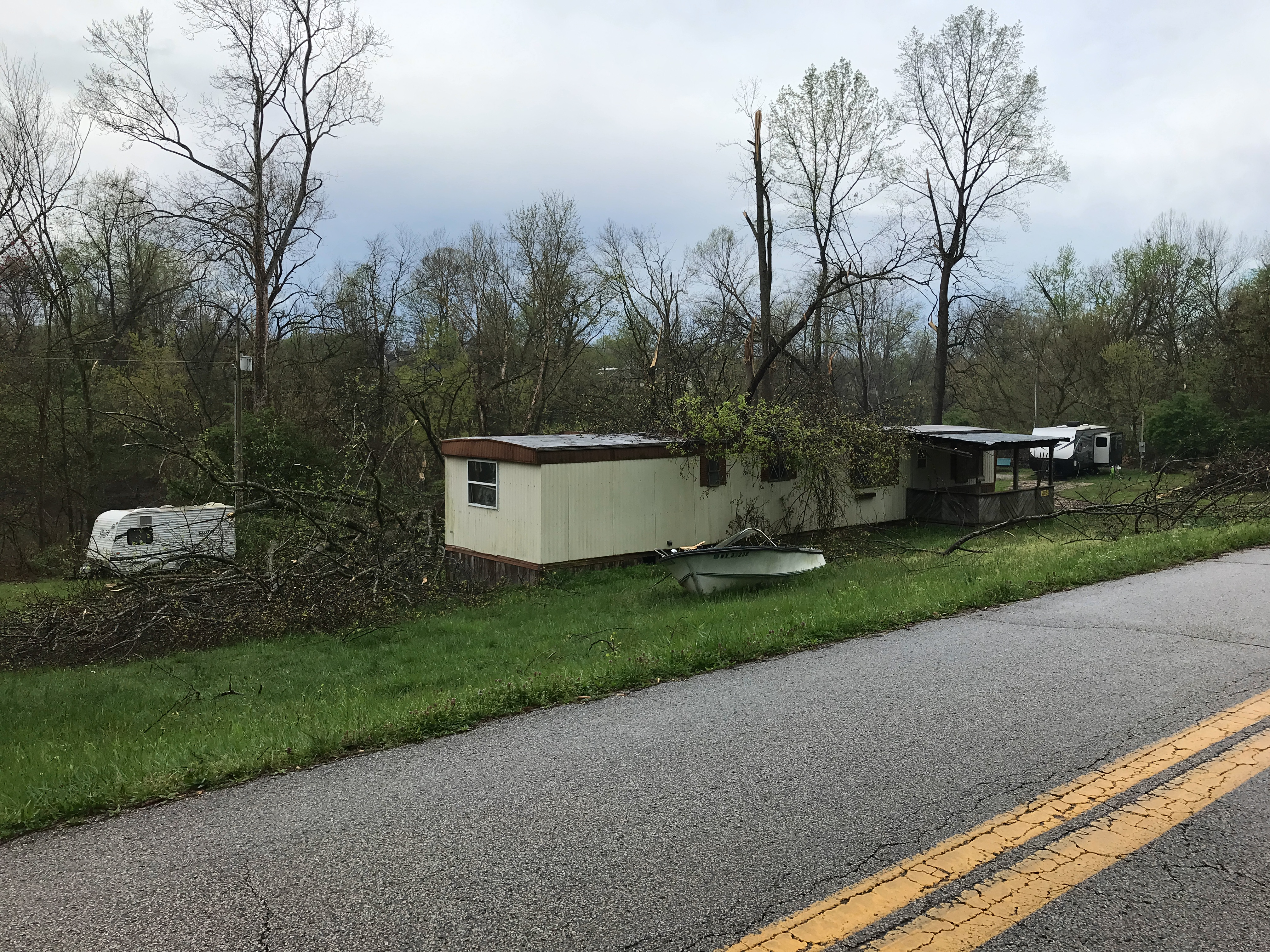
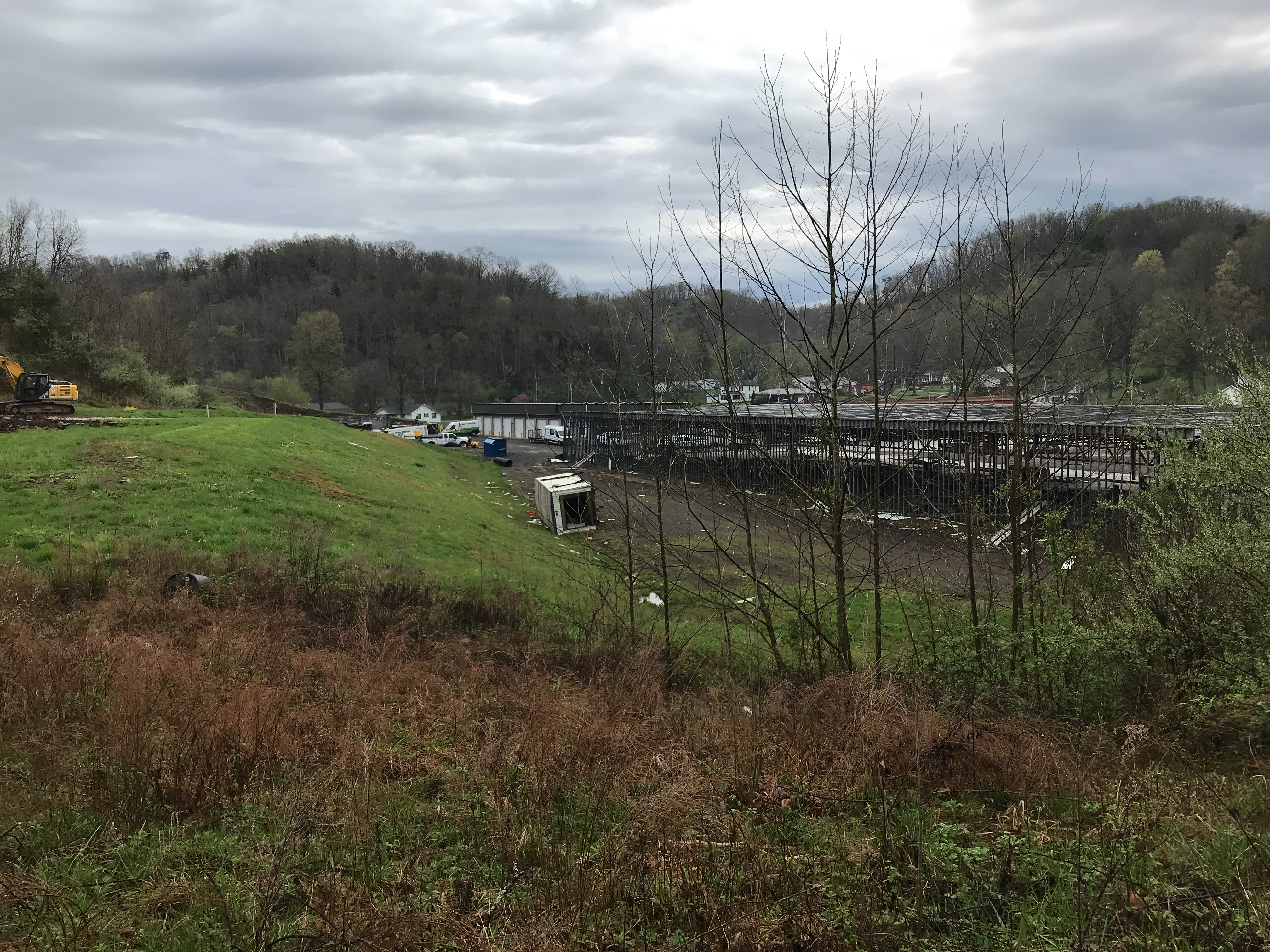
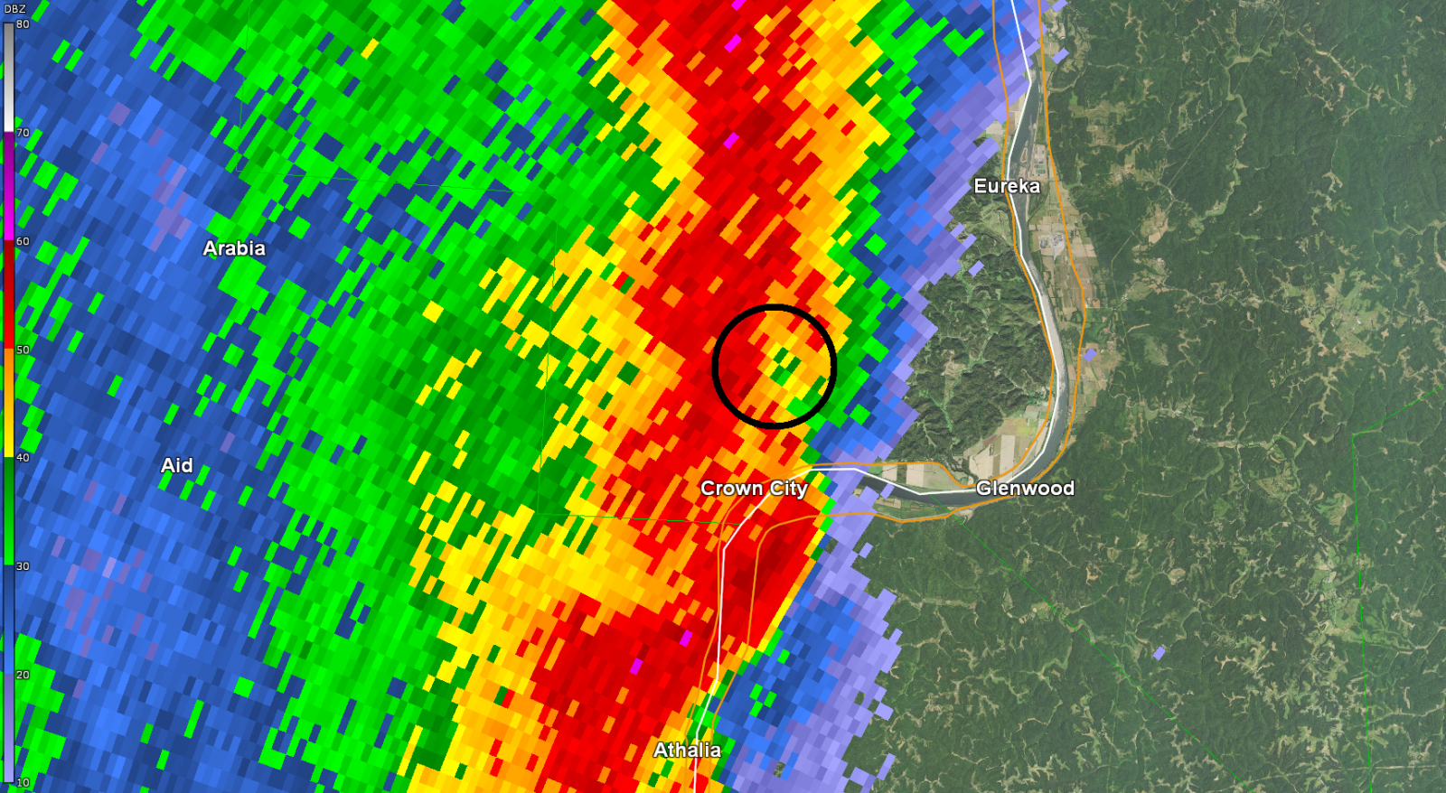
Tornado #8 - Crown City (OH)
Track Map 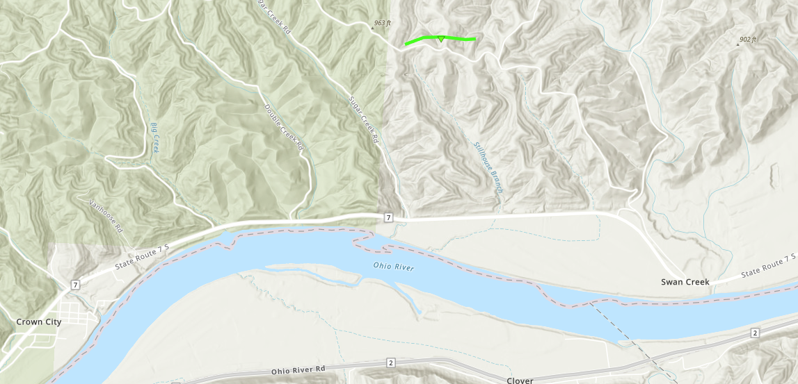
Radar Imagery: Base Reflectivity / Storm-Relative Velocity (0.5 Degree)
Damage Pictures
|
||||||||||||||||||||||||
|
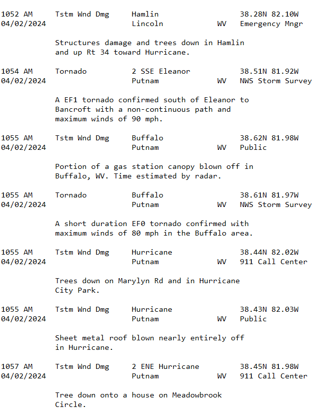
Tornado #9 - Eleanor - Bancroft (WV)
Track Map 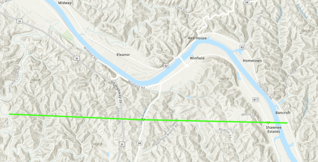
Radar Imagery: Base Reflectivity / Storm-Relative Velocity (0.5 Degree)
Damage Pictures
|
||||||||||||||||||||||||
|
Tornado #10 - Buffalo (WV)
Track Map 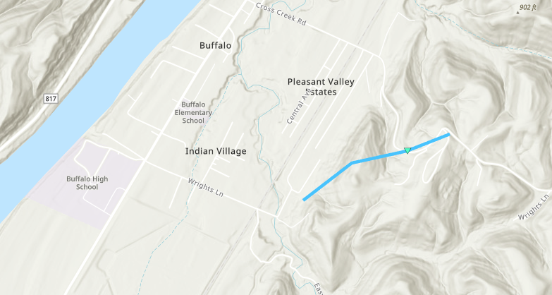
Radar Imagery: Base Reflectivity / Storm-Relative Velocity (0.5 Degree)
Damage Pictures
|
||||||||||||||||||||||||
|
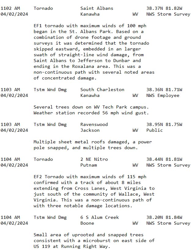
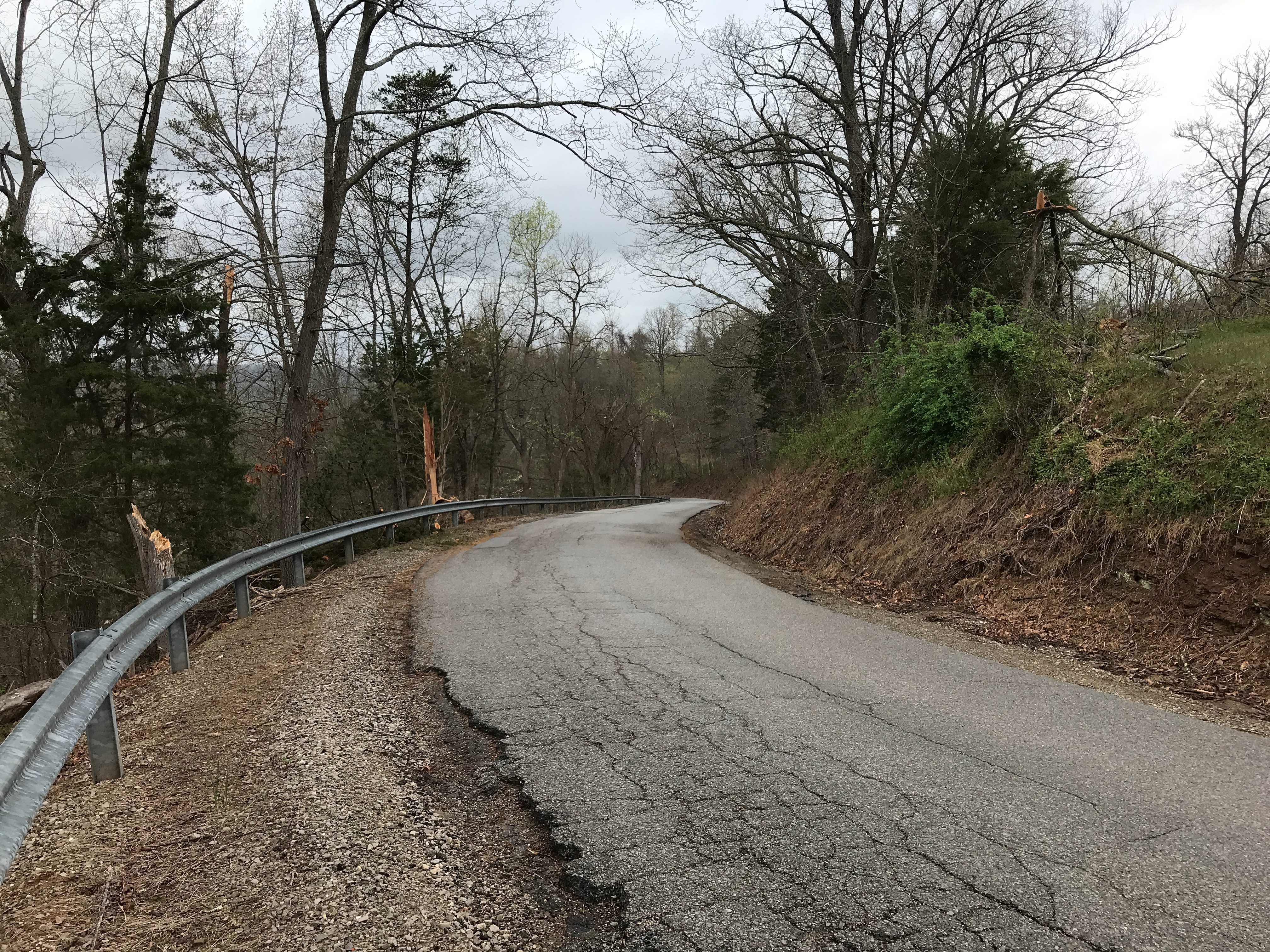
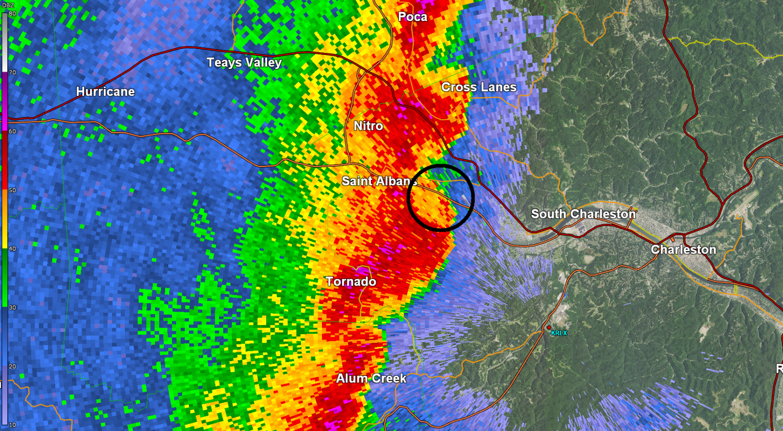
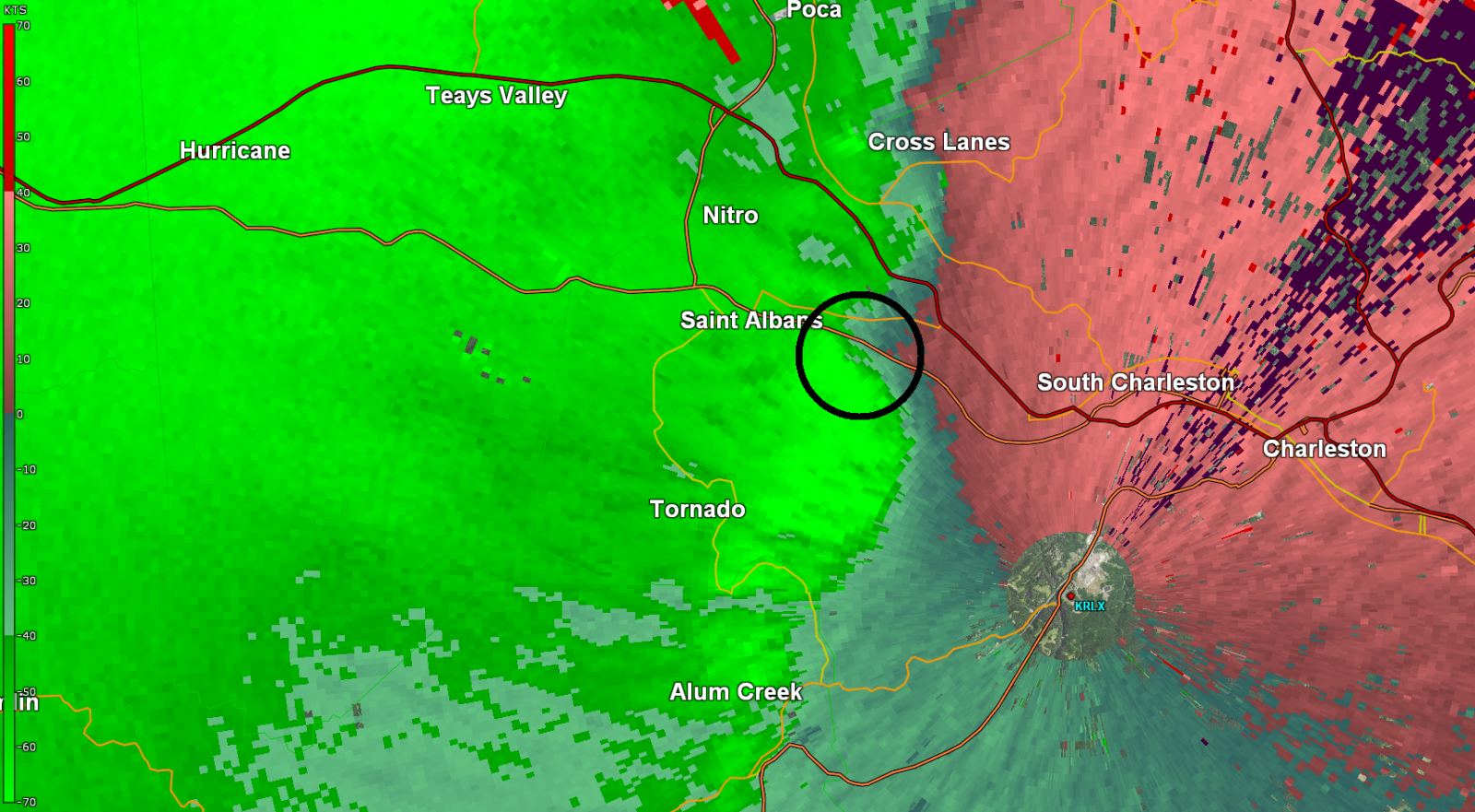
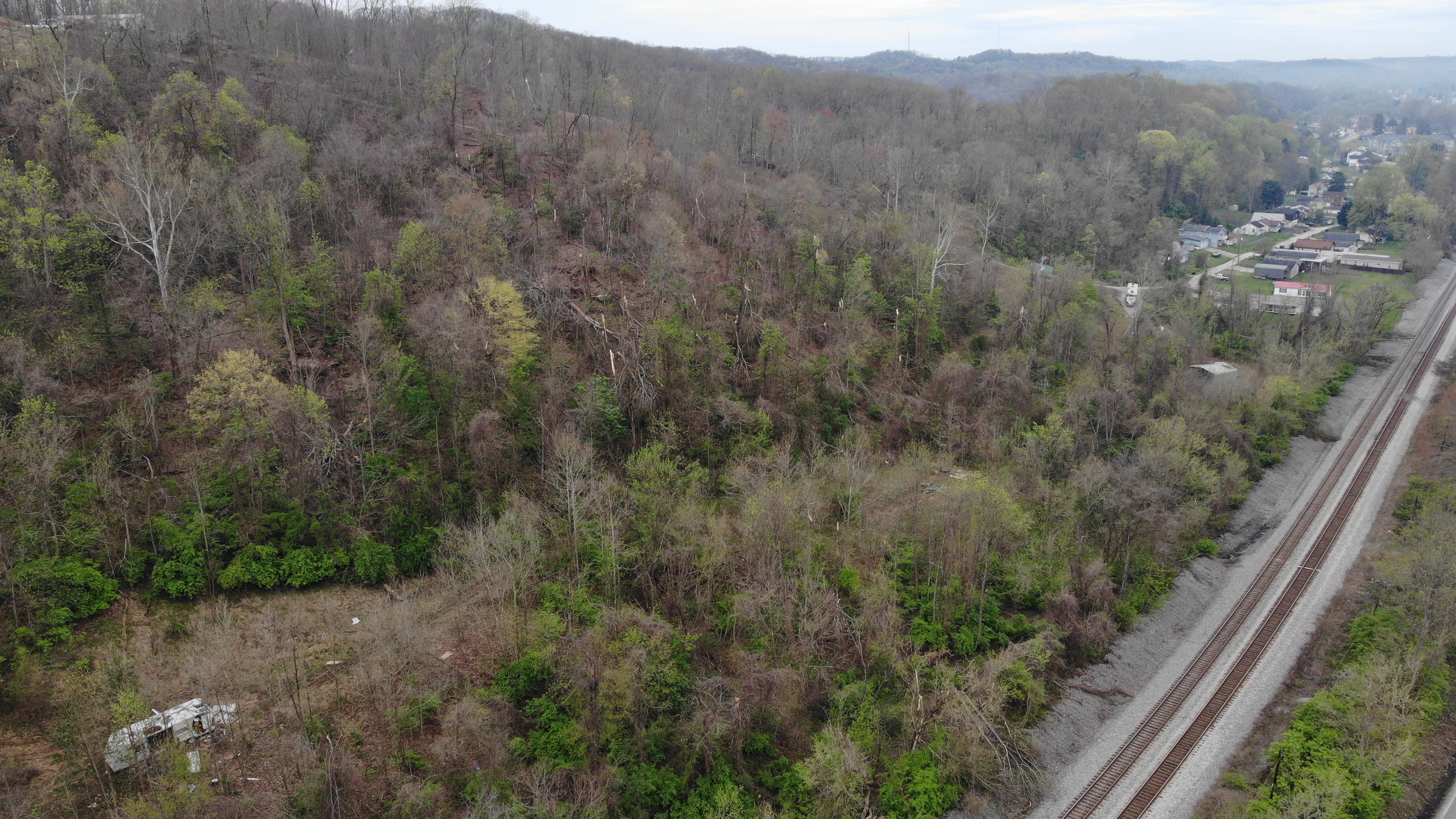
Tornado #11 - St. Albans - Dunbar (WV)
Track Map 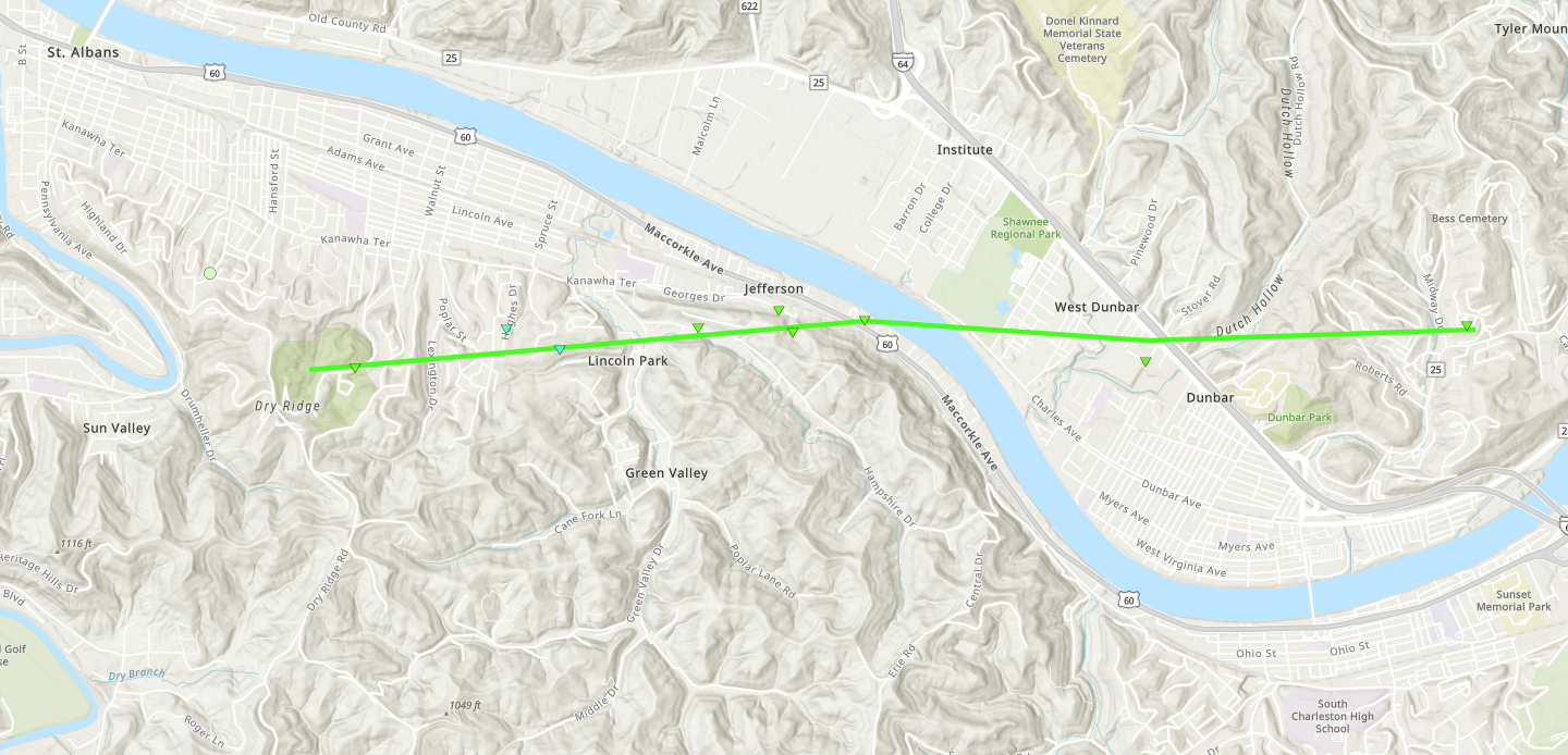
Radar Imagery: Base Reflectivity / Storm-Relative Velocity (1.3 Degree)
Damage Pictures
|
||||||||||||||||||||||||
|
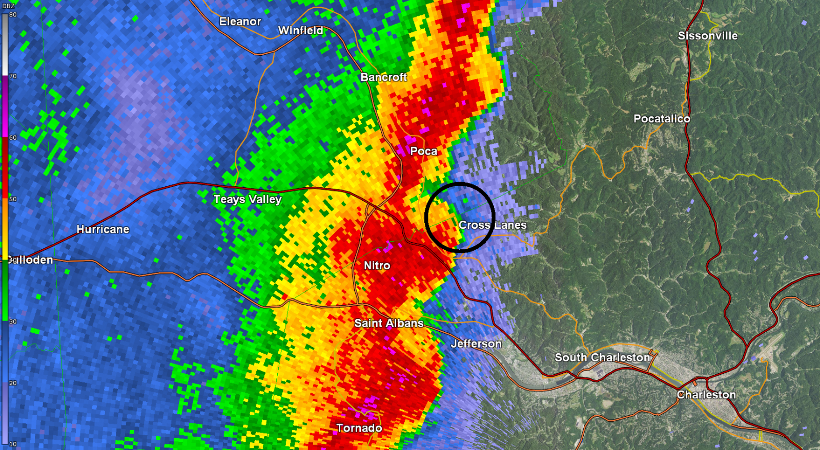
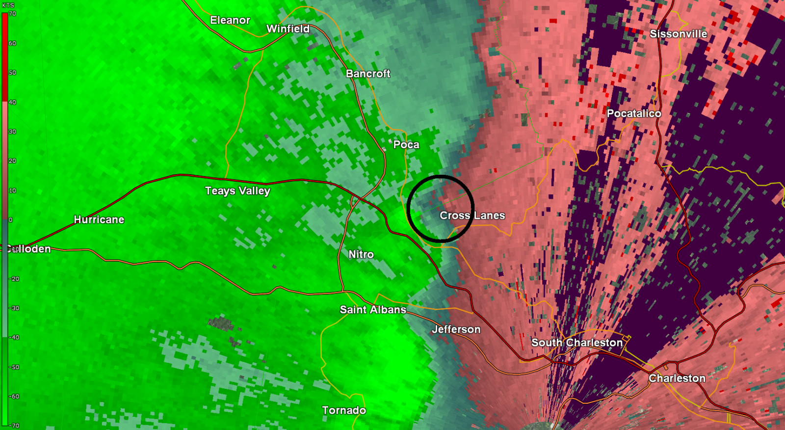
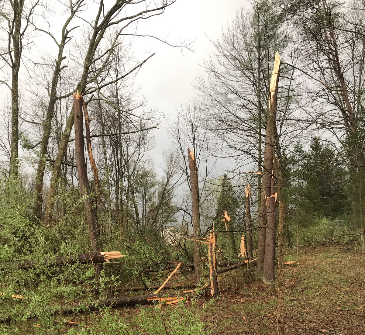
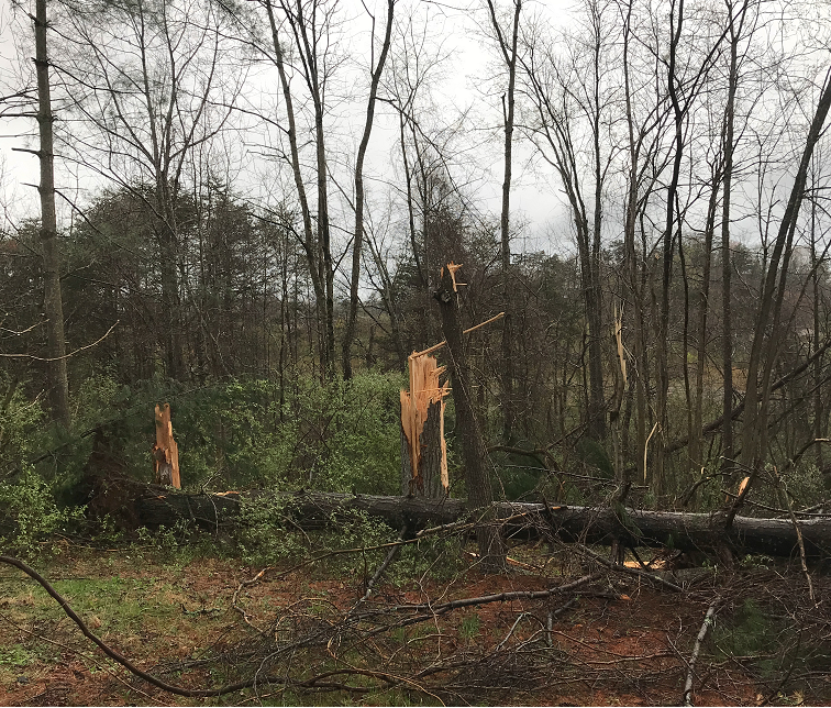
Tornado #12 - Cross Lanes (WV)
Track Map 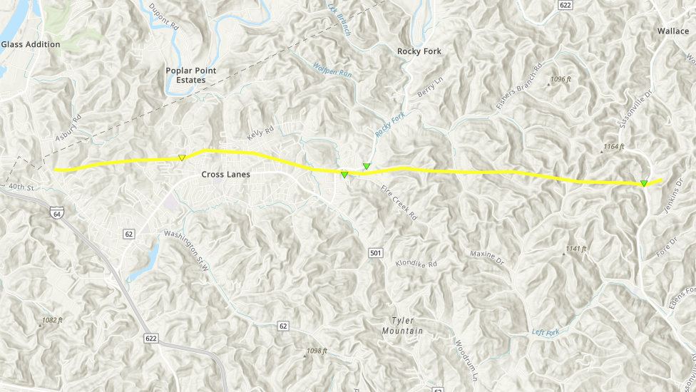
Radar Imagery: Base Reflectivity / Storm-Relative Velocity (0.9 Degree)
Damage Pictures
|
||||||||||||||||||||||||||||
|
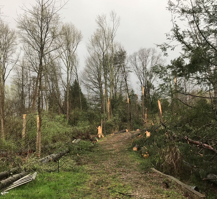
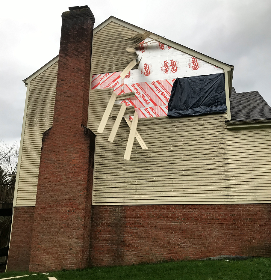
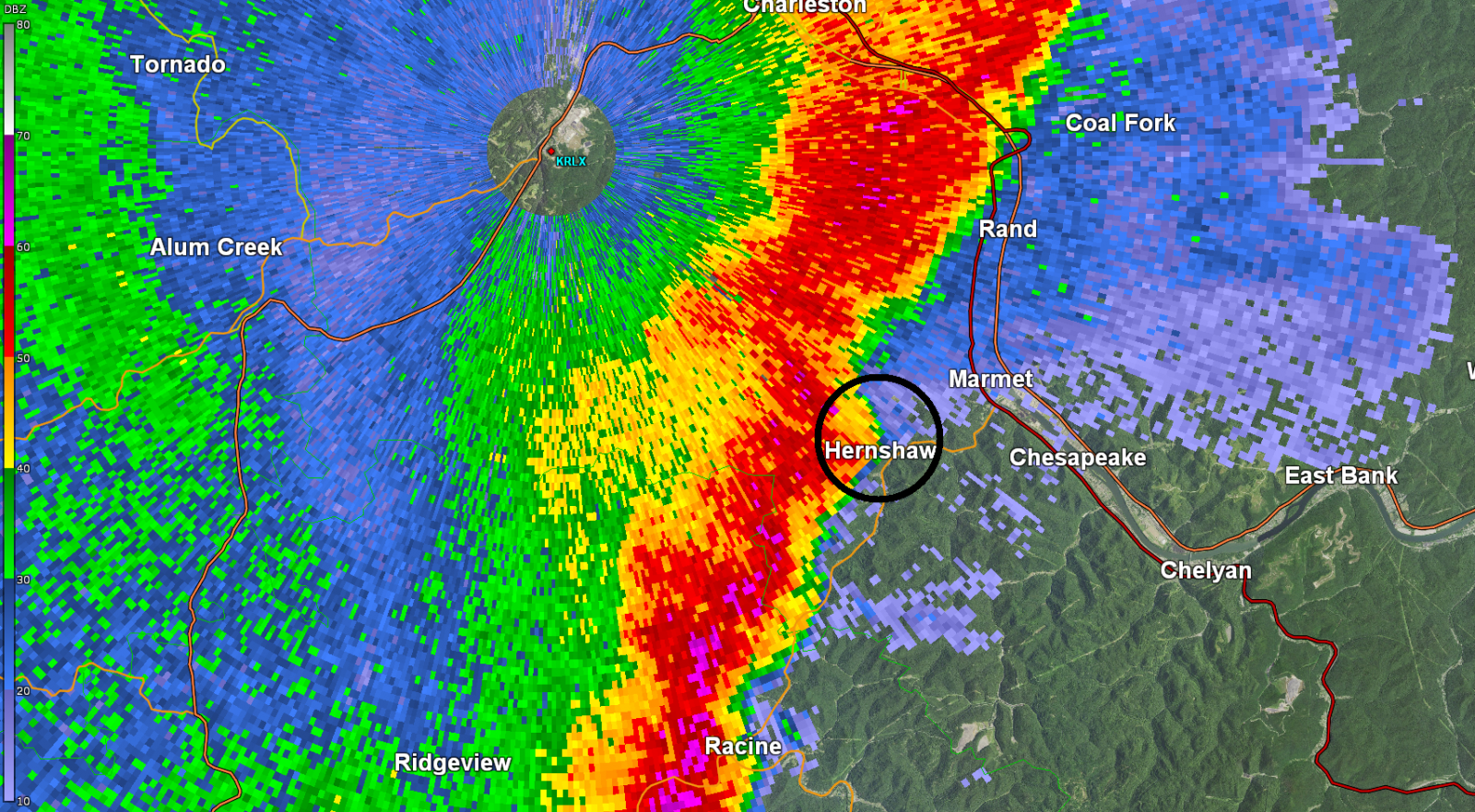
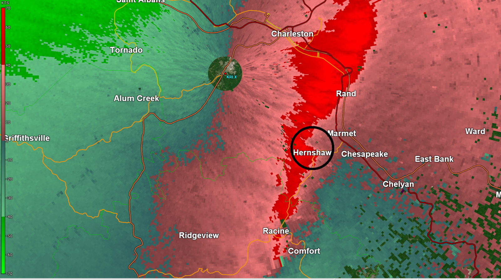
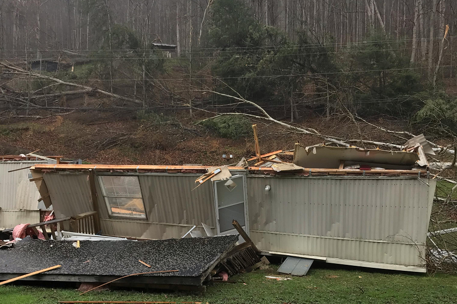
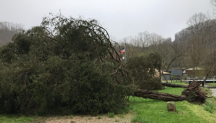
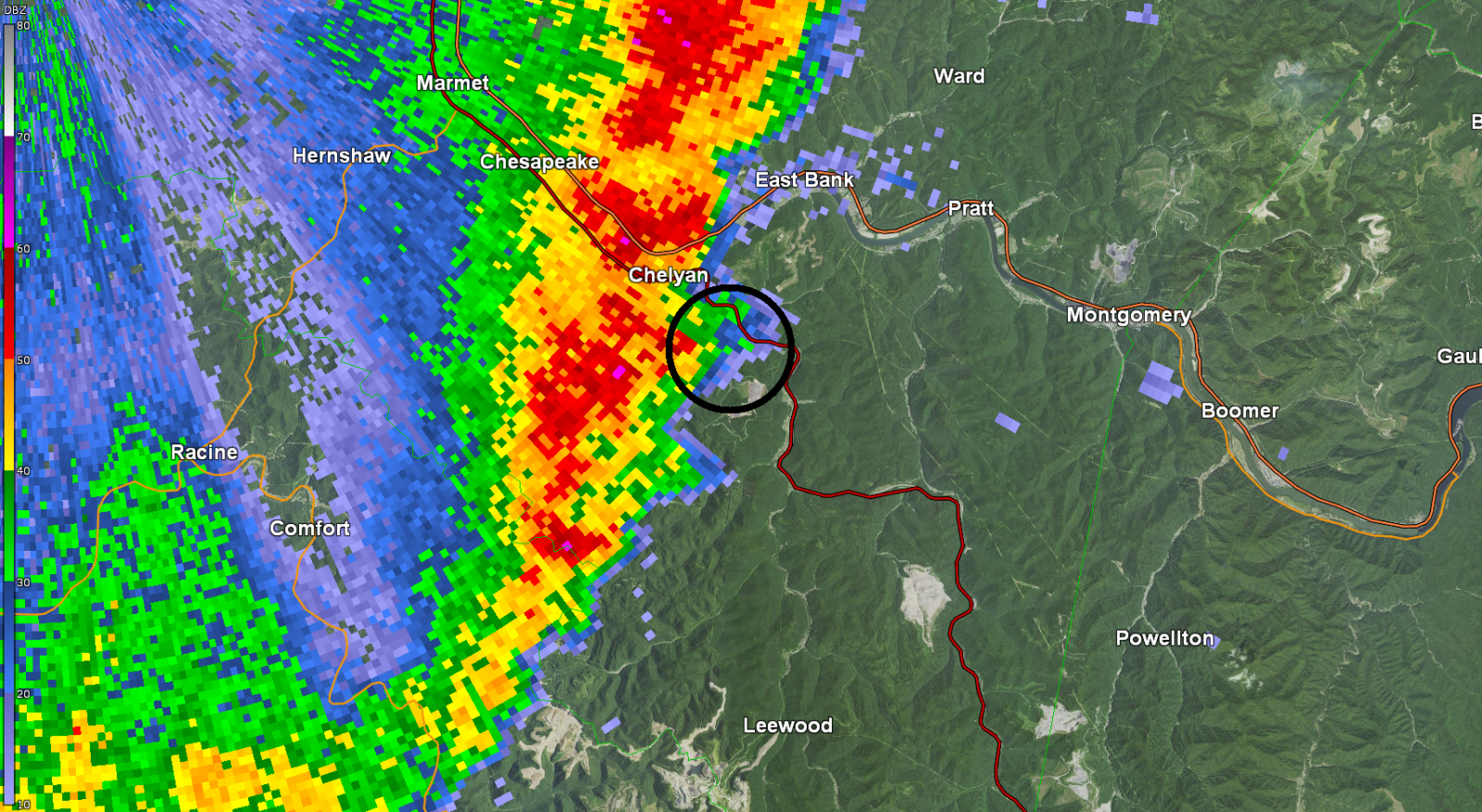
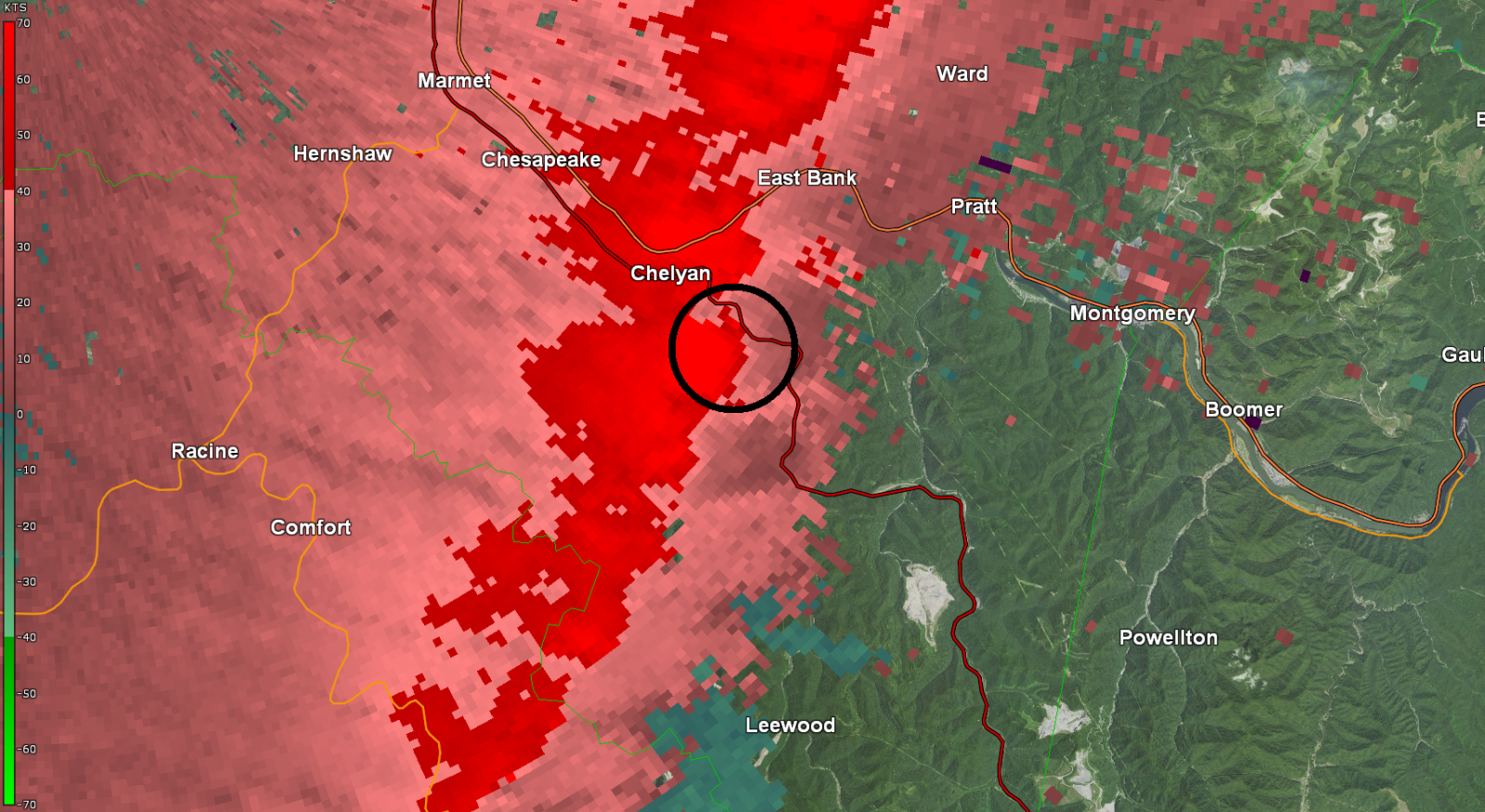
Tornado #13 - Hernshaw (WV)
Track Map 
Radar Imagery: Base Reflectivity / Storm-Relative Velocity (0.5 Degree)
Damage Pictures
|
||||||||||||||||||||||||
|
Tornado #14 - Quick (WV)
Track Map 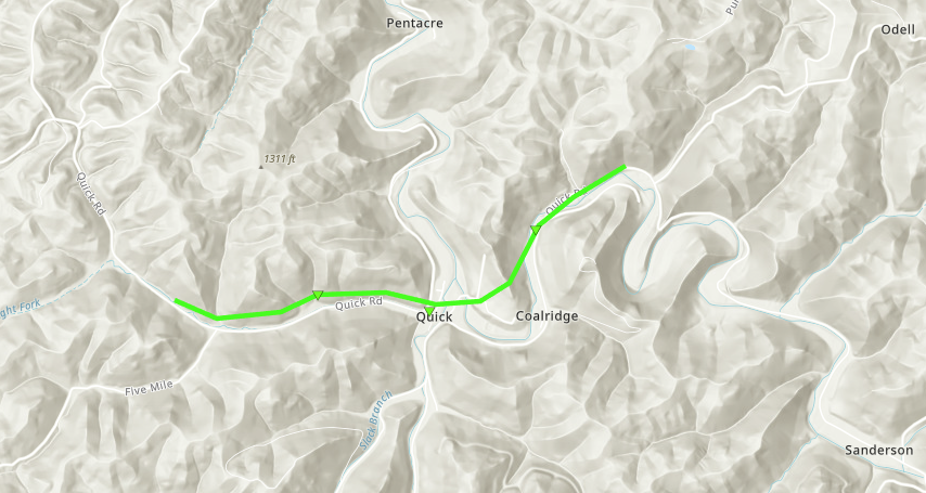
Radar Imagery: Base Reflectivity / Storm-Relative Velocity (1.3 Degree)
Damage Pictures
|
||||||||||||||||||||||||
|
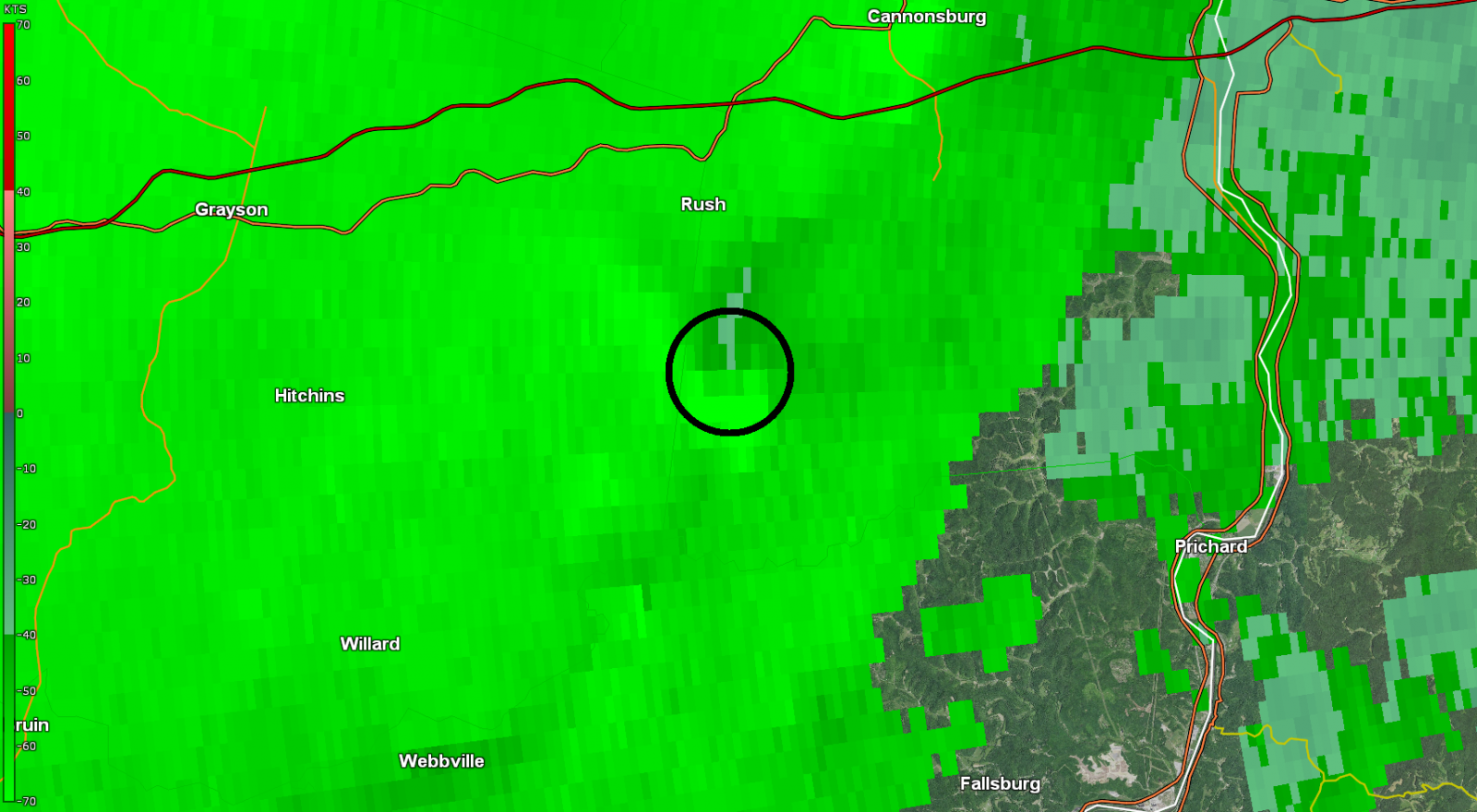
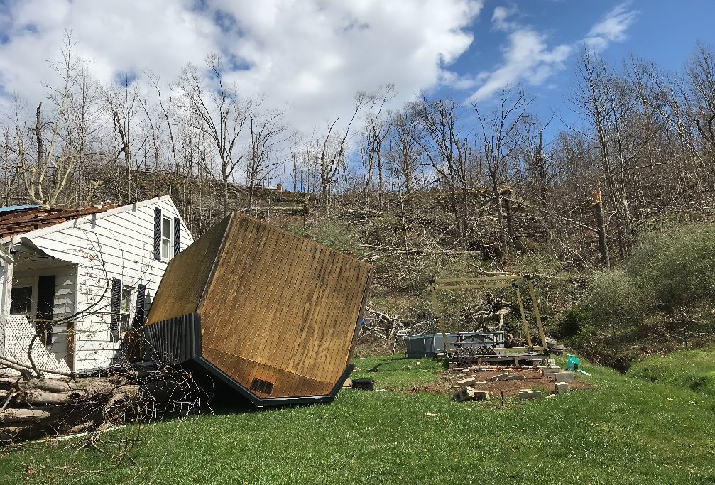
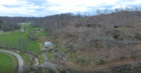
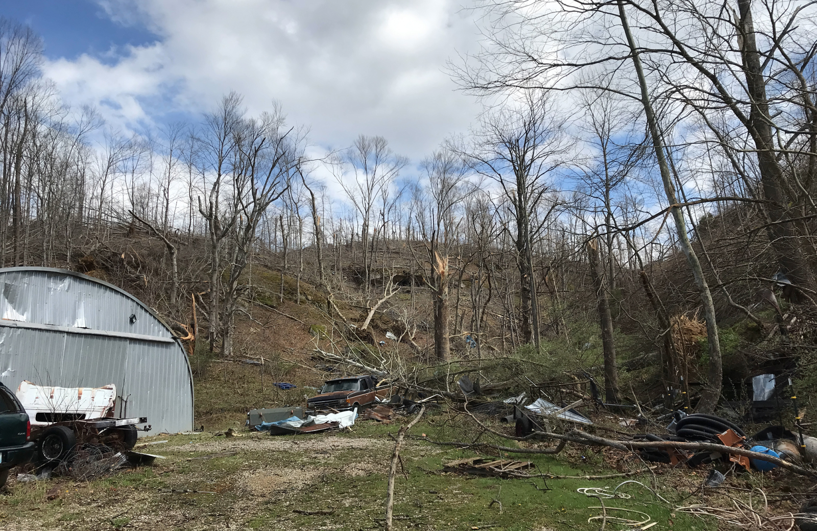
Tornado #15 - Ronda (WV)
Track Map 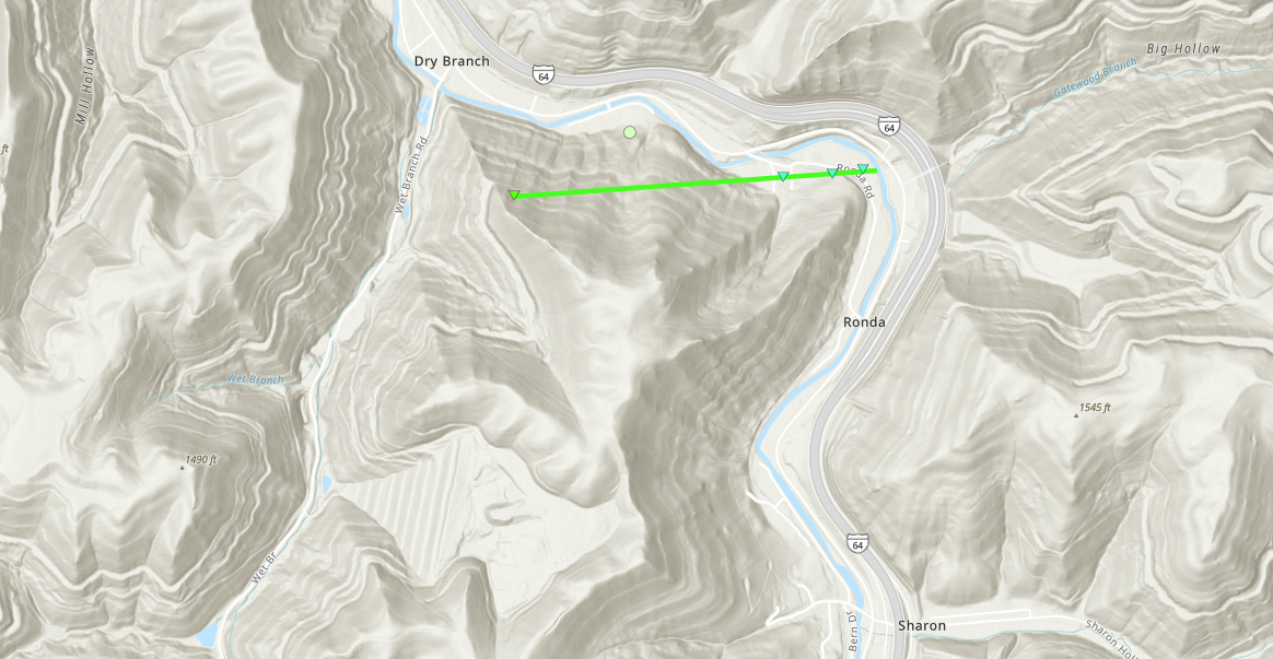
Radar Imagery: Base Reflectivity / Storm-Relative Velocity (0.5 Degree)
Damage Pictures
|
||||||||||||||||||||||||
|
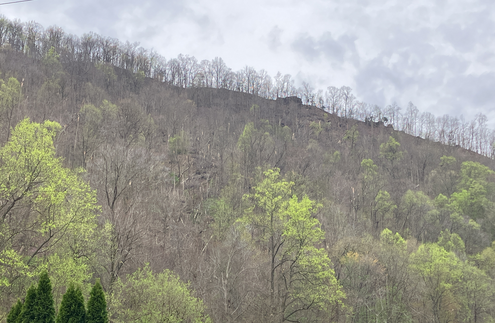
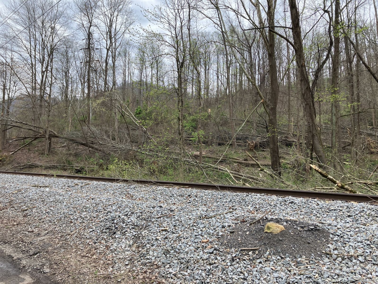
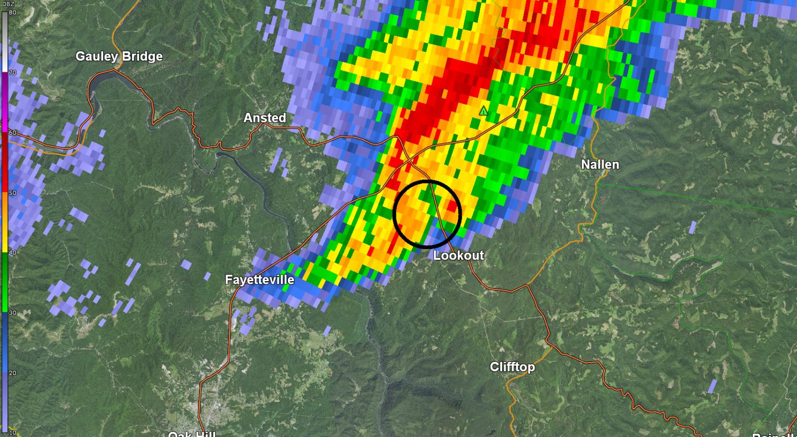
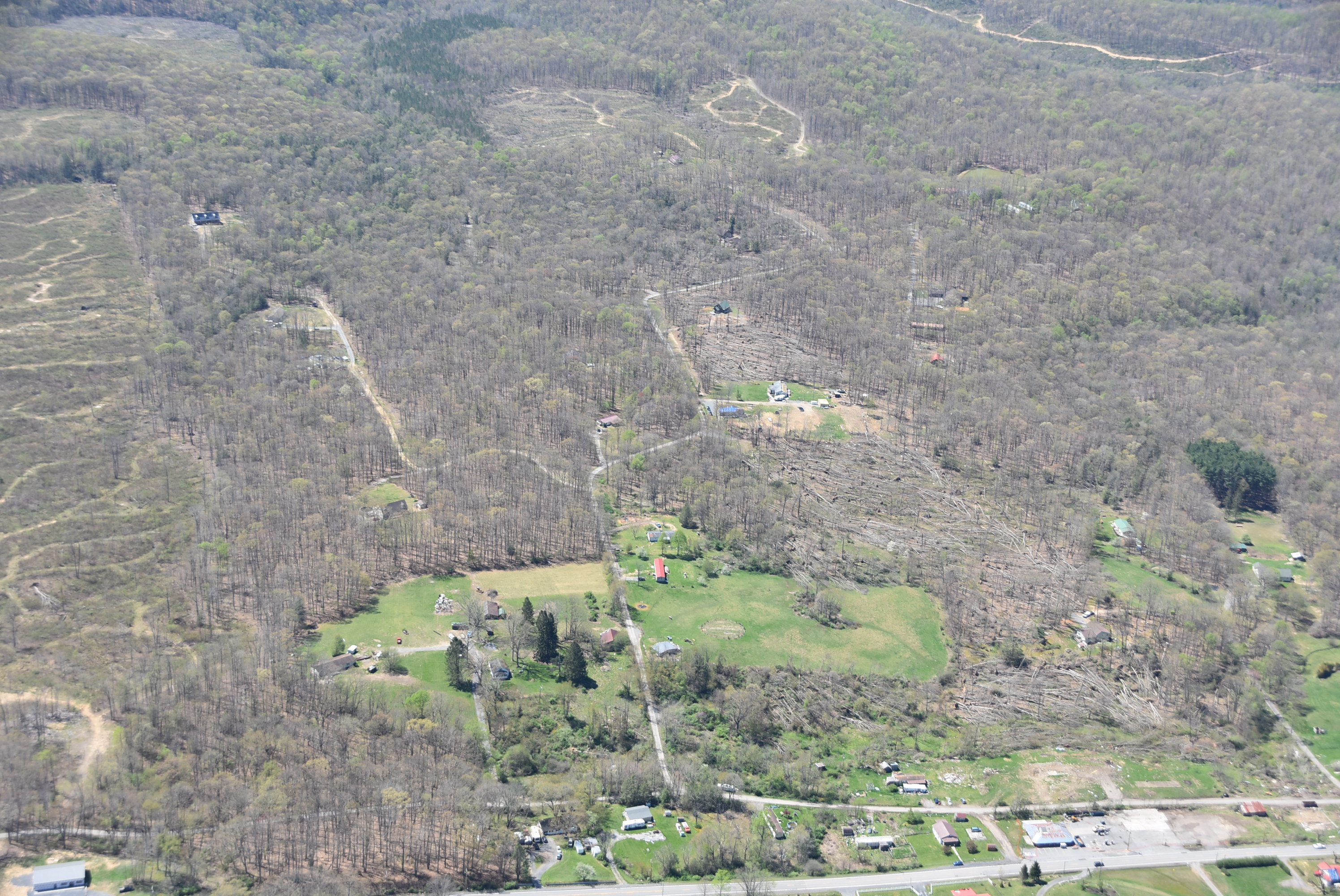
Tornado #16 - Hico (WV)
Track Map 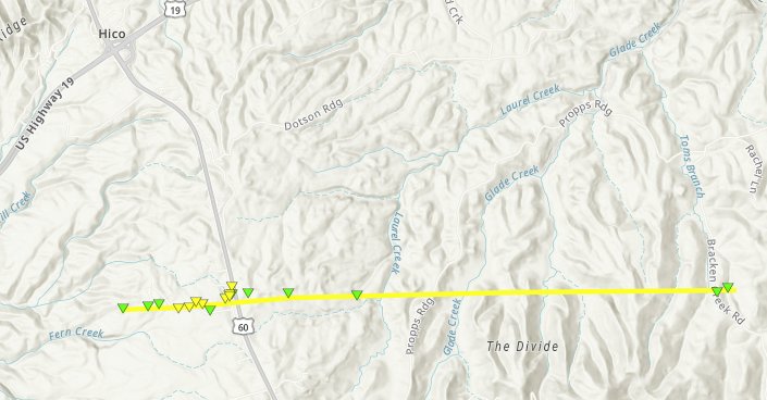
Radar Imagery: Base Reflectivity / Storm-Relative Velocity (0.5 Degree)
Damage Pictures
|
||||||||||||||||||||||||||||
|
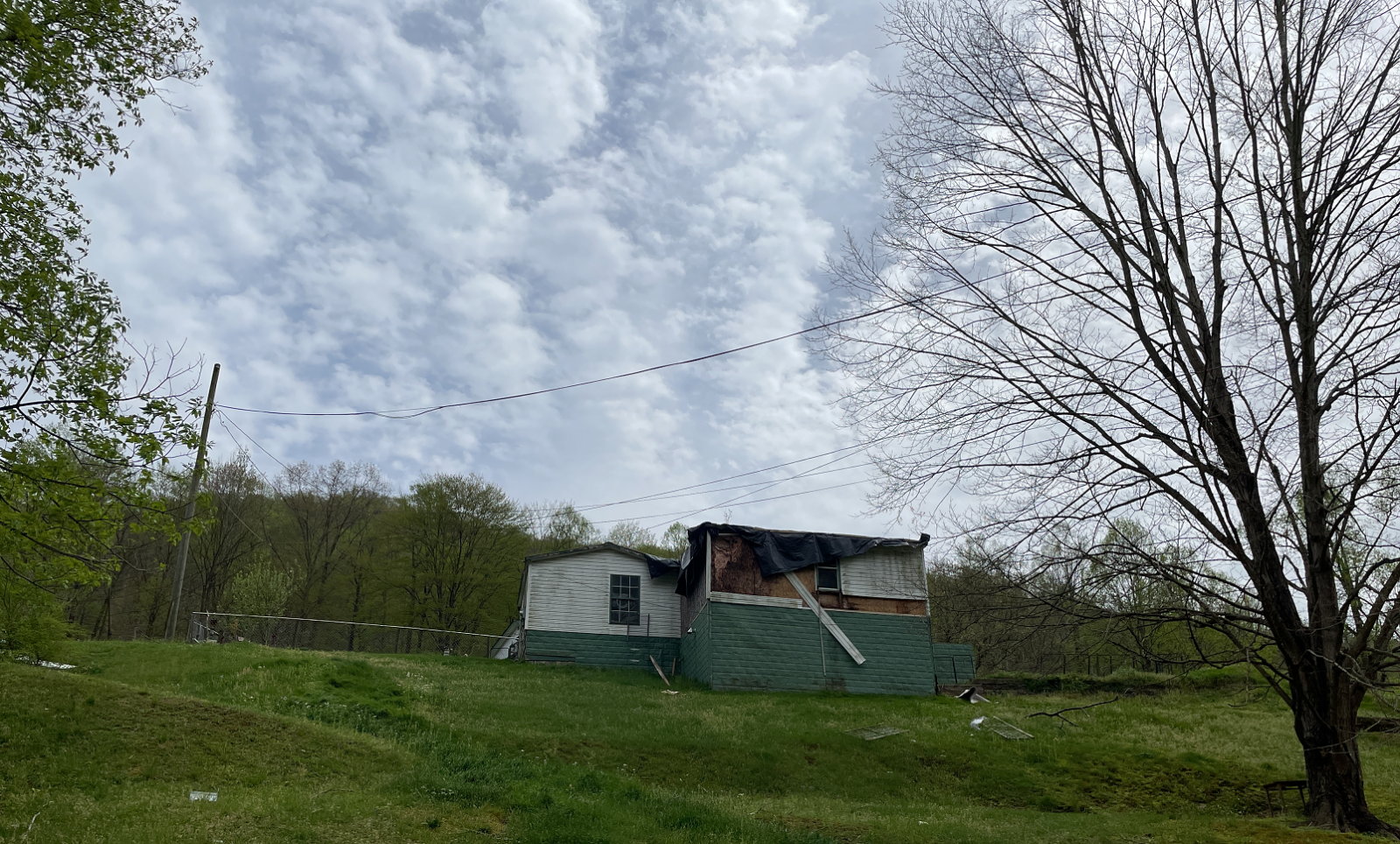
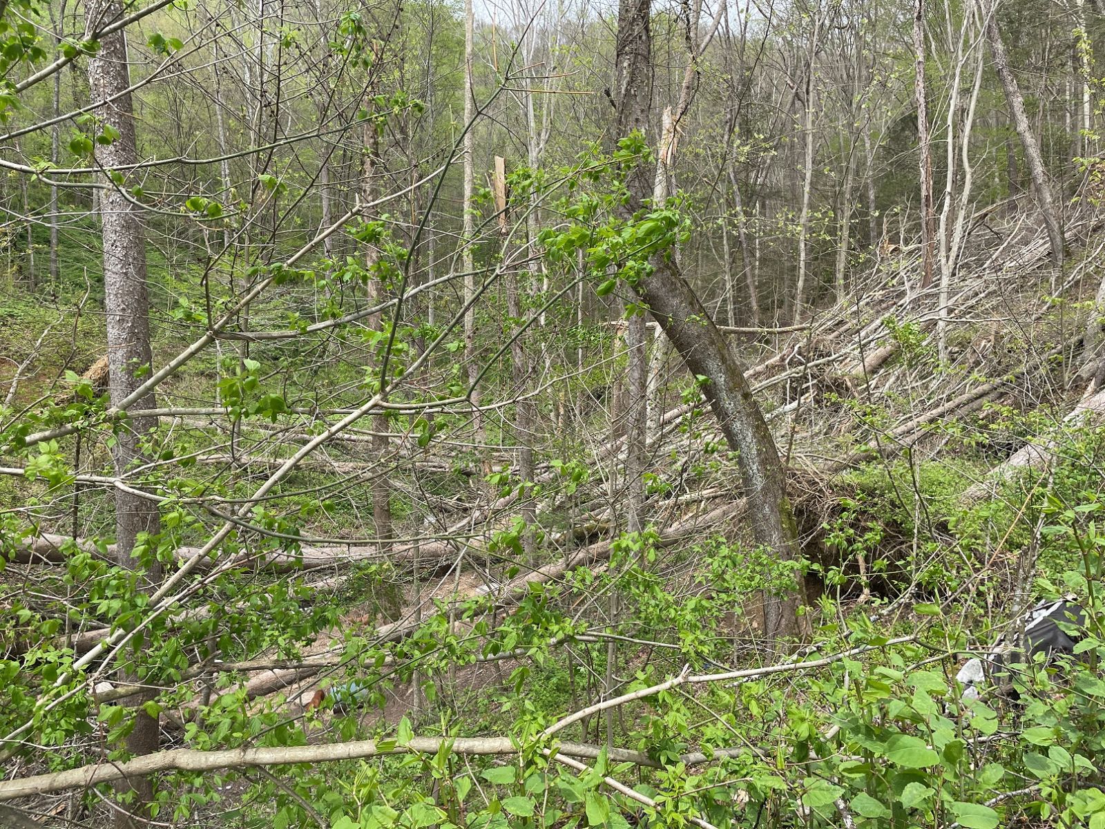
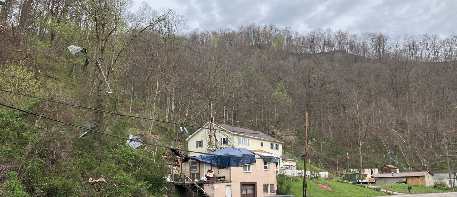
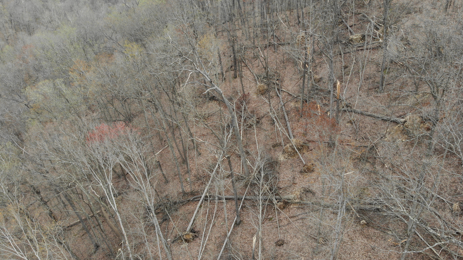
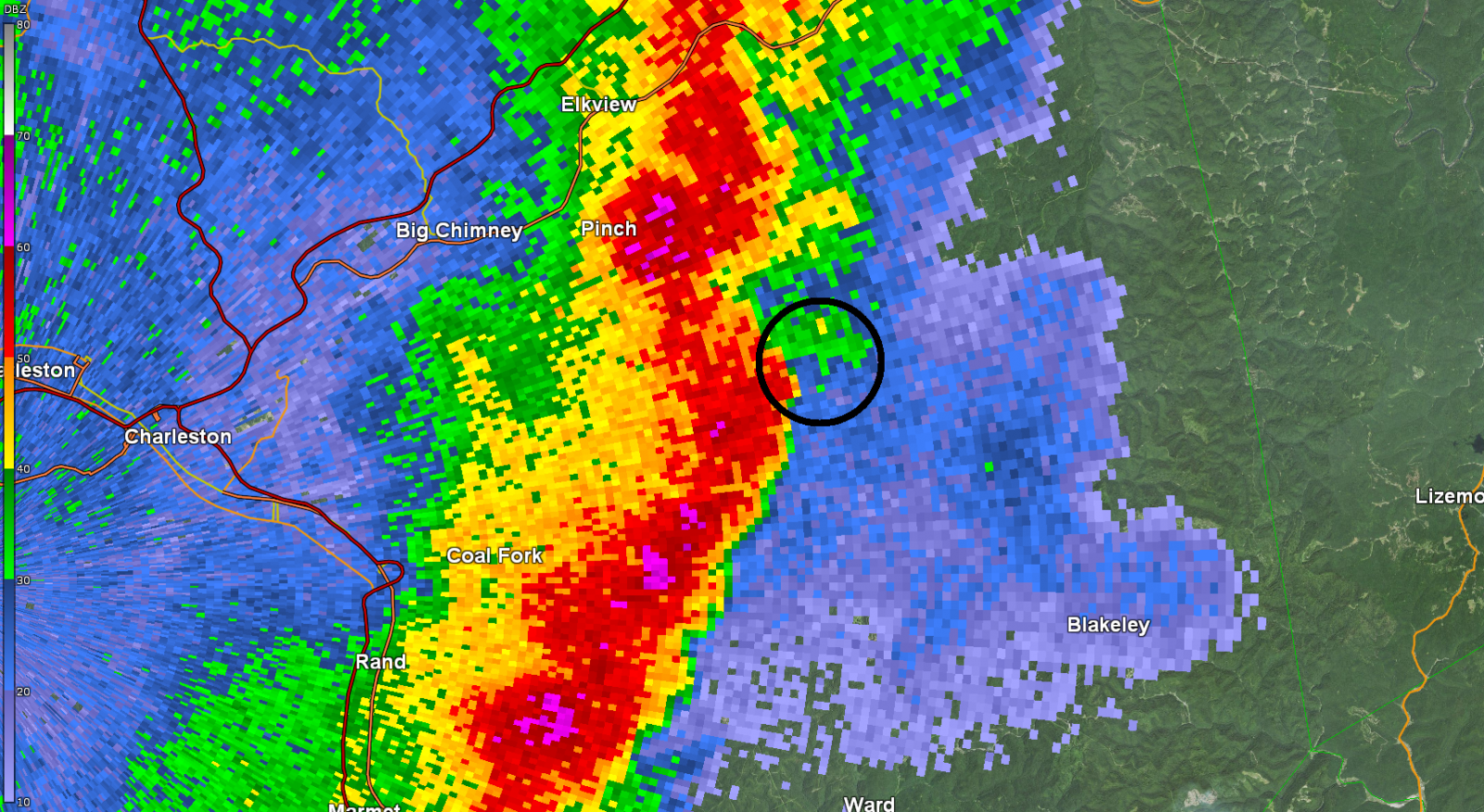
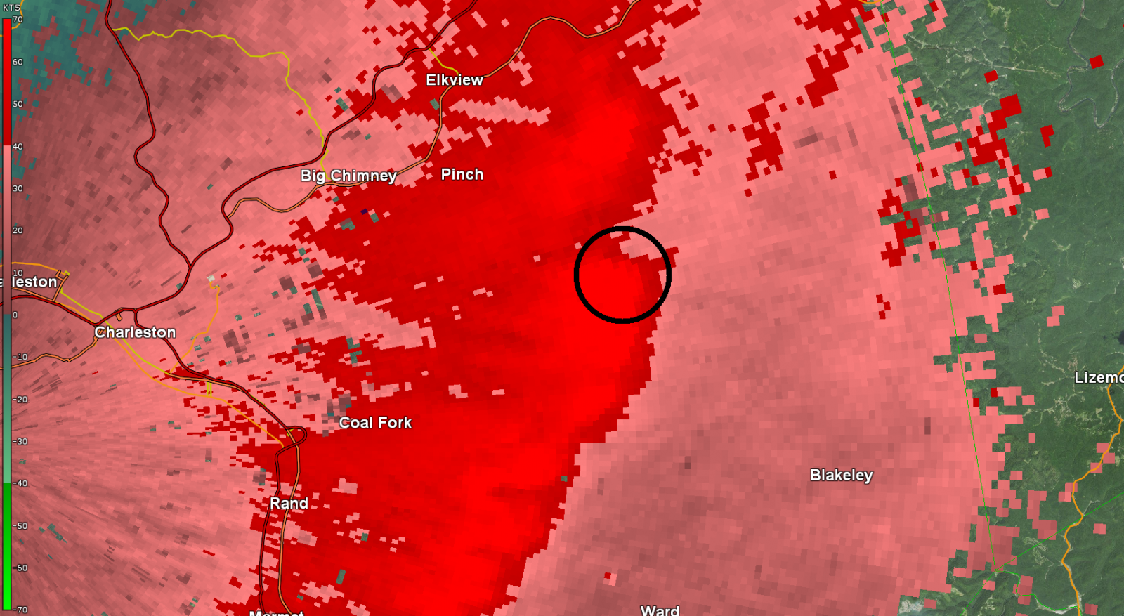
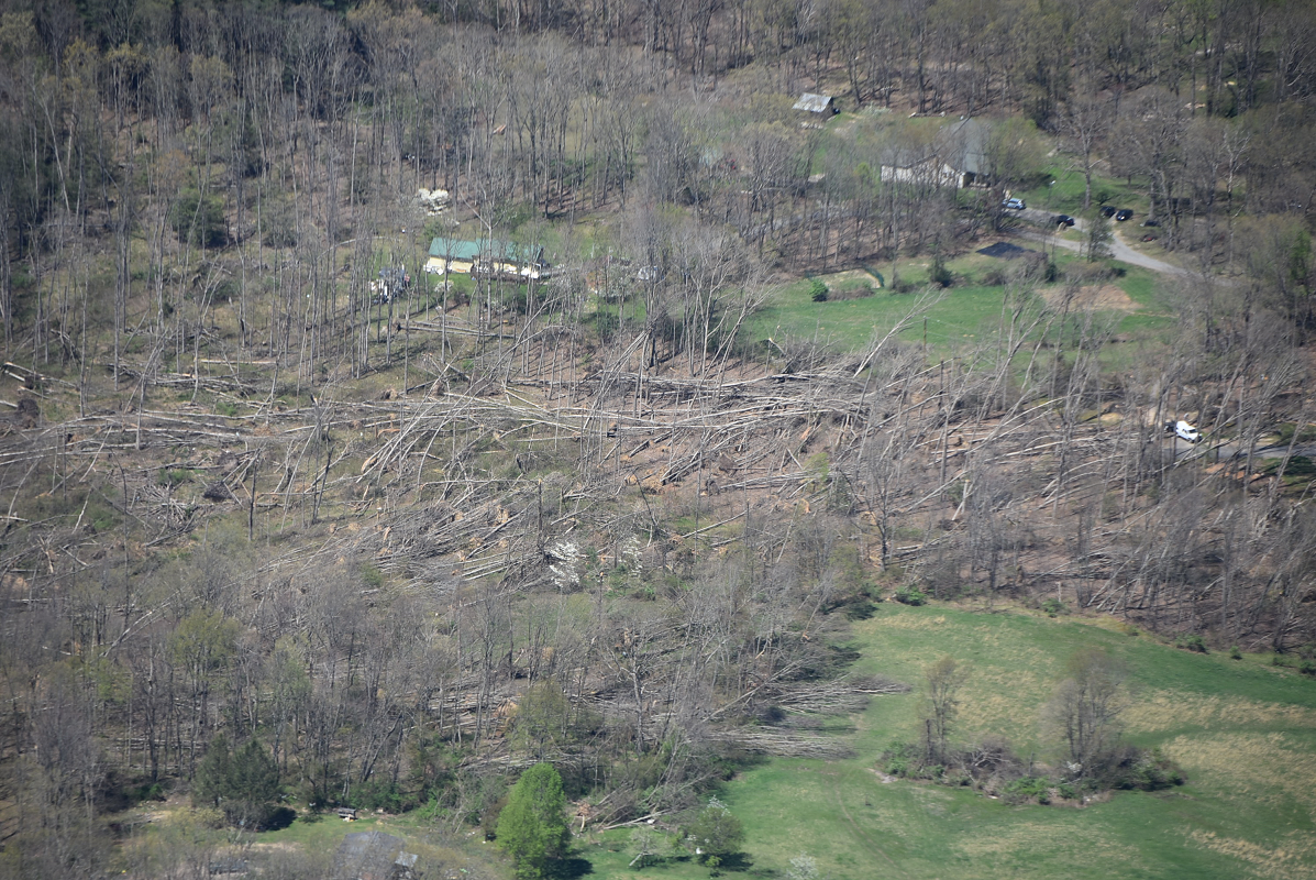
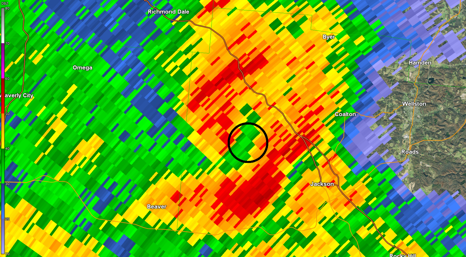
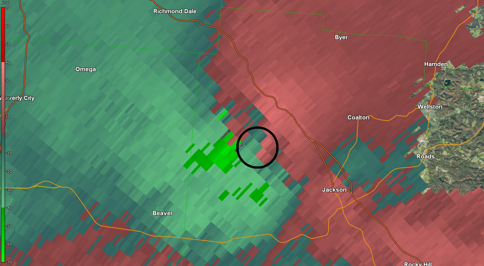
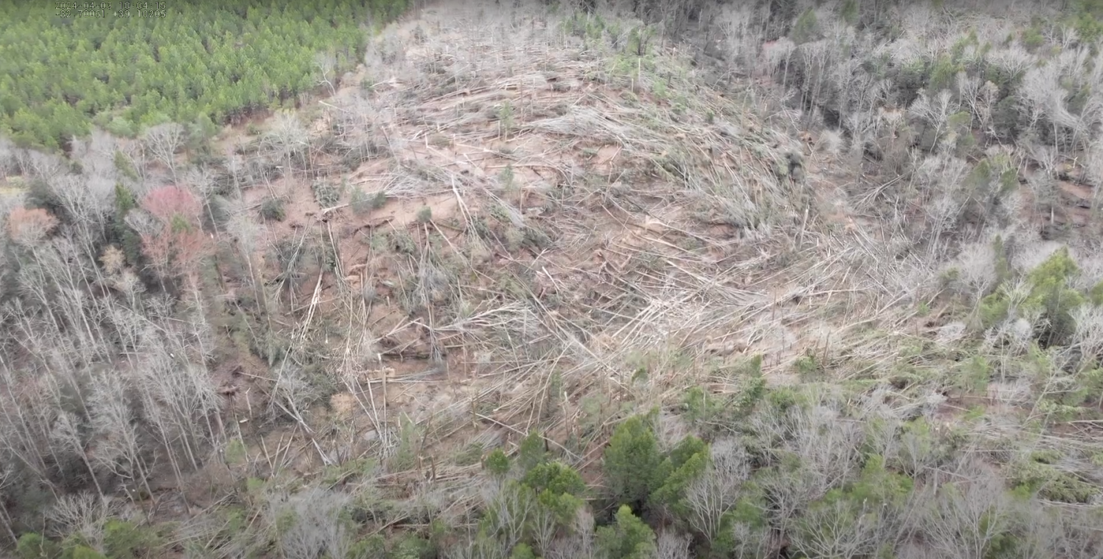
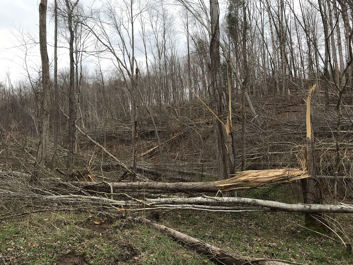
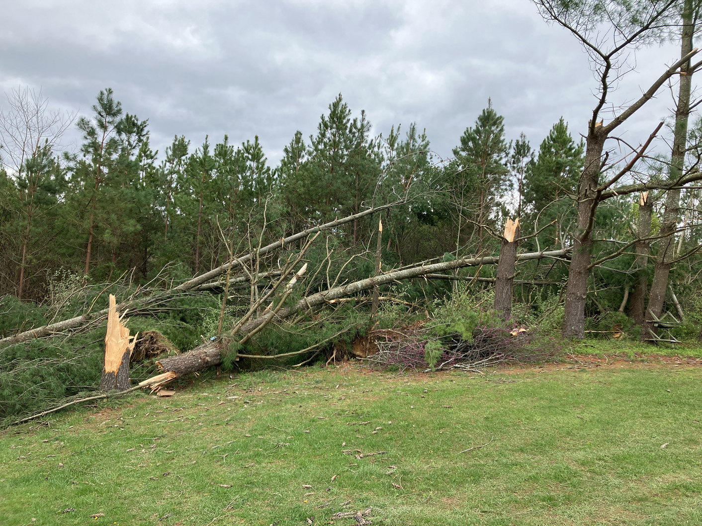
Tornado #17 - NW Jackson County (OH)
Track Map 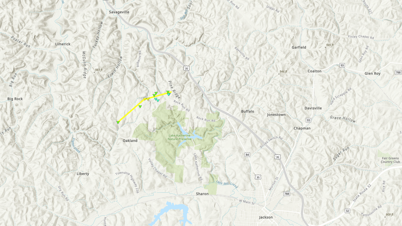
Radar Imagery: Base Reflectivity / Storm-Relative Velocity (0.5 Degree)
Damage Pictures
|
||||||||||||||||||||||||||||
The Enhanced Fujita (EF) Scale classifies tornadoes into the following categories
| EF0 Weak 65-85 mph |
EF1 Moderate 86-110 mph |
EF2 Significant 111-135 mph |
EF3 Severe 136-165 mph |
EF4 Extreme 166-200 mph |
EF5 Catastrophic 200+ mph |
 |
|||||
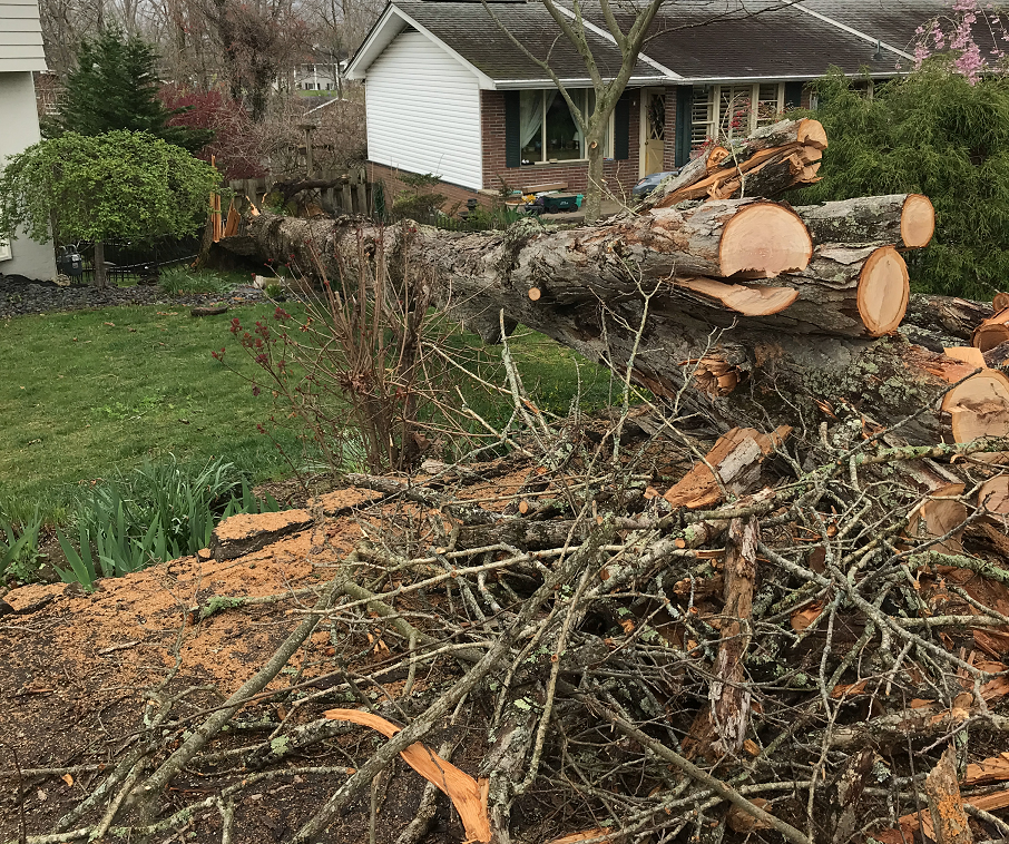
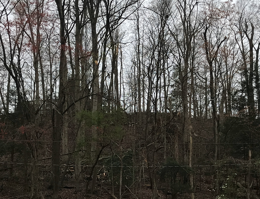
Detailed Information about the April 2nd Wind Damage (Public Information Statements, Track Maps, and Damage Images)
|
Microburst - Proctorville (OH)
Damage Pictures
|
||||||||||||||||||
|
Microburst - Charleston (WV)
Damage Pictures
|
||||||||||||||||||
|
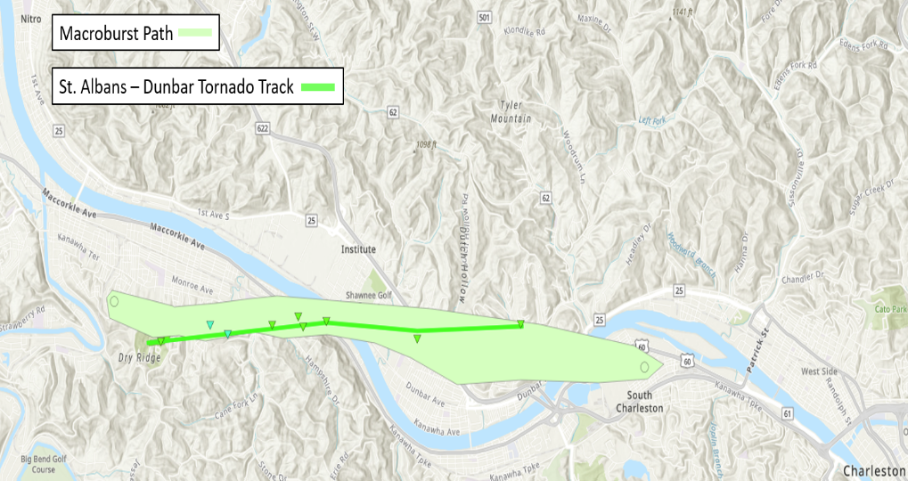
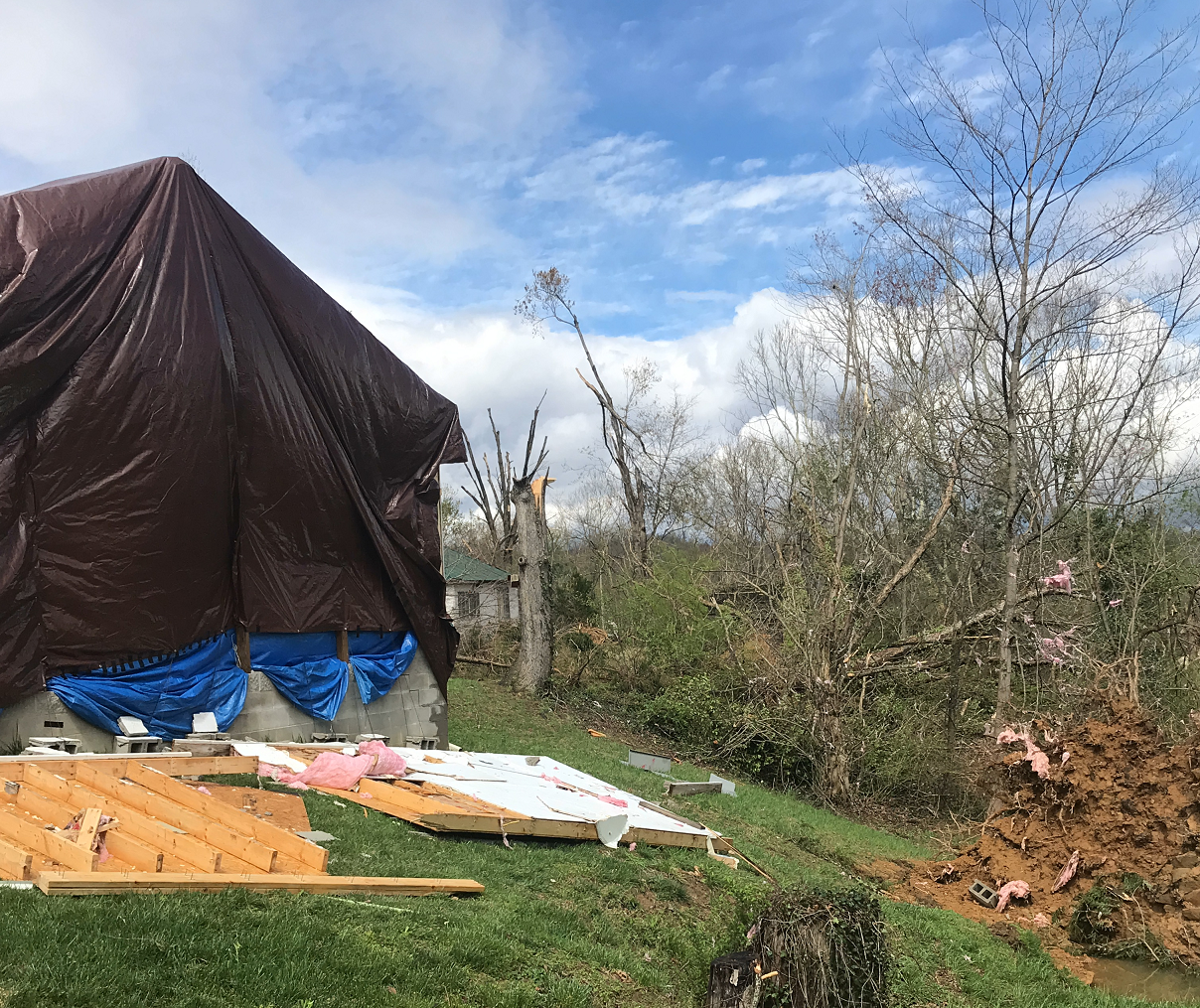
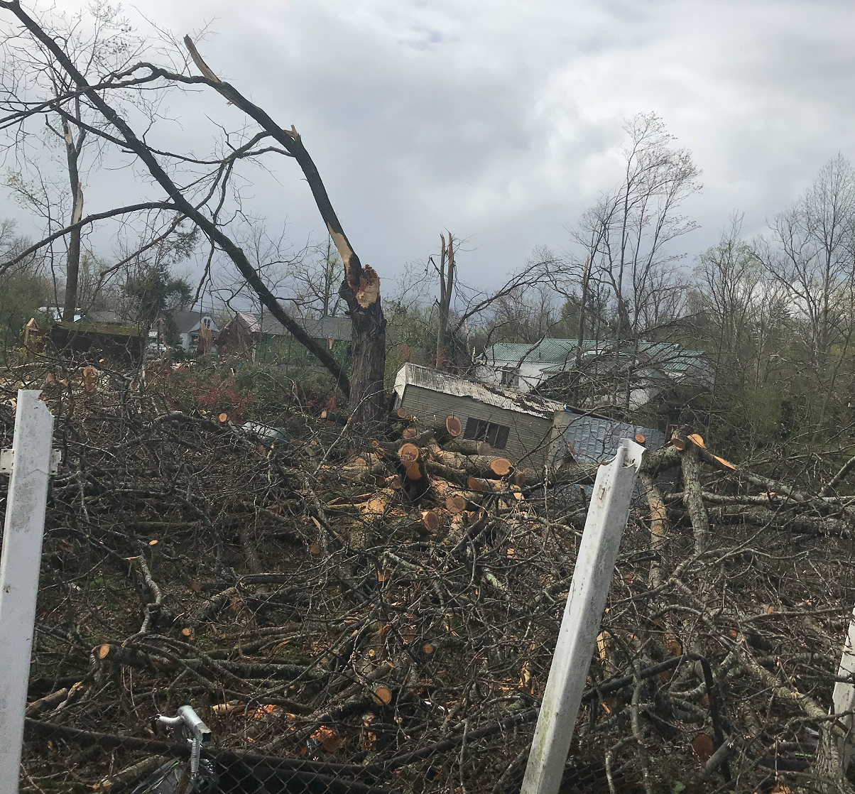
Macroburst - St. Albans to S. Charleston
Damage Pictures
|
||||||||||||||||||
|
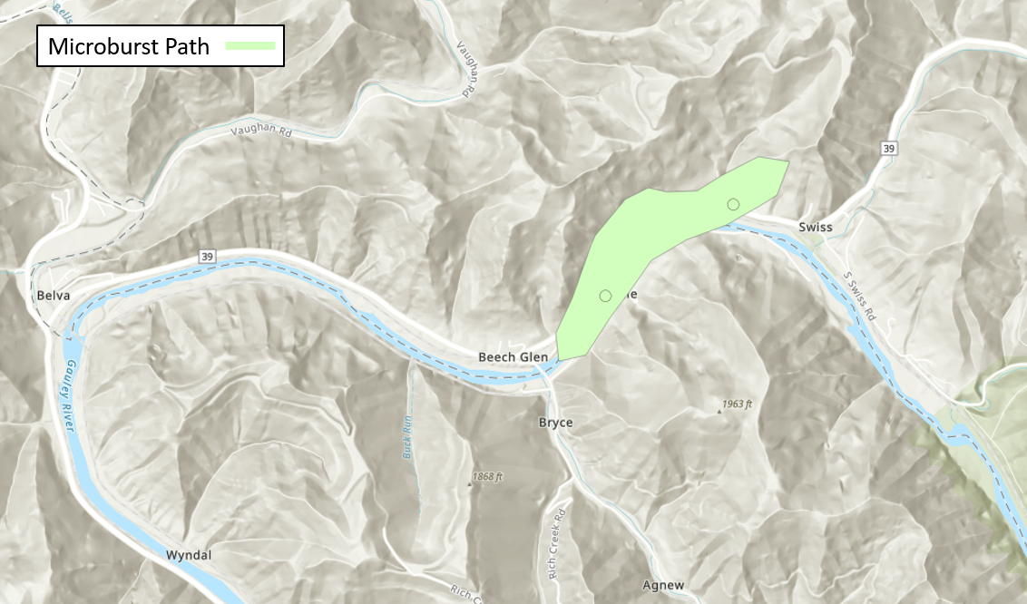
Microburst - Jodie to Swiss (WV)
Damage Pictures
|
||||||||||||||||||
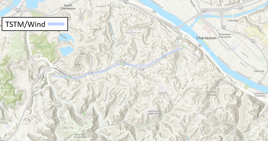
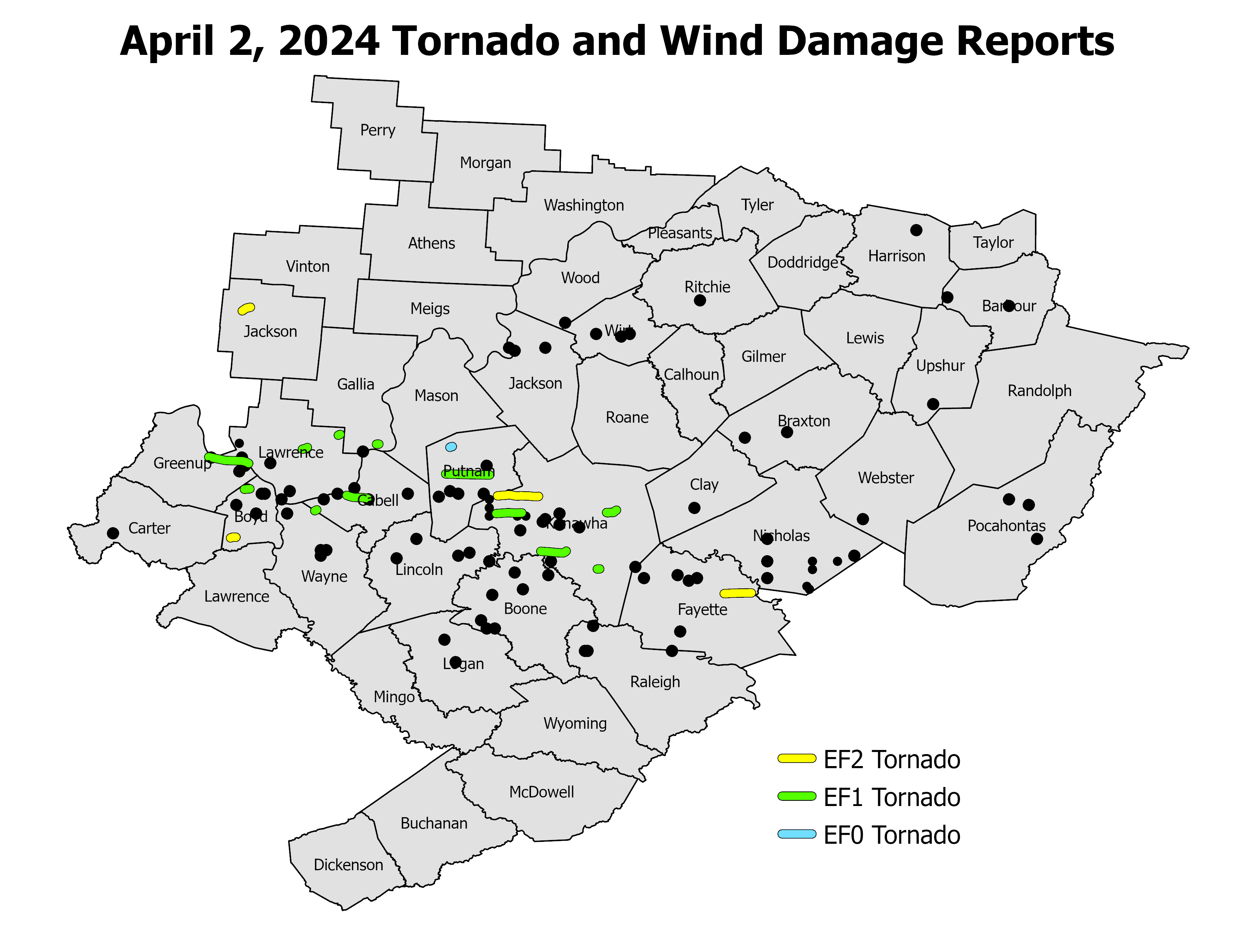
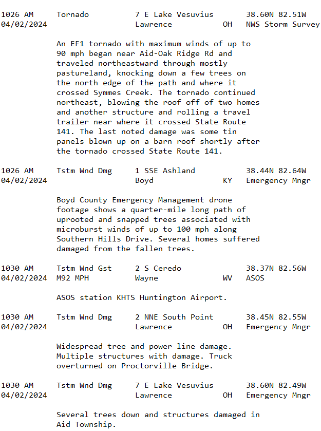
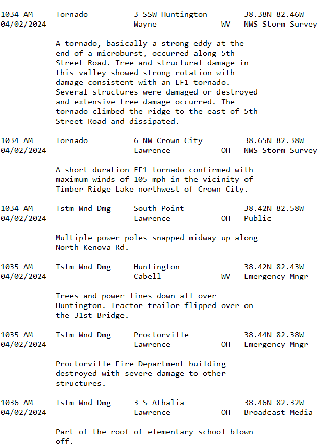
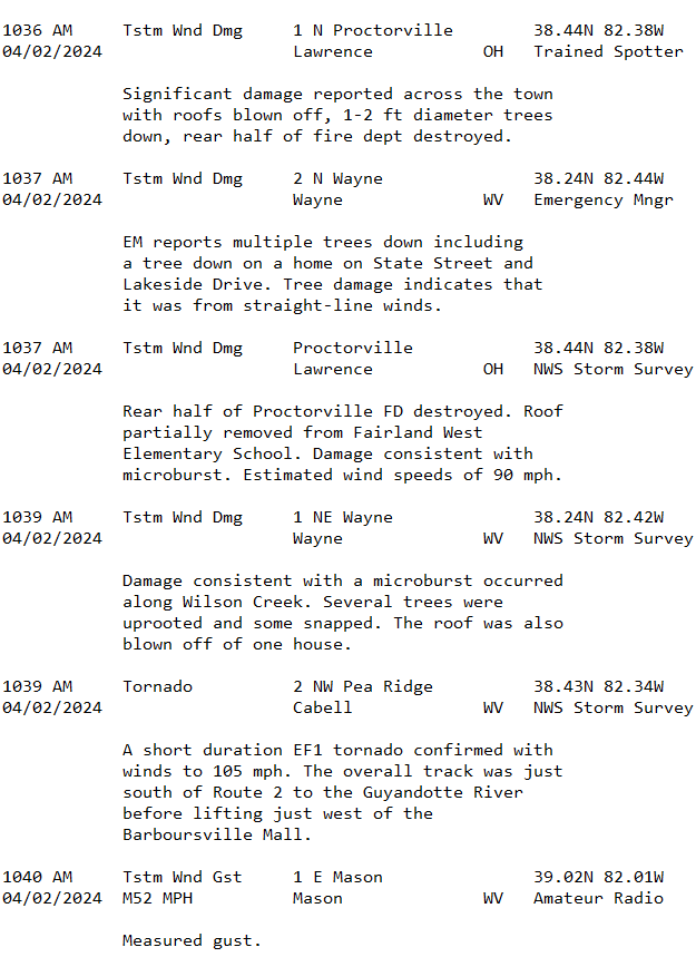
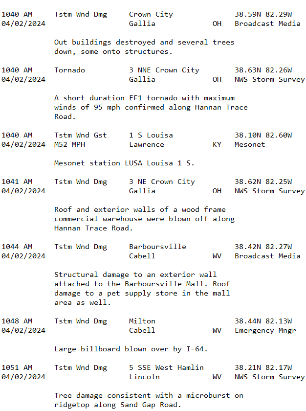
Map of Local Storm Reports from April 2nd
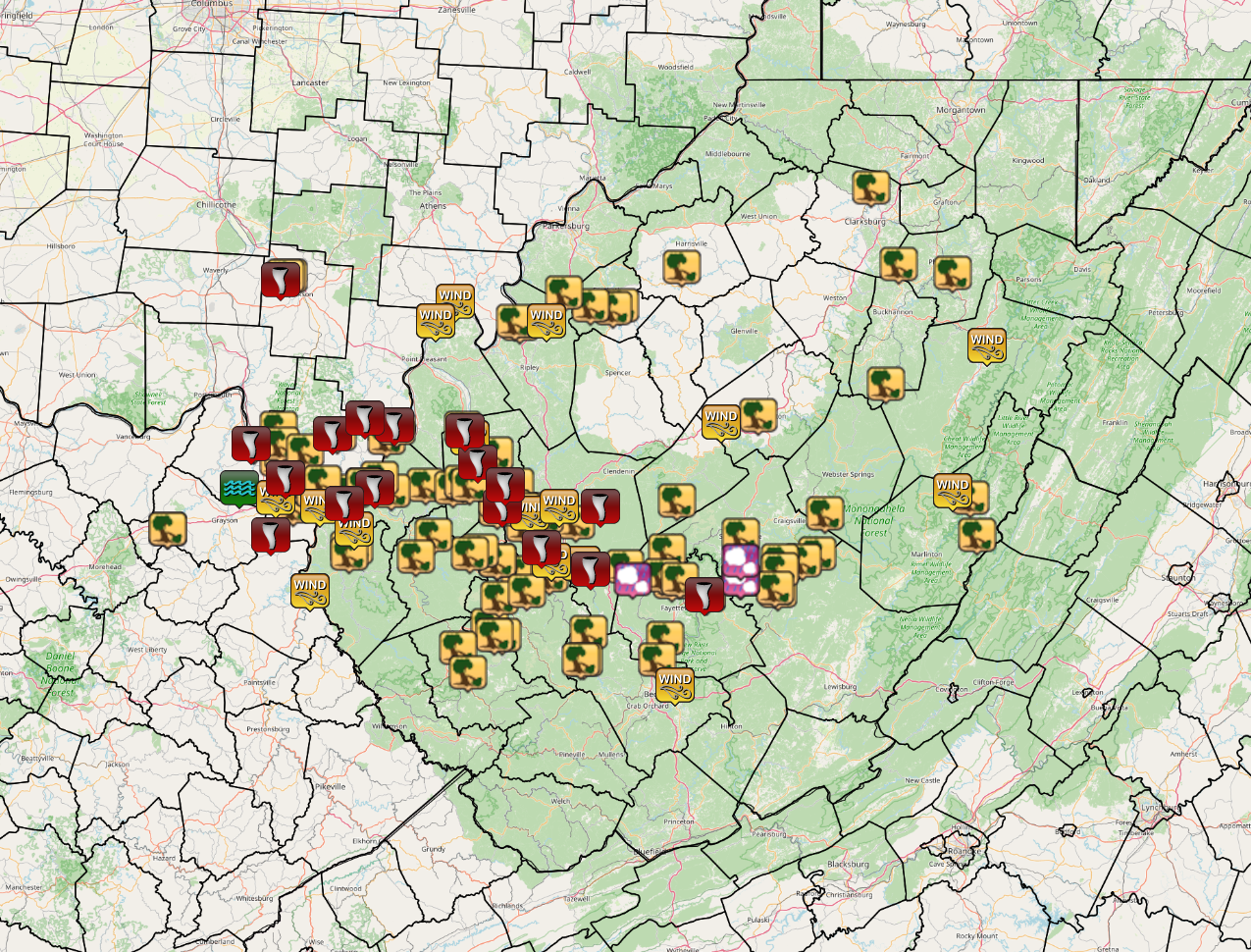 |
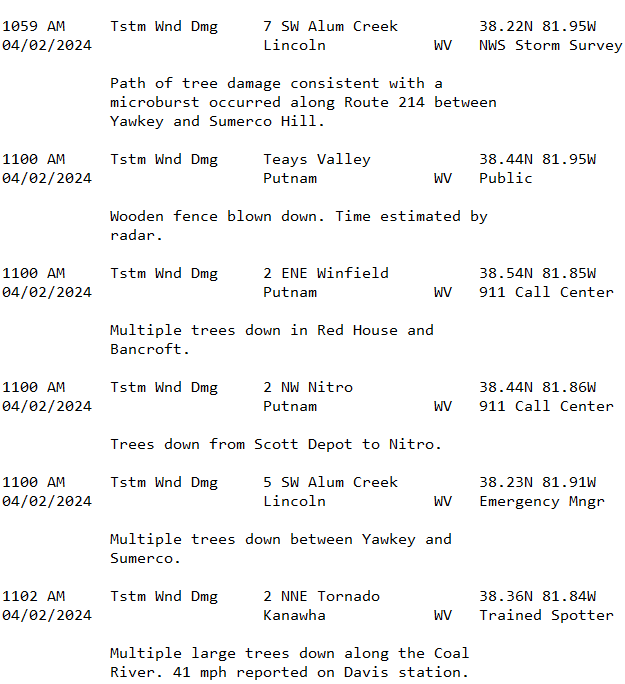
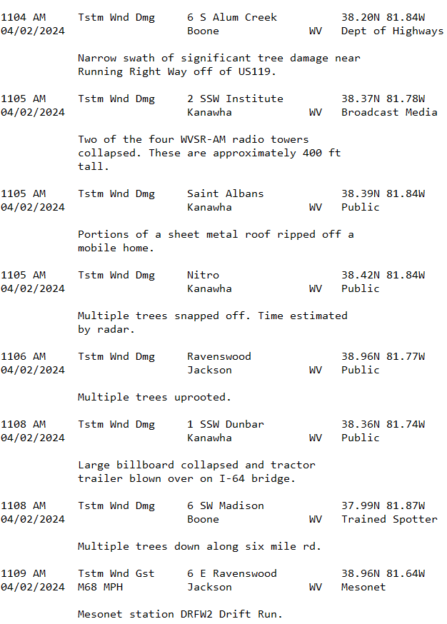
Text Summary of Local Storm Reports from April 2nd
.png)
.png)
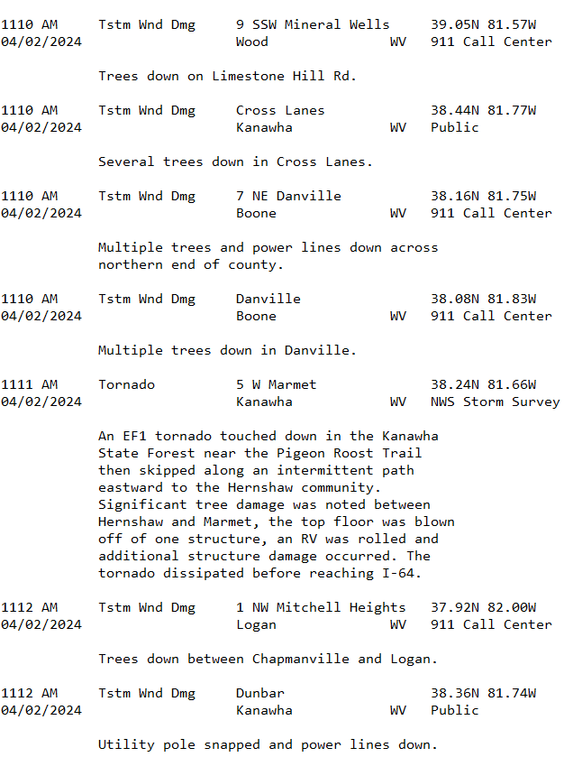
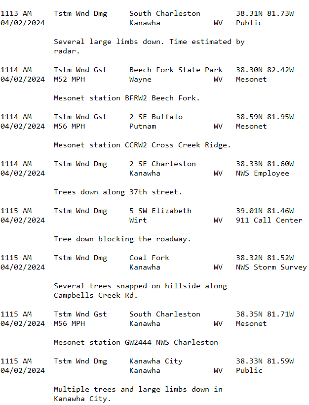
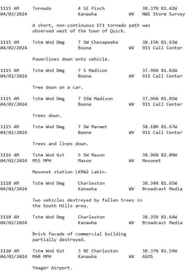
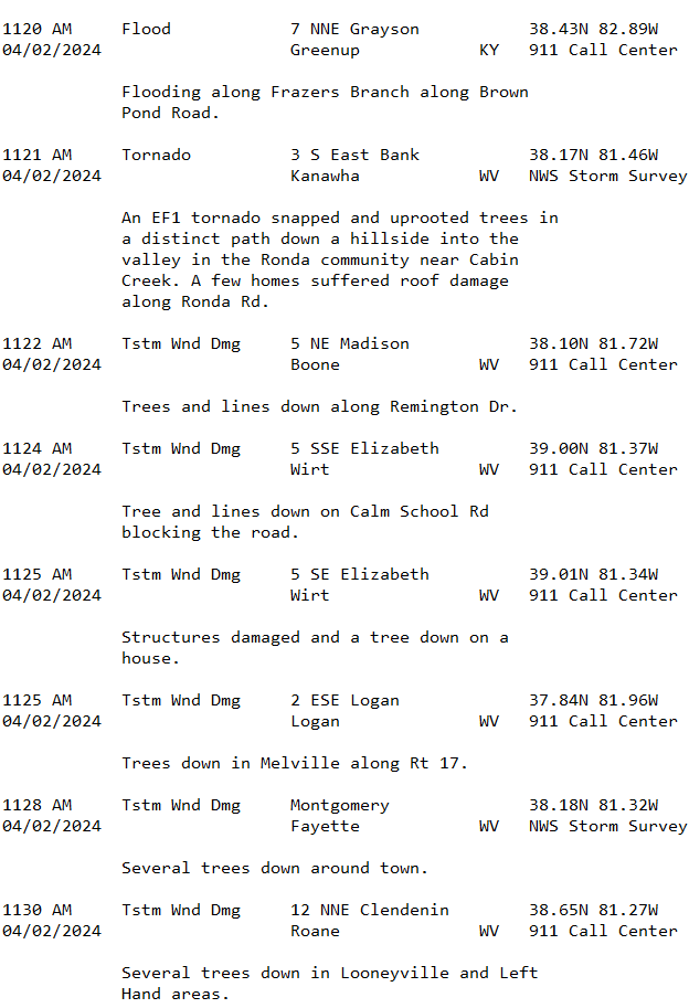
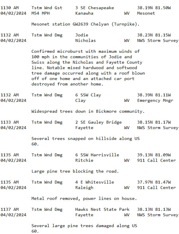
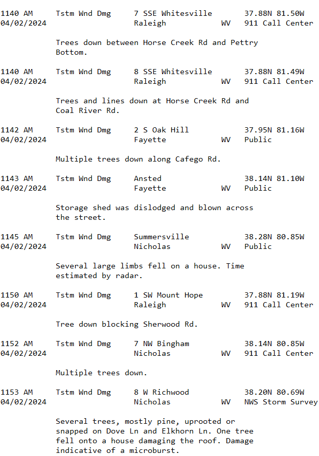
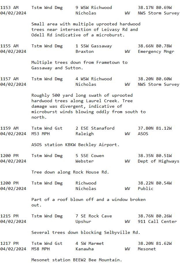


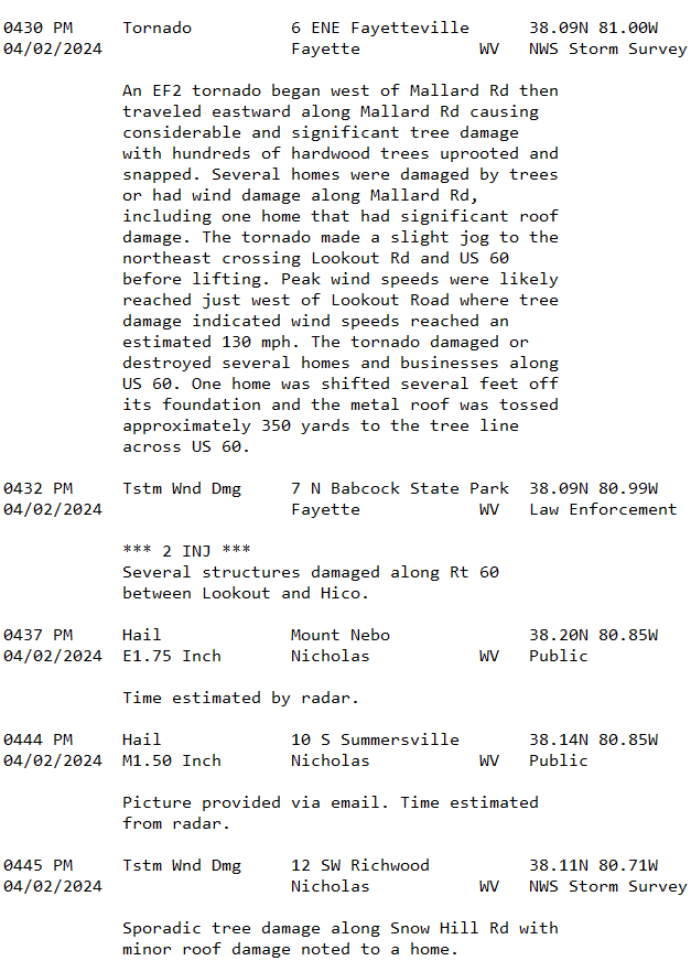
.png)
Records Set by the April 2nd Severe Weather Outbreak
A total of 17 tornadoes were confirmed from April 2nd, breaking records for the NWS Charleston CWA, as well as for the state of West Virginia.
Records Set for the NWS Charleston County Warning Area
Records Set for the State of West Virginia
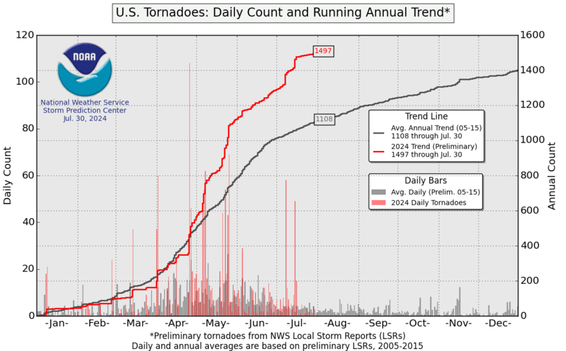
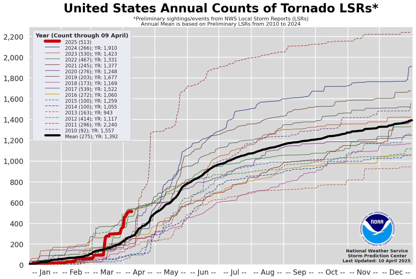
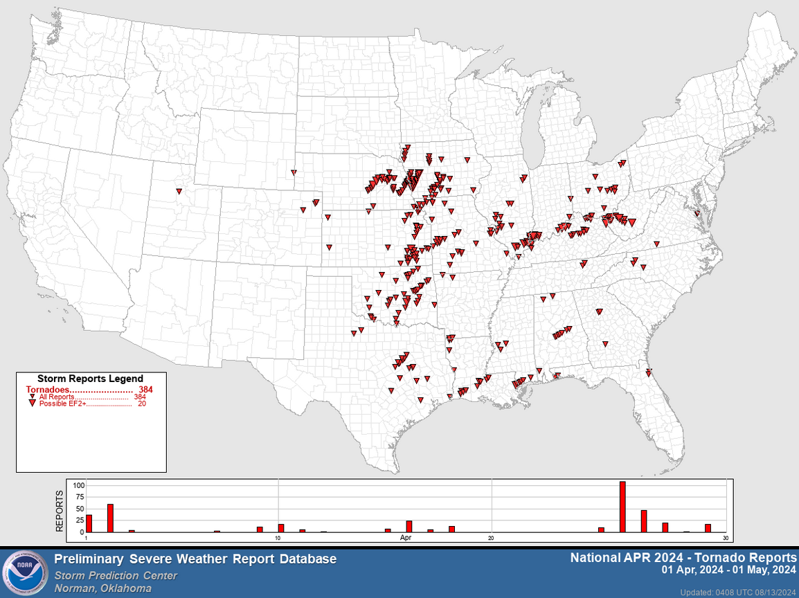
In 2024, we are at 20 tornadoes within the CWA thus far. The NWS Charleston forecast area is not alone in seeing increased activity this year. Tornado reports are above average for the contiguous United States as a whole, with April 2nd being one of many major tornadic events this year. April alone brought nearly 400 tornado reports to the CONUS, contributing to an abnormally busy year thus far.
 |
 |
 |
|
U.S. Tornadoes: Daily Count and Running Annual Trend |
U.S. Annual Counts of Tornado LSRs Since 2010 |
April 2024 Tornado Reports across the Contiguous United States |
 |
Media use of NWS Web News Stories is encouraged! Please acknowledge the NWS as the source of any news information accessed from this site. |
|


.jpg)
%20Base%20Reflectivity.png)
%20Storm%20Relative%20Velocity.png)


%20Base%20Reflectivity.png)
%20Storm%20Relative%20Velocity.png)
%20Base%20Reflectivity.png)
%20Storm-Relative%20Velocity.png)
.png)
%20Base%20Reflectivity.png)
%20Storm-Relative%20Velocity.png)
%20Damage.png)


.png)