
Thunderstorms Tuesday afternoon and evening could produce damaging winds and hail, particularly with a line that moves southeast ahead of an advancing cold front. A tornado or two, as well as Localized flash flooding, are also possible. There is a slight to enhanced Risk for Severe Storms, and a Slight Risk for Flash Flooding. Please keep updated on the forecast and have ways to receive warnings. Read More >
Northeast Kentucky straight-line wind and hail event
May 1st, 2016
|
After an overnight system deposited about a half inch to an inch of rain, clearing occurred for the late morning and early afternoon. With the daytime heating came an increase in instability. Thunderstorms formed across much of northern Kentucky after 3:00 p.m. These storms moved east, generally along and south of the interstate 64 corridor. A particularly strong supercellular thunderstorm developed in eastern Rowan County Kentucky and moved into Carter County, producing straight line wind damage near Grayson. This cell continued south and east with a robust updraft feeding on nearly 2000 J/Kg of ML CAPE analyzed by SPC Mesoanalysis. Baseball sized hail was observed as the thunderstorm moved into northern Lawrence County. More information on the meteorological setup and relevant products from the Storm Prediction Center can be found at this link.
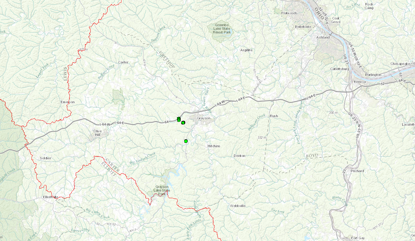
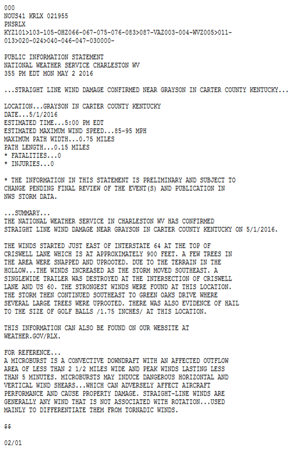
The National Weather Service conducted a survey of damage that started just east of Interstate 64. The damage started at the top of Criswell Lane, about 900 feet in elevation. A few trees in the area were snapped and uprooted. Due to the terrain in the hollow, the winds increased as the storm moved southeast. A single wide trailer was destroyed near the intersection of Satellite Road and Route 60. The strongest winds were estimated to be between 85 and 95 mph in this valley. The damage extended to Sunset Hill Road and ended along Green Oaks Drive. Several large trees were uprooted. Two small old barns were also damaged in this event. Luckily, no injuries occurred.
Wind damage survey maps:
 |
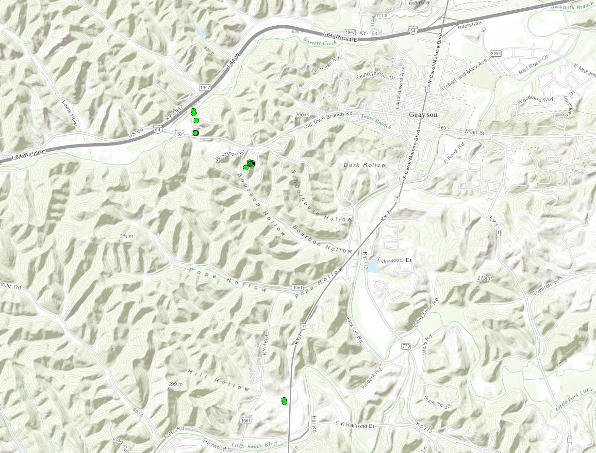 |
| Wide view of area in Carter County that saw wind damage. Circles represent surveyed damage locations. Click to enlarge. | Zommed view of area in Carter County that saw wind damage. Circles represent surveyed damage locations. Click to enlarge. |
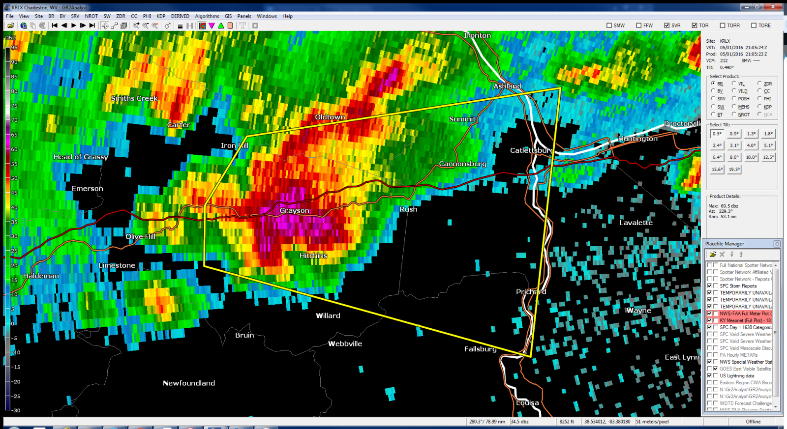
Radar data at time of wind damage reports:
 |
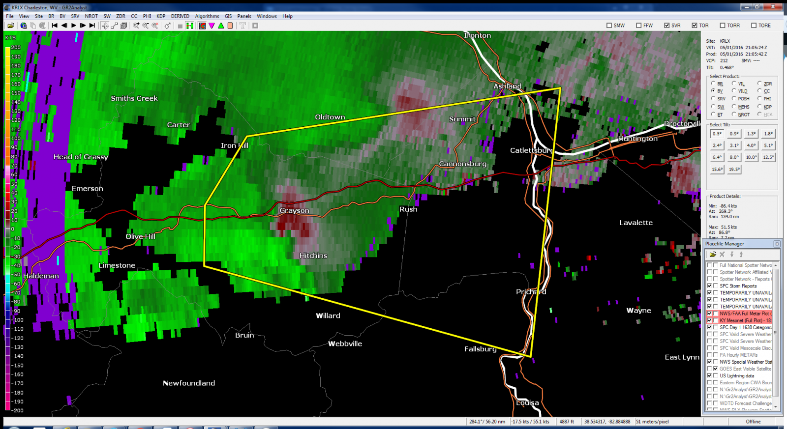 |
| This is an image of the 0.5 degree reflectivity data from KRLX at 5:05 pm. Click to enlarge. | This is an image of the 0.5 degree velocity data from KRLX at 5:05 pm. Click to enlarge. |
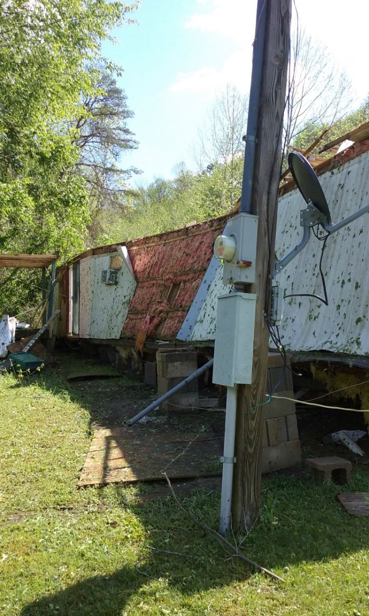
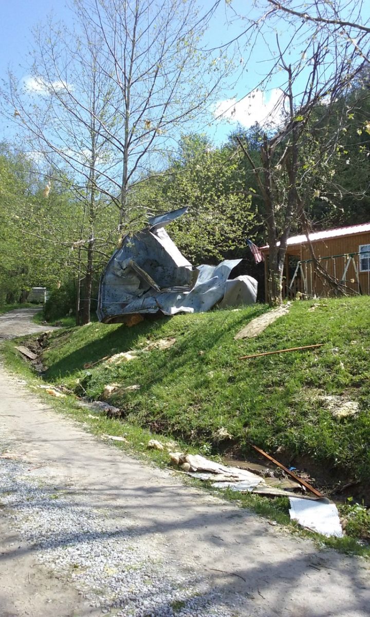
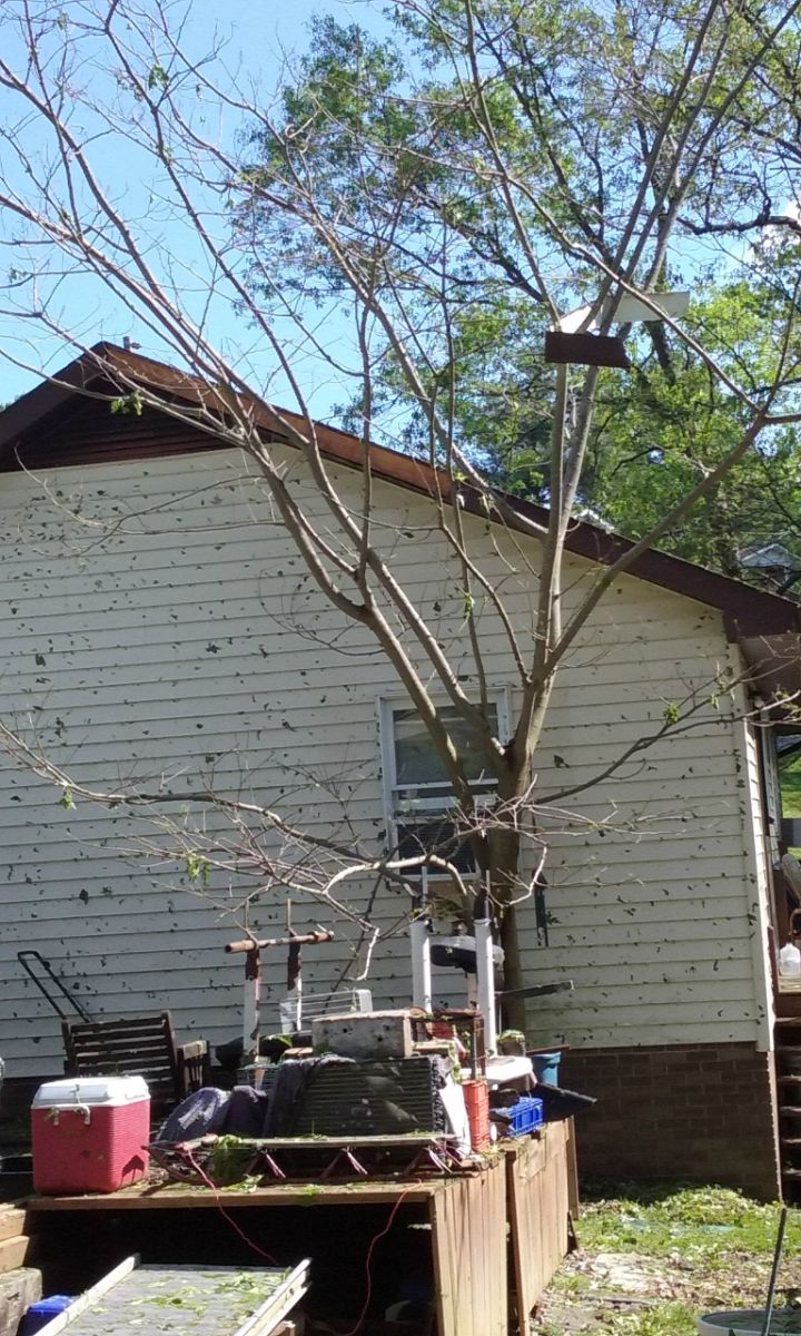
Storm damage images:
 |
 |
 |
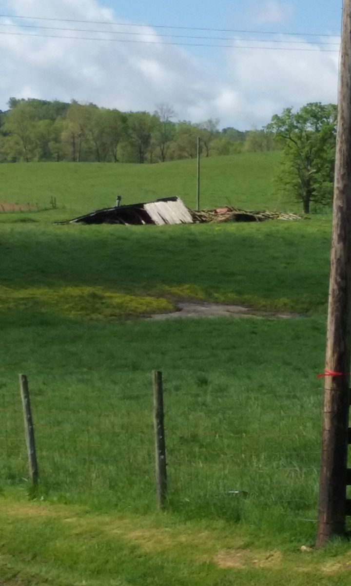 |
| Building shifted off its foundation along Satellite Road. Click to enlarge. | Roofing material removed from building along Satellite Road. Click to enlarge. | Hail damage to siding on buidling on Green Oaks Drive. Click to enlarge. | Part of roof from outbuilding along Route 7 near Leon. Click to enlarge. |
Official NWS damage survey public information statement:
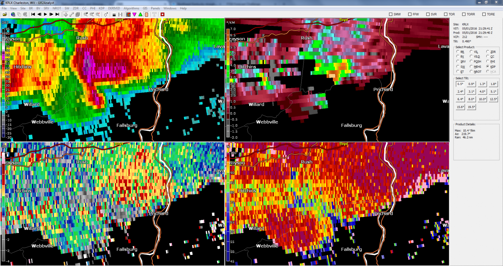
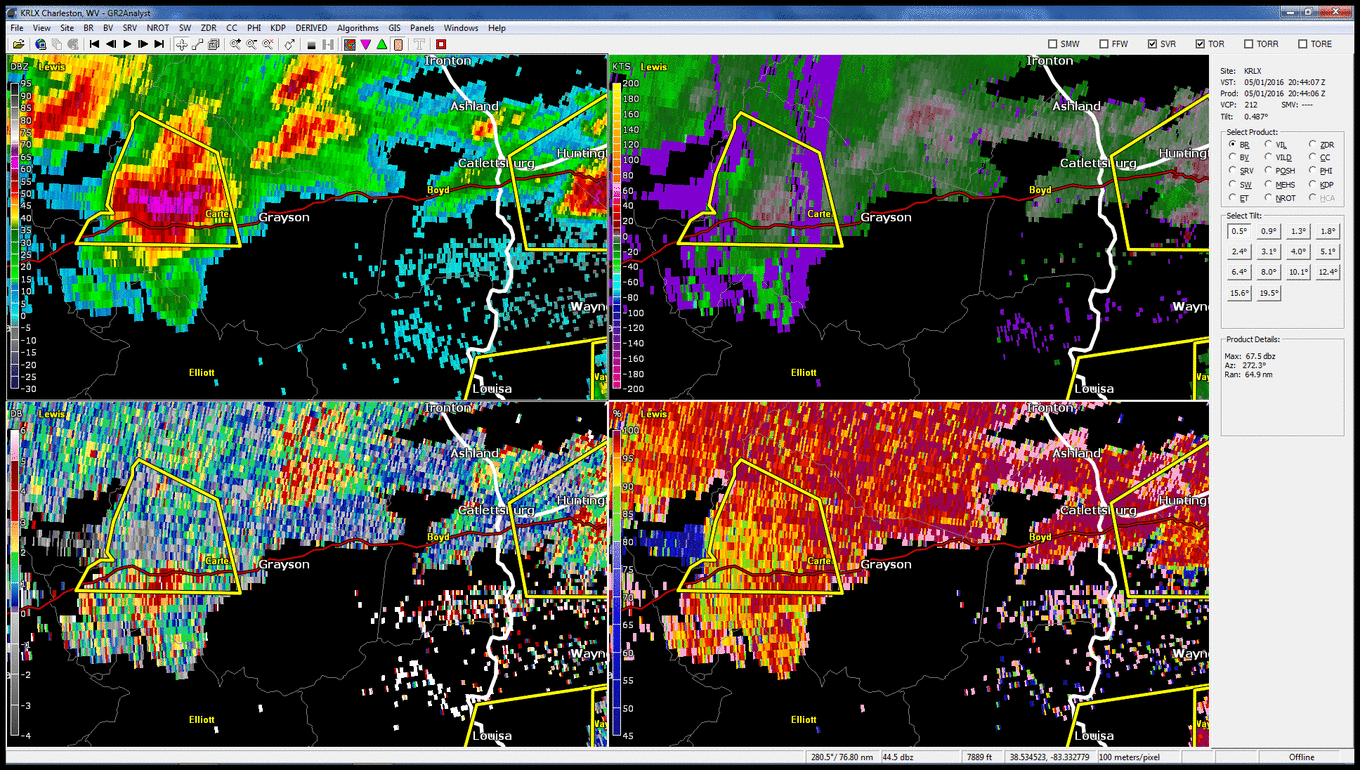
Radar Images at time of large hail reports:
 |
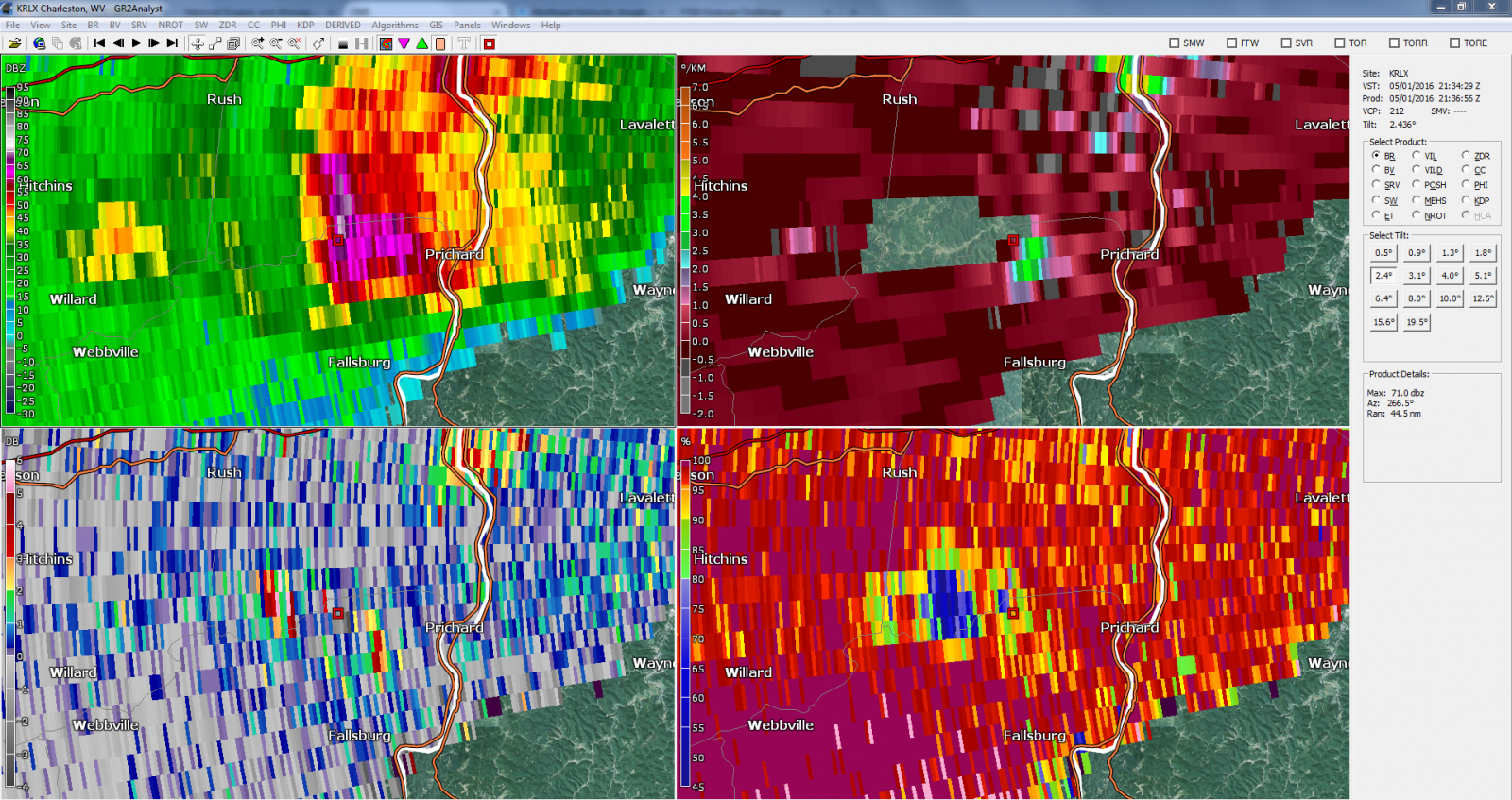 |
| 4-panel 0.5-degree radar image at 5:29 pm. From top left to bottom right: Base Reflectivity, Specific Differential Phase, Differential Reflectivity, and Correlation Coefficient. Click to enlarge. | 4-panel 2.4-degree radar image at 5:36 pm. Beam height in this image is approximately 13kft. From top left to bottom right: Base Reflectivity, Specific Differential Phase, Differential Reflectivity, and Correlation Coefficient. Note the hail core marked by the red square, and the Three-Body Scatter Spike to the west, down-radial. Click to enlarge. |
 |
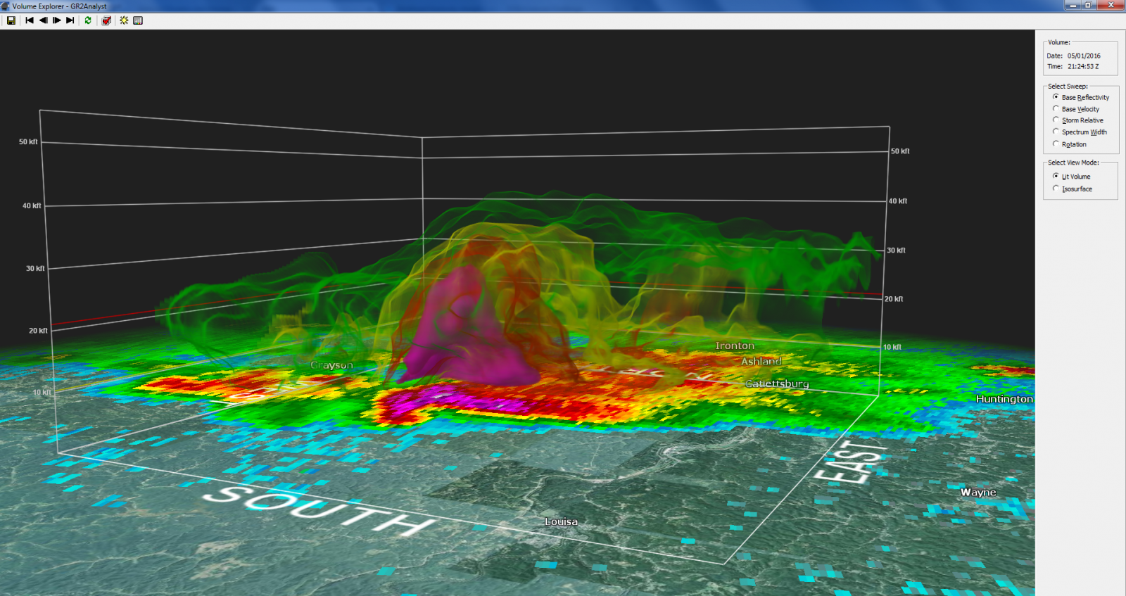 |
| Reflectivity cross section through the storm from KRLX at 5:29 pm. Northwest is to the left and southeast is to the right. Click to enlarge. | Reflectivity volume scan of the storm from KRLX at 5:24 pm. A solid shell marks the 60 dBZ threshold. 50 is marked by red, 40 by yellow, and 20 by green. Click to enlarge. |
| 4-panel 0.5-degree radar animation through the event. From top left to bottom right: Base Reflectivity, Specific Differential Phase, Differential Reflectivity, and Correlation Coefficient. Click animation to enlarge. |
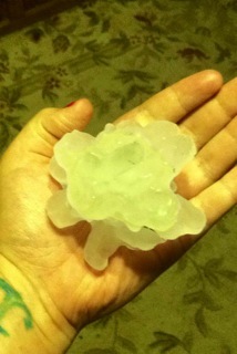
Hail photographs from northern Lawrence County:
.jpeg) |
 |
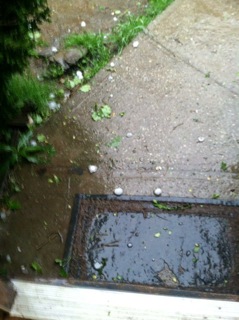 |
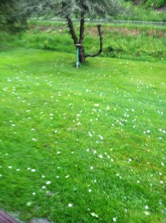 |
| Estimated 2" stones. Click to enlarge. | Estimated 2.75" stone (Baseball-sized). Click to enlarge. | Large hail on sidewalk. Click to enlarge. | Hail in yard. Some stones estimated to be baseball-sized. Click to enlarge. |
Click to view VIDEO of baseball-sized hail falling in Lawrence County, via NWS Charleston Twitter.
All hail pictures and video courtesy of Lawrence County Emergency Management.

