Event Summary
|
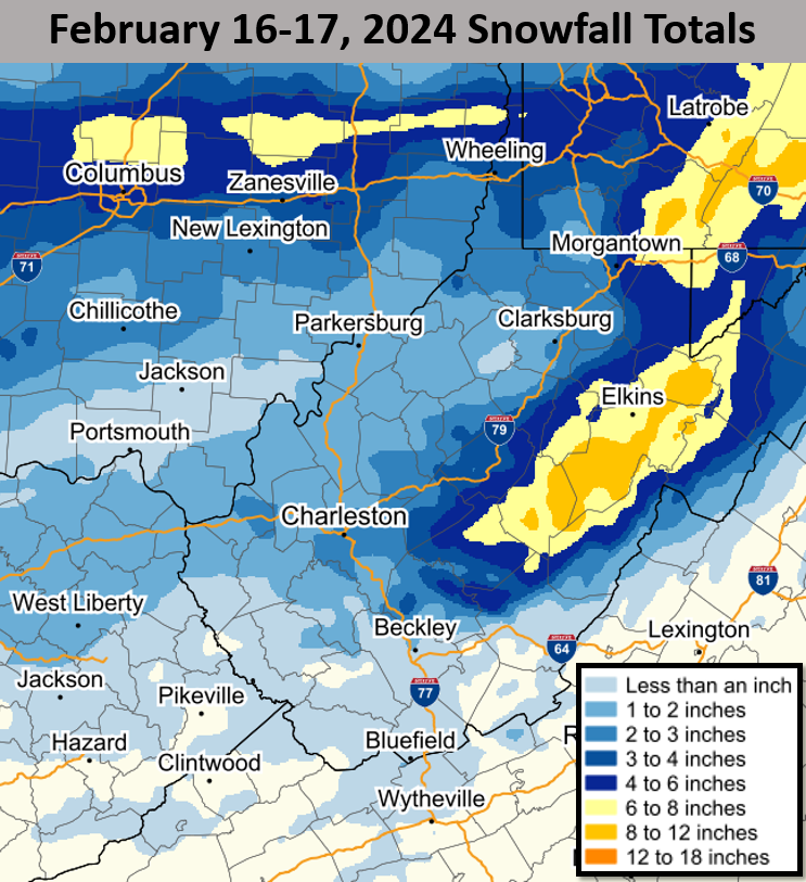
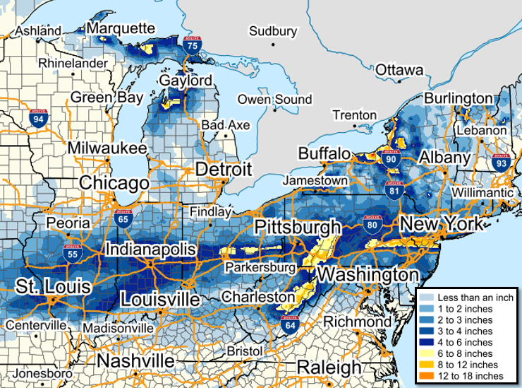
A fast-moving disturbance affected the region beginning on the evening of Friday, February 16th, with associated precipitation quickly exiting the area by the early morning hours of Saturday, February 17th. Precipitation began as a rain/snow mix across portions of the lowlands and southern mountains, with mainly snow elsewhere. Precipitation quickly transitioned to snow area-wide throughout Friday evening, with a quick burst of moderate to heavy accumulating snowfall affecting much of the NWS Charleston forecast region as low pressure exited south and east. Veering surface flow following the passage of the system resulted in scattered snow showers throughout Saturday, as moisture from the Great Lakes worked in tandem with upslope ascent. Additional light accumulations occurred across portions of the mountains into Saturday evening. When all was said and done, snowfall totals of up to 8" (or slightly higher) were reported across the mountains, with lighter amounts across the lowlands. All images and loops can be expanded by clicking on them. |
|
February 16-17 Time Synchronized Radar Loops
 |
 |
|
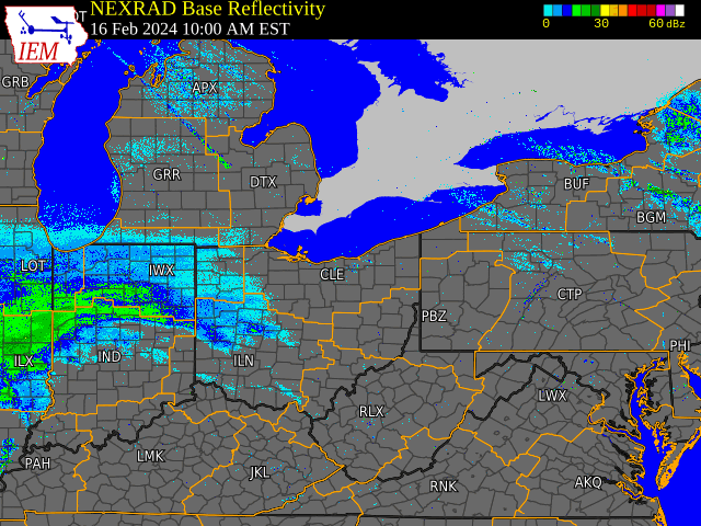
Regional Radar Loop Radar loop courtesy of Iowa Environmental Mesonet (IEM) |
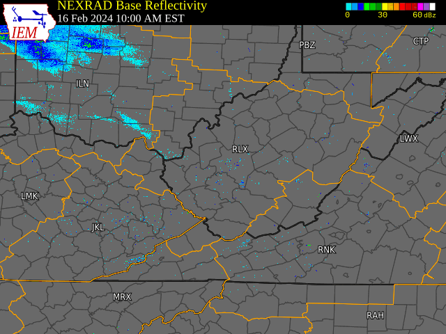
Local Radar Loop Radar loop courtesy of Iowa Environmental Mesonet (IEM) |
Regional Snowfall Totals and Satellite Image
 |
 |
|
48-Hour Regional Snowfall Totals (Ending at 7 AM on February 18) |
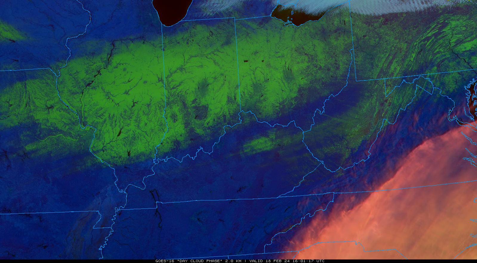
Day Cloud Phase Distinction RGB image from GOES-16 at 11:01 AM, February 18th, 2024 highlighting remaining snow cover (in shades of green) from the event across the Ohio Valley area Satellite image courtesy of NEXLAB - College of Dupage |
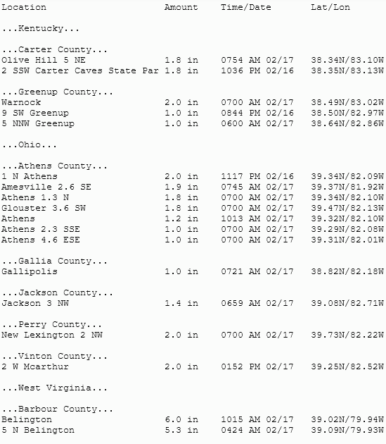
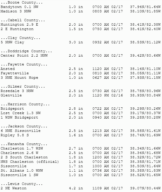
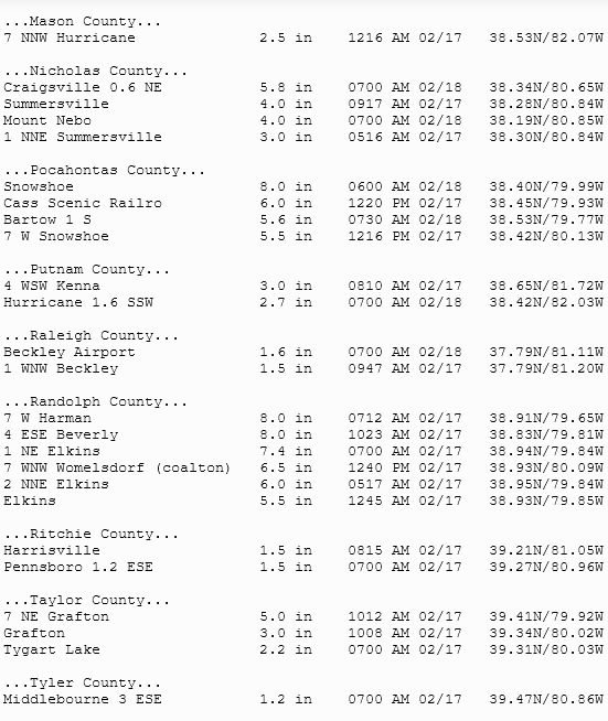
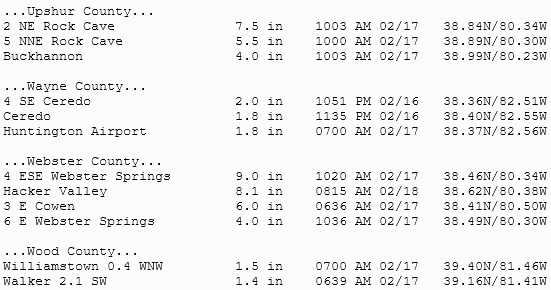
February 16-17 Storm Total Snowfall Reports (1" and greater)
 |
Media use of NWS Web News Stories is encouraged! Please acknowledge the NWS as the source of any news information accessed from this site. |
|