UPDATE: The KICX (Cedar City) radar will now be down for scheduled maintenance through June 24th. During this time, technicians will be replacing panels in the radome that have been damaged by lightning. Surrounding radars will continue to provide data during what is normally the driest time of the year.


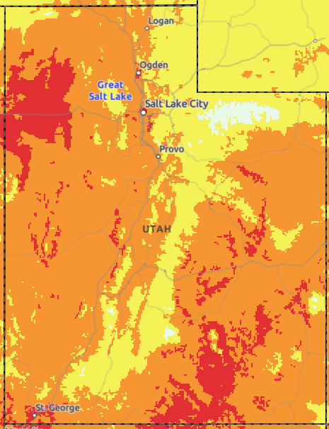 HeatRisk
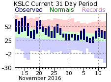 Monthly Climate Data