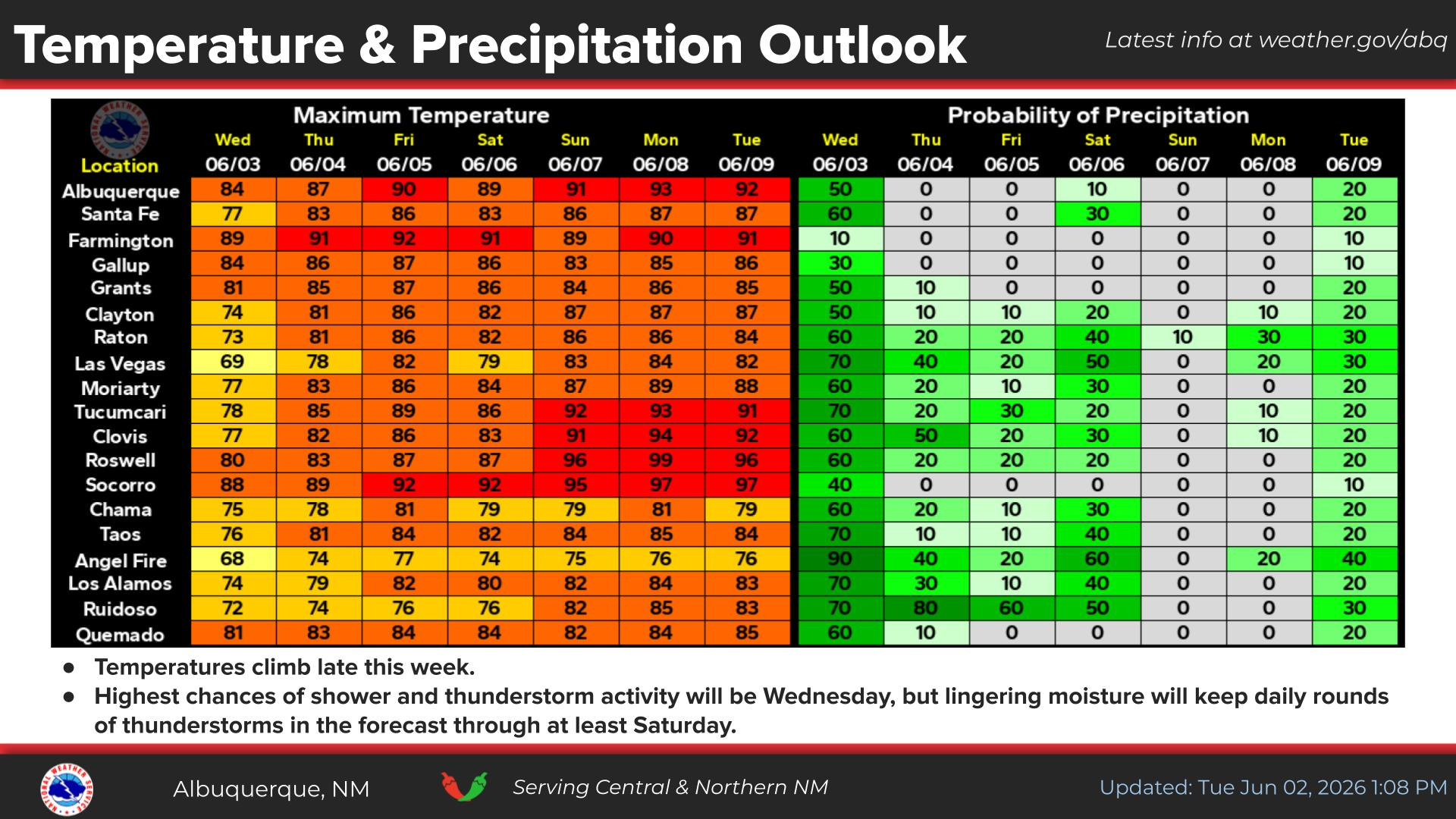
National Weather Service United States Department of Commerce
Click a location below for detailed forecast.

Last Map Update: Fri, Oct 3, 2025 at 4:26:02 pm MDT

Southwest winds will increase on Saturday, particularly across northeastern New Mexico. High temperatures will generally be a few to several degrees above average.
Scattered to numerous showers will return next week with potential for locally heavy rainfall, especially Tuesday and perhaps Wednesday.
Showers and a few storms over western NM this evening will spread eastward into the northwest high terrain through tonight. Low temperatures will be a couple degrees warmer than last night in most areas.
Sunday will be cooler with lighter winds. Temperatures in the morning will be the coolest so far this fall season. Taos and Gallup may see their first freeze.
Friday will be warm and breezy with increasing clouds across western NM. Showers and a few storms are possible in western NM.


Text Product Selector (Selected product opens in current window)


Submit Storm Report Icon

Submit Storm Report

Key Impacts Icon

Key Impacts

Observations Icon

Local Observations

Webcams Icon

Office Webcams

Satellite Icon

Satellite Imagery

Are You Prepared Icon

Are You Prepared?

Weekly Weather Briefing Icon

Weekly Weather Briefing

Area Forecast Discussion Icon

Area Forecast Discussion

Fire Weather Icon

Fire Weather

Aviation Weather Icon

Aviation Weather

Snow Probabilities Icon

Snow Probabilities

SKYWARN Icon

SKYWARN Spotters

On This Date in Weather History Icon

On This Date

Climate Graphs Icon

Climate Graphs

Drought Monitor Icon

Drought Monitor

Severe Weather Info and Climatology Icon

Severe Weather Climatology

Monsoon Awareness Icon

Monsoon Awareness

Winter Climatology Icon

Winter Climatology