
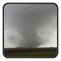
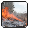
A heat wave over the Southwest will intensify this week, peaking and expanding into the Intermountain West and northern High Plains this weekend. Critical to extremely critical fire weather conditions are forecast from the Northwest and the northern Great Basin this weekend. Particularly Dangerous Situation Red Flag Warnings have been issued. Read More >
Last Map Update: Sun, Aug 2, 2026 at 5:50:58 am CDT
|
Text Product Selector (Selected product opens in current window)
|
|
 |
 |
 |
 |
 |
 |
| Storm Reports | Spotter Briefing | Storm Spotters | Storm Data | Tornado Statistics | Social Media |
 |
 |
 |
 |
 |
 |
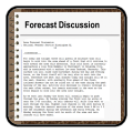
| Forecast Discussion | Hourly Forecast | Graphical Forecast | Fire Weather | Aviation | Hydrology |
 |
 |
 |
 |
 |
 |
| Observations | Air Quality | Satellite | Climate | Past Events | Weather Radio |


 Local Radar
 Weather Map
 Satellite