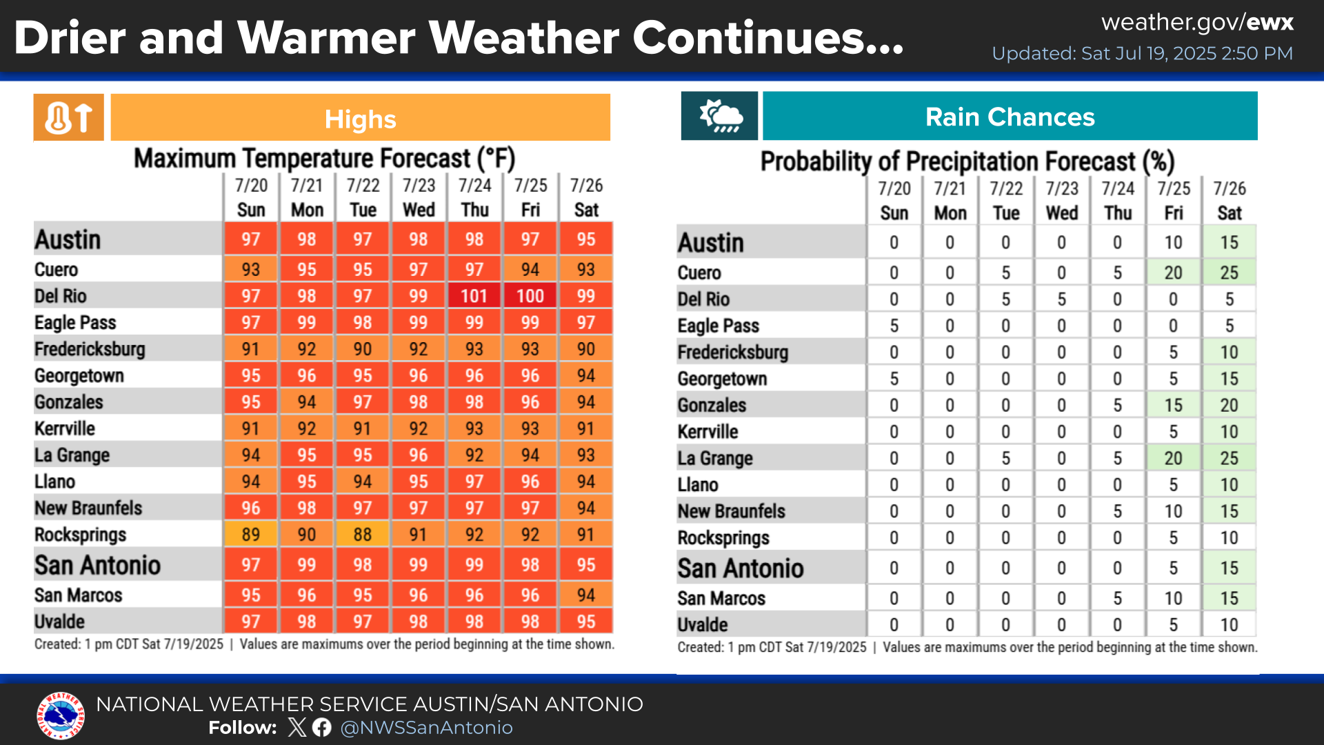
National Weather Service United States Department of Commerce

Severe Thunderstorms and Heavy Rain in the Central Plains and Midwest; Heat Pushes into the South and East

Scattered severe thunderstorms capable of large hail in excess of two inches, strong tornadoes, and damaging wind gusts are likely across parts of the Upper Mississippi Valley and Midwest this evening. Heavy to excessive rainfall may bring a flooding threat to portions of the Central Plains to the Midwest through Thursday. The heatwave in the Central U.S. will begin to push South and East Thursday Read More >

Click a location below for detailed forecast.

Last Map Update: Thu, Jun 11, 2026 at 12:12:27 am CDT

There are no watches, warnings, or advisories at this time.

As summer temperatures rise, taking precautions against heat-related illness is essential. Key safety recommendations include limiting strenuous outdoor activities during peak heat, drinking plenty of water, wearing light clothing and sunscreen, and shifting necessary outdoor work to the early morning or late evening hours.
Mostly cloudy and humid tonight, with most clouds after midnight. Low temperatures will be in the lower 70s across the Hill Country with mid 70s elsewhere. Southeast winds around 10 mph. Some light showers are possible around sunrise along and east of I-35.
Early summer heat will steadily build and continue this week, staying in the 90s for most areas to near 100 along the Rio Grande. Humid conditions will make the daytime heat feel hotter. Practice heat safety! It will be mostly dry through Saturday. Medium chances for rain return early next week, especially Monday and Tuesday.