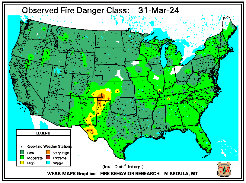
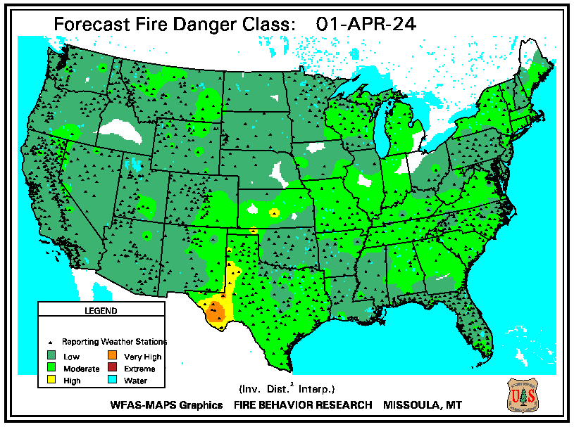
Gusty winds are expected from portions of the Mid-Atlantic into the Northeast through the night following the system that brought rain to the area. An atmospheric river will move into the Northwest late today into Saturday bringing moderate to heavy rainfall, mountain snow, windy conditions, and high surf to the area over the weekend. Read More >

782
WWUS84 KEWX 290556
RFWEWX
URGENT - FIRE WEATHER MESSAGE
National Weather Service Austin/San Antonio TX
1256 AM CDT Wed Oct 29 2025
...CRITICAL FIRE WEATHER CONDITIONS EXPECTED WEDNESDAY...
.A strong cold front moved through Tuesday afternoon, resulting
in breezy to windy conditions and low relative humidities.
Conditions will be favorable for critical fire danger across areas
along and south of Interstate 10, along US Highway 57, and the
Coastal Plains from mid-morning through late this afternoon.
TXZ187-189-203>207-218>225-228-300000-
/O.CON.KEWX.FW.W.0009.251029T1500Z-251030T0000Z/
Bandera-Kendall-Uvalde-Medina-Bexar-Comal-Guadalupe-Zavala-Frio-
Atascosa-Wilson-Karnes-Gonzales-De Witt-Lavaca-Dimmit-
1256 AM CDT Wed Oct 29 2025
...RED FLAG WARNING REMAINS IN EFFECT FROM 10 AM THIS MORNING TO
7 PM CDT THIS EVENING FOR WIND AND LOW RELATIVE HUMIDITY FOR
AREAS ALONG AND SOUTH OF INTERSTATE 10, ALONG US HIGHWAY 57, AND
COASTAL PLAINS...
* AFFECTED AREA...Along and south of I-10, along Hwy 57, and the
Coastal Plains.
* TIMING...From 10 AM this morning to 7 PM CDT this evening.
* WINDS...Northwest 15 to 25 mph with gusts up to 35 mph.
* RELATIVE HUMIDITY...As low as 14 percent.
* IMPACTS...Any fires that develop could rapidly increase in
size and intensity, move quickly, and be very difficult to
control.
* SEVERITY...
PRECAUTIONARY/PREPAREDNESS ACTIONS...
A Red Flag Warning means that critical fire weather conditions
are either occurring now....or will shortly. A combination of
strong winds...low relative humidity...and warm temperatures can
contribute to extreme fire behavior.
&&
$$
145
FNUS64 KEWX 011241
RFDEWX
TXZ183-202-217-012300-
FIRE DANGER STATEMENT
NATIONAL WEATHER SERVICE AUSTIN/SAN ANTONIO TX
741 AM CDT Sat Nov 1 2025
...NEAR CRITICAL FIRE WEATHER CONDITIONS EXPECTED...
* AFFECTED AREA: Along the Rio Grande, including Kinney, Maverick,
and Val Verde counties.
* TIMING: From 10 AM until 6 PM CDT today.
* WIND: North-northwest at 10 to 20 mph with gusts to 30 mph.
* RELATIVE HUMIDITY: As low as 20 percent.
* FUEL DRYNESS: Dry.
For additional forecast details please see the Fire Weather
Planning Forecast on our website.
PRECAUTIONARY/PREPAREDNESS ACTIONS...
Affected residents are urged to exercise care with respect to all
outdoor activities that could inadvertently cause wildfires.
Avoid the use of welding or grinding equipment near grass and dry
brush. In addition, avoid parking vehicles in tall, dry grass and
weeds that could be ignited.
Do not toss cigarette butts on the ground. Report wildfires
quickly to the nearest fire department or law enforcement office.
$$
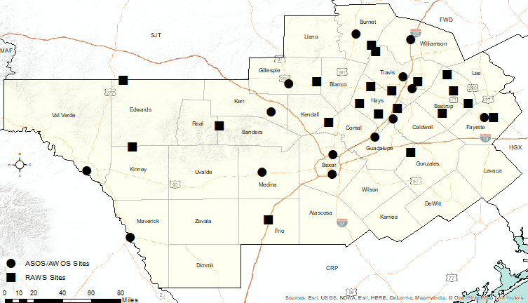
Click the map below for text from one of the following products at the selected locations:
Full text of these products can be found below the map.

Routine Fire Wx Fcst (With/Without 6-10 Day Outlook) Issued: 11/01/2025 10:12:00 PM UTC
Fire Weather Point Forecast Matrices Issued: 11/01/2025 11:07:00 PM UTC
Point Forecast Matrices Issued: 11/01/2025 11:07:00 PM UTC
Miscellaneous Fire Weather Product Issued: 11/01/2025 01:46:39 AM UTC
Spot Forecast Monitor
Spot Forecast Request