
A Pacific storm will bring rain and high elevation snow from the Pacific Northwest into the Northern Rockies. A series of storms are expected to move through the Bering Sea bringing strong winds, heavy precipitation, and elevated water levels from the West Coast to northern Alaska. Read More >
Midland/Odessa
Weather Forecast Office
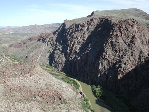
Rio Grande, looking downstream, from "Big Hill"
This page references hydrologic information and events impacting west Texas and southeast New Mexico. A good starting point for hydrologic information can be found on the Advanced Hydrologic Prediction Service (AHPS) page, located by clicking "Rivers and Lakes" on the menu bar above. Visit the AHPS home page for more information. For more information on West Texas and Southeast New Mexico hydrology, contact Jim DeBerry.
 |
 |
 |
Hazards
Spotter Briefing
Outlook
Current Hazards
Storm Report
Severe Weather
Drought
Storm Prediction Center
Weather Prediction Center
National Hurricane Center
Active Alerts
Winter Weather
Past Weather
Cooperative Observations
Local Climate Data
National Climate
Current Weather
Observations
Satellite
Upper Air
West Texas Mesonet
Radar
Forecasts
Activity Planner
Aviation
Climate Prediction Center
Fire
Forecast Discussion
Graphical
Local
Space Weather Center
Information Center
Weather Trivia
Forecast Models
GIS
International Weather
Glossary
Road Conditions
Water
Hydrology
Precipitation Estimates
Quantitative Precipitation Forecasts

US Dept of Commerce
National Oceanic and Atmospheric Administration
National Weather Service
Midland/Odessa
2500 Challenger Dr.
Midland, TX 79706-2606
(432) 563-5006
Comments? Questions? Please Contact Us.


 Follow us on X
 Follow us on Facebook
 MAF RSS Feed