Key West, FL
Weather Forecast Office


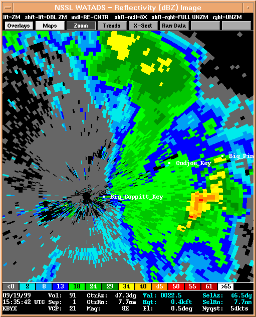
LOOP OF THE WATERSPOUT IN BASE REFLECTIVITY
UTILIZING WATADS TO PROCESS ARCHIVE II DATA
(COURTESY TOM BIRCHARD)
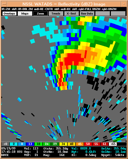
STILL IMAGE OF BASE REFLECTIVITY
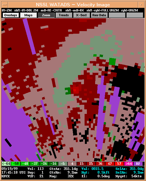
STILL IMAGE OF BASE VELOCITY
HUNGRY FOR MORE???
Check out our Tornado Presentation
Current Hazards
Hazardous Outlook
National Outlooks
National Hazards
Tropical Hazards
Coastal Flooding
Submit Storm Reports
Current Weather
Observations
Latest Sounding
Satellite Images
Rivers and Lakes
Precipitation Estimate
Hydrology
Forecasts
Local
Forecast Discussion
Activity Planner
Graphical Forecast
Tropical Weather
Fire Weather
Aviation Weather
Marine Weather
Climate
Local Observed Climate
National
Radar Imagery
Key West Radar
Miami Radar
Other National Radars
US Dept of Commerce
National Oceanic and Atmospheric Administration
National Weather Service
Key West, FL
1315 White Street
Key West, FL 33040
(305) 295-1316
Comments? Questions? Please Contact Us.

