A strong atmospheric river will bring prolonged heavy rainfall along with gusty winds to the Pacific Northwest through much of this week. The heavy rainfall may lead to widespread urban and river flooding. Accumulating snow is expected over parts of the central Appalachians and Mid-Atlantic today as well as the Upper Midwest and the Upper Great Lakes this evening into Tuesday. Read More >
Key West, FL
Weather Forecast Office
Statewide Current Hazards |
| Active Watches and Warnings for the State of Florida | |
| Text Products | |
|---|---|
| Current Watches for Florida | |
| Current Warnings in Florida |
| Active Watches and Warnings for the State of Florida | |
| Graphical watches and warnings | |
|---|---|
|
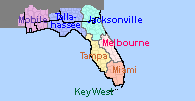
Click on the map below to display watches and warnings for your area
|
Current Hazards
Hazardous Outlook
National Outlooks
National Hazards
Tropical Hazards
Coastal Flooding
Submit Storm Reports
Current Weather
Observations
Latest Sounding
Satellite Images
Rivers and Lakes
Precipitation Estimate
Hydrology
Forecasts
Local
Forecast Discussion
Activity Planner
Graphical Forecast
Tropical Weather
Fire Weather
Aviation Weather
Marine Weather
Climate
Local Observed Climate
National
Radar Imagery
Key West Radar
Miami Radar
Other National Radars
US Dept of Commerce
National Oceanic and Atmospheric Administration
National Weather Service
Key West, FL
1315 White Street
Key West, FL 33040
(305) 295-1316
Comments? Questions? Please Contact Us.