National Weather Service United States Department of Commerce
Hurricane Fern
September 3-13, 1971

ATS-3 visible satellite image of Fern at 11:09 AM CDT on September 10, 1971 shortly before landfall.
Above: ATS-3 visible satellite image of Fern at 11:09 AM CDT on September 10, 1971 shortly before landfall.

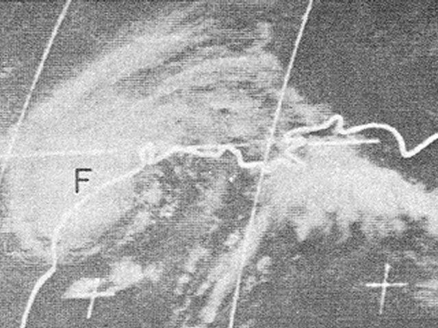
A tropical depression formed in the Gulf of Mexico about 200 miles south of Mobile, Alabama around daybreak on September 3rd. With weak steering currents, the depression drifted northwest, moving ashore Southeast Louisiana the evening of September 4th into the early morning hours of the 5th. Upper level ridging the north caused the weak system to stall and move southwestward, emerging back into the Gulf the afternoon of September 6th. The depression gradually became better organized, and was upgraded to Tropical Storm Fern the evening of September 7th.

A gradual weakening in the upper level ridge caused Fern to slow down and begin moving back to the northwest while strengthening into a minimal hurricane the evening of September 8th. Fern continued to strengthen heading northwest towards the Southeast Texas coast, reaching a peak intensity of 90 mph (80 knots) during the early morning hours of September 9th while located 150 miles south of Galveston, Texas.

Upper level ridging over the Western U.S. began to move eastward, causing Fern to gradually weaken to a strong tropical storm and slow down as it approached the Texas coast just south of Freeport. Fern turned back towards the southwest, making landfall just southwest of Matagorda Bay around Noon CDT September 10th with maximum sustained winds of 70 mph (60 knots) and a minimum central pressure of 979 millibars (28.91 inches). Here is an ATS-3 visible satellite image of Fern at 11:09 AM CDT on September 10, 1971 shortly before landfall. Fern paralleled the Texas coast finally coming ashore near Corpus Christi during the early morning hours of September 11th. Fern continued to slowly weaken as it moved across South Texas through the morning of September 12th, dissipating over Mexico later that evening. Click here for an interactive track of Hurricane Fern.

WIND & PRESSURE:
The highest winds with Fern occurred along the Texas coast where the center of Fern traversed. Sustained winds of 40 to 60 mph with gusts of 60 to 75 mph were recorded across this area. Further up the Texas coast at the National Weather Service in Port Arthur, the highest sustained winds of 28 mph (24 knots) and a peak wind gust of 36 mph (31 knots) was recorded at 1:01 AM CDT September 10th. For complete meteorological statistics, see the Wind and Pressure section.

STORM SURGE:
Storm surge values ranged from 3 to 4 feet MSL across coastal Jefferson County in Southeast Texas. Higher readings of 5 to 6 feet MSL were recorded across Galveston Bay to Matagorda Bay. For other storm surge and high-water marks across our region, see the Storm Surge section.

RAINFALL:
Rainfall varied greatly across the region ranging from over 6 inches to less than one half of an inch. The highest total of 6.57 inches was recorded in Morgan City, Louisiana. Much higher rainfall totals of 5 to 26 inches occurred across South Texas, with the highest total of 26.00 inches recorded in Beeville, Texas. For complete rainfall totals reported across our region, see the Rainfall section.

TORNADOES:
Several F0-F1 tornadoes were reported from September 10th to the 12th across the Central and Southern Texas Coastal Plains. For complete details on all the tornadoes reported, see the Tornadoes section.

Additional Data, Maps, Tables 
Wind and Pressure Storm Surge Rainfall Tornadoes


Other Post Tropical Cyclone Reports
National Hurricane Center Preliminary Report on Hurricane Fern
Monthly Weather Review - 1971 Atlantic Hurricane Season


Satellite Animated Imagery
(NWS LCH YouTube)
1971 Atlantic Hurricane Seasons Applications Technology Satellite III Visible Imagery


News
Hurricane Fern Hits Texas - September 1971


Webpage design and content by: Donovan Landreneau