
Dangerous and extreme heat will remain across portions of the Central U.S. this week, persisting across the Mid to Lower Mississippi Valleys, Gulf Coast, Southern Plains and portions of Texas. A heat wave over the Southwest will intensify late this week. Severe thunderstorms and flash flooding will spread from the Great Lakes/Ohio Valley to the Mid-Atlantic and Northeast the next few days. Read More >
Lake Charles, LA
Weather Forecast Office
| Hurricane Carmen | ||
| August 29-September 10, 1974 | ||
|
|
||
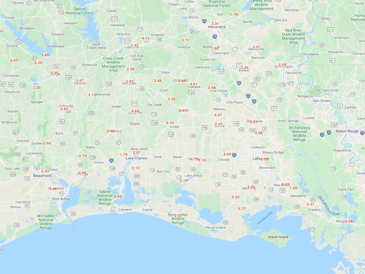
| Storm Total Rainfall Map: September 7-10, 1974 Compiled by: xmACIS2 |
||
 |
||
| Storm Total Rainfall Map and Table: September 7-10, 1974 (.pdf) | ||
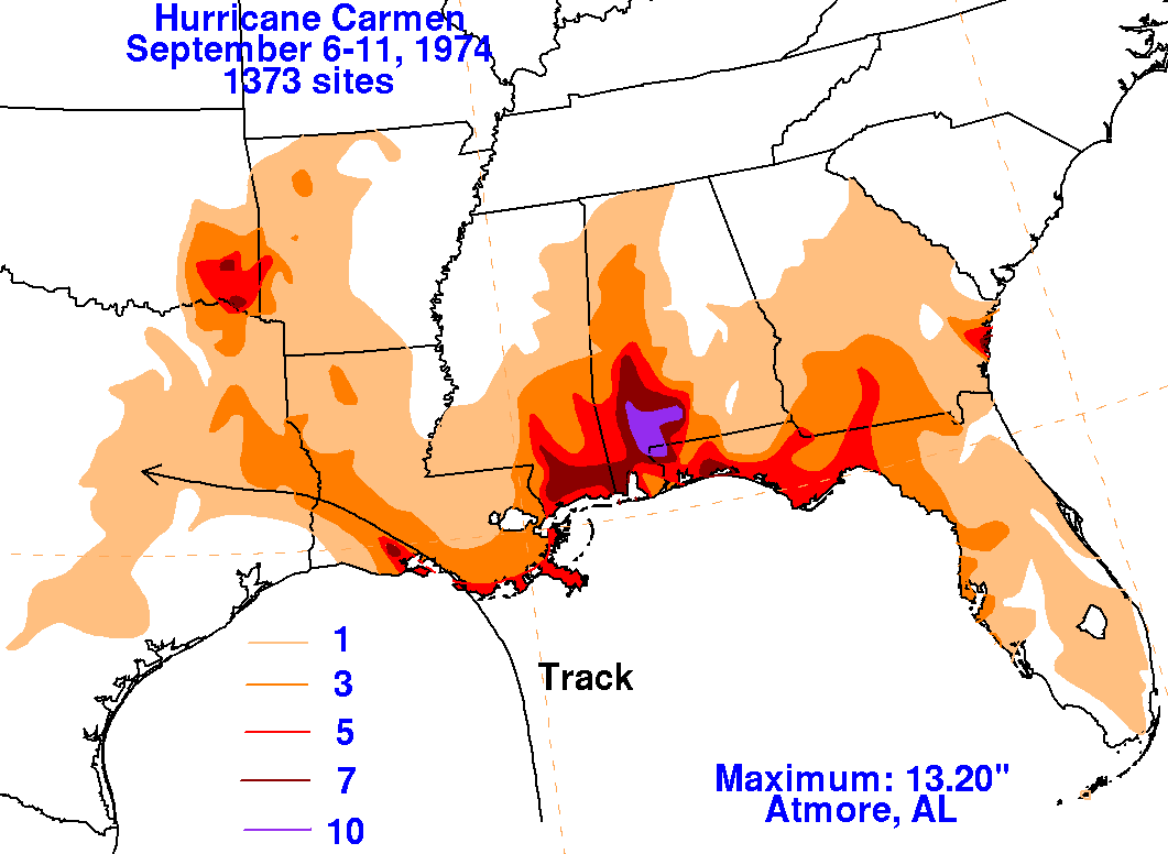
| Rainfall Map for Hurricane Carmen Compiled by David Roth, Weather Prediction Center |
||
 |
||
Forecasts
Aviation Weather
Activity Planner
Mardi Gras Decision Support
Marine Forecasts
Local Products
Model Data
Forecaster's Discussion
Fire Weather
Graphical Forecasts
Wet Bulb Globe Temps
Other Links
National Hurricane Ctr
Storm Prediction Ctr
Weather Prediction Ctr
Other Links
Office History
LCH StoryMap
Hazards
Severe Weather
Tropical Weather
National Outlooks
Local Storm Reports
Tropical Cyclone Reports
Current
Observations
Tide Data
Satellite Data
Hydrology
Calcasieu Par. Network
Jefferson Co. DD6 Network
River/Lake Forecasts
Radar
Shreveport (SHV)
New Orleans (LIX)
Fort Polk (POE)
Houston/Galveston (HGX)
Lake Charles (LCH)
Probabilistic Pages
Probabilistic Snowfall
Probabilistic Rainfall
Probabilistic DSS
US Dept of Commerce
National Oceanic and Atmospheric Administration
National Weather Service
Lake Charles, LA
500 Airport Boulevard
Lake Charles, LA 70607
(337) 477-5285 M-F 8a to 4p only
Comments? Questions? Please Contact Us.

