
In the Upper Midwest, heavy to excessive rain may bring flash and urban flooding through Wednesday. Scattered severe thunderstorms capable of large hail and damaging wind gusts are possible from the central High Plains into the Upper Midwest Wednesday. Extreme heat is ongoing over the Desert Southwest through Thursday. Read More >
Lake Charles, LA
Weather Forecast Office
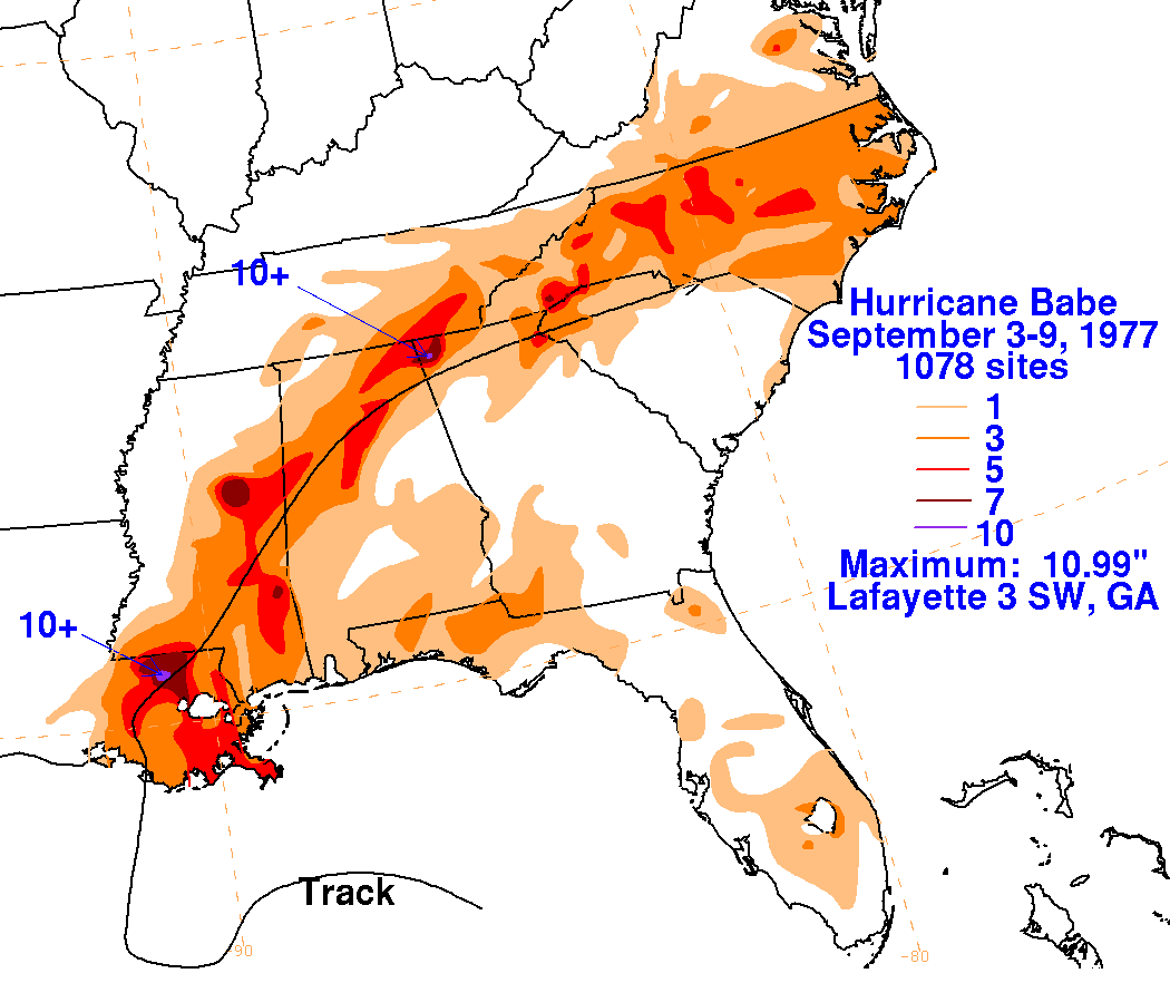
| Hurricane Babe | ||
| September 3-9, 1977 | ||
|
|
||
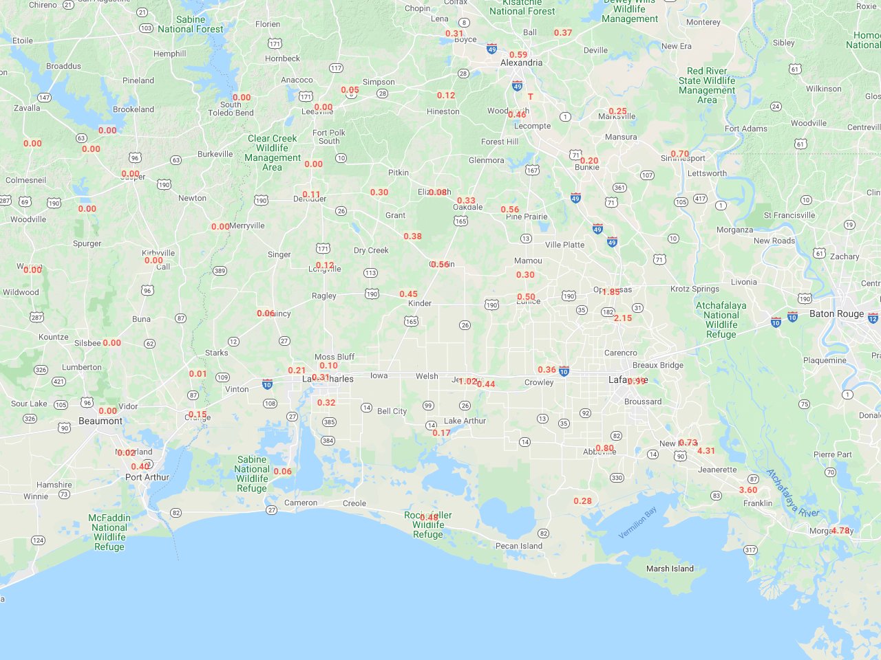
| Storm Total Rainfall Map: September 3-6, 1977 Compiled by: xmACIS2 |
||
 |
||
| Storm Total Rainfall Map and Table: September 3-6, 1977 (.pdf) | ||
| Rainfall Map for Hurricane Babe Compiled by David Roth, Weather Prediction Center |
||
 |
||
Forecasts
Local Products
Model Data
Forecaster's Discussion
Fire Weather
Graphical Forecasts
Wet Bulb Globe Temps
Aviation Weather
Activity Planner
Mardi Gras Decision Support
Marine Forecasts
Other Links
National Hurricane Ctr
Storm Prediction Ctr
Weather Prediction Ctr
Other Links
Office History
LCH StoryMap
Hazards
Severe Weather
Tropical Weather
National Outlooks
Local Storm Reports
Tropical Cyclone Reports
Current
Tide Data
Satellite Data
Observations
Hydrology
Jefferson Co. DD6 Network
River/Lake Forecasts
Calcasieu Par. Network
Radar
Shreveport (SHV)
New Orleans (LIX)
Fort Polk (POE)
Houston/Galveston (HGX)
Lake Charles (LCH)
Probabilistic Pages
Probabilistic Rainfall
Probabilistic DSS
Probabilistic Snowfall
US Dept of Commerce
National Oceanic and Atmospheric Administration
National Weather Service
Lake Charles, LA
500 Airport Boulevard
Lake Charles, LA 70607
(337) 477-5285 M-F 8a to 4p only
Comments? Questions? Please Contact Us.

