|
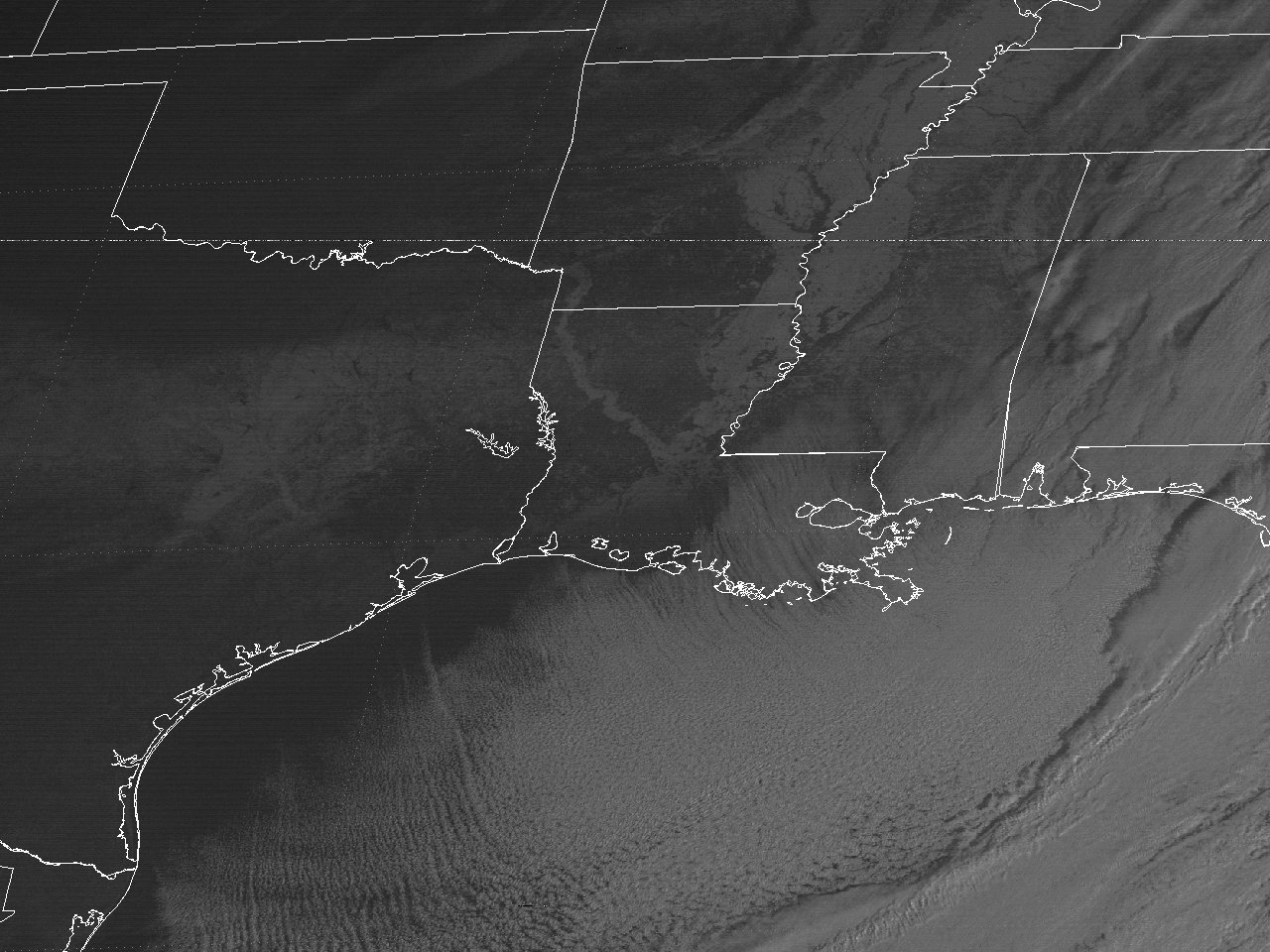
Above: GOES 5 Visible Satellite Image at 8:00 AM CST January 14, 1982 showing the snow and ice cover across Texas and Louisiana.
A large and deepening longwave trough over Central and Eastern North America allowed for a strong Arctic airmass over Canada to plunge southward across the upper Midwest on January 8th. The strong and fridge surface high continued to plunge south-southeast across the Midwest into Texas and eastward across the remainder of the eastern two thirds of the U.S. and the Gulf. This frigid airmass brought the coldest temperatures to this area since January 1962, with record lows ranging from the upper single digits to lower teens across Central and South-Central Louisiana, and lower to mid-teens across Southeast Texas on January 11th. Temperatures fell below freezing during the afternoon and early evening hours of January 10th, and remained below freezing through the morning or early afternoon hours of January 12th, a period of 36 to 46 hours at the primary climate reporting sites at the time.
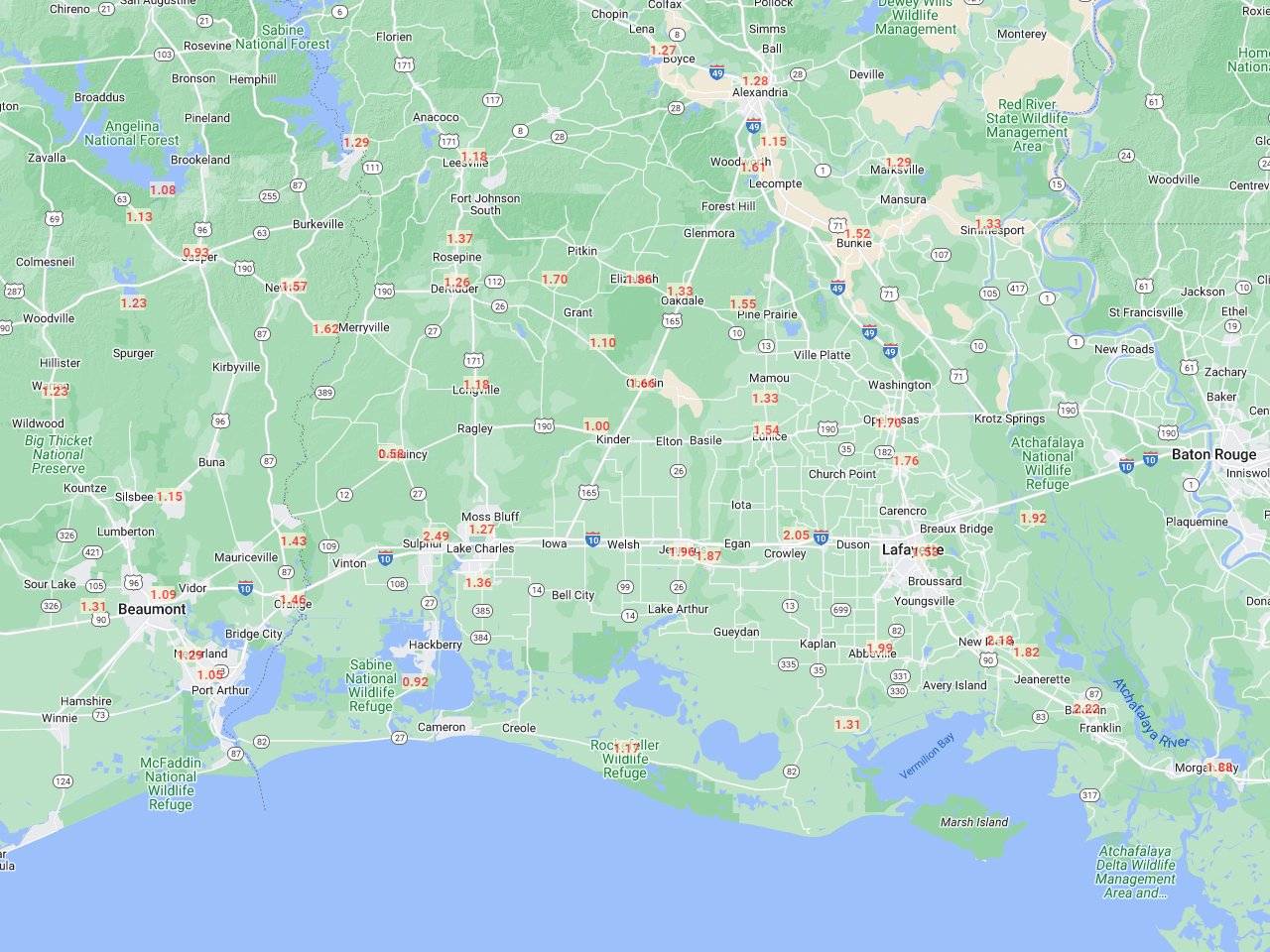
To complicate the severe freeze in progress, two significant mid to upper-level disturbances and Northern Gulf surface lows moved across the area the night of January 11th through the morning of the 12th, and again on January 13th. This brought significant amounts of freezing rain, mixed with sleet and some snow. With everything still frozen, including the ground with these low temperatures, all bridges, roads, trees, and power lines experienced significant ice accumulations. It is estimated that 1 to 2 inches of this wintery mix accumulated across areas along and north of I-10, with lesser amounts further south. Some of this wintery mess melted across southern areas south of I-10 when temperatures rose above freezing briefly the afternoon and evening of January 12th. Total water equivalent rainfall from January 12-13th ranged from an inch up to 2 ½ inches across the area.
The combination of the severe freeze on the 11th, and the winter storm that followed that night through the 14th, caused massive power outages across the area. The ice-covered roads and bridges halted traffic after hundreds of auto accidents had already occurred. Many frozen pipes burst in homes and businesses, causing severe water shortages across the area. For those who were fortunate to have natural gas as a heating source, supplies were unfortunately reduced due to the increased demand and use. Several fires ignited by heating sources were difficult to put out due to the low water pressure across many areas, with a few fatalities across the state.
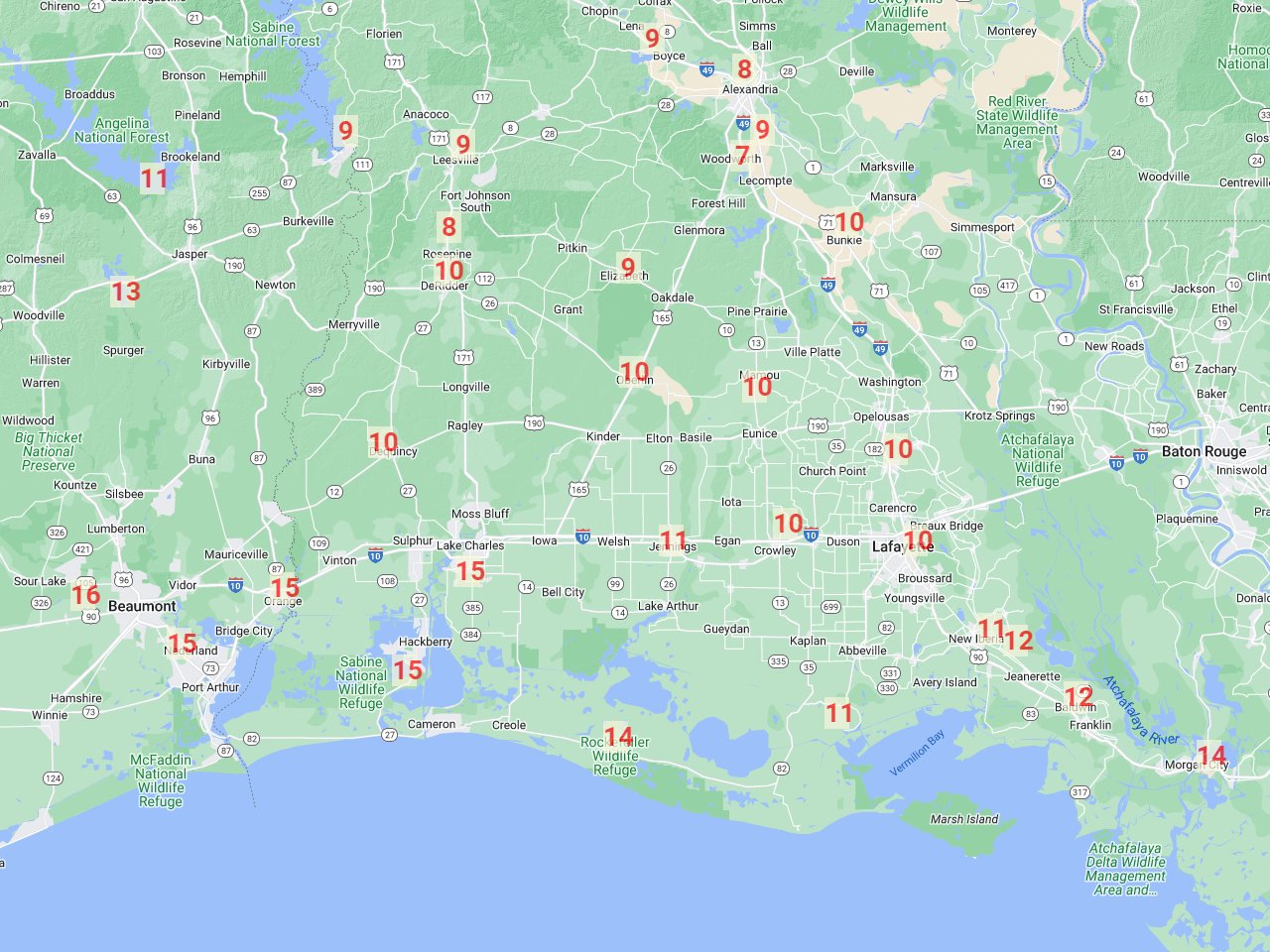
January 11, 1982 Record Low Temperatures
Compiled by: xmACIS2 |
 |
| STATE |
LOCATION |
STATION TYPE |
LOW |
| LA |
ALEXANDRIA |
COOP |
8 |
| LA |
BOYCE 3 WNW |
COOP |
9 |
| LA |
BUNKIE |
COOP |
10 |
| LA |
DE QUINCY |
COOP |
10 |
| LA |
DE RIDDER |
COOP |
10 |
| LA |
ELIZABETH |
COOP |
9 |
| LA |
FRANKLIN 3 NW |
COOP |
12 |
| LA |
GRAND COTEAU |
COOP |
10 |
| LA |
HACKBERRY 8 SSW |
COOP |
15 |
| LA |
JEANERETTE 5 NW |
COOP |
12 |
| LA |
JENNINGS |
COOP |
11 |
| LA |
LAFAYETTE REGIONAL AIRPORT |
WBAN |
10 |
| LA |
LAKE CHARLES REGIONAL AIRPORT |
WBAN |
15 |
| LA |
LEESVILLE |
COOP |
9 |
| LA |
LELAND BOWMAN LOCK |
COOP |
11 |
| LA |
LSU DEAN LEE RESEARCH STATION |
COOP |
9 |
| LA |
MAMOU 4 S |
COOP |
10 |
| LA |
MORGAN CITY |
COOP |
10 |
| LA |
NEW IBERIA |
COOP |
11 |
| LA |
OBERLIN FIRE TOWER |
COOP |
10 |
| LA |
ROCKEFELLER WILDLIFE REFUGE |
COOP |
14 |
| LA |
ROSEPINE RESEARCH STATION |
COOP |
8 |
| LA |
WOODWORTH 2 SE |
COOP |
7 |
| TX |
BEAUMONT RESEARCH CENTER |
COOP |
16 |
| TX |
ORANGE |
COOP |
15 |
| TX |
PORT ARTHUR SE TX REGIONAL AIRPORT |
WBAN |
15 |
| TX |
SAM RAYBURN DAM |
COOP |
11 |
| TX |
TOLEDO BEND DAM |
COOP |
9 |
| TX |
STEINHAGEN LAKE |
COOP |
13 |
| TX |
TOWN BLUFF DAM |
COOP |
13 |
| Consecutive hours below freezing |
| Location |
Start Date/Time |
End Date/Time |
Hours |
| Fort Polk, LA (KPOE-Army) |
01/10 - 2 PM |
01/12 - 1 PM |
*46 |
| Alexandria Esler Field, LA (KESF-WBAN) |
01/10 - 5 PM |
01/12 - 11 AM |
42 |
| Lake Charles Regional Airport, LA (KLCH-NWS) |
01/10 - 8 PM |
01/12 - 9 AM |
37 |
| Lafayette, LA (KLFT-WBAN) |
01/10 - 7 PM |
01/12 - 9 AM |
38 |
| Port Arthur Southeast Texas Regional Airport, TX (KBPT-NWS) |
01/10 - 8 PM |
01/12 - 9 AM |
36 |
| *Had 2 hours above freezing on 01/11/1982 from 4-5 PM. |
Webpage design and content by: Donovan Landreneau
|


