Dangerous heat will expand from the Gulf Coast into the Southern Plains and Desert Southwest through week's end. Additional extreme heat impacting the Pacific Northwest will shift to the northern Plains by the weekend. Tropical Storm Bertha is expected to continue to impact portions of the northern Gulf Coast from the western Florida Panhandle to southeastern Louisiana through tonight. Read More >
| January 20-22, 1985 Record Arctic Cold | |||||||||||||||||||||||||||||||||||||||||||||||||||||||||||||||||||||||||||||||||||||||||||||||||||||||||||||||||||||||||||||||||||||||||||||||||||||||||||||||||||||||||||||||||||||||||||||||||||||||||||||||||||||||||||||||||||||||||||||||||||||||||||||||||||||||||||||||||||||||||||||||||||||||||||||||||||||||||||||||||
|
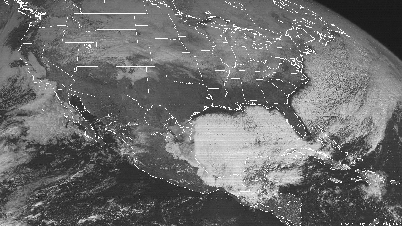
A deepening mid to upper-level longwave trough over Central North America with a large cutoff low within the trough axis over Hudson Bay moved southward from January 18th through the 20th. This allowed for a very frigid Arctic airmass over Western Canada to plunge rapidly south southeast across the Midwest to the Gulf and eastward through January 22nd. Record cold low temperatures were experienced with readings in the lower teens north of I-10, and mid to upper teens further south. Cold air stratocumulus clouds prevailed once again just offshore the coastline over the entire Gulf and Western Atlantic, as shown by this GOES 6 Visible Satellite Image at 12:00 PM CST January 21st.
|
|||||||||||||||||||||||||||||||||||||||||||||||||||||||||||||||||||||||||||||||||||||||||||||||||||||||||||||||||||||||||||||||||||||||||||||||||||||||||||||||||||||||||||||||||||||||||||||||||||||||||||||||||||||||||||||||||||||||||||||||||||||||||||||||||||||||||||||||||||||||||||||||||||||||||||||||||||||||||||||||||