|
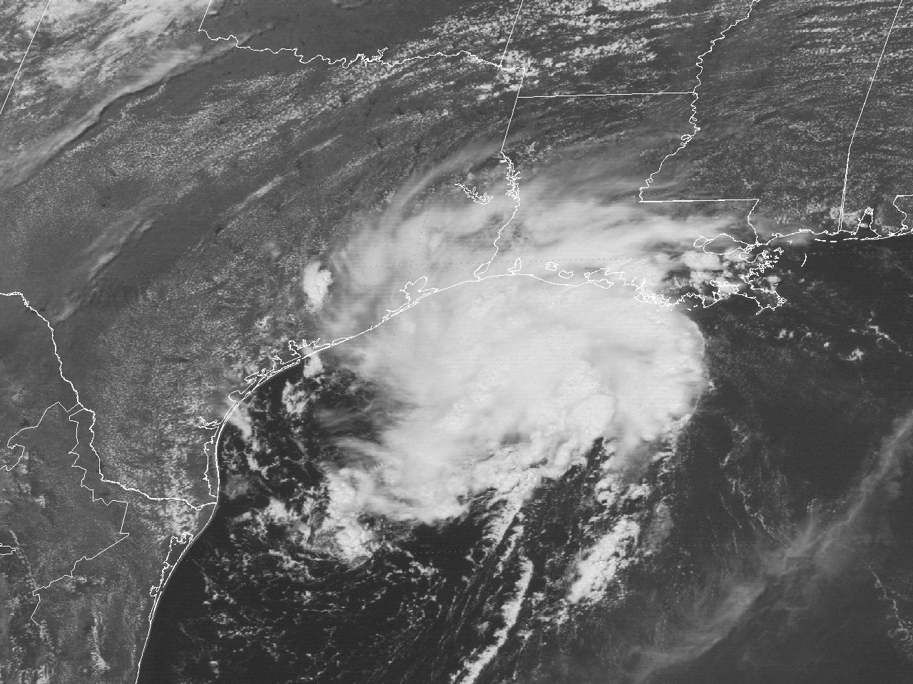
Above: GOES-7 visible satellite image of the Unnamed Tropical Storm off the Southeast Texas Coast at 1:01 PM CDT August 9, 1987.
A tropical wave moved off the coast of Africa on July 29th and traveled west across the tropical Atlantic along the southern perimeter of an extensive swath of dust that extended from Africa to the Bahamas. The wave had little convection until reaching the Lesser Antilles around August 4th. The southern portion of the wave moved across Central America on August 7th, with the northern portion of the wave moving northwest across the Central Gulf on August 8th.
Around daybreak on August 9th, convection increased rapidly as a low-level center developed across the Northwest Gulf. Organization continued to improve and advisories on Tropical Depression #2 were initiated by Noon that day. Since the tropical depression was expected to strengthen and make landfall within 24 hours, a tropical storm warning was issued from Matagorda, Texas to Morgan City, Louisiana. This is the first time that a tropical storm warning has been issued for the United States. Beginning in the 1987 Atlantic Hurricane Season, tropical storm watches and warnings replaced gale watches and warnings with tropical cyclones.
During the afternoon and evening of August 9th, the tropical cyclone appeared to be losing organization on satellite imagery with the low-level center becoming increasing difficult to track, along with southerly wind shear noted. Oil rigs off the Louisiana coast indicated that winds were gradually increasing, but since these highest winds were over 100 miles east of the center, were initially considered to be attributed to local convection rather than the circulation. Thus, operational assessments kept the cyclone a tropical depression through landfall across the Upper Texas coast near High Island around 1 AM CDT August 10th. During the post storm analysis, the National Hurricane Center obtained additional oil rig reports, aircraft reconnaissance reports just after landfall, and the fact the system retained tropical depression for days after landfall, to upgrade the system to a 45 mph (40 knot) landfalling tropical storm. The weak tropical storm weakened to a tropical depression by the early afternoon hours.
The tropical depression moved northeast across North Louisiana on August 11th, and drifted east southeast across Southern Mississippi, Alabama, the Florida Panhandle, and South Georgia August 12th through the 16th. Click here for an interactive track of the Unnamed Tropical Storm.
WIND & PRESSURE:
No tropical storm force winds were observed across Southeast Texas, Central or Southern Louisiana. Tropical storm force winds were observed across numerous offshore oil production platforms off the Louisiana Coast. For complete meteorological statistics, see the Wind and Pressure section.
STORM SURGE:
No significant storm surge was reported across the Southeast Texas or Louisiana coasts.
RAINFALL:
Rainfall totals across the region ranged from 1 to 5 inches, with the highest total of 5.36 inches reported at Eunice, Louisiana. For complete rainfall totals reported across our region, see the Rainfall section.
TORNADOES:
No tornadoes were reported with this system across Texas or Louisiana.
|


