|
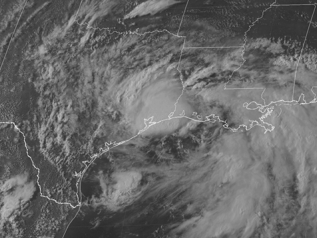
Above: GOES-8 visible satellite image of Tropical Storm Dean just prior to landfall across the Upper Texas coast at 5:30 PM CDT July 30, 1995.
Dean originated from a mid-level trough of low pressure over the Northeastern Gulf. By July 27th, a weak surface low developed as indicated by the buoys across the Eastern Gulf. With increasing organization on satellite imagery and surface reports, the tropical disturbance was designated Tropical Depression #4 with advisories being initiated the afternoon of July 28th.
The mid to upper-level pattern was dominated by a large ridge of high pressure over the Western United States and the Bermuda High, with a weak trough of low pressure over the Eastern United States through the Northeast Gulf. This resulted in a slow westward drift of the depression through early on July 29th. By that afternoon through July 30th, the mid to upper-level ridge of high pressure shifted eastward over the Central and Eastern United States. This resulted in Tropical Depression #4 moving quicker to the west northwest at 10 to 15 mph and gradually becoming better organized off the Louisiana Coast. By the afternoon of July 30th, reconnaissance aircraft found the minimum central pressure falling from 1005 millibars to 999 millibars, with flight level winds increasing from 40 to 50 knots. This warranted the upgrade to Tropical Storm Dean, located about 70 miles south of Sabine Pass near the Louisiana & Texas border. A GOES-8 visible satellite image at 5:15 PM CDT July 30th shows Tropical Storm Dean just prior to landfall off the Upper Texas coast.
Tropical Storm Dean intensified further and made landfall near Freeport, Texas at 9 PM CDT July 30th with maximum sustained winds of 45 mph (40 knots) and a minimum central pressure of 999 millibars (29.50 inches), as shown by the National Weather Service Houston, TX WSR-88D radar image. Dean weakened back to a tropical depression just after landfall later that evening. Tropical Depression Dean continued moving northwest across Southeast and Central Texas on July 31st, and stalled across North Texas on August 1st through August 2nd, dissipating by daybreak. Click here for an interactive track of Tropical Storm Dean.
WIND & PRESSURE:
No sustained winds of tropical storm force were recorded across Southeast Texas or Southern Louisiana. The highest sustained winds of 36 mph (31 knots) with a peak wind gust of 45 mph (39 knots) were recorded at Sea Rim State Park along coastal Jefferson County Texas at 6 AM CDT July 31st. Elsewhere, maximum sustained winds of 15 to 25 mph with peak gusts of 25 to 35 mph were recorded across the remainder of Southeast Texas, Central and Southern Louisiana within the passing rainbands. For complete meteorological statistics, see the Wind and Pressure section.
STORM SURGE:
Tides of 4 to 5 feet MSL occurred across the Southwest Louisiana and Upper Texas coasts. The storm surge covered portions of Highway 82 between Johnsons Bayou and Holly Beach in Cameron Parish Louisiana, and portions of Highway 87 between Sea Rim State Park and Sabine Pass across Jefferson County Texas. For other storm surge and high-water marks, see the Storm Surge section.
RAINFALL:
Around two to six inches of storm total rainfall occurred across Southeast Texas, Central and Southern Louisiana from July 29th through August 2nd. The highest rainfall within our area of 6.13 occurred at the National Weather Service in Lake Charles, Louisiana. Higher totals of 7 to 15 inches occurred further west along the track of Dean, with the highest total of 17.60 inches being recorded at Vernon, Texas. For complete rainfall totals reported across our region, see the Rainfall section.
TORNADOES:
An F0 tornado was observed in a field just north of Holly Beach, Louisiana around 8 PM CDT July 30th, with no damage or injuries noted. Two other F0 tornadoes were observed near High Island and Anahuac Texas the evening of July 30th. For complete details on the tornadoes reported across Texas and Louisiana, see the Tornadoes section.
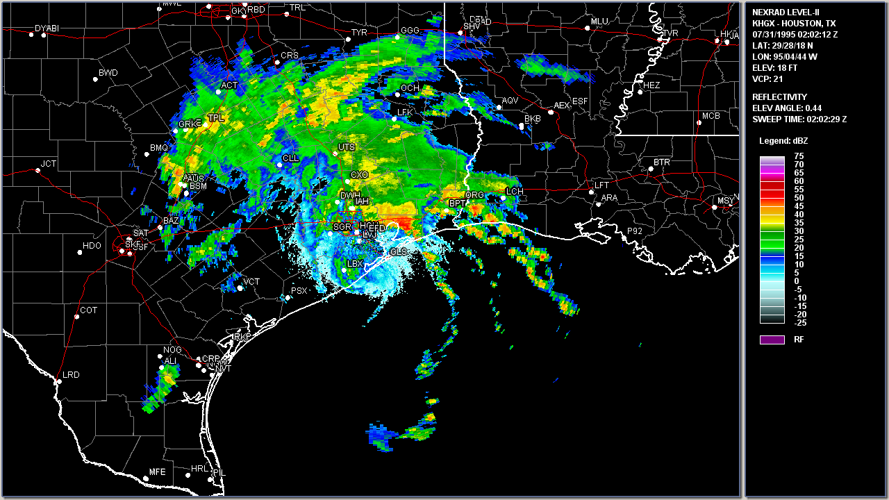
Above: Houston, TX WSR-88D radar image of Tropical Storm Dean making landfall near Freeport, Texas at 9:02 PM CDT July 30, 1995.
|


